 Note: Photos here. The host of photos for this post is having issues so photos may no longer appear in the post.
This the first of a series of posts on the Trinity Alps High Route, a mostly off-trail loop through the Trinity Alps that covers many of the highlights of this spectacular region. There are numerous variations of this route for the adventurer to consider, and I am sure my itinerary on my next visit will be different, but the route I am sharing is a complete loop around the upper Canyon Creek drainage including summits of the six named peaks surrounding the drainage. Each of these summits offered its own rewards and I highly recommending including at least some of the peaks into any itinerary as the views are breathtaking. While my fastpack took two days with the single night spent at Grizzly Lake, I feel it makes more sense to split up the copious photography and my thoughts on the route into three parts: the first part from the trailhead to Little Granite Peak to Sawtooth Mountain; the second part from Sawtooth Mountain to Caesar Peak to Thompson Peak; and the third part from Thompson Peak to Mount Hilton to Boulder Lakes. Photos here.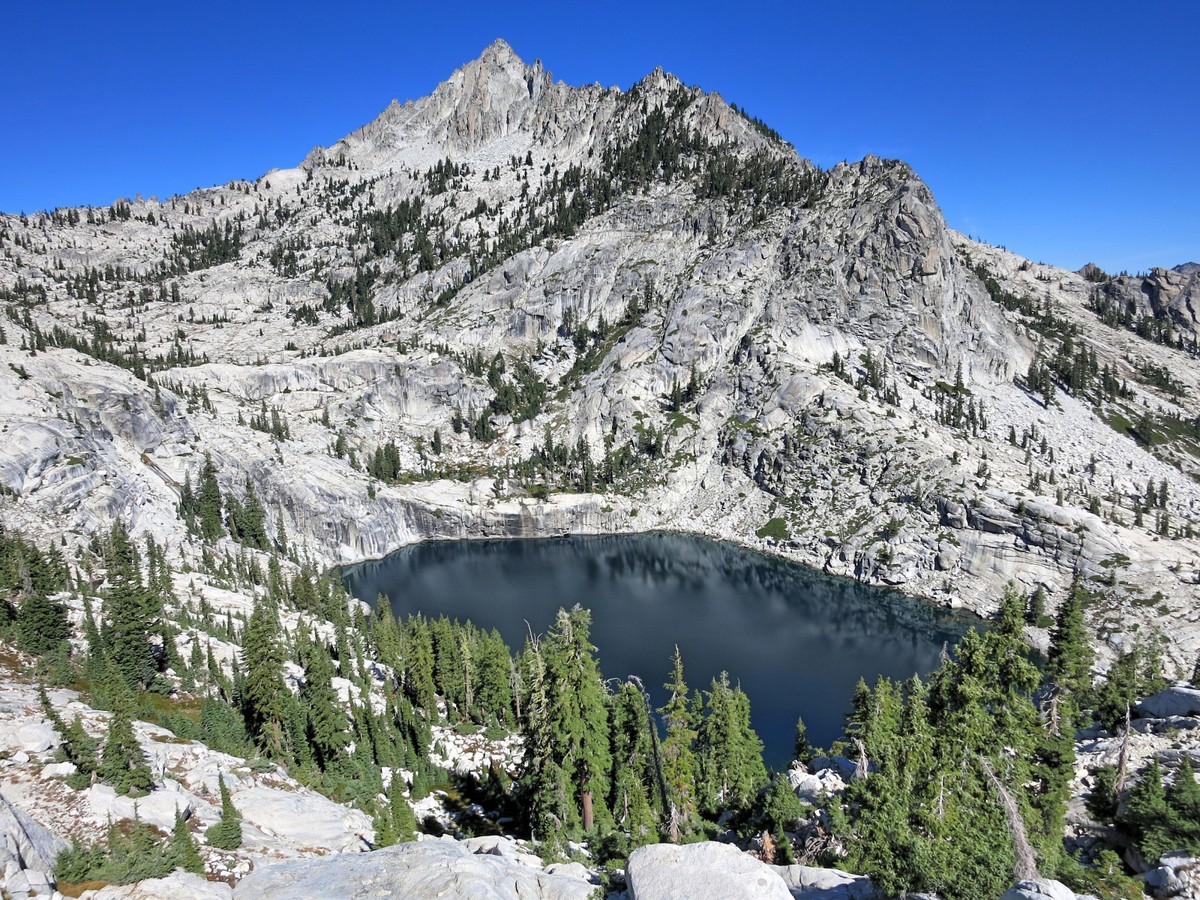

 The Trinity Alps are a spectacular and rugged collection of mountains and ridges tucked deep in the Klamath Mountains of Northern California. Largely overlooked for the neighboring greater ranges in the Sierra Nevada and Cascades, these mountains remain a gem where solitude and adventure can be found in a large expanse of trail-less wilderness. In fact, as the Trinity Alps are geographically between the Cascades and the Sierra, the mountains contain a magical blend of both range’s characteristics. The Trinity Alps High Route (TAHR) was conceived by Deems Burton after decades of exploration learning the intricacies of this wild terrain. His photo gallery contains many inspirational photos and ideas for cross country treks. The high route is characterized by ubiquitous white granite, serene alpine lakes, and clumps of picturesque krummholz. It is said that the ubiquitous white granite of these mountains produces an incomparable deep blue sky and I’d have to agree.
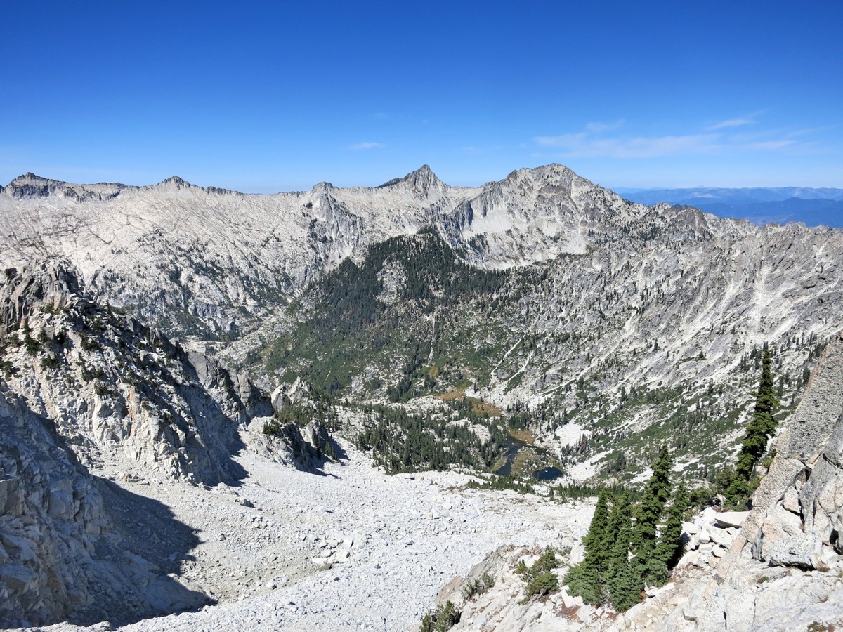
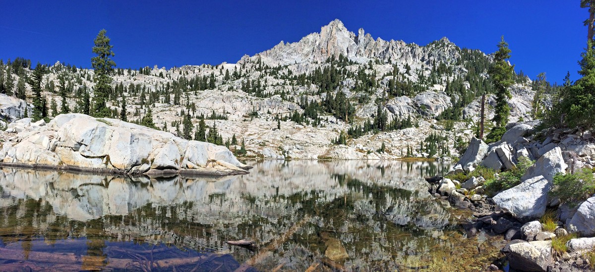
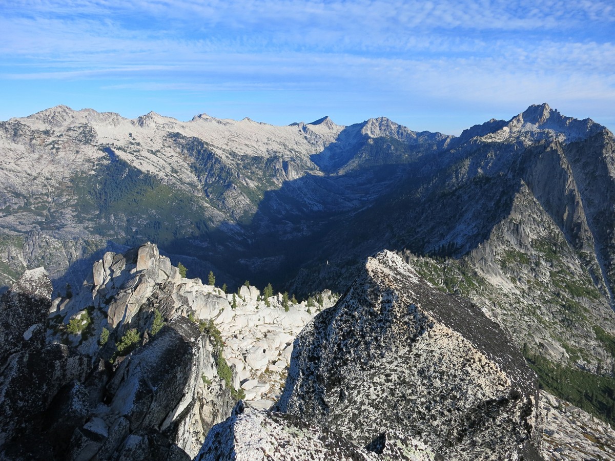
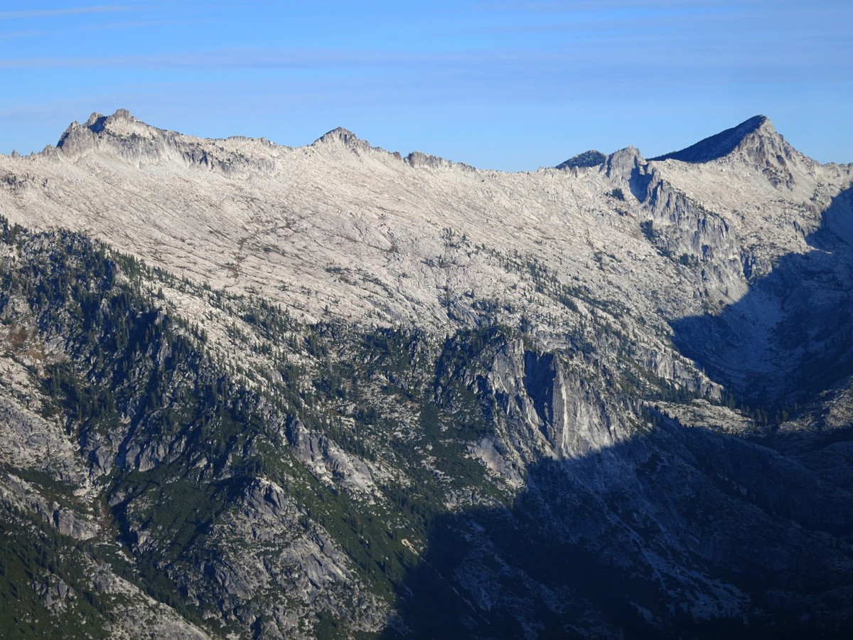
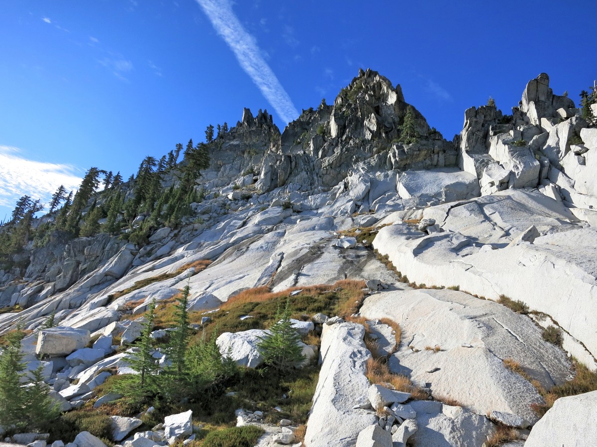
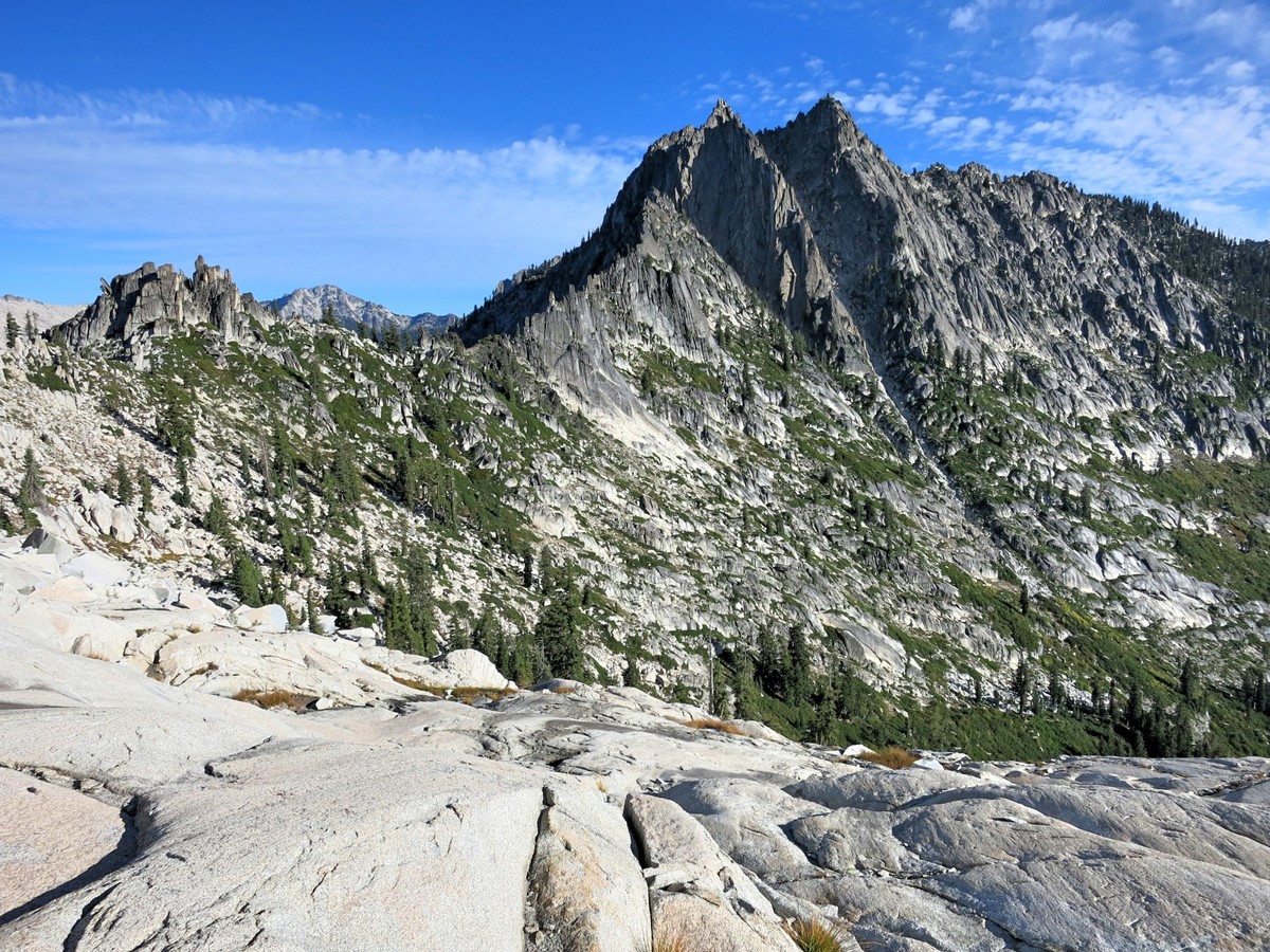
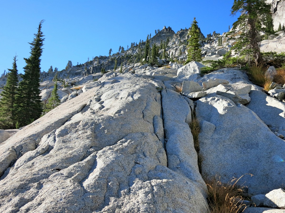
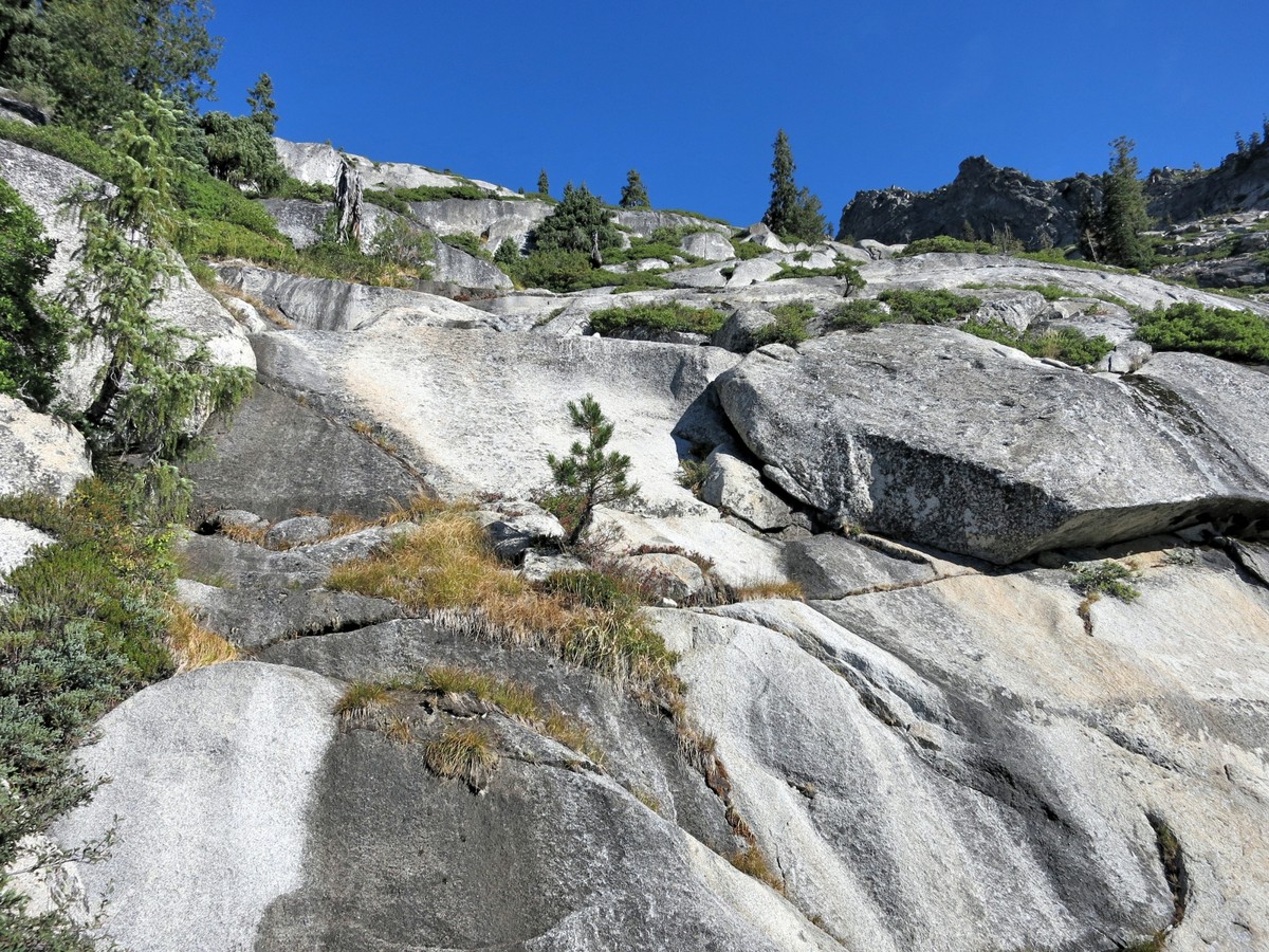
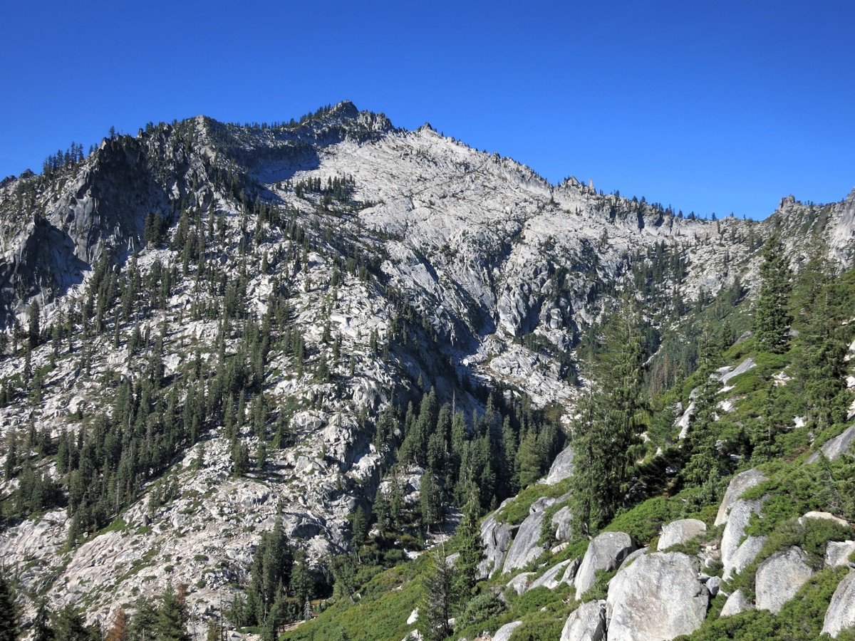
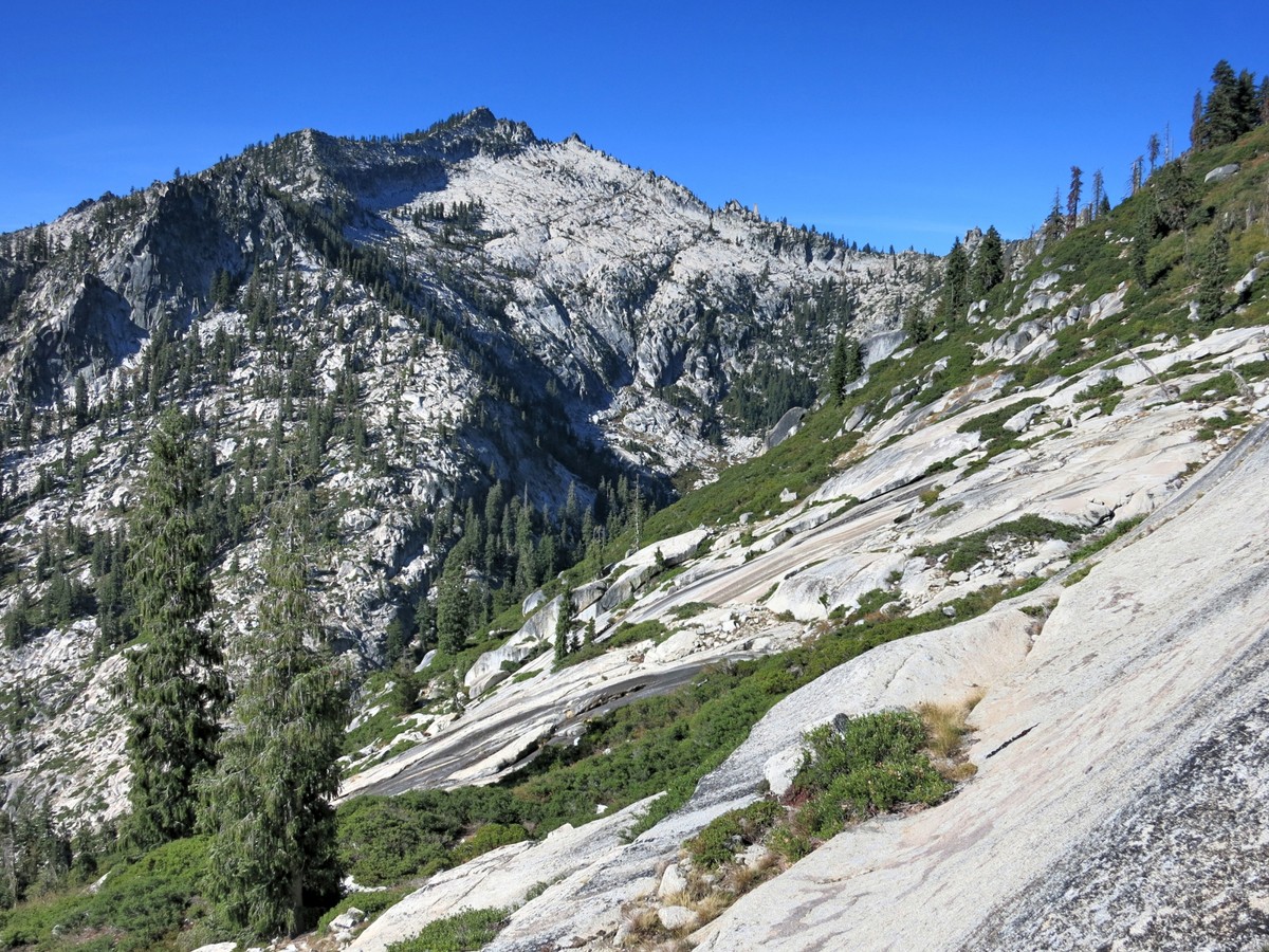
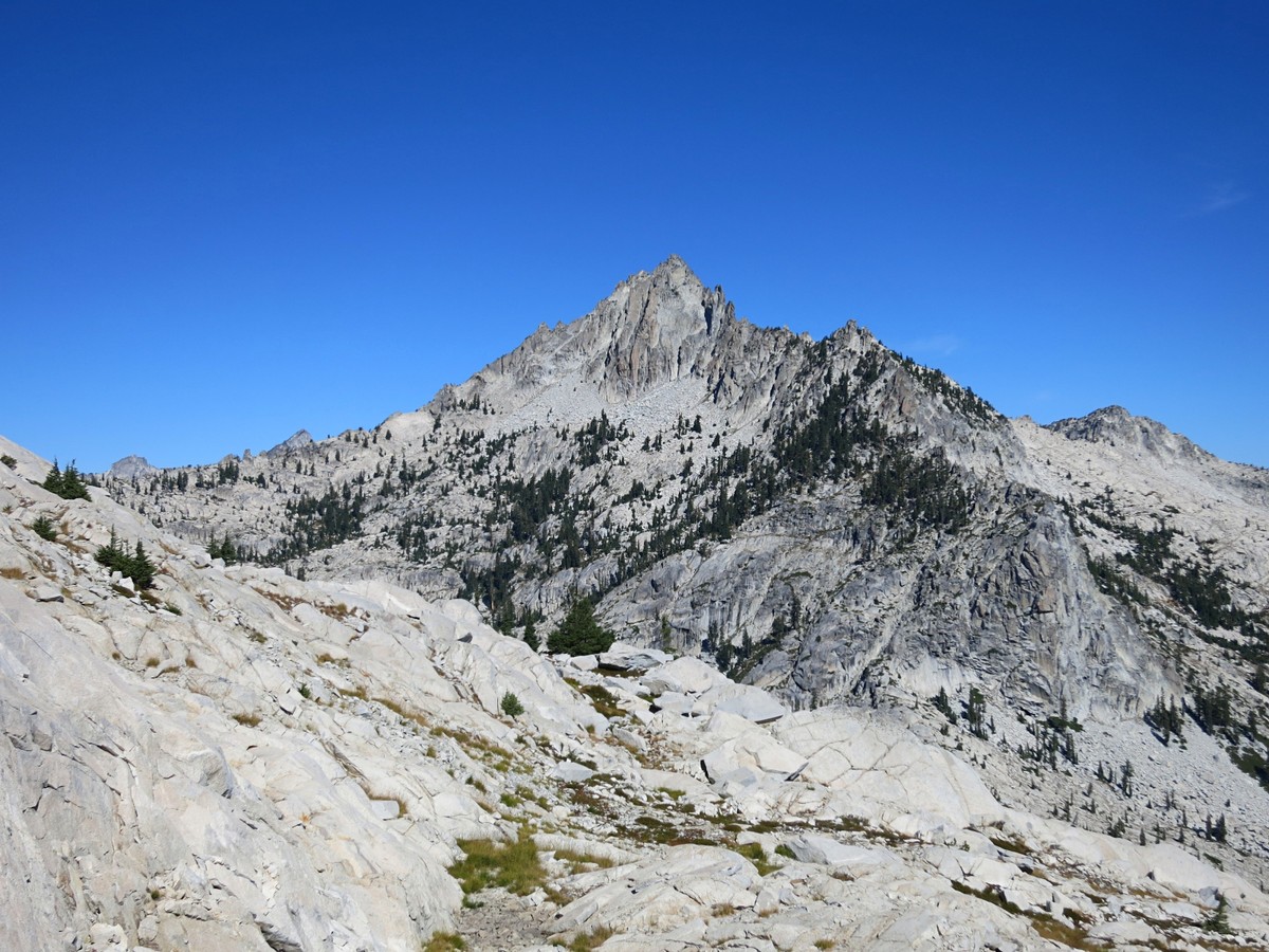
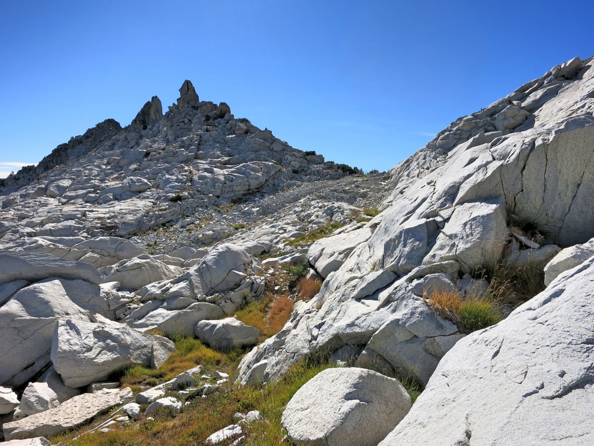
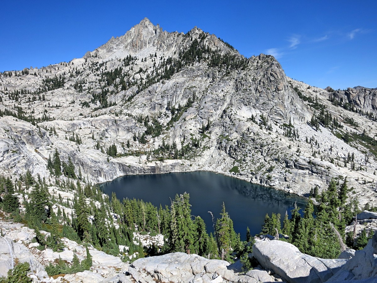
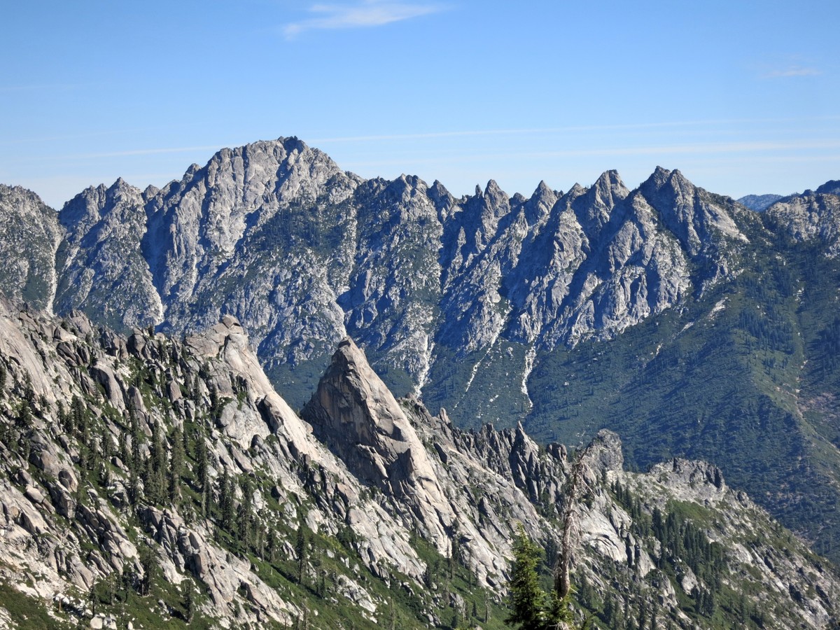
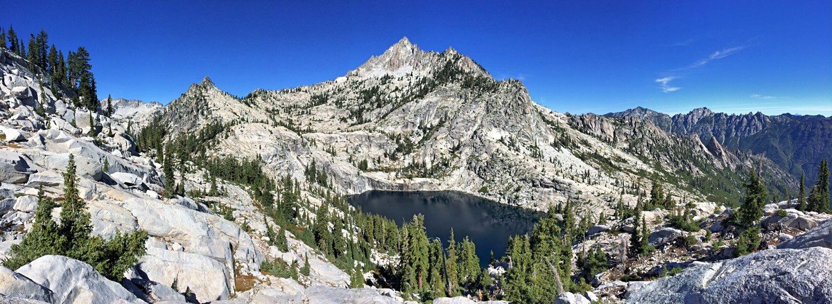
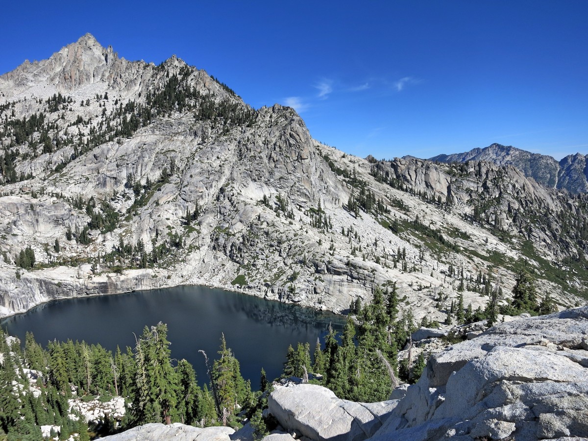
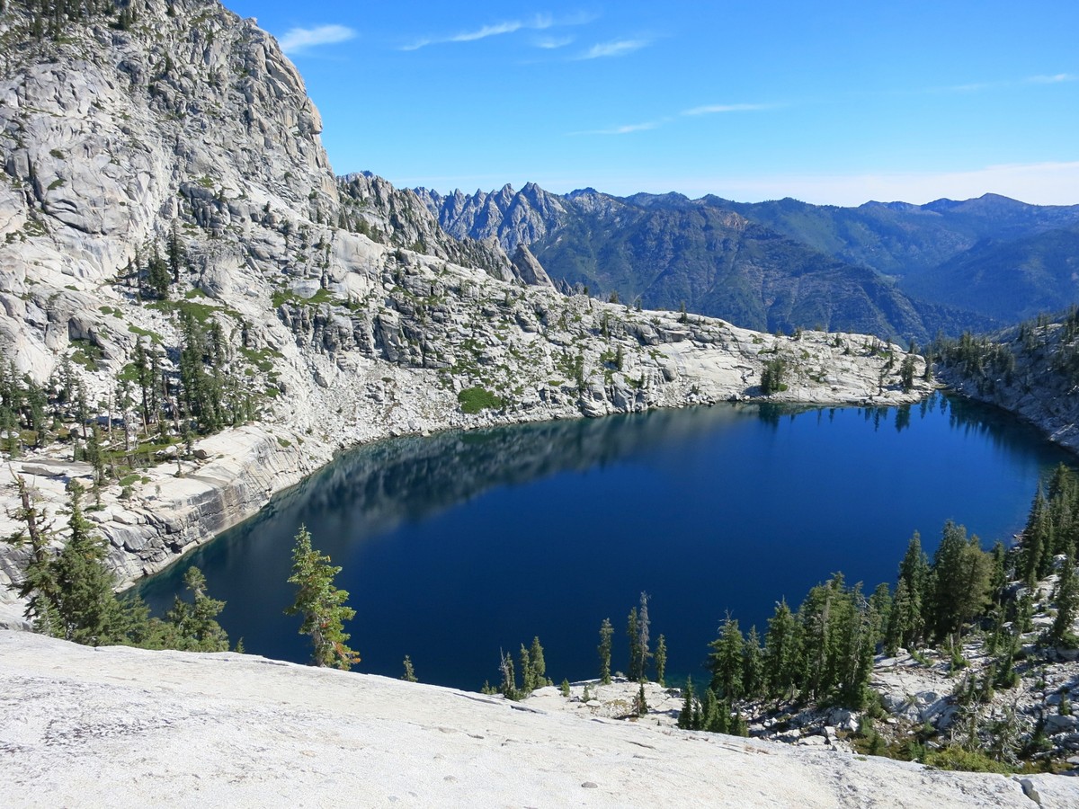
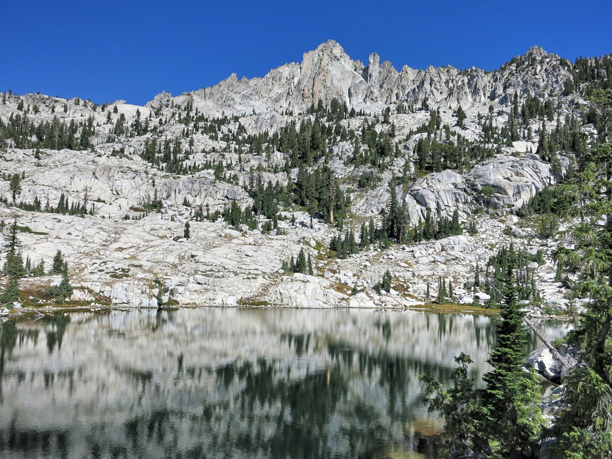
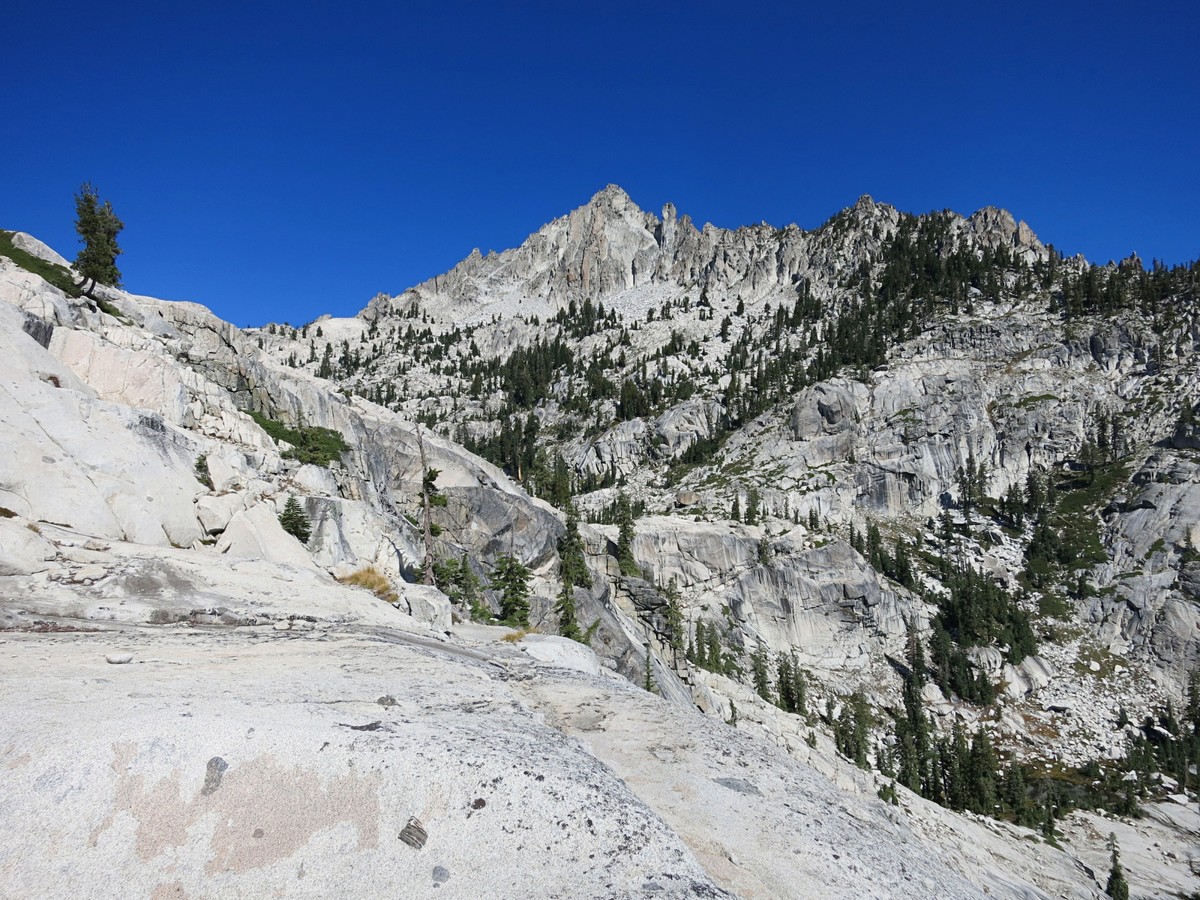
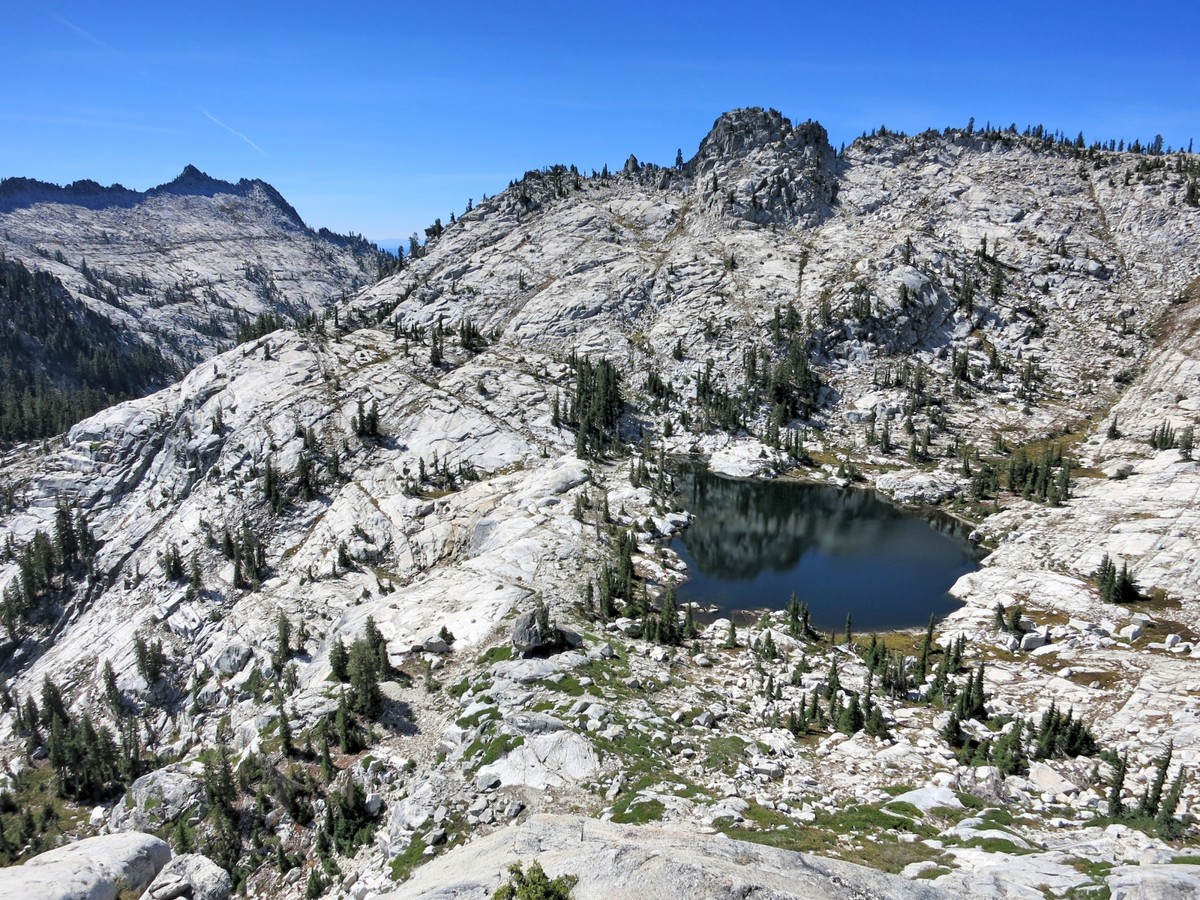
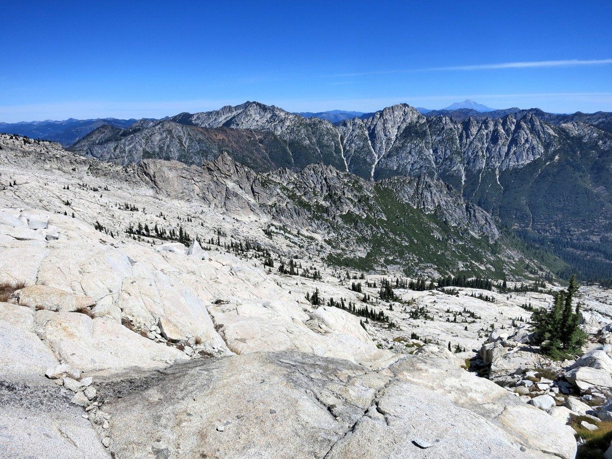
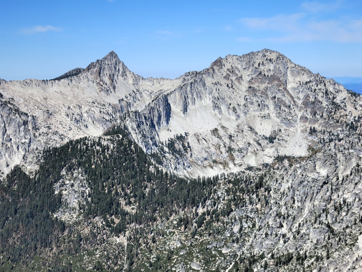
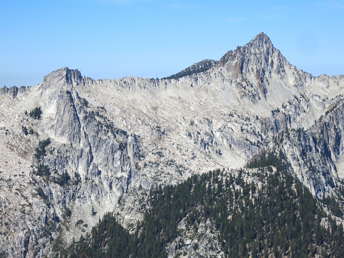
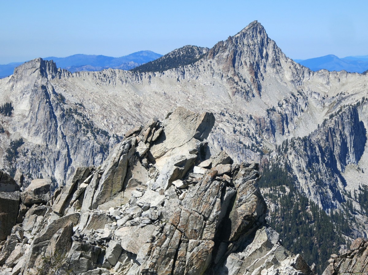
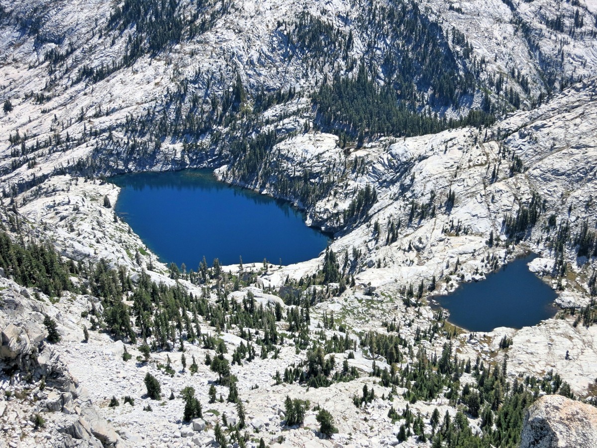
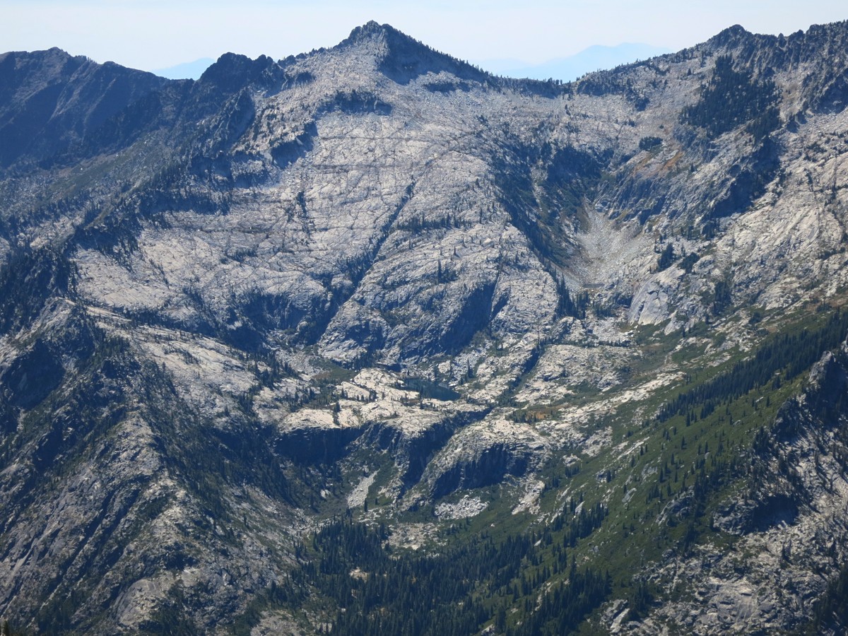
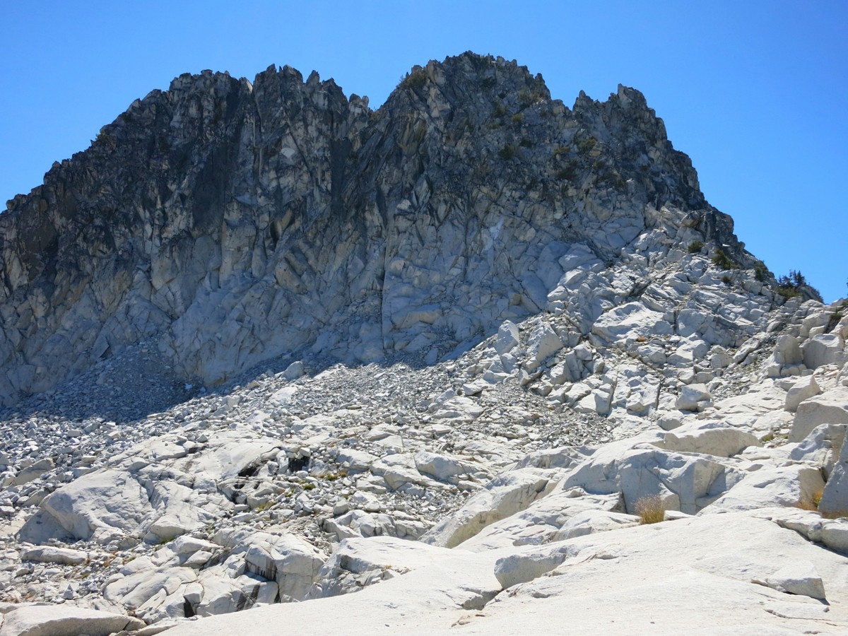
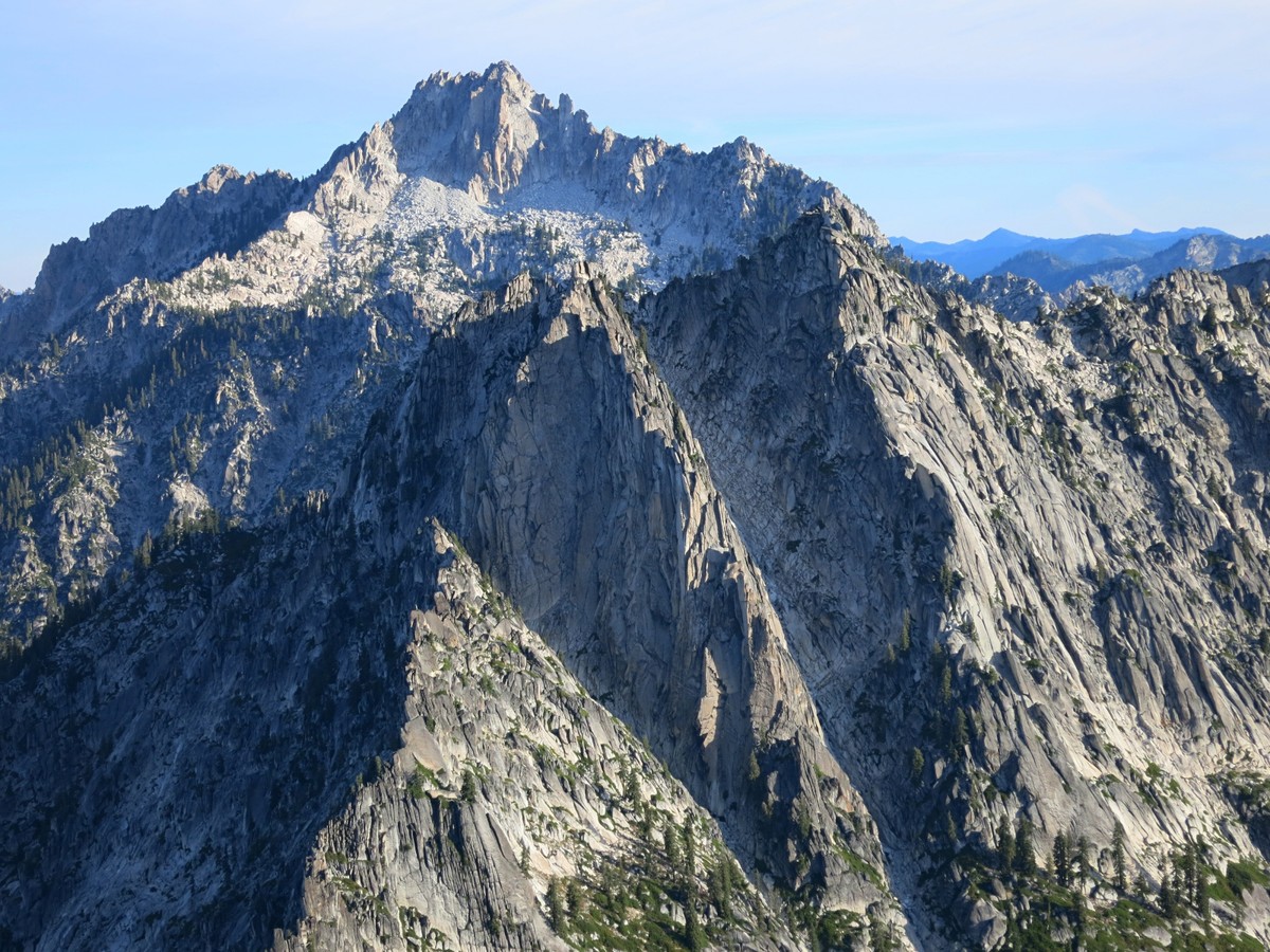 The following description starts and finishes from the Canyon Creek Trailhead. For many it will be the most convenient and enable a complete loop without repetition. There are several other potential trailheads at which one could emabark on a similar loop. From Canyon Creek trailhead the start includs a climb up to the Stuart-Bear Divide which becomes quite steep near the top. At the divide, instead of taking the trail down the other side head up cross country to Little Granite Peak. With a little bit of mico-navigating, one can avoid the brush at the lower part and the rock outcroppings on the summit ridge. The final hundred vertial includes some some class 3 scrambling to reach the summit. Lttle Granite affords a great vantage to survey the TAHR as the entire Canyon Creek drainage is visible. Perhaps the most impressive view is looking toward the impressive Sawtooth Mountain, with its nearly vertical fang of gray granite rising abruptly from the more subdued white granite slopes below. I enjoyed the early morning view from the summit while contemplating my descent to Alpine Lake. The descent from Little Granite Peak to Alpine Lake is a section with no information available online. There may be alternative descent routes, but it appears the western side of the slope provides the highest likelihood of successes. The complexity is due to the fact that east and south sides of Alpine Lake are surrounded by cliffs and steep slabs while the west side is a jungle of coarse brush. Care must taken to find the most efficient route down to avoid cliffs and nasty bushwhacking. From just below the summit utilize a ramp to descend down to more moderately angled slabs. Cruise down the easy slabs for awhile staying to skiers left near the ridgecrest and descended towards the fields of brush west of Alpine Lake. At the brush find a shallow gully which turns into a dry streambed and provides a mostly brush-free descent to Alpine Lake.
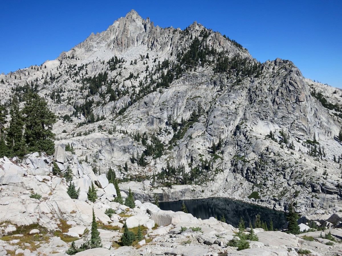
 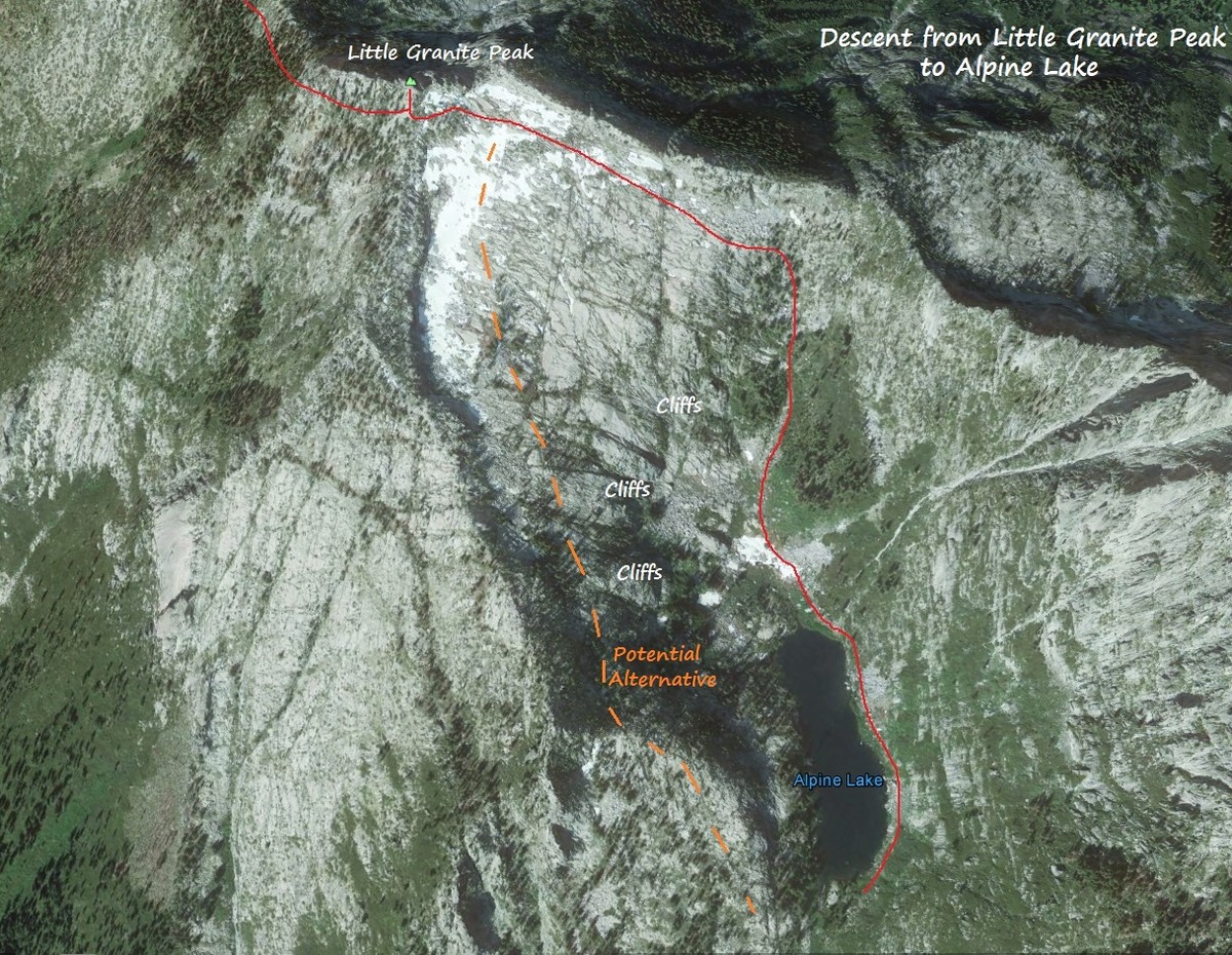 As mentioned previously, Alpine Lake is a beautiful spot nestled in a granitic cirque beneath Little Granite Peak and the rugged unnamed summit to the north. From Alpine Lake the next objective is to gain a pass between the Alpine Lake drainage and the Smith Lake drainage. Most of the terrain to gain this pass is efficient travel on granite slabs but the lower part is field of nearly impenetrable brush. One can use a dry streambed to avoid the brush and gain access to the granite slopes above, but a path has been clipped through the brush avoiding the necessity to scramble in the large boulders of the streambed. While the scramble is fun and not very time-consuming, it may be worthwhile to look for the clipped path through the wall of brush.
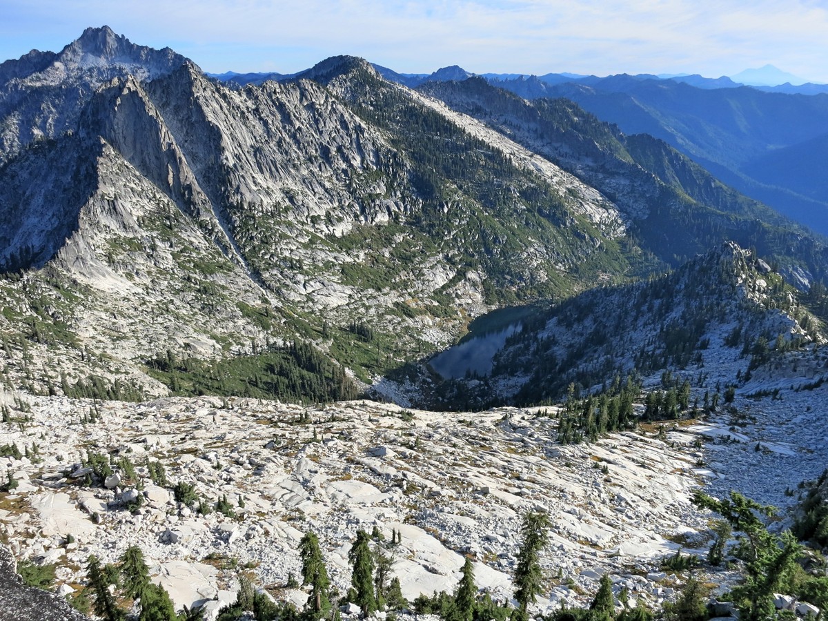
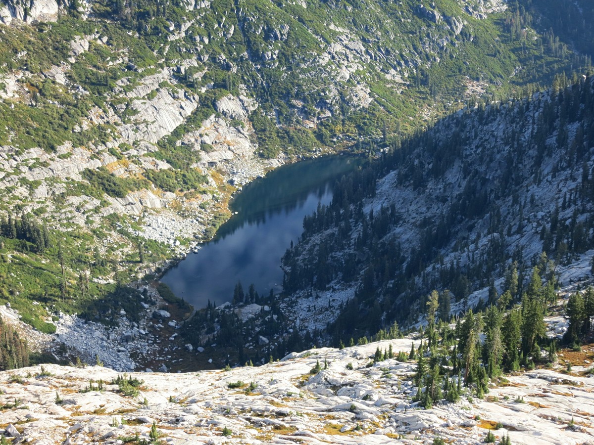
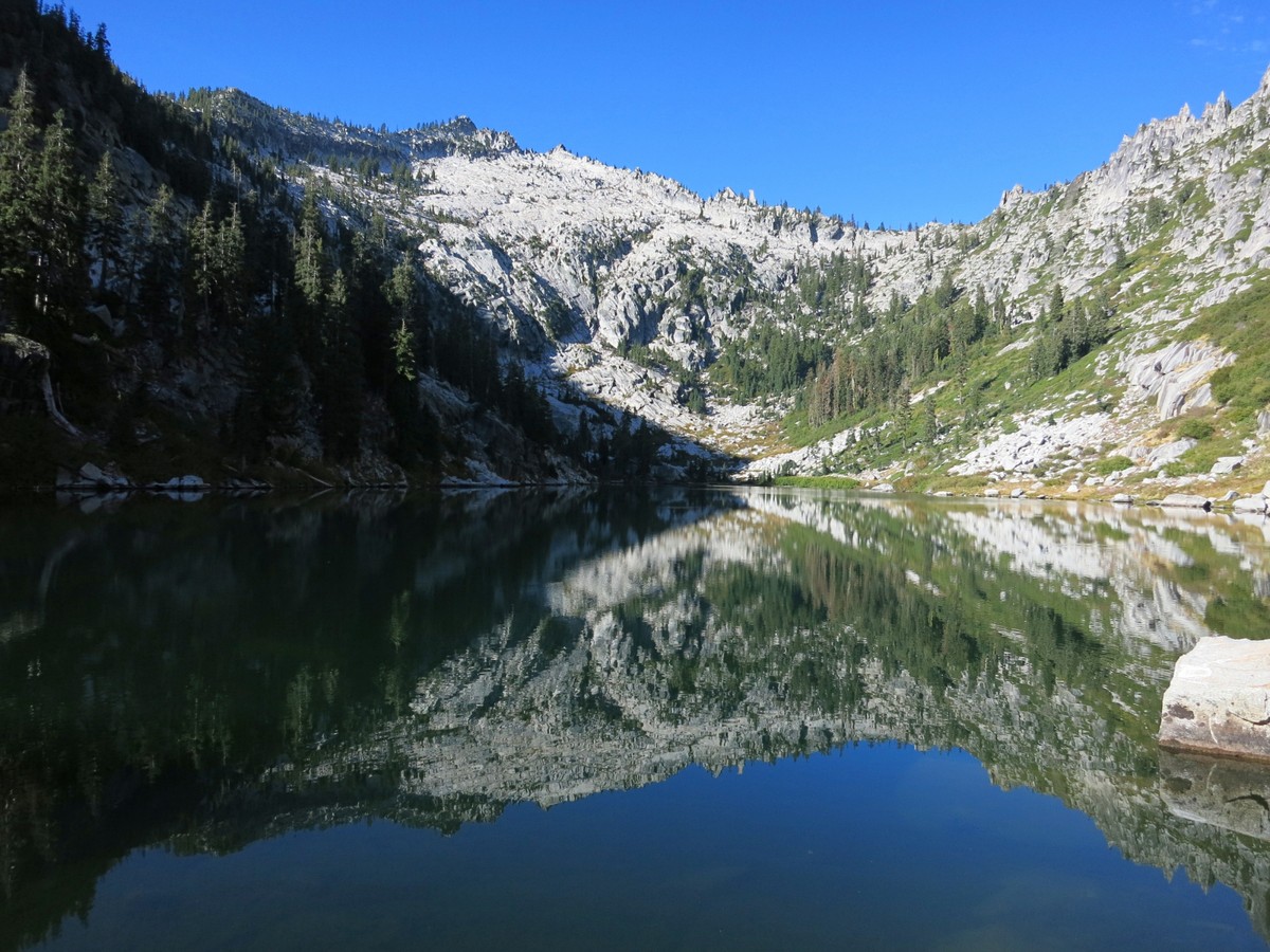
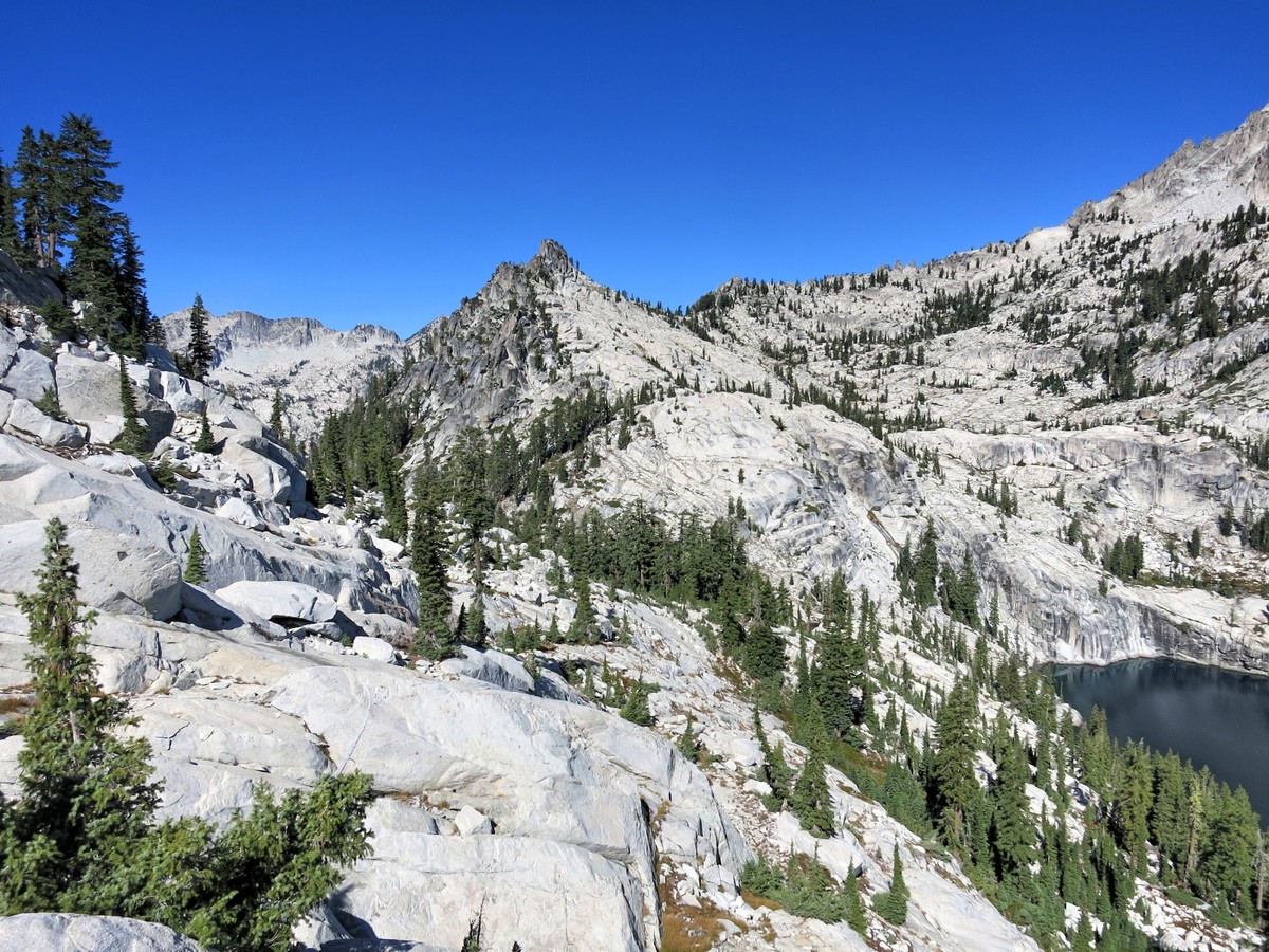
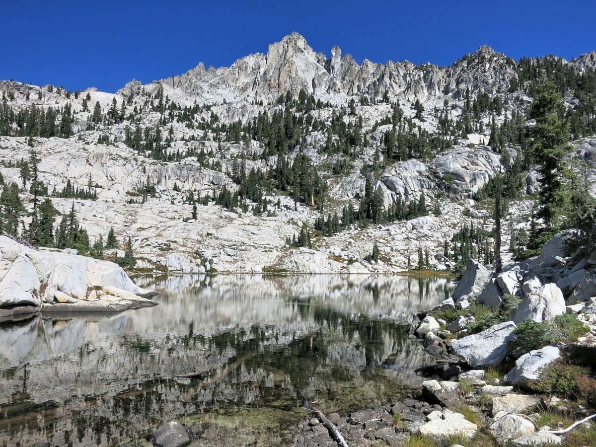
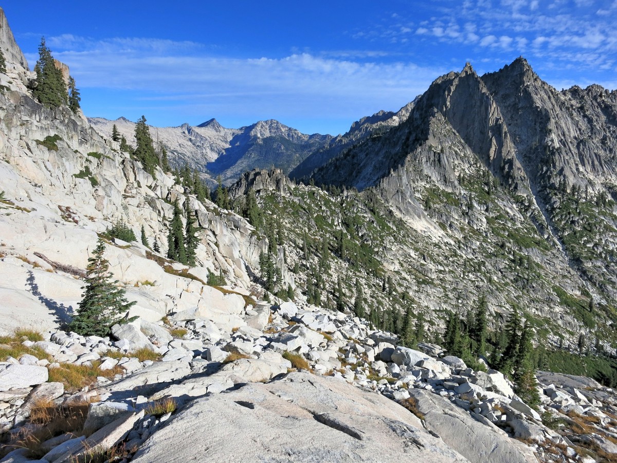


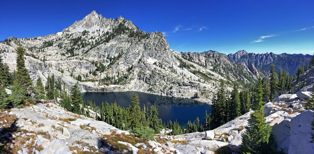
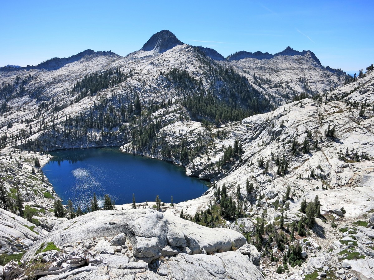
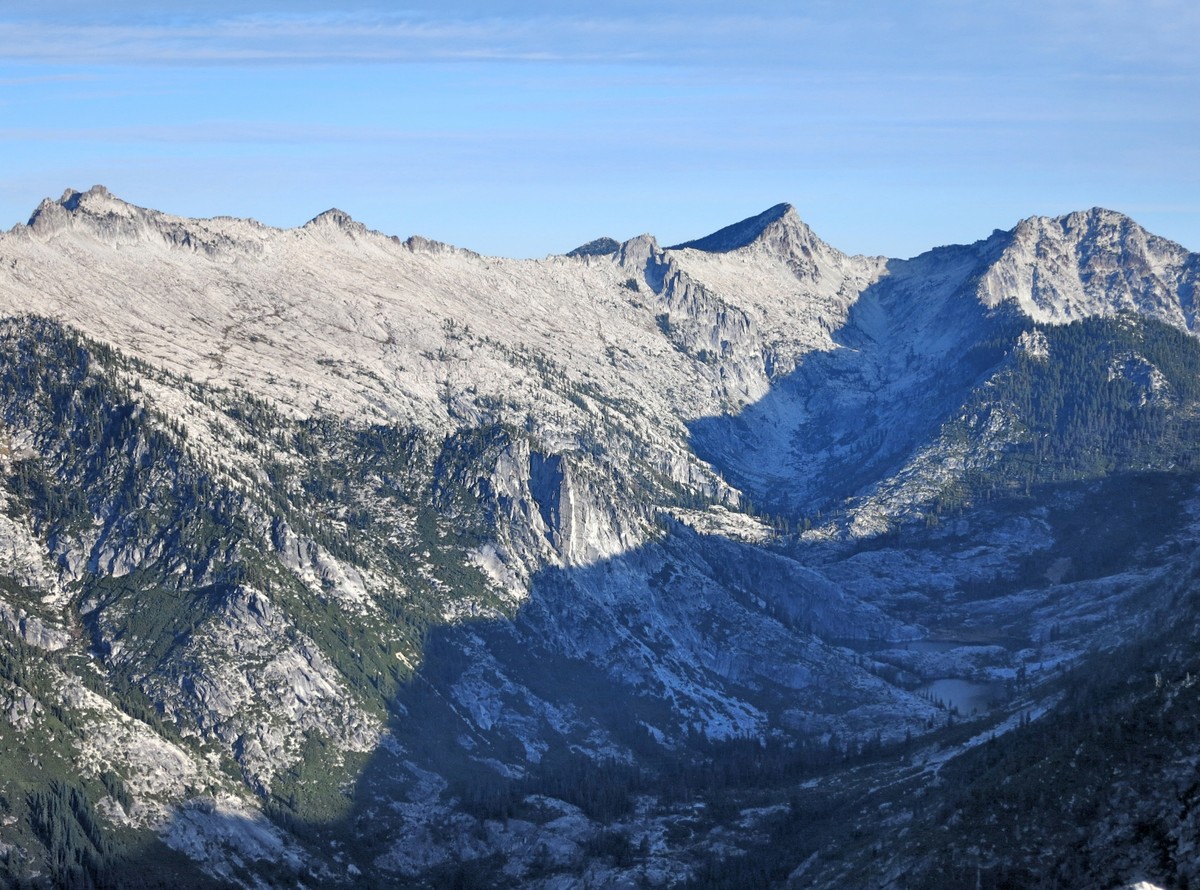
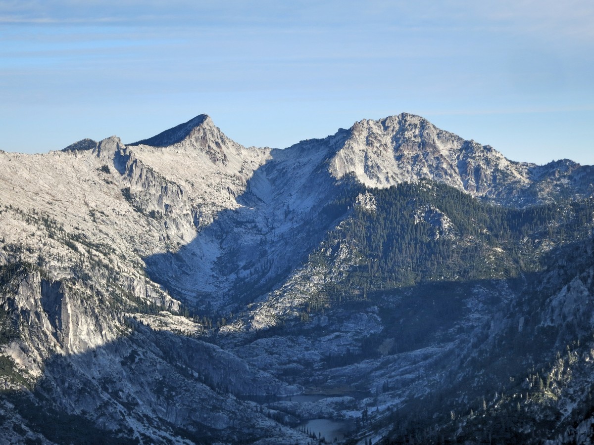
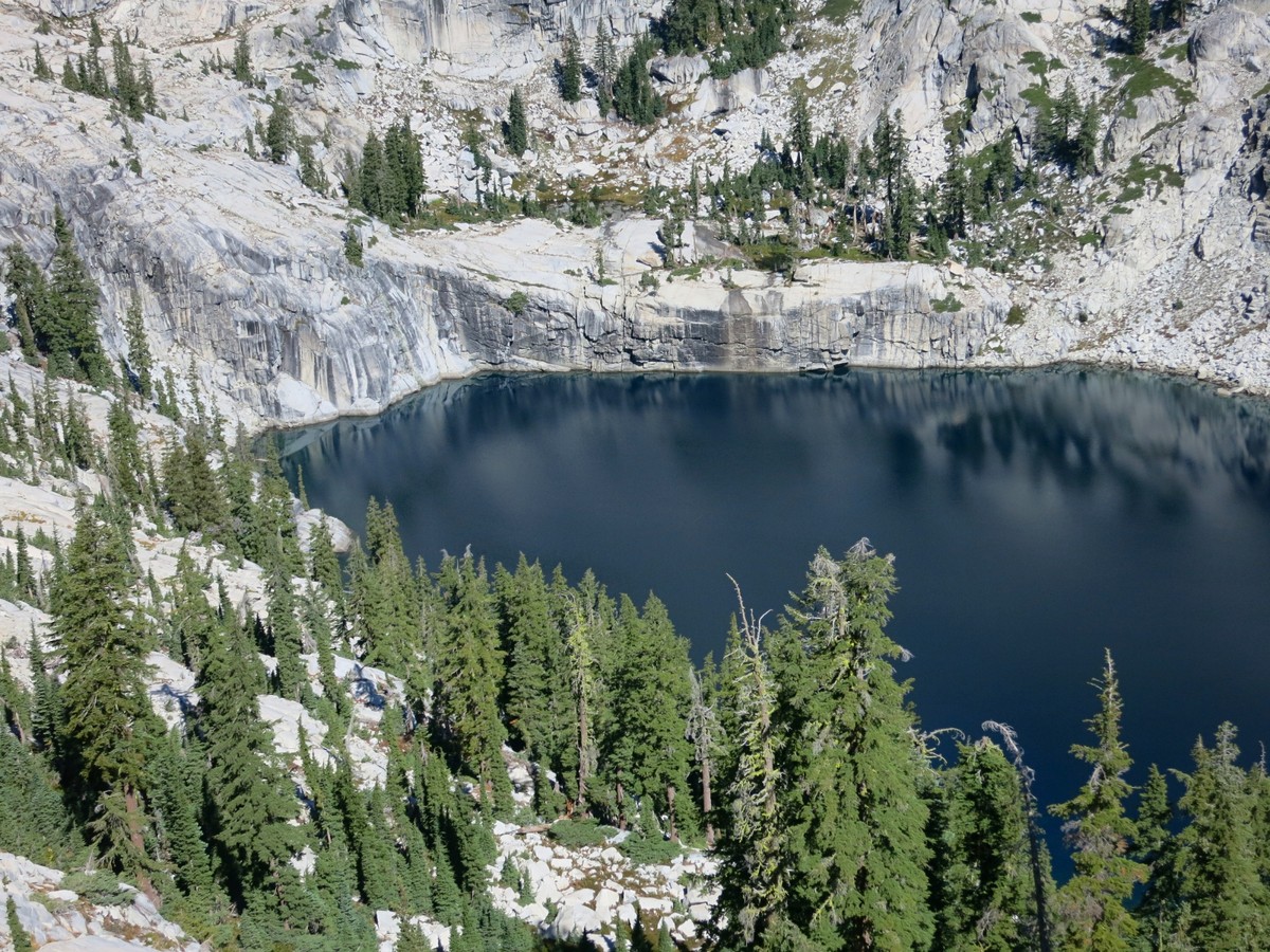
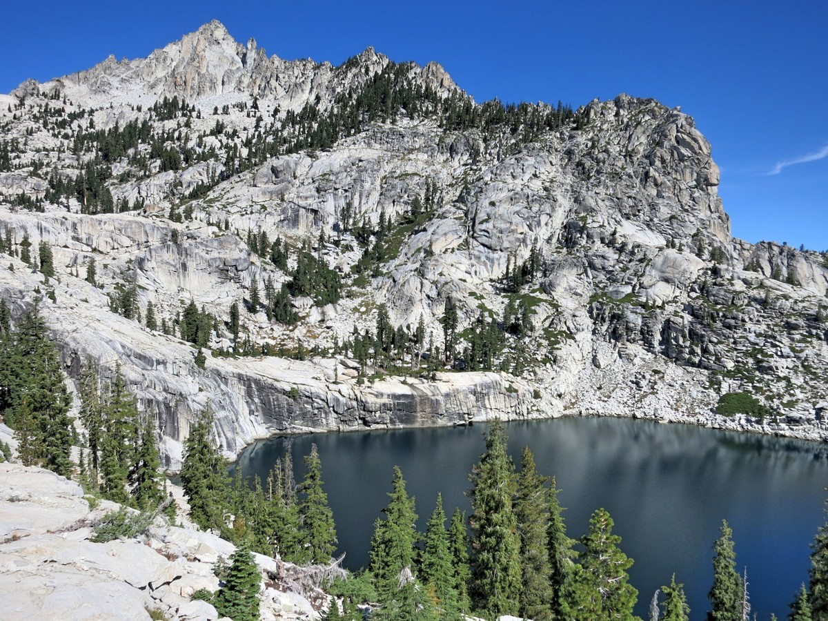
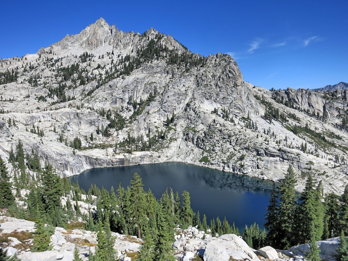
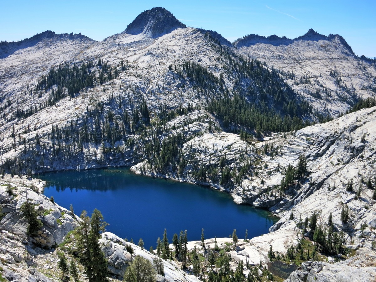
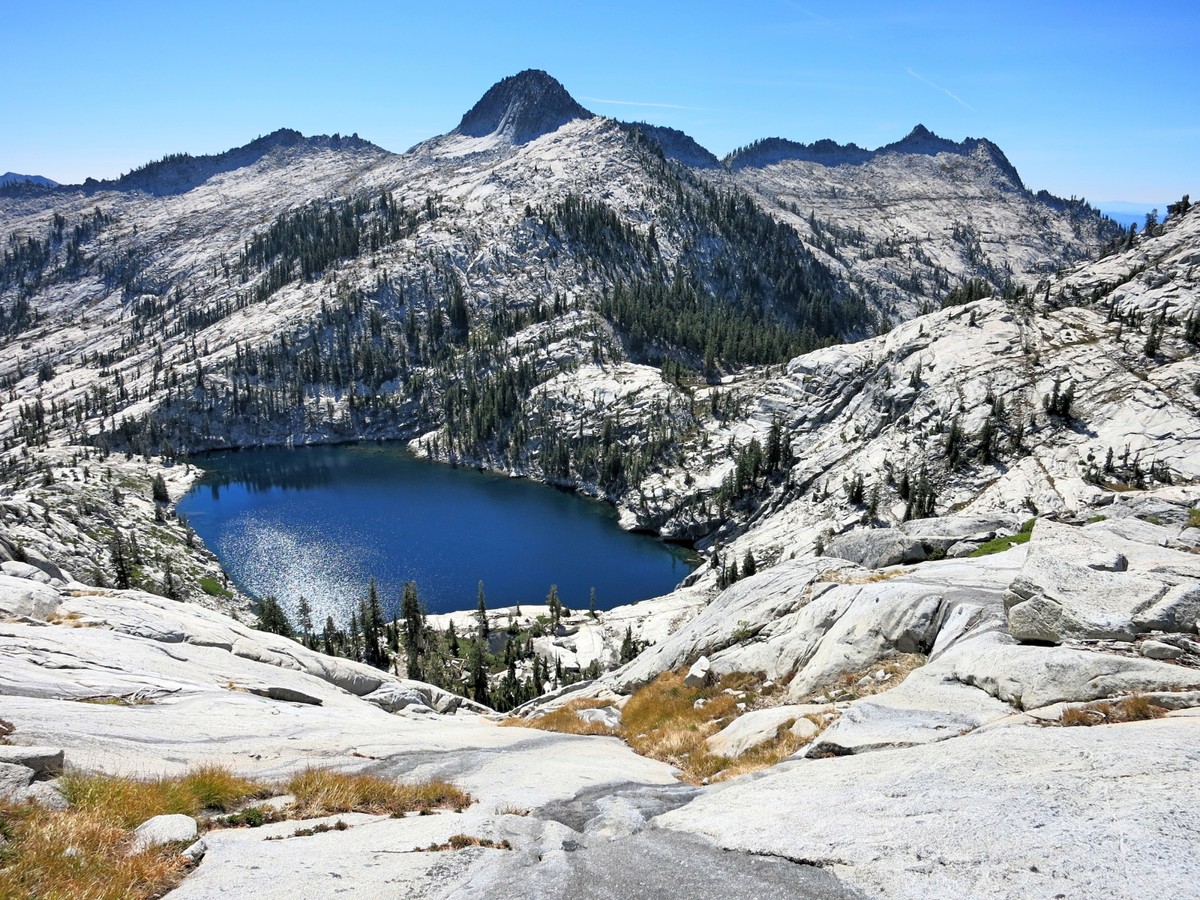
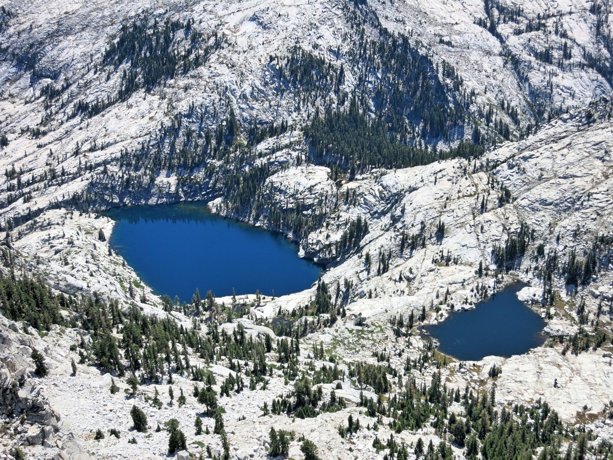
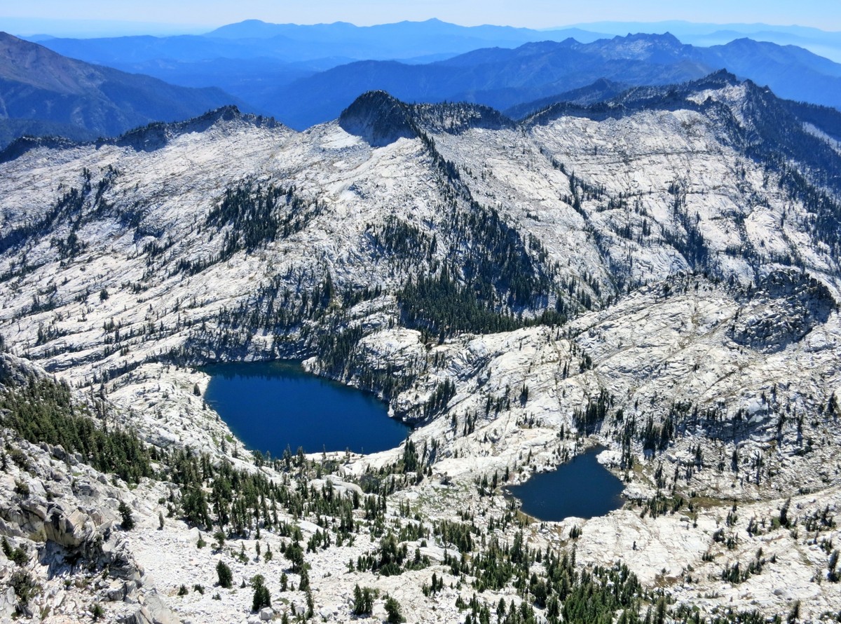
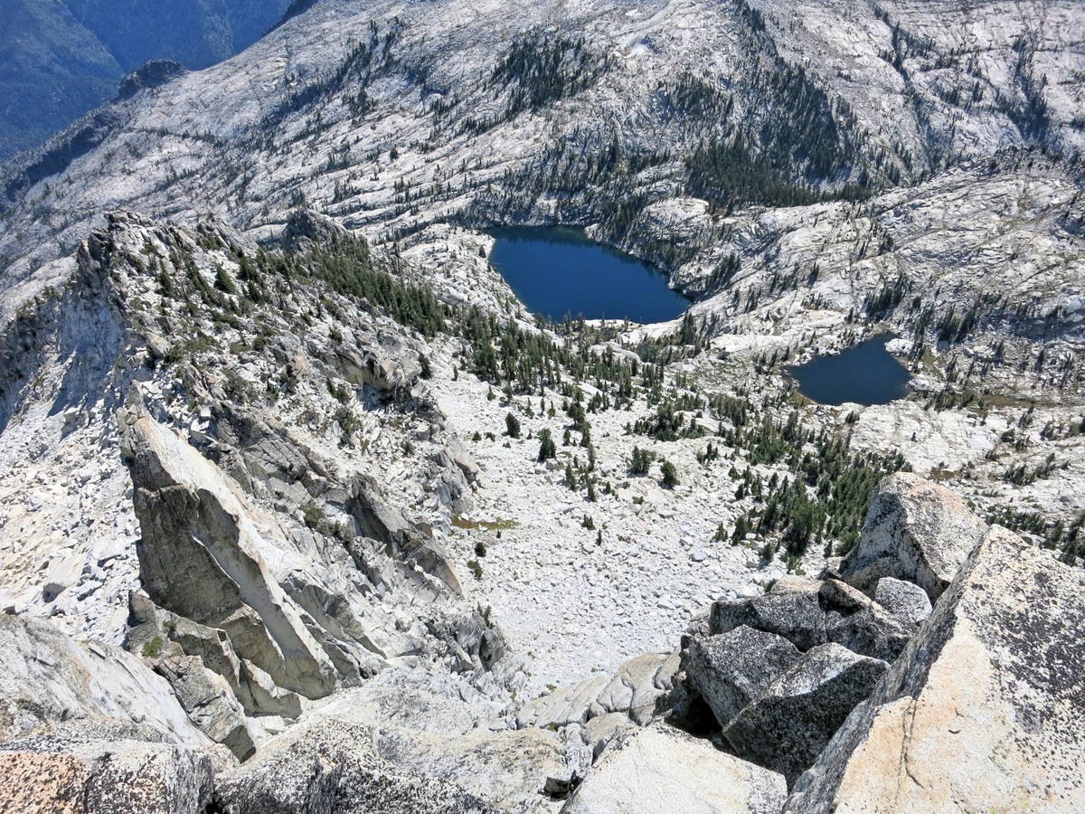
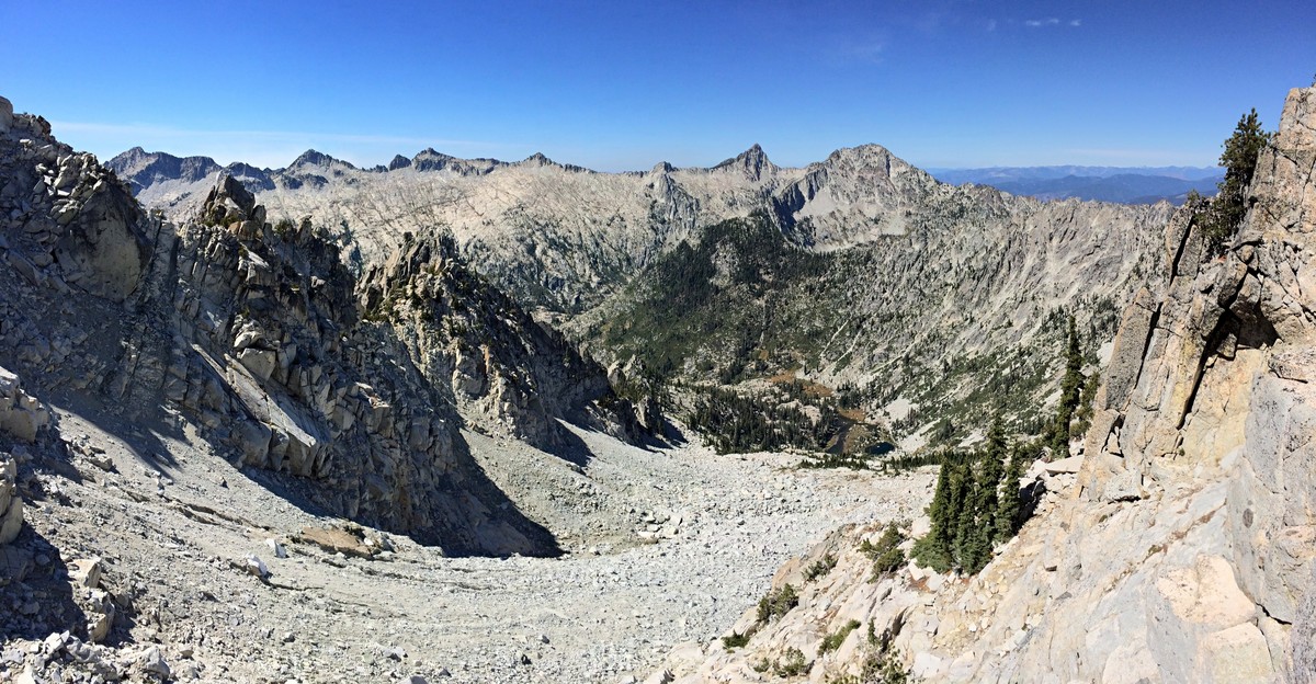
 From the pass, instead of descending directly to Smith Lake’s outlet, traverse high around its south side to Morris Lake. The terrain down to the outlet is certainly negotiable, but one would miss the stellar view of Sawtooth Mountain towering above picturesque Smith Lake, which is among the favorite vistas of the route for the author. Smith Lake is known as the Queen of the Alps, and rightfully so, with it’s deep blue waters carved in a smooth bowl of white granite. This is an awesome and inspirational spot with outstanding scenery.
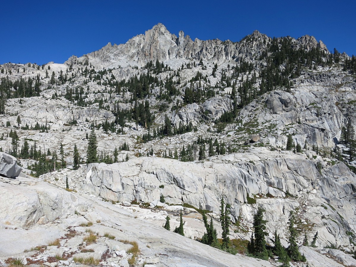
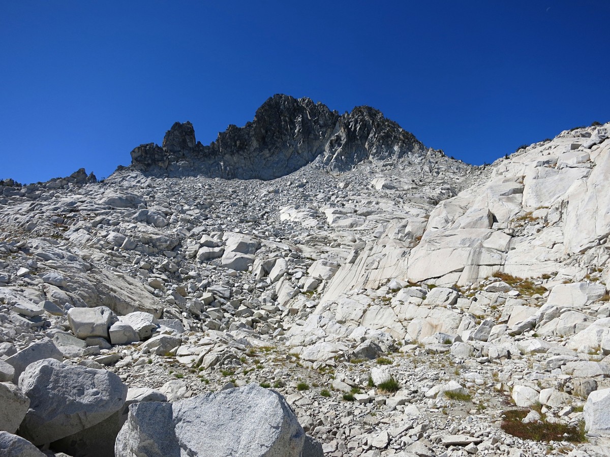
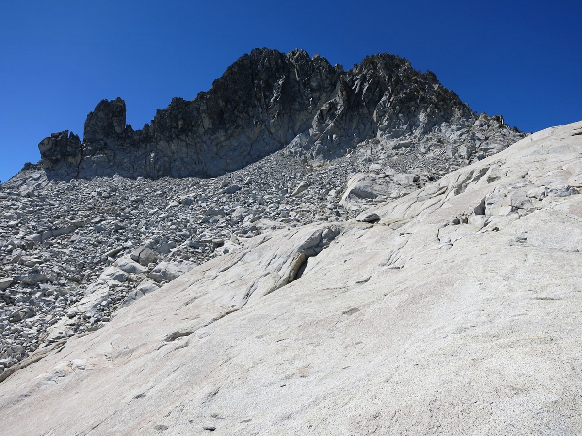
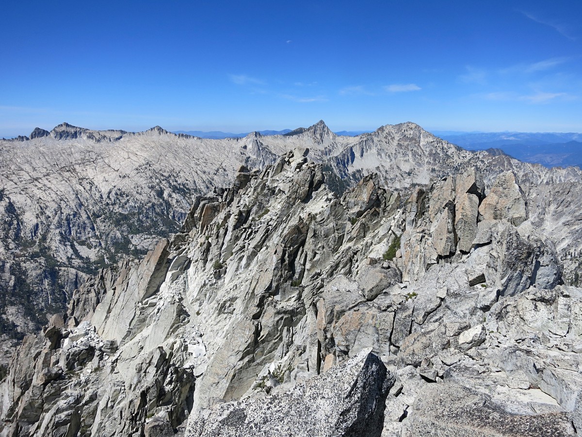
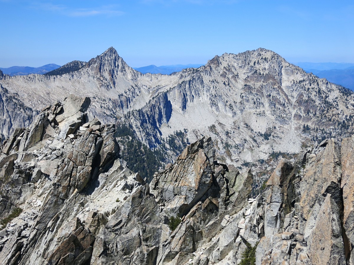
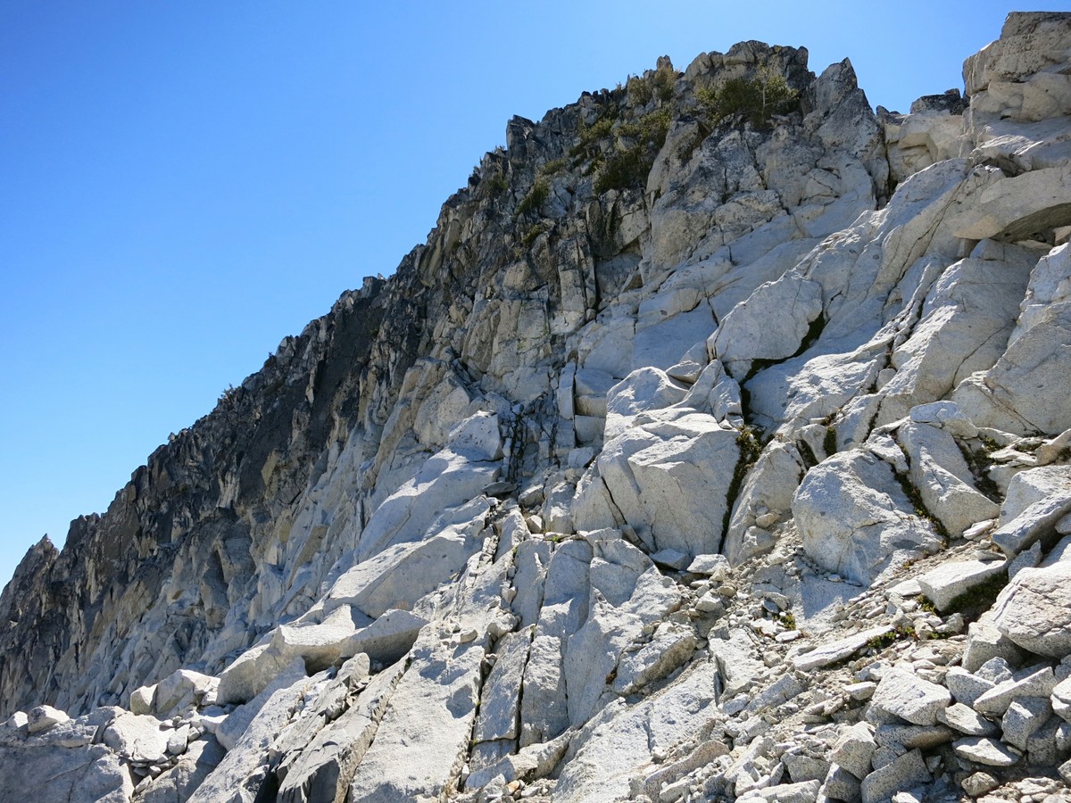
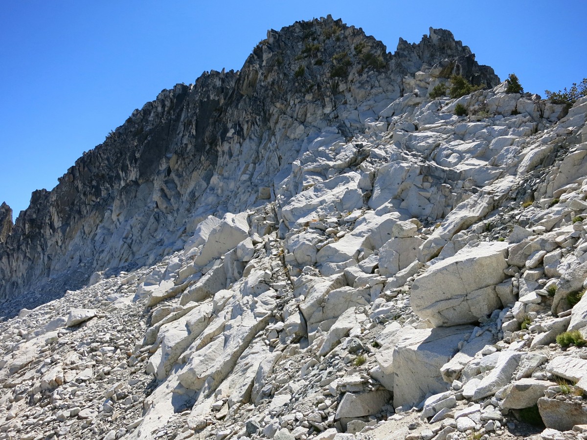
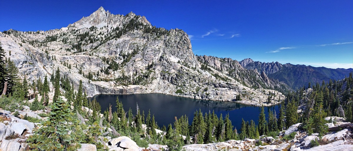 From Morris Lake use a steep ramp to cross over the southeast ridge of Sawtooth Mountain at a notch. From the notch it was fairly easy travel on slabs and talus up to the north ridge of Sawtooth Mountain. Of the six named peaks surrounding the Canyon Creek drainage, Sawtooth Mountain is arguably the most compelling as it is the most remote and difficult mountain in the Trinity Alps with a wild character. Despite not being the tallest mountain in the Trinities (a title which belongs to Thompson Peak), a strong argument can be made that it is the centerpiece peak of the Trinity Alps, and in the opinion of the author it is. Information on the final scramble up the large summit block (the “tooth”) was scarce, but I found it to be fairly straightforward. The first few moves up the ridge are probably the most difficult but go as class 3 if you look carefully. More class 3 climbing continues up along the ridge (generally on its east side) until the climber reaches a spot on the crest of the ridge near the north summit, which is a few feet lower than the south summit. The traverse over to the south summit entails some more class 3 scrambling and micro-routefinding passing over and around a couple gendarmes but the south summit is ultimately not far away and the climber soon finds themselves sitting atop the summit rocks with a birds eye view of the Trinities.
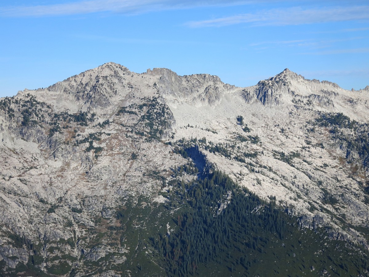
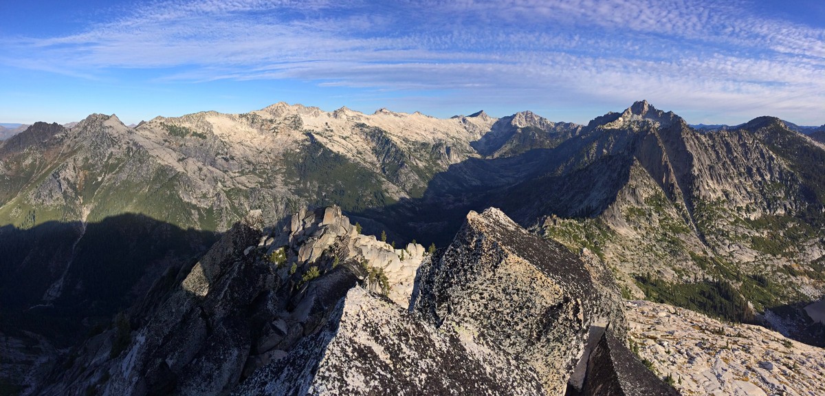
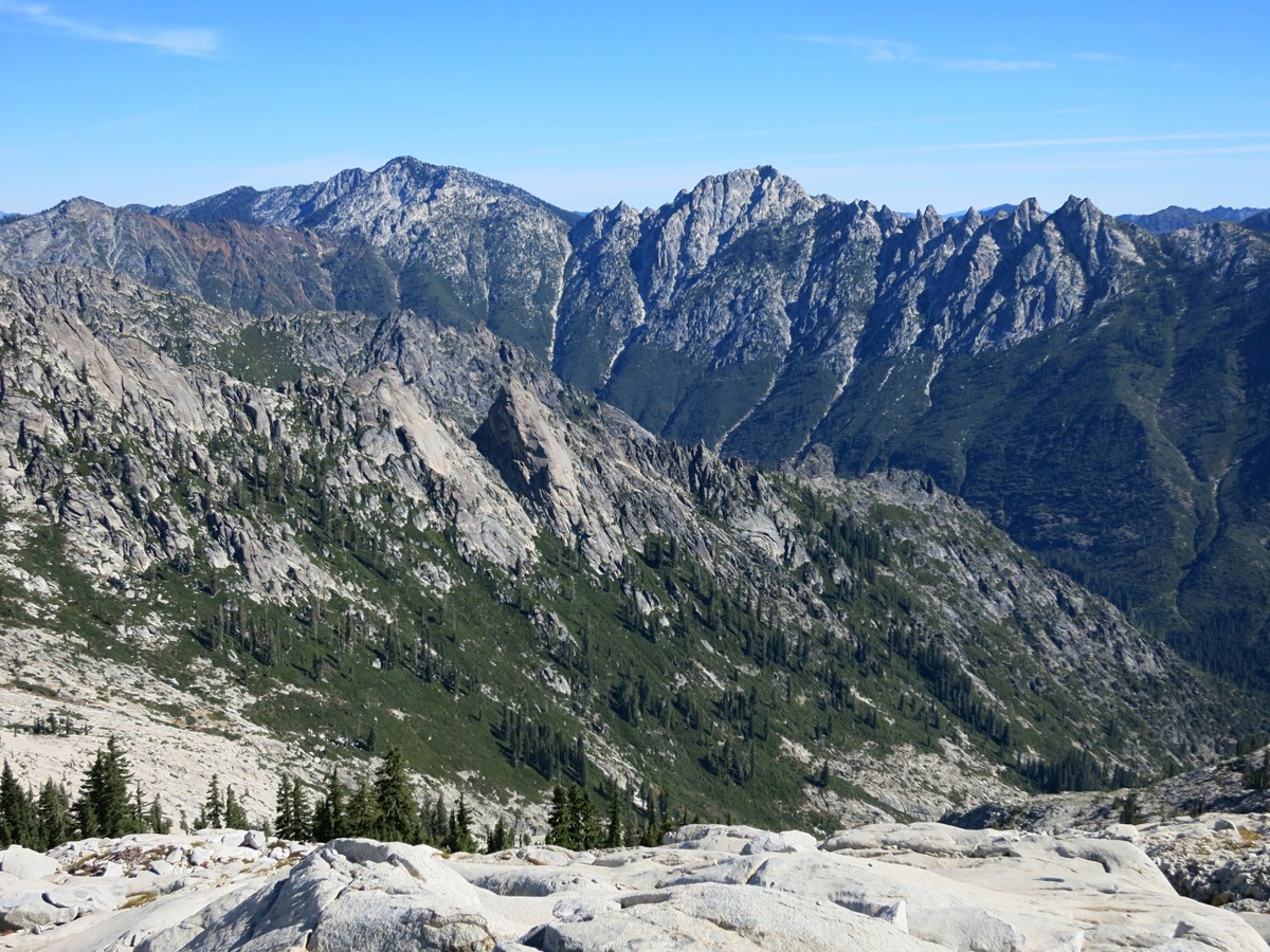
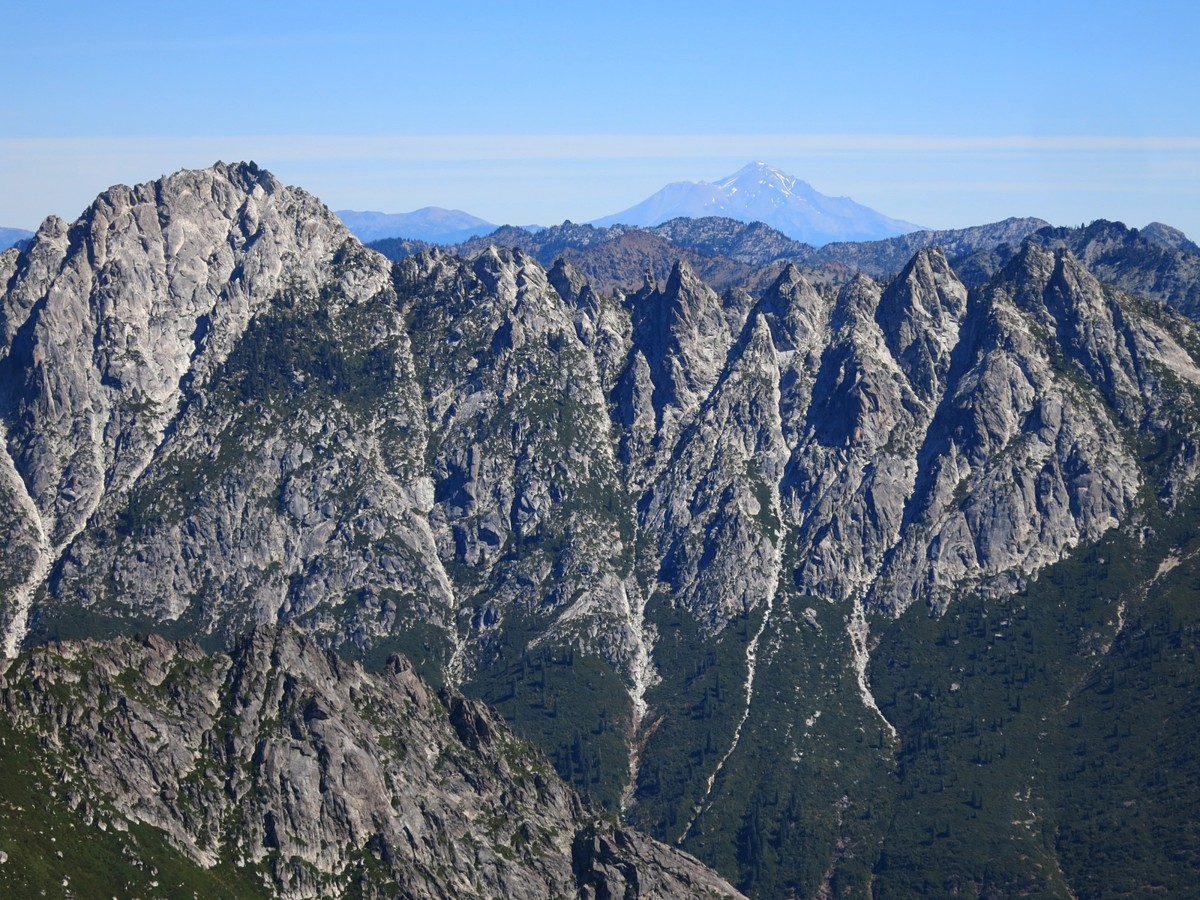
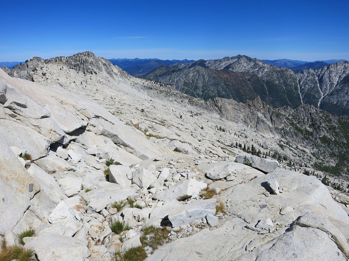
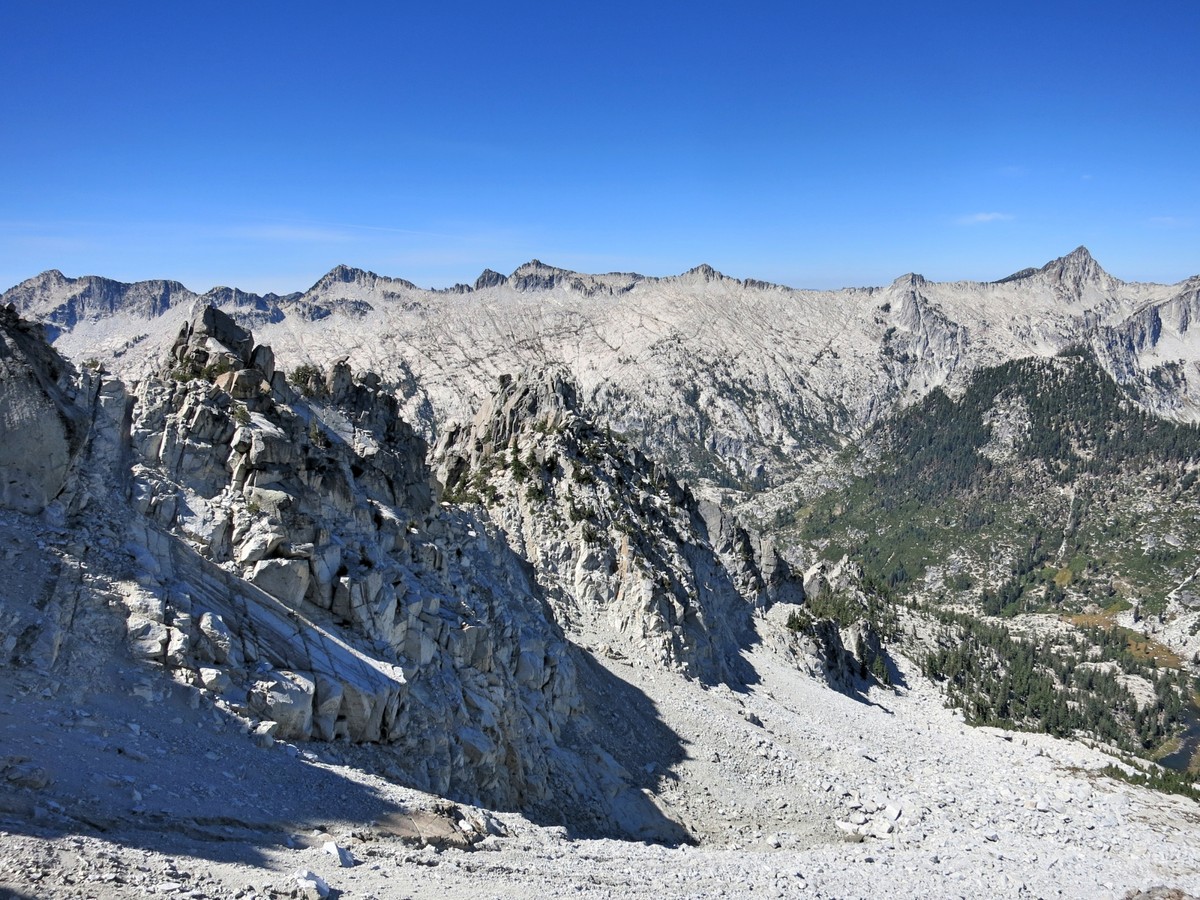
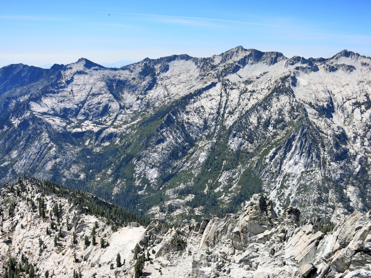
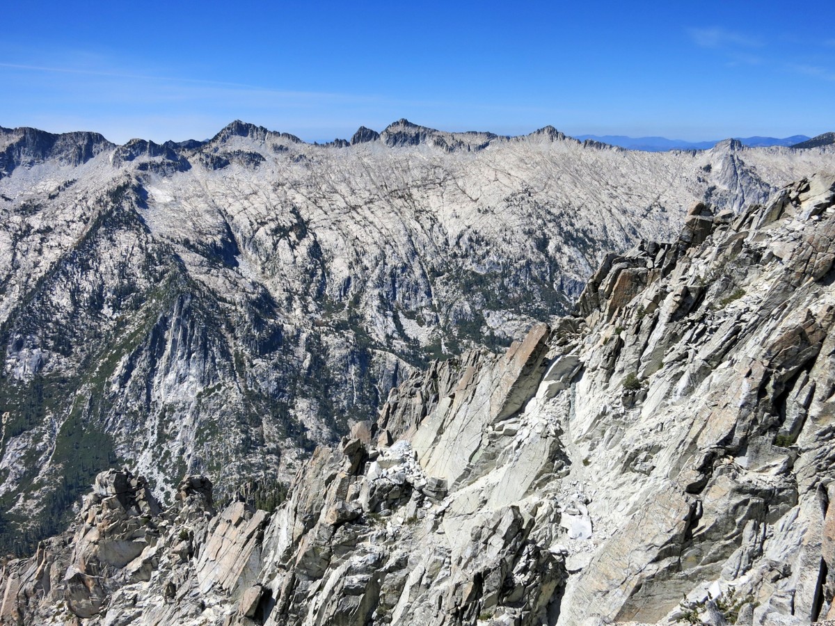
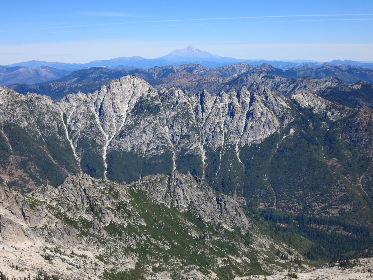
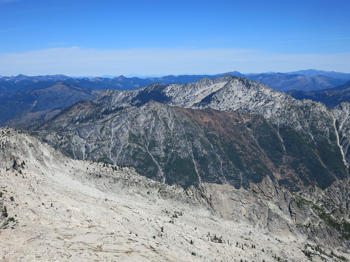
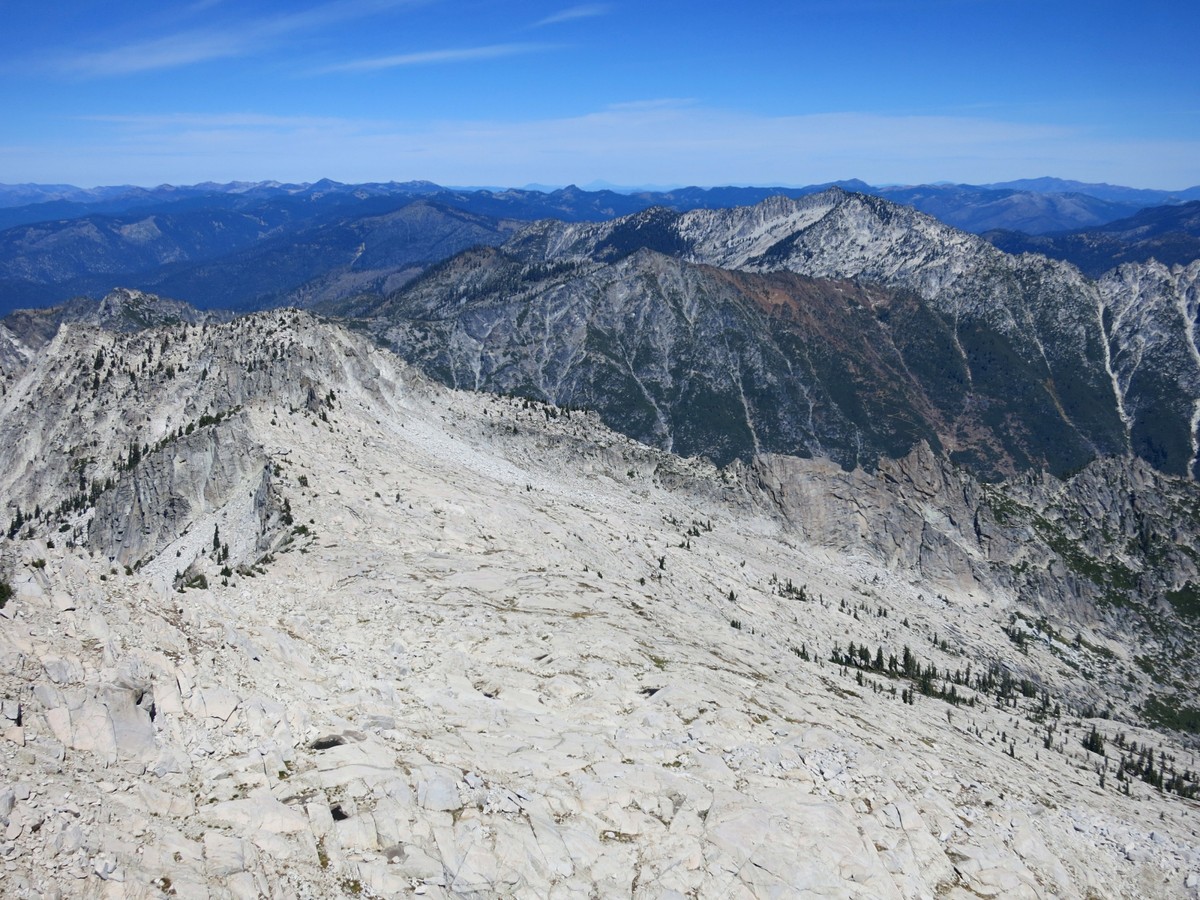
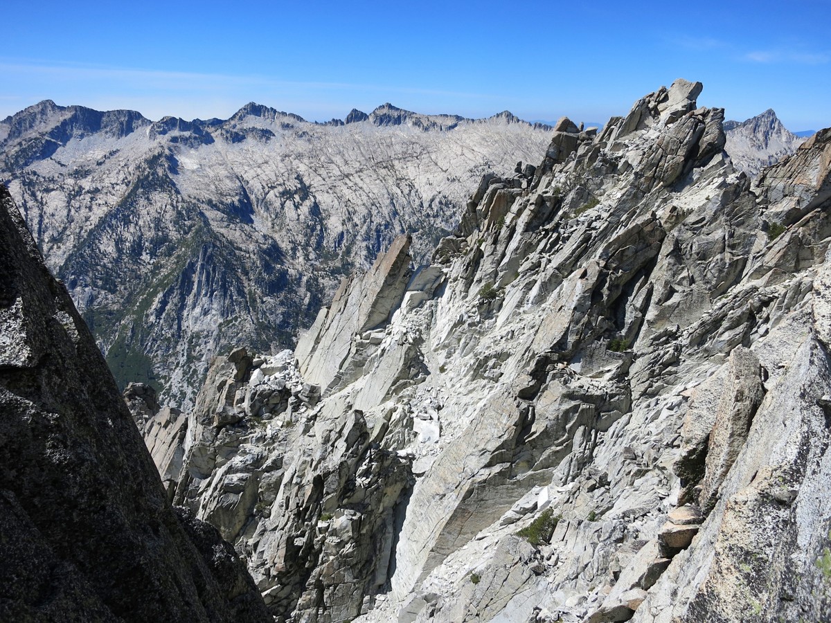
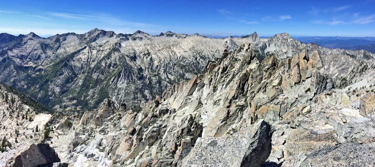 Sawtooth Mountain is an excellent vantage of all of the surrounding terrain including Mount HIlton, Thompson Peak and Caesar Peak with distant views to the Red Trinities and Mount Shasta. Immediately below are Smith Lake and Morris Lake, shimmering in their granite bowls. It’s a grand vista and worthy of spending some time to enjoy the scene. After reversing the rock scramble moves up Sawtooth Mountain one must traverse to Mirror Lake which entails passage through Twin Pine Pass and a traverse to Kalmia Pass and the ledges above Mirror Lake. This segment of the Trinity Alps High Route, along with the continuation of the journey to Caesar Peak, Grizzly Lake and Thompson Peak will be covered in the next post.
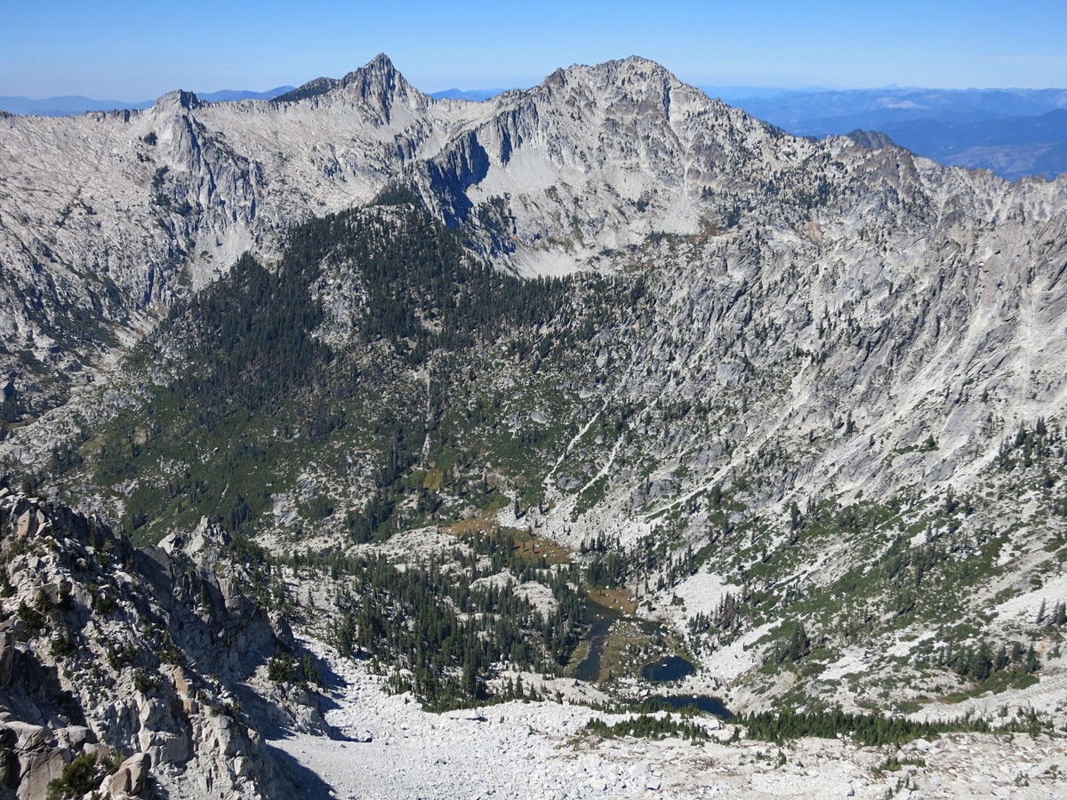


The pictures perfectly capture why the mountains, the heights are the best place to be in, whether it’s hiking or riding. There are just some things up there, the views, the summits, the lakes, the flora and fauna, that calls us to it.
Good thing the TAHR was developed!
Leor, well done, I’ve been eyeing this route since first reading your report on the earlier traverse. Only got to get down to the Trinities for a short out and back do to fires during the summer. Can you supply basics like mileage and elevation for your route? Thanks!
Great trip. I have done bits and pieces of the TAHR and hope to finally put together a loop that would most likely bypass the Bear Creek route and opt for the gully into Canyon Creek from the saddle south of Morris Lake. To find that “clipped” brush route to the pass between Alpine and Morris is indeed a treat! If you miss it, take plenty of bandaids!
We know you are a stud but quit posting off trail routes in the Trinities. Let courageous folks discover them on their own. That is best for all.