 Photo album here.
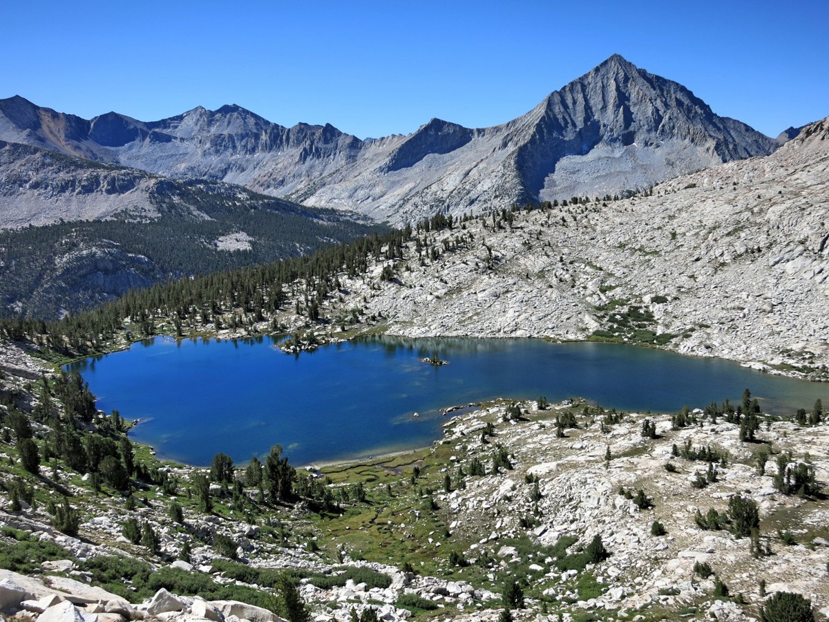
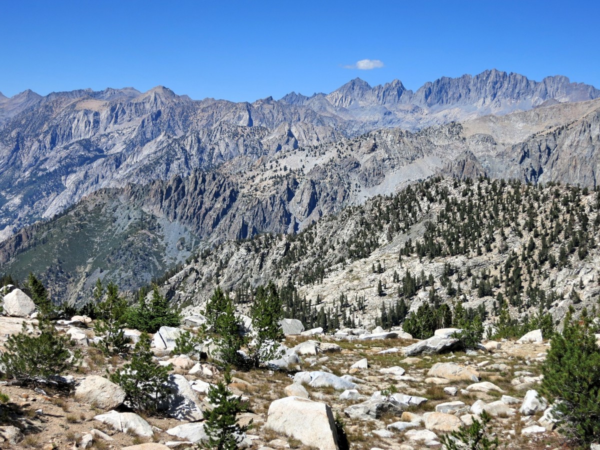
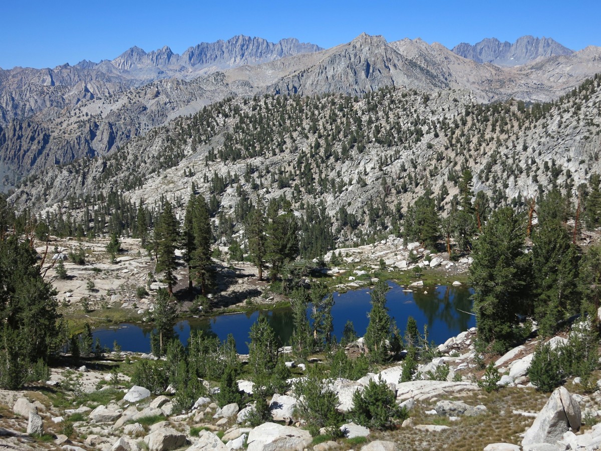
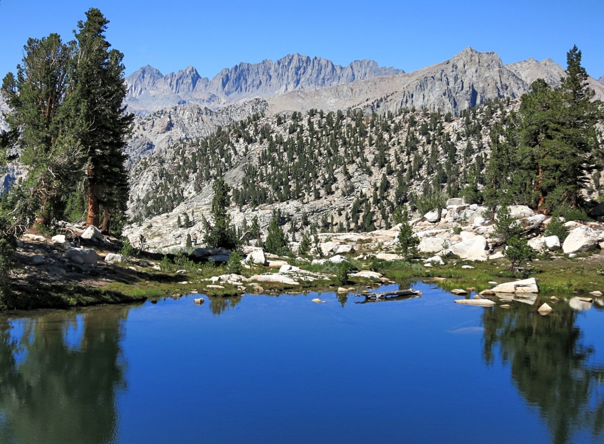
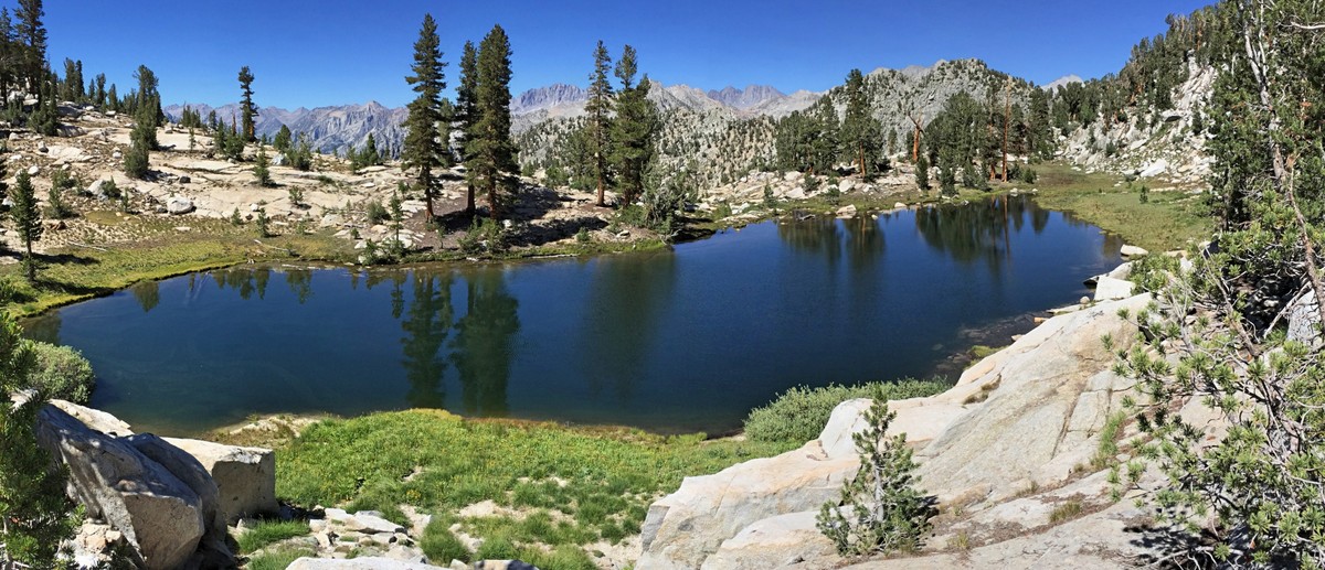
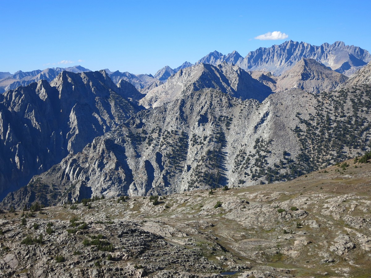
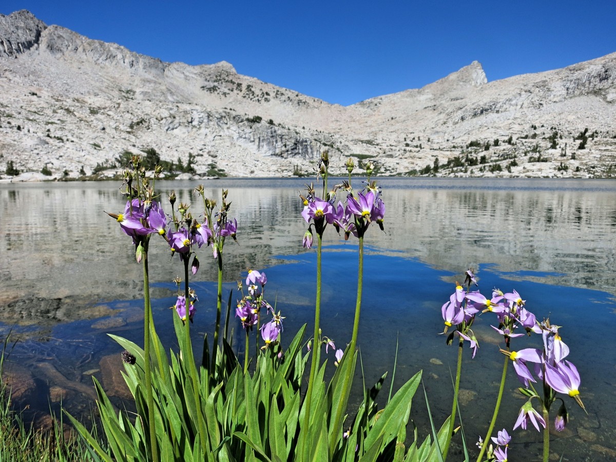
I have been wanting to get into Lake Basin since I looked down into it from the summit of Marion Peak last fall and Mount Ruskin has looked intriguing from the summit of Arrow Peak so I decided to combine the two in a two day fastpack loop and include Bench Lake, one of my favorite spots in the High Sierra. I started from Road’s End up the Copper Creek trail and it was quite warm. I would have rather started before the sun came up but the necessity of a permit and waiting behind other visitors asking questions precluded that. It was a relief to reach the relative cool of Grouse Lake and start this section of the Sierra High Route to Marion Lake. I was familiar with this stretch after my Cirque Crest loop last year, except this year I had an even better view across the Middle Fork Kings Canyon from Windy Ridge and Gray Pass. This area is simply spectacular with the “Windy Peak Lake” perfectly situated in the foreground of the Middle Fork Kings Canyon, Le Conte Canyon and the breadth of peaks surrounding the Middle Fork from Mount Goddard to the Palisades. The clarity on this afternoon was amazing and confirmed my opinion that this is one of the grandest views in all of the High Sierra. I continued from Gray Pass to White Pass and finally Red Pass before descending to Marion Lake in the early evening. Strava GPS route here. 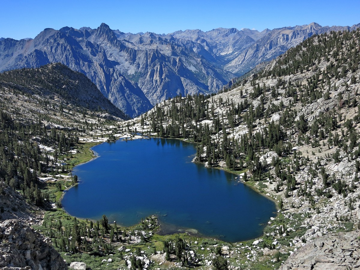
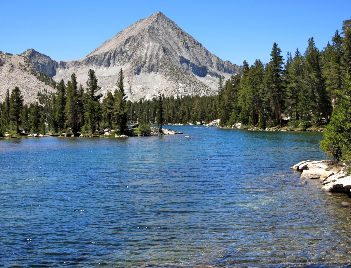
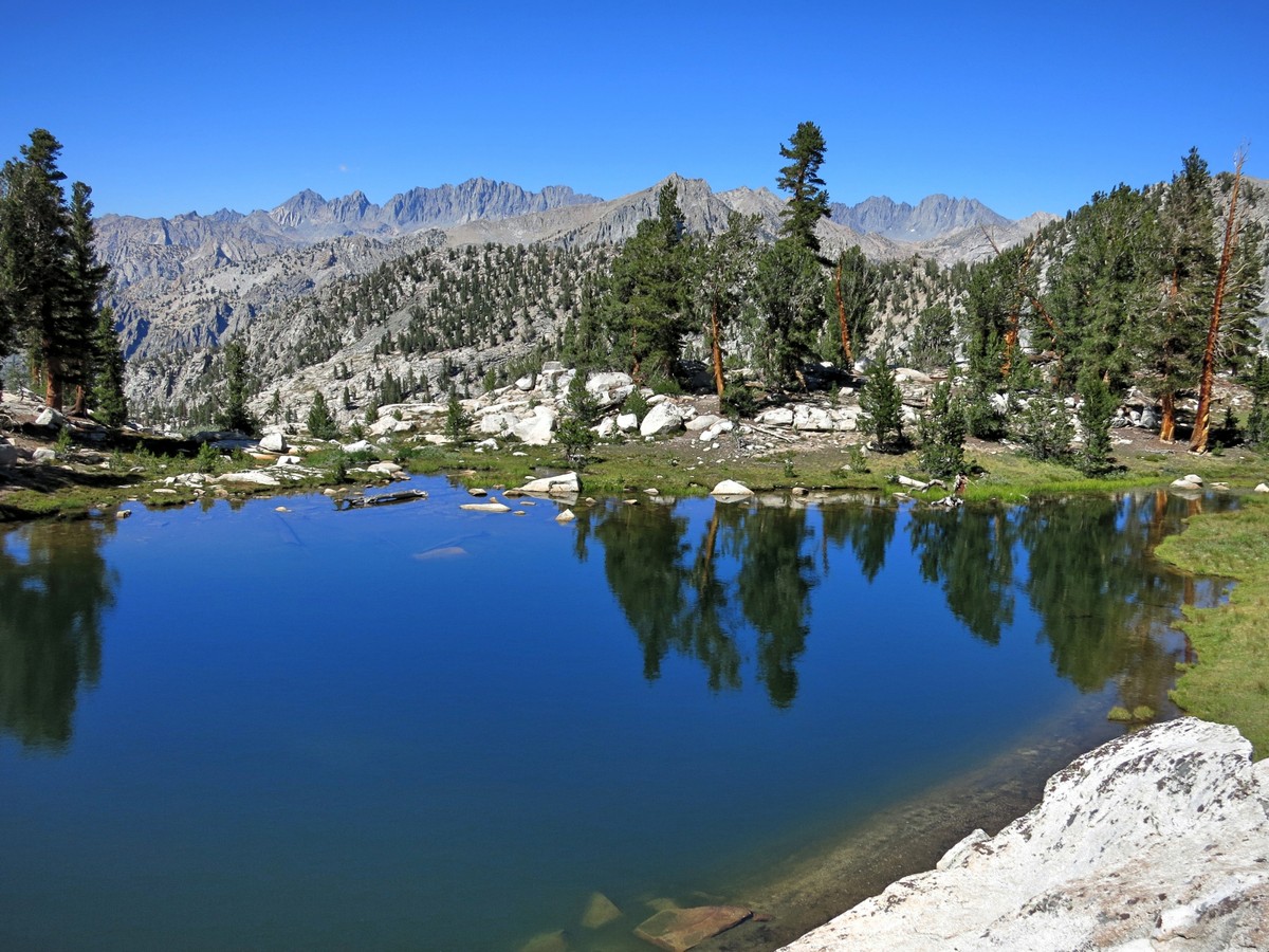
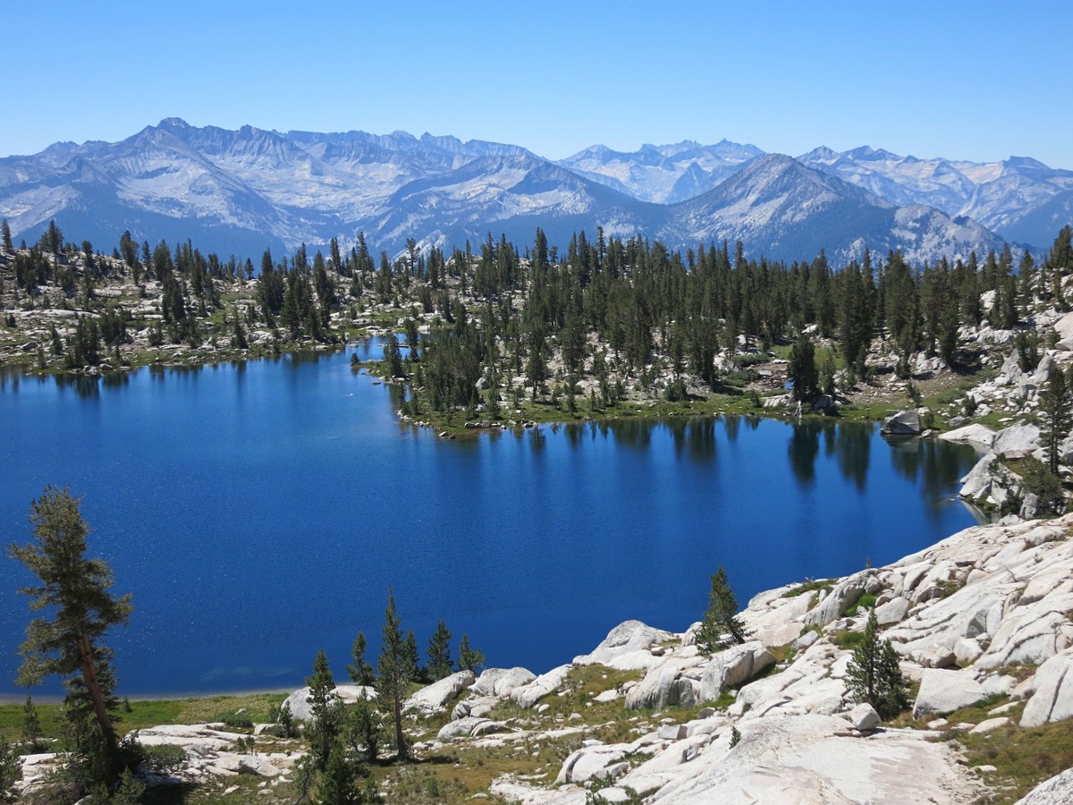
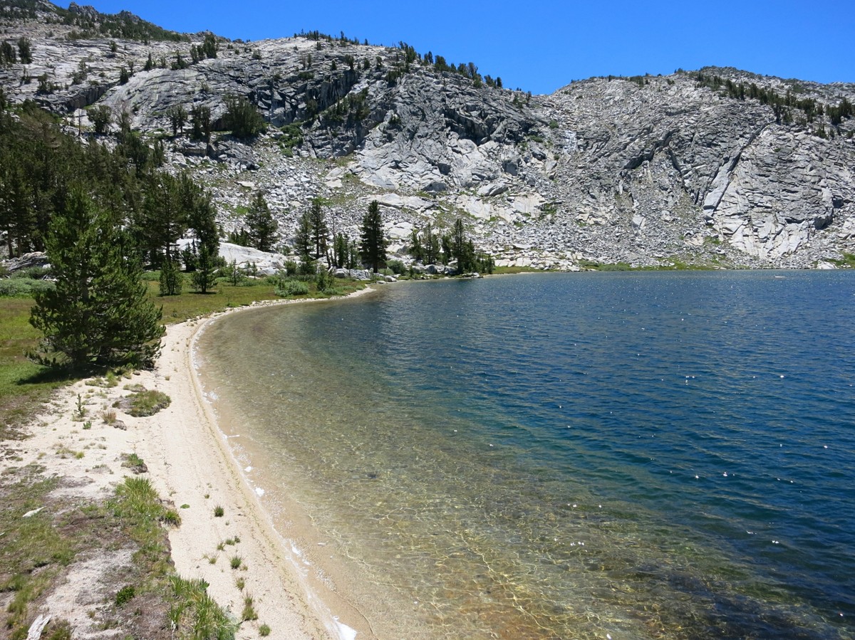
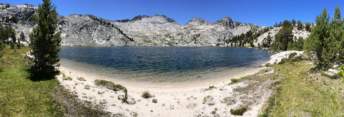
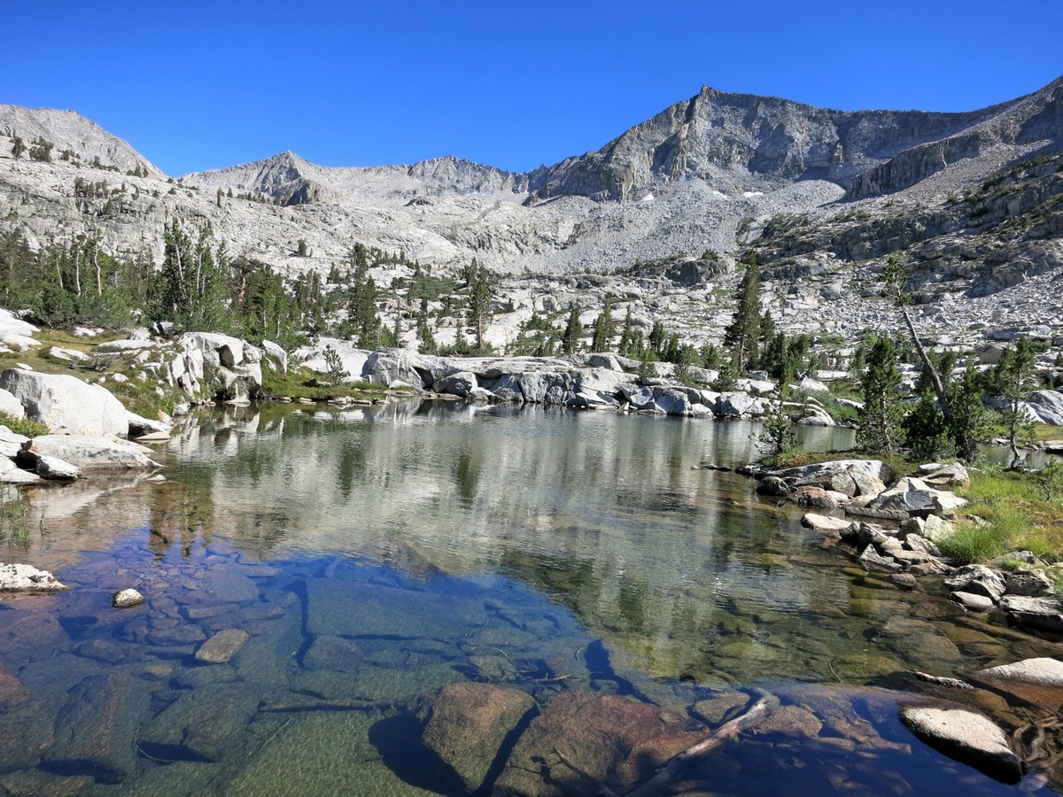
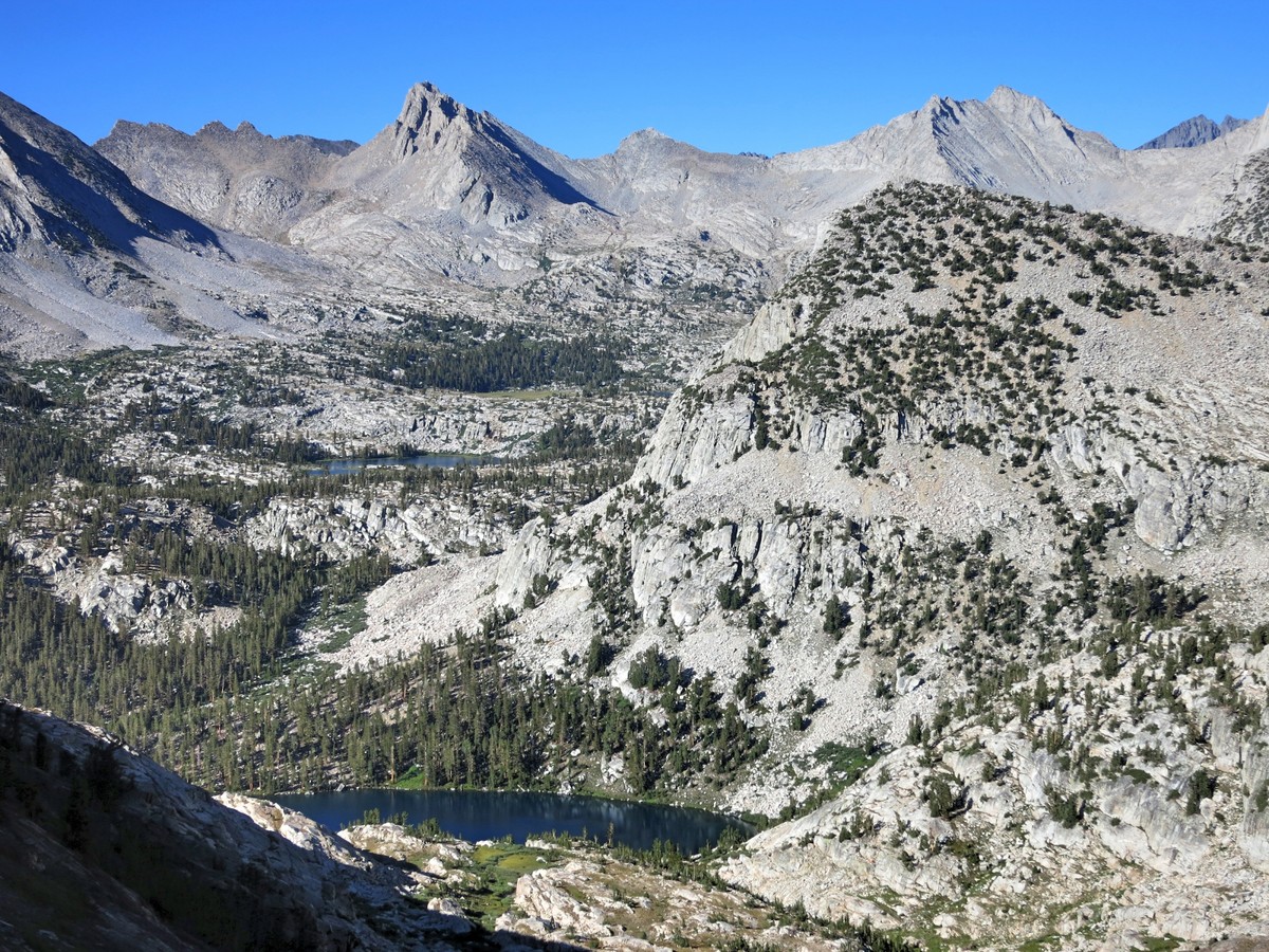
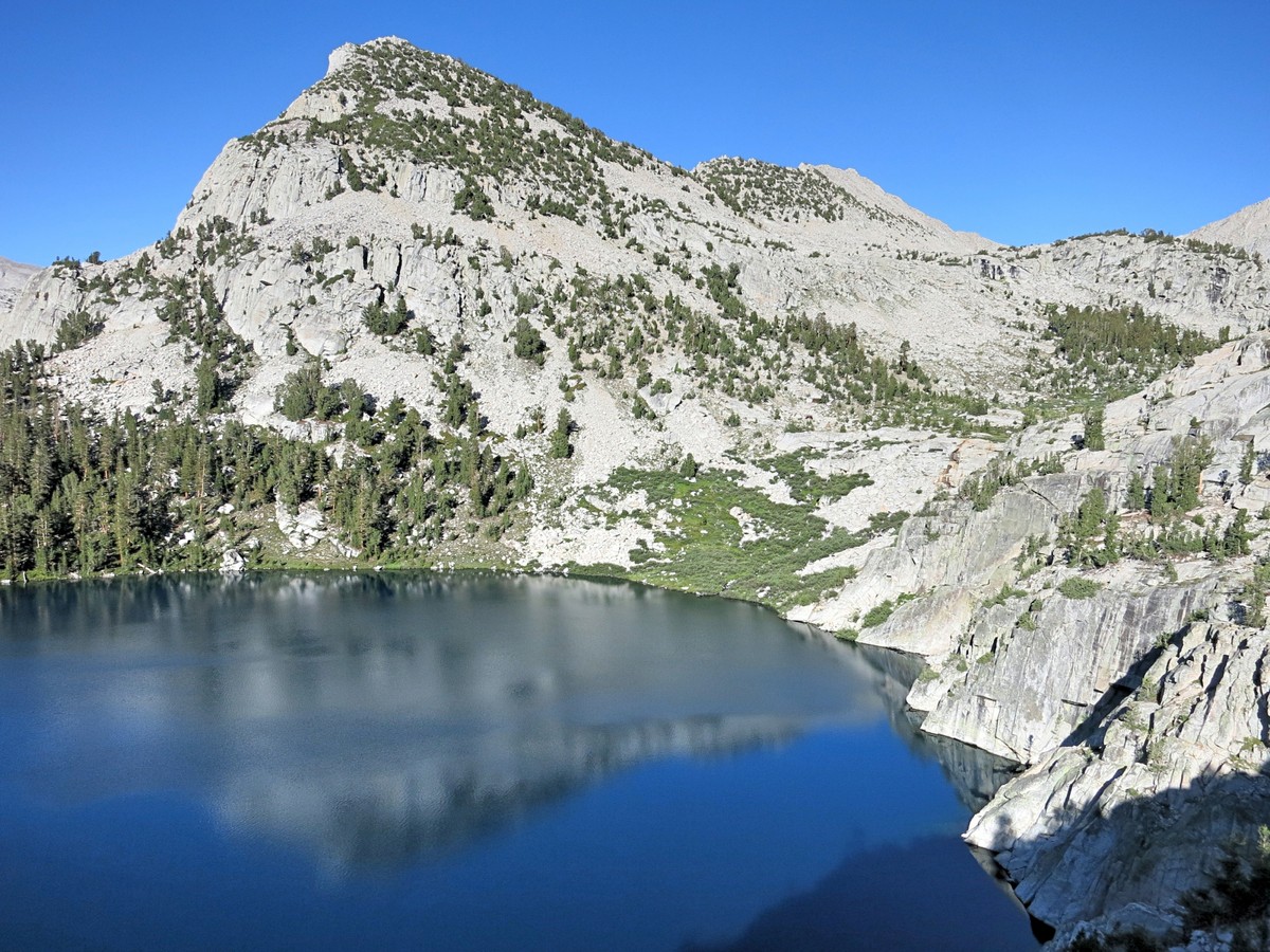
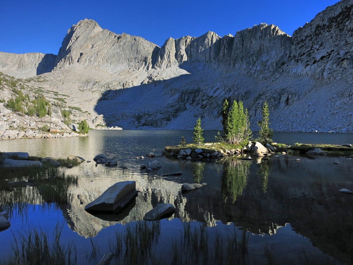
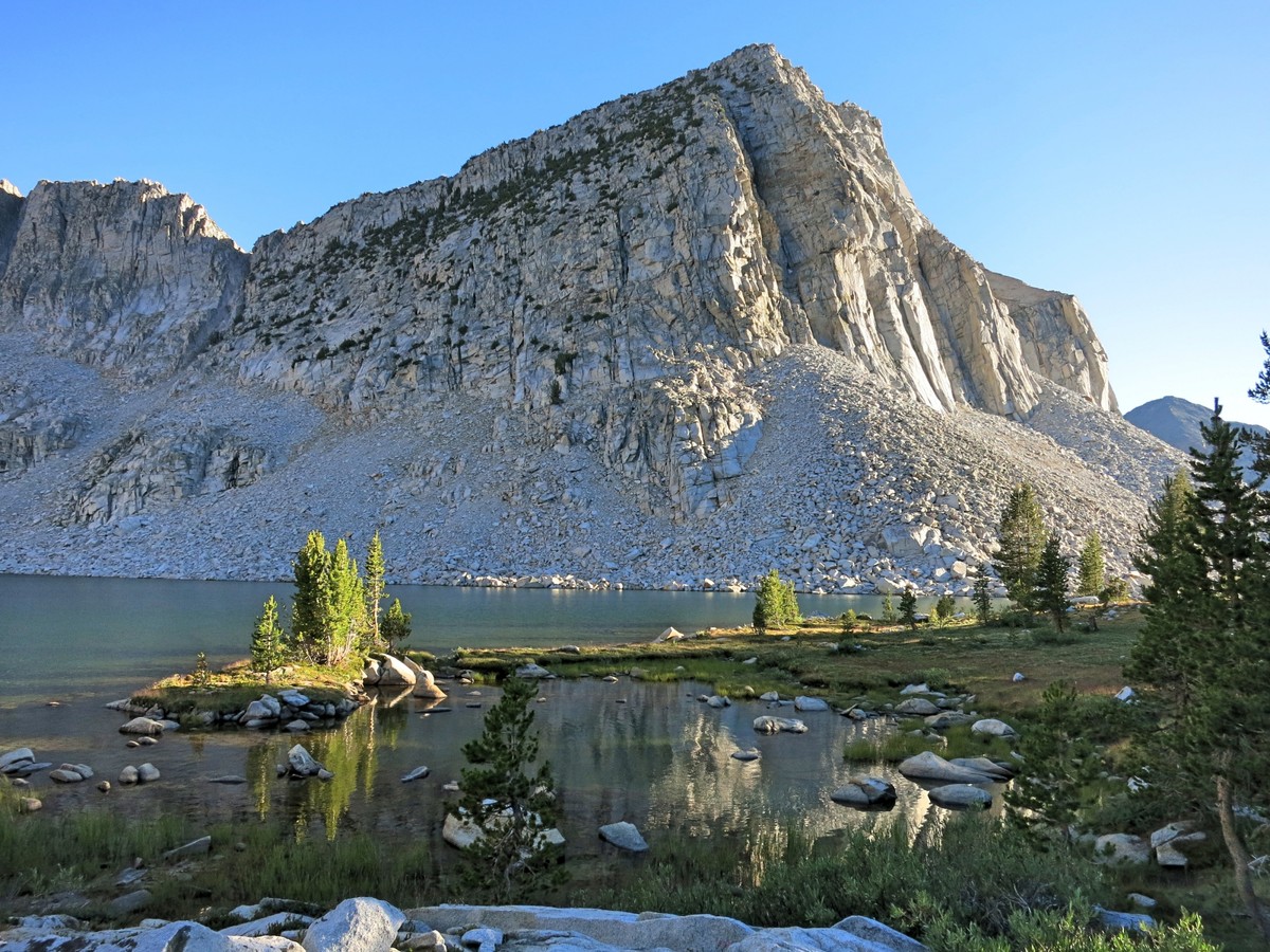
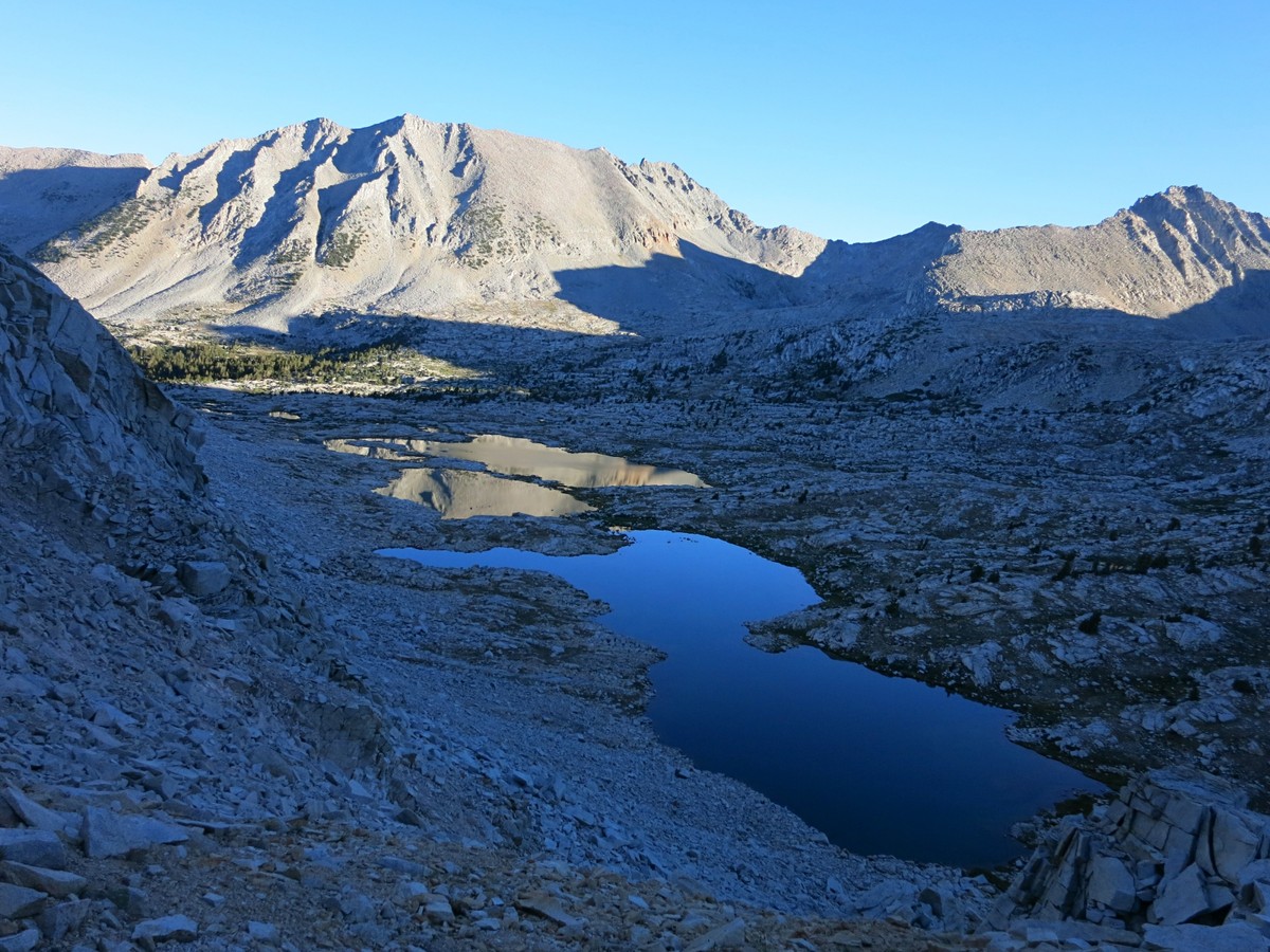
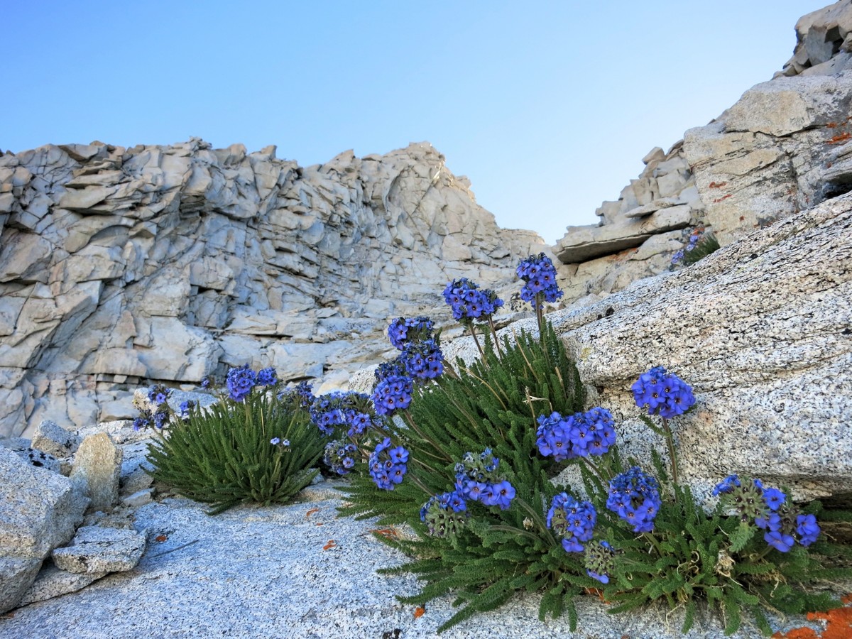
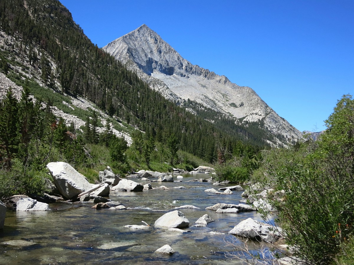
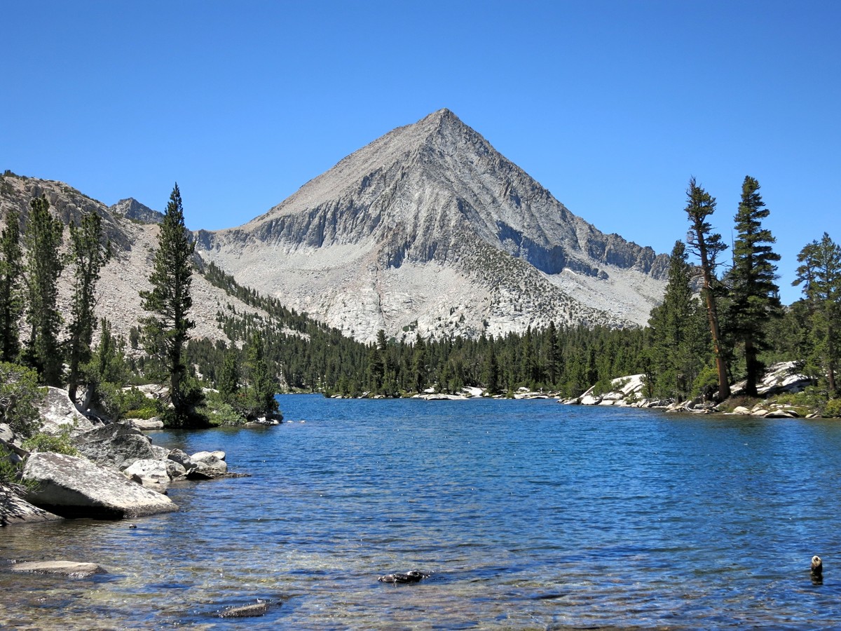
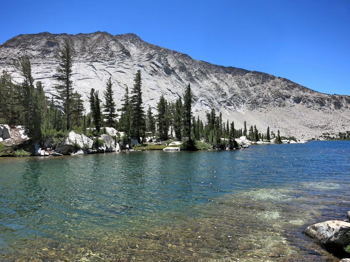
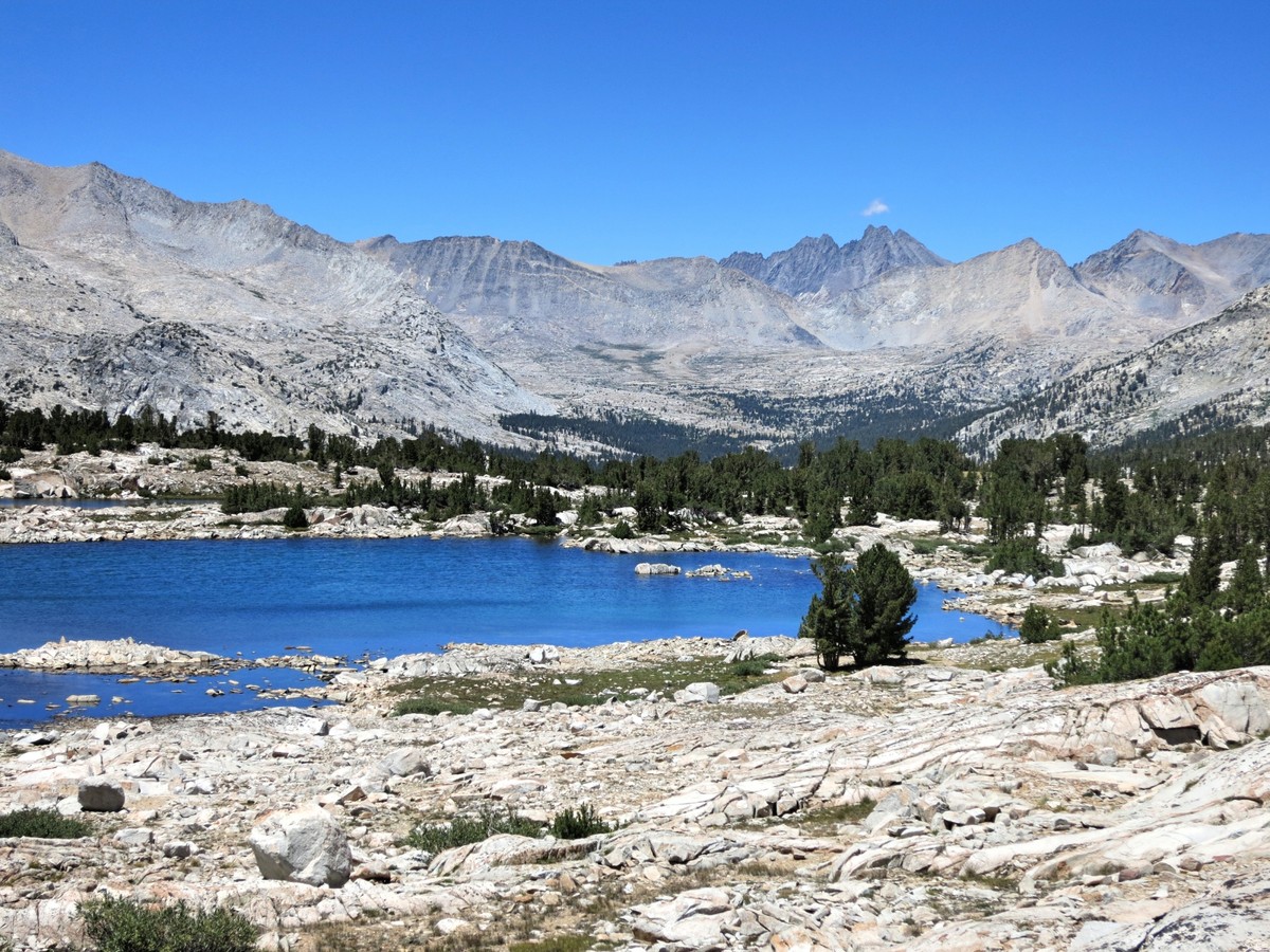
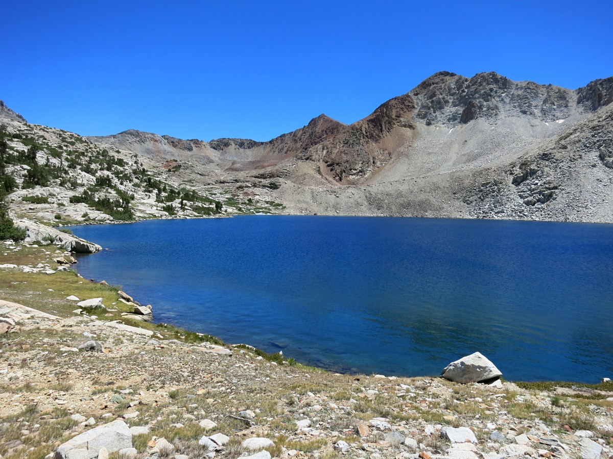
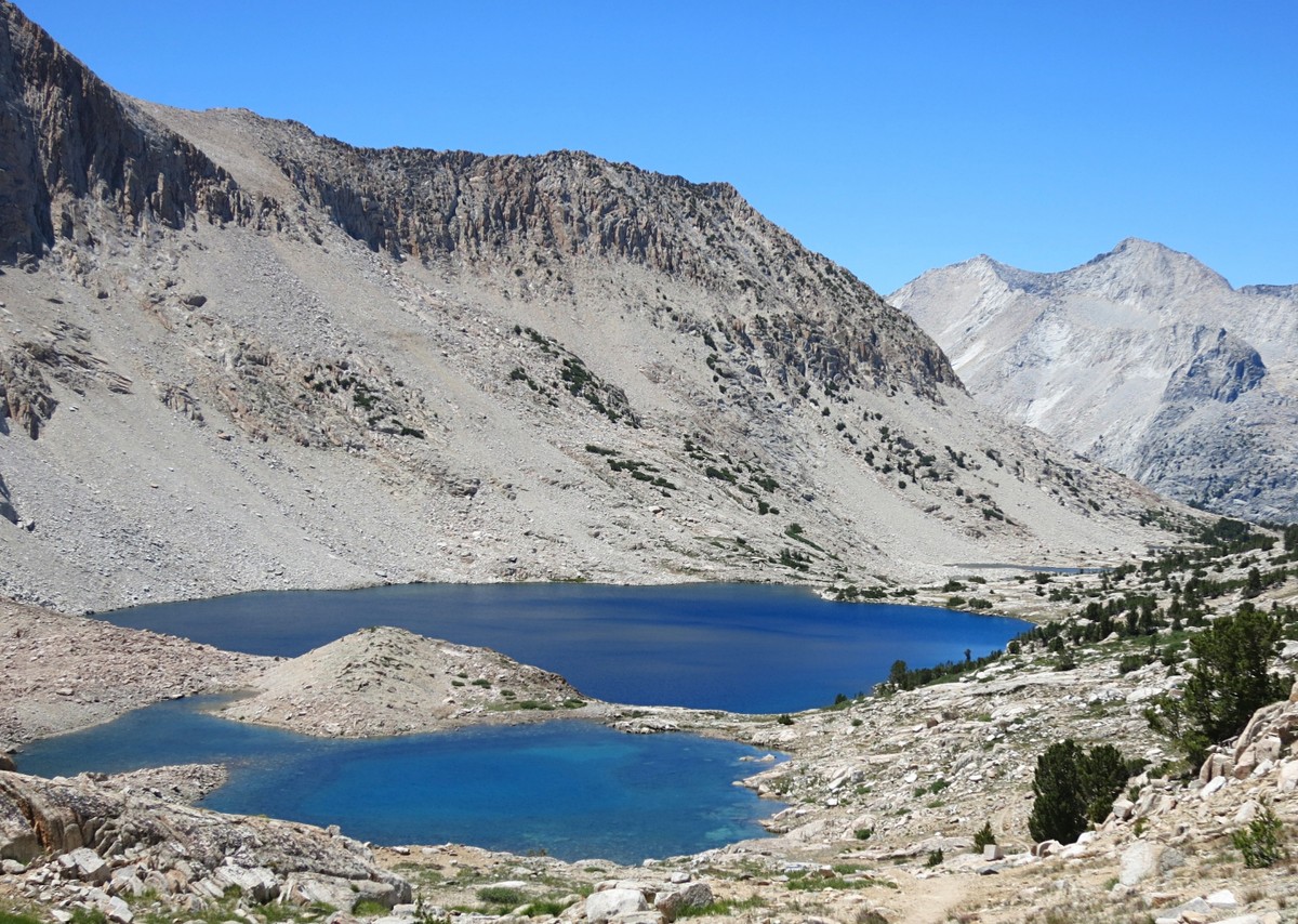
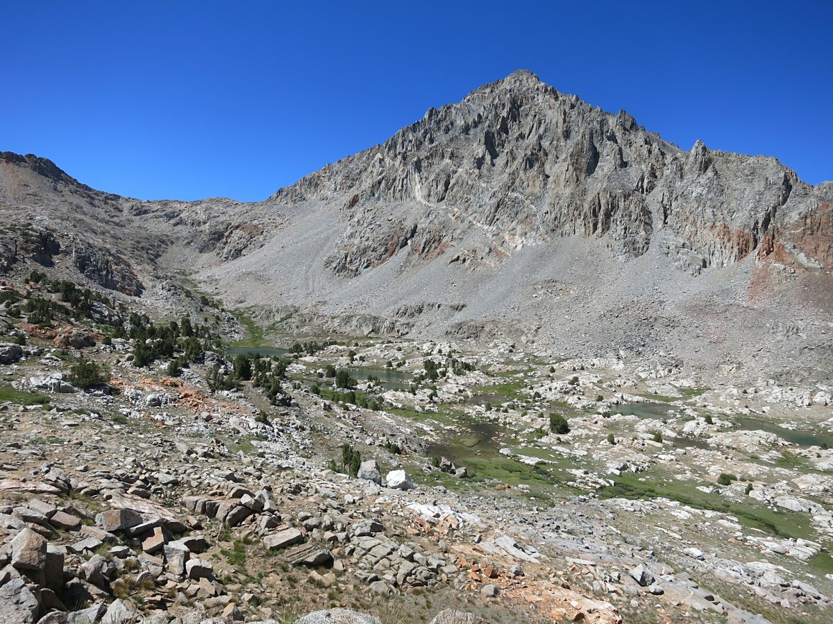
 Marion Lake is nestled in a granite bowl with the Cirque Crest and Marion Peak towering above, but what makes this lake so special is its vibrant deep blue color. Marion Lake is the bluest lake I have seen in the Sierra. I’m guessing this is due to the depth of the lake and a mineral deposit from the adjacent white granite cliffs. While Marion Lake was lovely and I took many photographs of its spectacular setting and reflections, it was also infested with mosquitoes so I continued up Lake Basin, passing by several beautiful lakes in evening light before finding a suitable camping spot with far less mosquitoes. My fastpack setup was adequate for the relatively warm temps and I got several hours of quasi-sleep before getting up around 6 am. I traversed through upper Lake Basin and ascended to Cartridge Pass where the old trail can still be followed. From Cartridge Pass I ascended the southwest chute of Mount Ruskin. The lower part of the climb was class 2, transitioning to class 3 in the upper slopes and finally a stout but fun old school Sierra class 3 summit block that had some exposure.
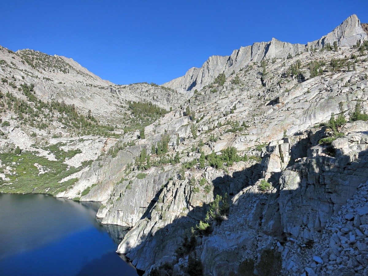
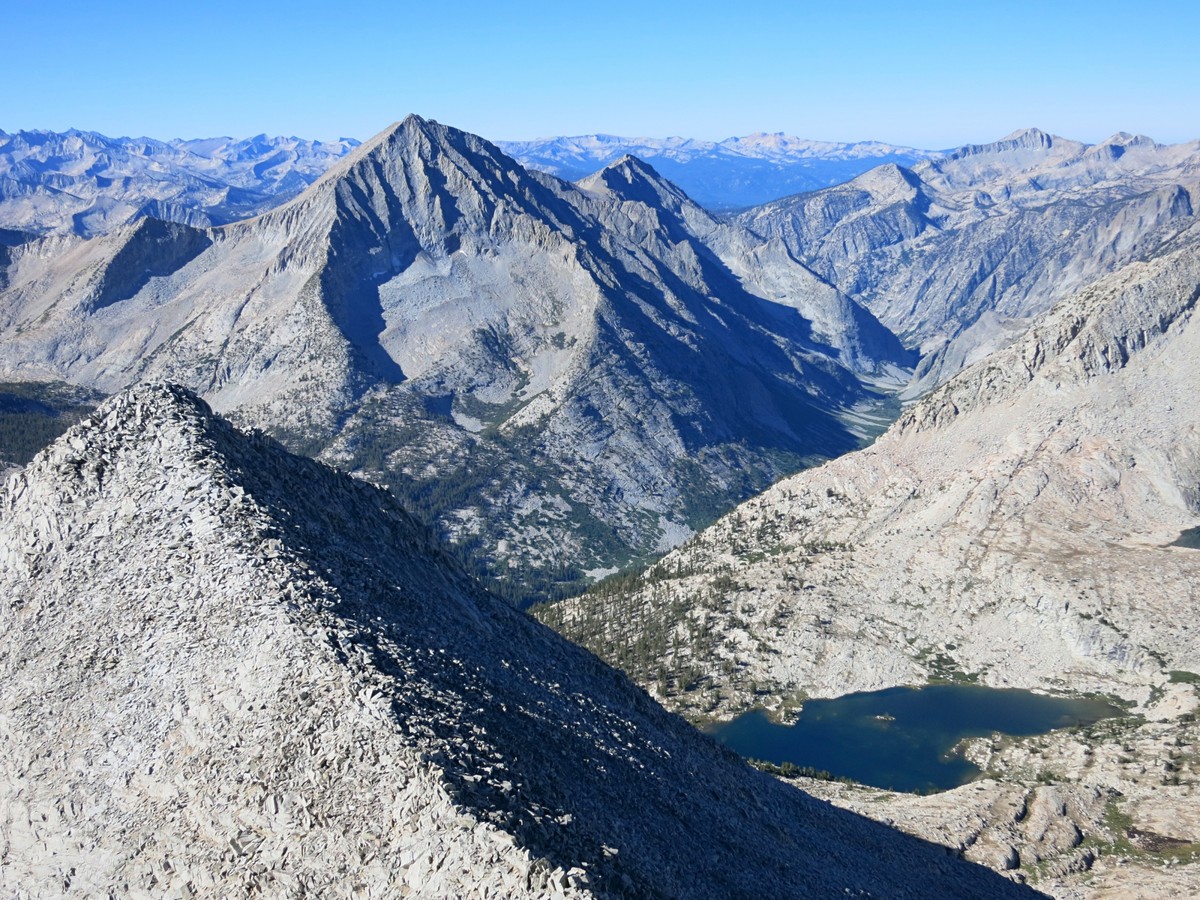
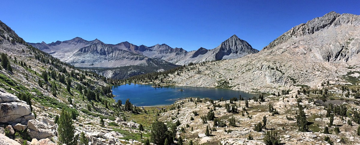
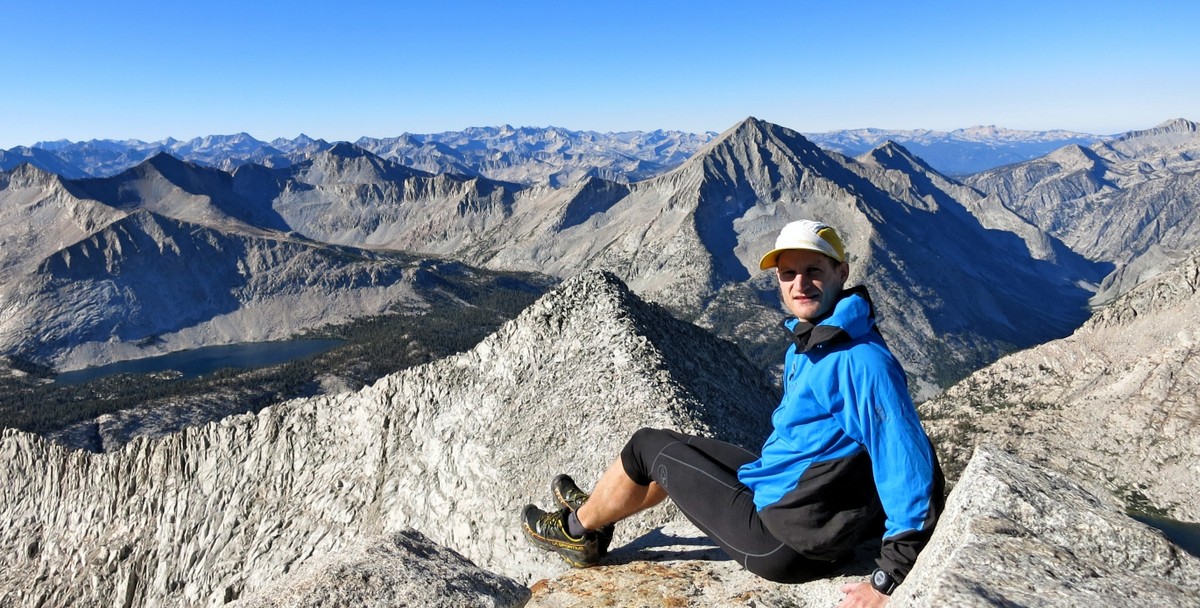
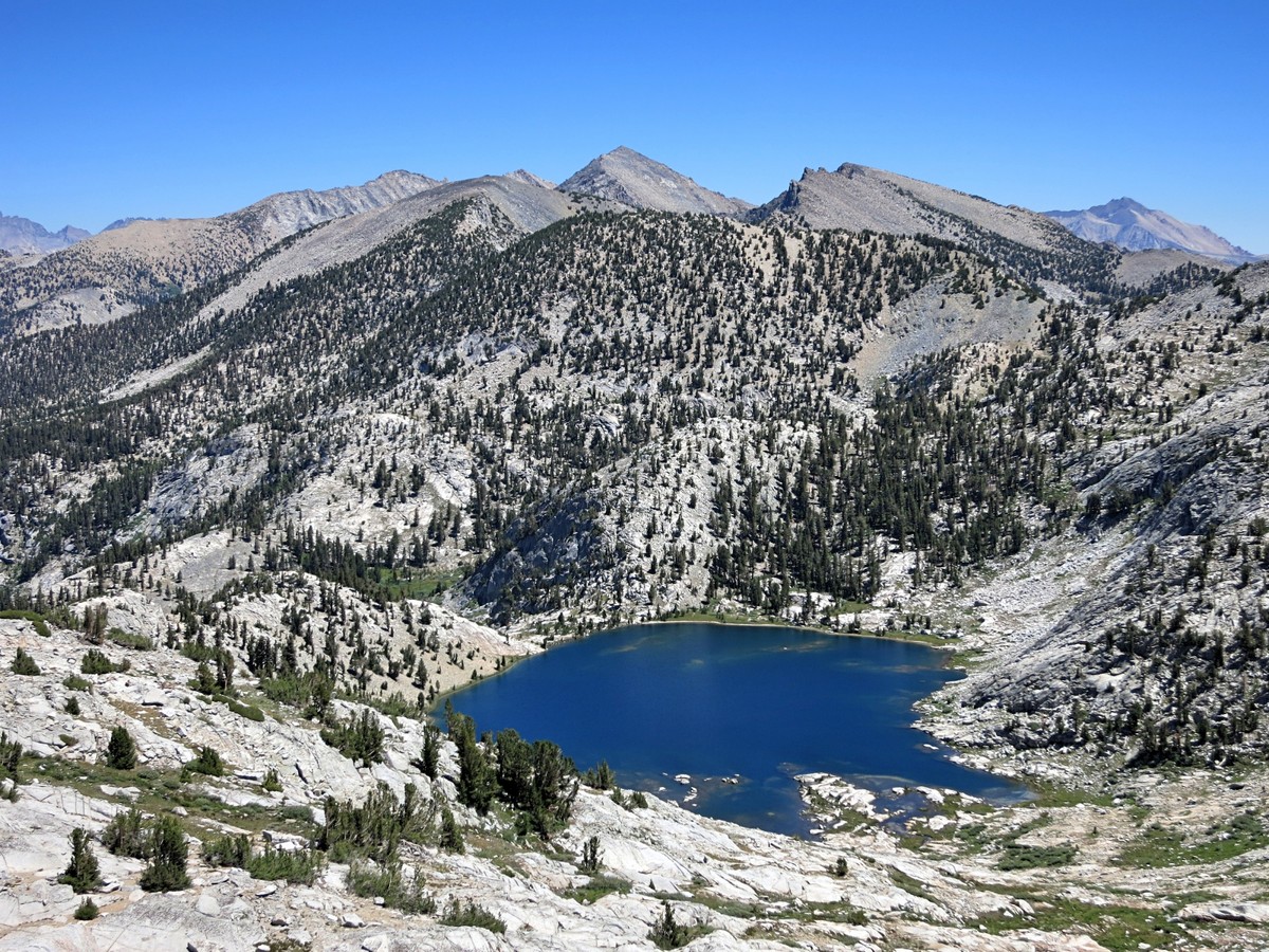
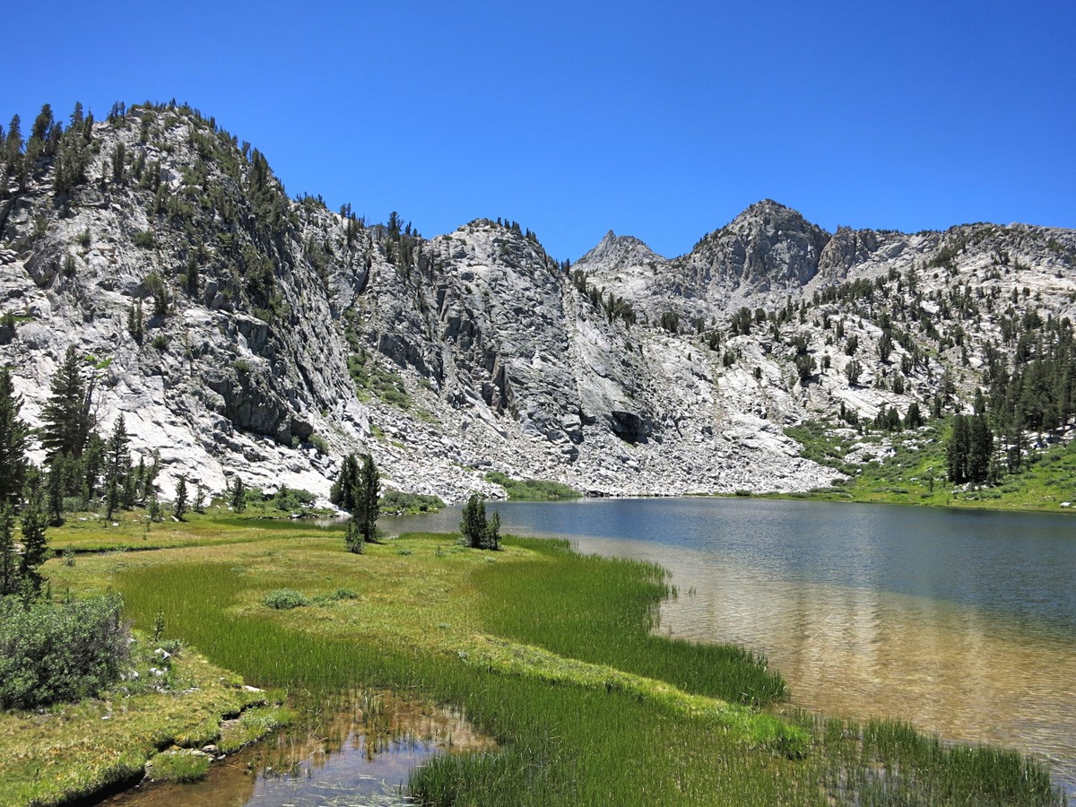
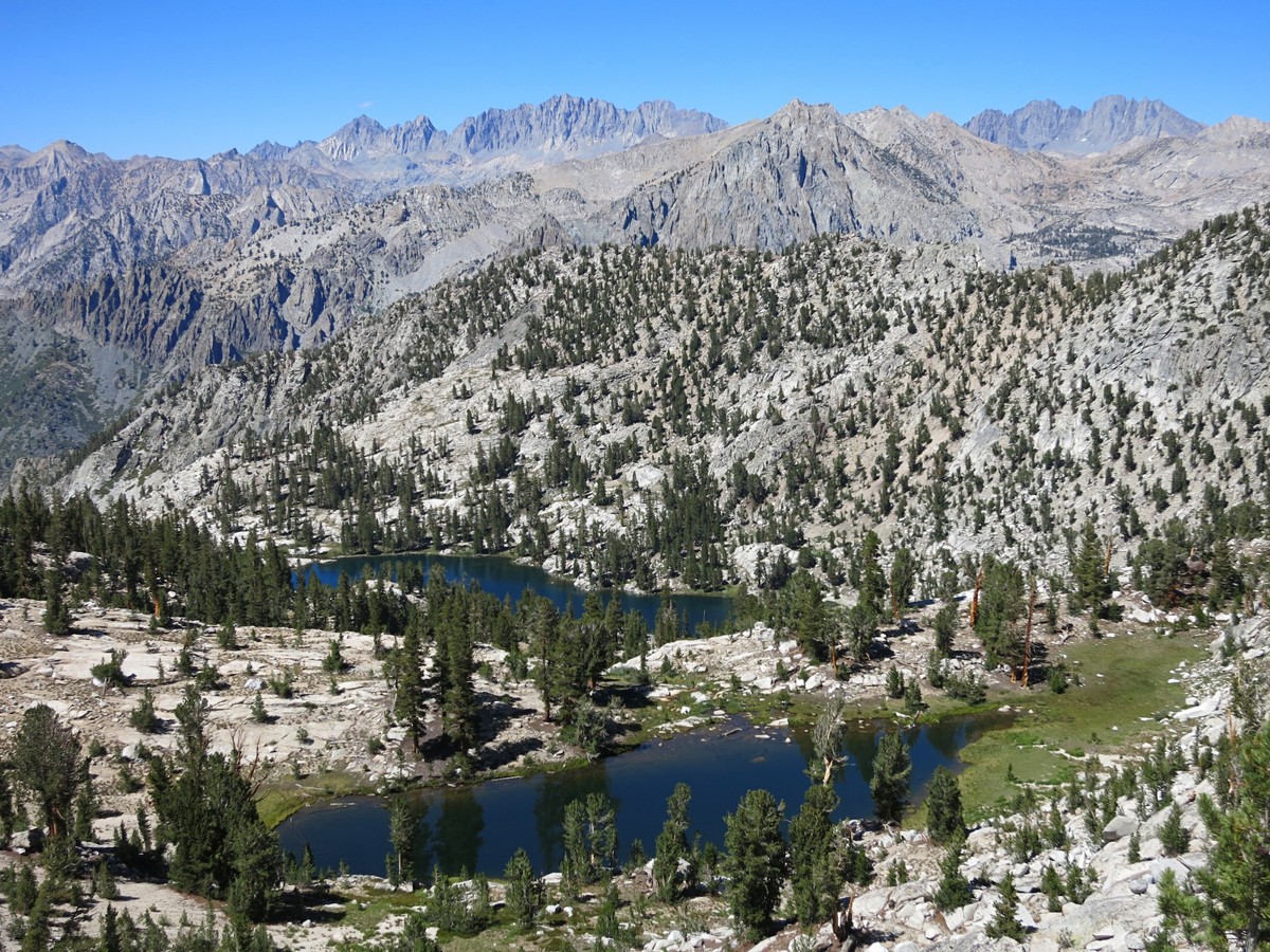
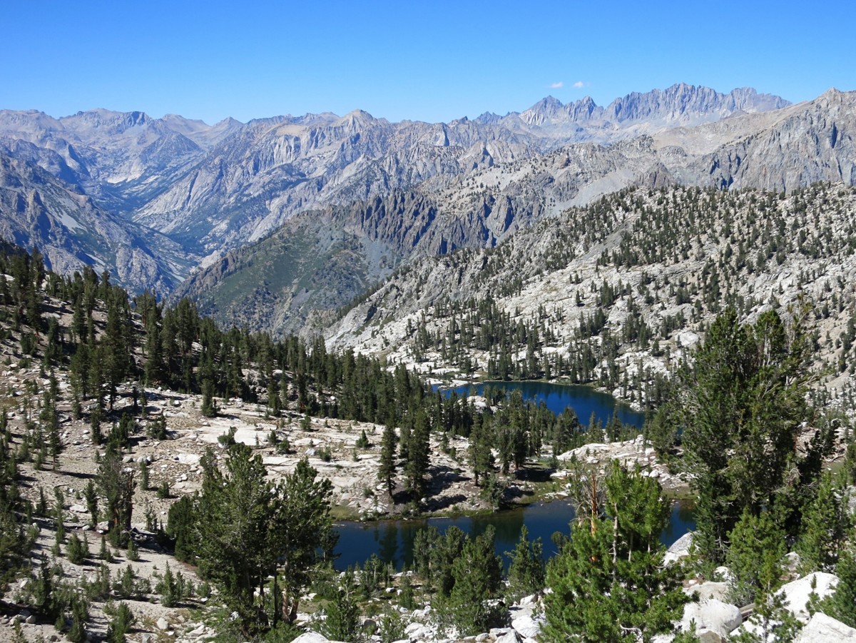
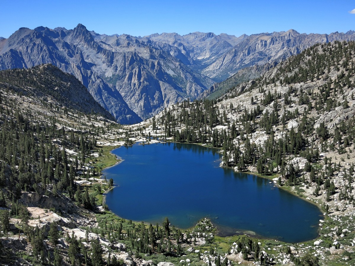
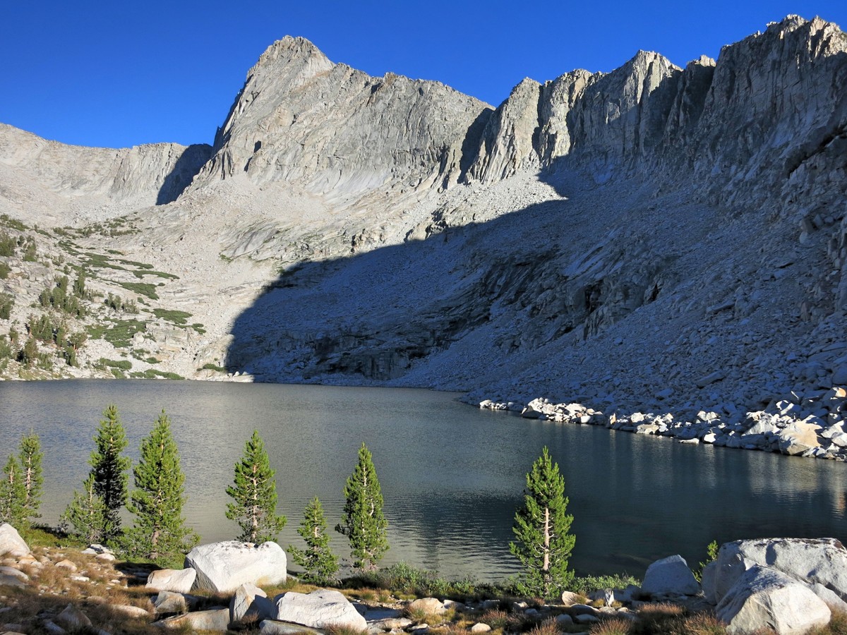
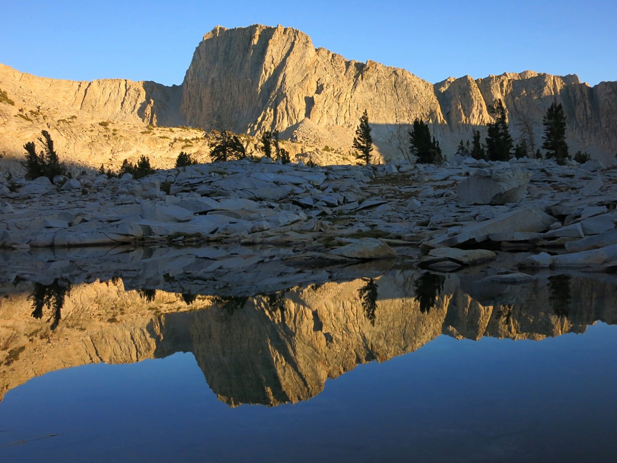
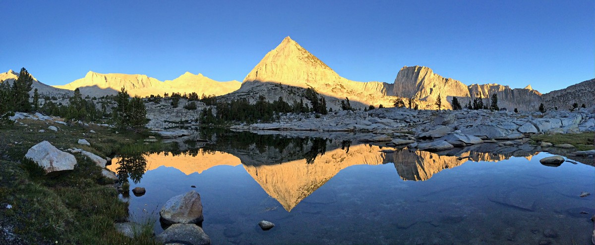
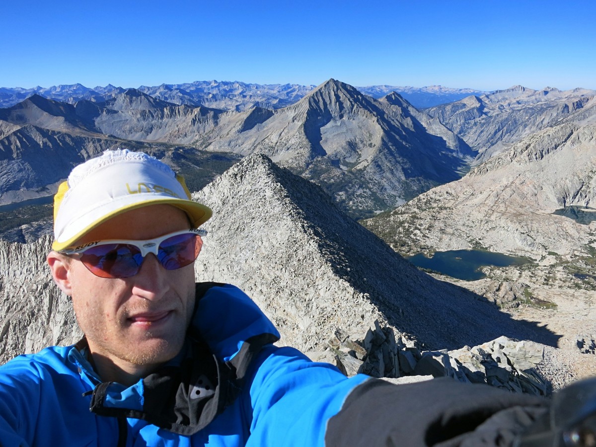
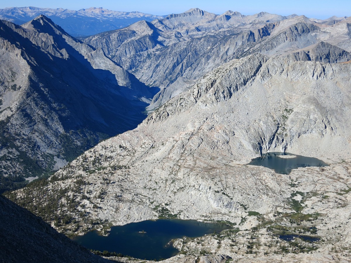
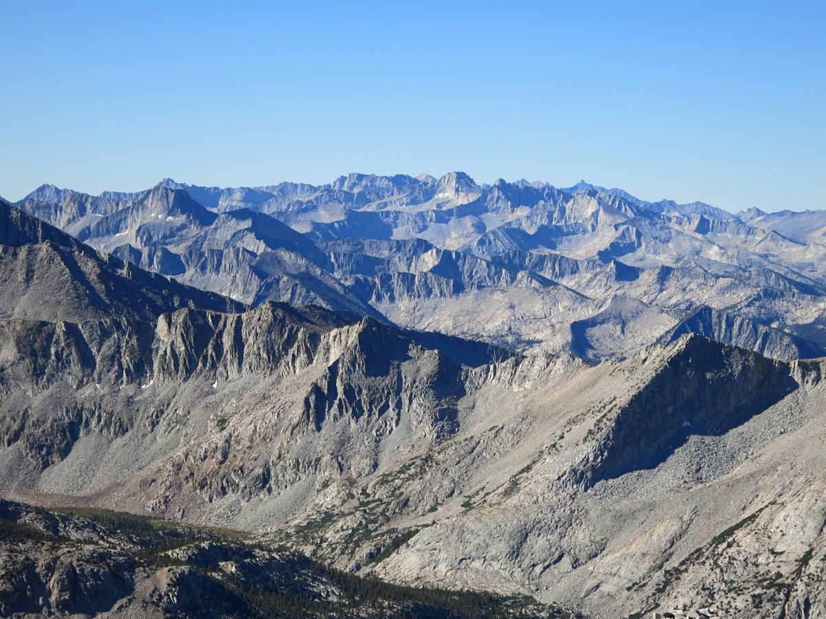
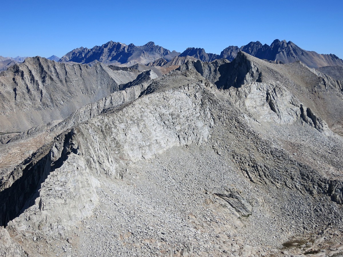
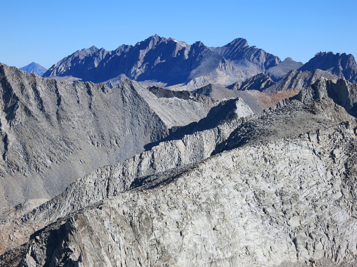
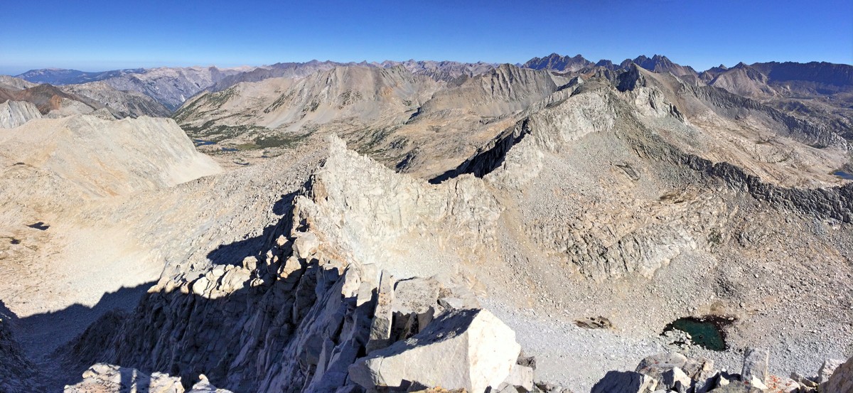
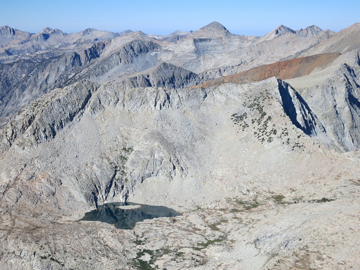
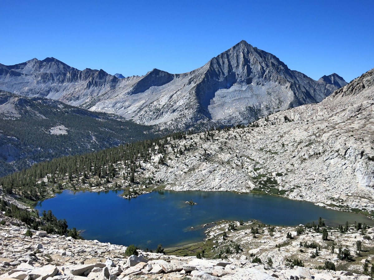
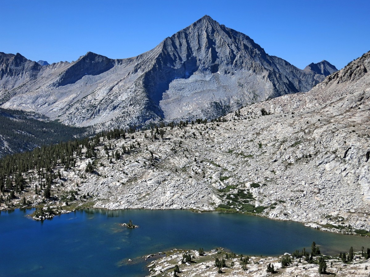
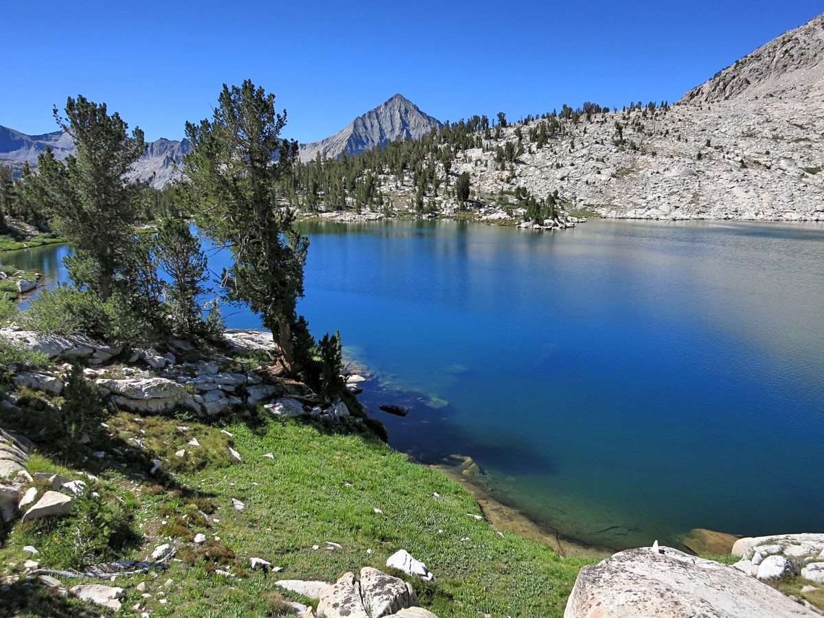
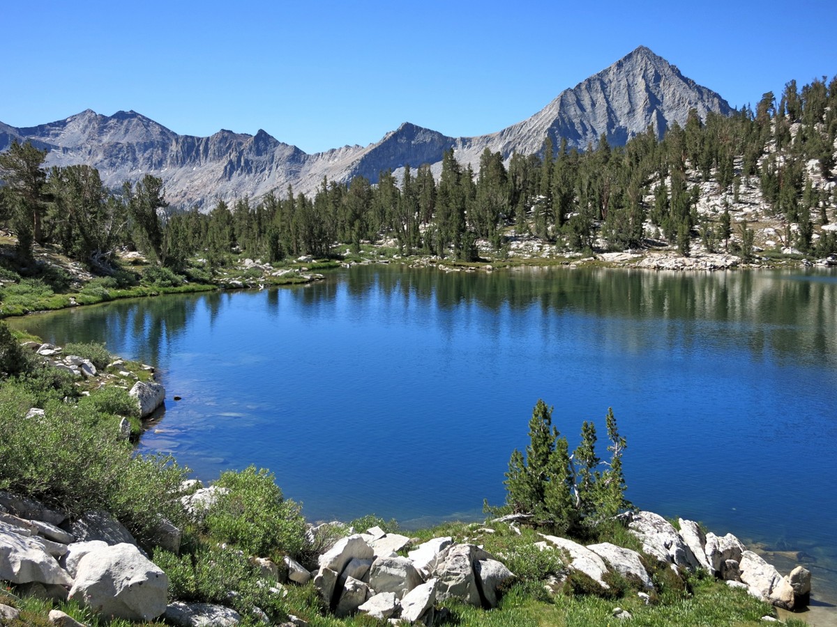
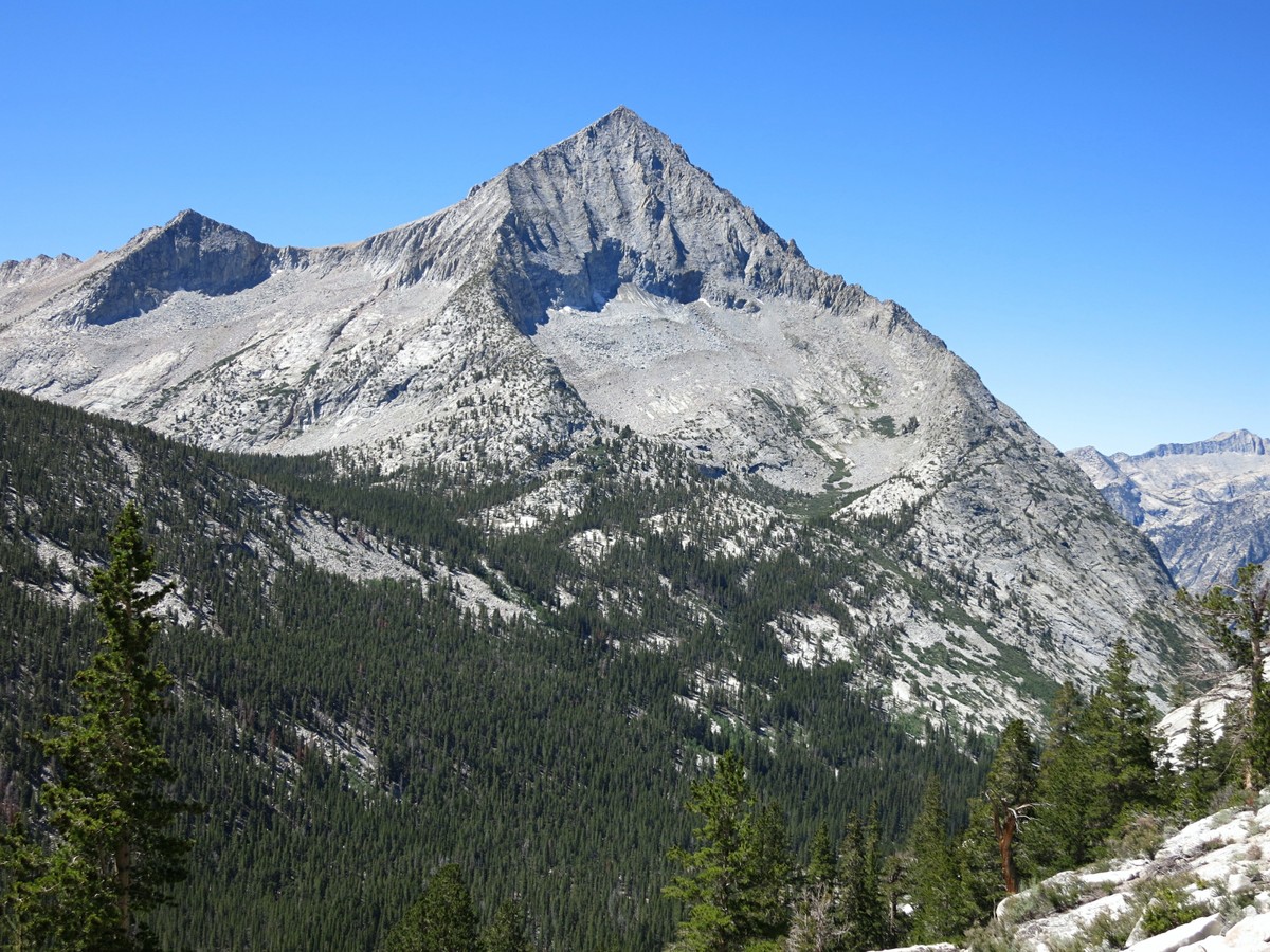
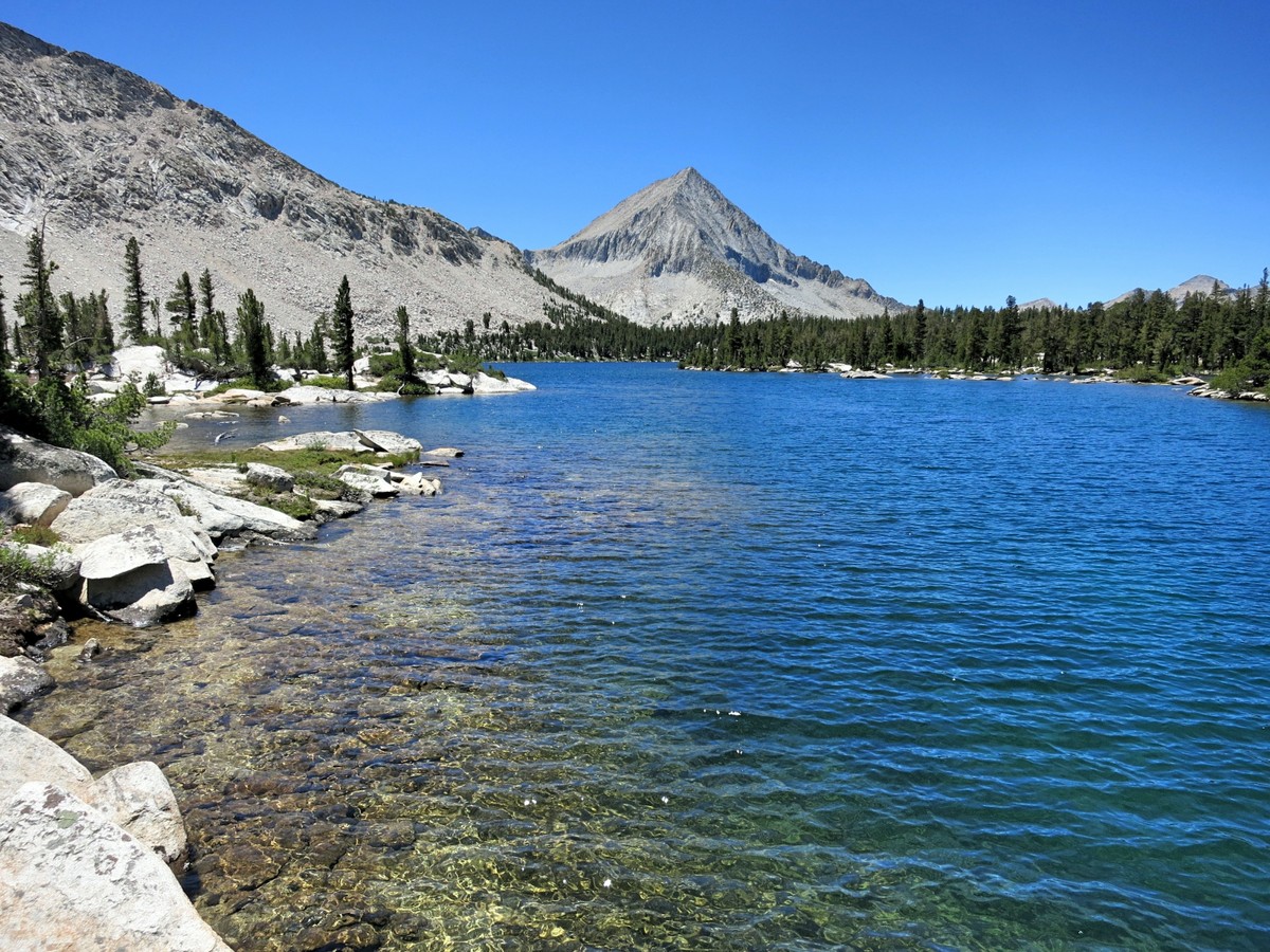
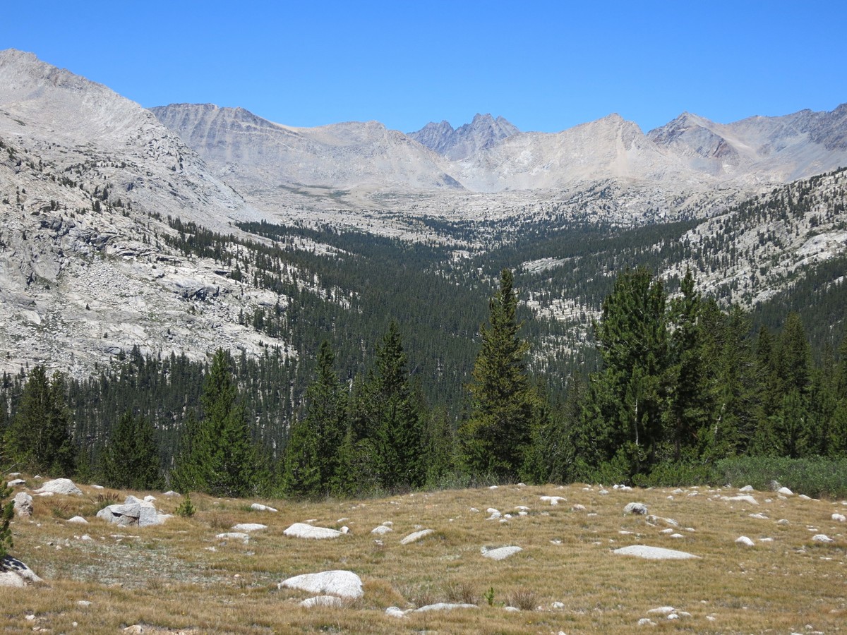
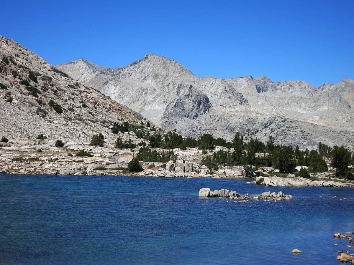
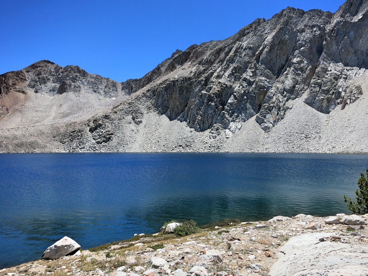
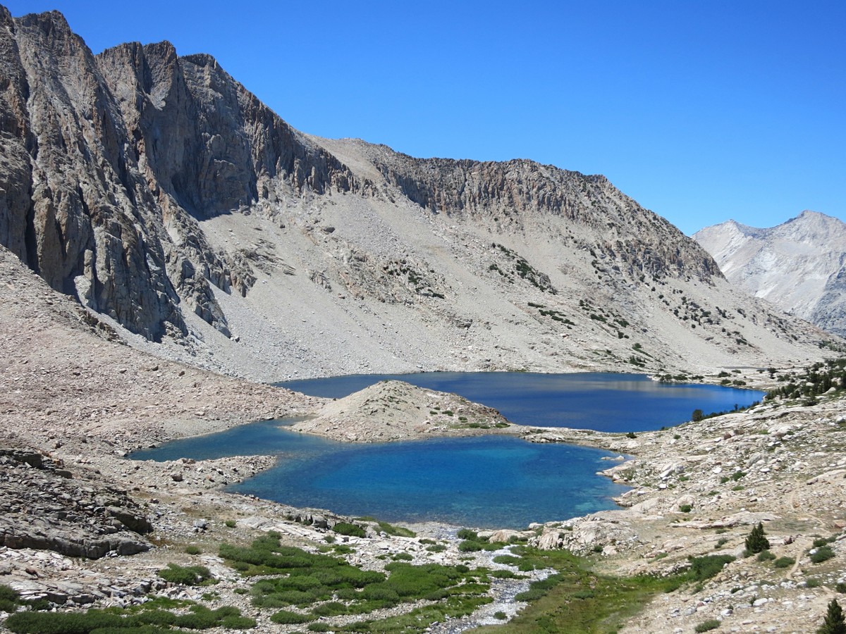
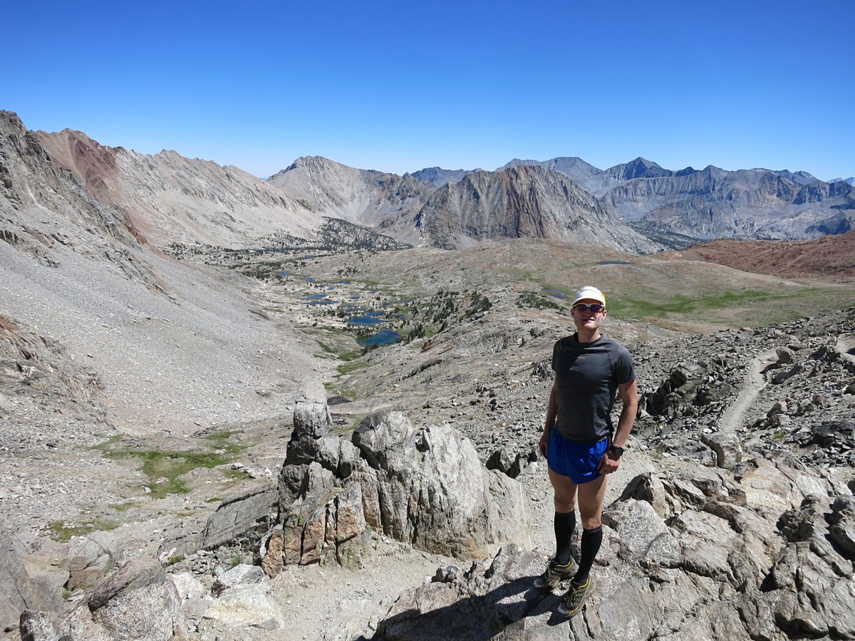
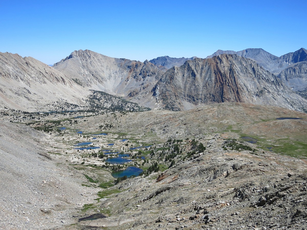
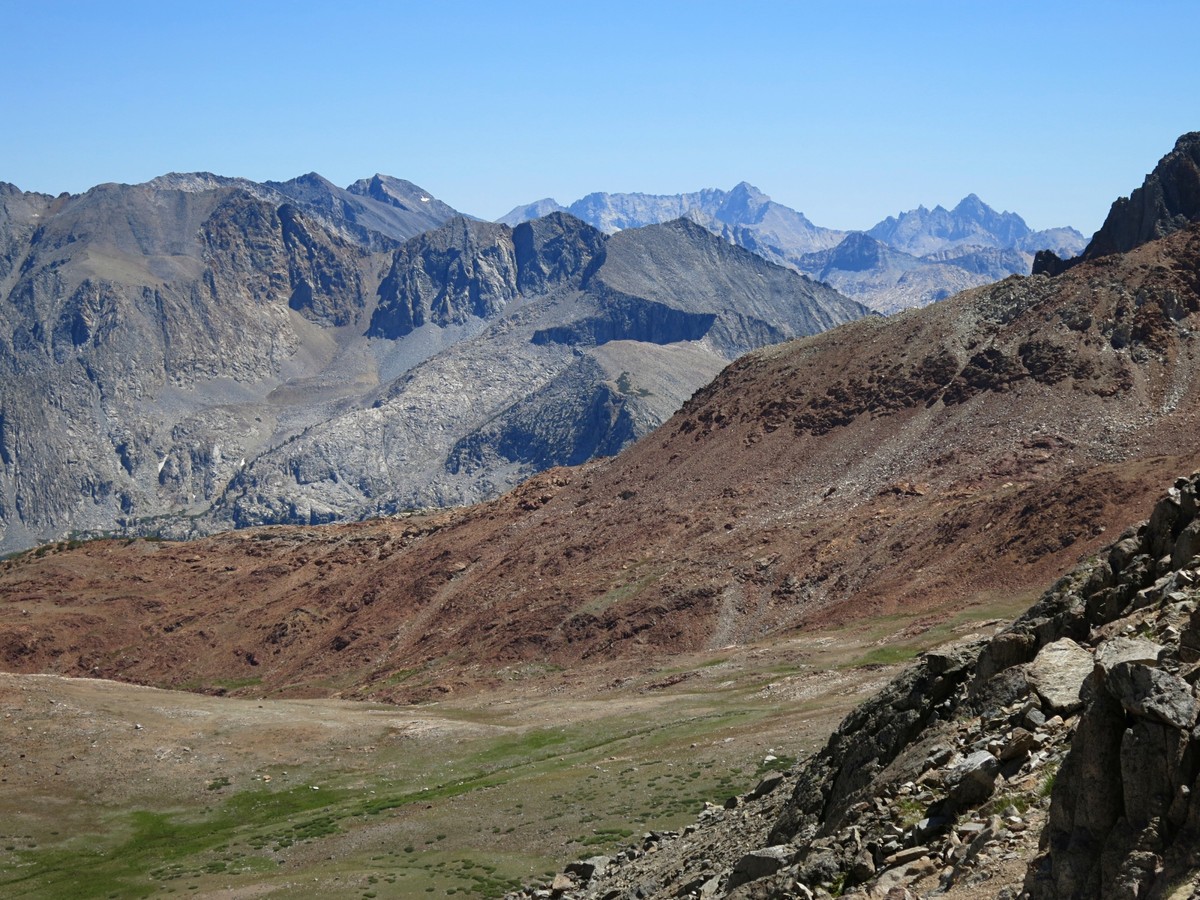
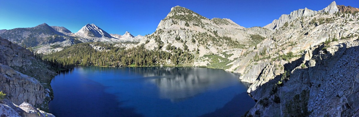 The view from the summit of Mount Ruskin was one of the best I have seen in the Sierra and I’m not saying that because it was a recent summit. I have stood atop many summits over the years and this one was very memorable. The clarity was amazing and the entire southern High Sierra was at my feet from Whitney to the Kings-Kern Divide to the Great Western Divide. The centerpiece view was Arrow Peak and its picturesque north face towering above the Muro Blanco of the South Fork Kings River. The addition of this photogenic arrow-shaped peak makes the view even better than the one I experienced standing atop Arrow Peak last year, which at the time I thought was the best. To the north the view was also breathtaking and included the striking Palisades, the Goddard Divide, the White Divide and the peaks of the Ionian Basin. It was a marvelous 360 degree panorama and the mid-morning light was ideal so I spent a lot of time reveling in the panorama and filling up my memory card. I have been to many places in the Sierra and I must admit that after repeatedly seeing the same general views from slightly different angles and knowing the names of virtually every peak and major feature int the range, there is less “mystery” factor and therefore less excitement than I used to have. However, on this day I was just as excited as on my first trips in the Sierra. There are still ways the High Sierra can captivate and inspire me after all these trips, I just have to be more creative finding them! After a long stay at the summit, I finally packed up and headed down toward the lakes beneath Cartridge Pass. This is a marvelous area and the lakes are perfectly situated to frame Arrow Peak in the background. A great day seemed to be getting even better as I strolled along the shores of the lake taking multitudes of photos. I picked up the old Cartridge Pass trail (fairly easy to follow) by the lakes and took it down to the South Fork Kings River.
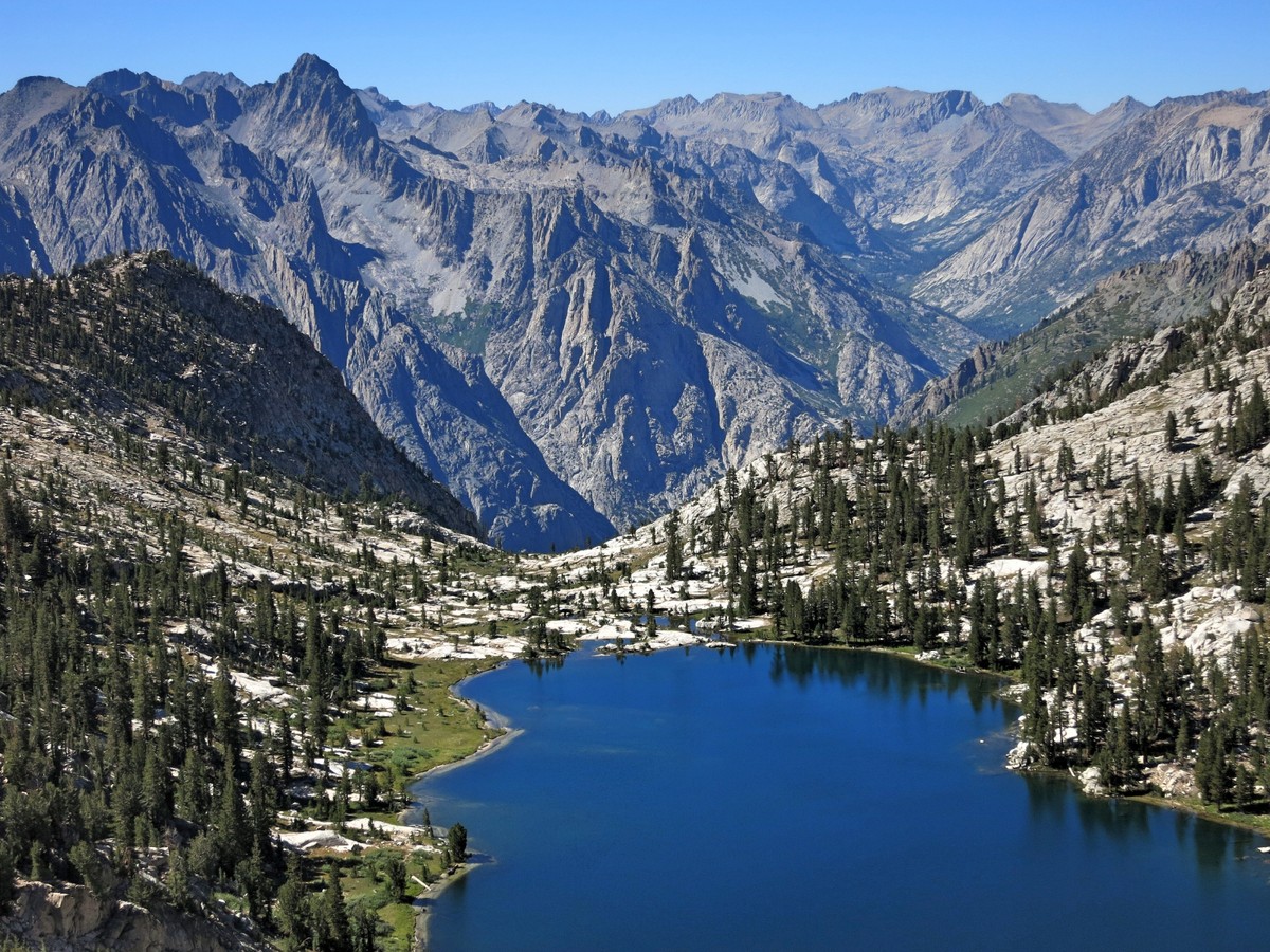

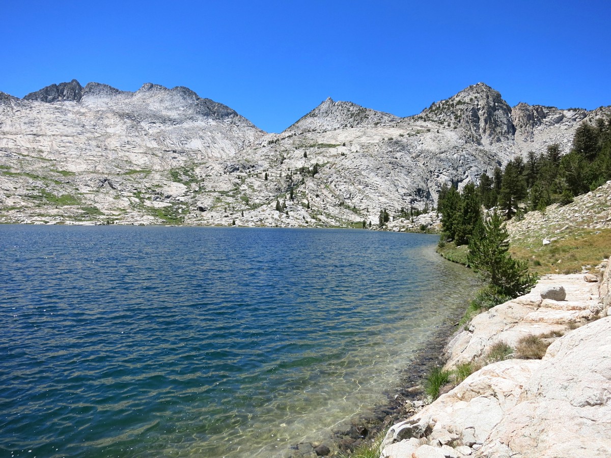
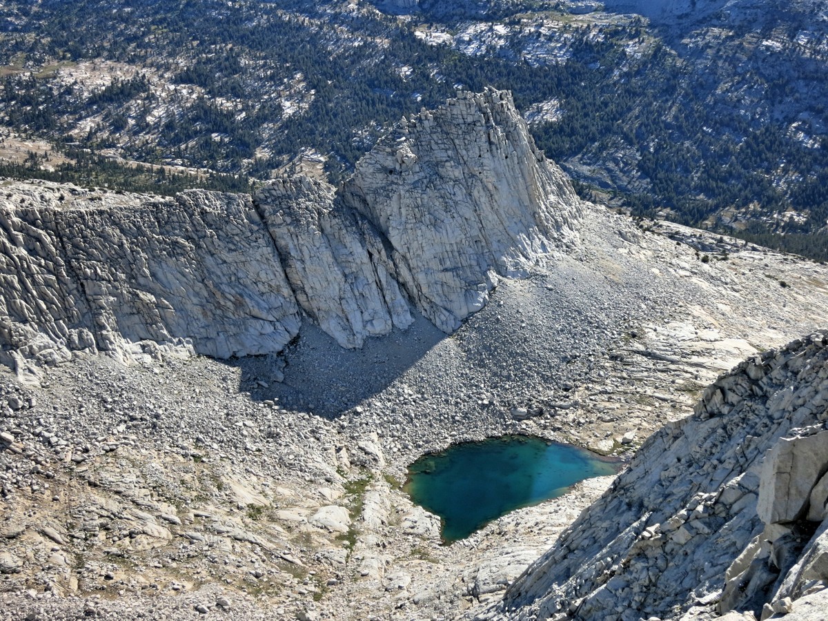
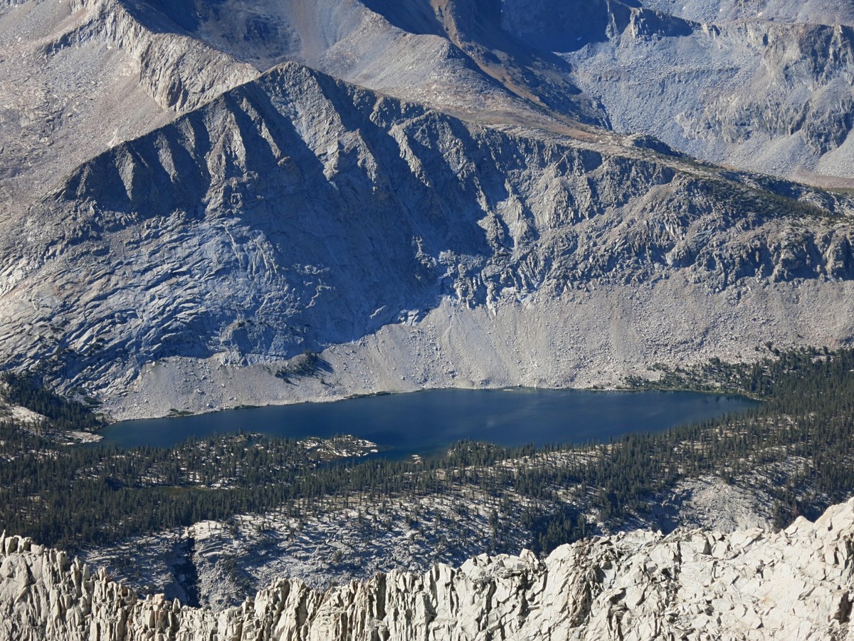
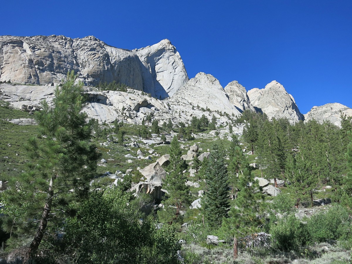
 In the lush meadows near the river I spotted a large black bear and I made sure to give the bear plenty of space as I passed. It kept eating and either didn’t notice me or, more likely, didn’t care enough to acknowledge my presence. I crossed the river and headed up steep talus slopes to Bench Lake. I could have taken a use path along the river all the way up to the JMT, but I wanted to see Bench Lake again and this direct route would save time and distance. Bench Lake is a gem of the High Sierra and I was happy to be along its shores once more. After a dip in the lake and lunch it was time for a long trail hike and jog back to Road’s end via Pinchot Pass.
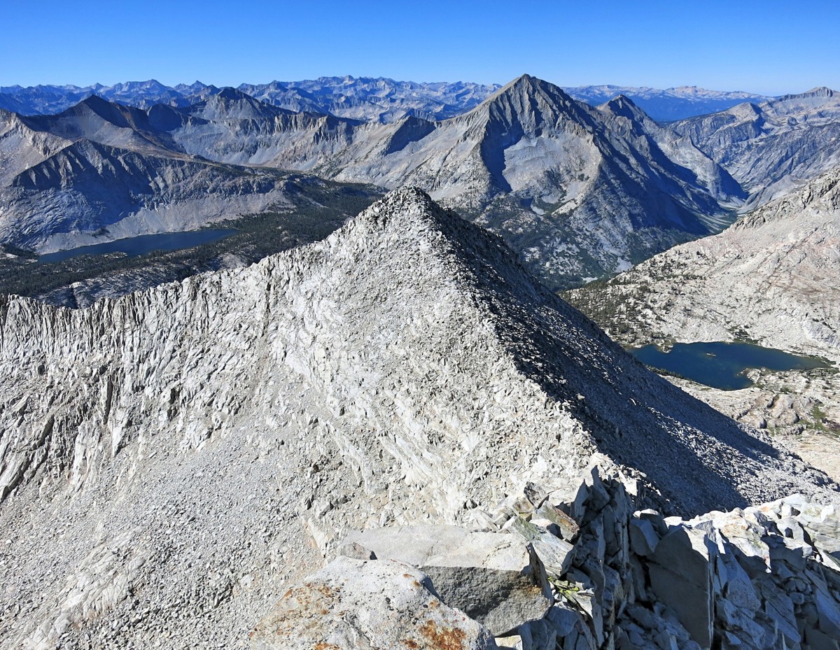

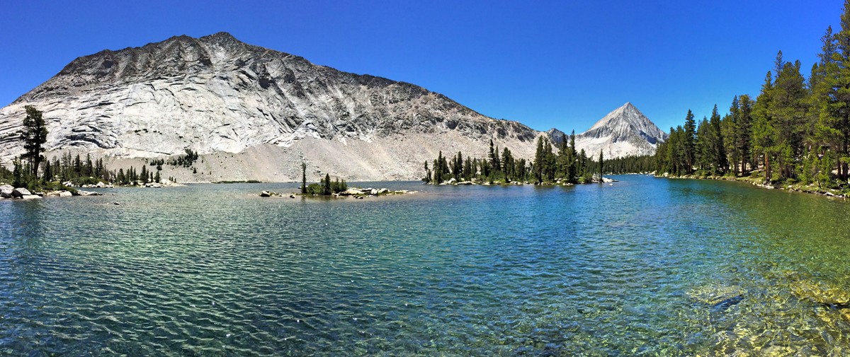
 In the past I had only seen the area around Pinchot Pass in the dark or under cloud cover so I failed to appreciate the beauty of this region, but I found it to be quite scenic with a palette of rock colors and beautiful Marjorie Lake which also possesses a deep blue (but not as blue as Marion Lake). I enjoyed the entire stretch along the JMT and the descent toward Castle Domes, chatting with many thru-hikers along the way and the backcountry rangers. The final few miles down to Road’s End seemed to go on longer than normal since the added weight on my back resulted in a slower pace than usual, but I still made it back at sunset. This was my first fastpacking experience and it turned out very well. I used everything I carried and didn’t really need anything else. While I can reach anywhere in the High Sierra in a single day, there is something to be said for being at the right place and the right time for the golden hours – sunrise and sunset – and having the time to really enjoy the scenery as I was able to do on Mount Ruskin and Bench Lake.
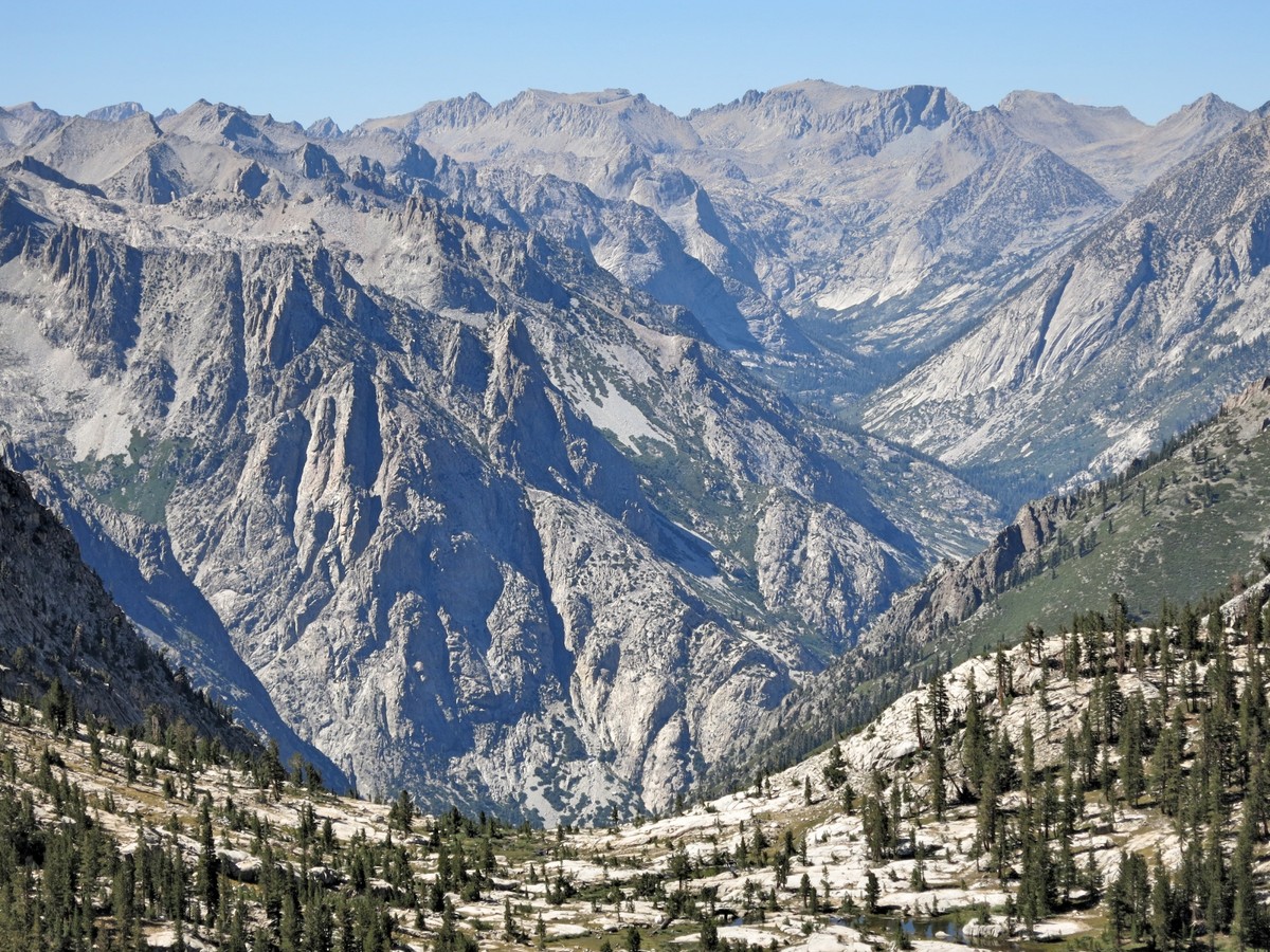


stunning pics as always. thanks!
Another marvelous post! This is one of my favorite parts of the Sierra and now I want to visit it again. Thank you so much, Leor, for sharing your experience and photos.
Leor, thanks for all the great pics and inspiration…this is my backyard ( I live in Visalia ) , Can’t wait to take a look on my maps of this. Fastpacking is the only way to go if you have to spend a few days out in the backcountry! Keep sending.
Wowie, gorgeous. How long did it take from Pinchot Pass back to Road’s end?