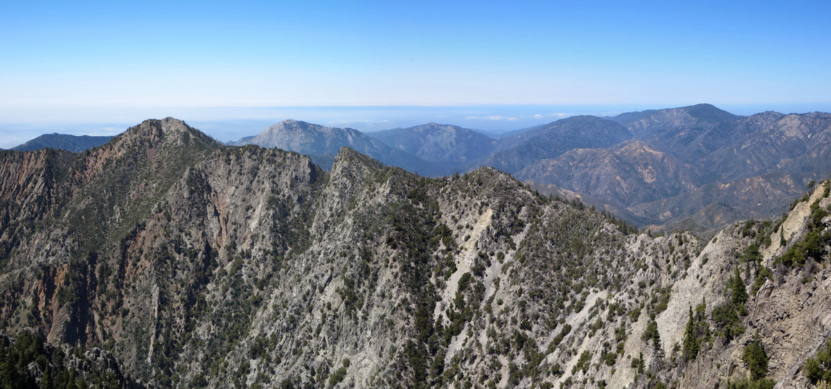
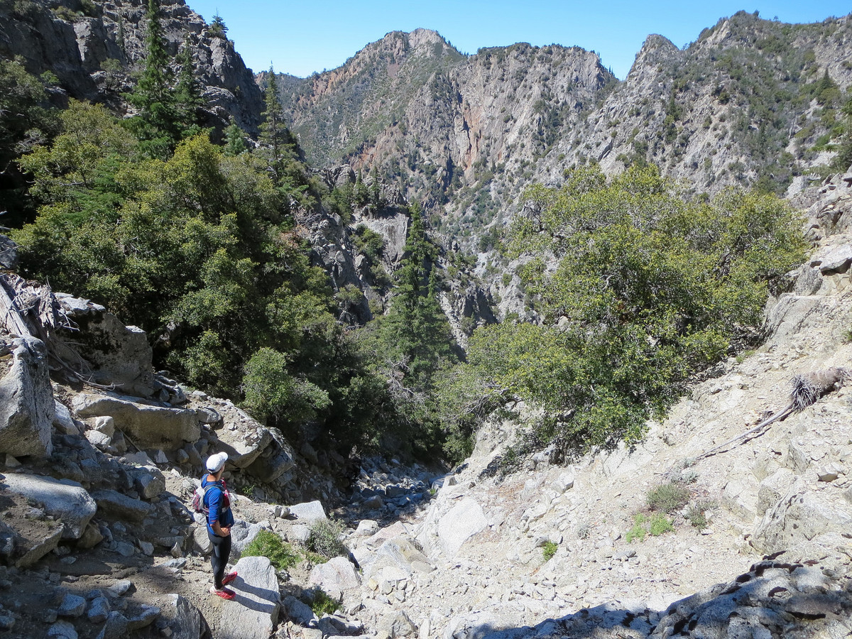
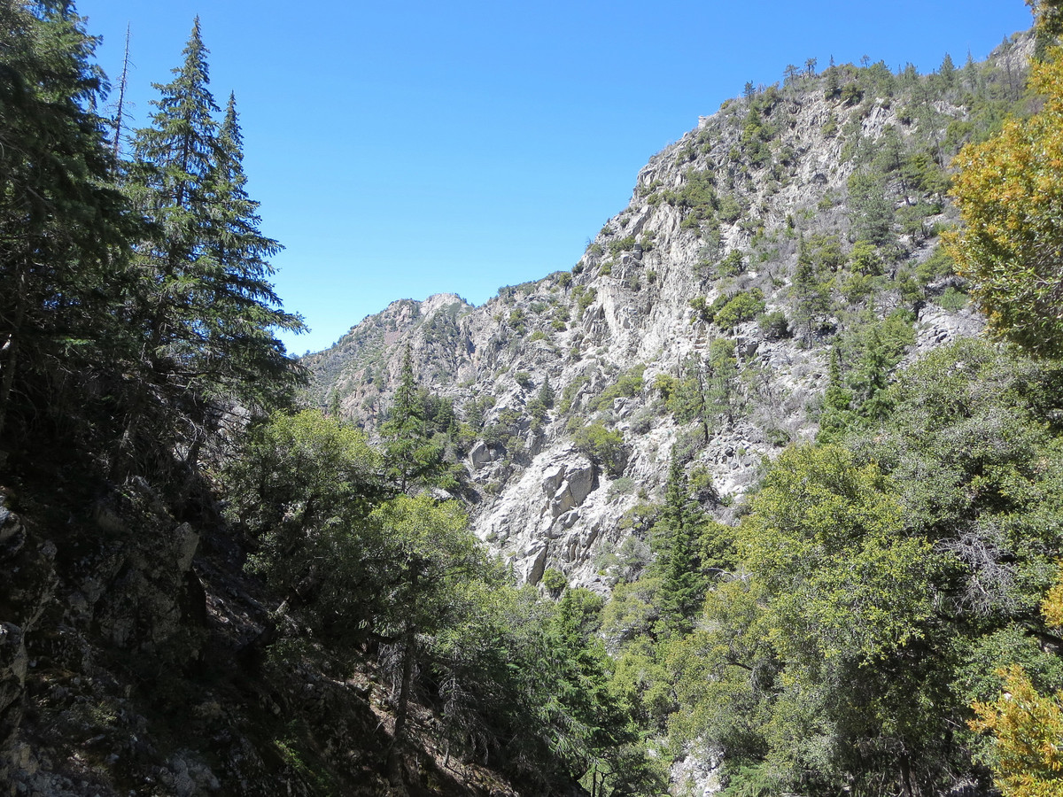
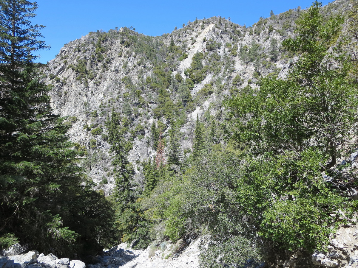
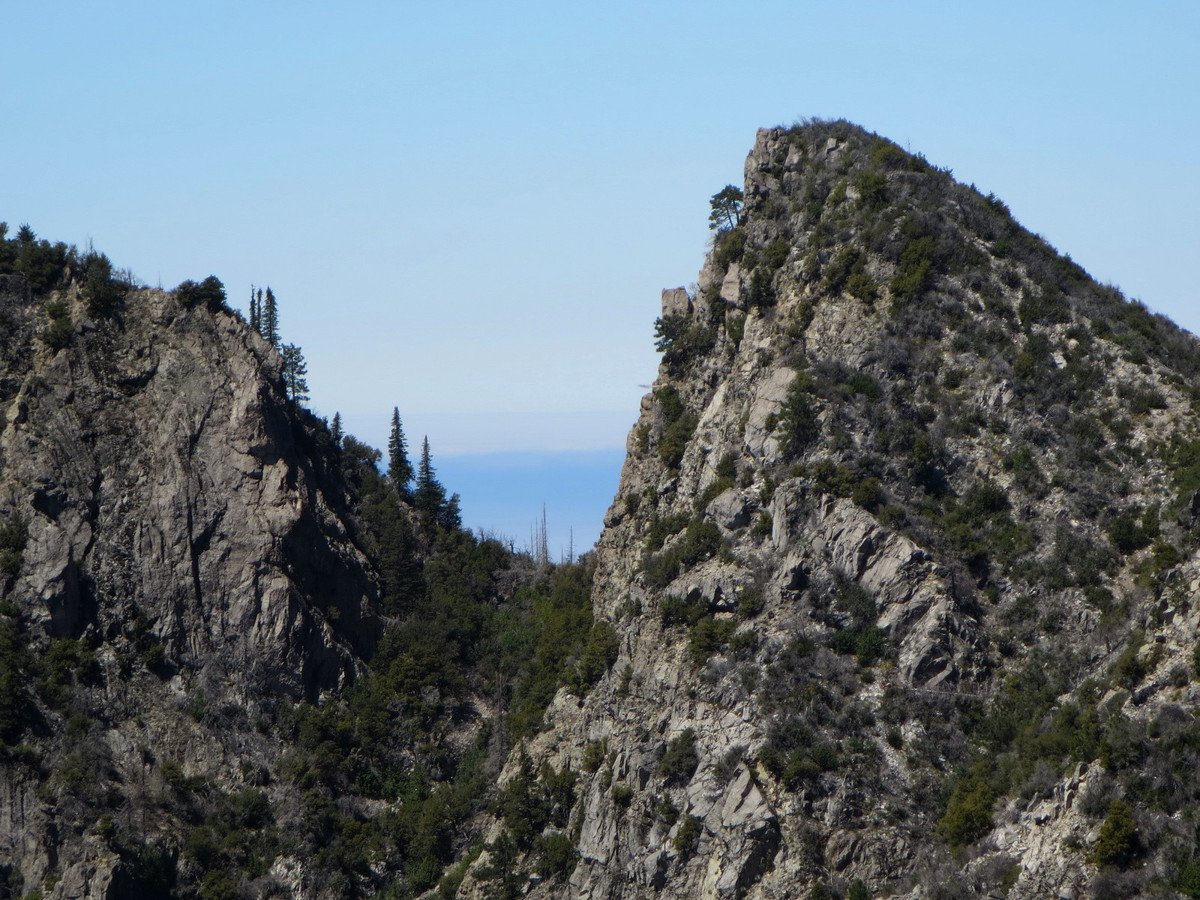
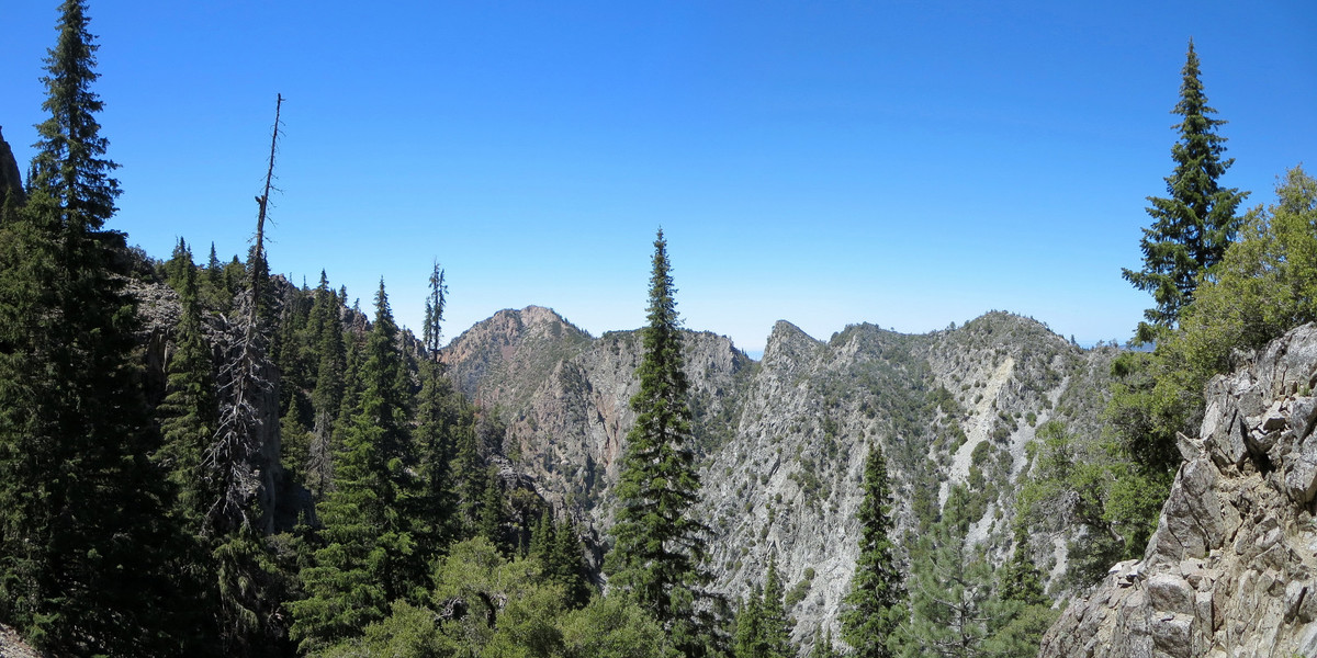
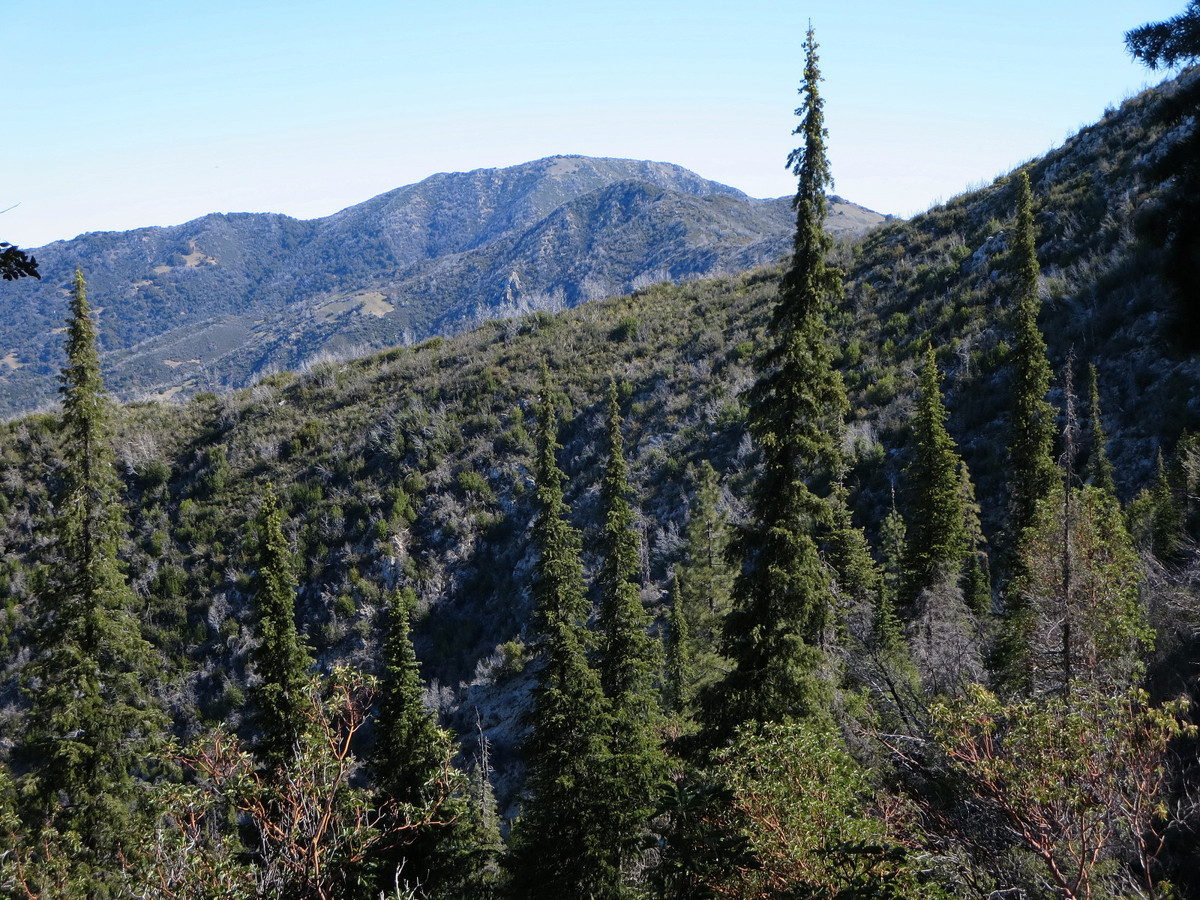
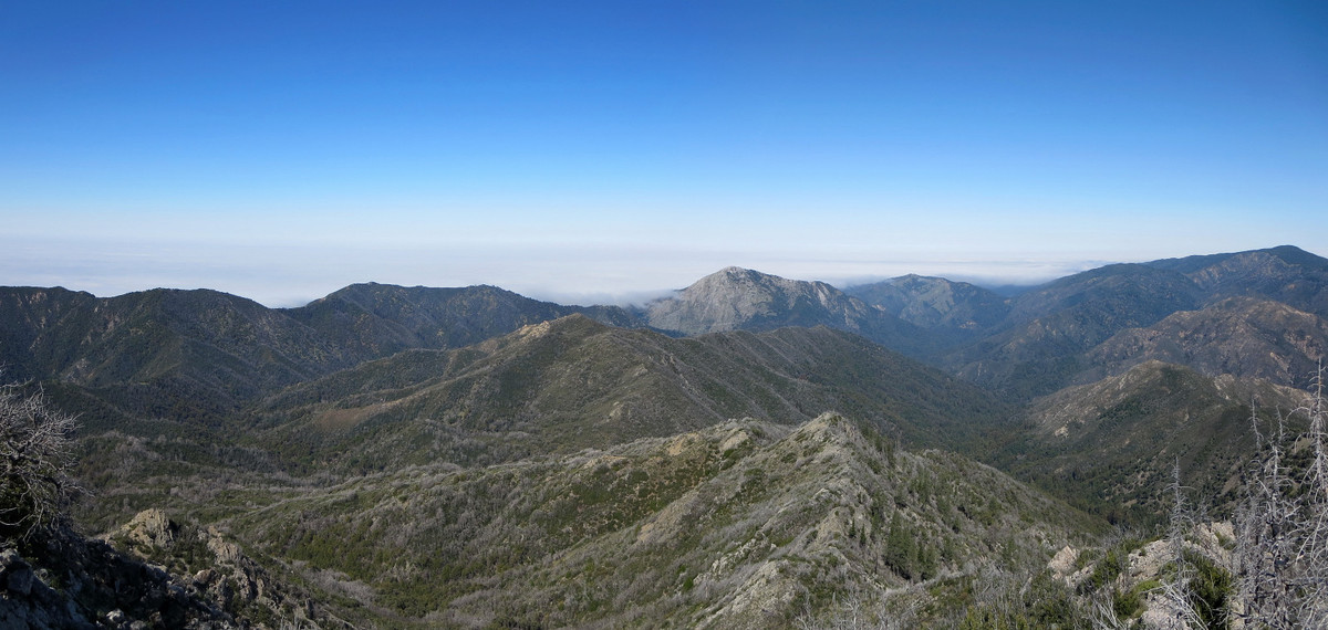
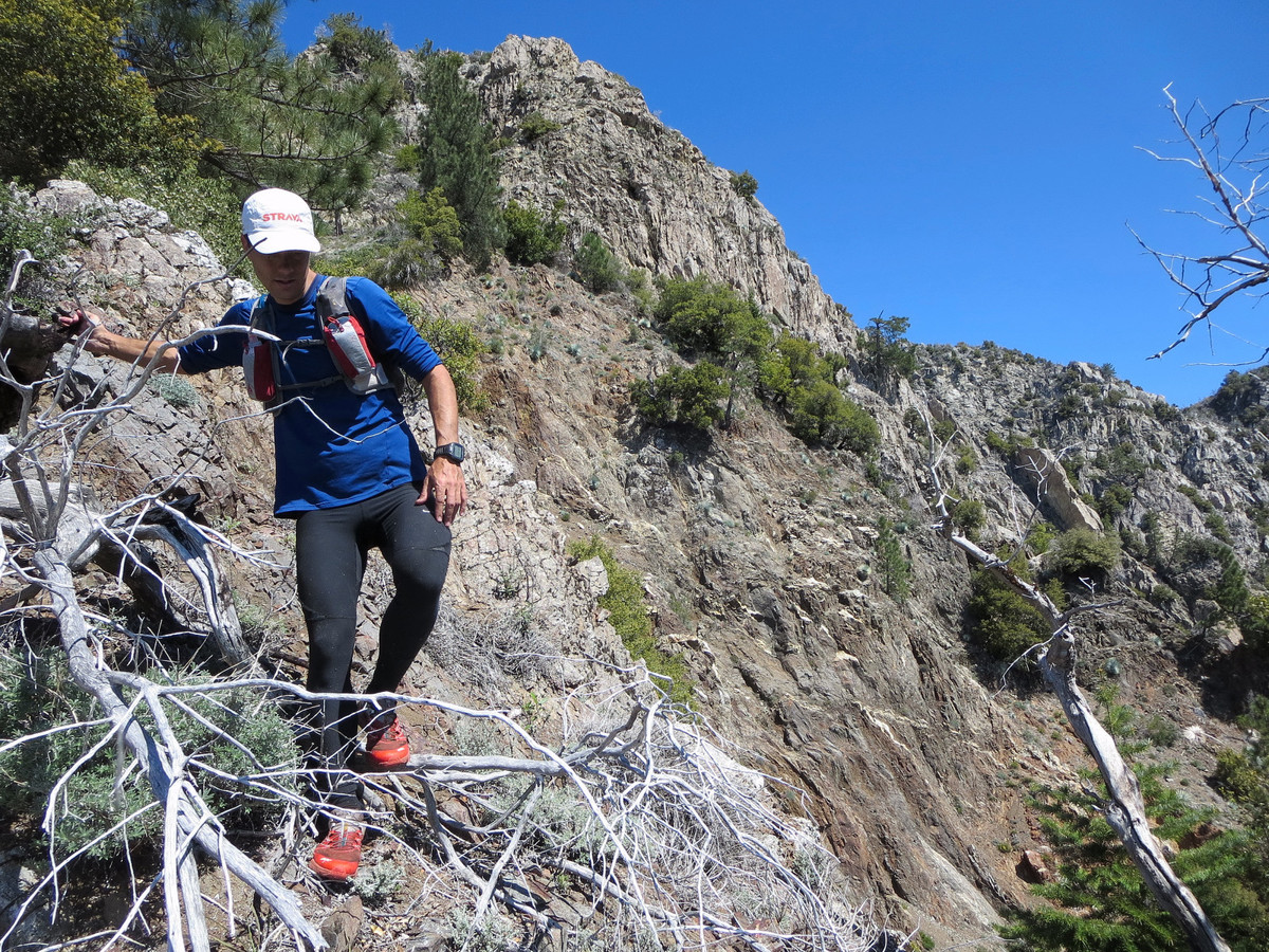
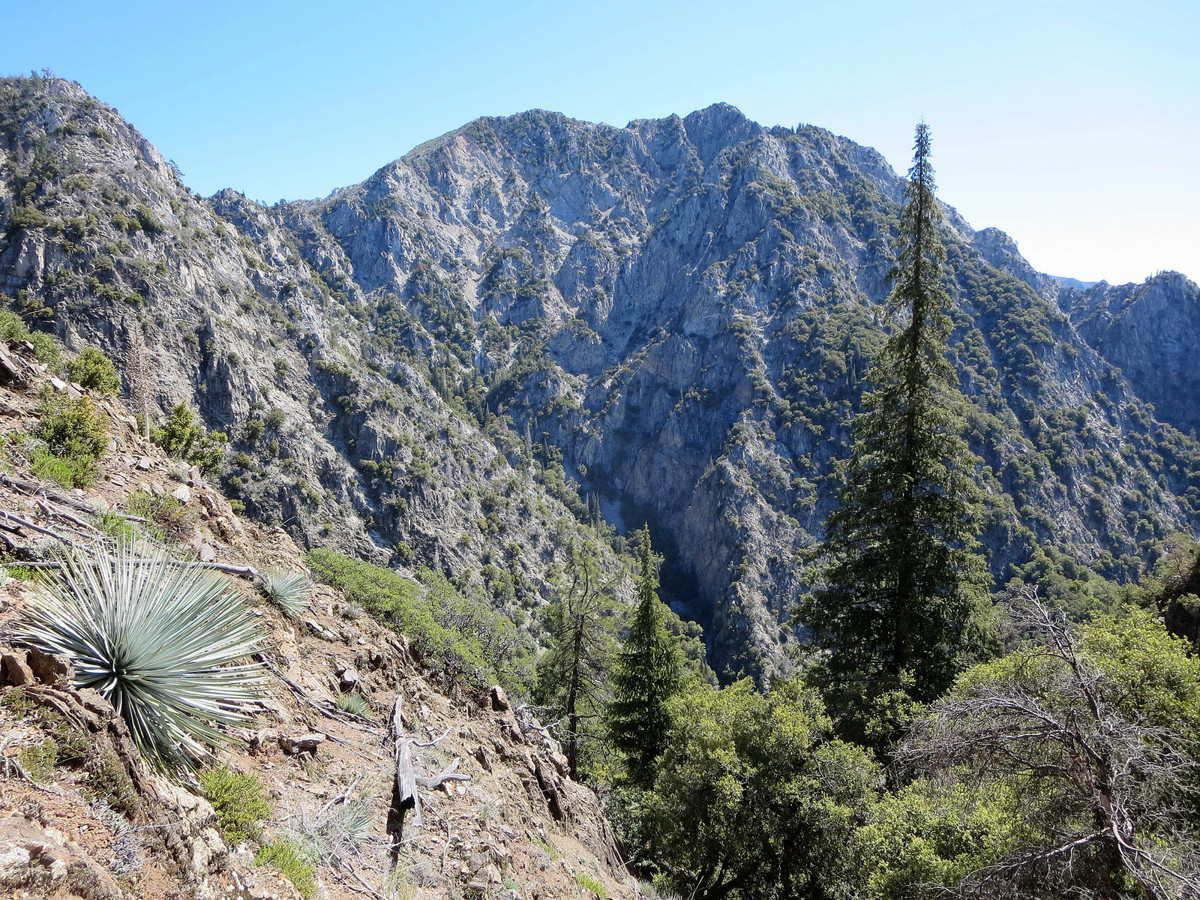
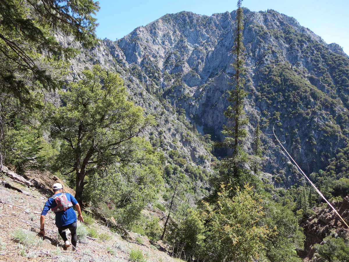
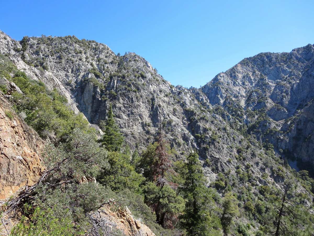
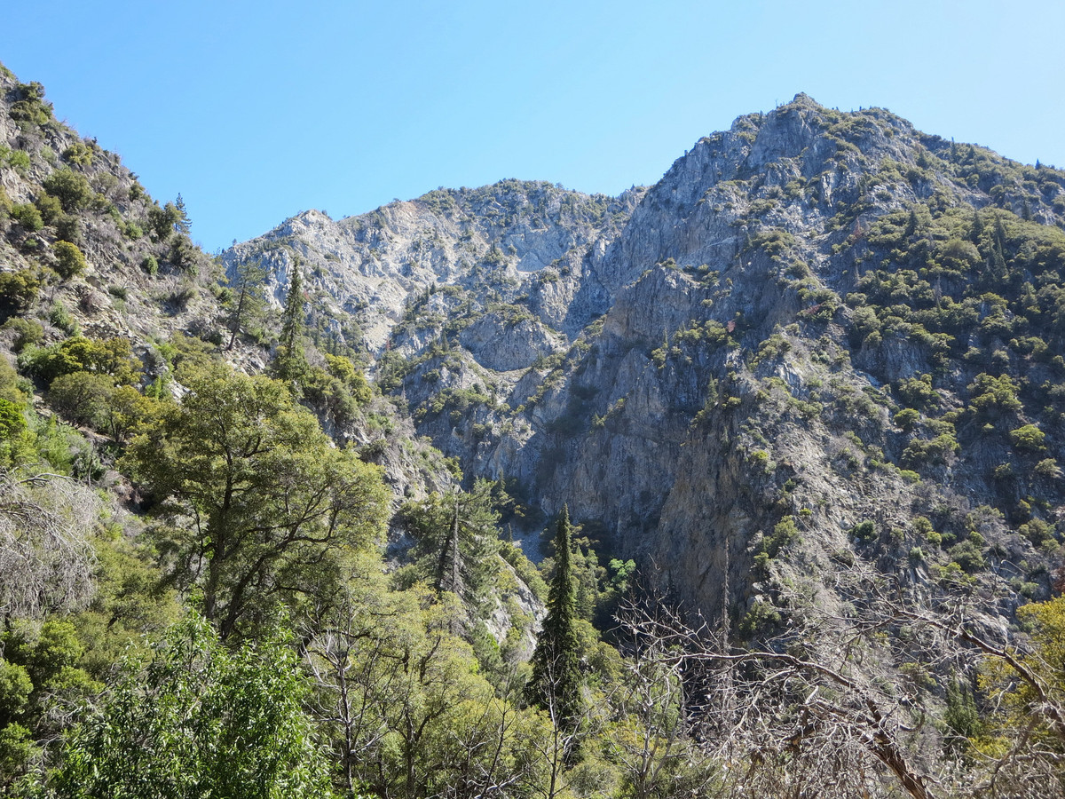
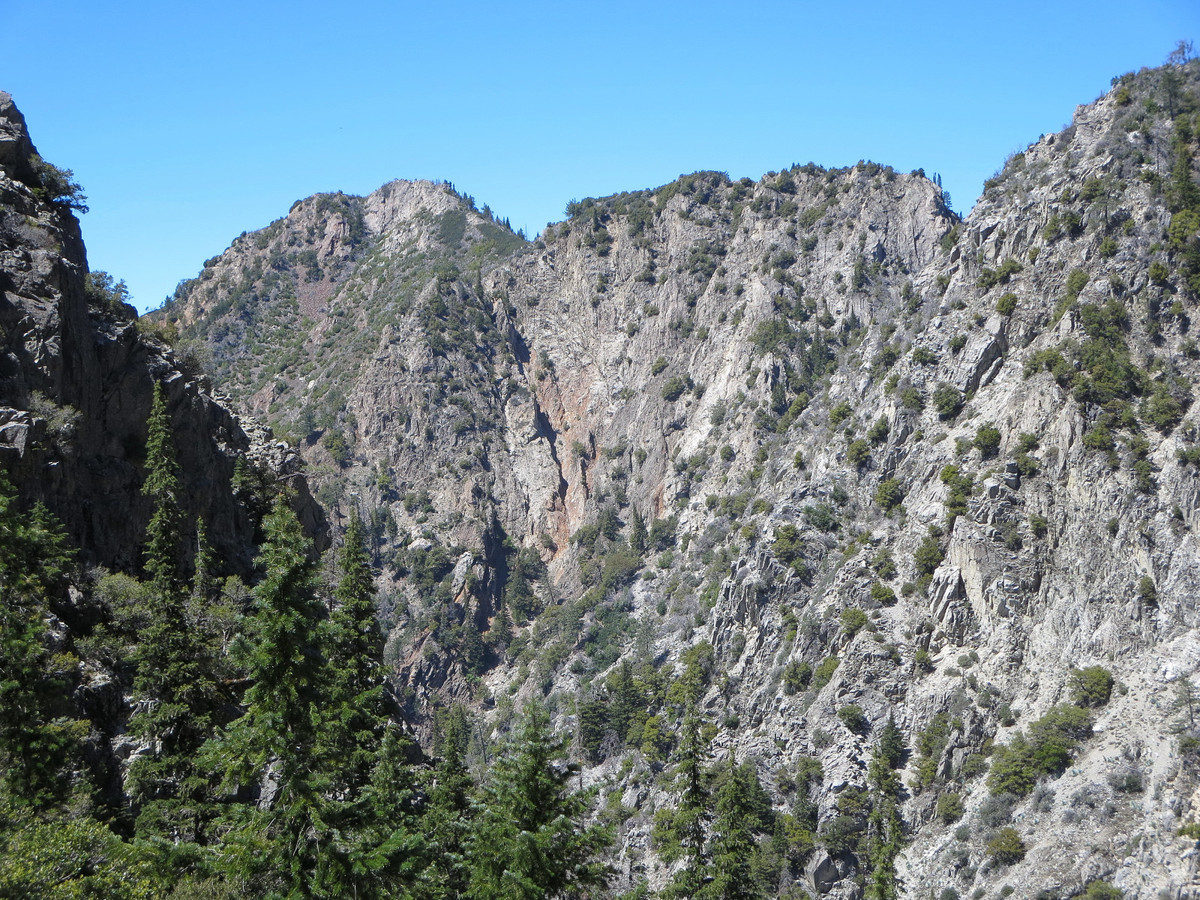
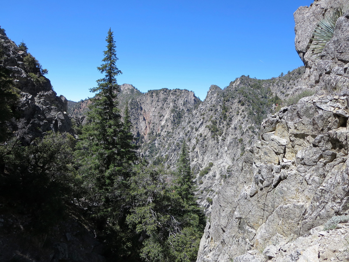
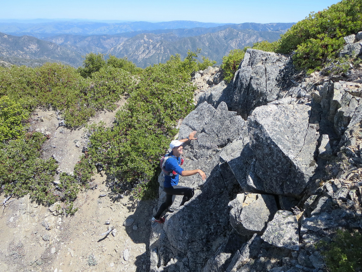
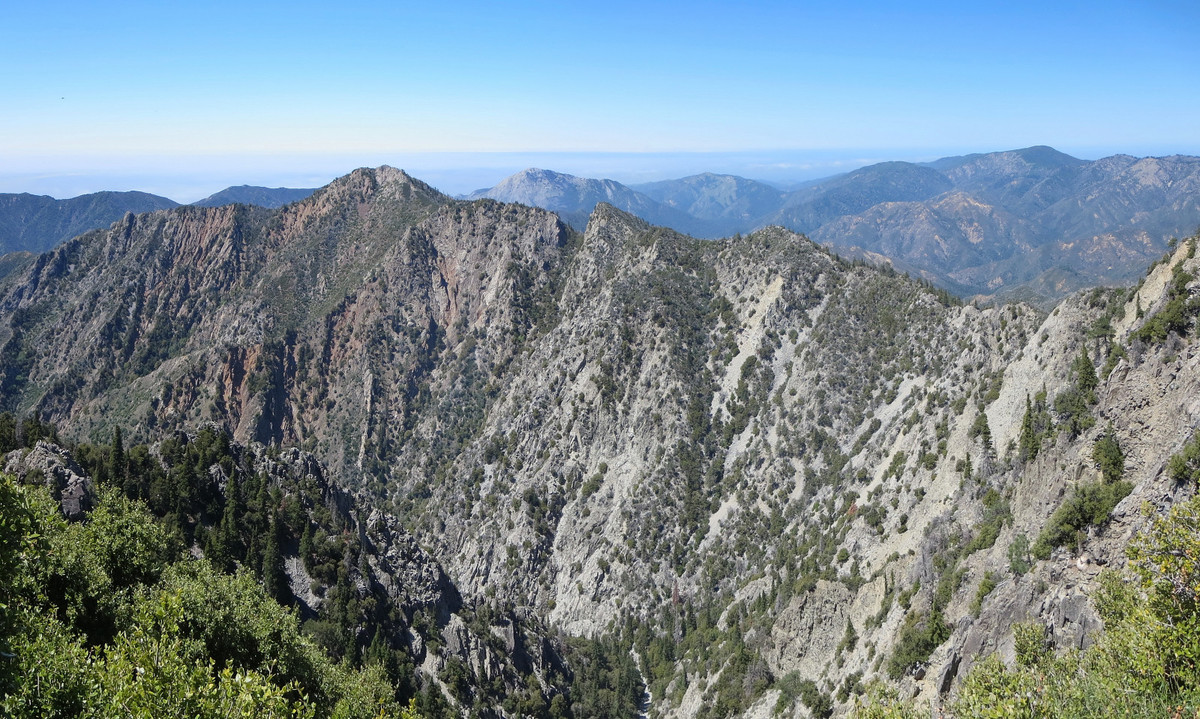
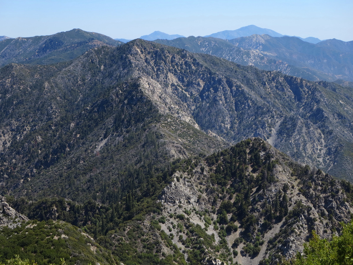
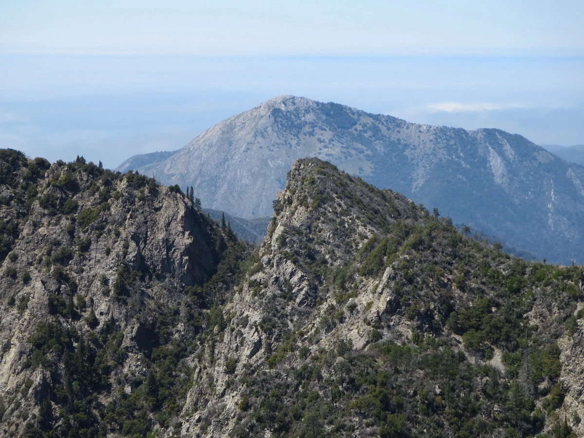
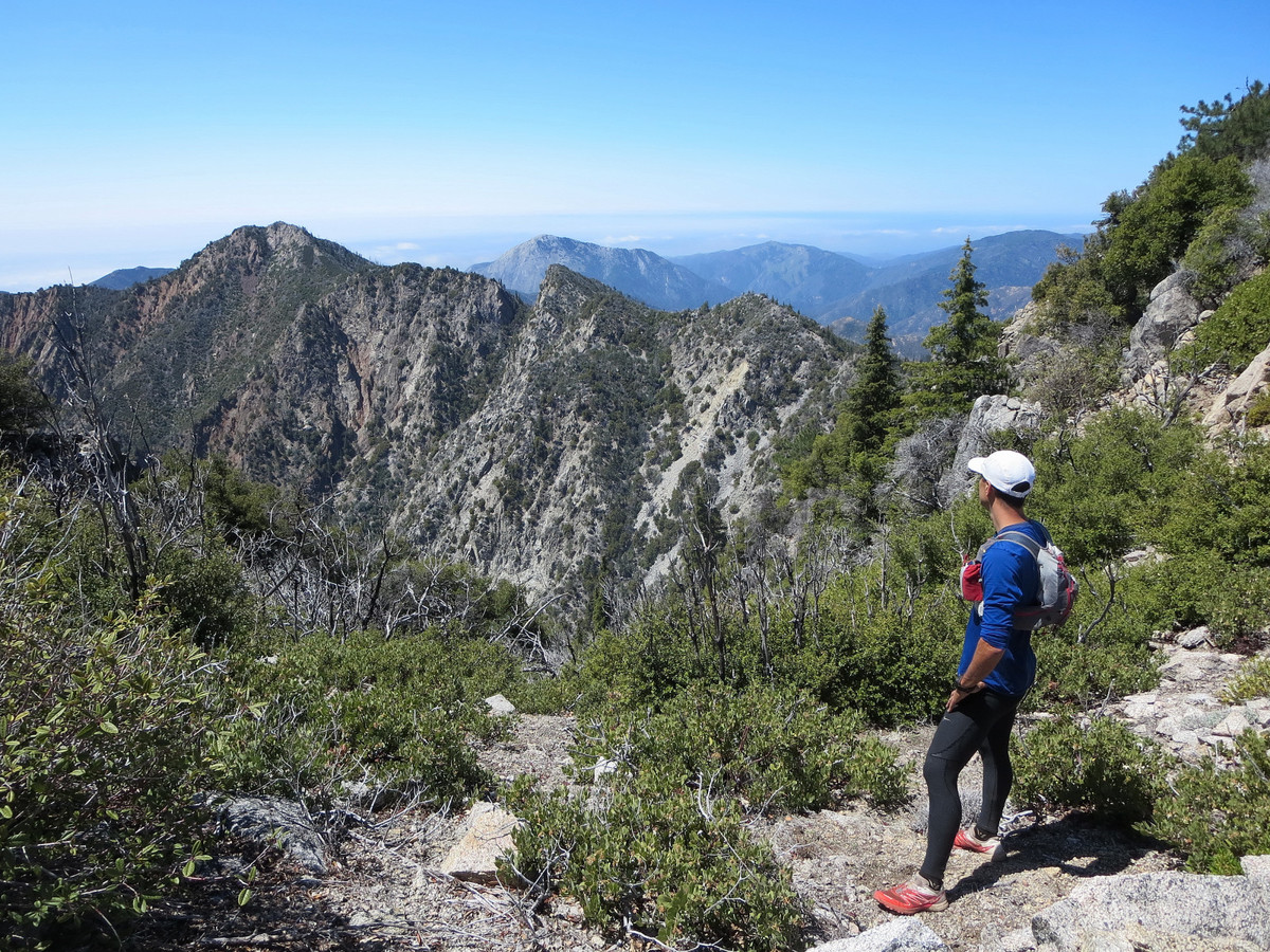
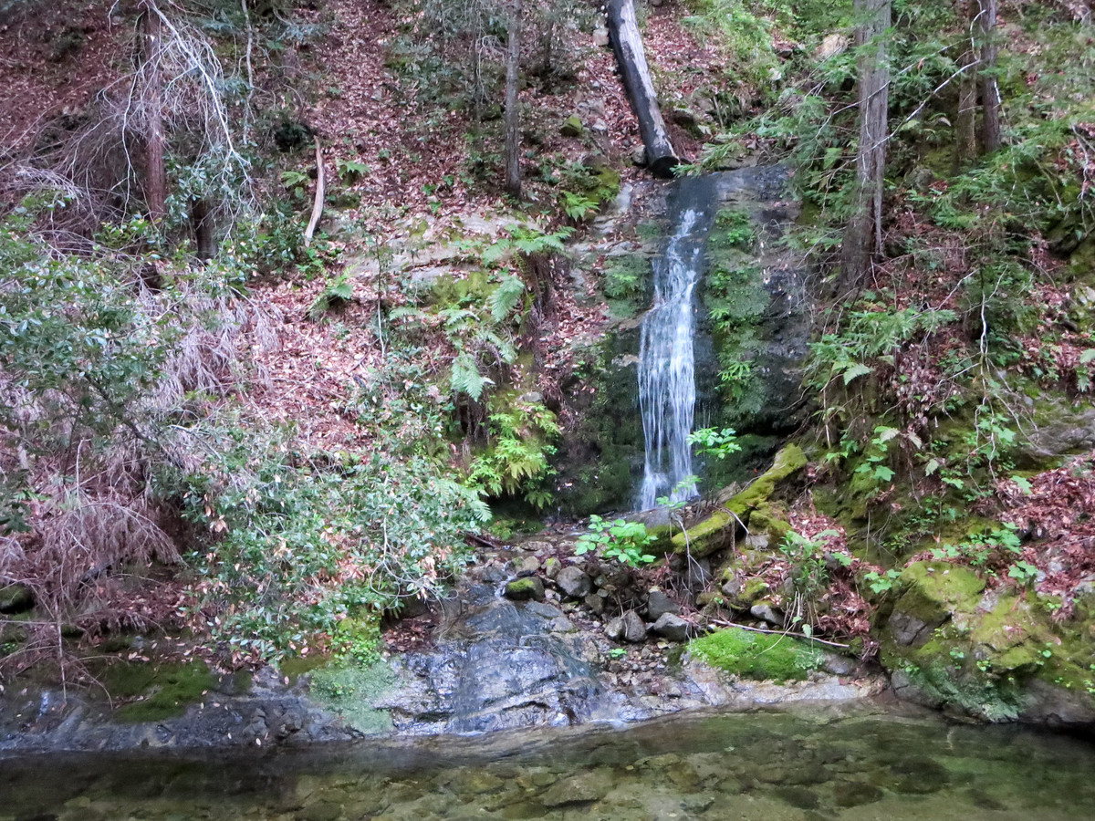
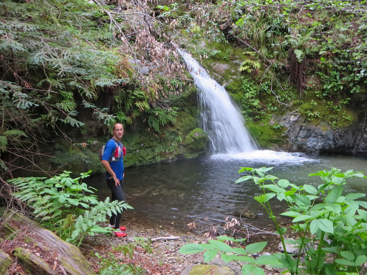
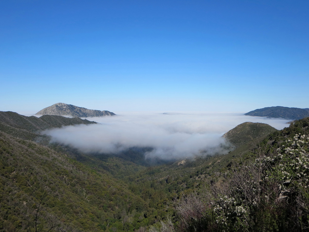
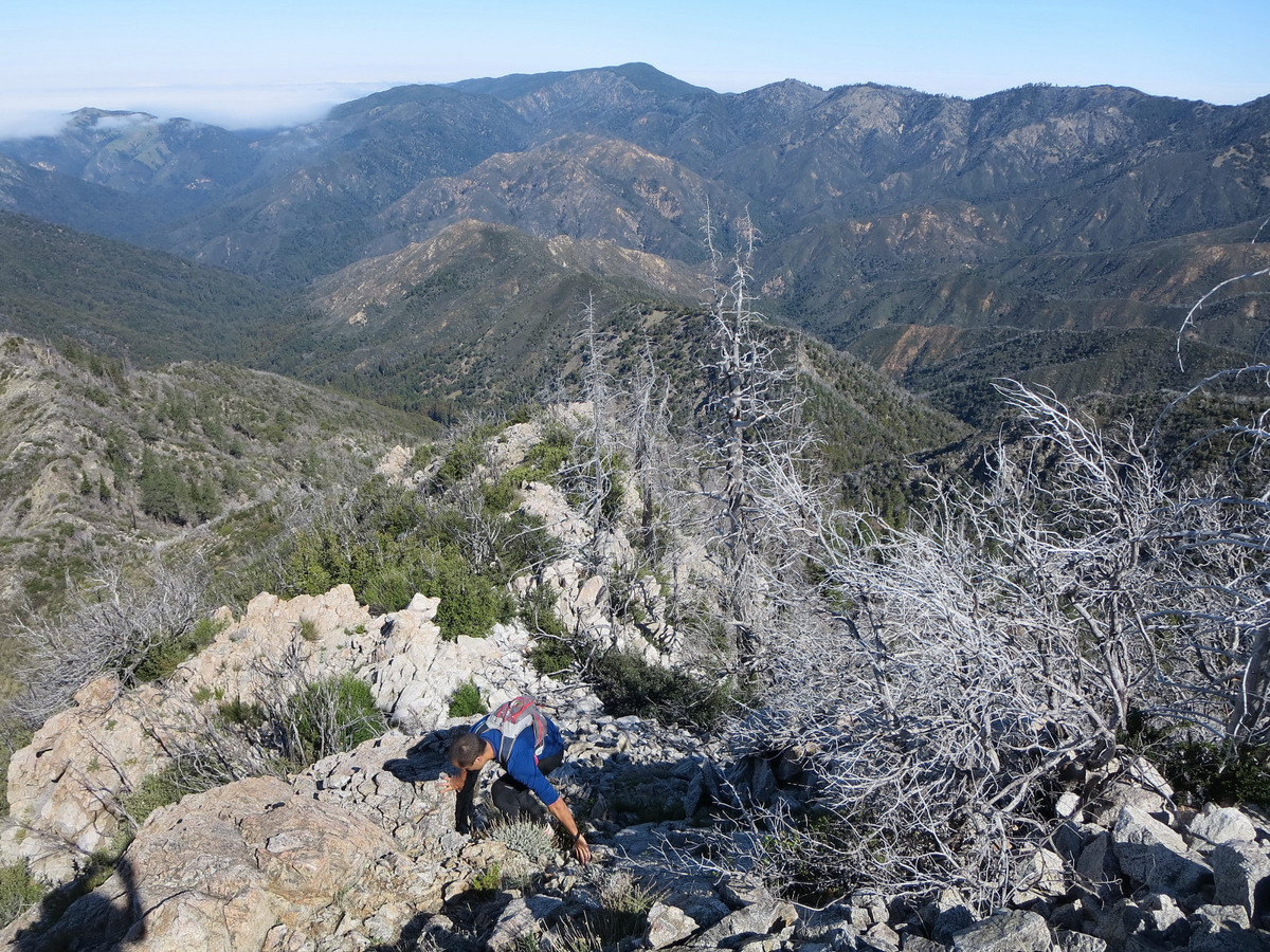
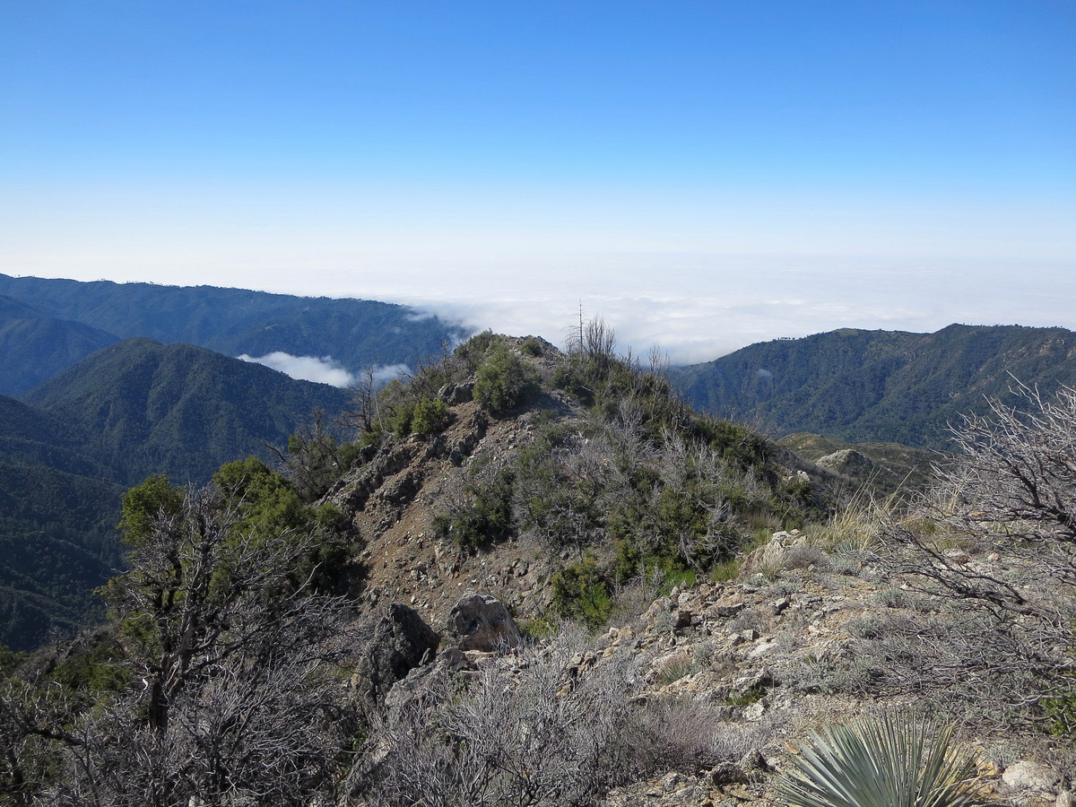
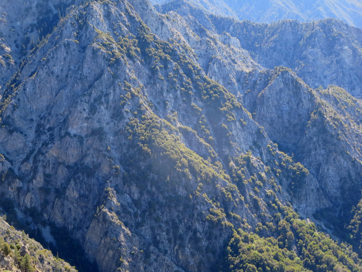
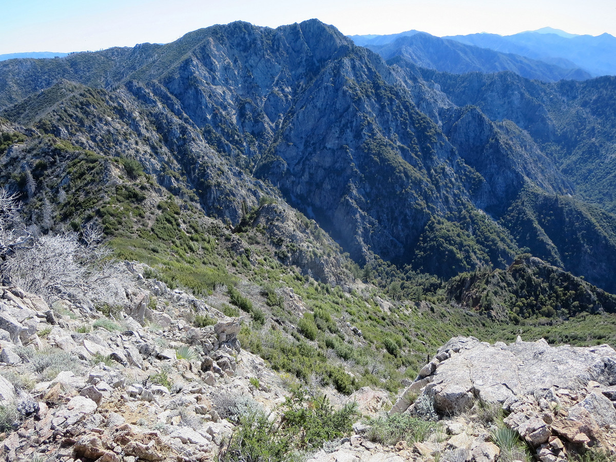
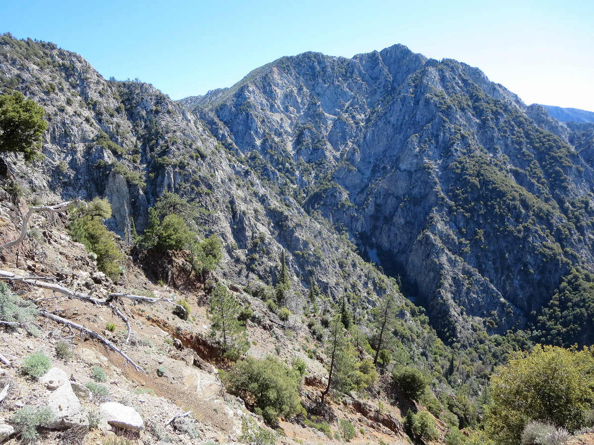
Intro: Building on our La Ventana Loop adventure, Joey Cassidy and I descended into the extremely rugged headwaters of Ventana Creek to climb Ventana Double Cone via “The Drain,” a prominent rocky gully that funnels all of the water in the wild cirque that stretches from Ventana Double Cone to Kandlbinder. From within this chiseled canyon, we gazed up at the ridge that separates the Little Sur River drainage from the Big Sur River drainage, a formidable rampart with massive cliffs and buttresses along its entire length. We walked among old growth Santa Lucia Firs that stand proud in quintessential columnar fashion and have seen few, if any, humans beneath their shadows. A picturesque waterfall part of the way up the Drain blocks easy progress, but this obstacle is surmounted with a couple class 4 moves. Additional scrambling in the Drain and the final chute was mostly solid and enjoyable. Note: Advanced navigation skills and comfort on very steep, rugged terrain with sustained scrambling are essential for any explorations into Ventana Creek Cirque. Prior experience with off-trail travel in the Ventana Wilderness is extremely helpful before attempting this route since the Ventana backcountry posses its own unique set of challenges.
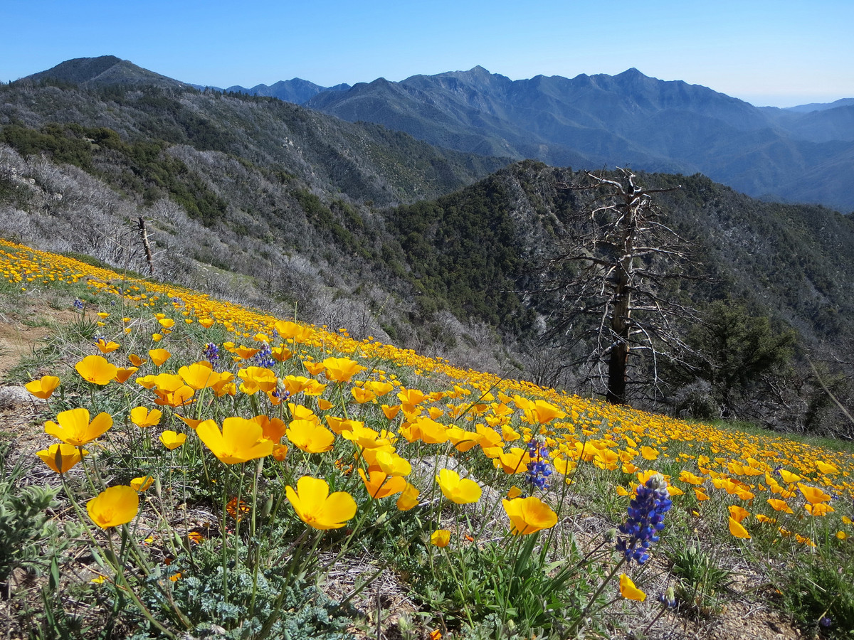
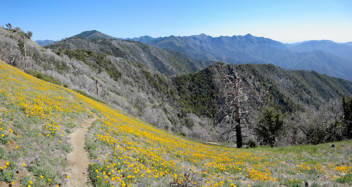
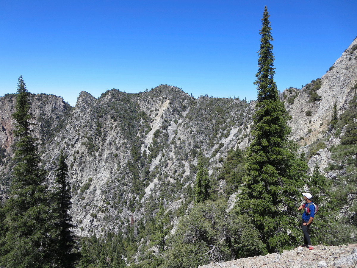
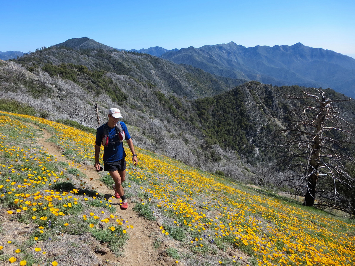
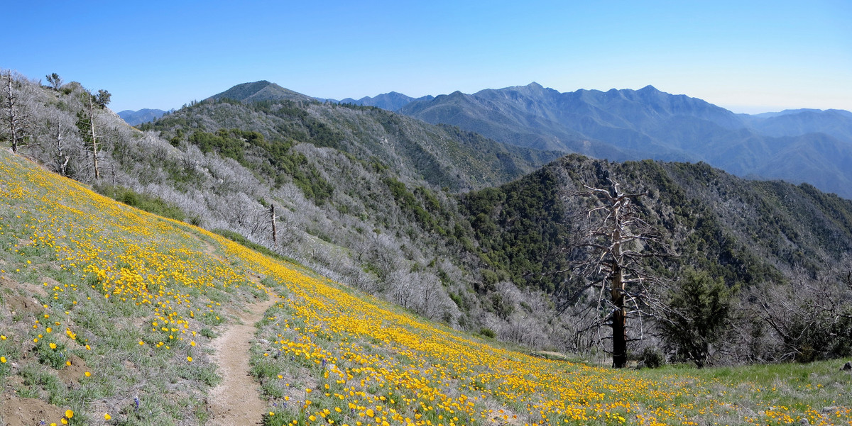
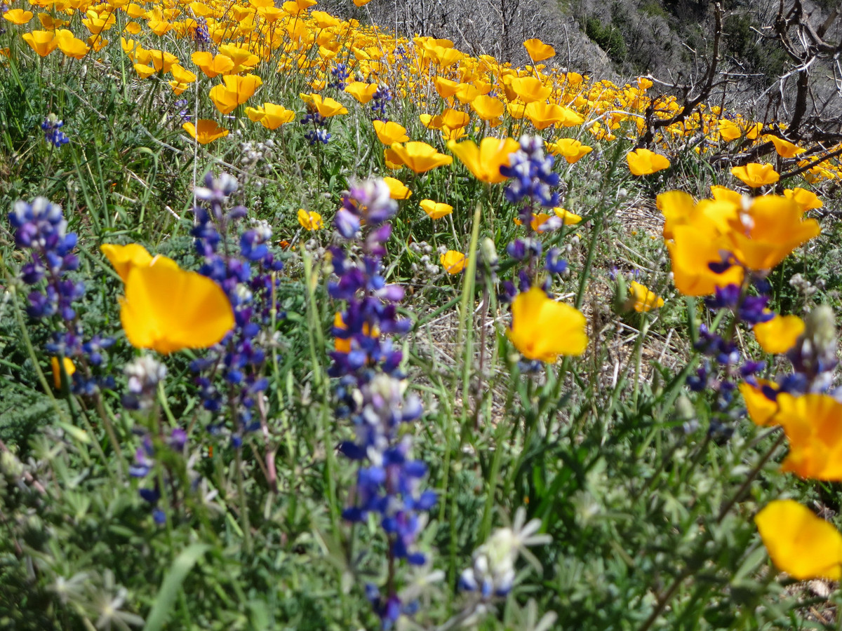
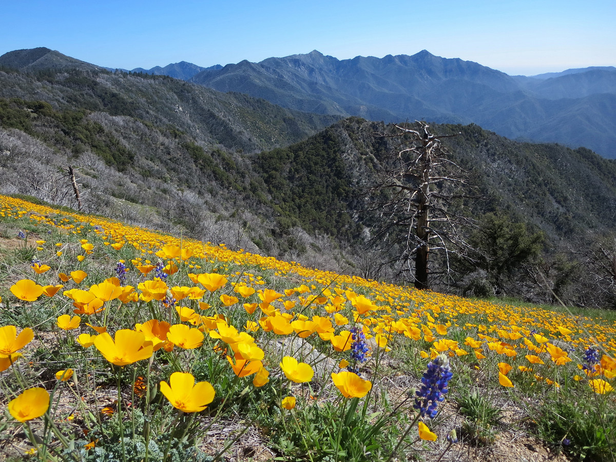
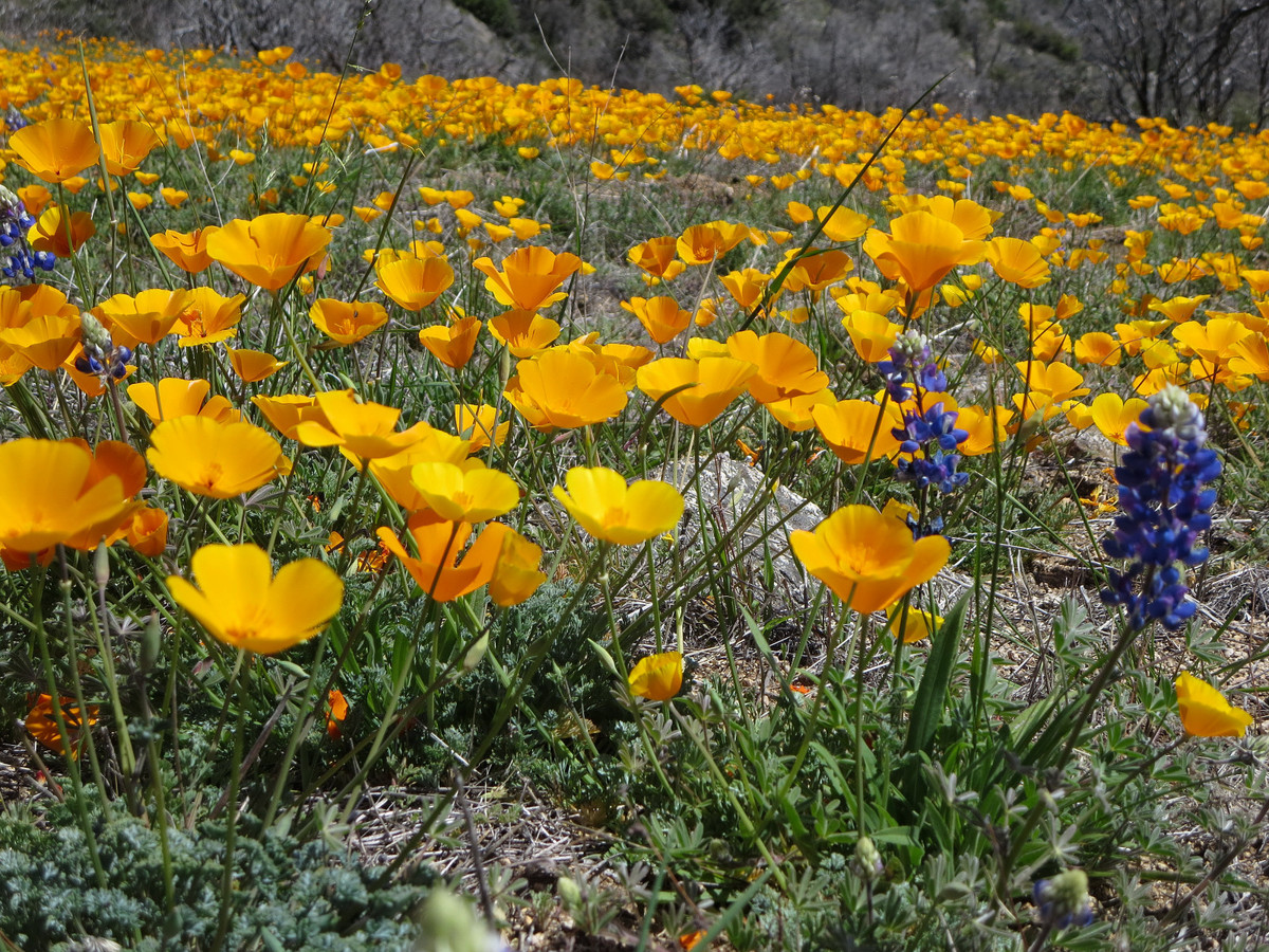
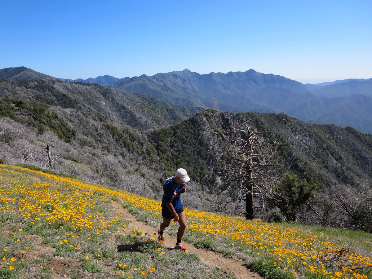
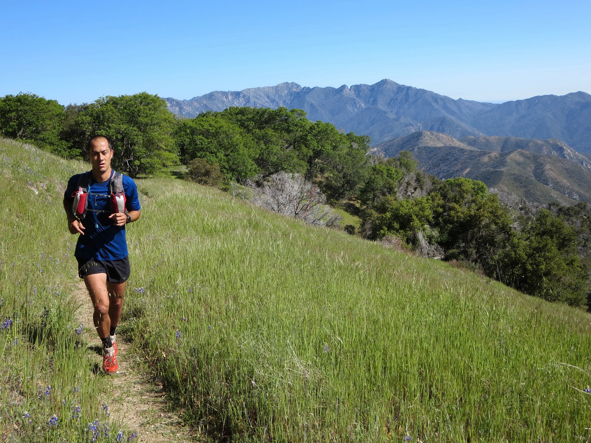
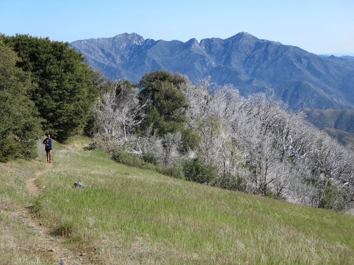
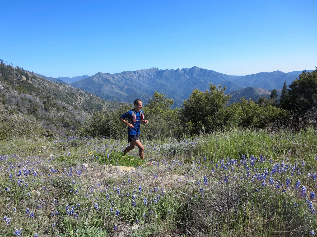
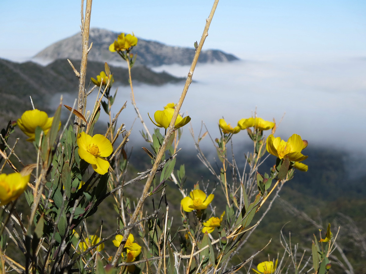
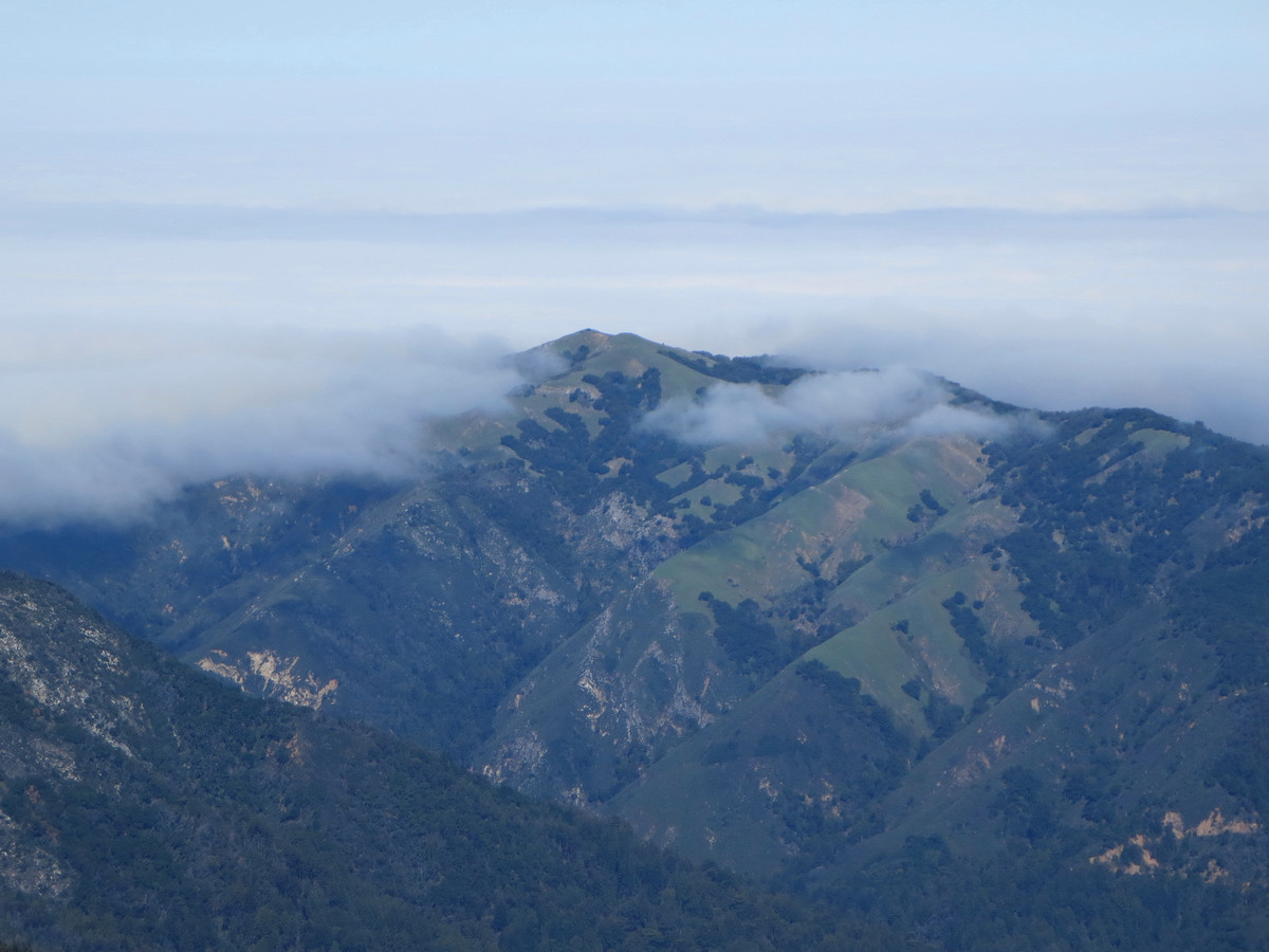
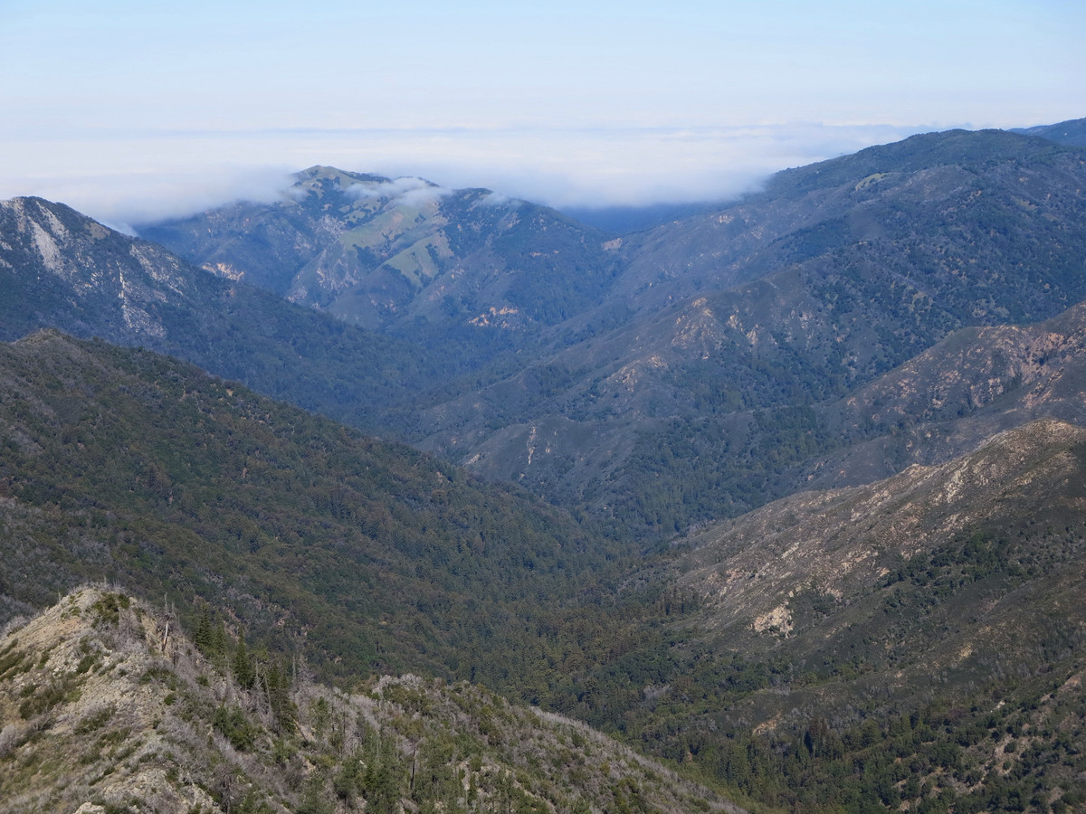
 To set the stage for this climb, we ascended Jackson Creek, with its lovely waterfalls and old growth redwoods, and then climbed Kandlbinder via its direct north face talus gully. With prior experience traveling up Jackson Creek, we were able to reach the summit of Kandlbinder 3h59m after leaving the Bottchers Gap Trailhead. On the way back from Ventana Double Cone to Bottchers Gap we were treated to a spectacular display of wildflowers in the meadows near Pat Springs and Devils Peak. The Ventana Double Cone Trail is heavily overgrown south of Puerto Suello, but recent trail work to Puerto Suello (we met some of the trail crew) has greatly improved the condition of the trail from Pat Springs to Puerto Suello – thank you! With much photography along the way, we were still able to complete the loop in 10h49m confirming my suspicion that this route would be a more efficient way to connect Kandlbinder and Ventana Double Cone without any of the hideous brush present on the ridge crest. This is easily one of the most aesthetic, spectacular routes I have done anywhere. The Ventana Creek cirque provides a real sense of adventure in a truly wild canyon that is rugged and unspoiled. GPS route here.
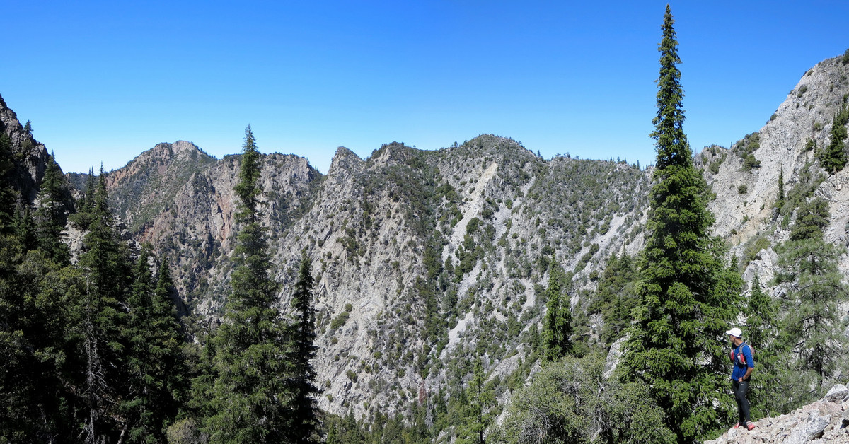

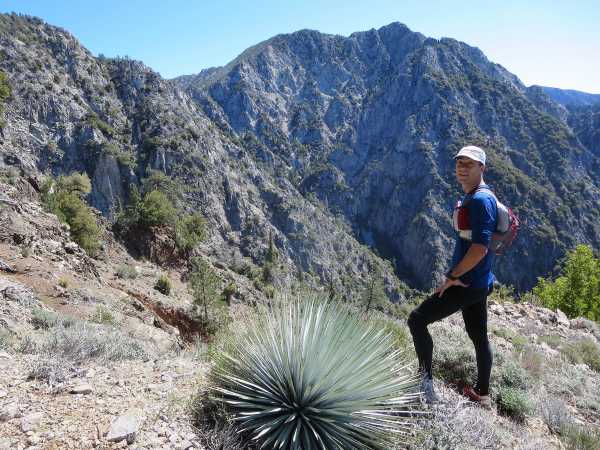
Concept: Back in January we completed the La Ventana Loop, becoming the first individuals to tag Kandlbinder, La Venana (aka the Window), and Ventana Double Cone all in the same day. On that 13 hour outing, our route stuck to the ridge crest (or near it) resulting in some atrocious Ventana bushwhacking, particularly between La Ventana and Ventana Double Cone. There had to be another way. The talus gully route up Kandlbinder was brush-free and beautiful so I knew that I wanted to return for that excellent climb. From the summit of VDC and Kandlbinder, I also had my eye on the prominent drainage of Ventana Creek wrapping around the west ridge of Ventana Double Cone. This drainage seemed to provide a non-technical and brush-free route up VDC but questions remained regarding the descent into this drainage from Kandlbinder. These questions were answered when Toshi Hosaka an Sachin Sawant successfully descended into the Ventana Creek cirque from Kandlbinder on the way to their awesome scramble route (likely a first ascent) up the west ridge of VDC. With further satellite inspection, I identified a gully that would provide an excellent descent route from Kandlbinder directly to Ventana Creek that avoids both brush and sketchy loose rock, and efficiently deposit us into Ventana cirque. We would then ascend the upper reaches of Ventana Creek all the way to VDC via the prominent gully I call “the Drain” since a complex network of chutes and gullies from La Ventana all the way to VDC funnel into the main gully. See below for a detailed route description. GPS route here.
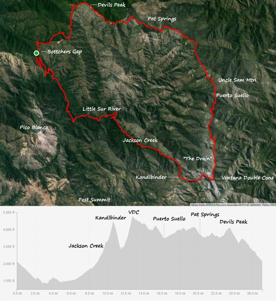
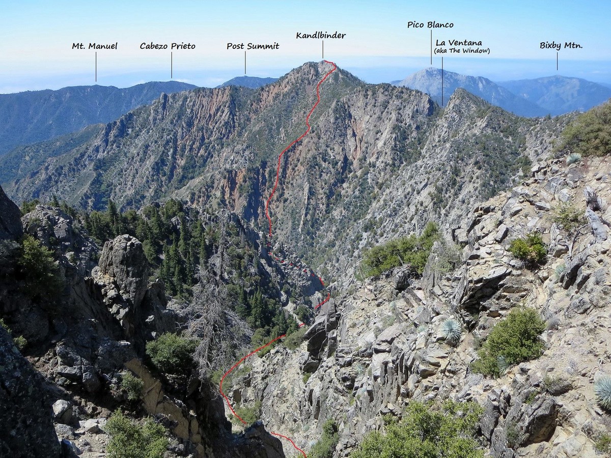
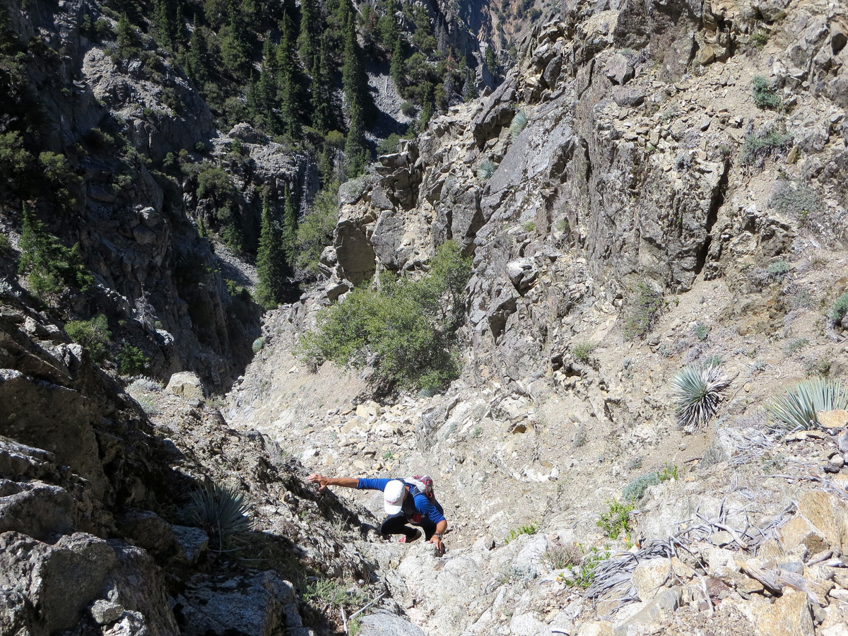
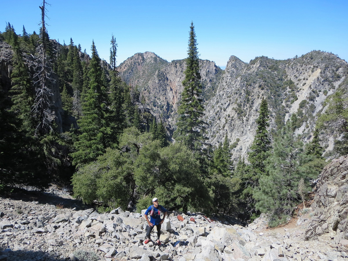
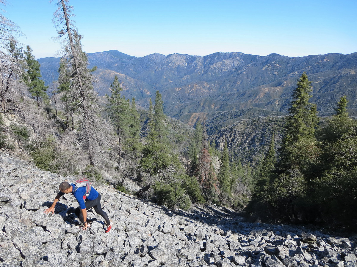
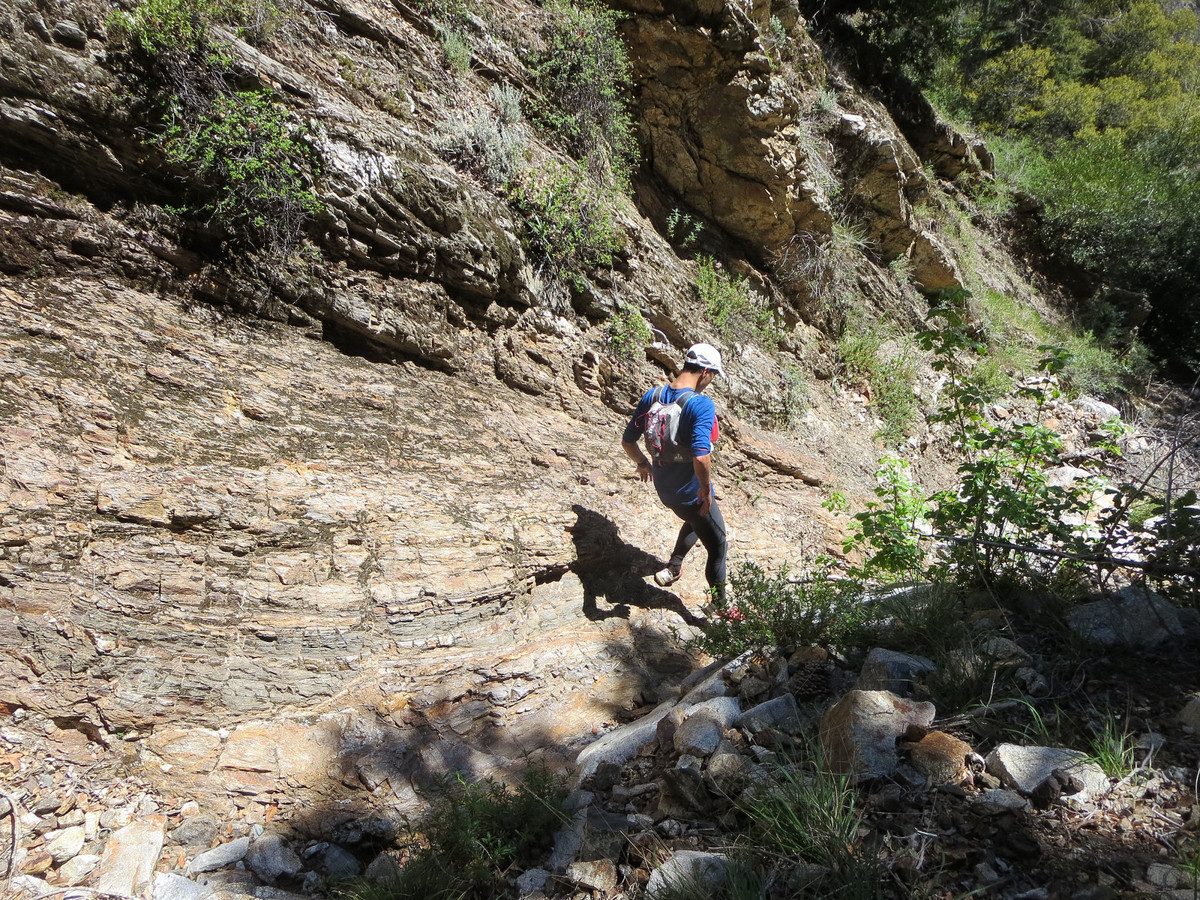
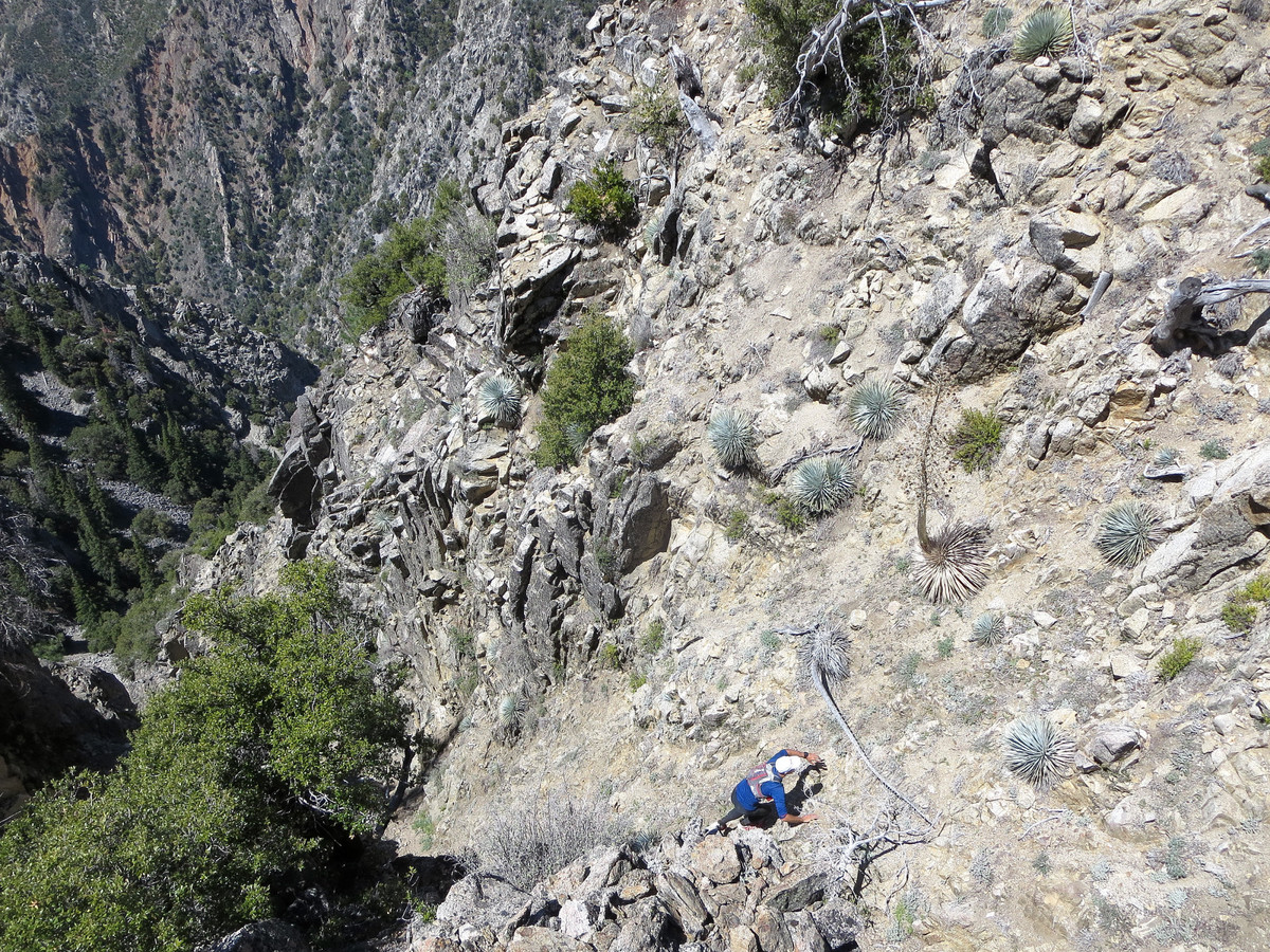
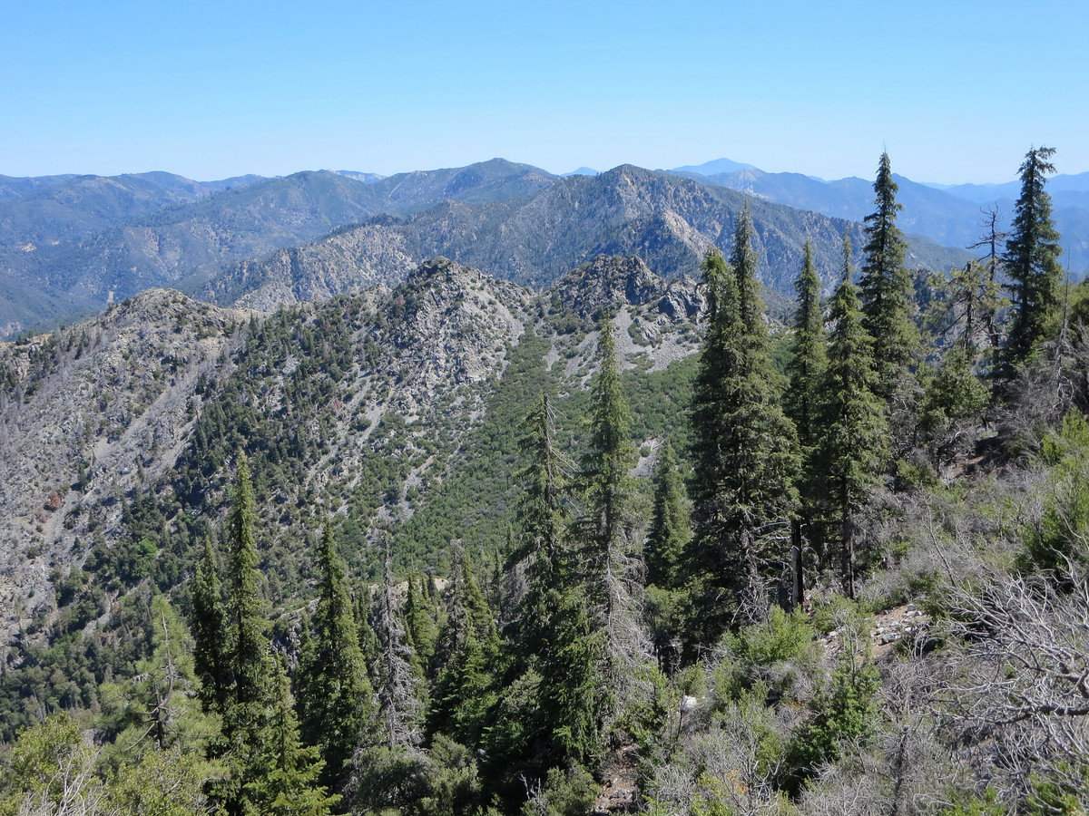
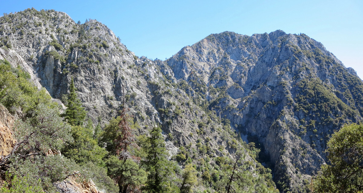 Route Description: The Drain route is identical to the La Ventana Loop with the exception of the portion between Kandlbinder and VDC, so that is the section I will focus on in the following route description: From the summit of Kandlbinder, descend the east ridge a short distance until you are below white cliffs that compose the southern aspect of the summit block. From here descend straight down on loose talus or rock ribs aiming for a large patch of red talus below. Before reaching the red talus field, begin traversing left, utilizing user friendly dirt patches for quick plunge steps. At ~4,000 ft, traverse over to a sub-ridge where the terrain drops off steeply to the east. Descend this sub-ridge to ~3,700 ft and drop into a gully. While the terrain is steep the ground is generally stable. The main section of the gully has a nice section of plunge stepping underneath oaks and Santa Lucia Firs. At one point the gully reaches a constriction that may require downclimbing. We trended skiers right a short distance and then traversed back into the gully below the constriction. The balance of the route down to Ventana Creek and the start of the Drain is a straightforward trip down a dry streambed.
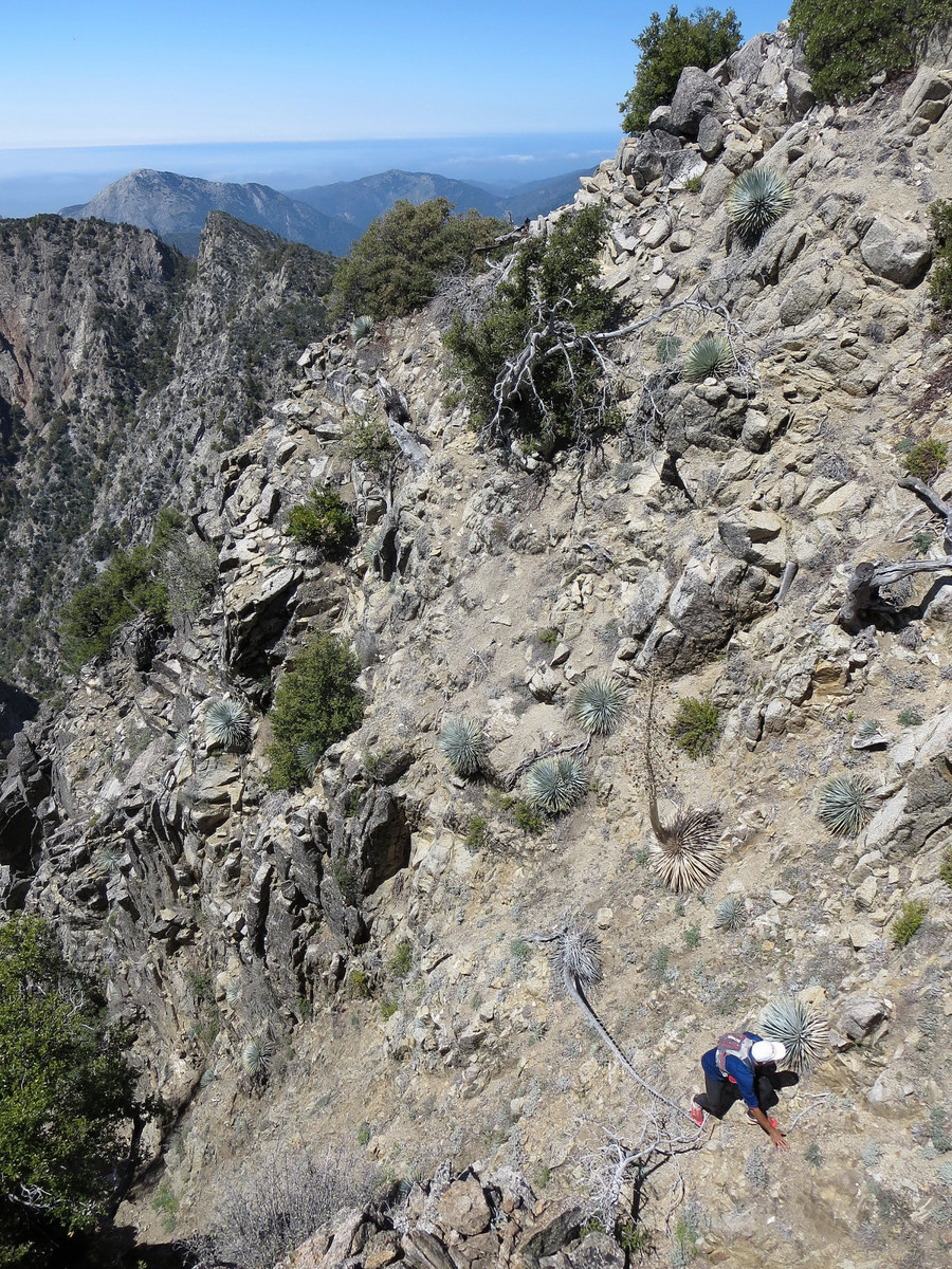
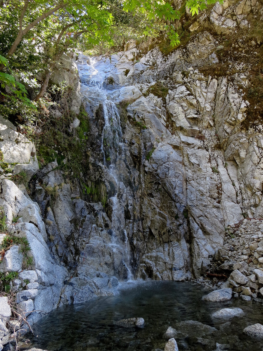
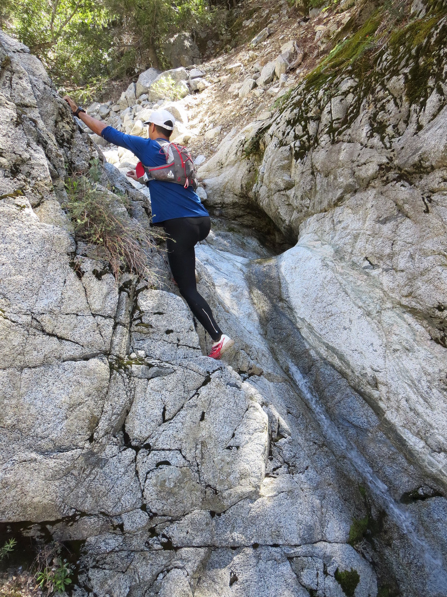
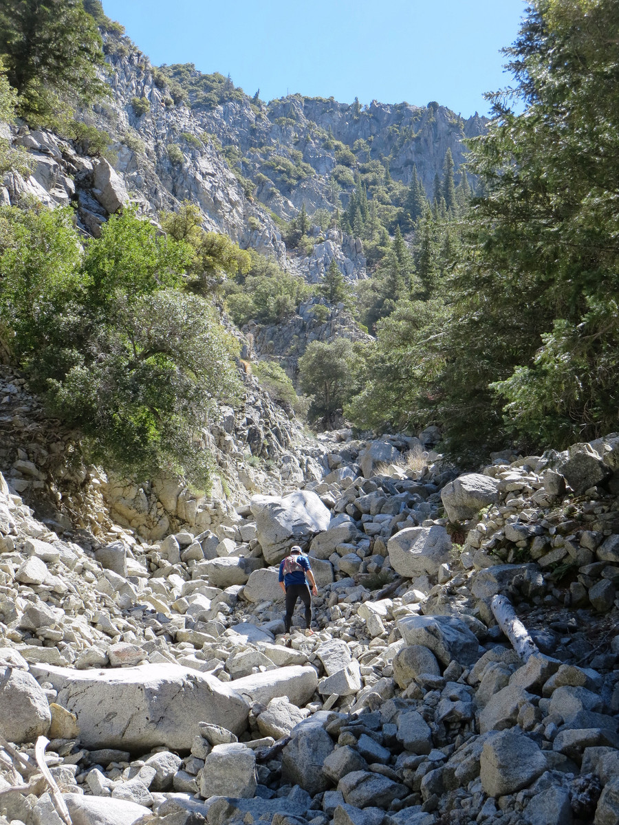
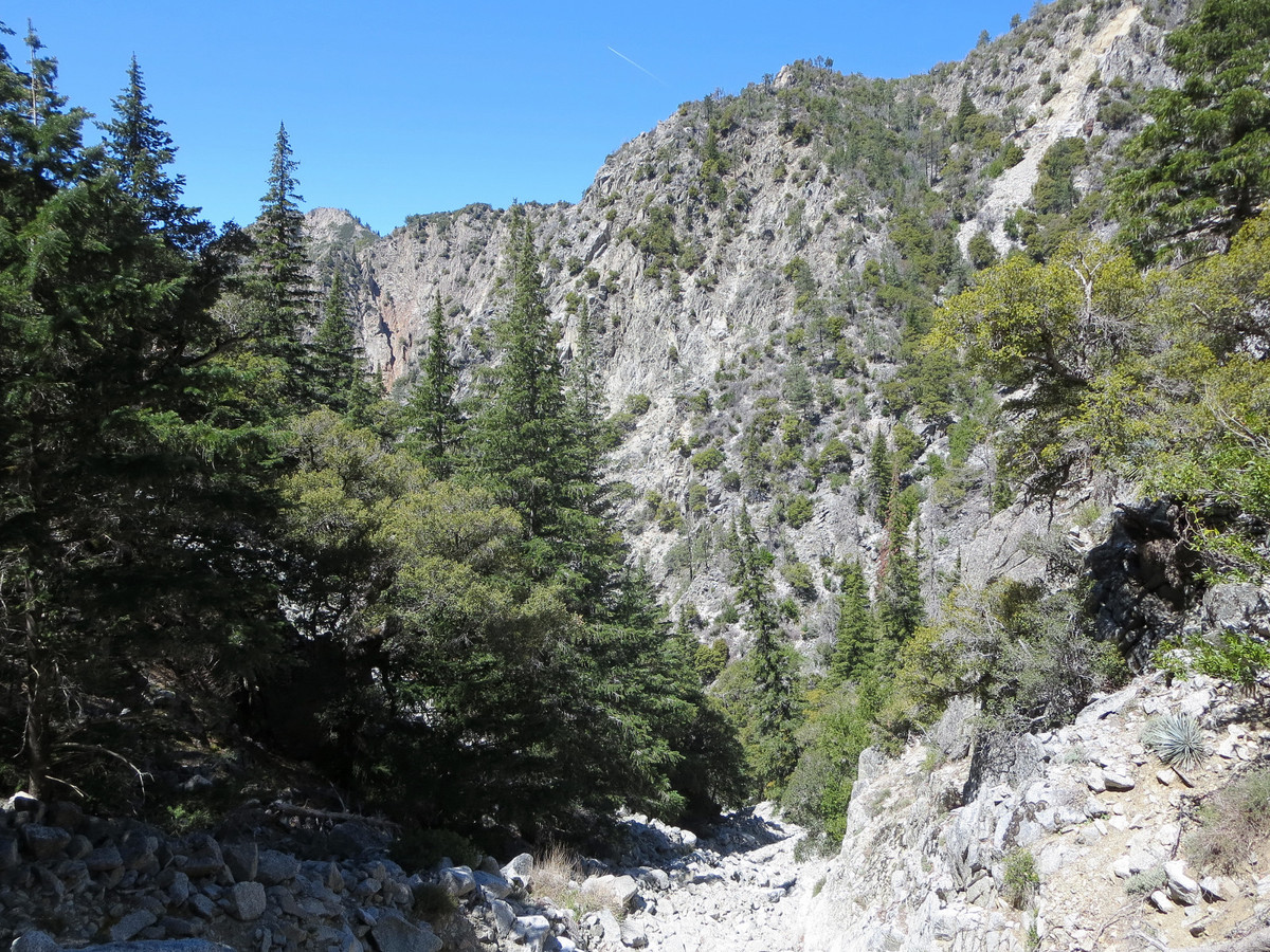
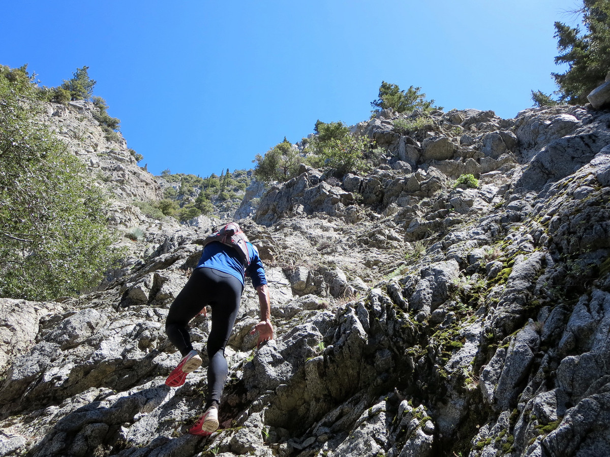
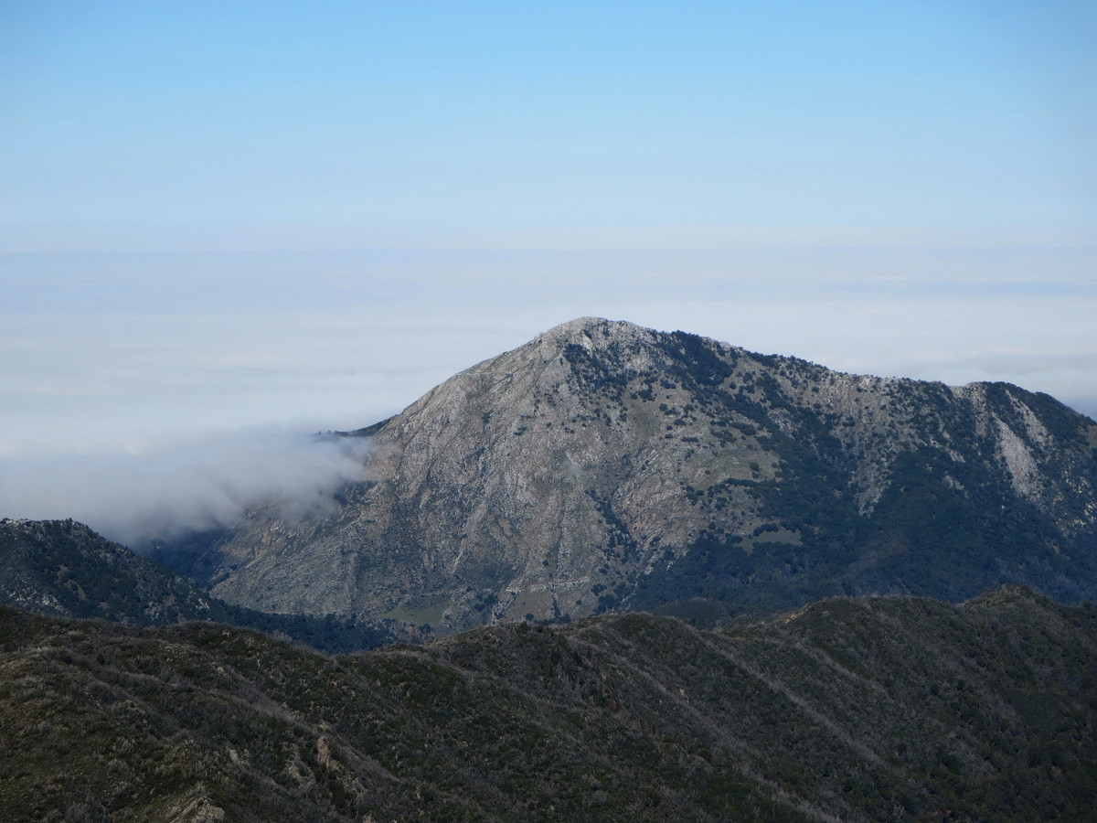
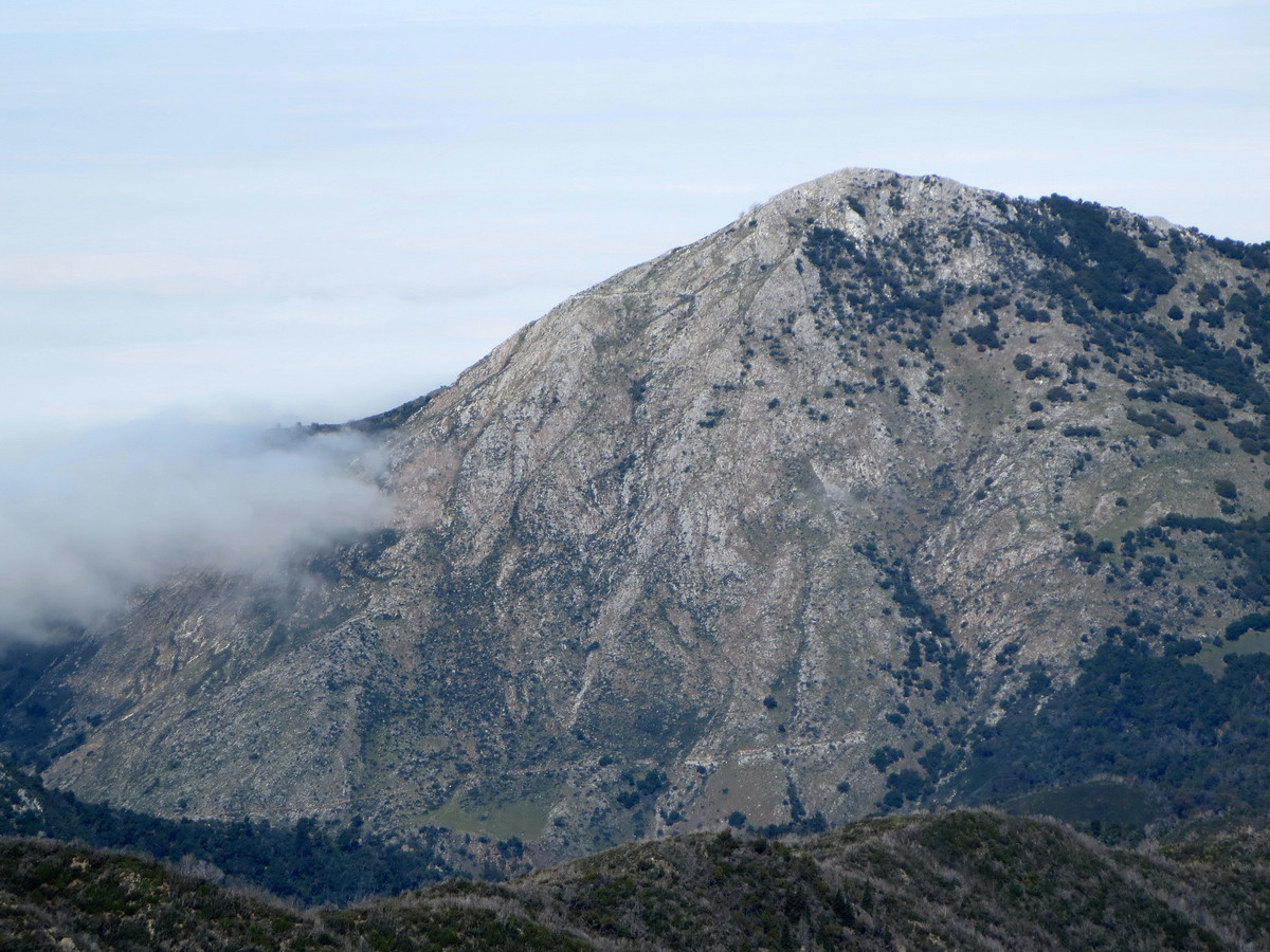
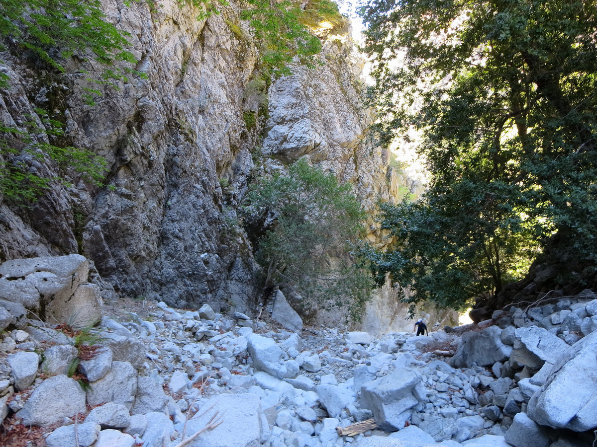
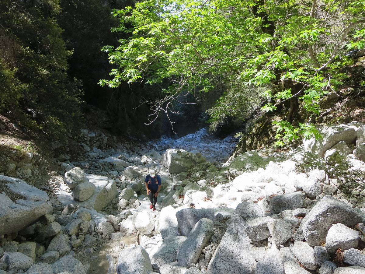
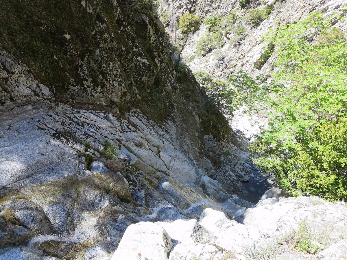
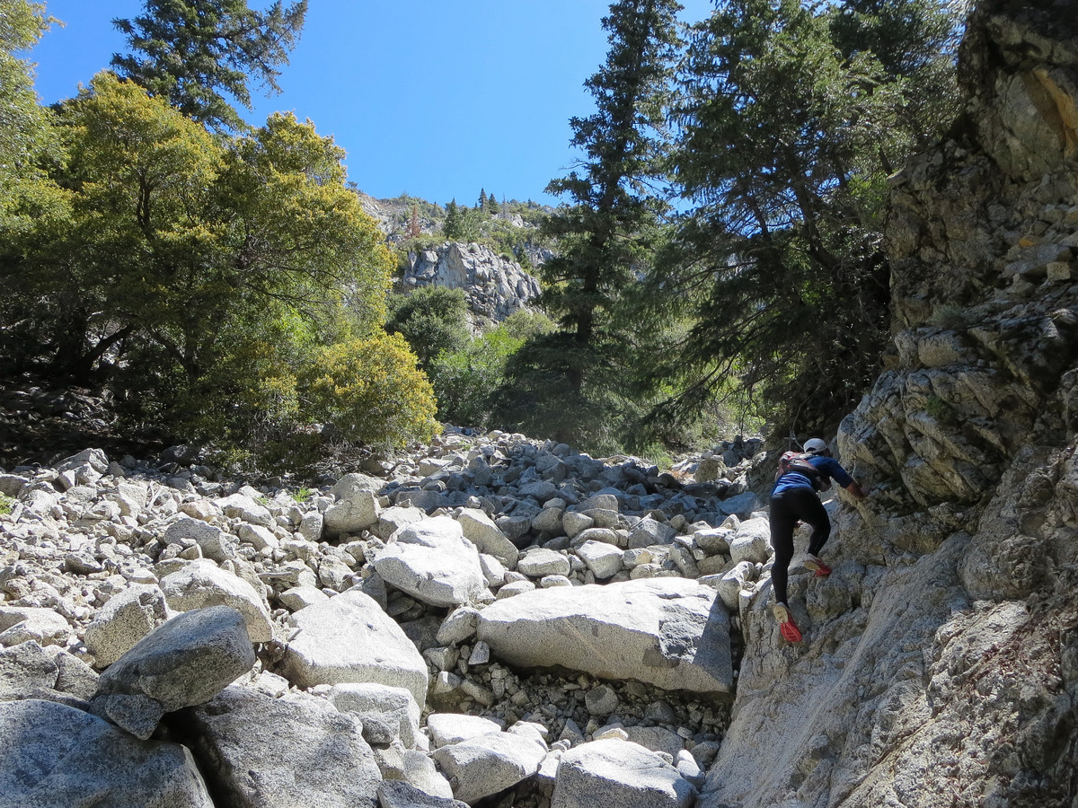
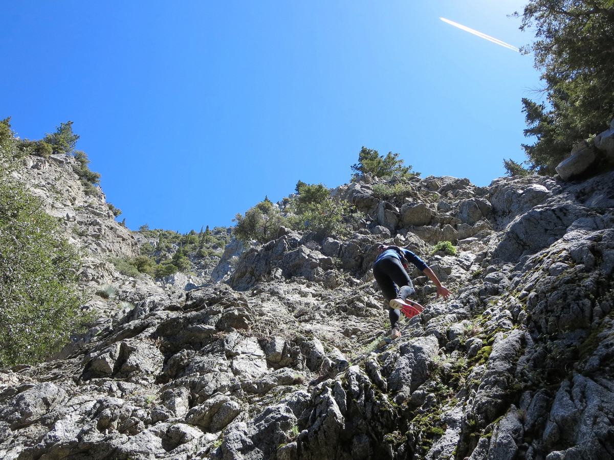
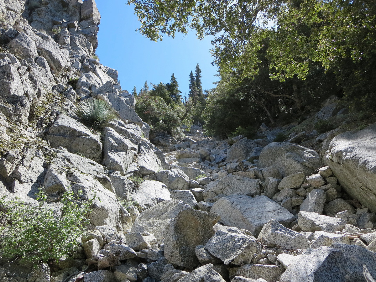
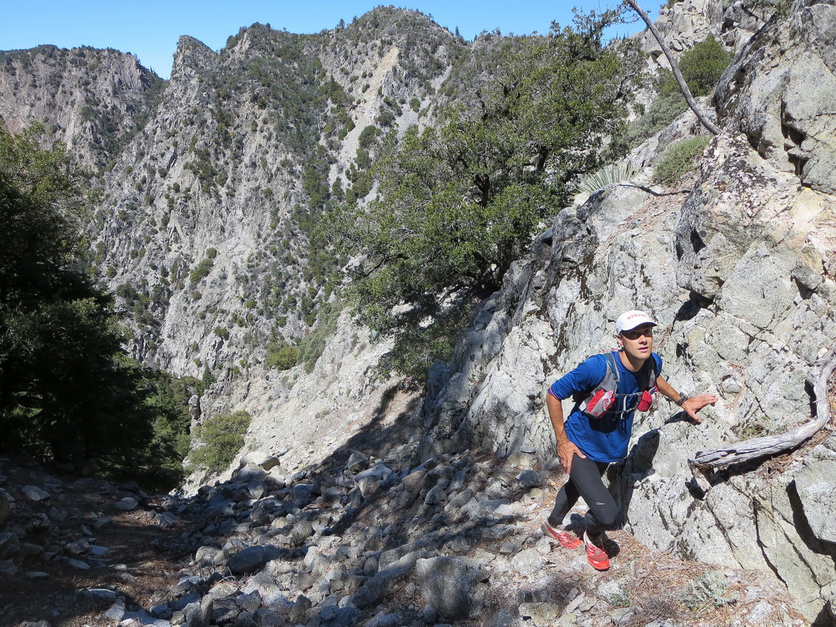
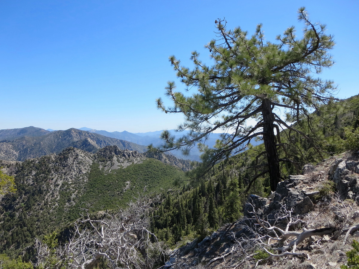
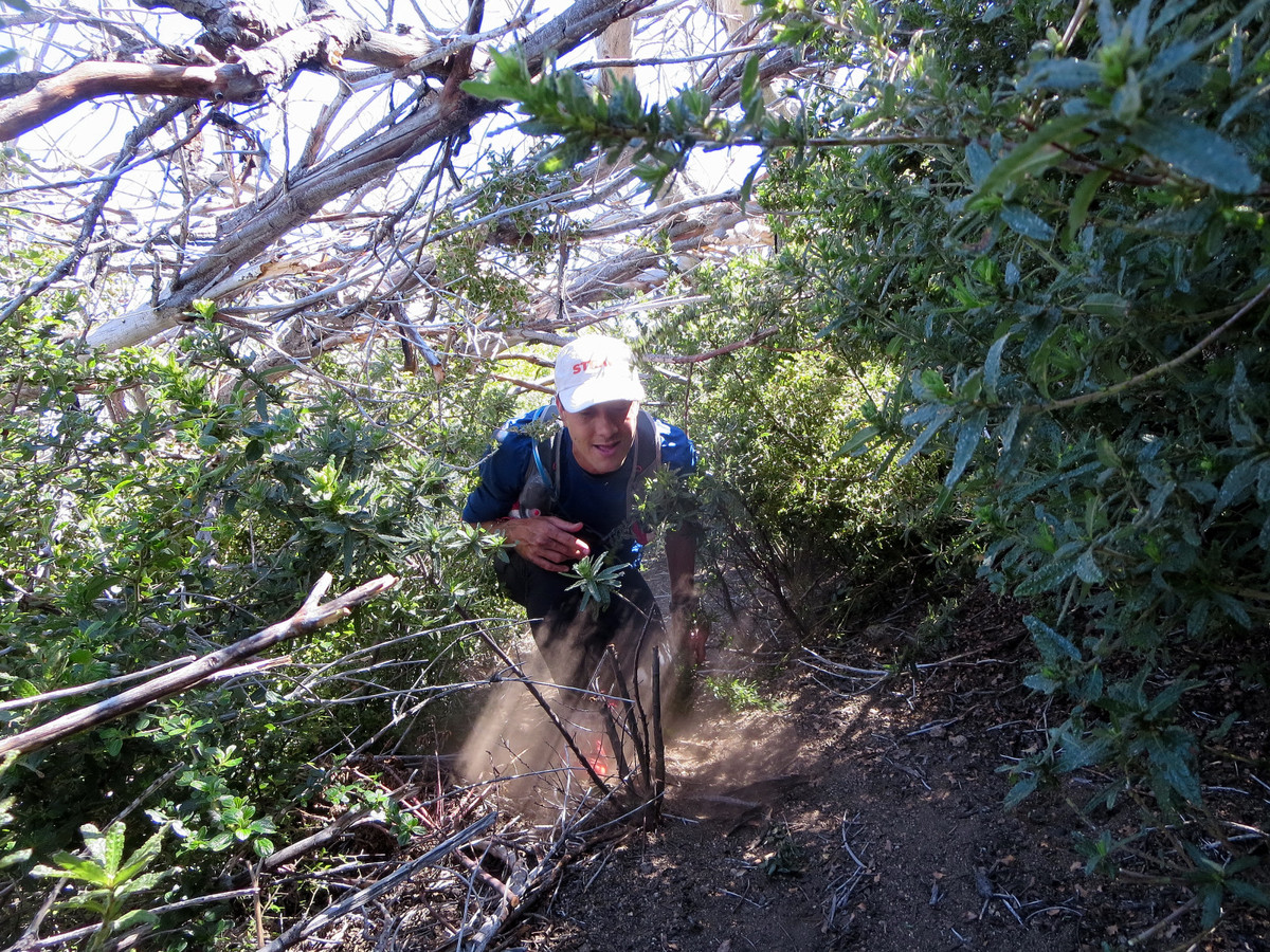
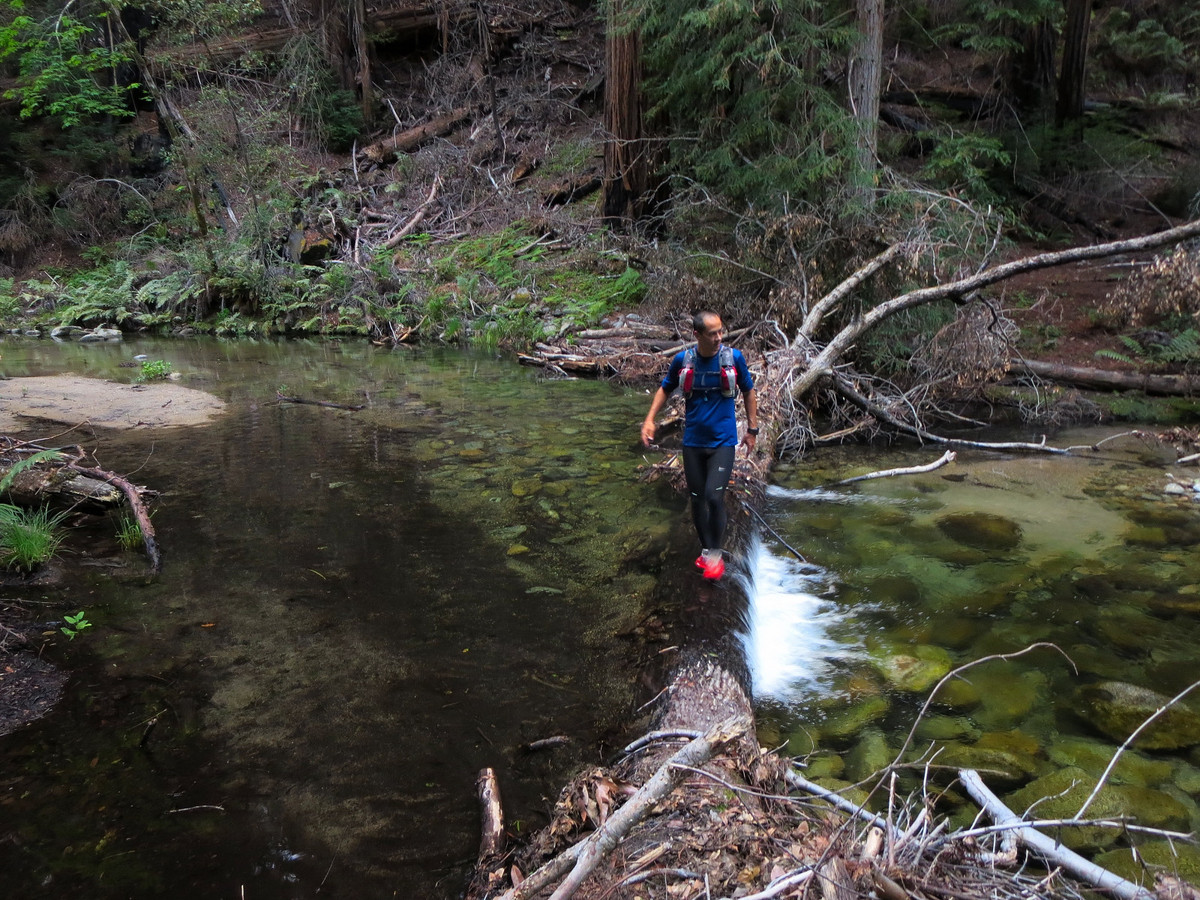
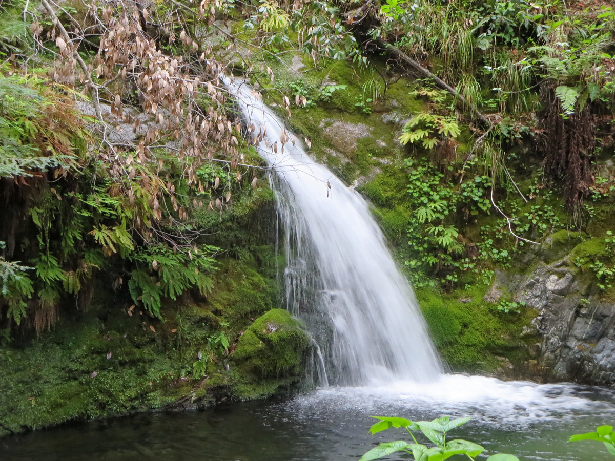
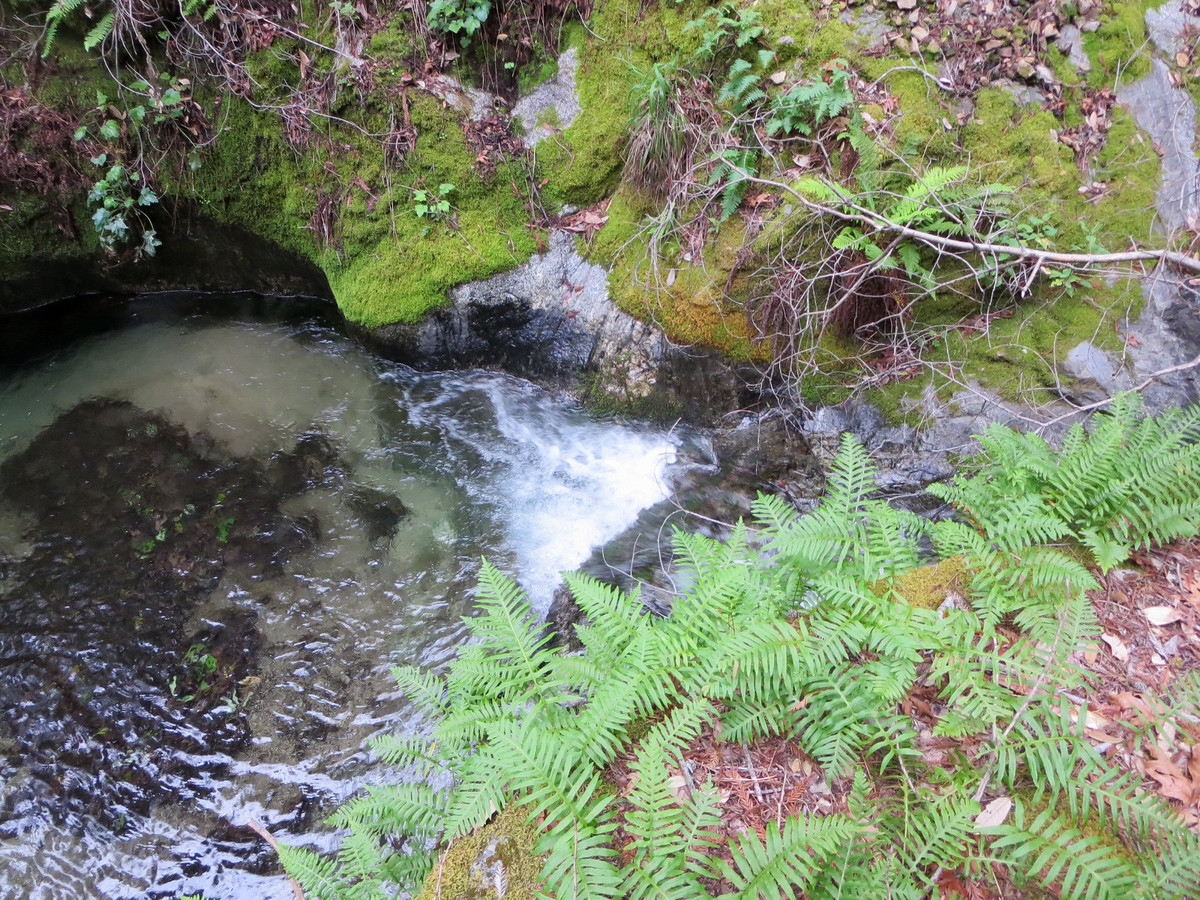
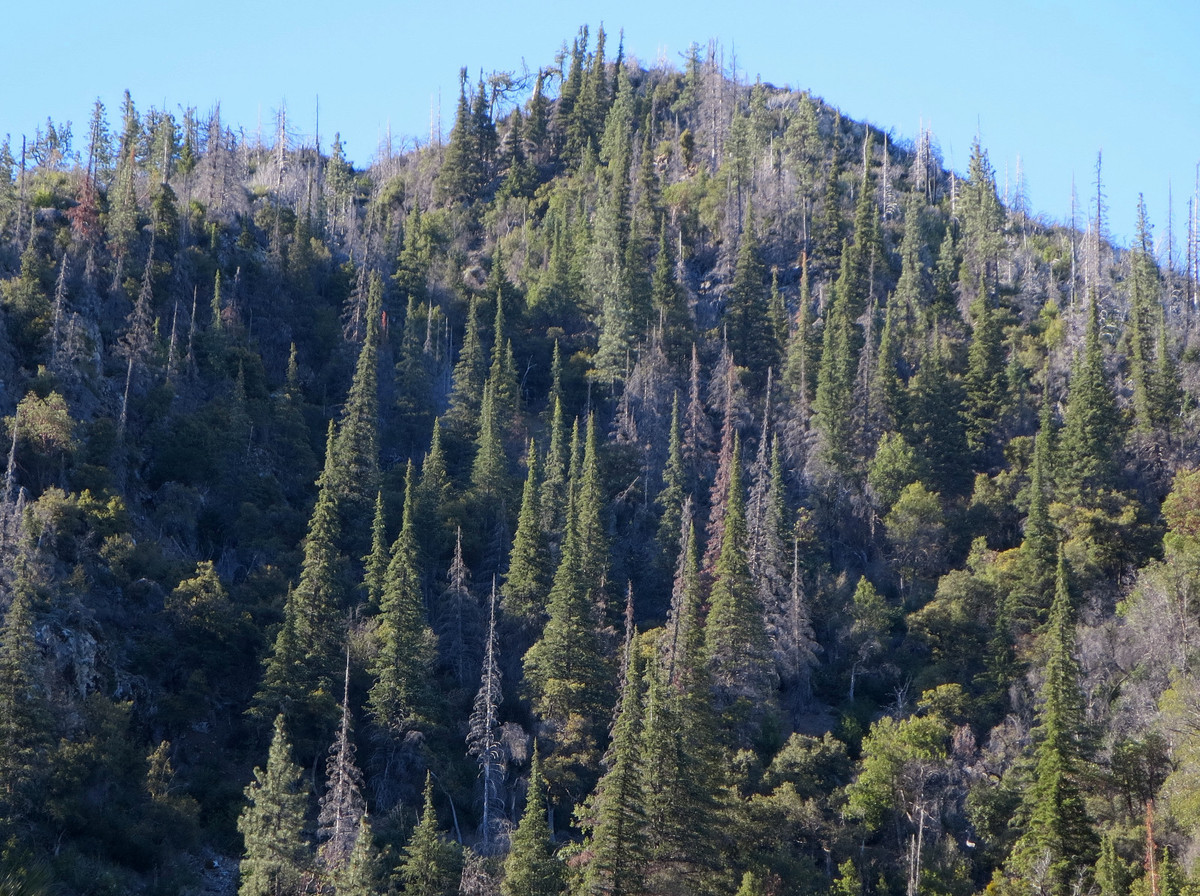
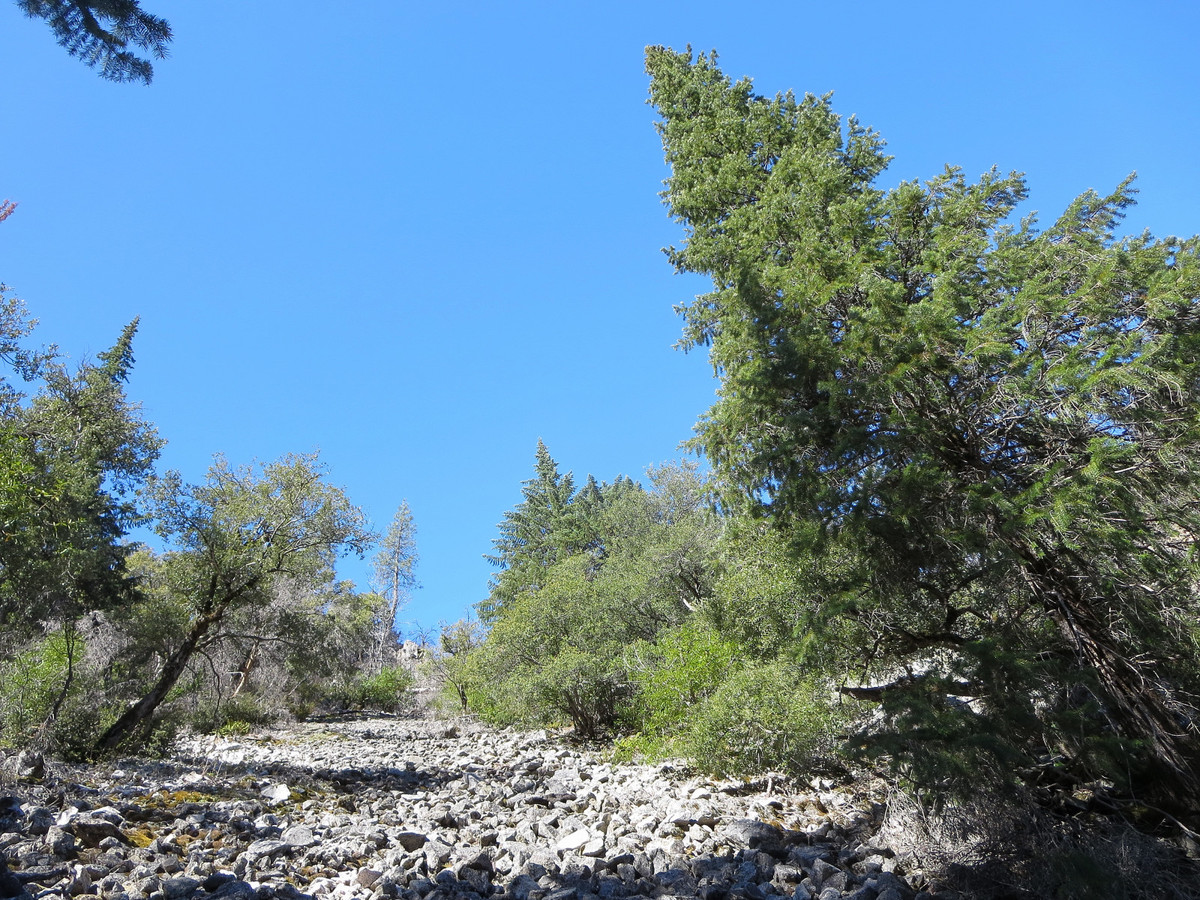
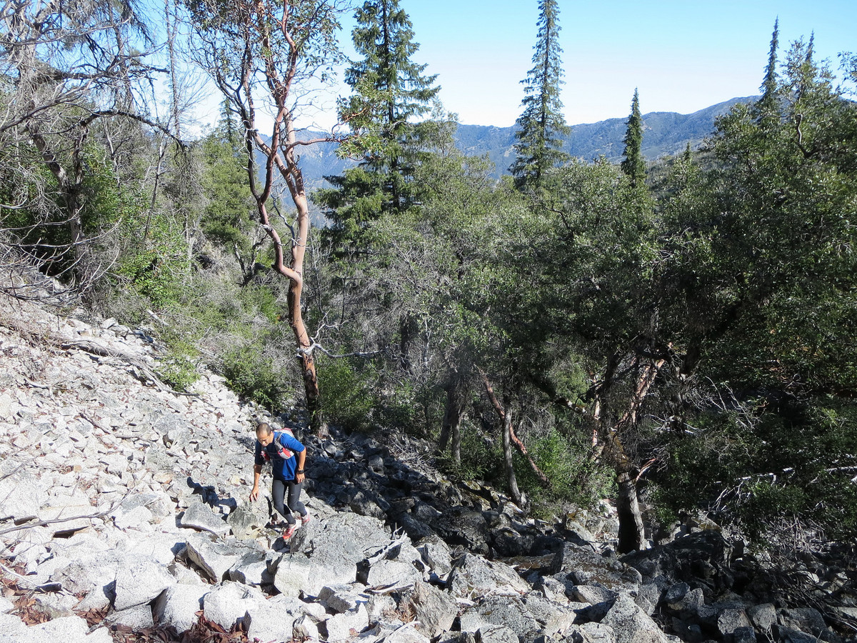
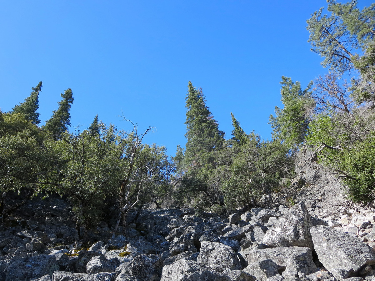
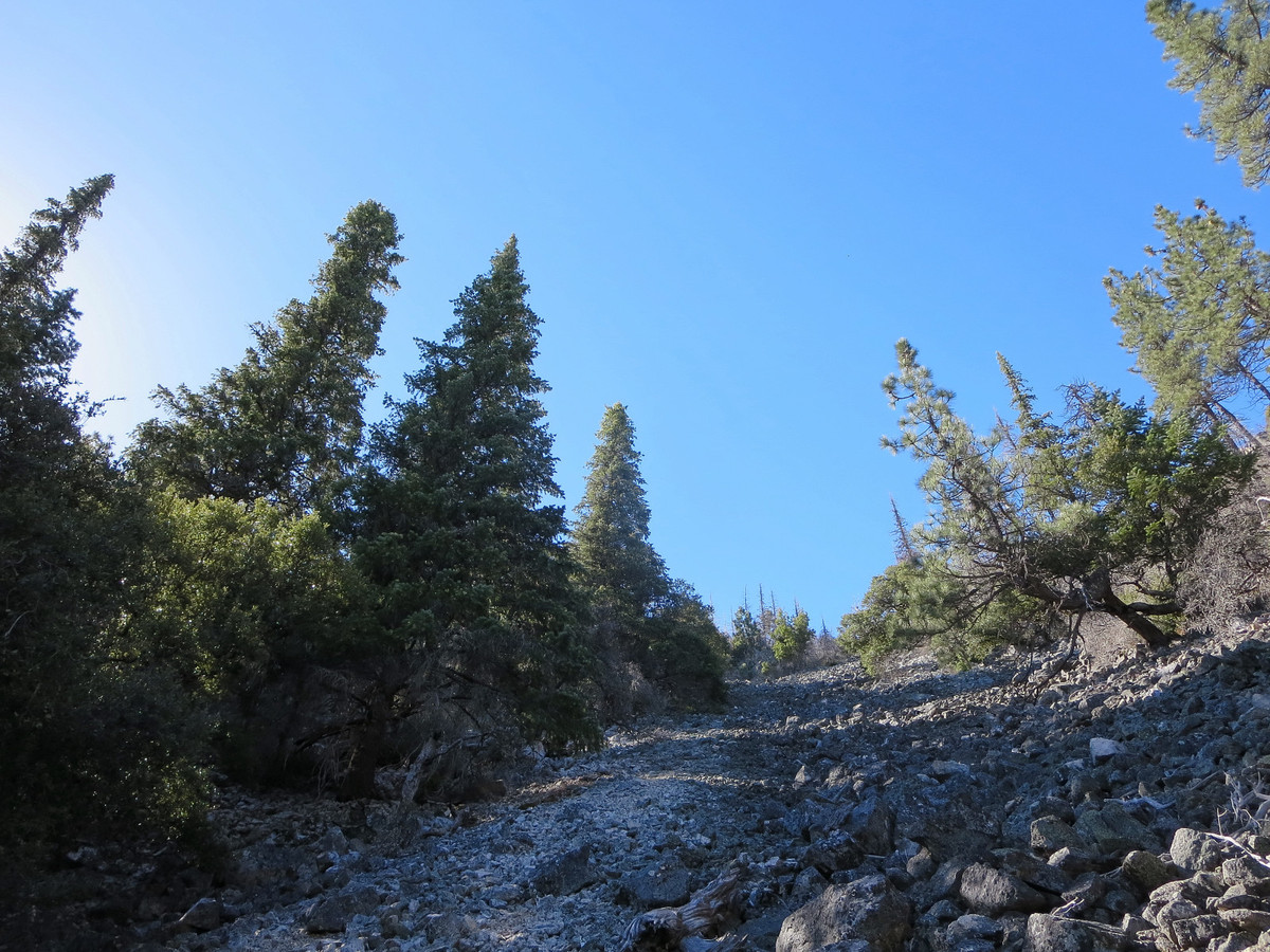
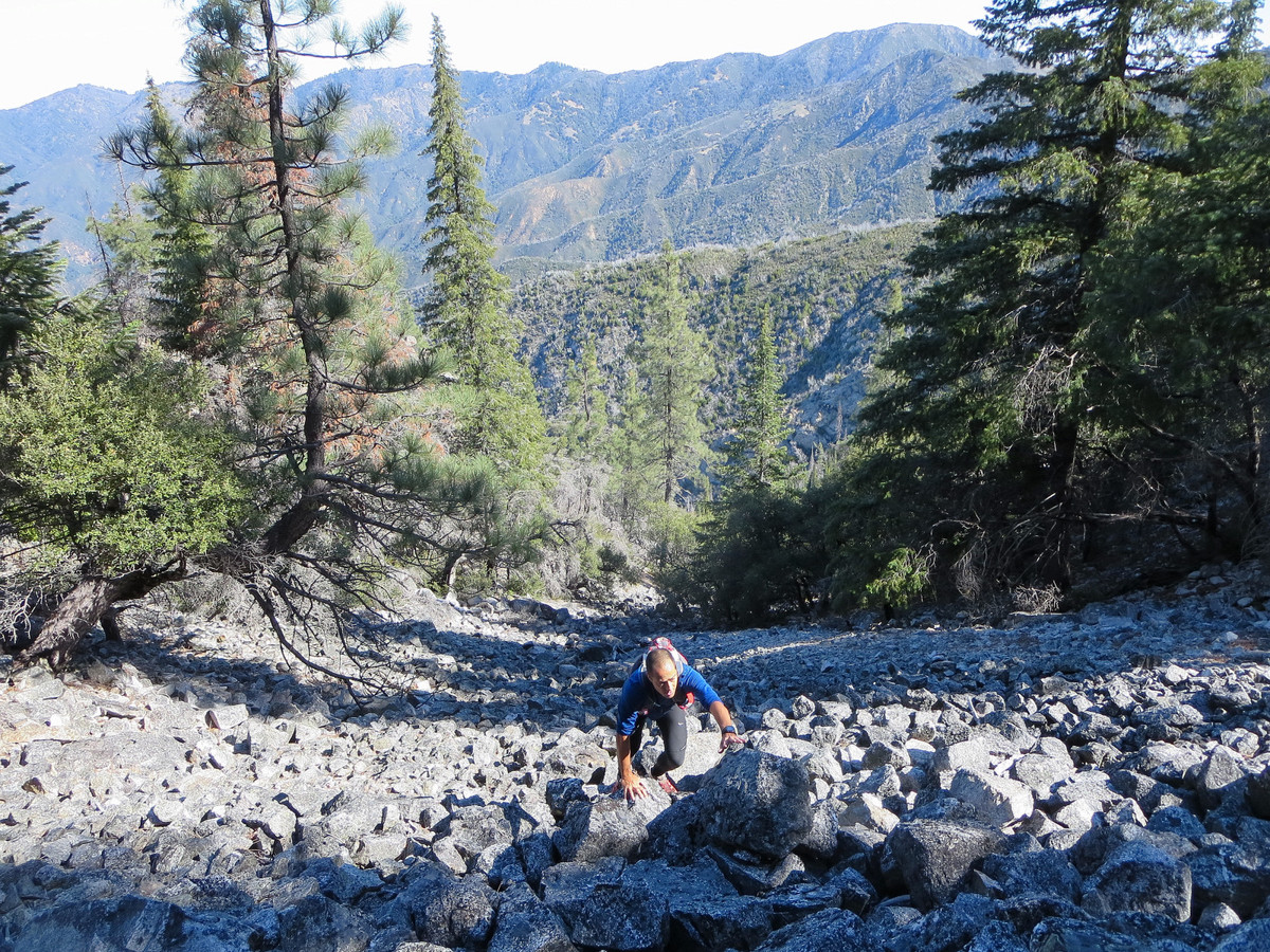
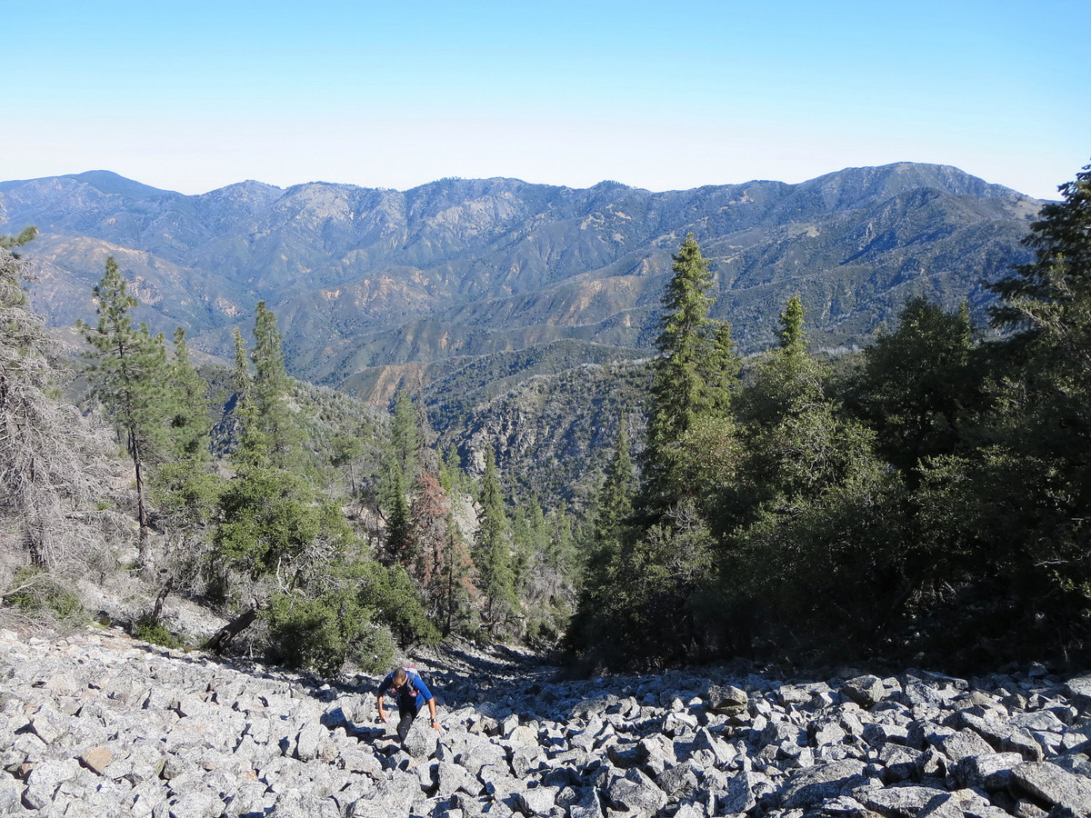
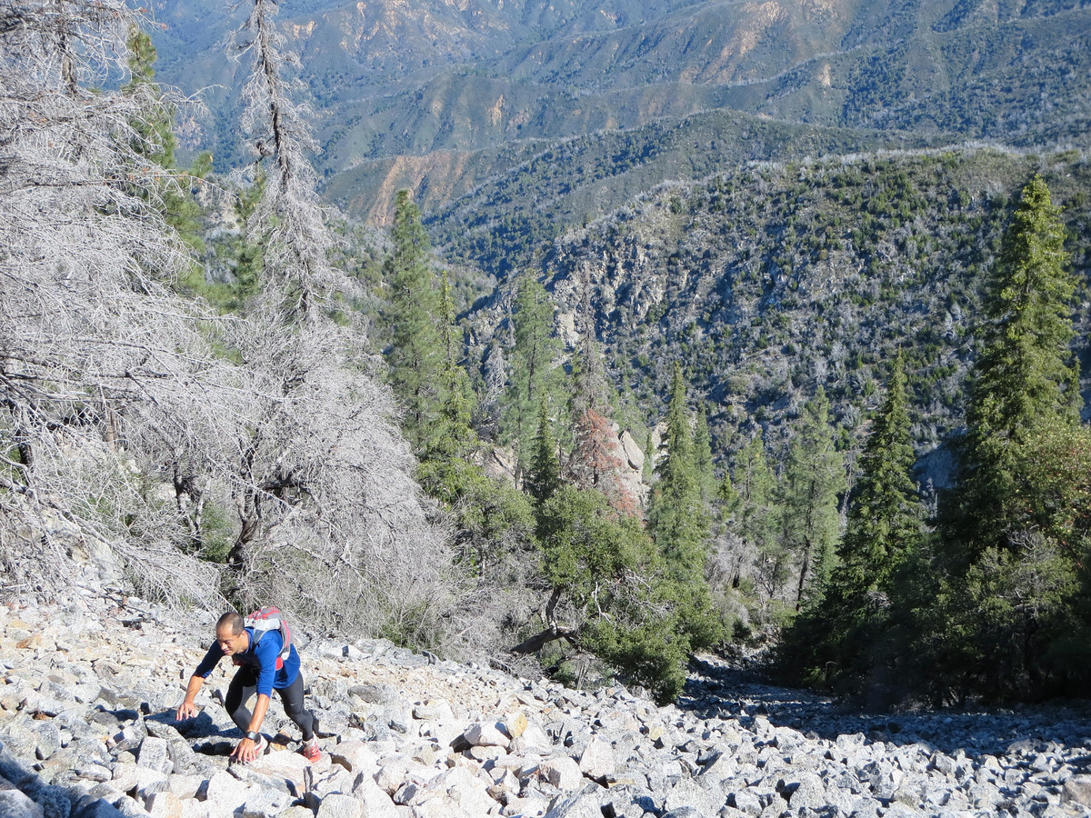
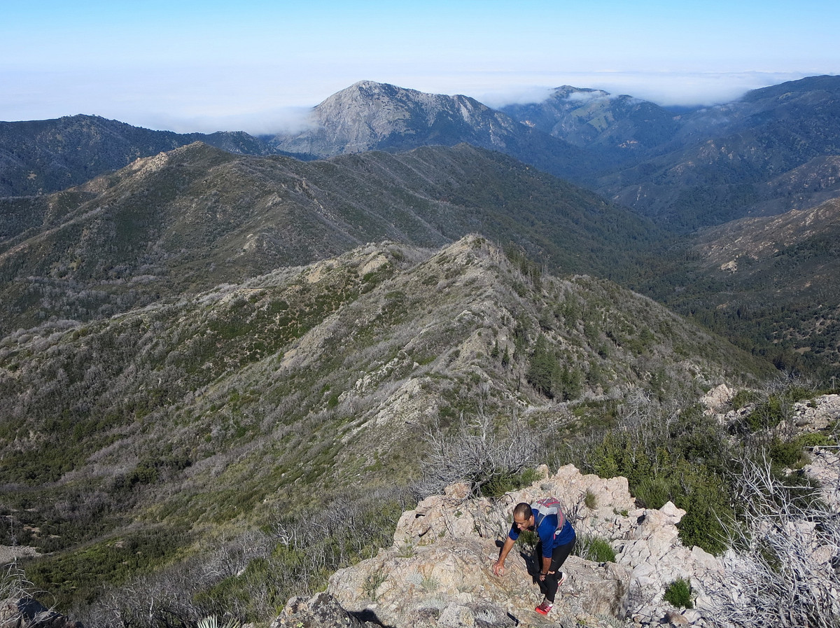
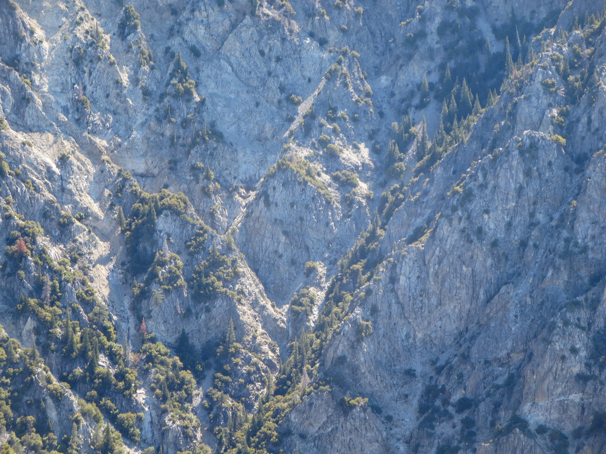
 At the junction with Ventana Creek (~2,850 ft), the water flows underneath large talus blocks, but just around the corner from this point the water is exposed over solid rock. This section of accessible water is fairly short before the stream disappears under the rocks once again, only to reappear before a series of cascades and a small waterfall. The scrambling is easy before this waterfall, but surmounting the falls involves a couple class 4 moves. Shortly after this waterfall, the water disappears for good leaving a dry streambed of fairly stable talus. At around 4,200 feet, the gully appears to reach a headwall, but turn climbers right and cross a loose rock rib to reach more solid talus blocks underneath an old growth forest of Santa Lucia Firs. This section of talus is littered with rusting parts of the structure that once existed atop Ventana Double Cone. It seems as if the at least part of the structure was simply thrown off the summit cliffs. At ~4,400 feet, the final chute appears providing non-technical access to the summit ridge a few feet from the summit. This final chute has some loose sections of class 3 scrambling so care must be taken. From VDC, the remainder of the route is all on trails back to Bottchers Gap. If done correctly, the Drain route avoids much of the infamous Ventana brush, and in fact, the worst brush is on the Ventana Double Cone Trail in the miles south of Puerto Suello Pass. Despite being a “trail” this stretch of brush is not trivial. GPS route here.
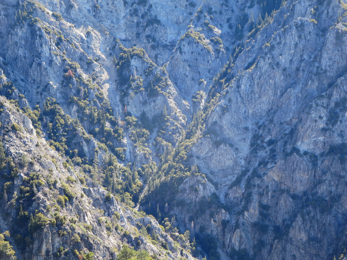
Gear: The La Sportiva Bushido handled the scrambling, creek walking and trail miles masterfully. In particular the sticky rubber provided confidence on the rocks. The Ultimate Direction PB Adventure Vest provided more than enough capacity and was comfortable all day (Joey used the SJ Ultra Vest). These lightweight vests are essential pieces of equipment for these long adventures, but note that sharp Ventana brush can wreak havoc on the light material so be careful! 


Awesome!!! This outing looked like a brute…… but fun for sure. Those long rock beds are amazing. Leor, are you using a handheld gps unit or a wrist unit? I think you mentioned the Fenix 2 in another report – if so, is that unit working well/accurate? Awesome, awesome blog.
As you fill an electric airpot with drinking water, it will automatically boil the drinking water.