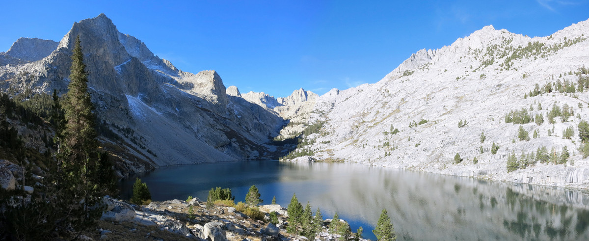
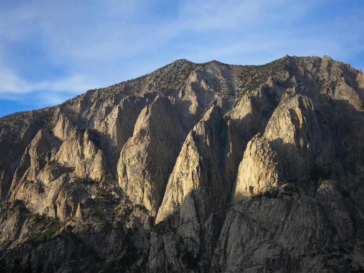
Mount Ericsson and Mount Genevra are two points along the rugged and immensely scenic Kings-Kern Divide which is a high barrier between the Kern River watershed and the Kings River watershed, two of the three important watersheds in the Southern High Sierra (the other being the Kaweah River). The point separating these three watersheds is aptly-named Triple Divide Peak along the Great Western Divide, which I visited last year. The Kings-Kern divide also serves to connect the Sierra Crest with the Great Western Divide and marks the border between Sequoia National Park and Kings Canyon National Park. Foerster Pass, the highest point along the Pacific Crest Trail at over 13,000 feet, is the only trail that crosses the Kings-Kern Divide, although there are a number of other cross country passes of varying difficulty. I have spent quite a bit of time in this area. In 2009 I did an aesthetic loop crossing through Milly’s Foot Pass to visit Upper Kern Basin and Lake Reflection for the first time. Last year, I climbed Mount Stanford, the highest point on the Kings-Kern Divide via Harrison Pass. On this trip I gained the divide via a little known route from Lake Reflection and then climbed Mount Ericsson. I then traversed the upper reaches of Kern Basin to Mount Genevra and descended Milly’s Foot Pass back to Lake Reflection, a jewel of the High Sierra. The route also included passage by lovely East Lake. GPS route here.
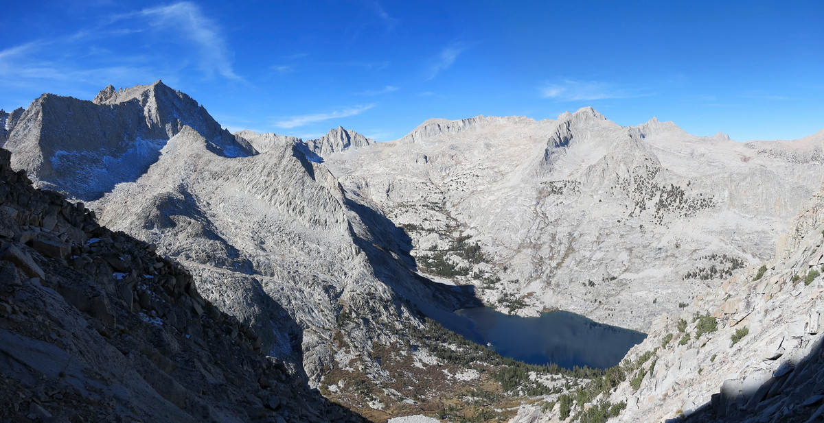
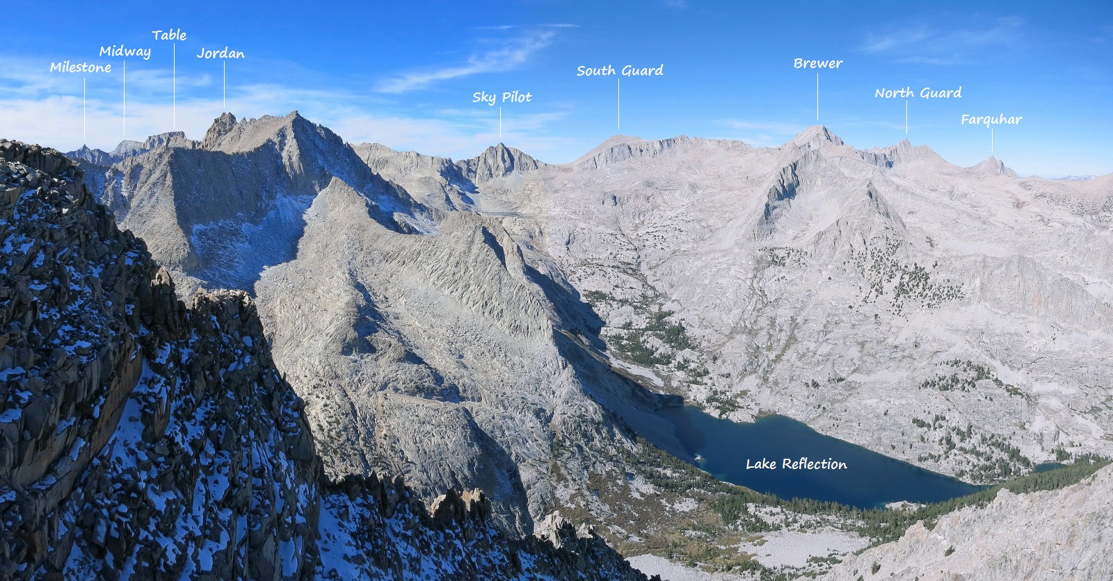
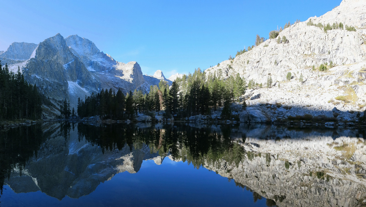
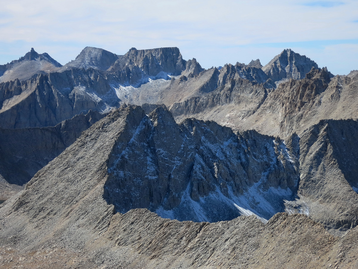
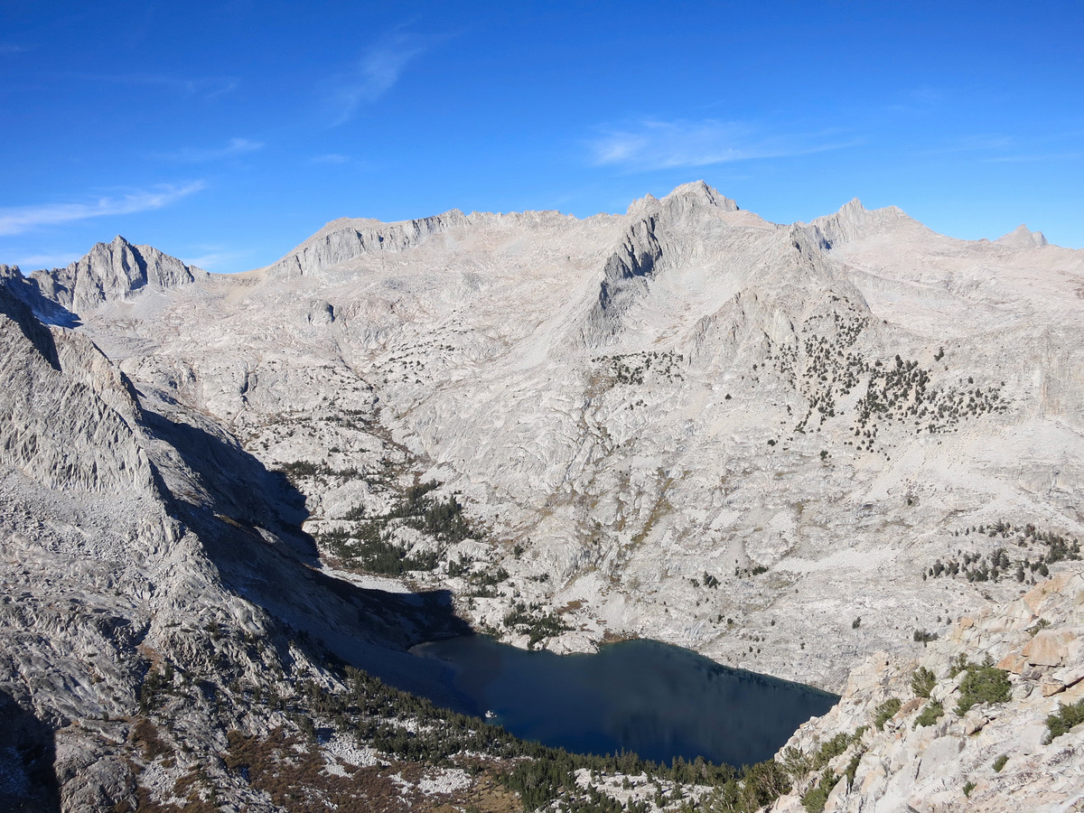
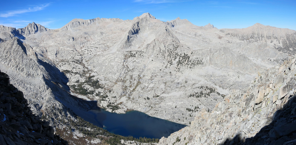
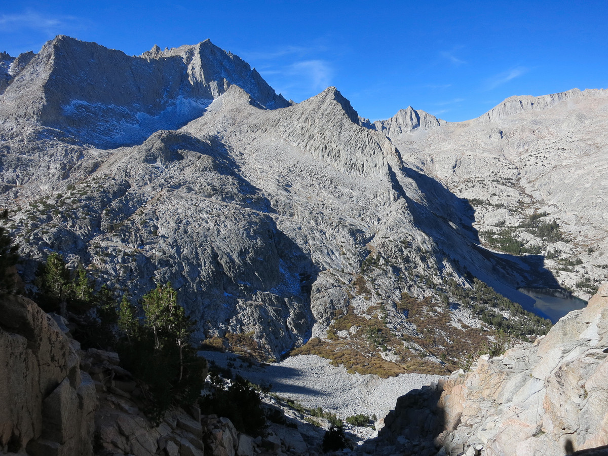
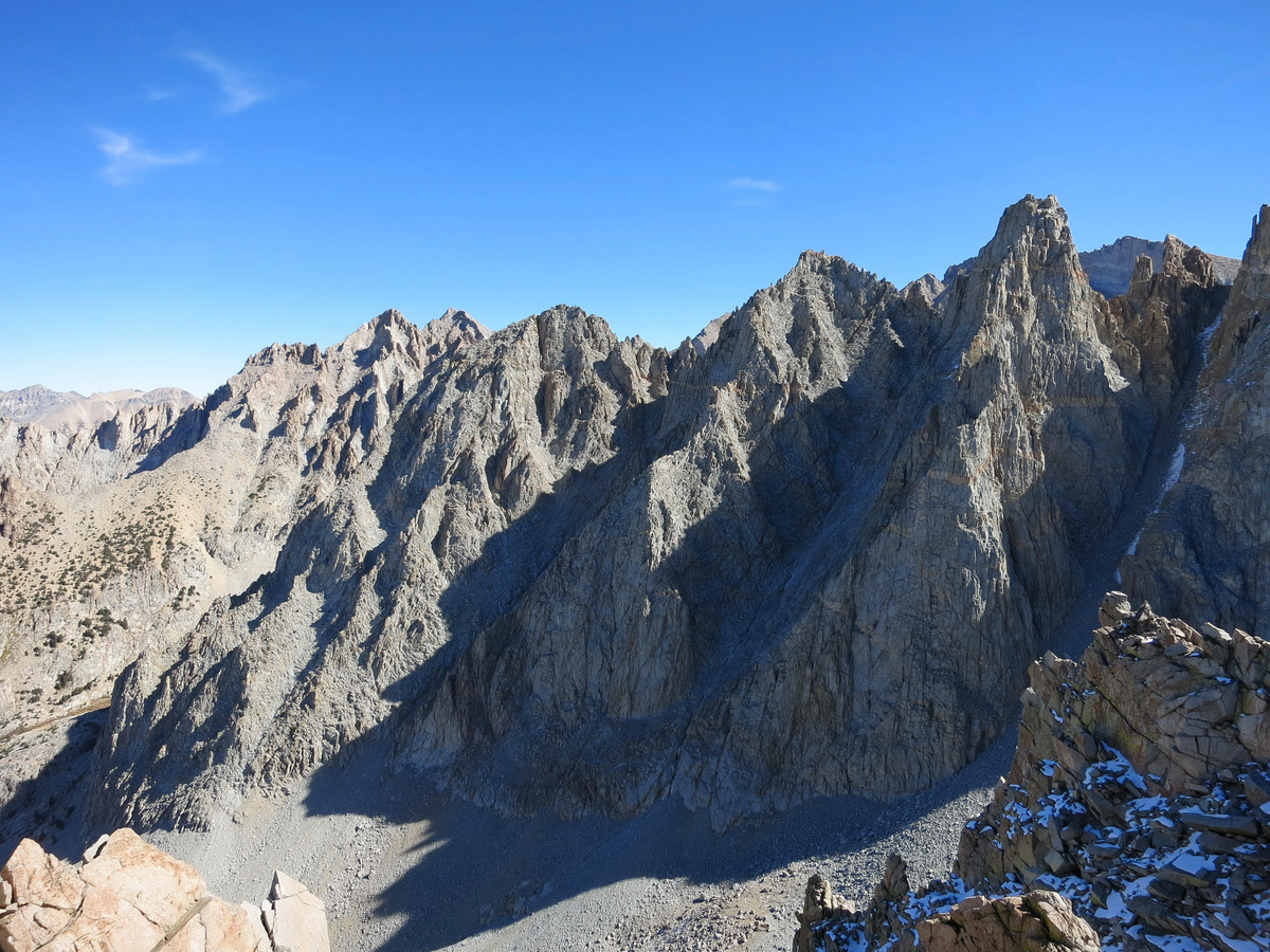
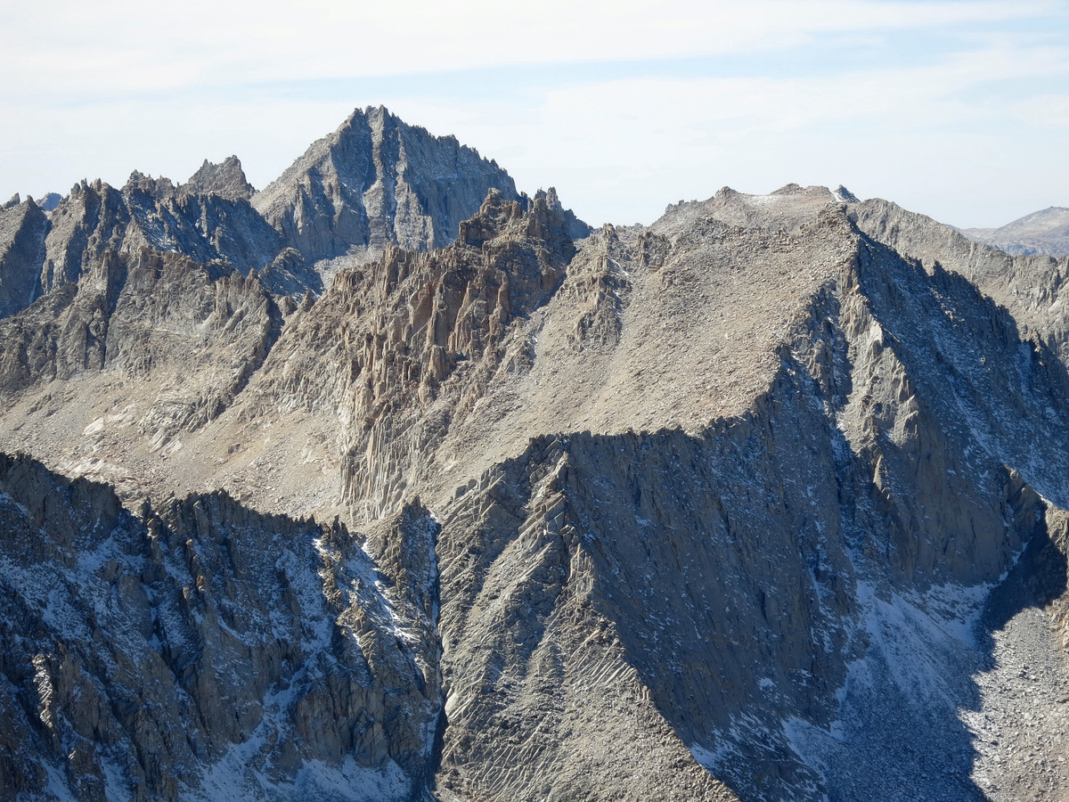
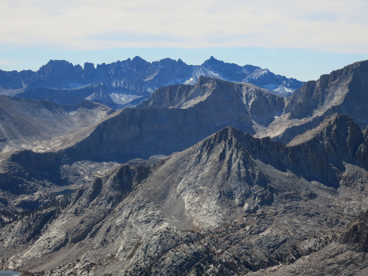
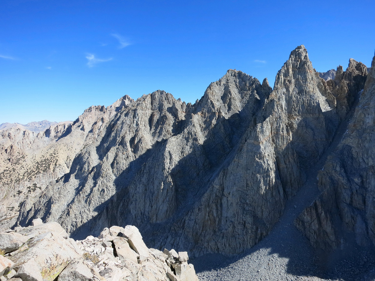
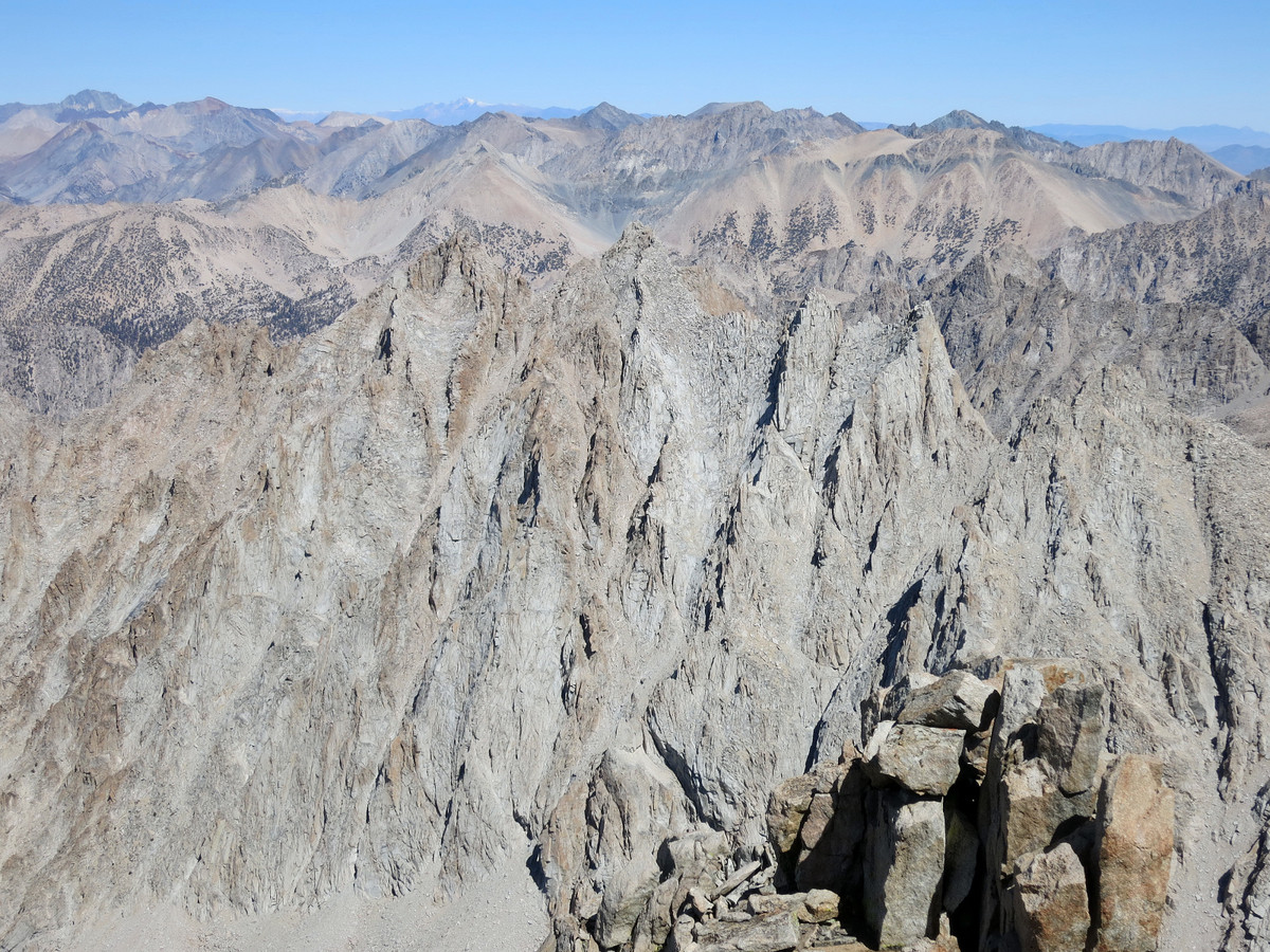
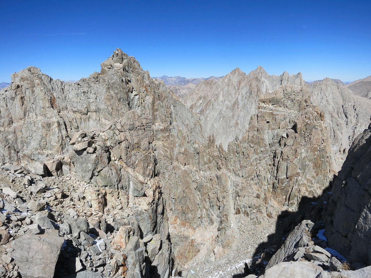
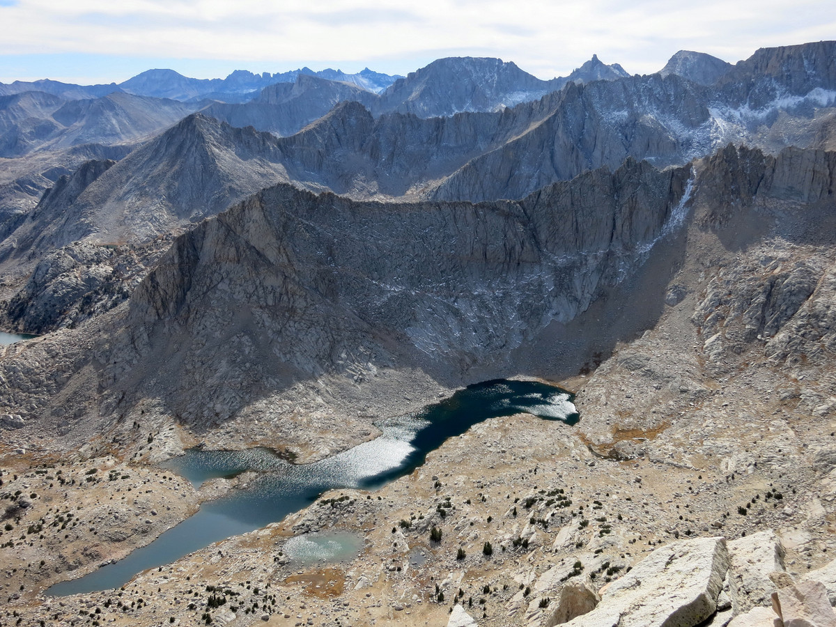
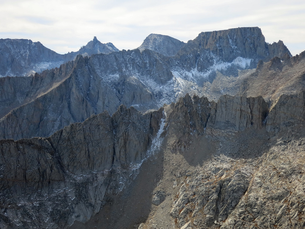
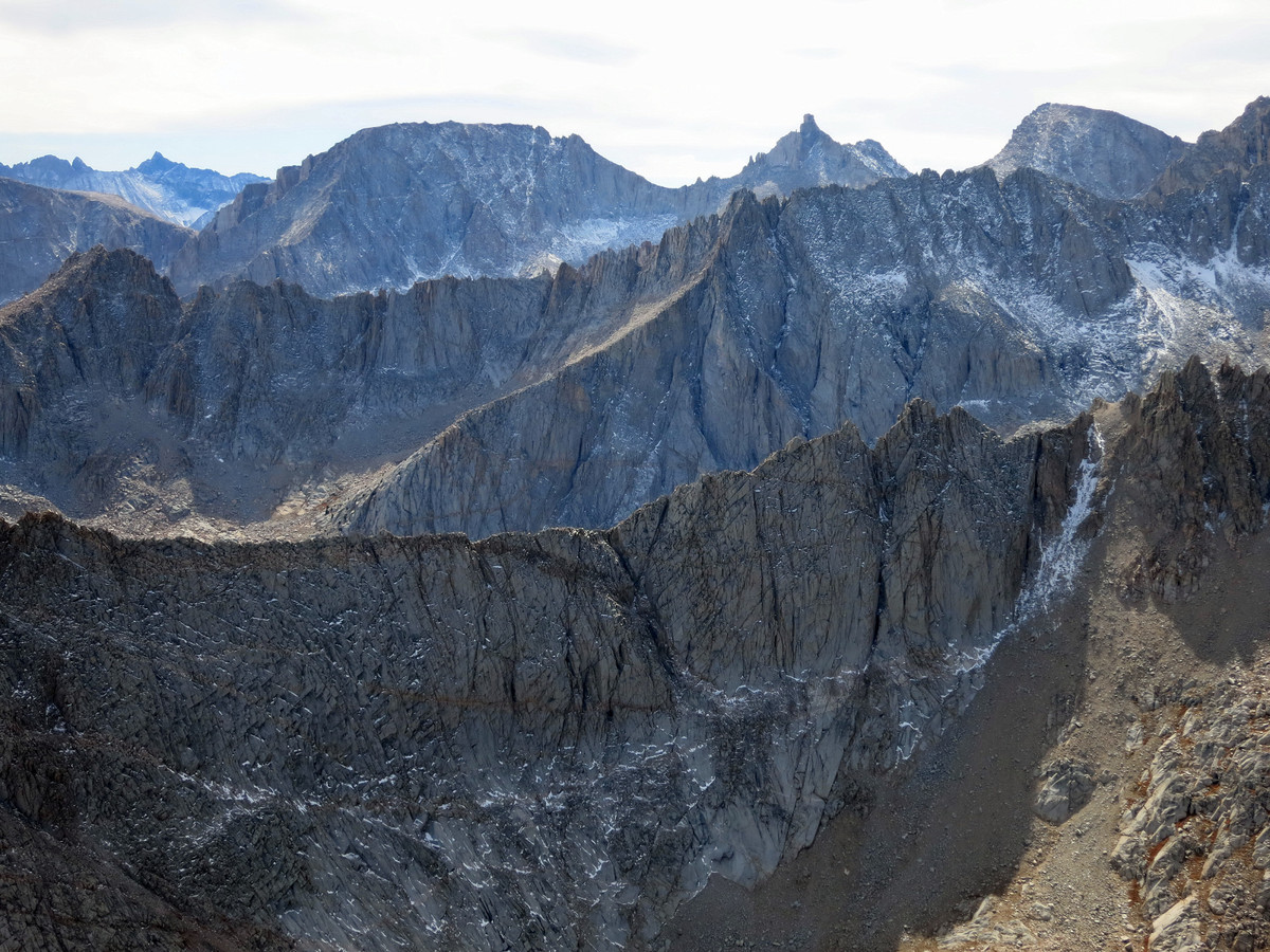
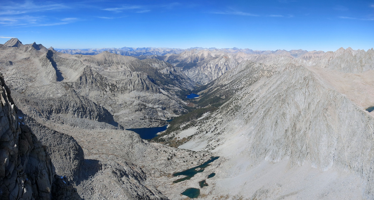
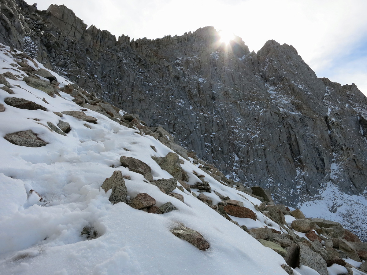
 While numerous cross country passes cross the Kings-Kern Divide, perhaps the second easiest route over the divide (after the Foerster Pass trail) is not a pass at all but a little known route over a high shoulder east of Lake Reflection, an unnamed point I like to call “Reflection Point”. This route takes an efficient class 2 avalanche chute all the way up and over the divide, lacking the unstable talus, scree and sand of the nearby passes, including Harrison Pass, Lucy’s Foot Pass, and Milly’s Foot Pass. More importantly, the Reflection Point route affords astounding views of Lake Reflection the Great Western Divide for its entire length. Mount Brewer and the Guards rise sharply above Lake Reflection with granite virtually everything in sight. A high shoulder marks the top of the chute where the climber is steps away from Reflection Point and a marvelous view that is better than most named summits. The south side of the pass is an easy descent into Kern Basin on gravel and meadows. The key to the Reflection Point route is finding the correct chute since more difficult terrain lies nearby and technical terrain is not much further. Once in the chute, the terrain is mostly slabs all the way up (make sure to stay in the central wide chute) and goes as class 2 the entire way. On this day I used this route to access Mount Ericsson, centrally located on the Kings-Kern Divide with an excellent 360 degree view including the entire Sierra crest from the Palisades to Mount Whitney and the Great Western Divide from North Guard to Milestone Mountain. Once at the top of the route, it’s an easy stroll down to the top of Lucy’s Foot Pass with stunning views of the jagged Ericsson Crags.

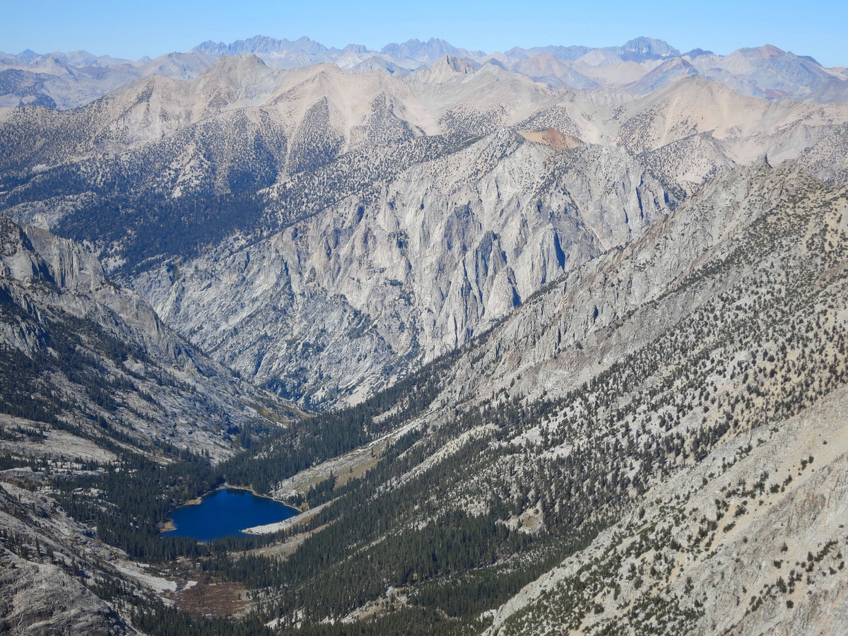
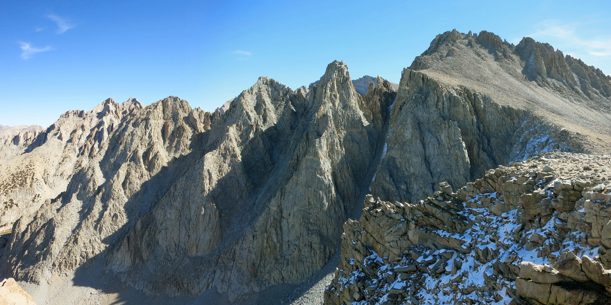
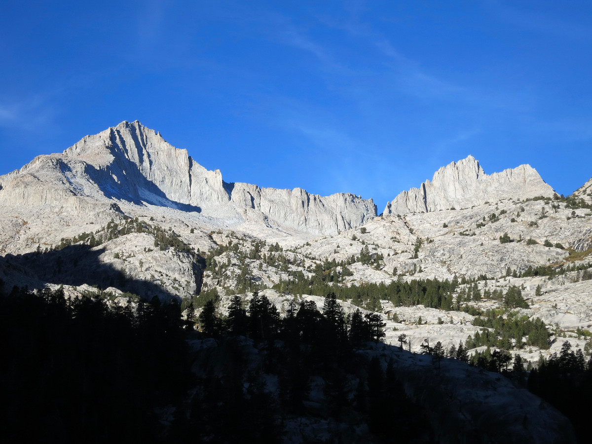
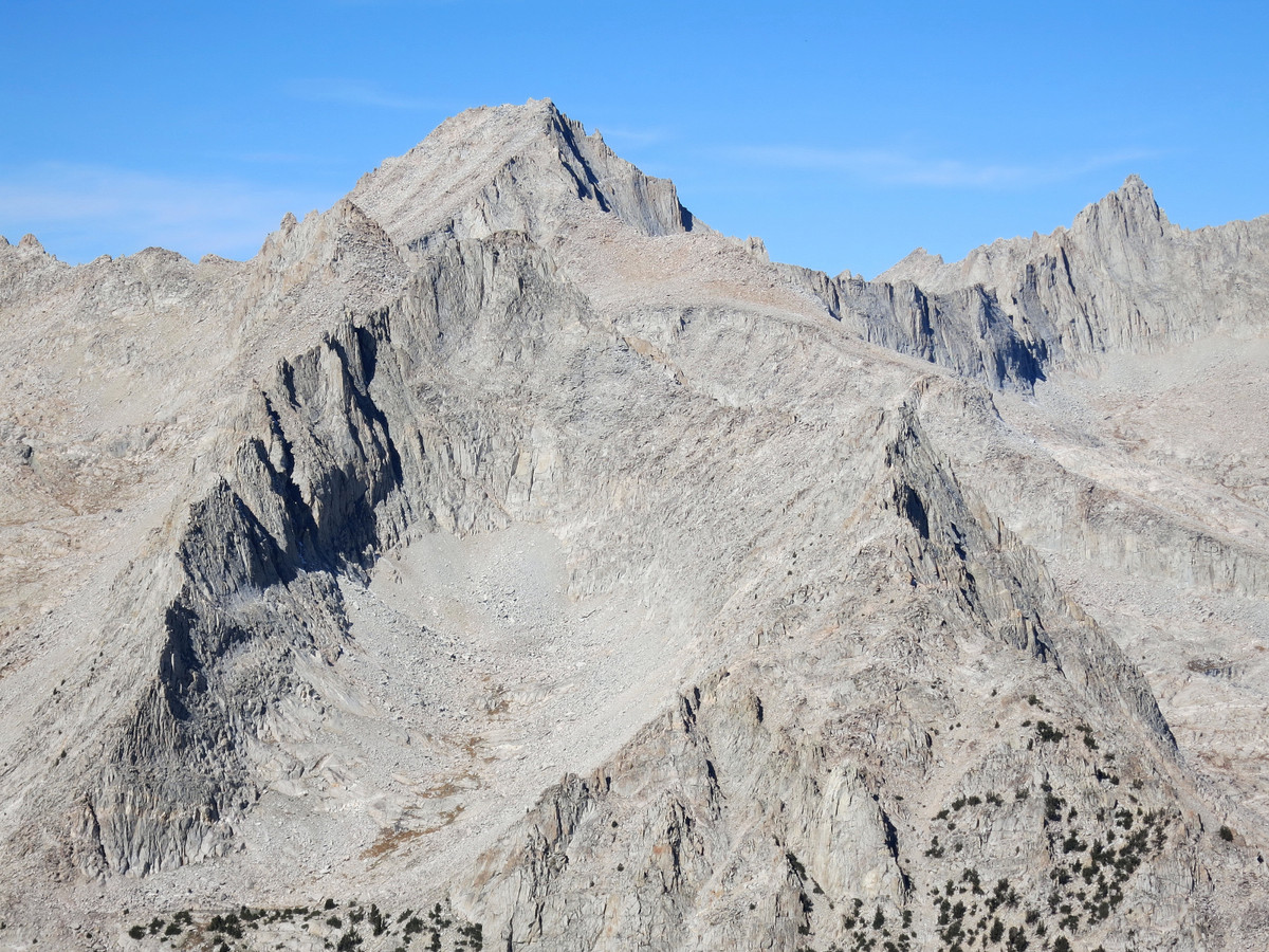
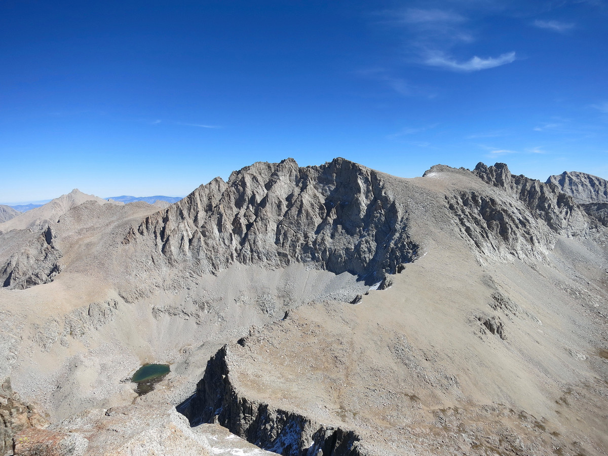
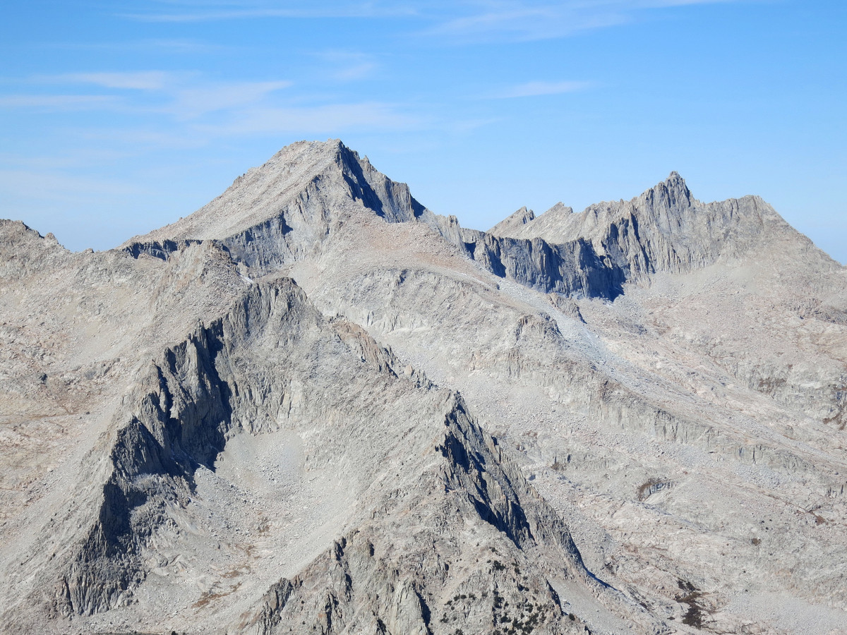
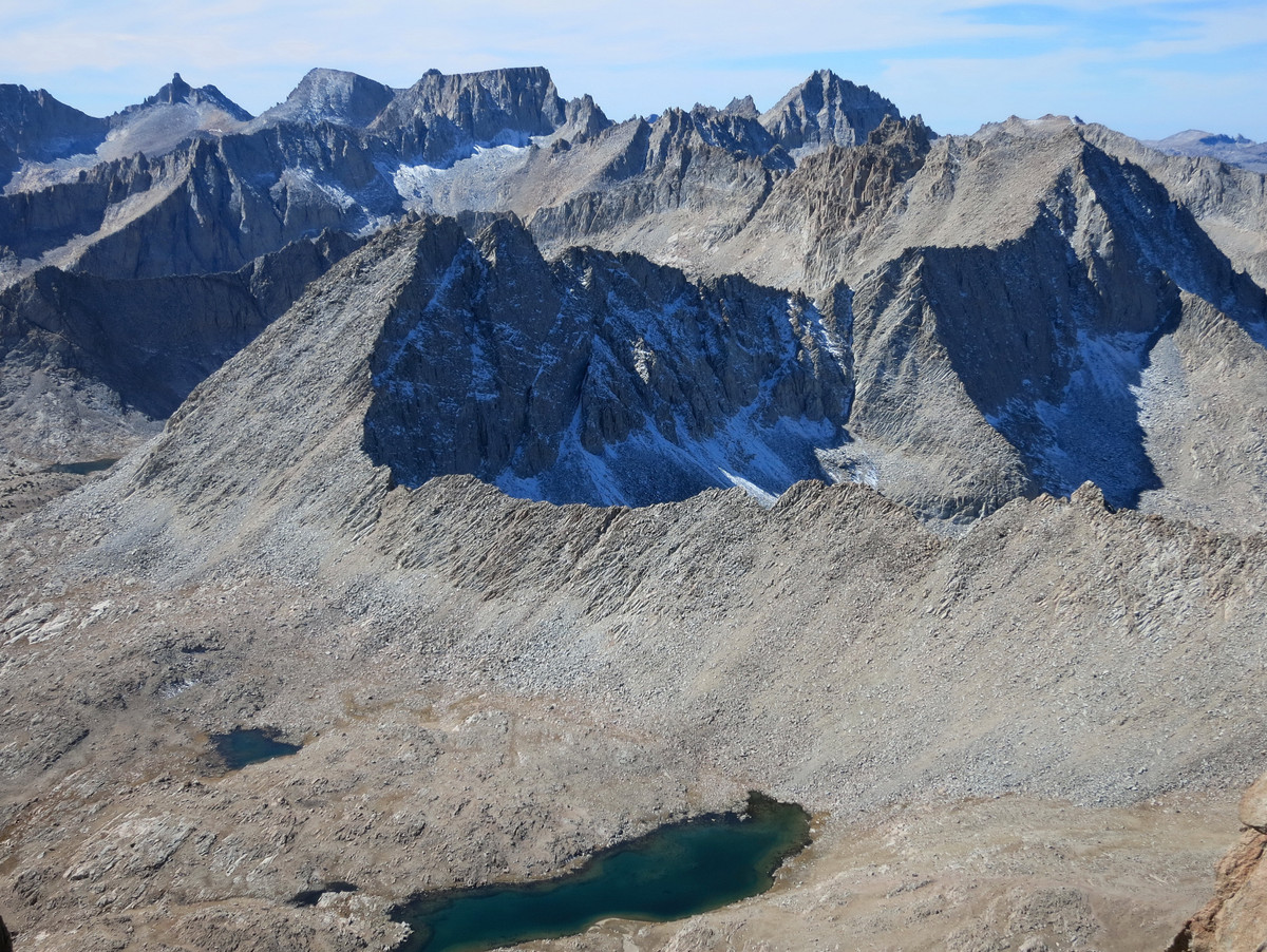
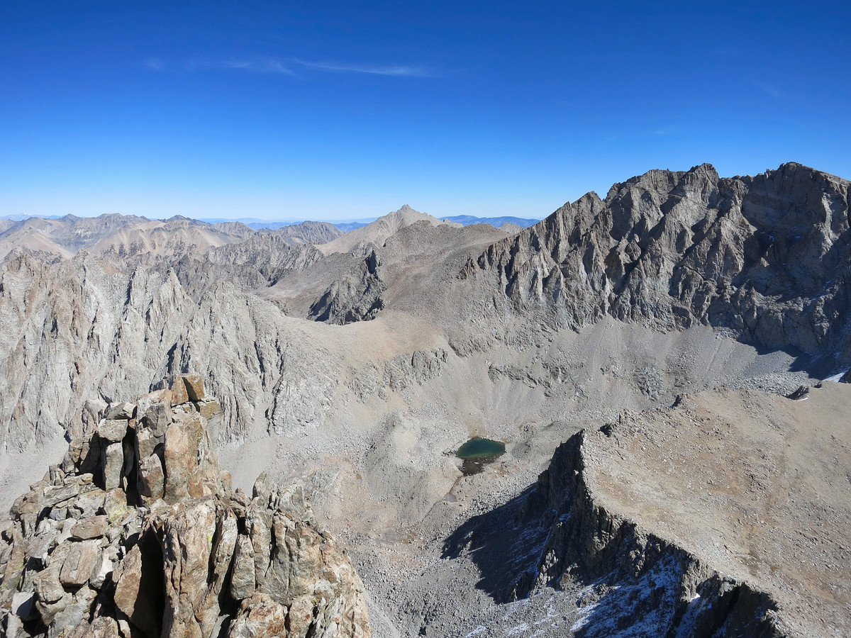
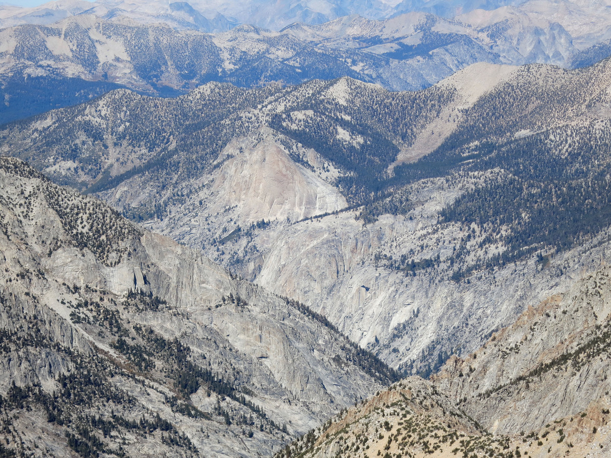
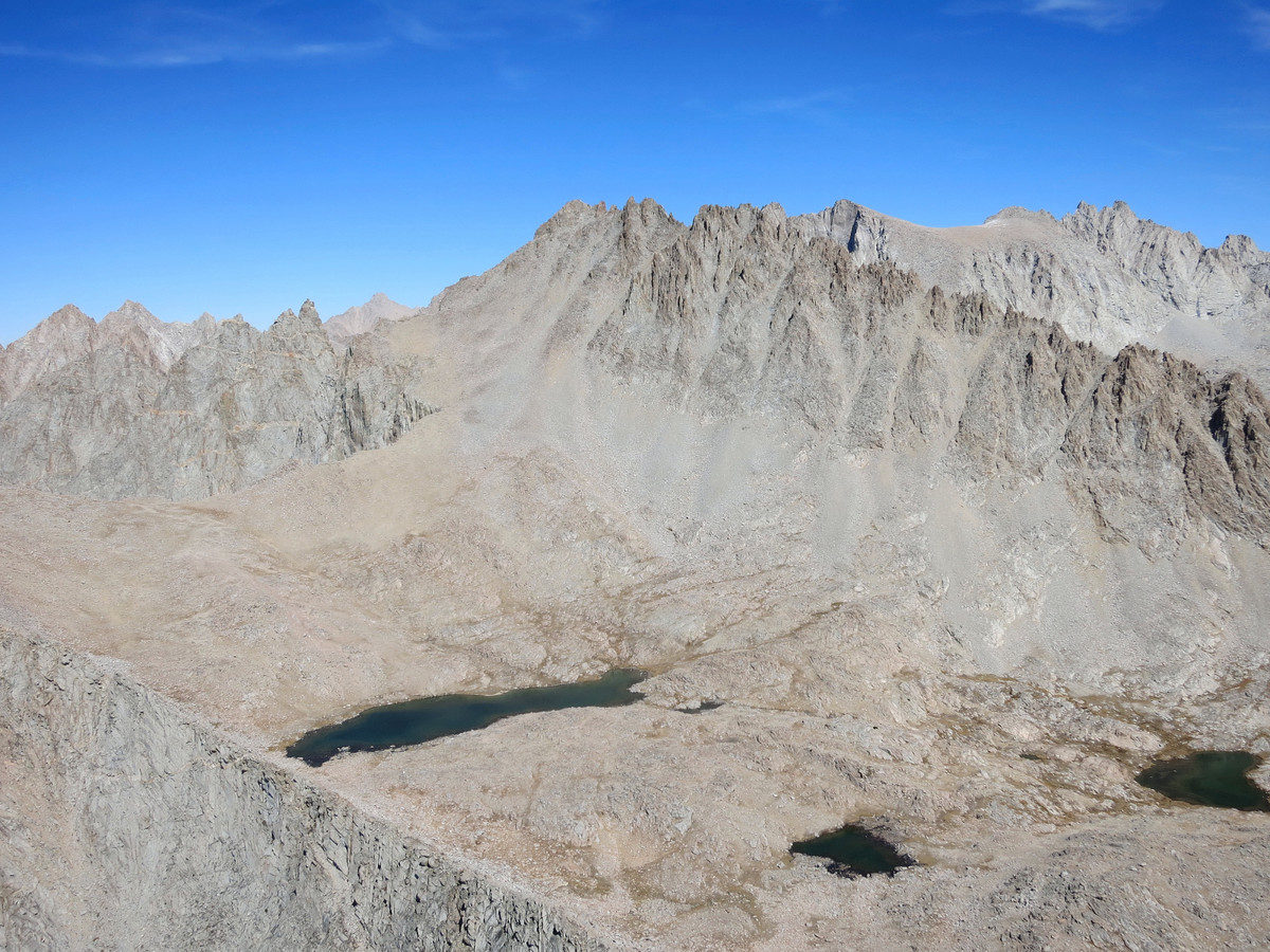
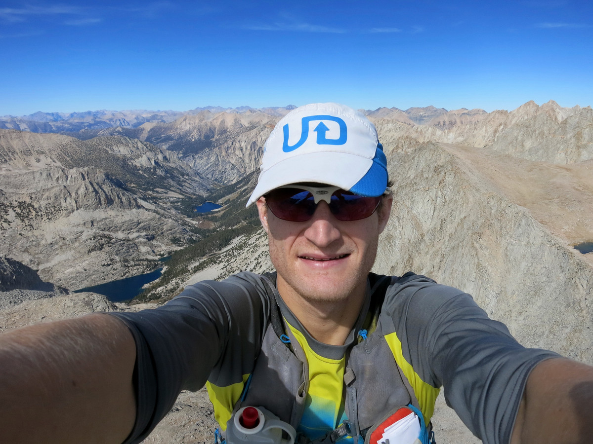
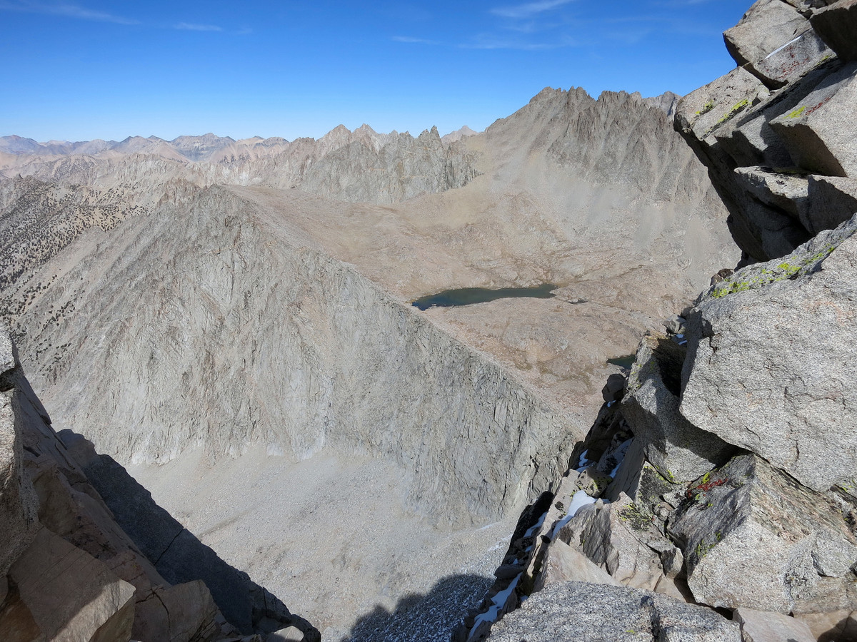
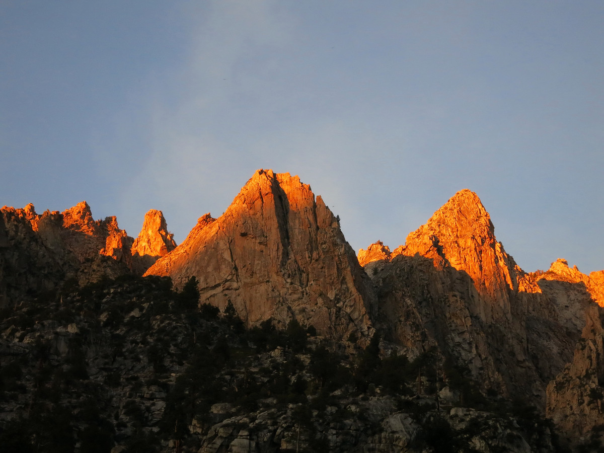
 At Lucy’s Foot Pass, you’re at the base of Mount Ericsson which goes as a class 2 talus slog with a little bit of class 3 at the top. Mount Ericsson’s central location affords an amazing view of the entire southern Sierra. Ericsson’s most distinctive feature is its serpentine south ridge with numerous rocky ribs extending deep into Kern Basin. Of the sea of peaks surrounding Mount Ericsson, the closest and easiest is Mount Genevra across the upper reaches of Kern Basin. Mount Genevra also happens to be above Milly’s Foot Pass which provides passage through the Kings-Kern Divide back to Lake Reflection. Milly’s Foot Pass includes a sketchy 3rd class chute at the top where one must be cautious of kitty litter over the rocks, especially while descending. The remainder of the descent from Milly’s to Lake Reflection involves plenty of arduous talus, but there are some pretty alpine tarns midway down the descent. While Mount Genevra is much lower than Ericsson, its position provides very nice views to the Mount Whitney region and the Great Western Divide. My favorite angle was down the East Creek drainage including Mount Bago towering above East Lake.
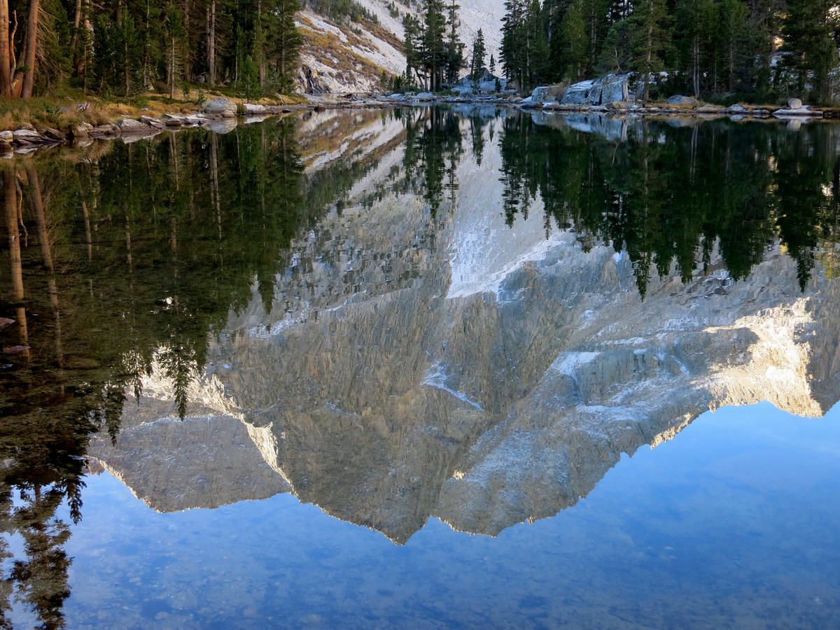
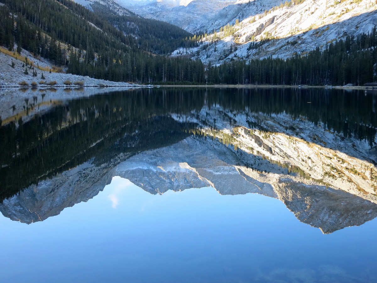
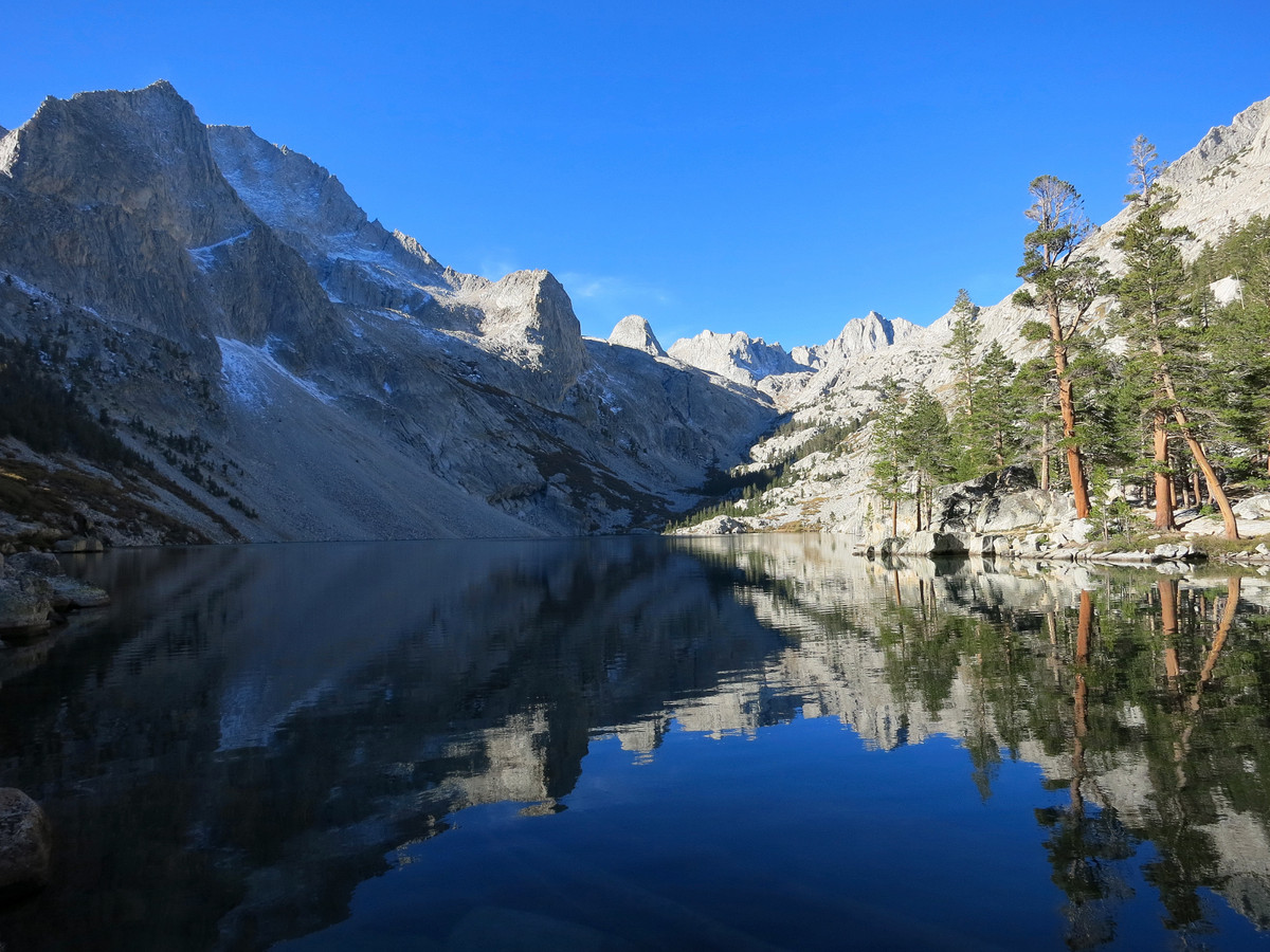
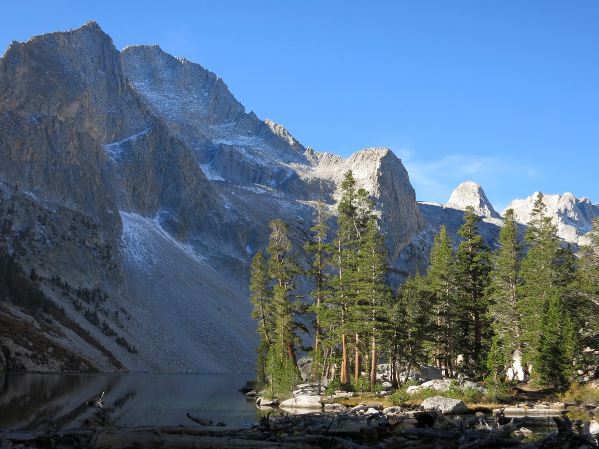
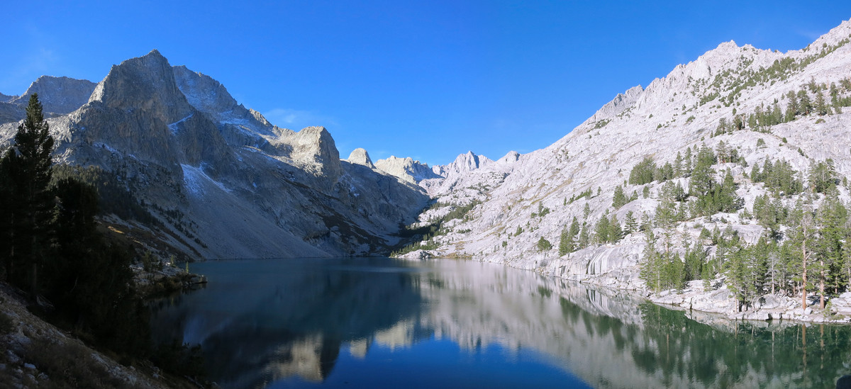
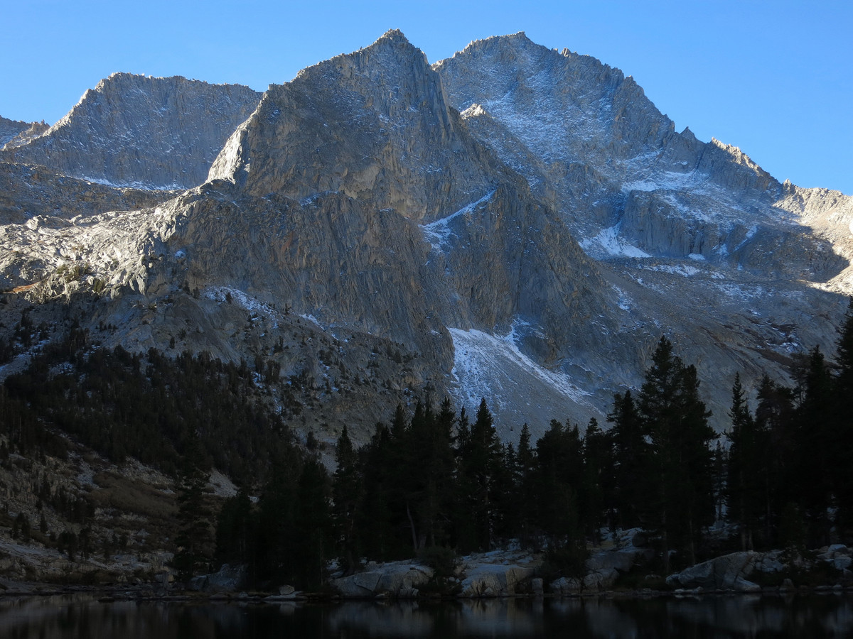
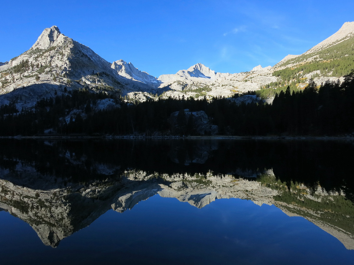
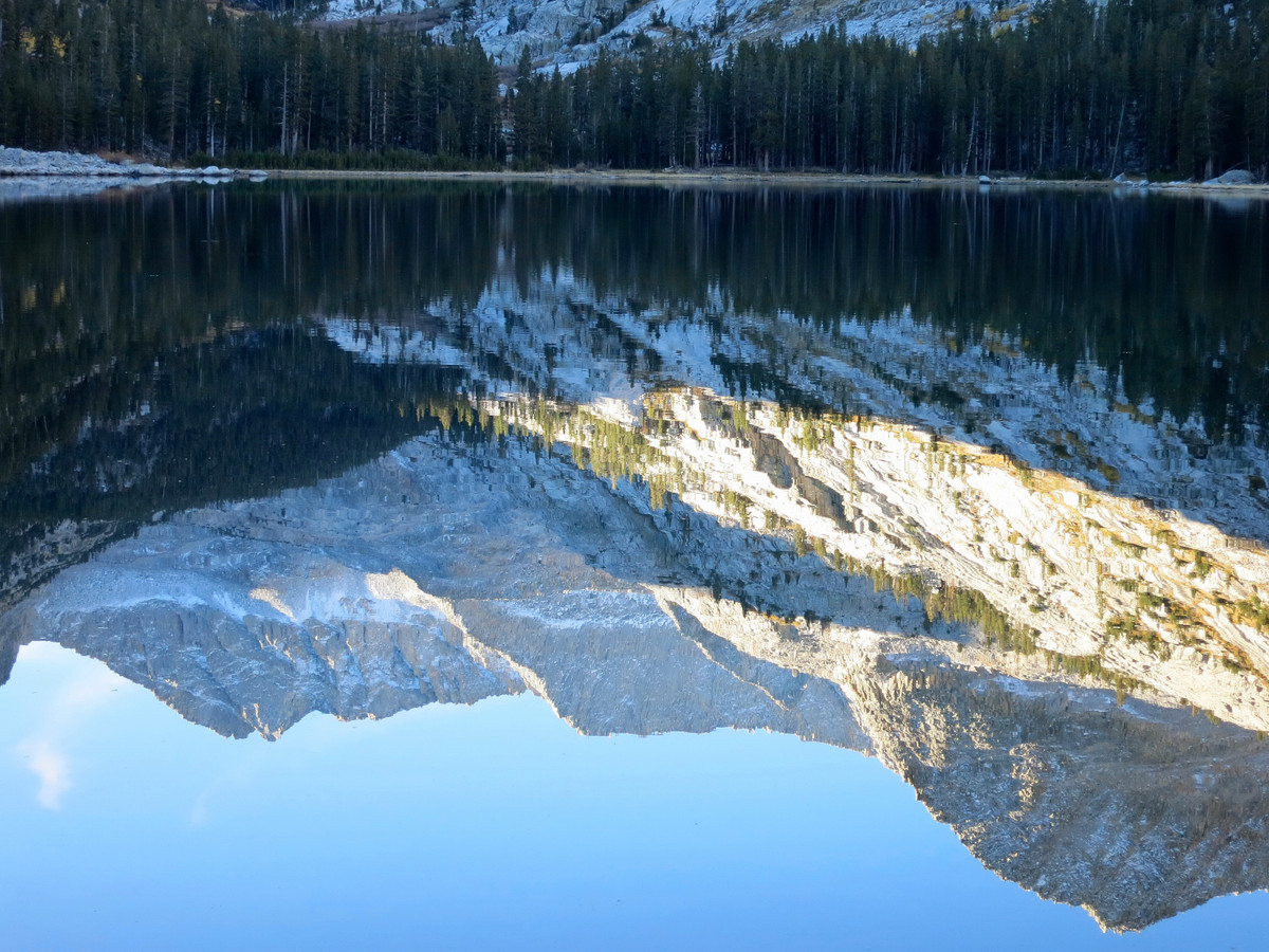
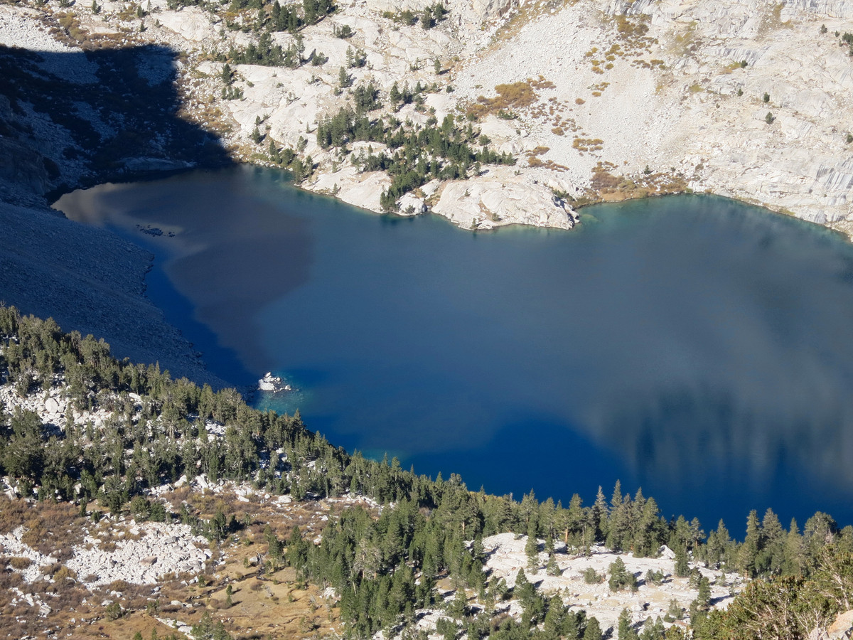
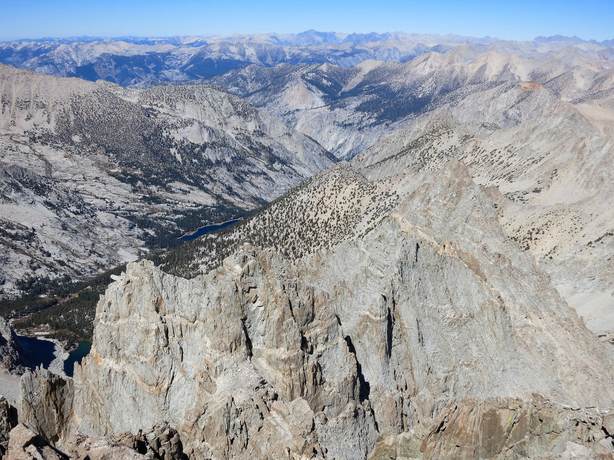
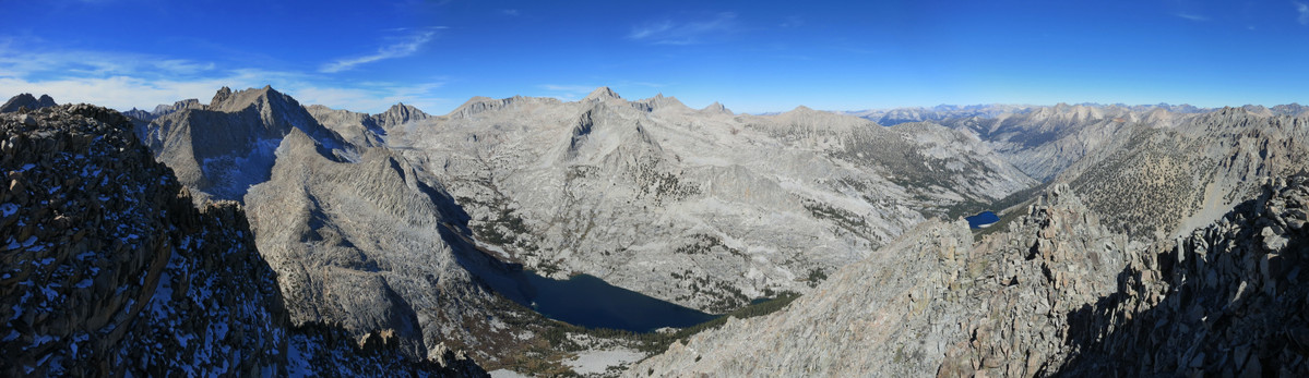
 Perhaps the most endearing location on this route is Lake Reflection, one of the greatest gems in the Sierra. While I have visited Lake Reflection twice before, this was my first time for early morning light to see the exquisite reflections for which this lake is named. The early morning reflections did not disappoint and some new snow lining the cliffs of Mount Genevra and Mount Jordan only added to the tremendous setting. East Lake, located a couple miles before Lake Reflection, is also an excellent destination with beautiful views and reflections. It’s about 11 miles to Junction Meadow along the Bubbs Creek Trail. At the meadows, turn right onto the East Lake Trail which shortly crosses Bubbs Creek (can be hazardous in early season) and then begins and ascent to East Lake, reaching East Lake about 13.5 miles from Road’s End. After East Lake the trail becomes faint in spots manifesting the lack of visitation to this region, but the idea is to generally follow the watercourse upstream and in a couple miles the outlet of Lake Reflection is reached. At first glance, Lake Reflection might seem small, but this is only the outlet bay. A few meters away lies a log jam and views of the expansive alpine lake. GPS route here.


As always, awesome photos! Thanks for sharing Leor!
Very well done, great pics. & documentation. This area is remarkable. Milly’s Pass is truly an ass kicker…not sure I would do it again, well then again, maybe, oh, all right!
Greetings. Great pics and recap. We went from Reflection the Lake South America several years ago via Milly’s and swore we would never do it again. However, we have another trip planned that would take us from East Lake towards Mt. Whitney and would like to avoid goining all the way back via Jct. Meadows on trail over Forrester. Would it be possible to get your GPS route emailed or posted (.gpx) over your “Reflection Pointe” route as it is challenging to decipher it on this blog. Thank you for your time.