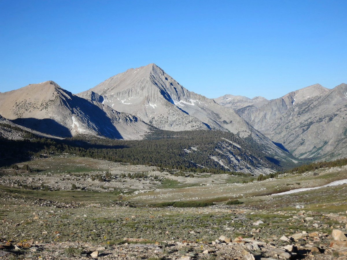
Arrow Peak and Bench Lake have been on my list of places to visit for several years. The iconic view of Arrow Peak towering above Bench Lake was one of the first images of the High Sierra that inspired me to explore the range when I first moved to California. However, a relatively long approach over Taboose Pass and an even longer drive from the Bay Area to the trailhead likely deterred me from getting it done. On an ideal early summer morning I finally made it out to Bench Lake to see in person what I had dreamed of all those years. Often times such anticipation built up over a long time can result in unrealistic expectations, and commensurate anticlimactic experiences, but the scenery surpassed even what I had imagined. Bench Lake is a Sierra gem with a priceless view as aptly named Arrow Peak reflects in its waters. The objective for the day was the 2,700 vertical foot Northeast Ridge route up Arrow Peak which is front and center when viewed from Bench Lake and looks quite intimidating from that vantage. However, once on the route one discovers that the technicality is limited to a class 3 scramble with just enough exposure and steepness to make it an engaging and fun route. Combined with the outrageous views en route, the northeast ridge of Arrow is one of the most aesthetic scramble routes in all of the High Sierra. This region of the range is probably the area I have spent the least amount of time so it was great to finally get out there to see the amazing scenery and dream up future routes in the area. GPS route here.
![]()

 The logical approach to the Bench Lake and the Northeast Ridge of Arrow Peak is via Taboose Pass, an infamous pass that starts in the sage-filled desert of the Owens Valley and climbs 6,000 vertical feet to the pass in a consistent ascent with little shade. Starting before dawn, I found the trail reasonable and a fairly efficient way to reach the crest and the incredible beauty that lies beyond. In other words, I hope to be back to Taboose Pass soon. I can’t say as much for the access road which is totally beat up with large rocks everywhere. In many ways the access road is in worse shape than the trail! While having a low clearance vehicle doesn’t help, this road wouldn’t be much faster in a high clearance vehicle. Most of the obstructions are large rocks buried in the sand so it doesn’t seem like it would take much machinery to improve this rough road dramatically, but I guess the poor condition naturally regulates visitation. When I’m driving under 10 mph I start to second guess why I’m driving at all (as opposed to running). Next time I will likely park my car at the end of the pavement and jog up the east slopes of the Owens Valley to the trailhead.
![]()
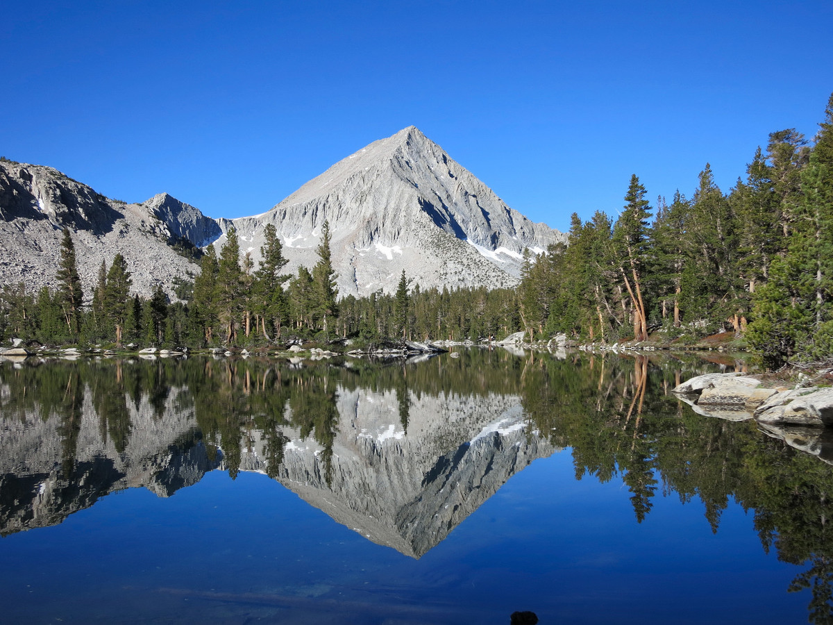
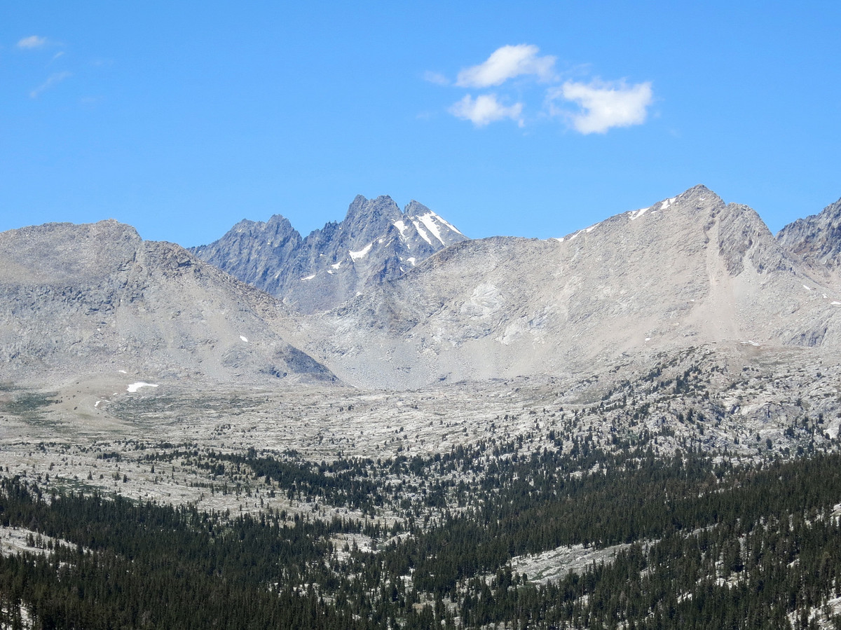
Bench Lake and Arrow Peak’s Northeast Ridge close-up: ![]()
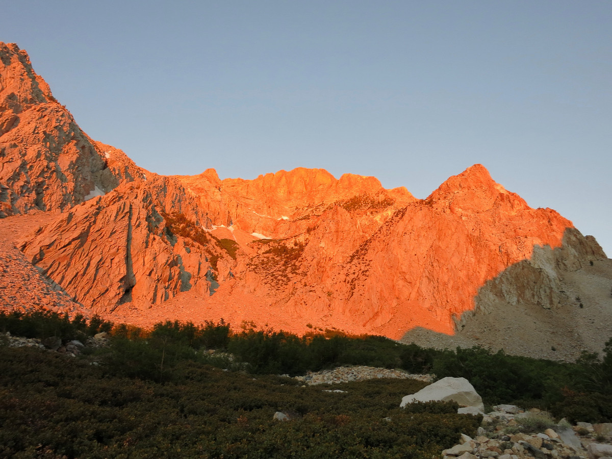
As mentioned, the Taboose Pass trail starts in a desert environment with sage and sand. The going is slow for awhile until one enters the Taboose Canyon where the tread improves. The trail steadily climbs along the north side of Taboose Creek before crossing the stream and entering the only shaded part of the climb in a beautiful pine forest. The shade is short lived and soon the trail is back to switchbacking through open talus slopes. The grade eases up towards the pass where there are numerous small tarns and the terrain gradually shifts from rock to tundra. At Taboose Pass one enters Kings Canyon National Park and is greeted by a lovely view down the South Fork Kings Canyon, the Cirque Crest, Bench Lake and Arrow Peak. The connector trail from Taboose Pass to the John Muir Trail is an amazing stretch with glorious meadows and astounding views. Turning south on the JMT for merely a hundred meters brings you to junction with Bench Lake. Judging by the faint tread it seems as if few through hikers bother to take the time to visit Bench Lake. This has served the Bench Lake area well as it seems unspoiled for such a beatiful spot. The trail to Bench Lake gradually descends through pine forest passing a couple small lakes to reach Bench Lake, a Sierra gem with one of the finest views in the range. 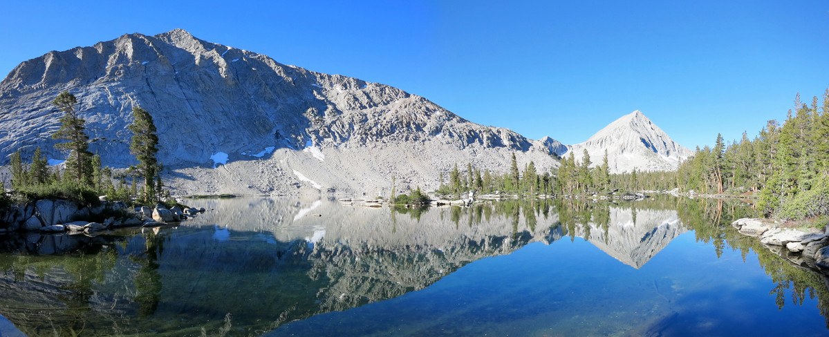
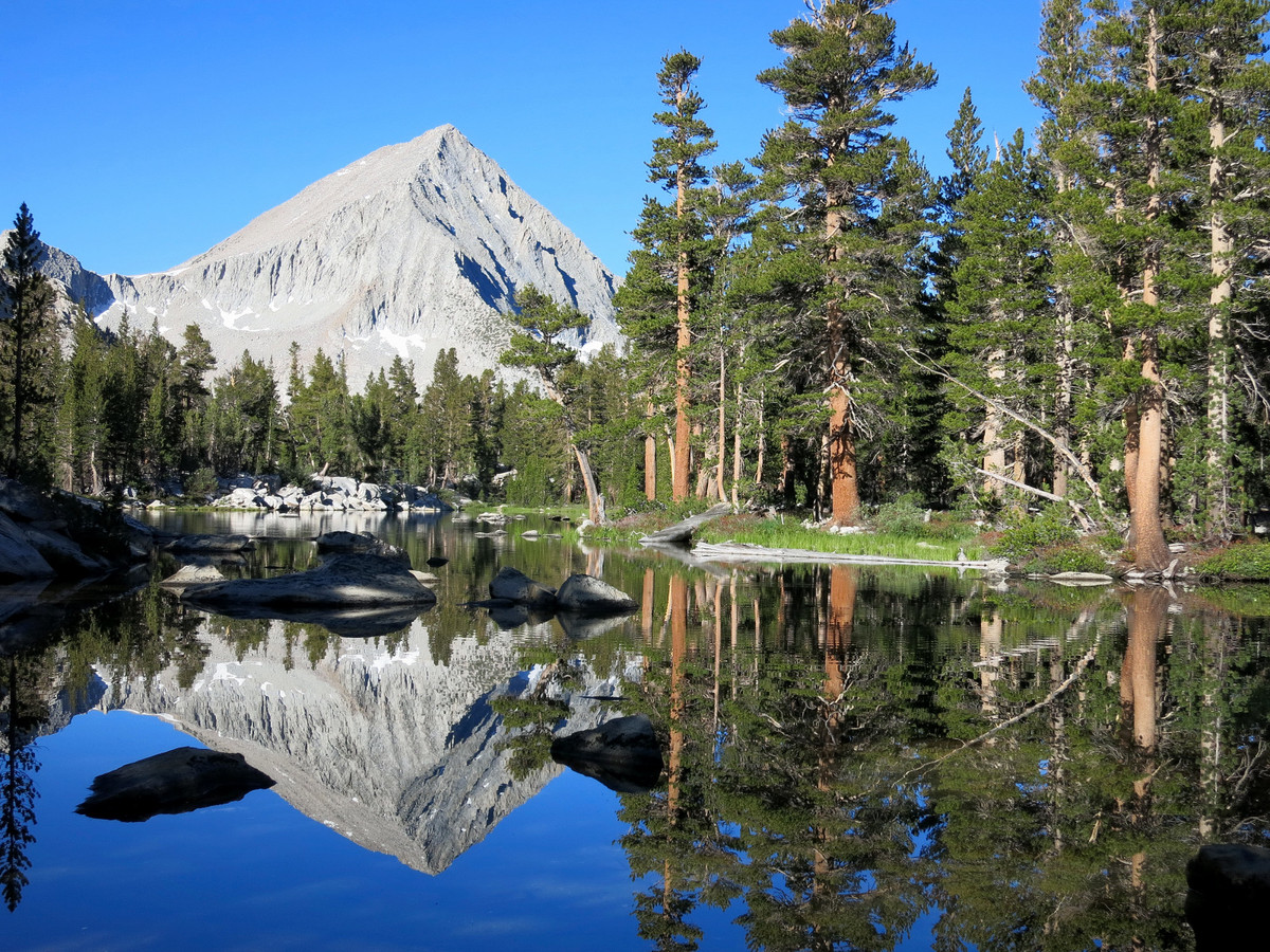

After a beautiful stretch along Bench Lake’s shores the trail peters out, but off-trail travel is easy through through open pine forest over a small rise followed by a descent to a small drainage at the base of Arrow Peak’s Northeast Ridge. The initial slope up to the Northeast ridge can be accomplished by various routes, but they all converge on the ridge crest where the cliffs on either side make the spine of the ridge the logical route. The lower portion of the route features some scrappy low-lying pine trees that can be cumbersome as they tend to grow into thick, unmalleable bushes. The vegetation scrambling peters out about half way up the ridge leaving clean, enjoyable rock scrambling for the second half. The ridge features some nice exposure, a few knife edge sections, and awesome views in all directions including Bench Lake below, the Cirque Crest, and as one ascends higher, the mighty Palisades. The Northeast Ridge is a long and sustained climb with over 2,700 ft of vertical from its base to the summit. Once on top, enjoy Arrow Peak’s amazing view, perfectly positioned to have one of the best 360 degree panoramas in all of the High Sierra. To the south lies the Kings-Kern Divide, Great Western Divide and the Kaweah Range. To the north is the Goddard-Evolution area and the Palisades. Close at hand is the Cirque Crest, a region of the High Sierra I have yet to visit but near the top of my list for future exploration. Perhaps the most compelling view is down the Muro Blanco, or the South Fork Kings River Canyon. This is a truly wild canyon with no trails and sparse documentation. From Arrow Peak’s perch I could see the entire length of the aptly named canyon, which is virtually entirely composed of distinctly white granite slabs and cliffs. From Arrow Peak, the easy descent is off the WSW slopes which have some helpful sand for efficient descending. From Arrow Pass, talus and slabs are taken down to the drainage east of Arrow Peak. This drainage has some gorgeous turquoise pools from which to admire the northeast ridge of Arrow Peak. Ascend back to Bench Lake through the forest and retrace steps over Taboose Pass. 


Its too beautiful to even put into words!
Leor,
HUGE, EPIC, CONGRATS on just setting new JMT FKT!!! and, done solo!! super excited for you!! super inspiring and impressive!!
recover well. I hope I’m able to hear stories soon.
regards,
Mike Wolfe
Mike,
Thanks so much for your congratulations! It means a lot to follow in the footsteps of such great athletes as yourself, Hal, Brett, Sue, Peter, Buzz, Kevin, and all the others who attempted the Muir trail for speed. Hope our paths cross soon for mountain adventures!
Leor