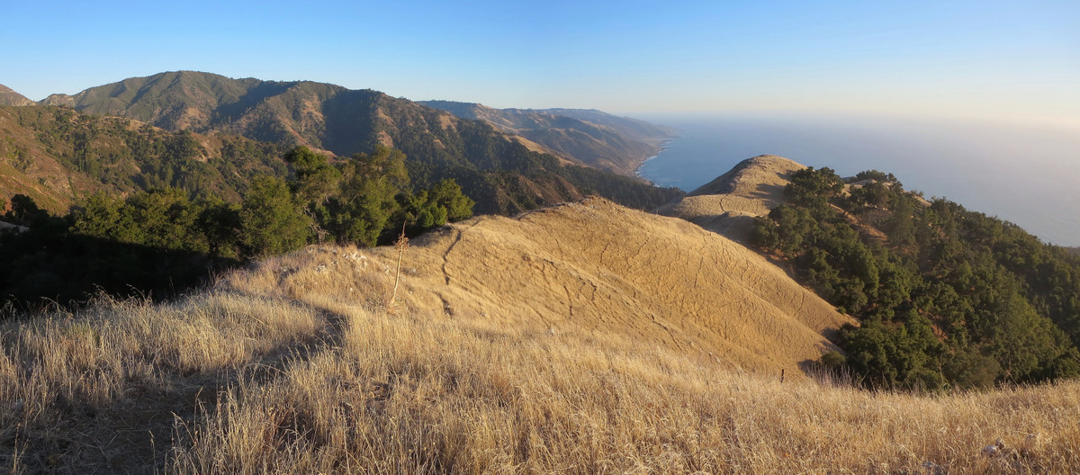
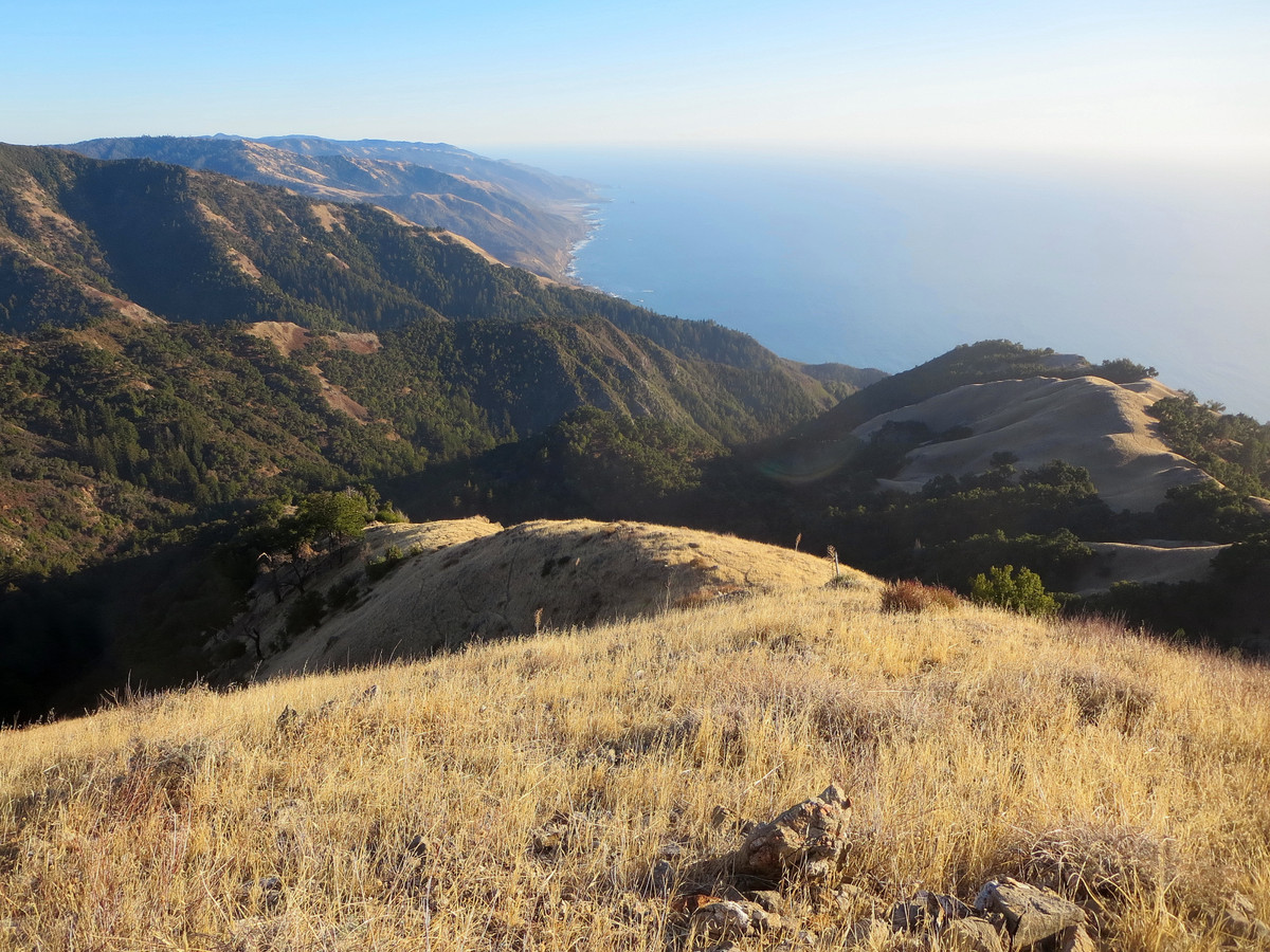
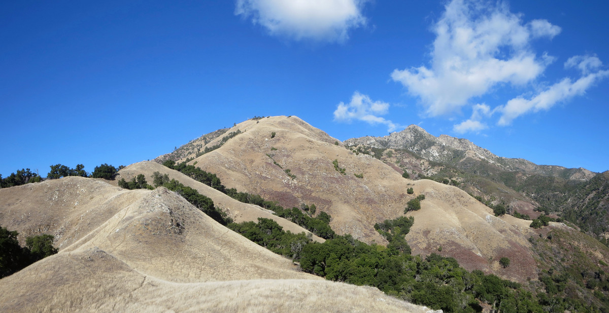
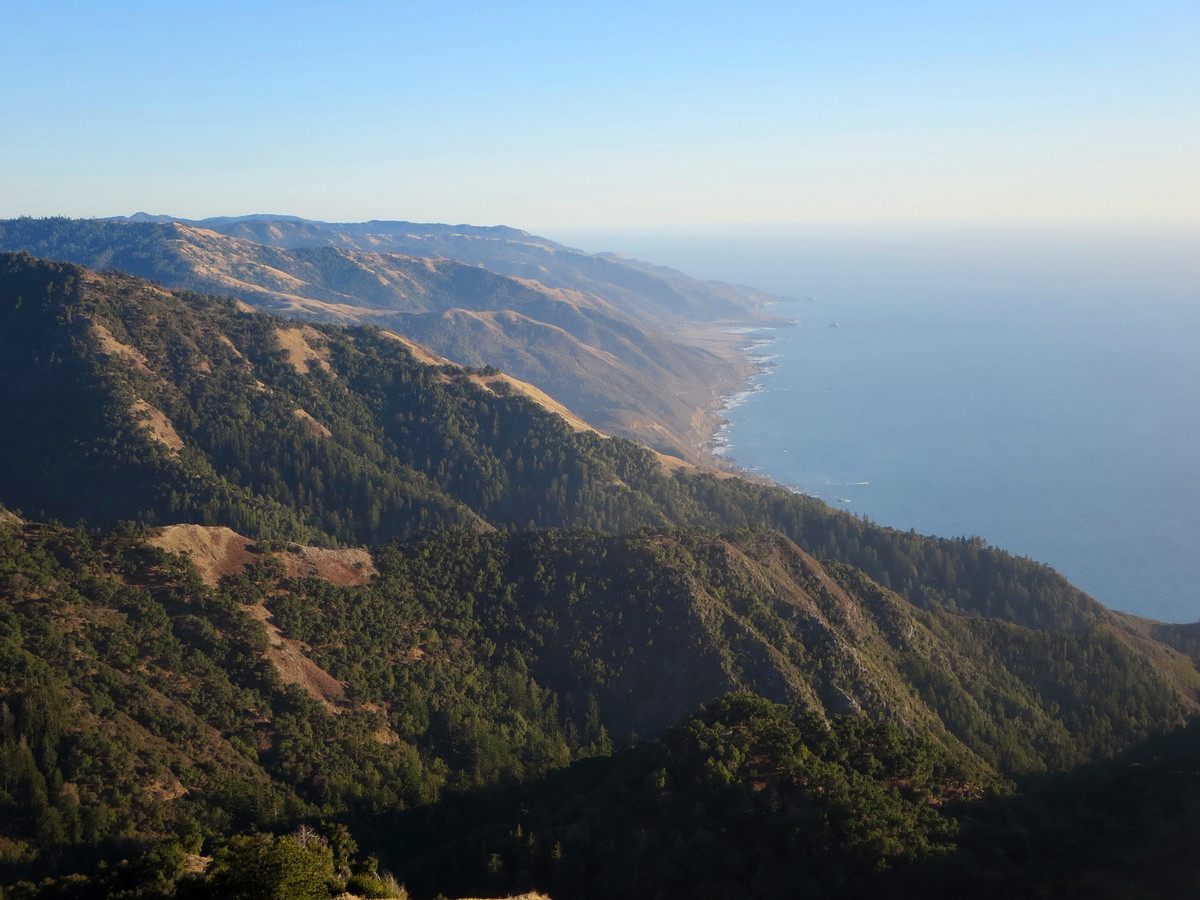
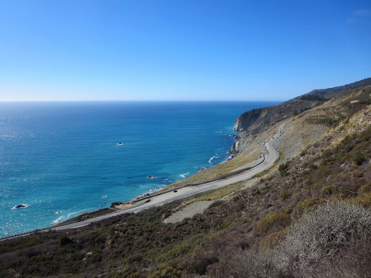
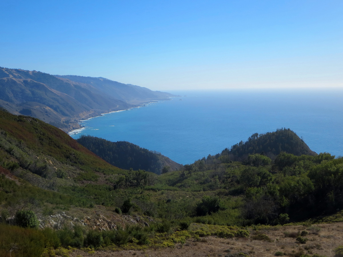
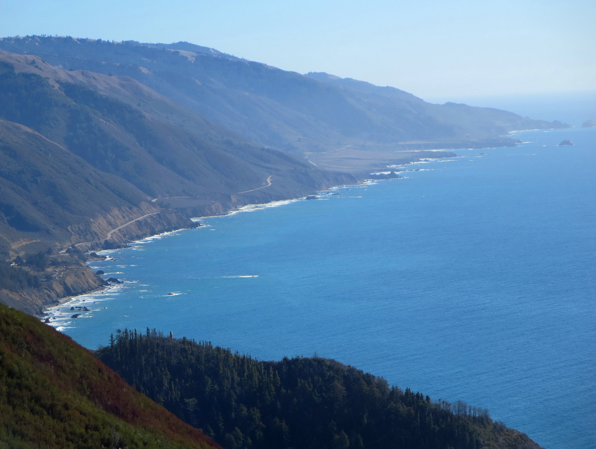
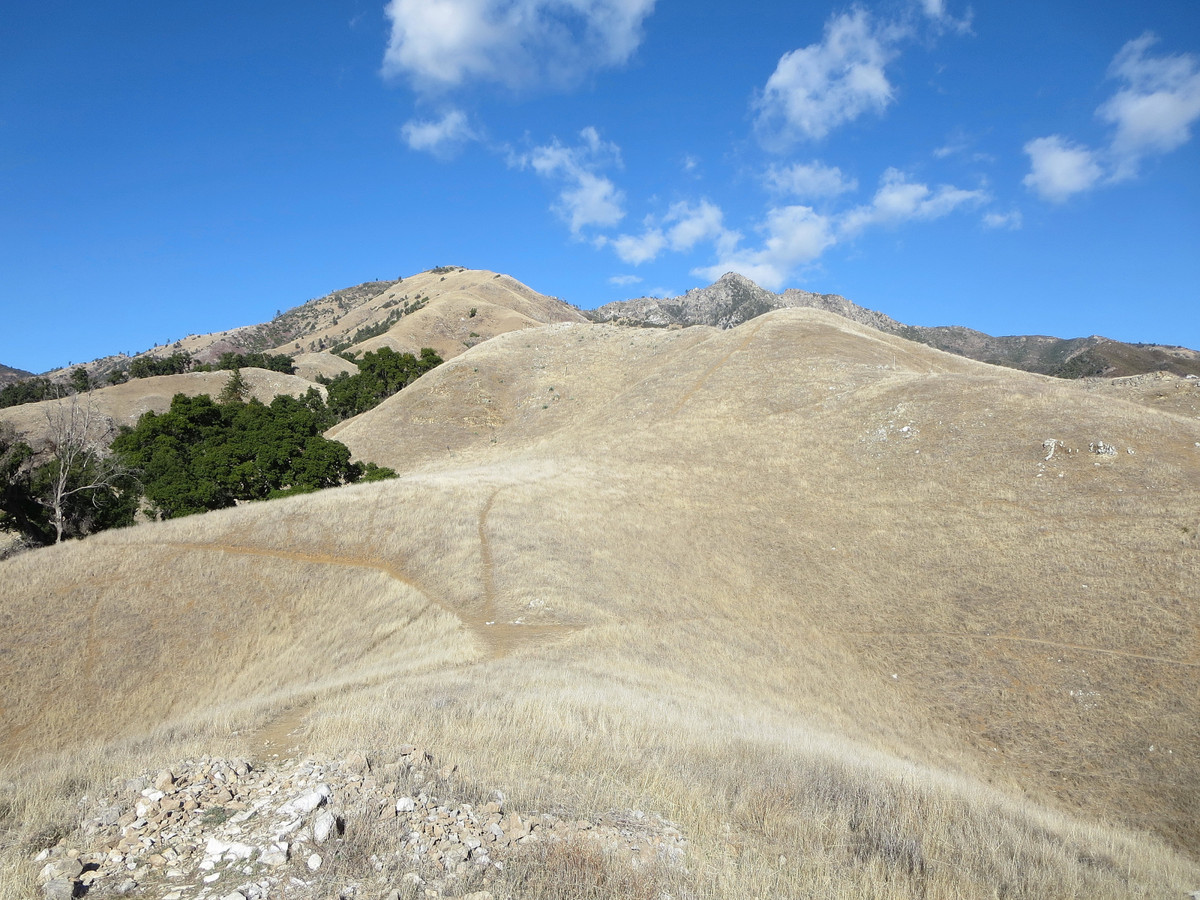
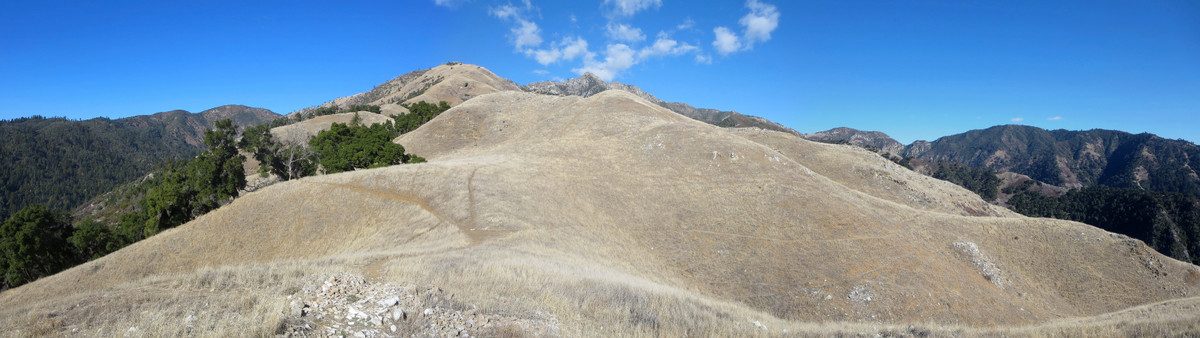
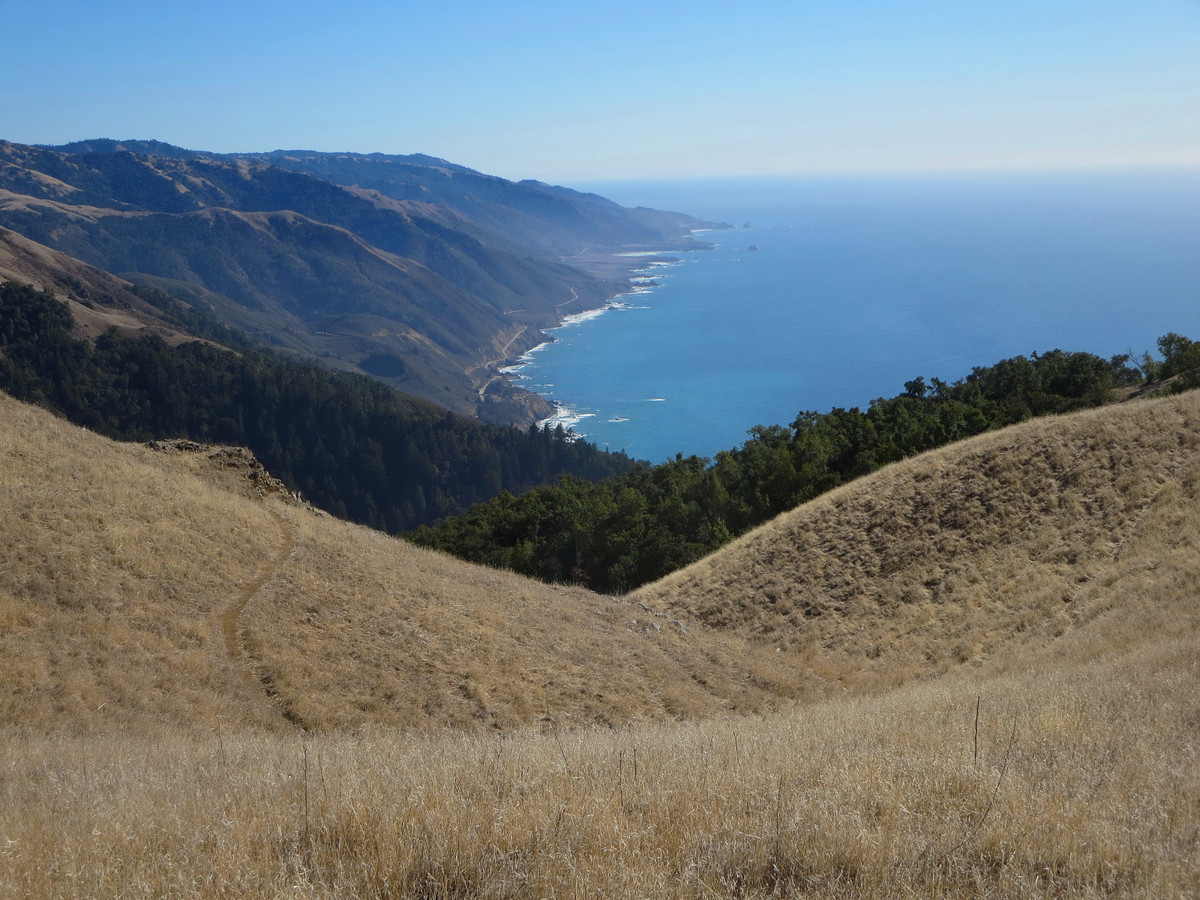
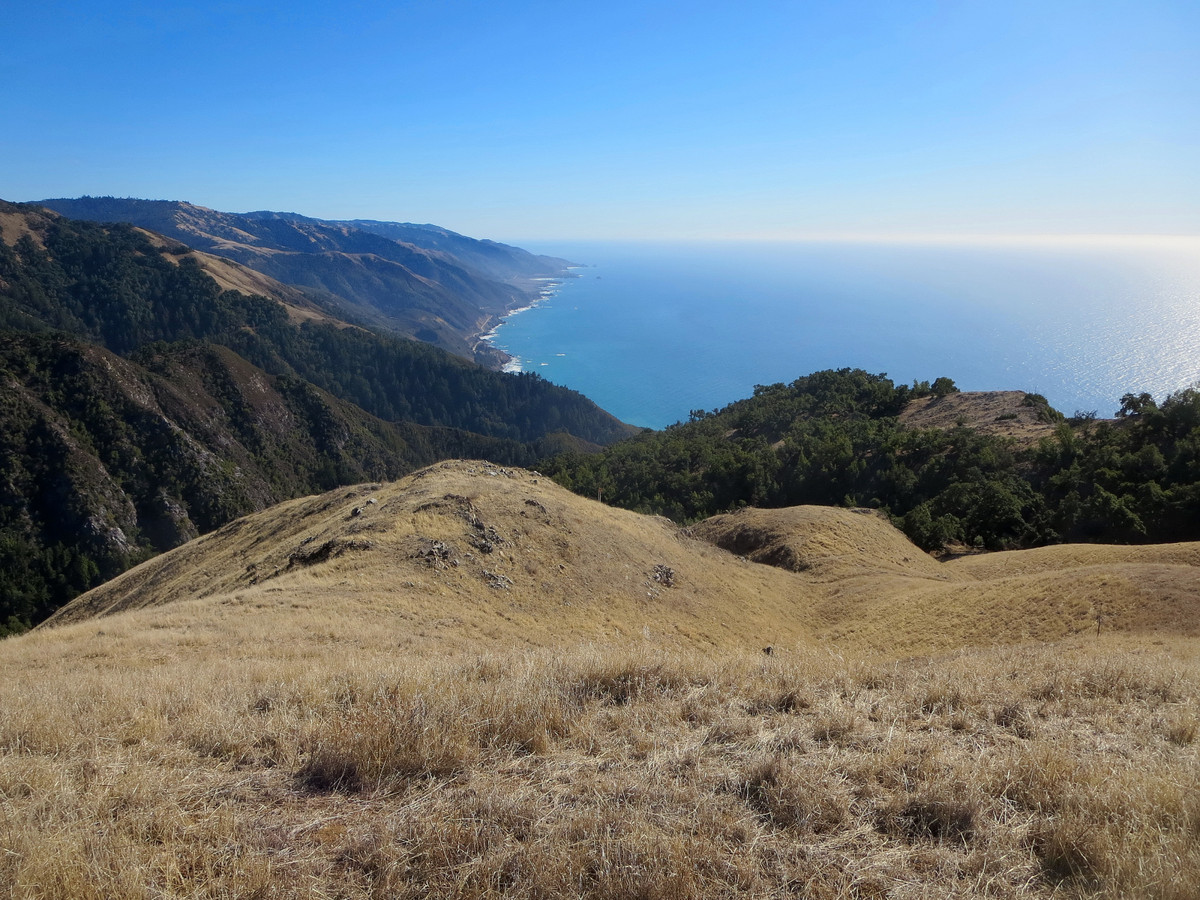
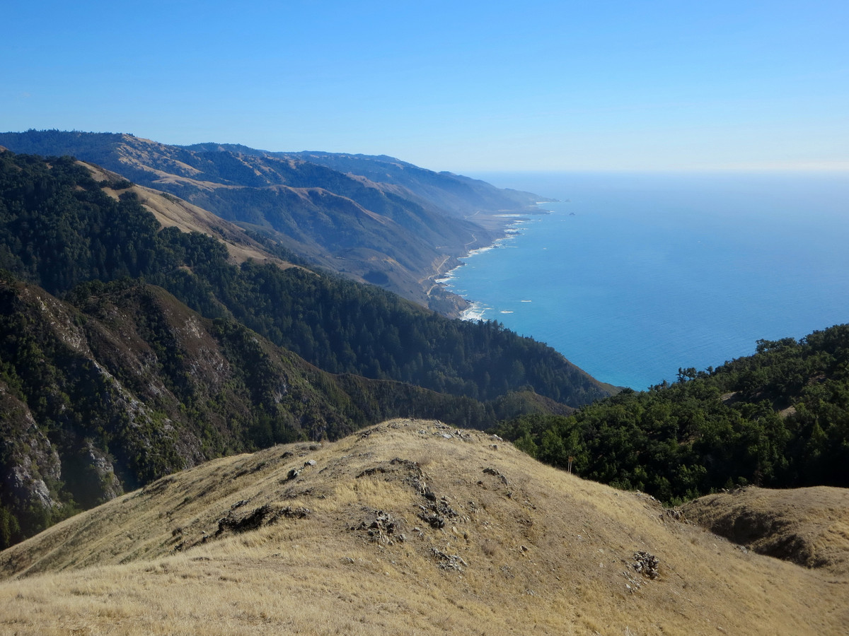
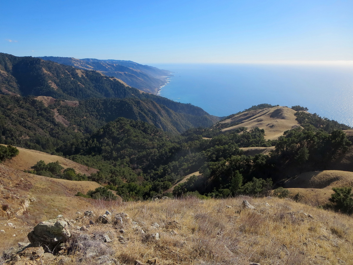
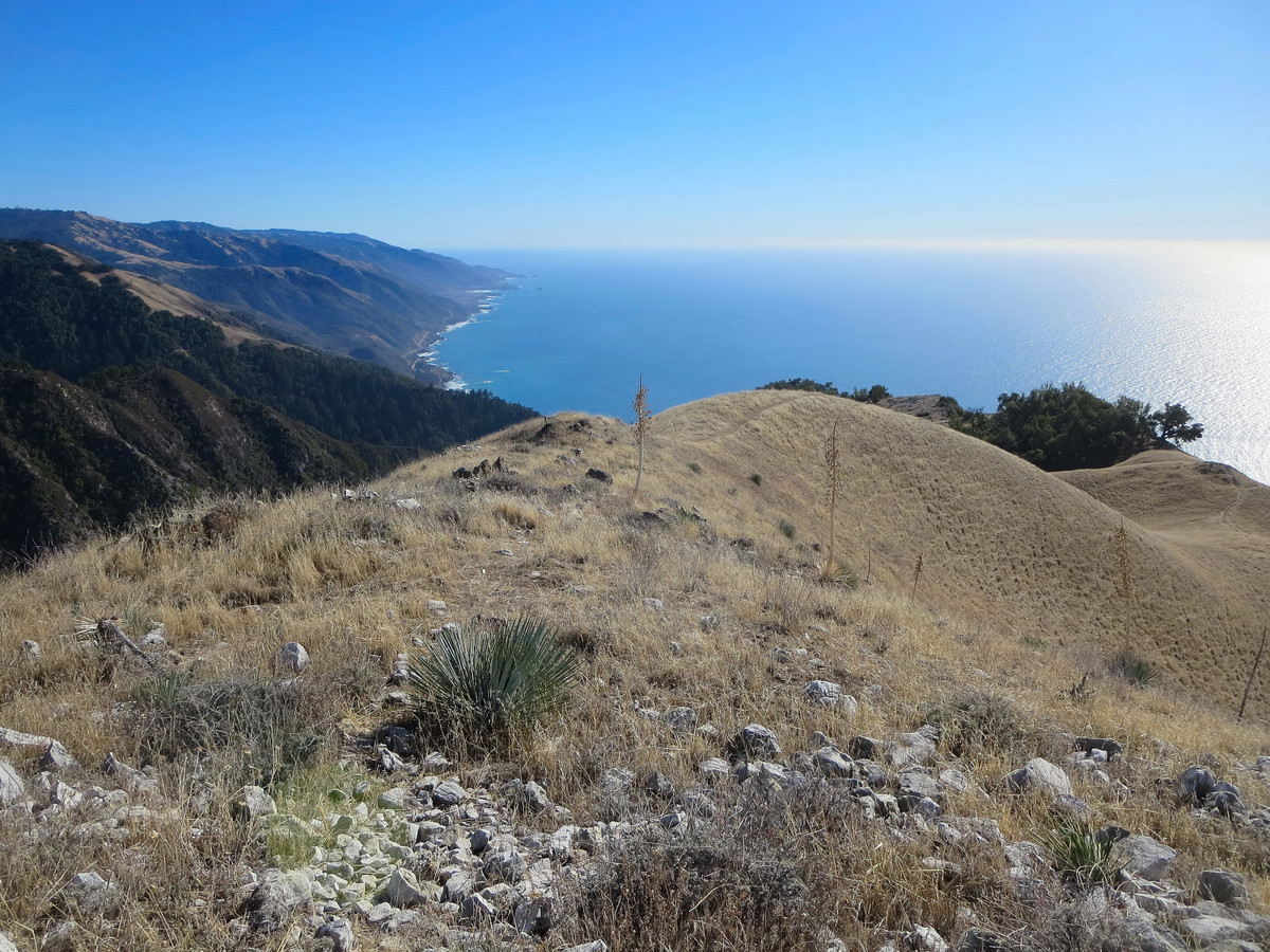
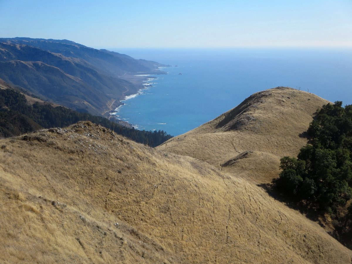
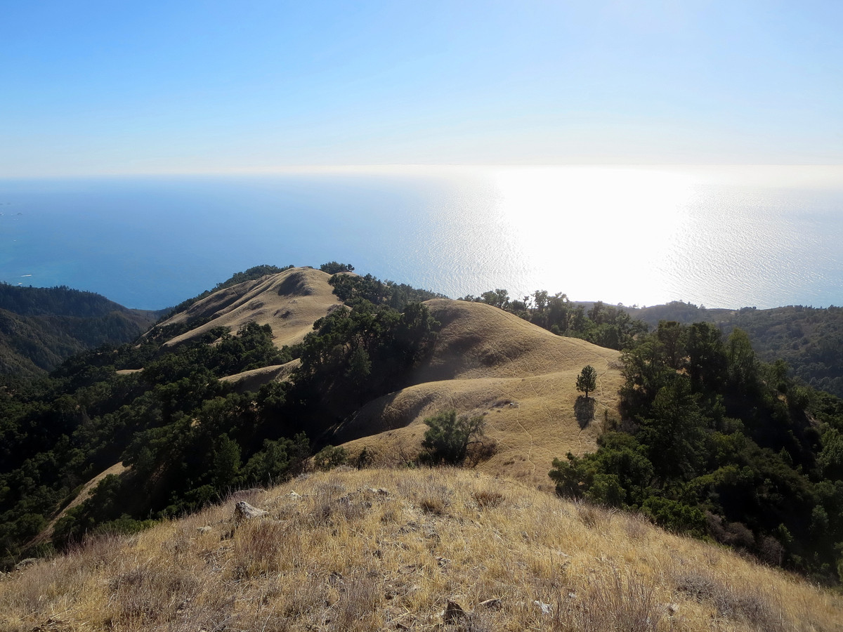
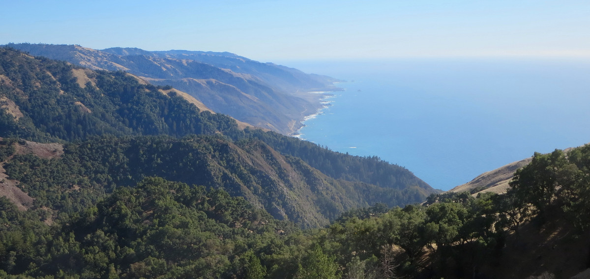
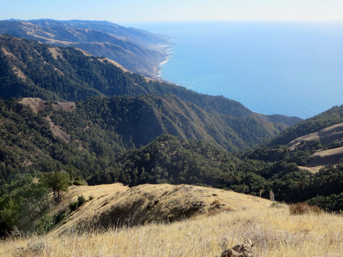
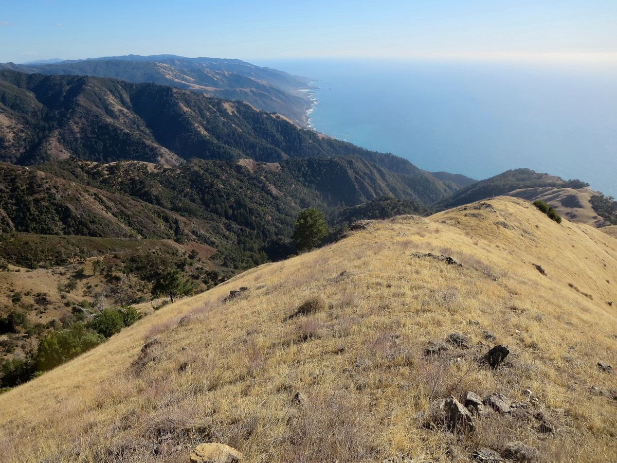
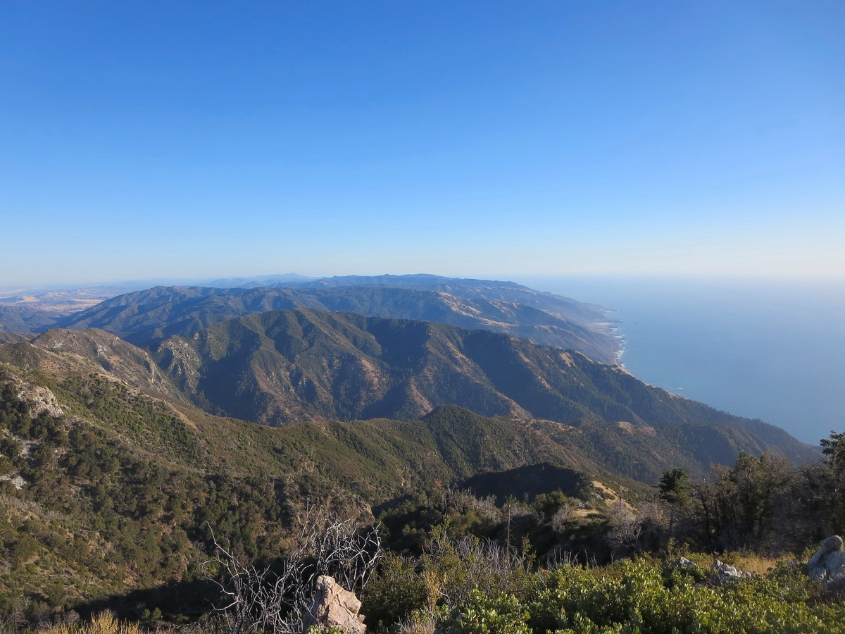
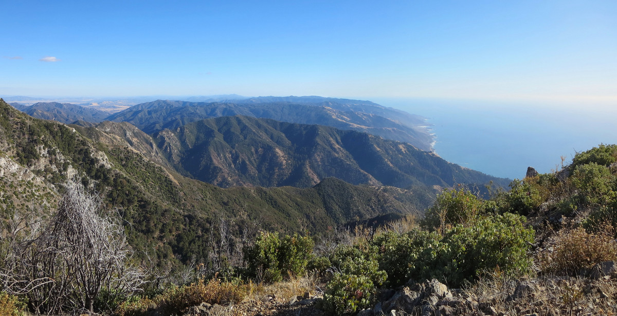
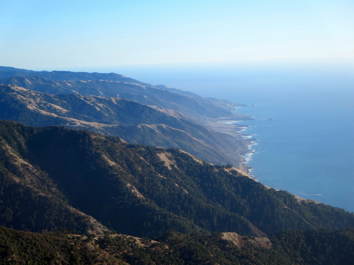
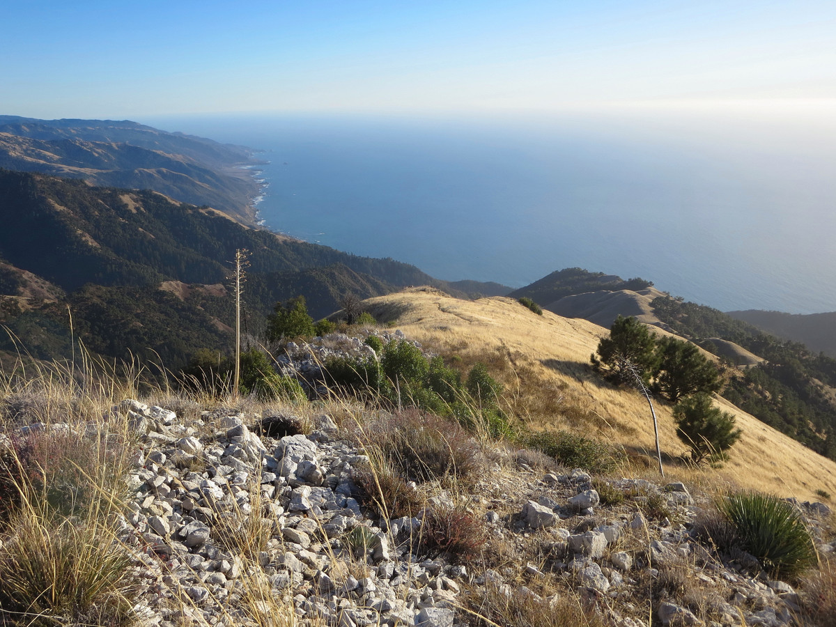
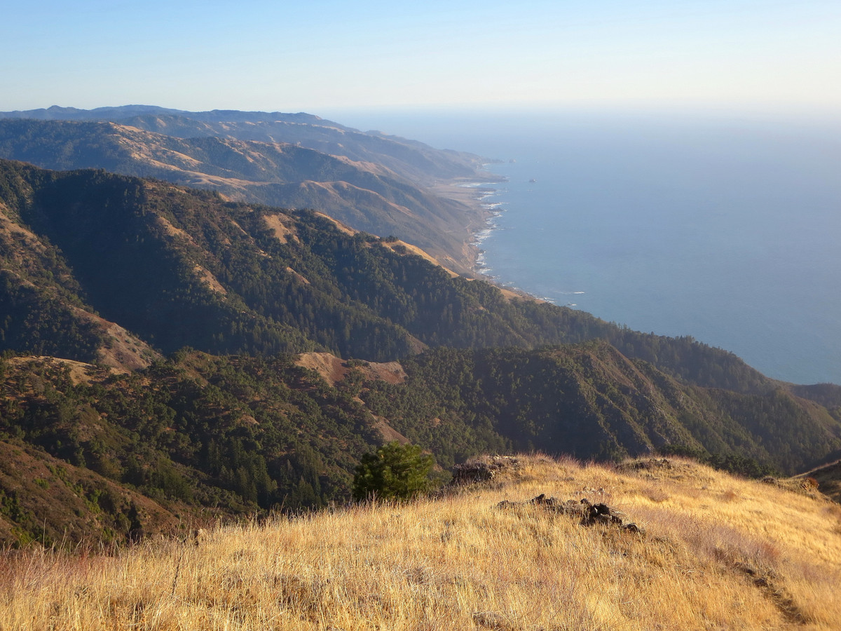
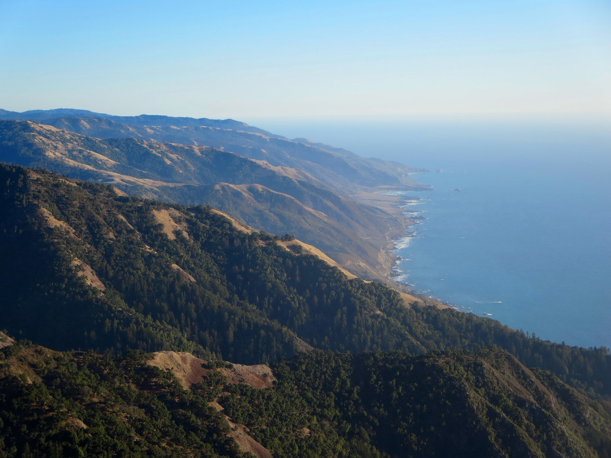
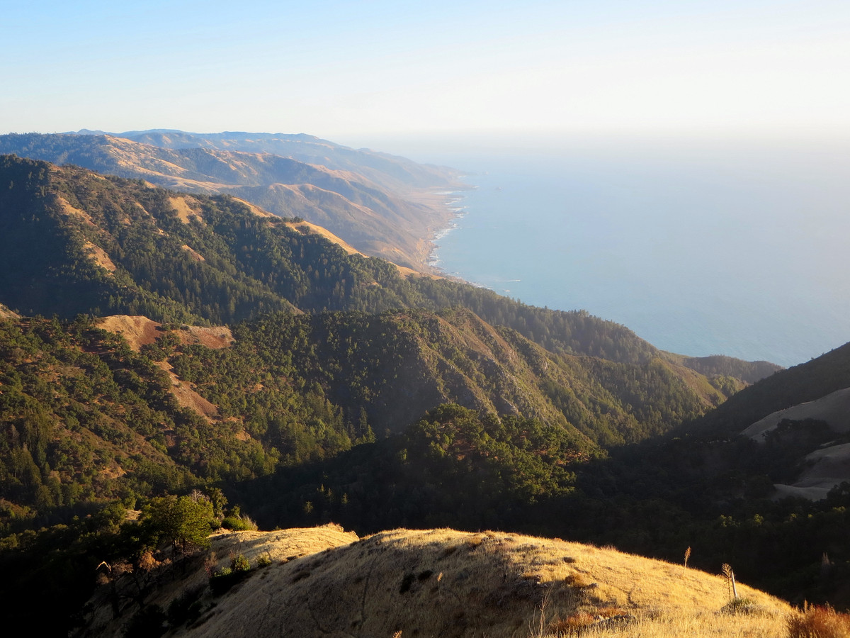
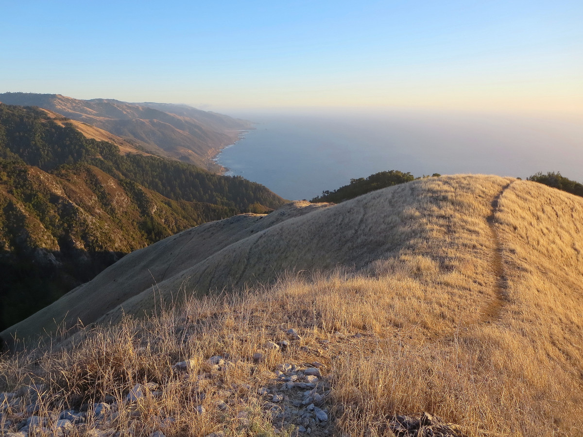
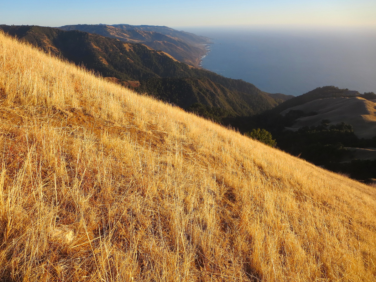
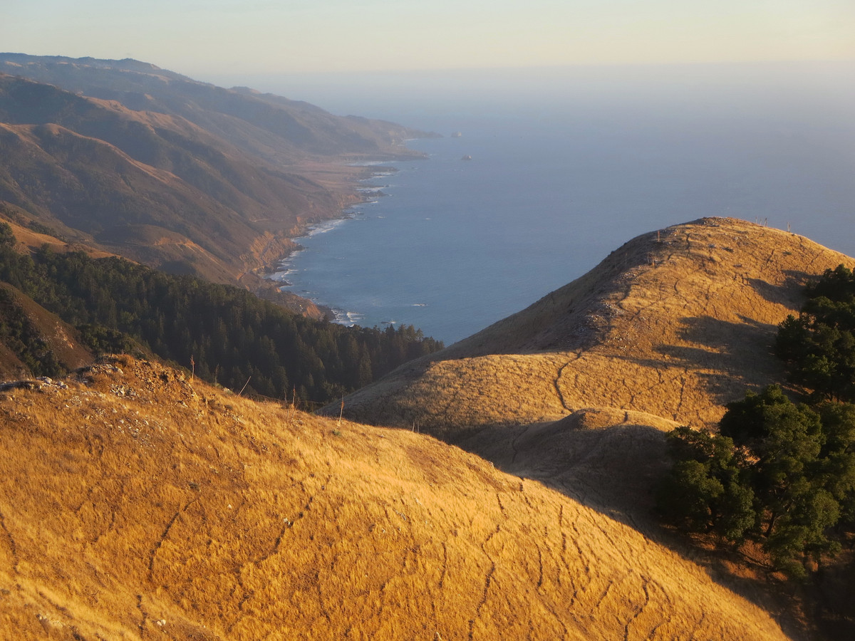
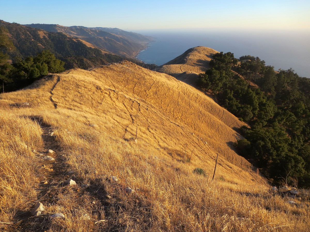
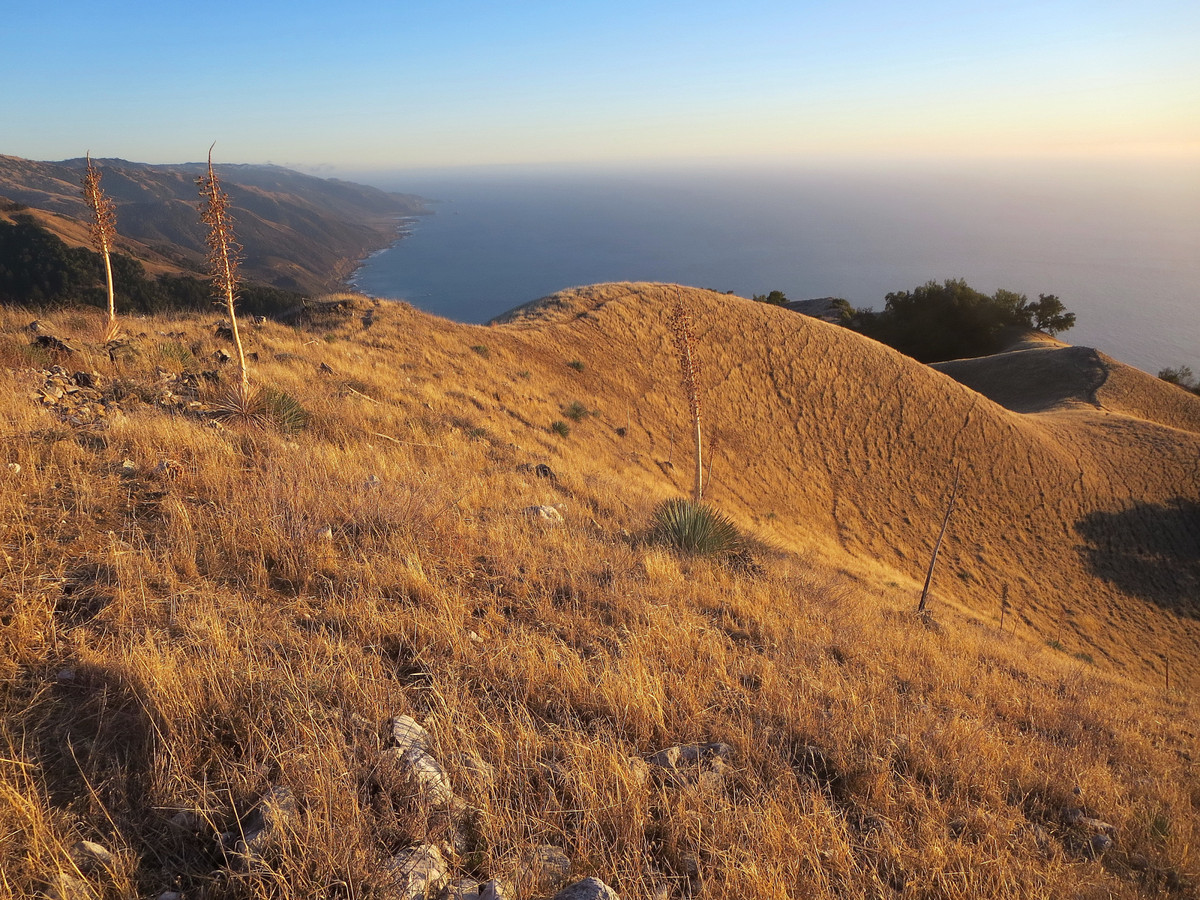
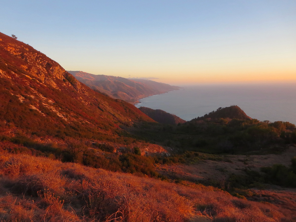
An ascent of Cone Peak via Stone Ridge Direct is a tremendous route and worthy of the title “Sea to Sky.” Stone Ridge is easily the most impressive and prominent ridge along the entire Big Sur Coast. While there are a bevy of tremendous grassy ridges near the ocean that I have explored (Boronda, Prewitt, Shouey, East Molera, Kirk Creek, Mount Mars to name a few), each with its own charm and inspiration, none compare to Stone Ridge in terms of height (4,800 ft), length (4 miles) and sheer topography in all directions. In 5.25 miles, one can go from the Pacific Ocean to the 5,155 ft summit of Cone Peak, the King of the Big Sur Coast. Suffice it to say, Stone Ridge is one-of-a-kind. 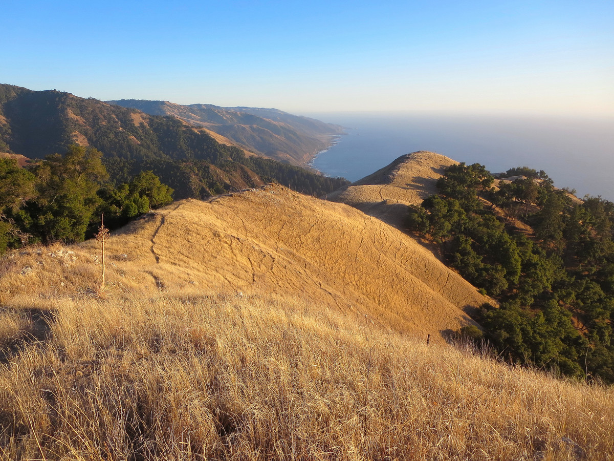
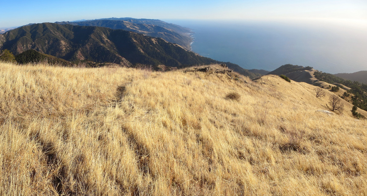
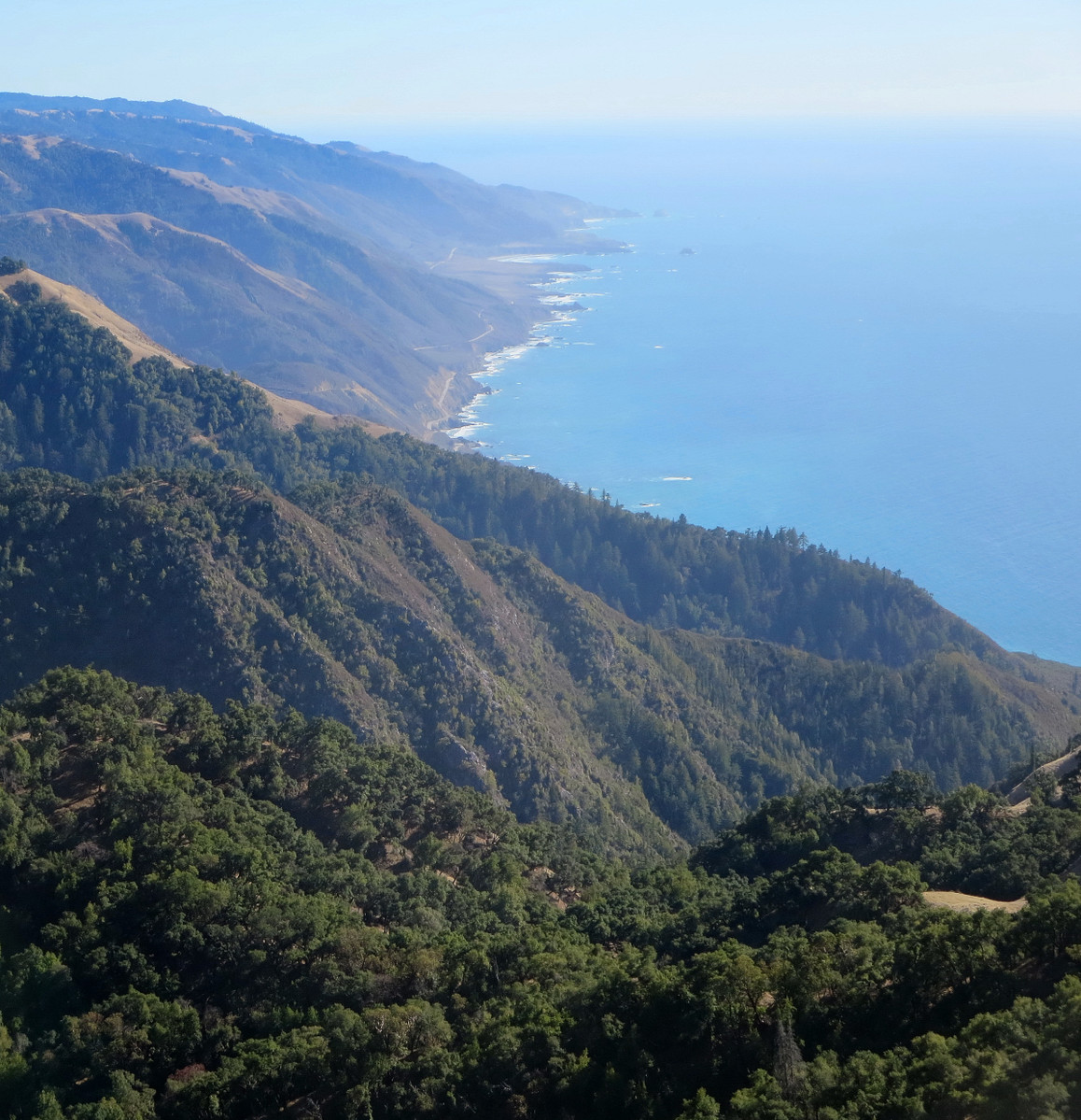
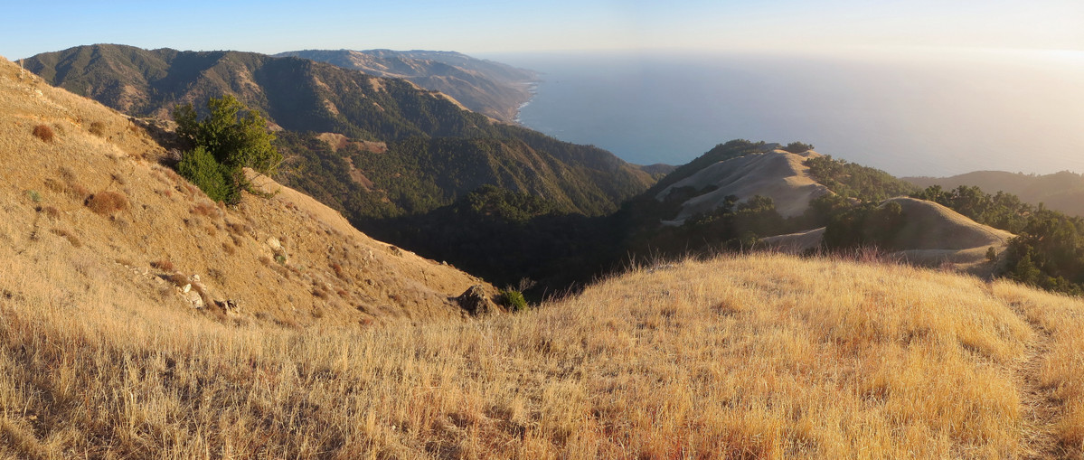
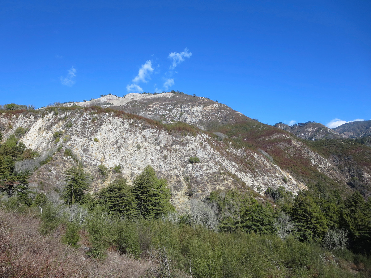
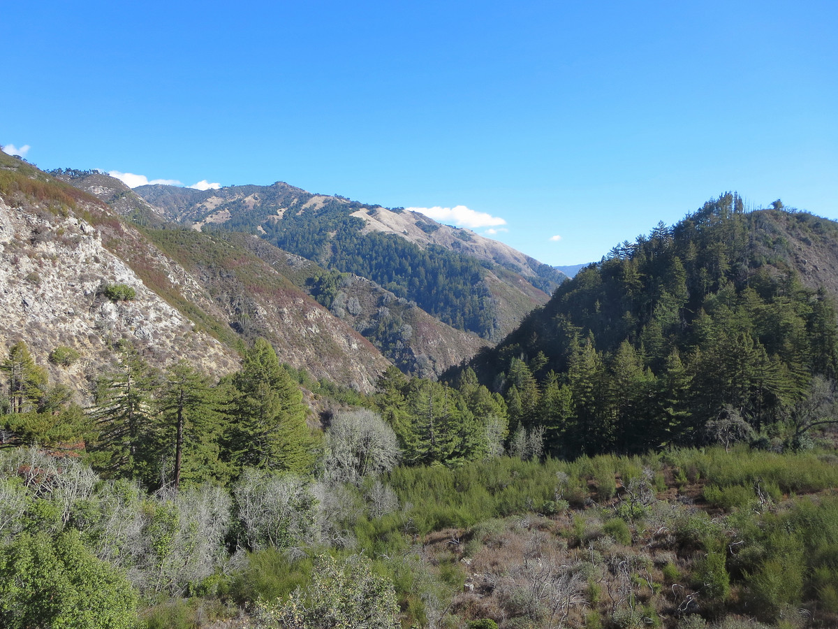
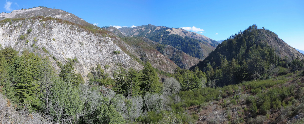
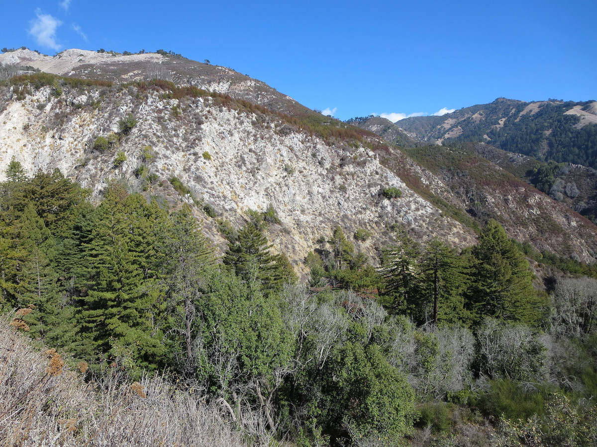
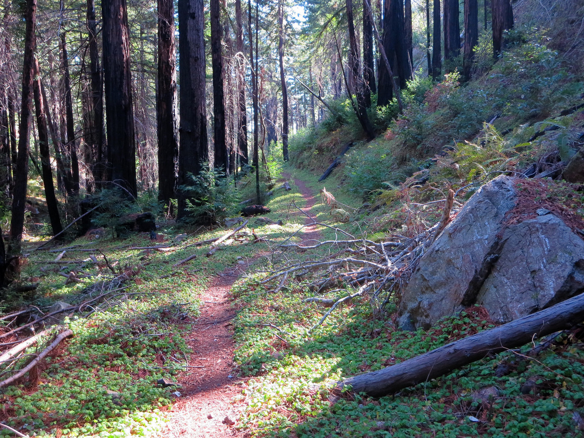
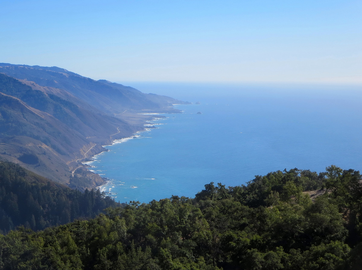
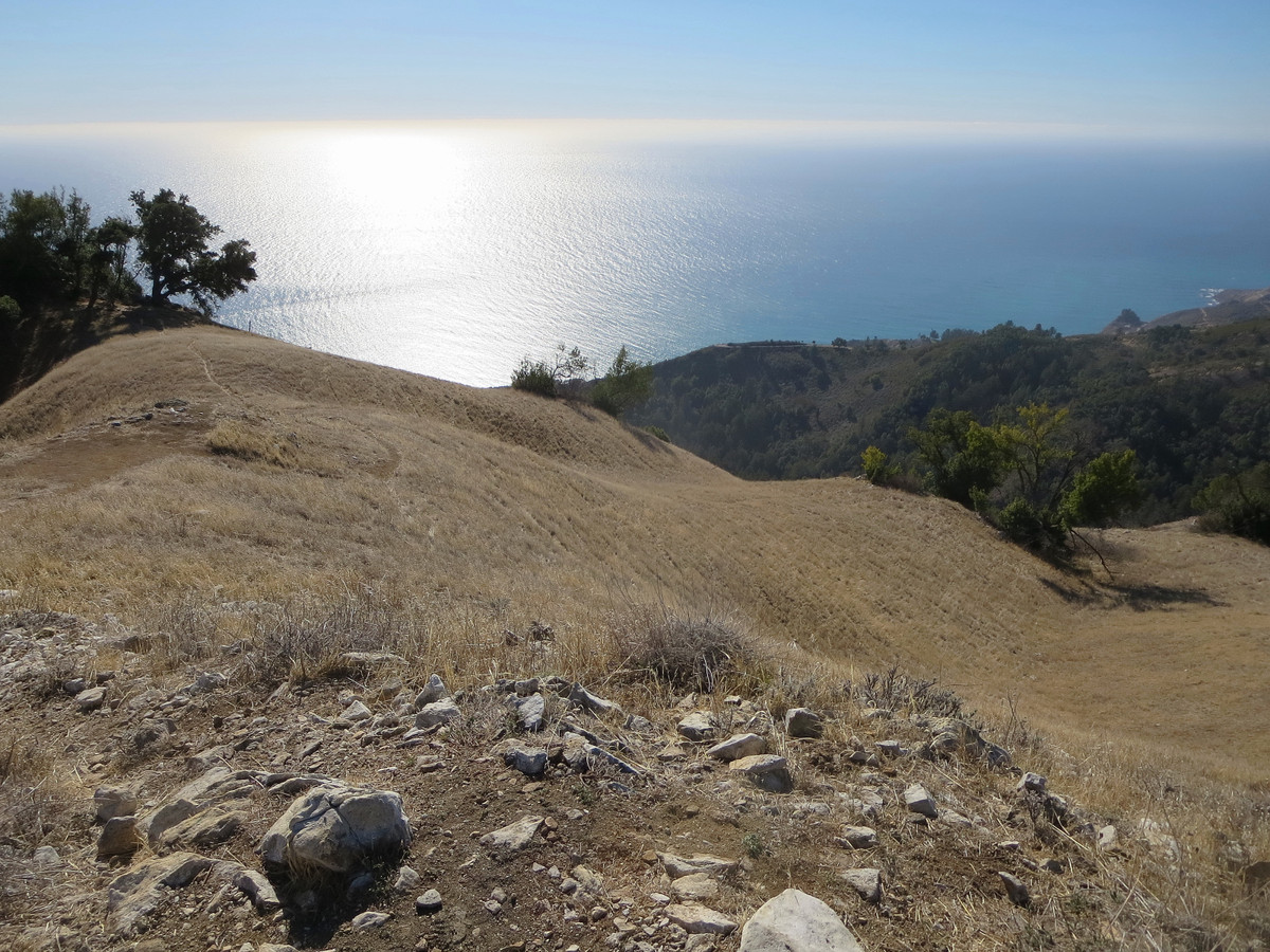
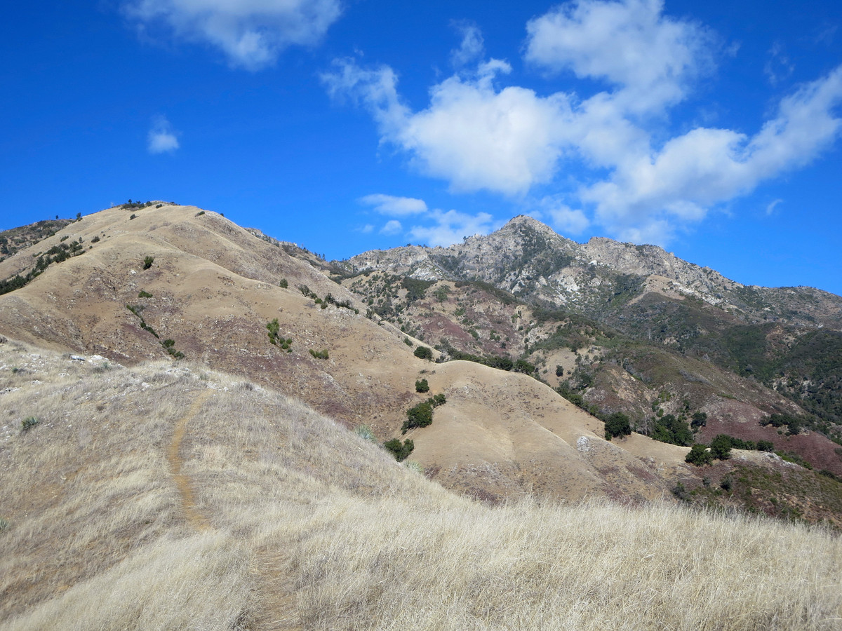
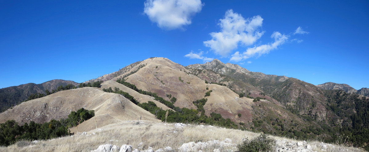
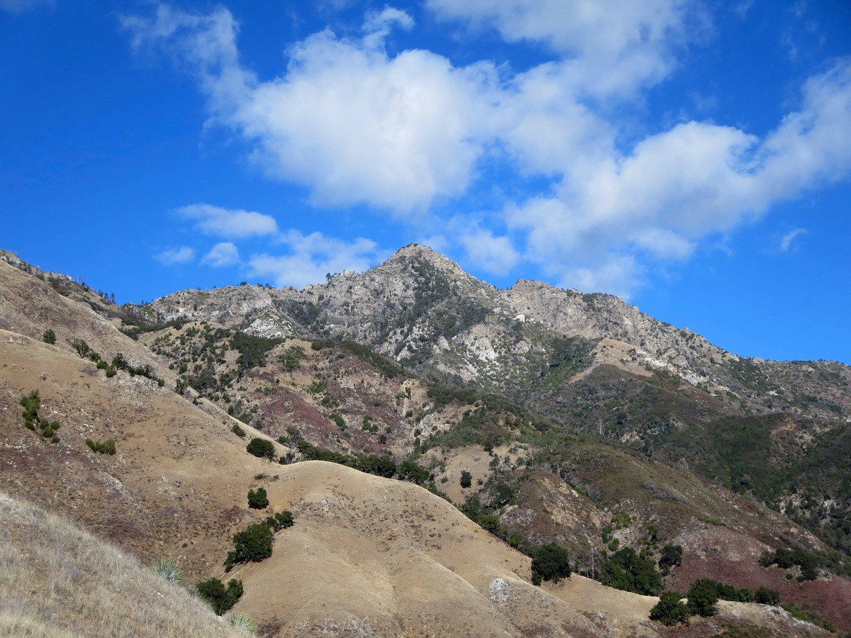
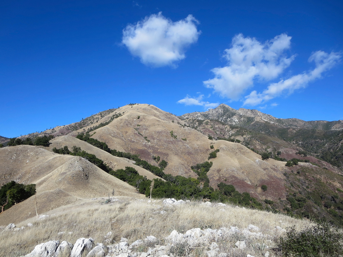
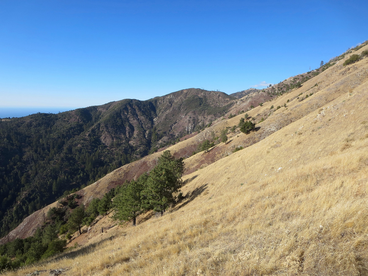
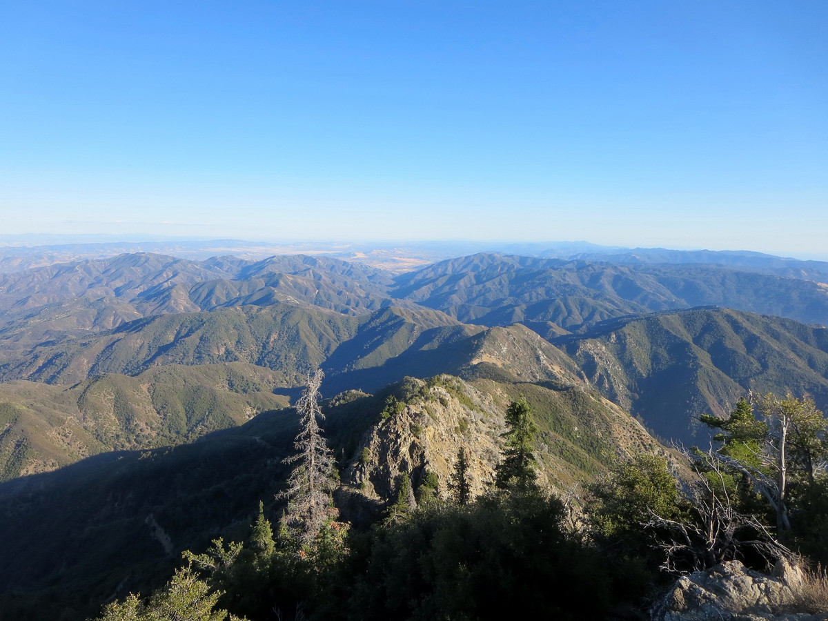
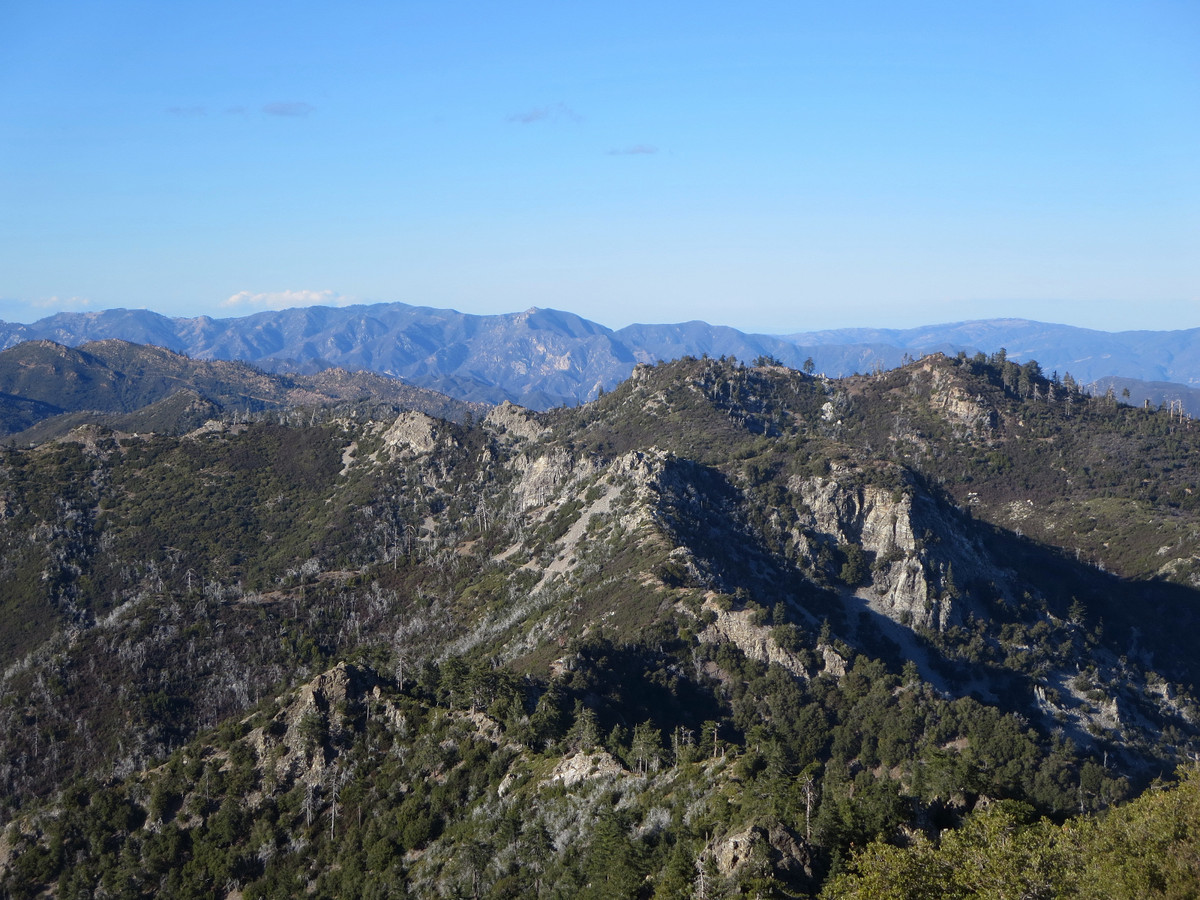
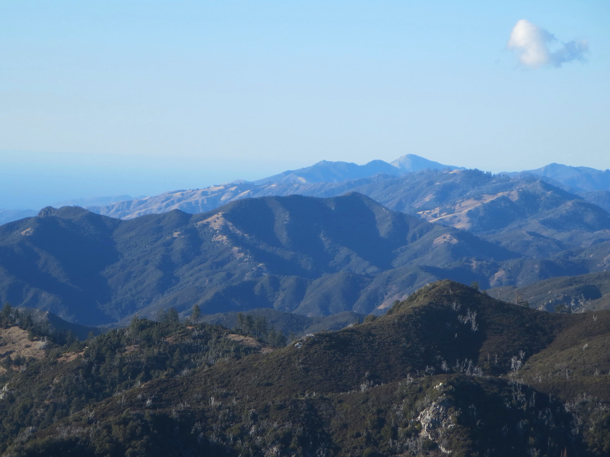
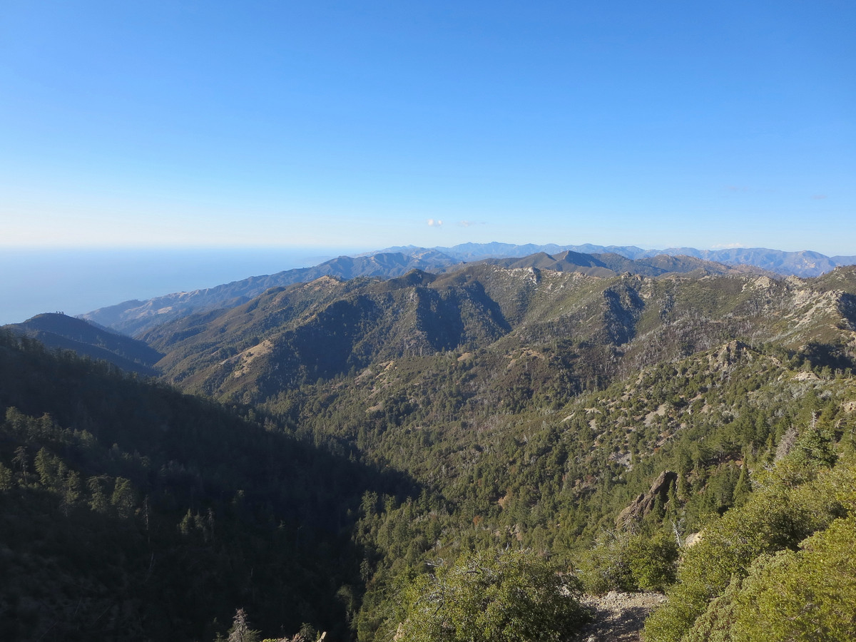
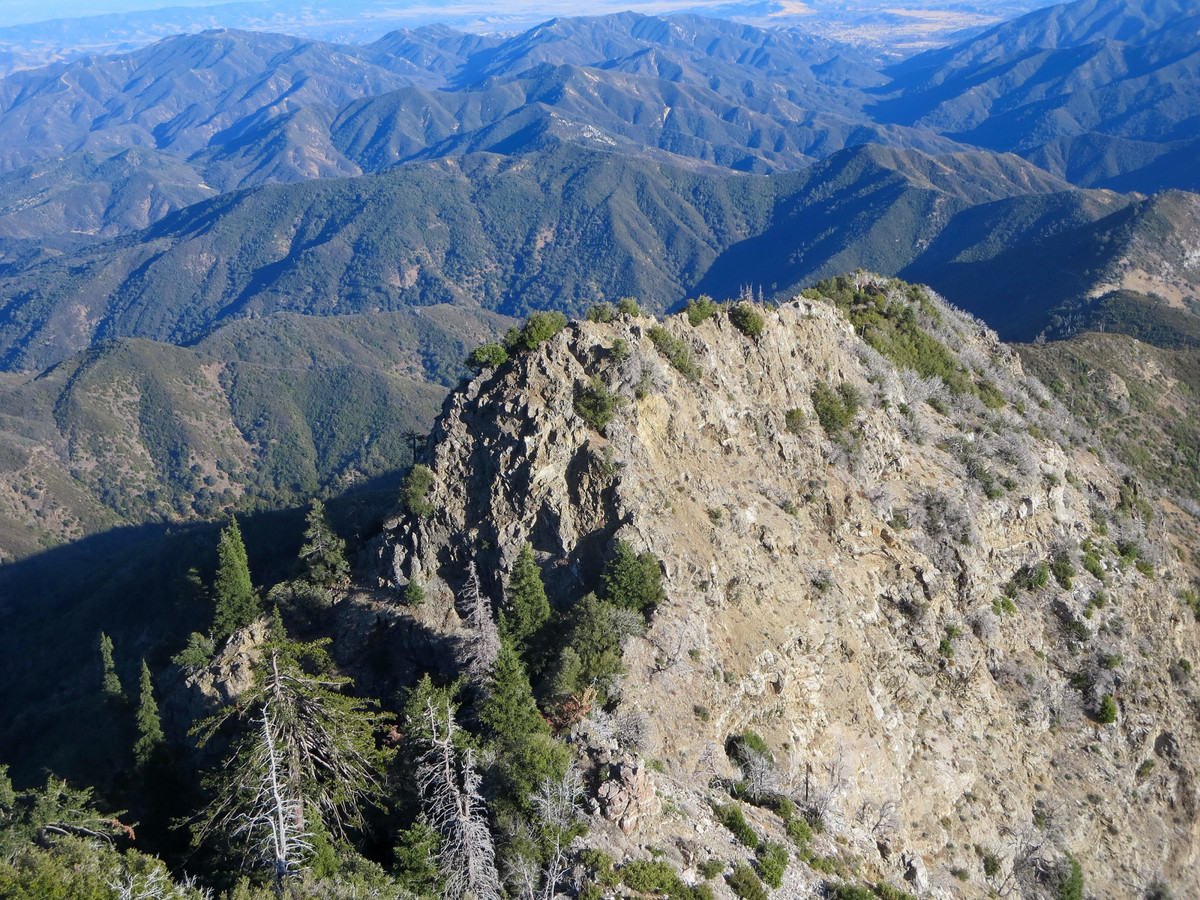
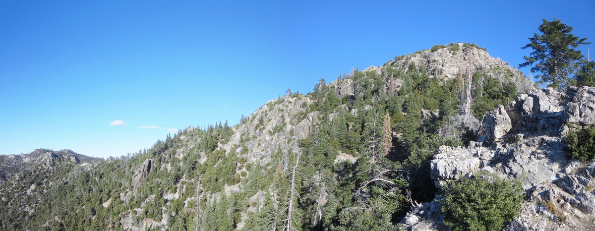
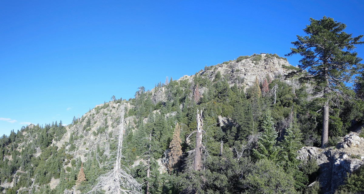
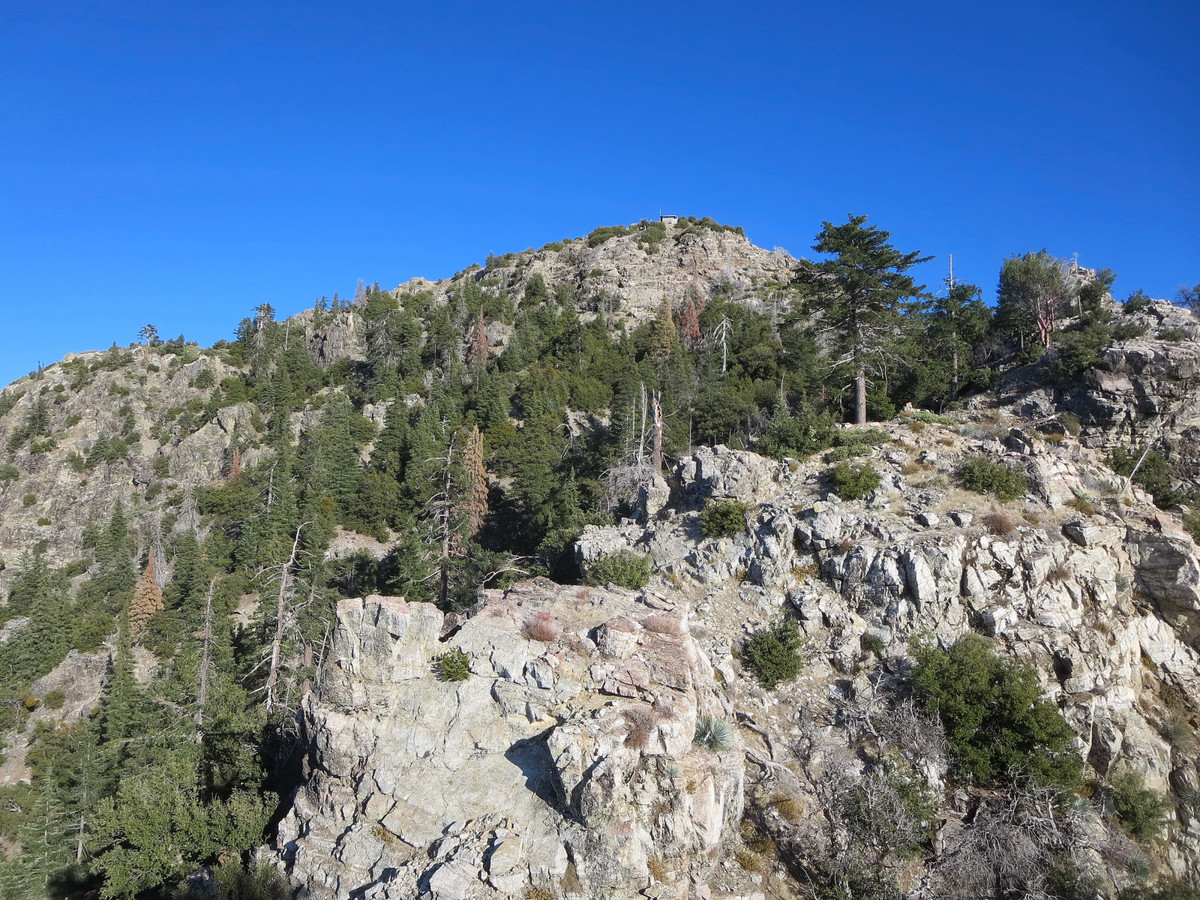
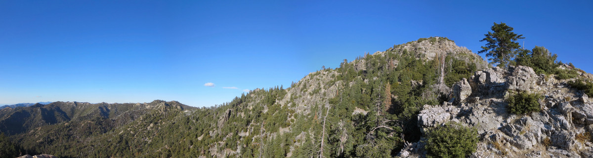
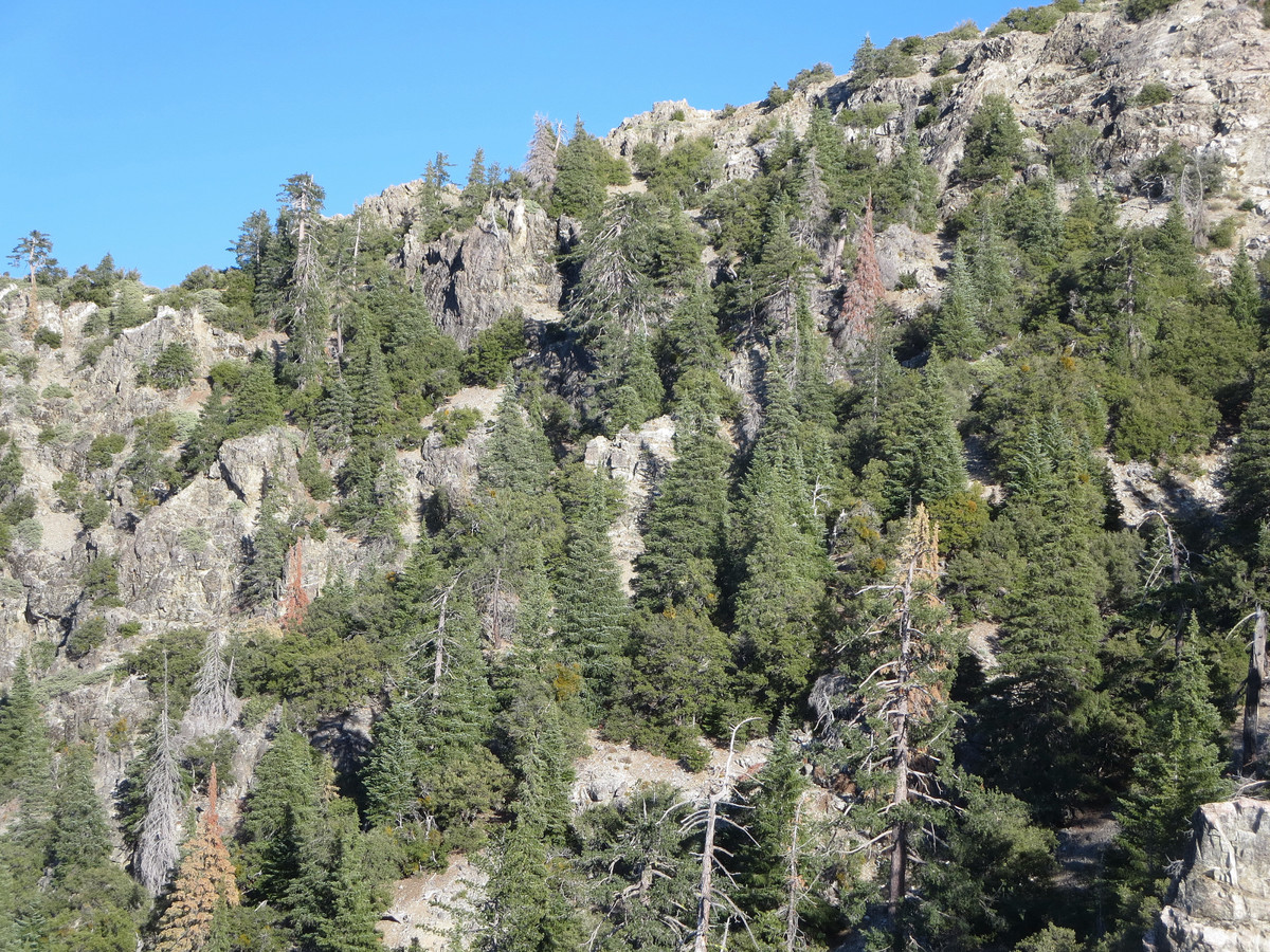
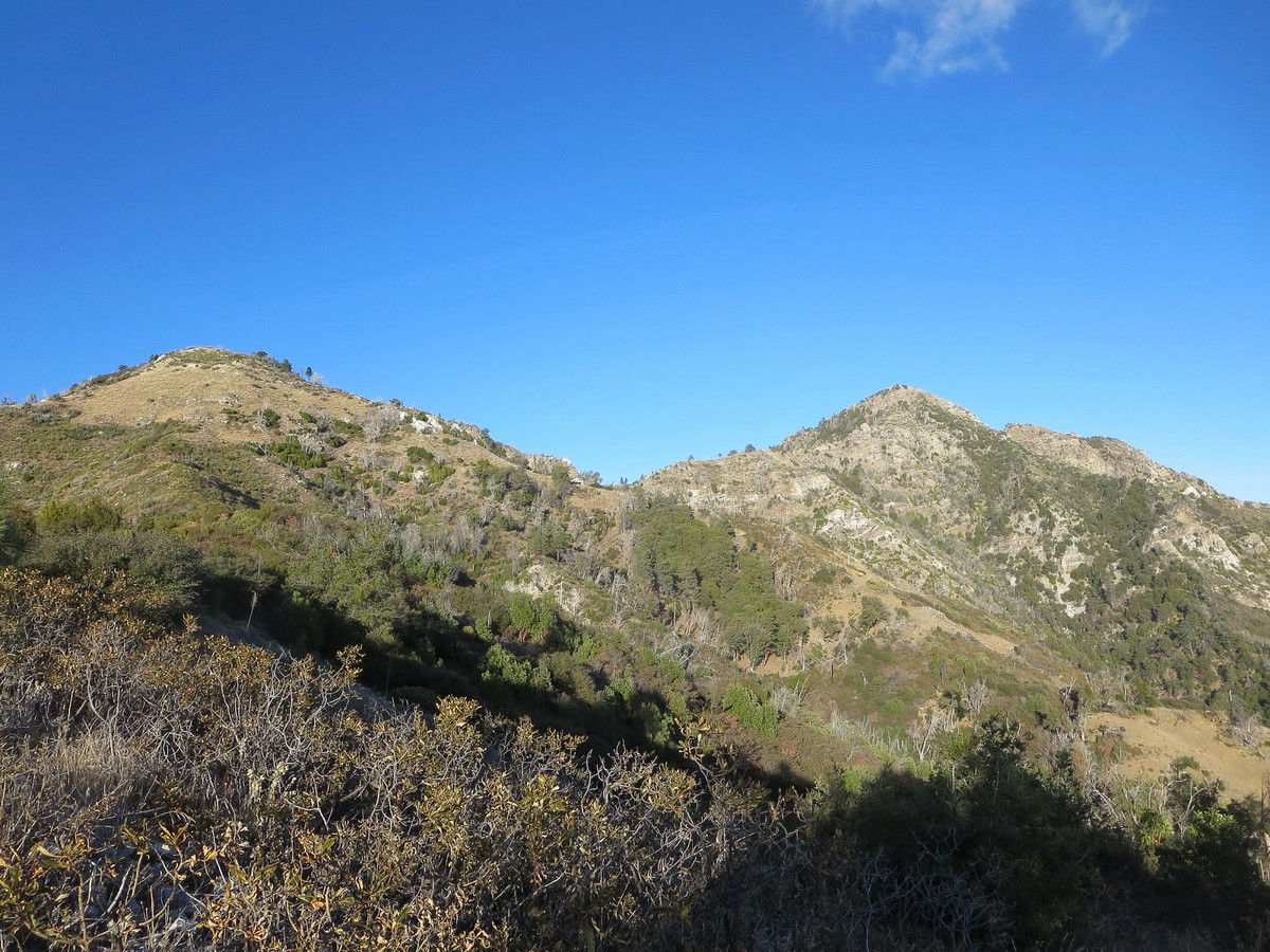
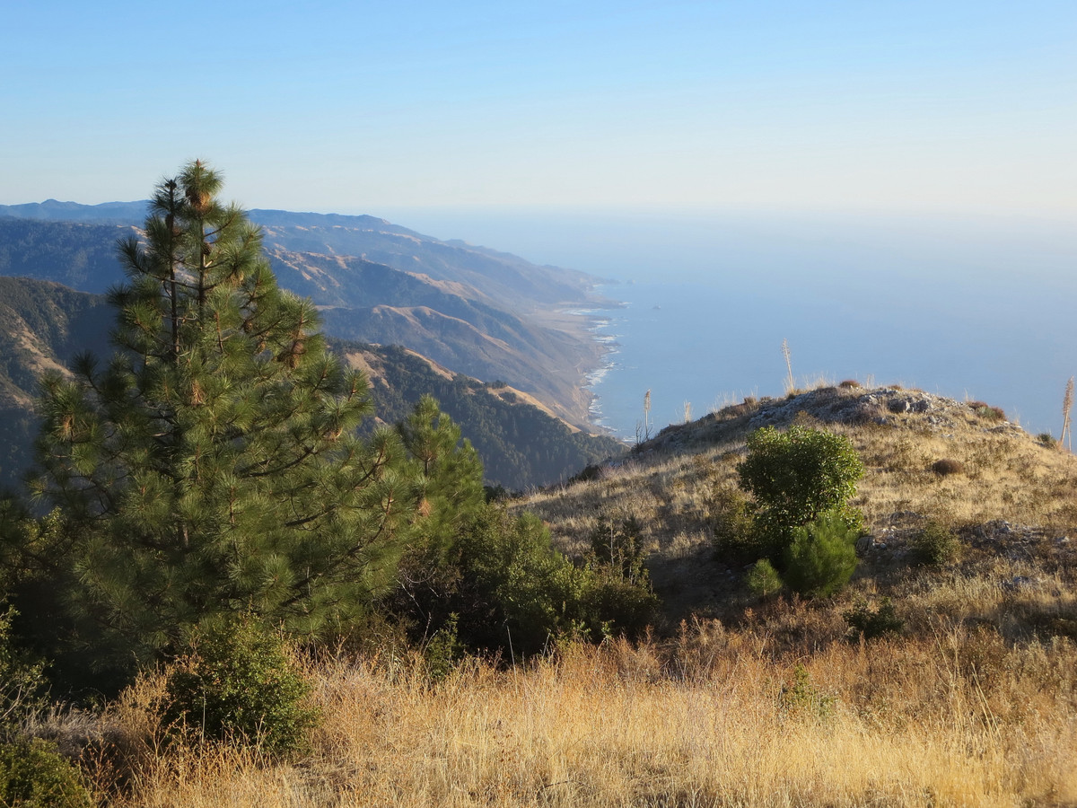
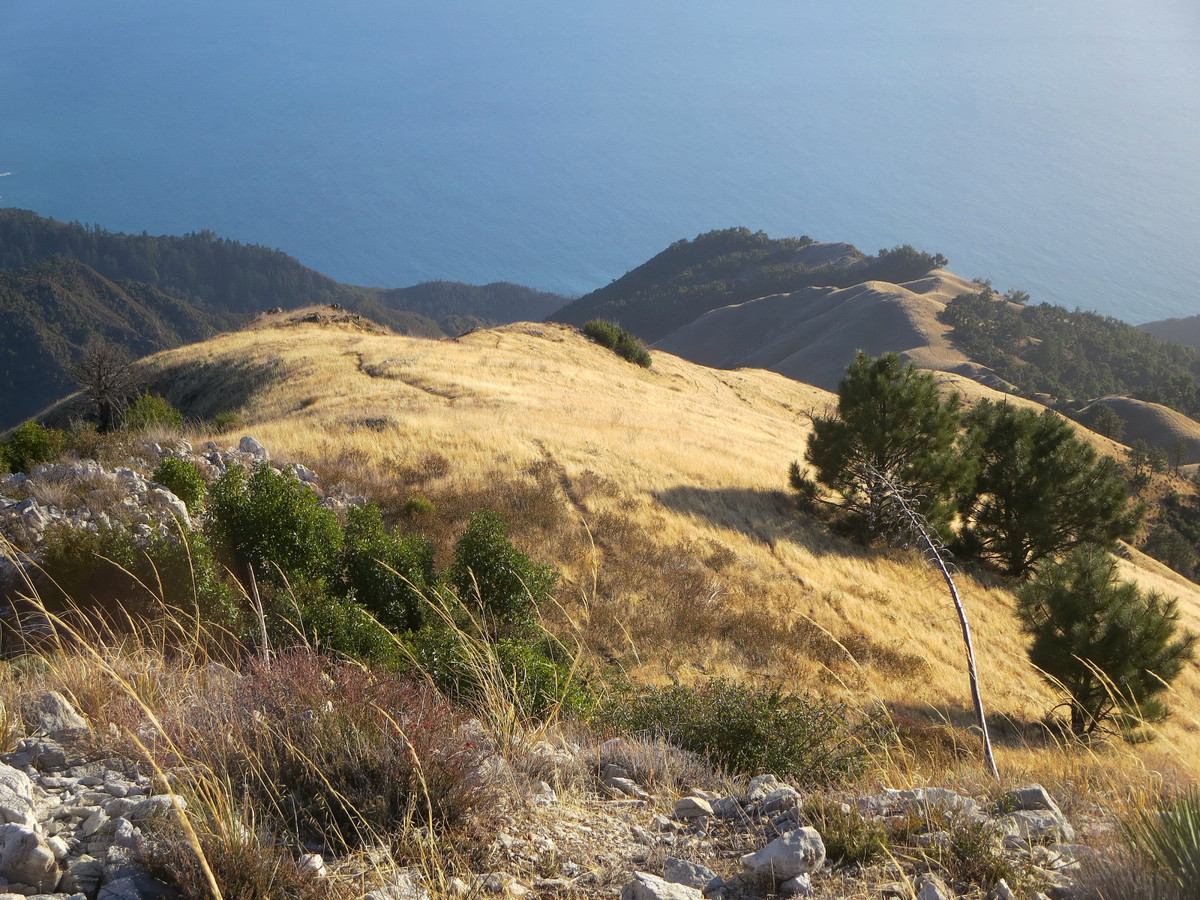
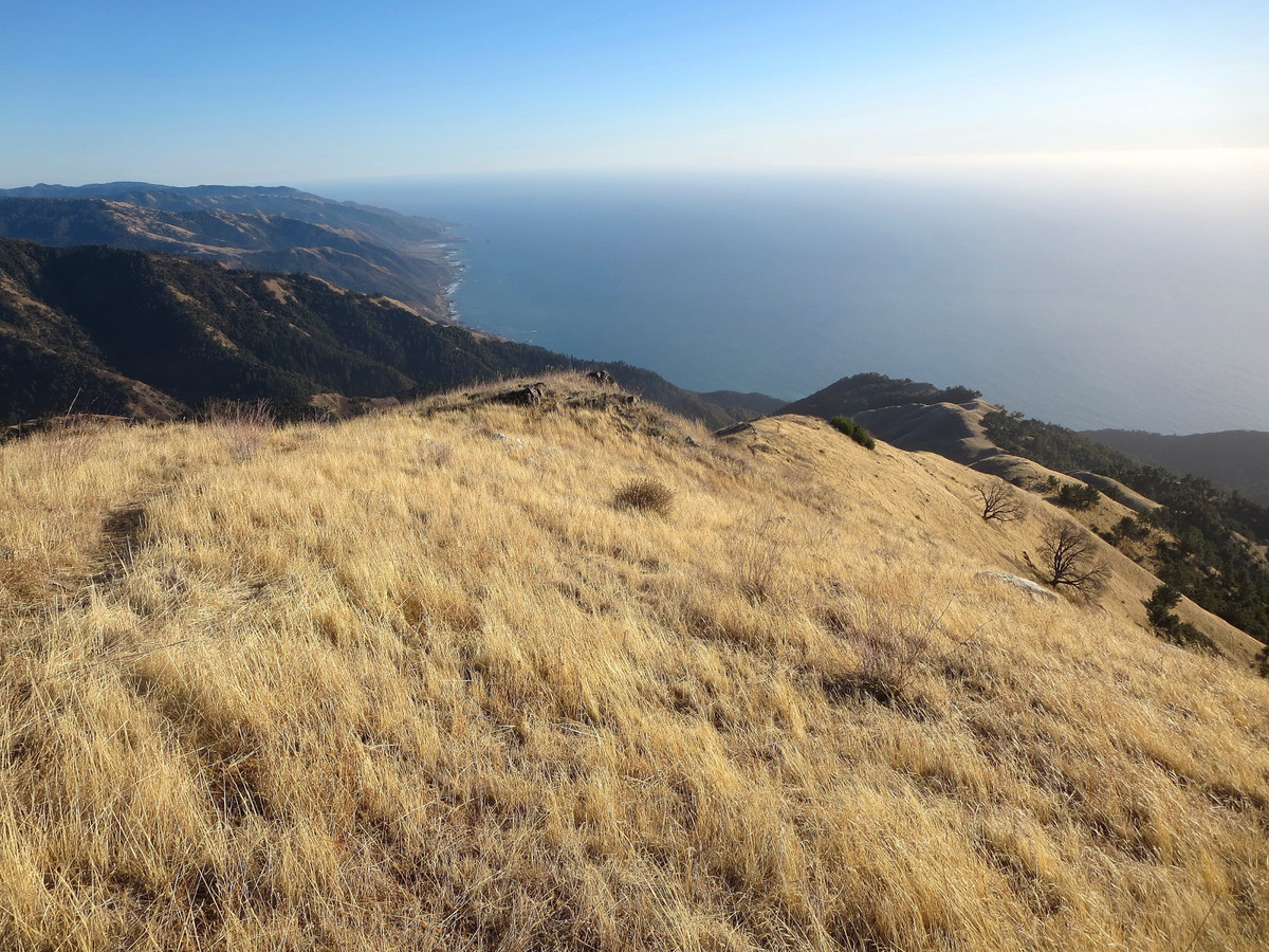
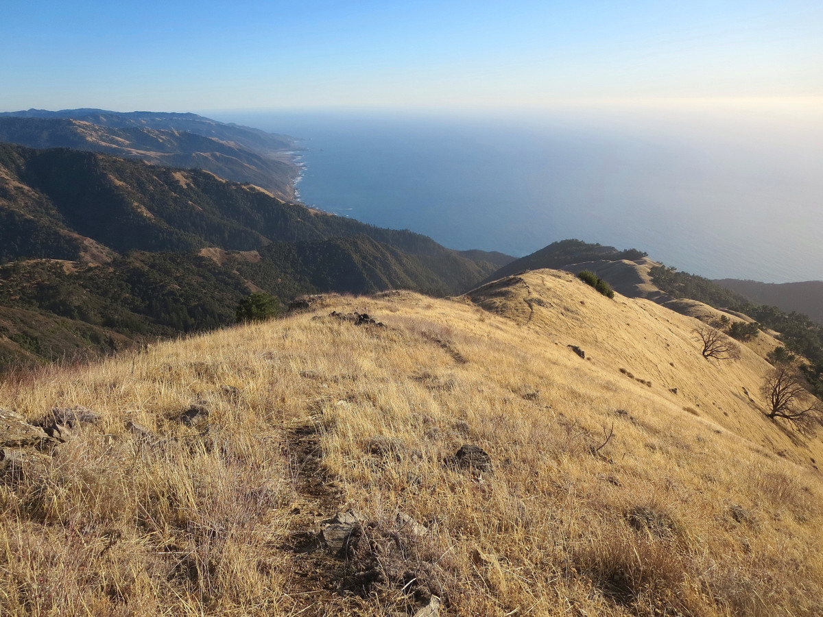
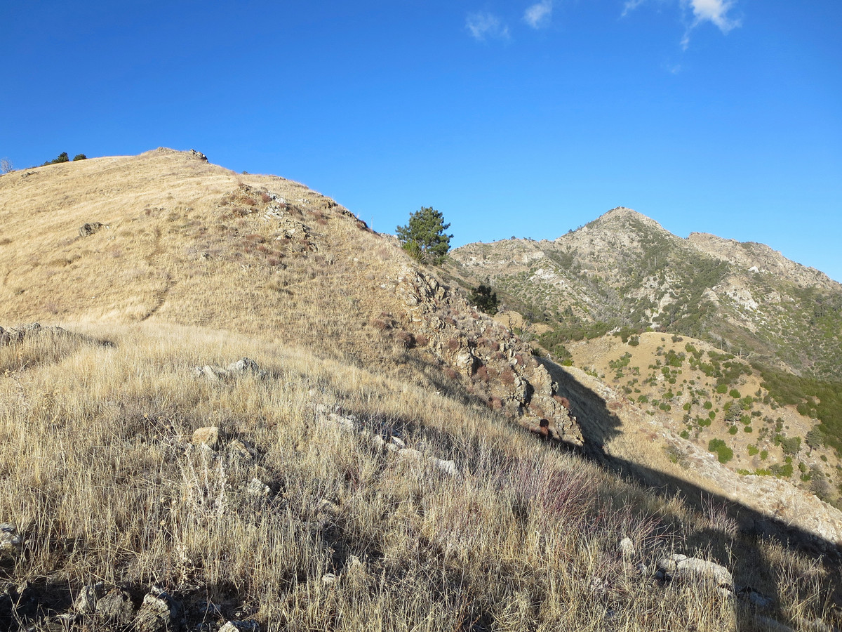
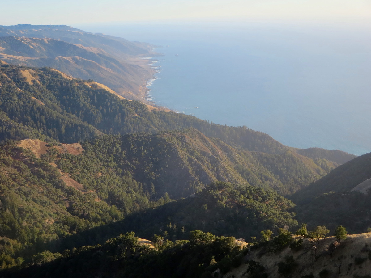
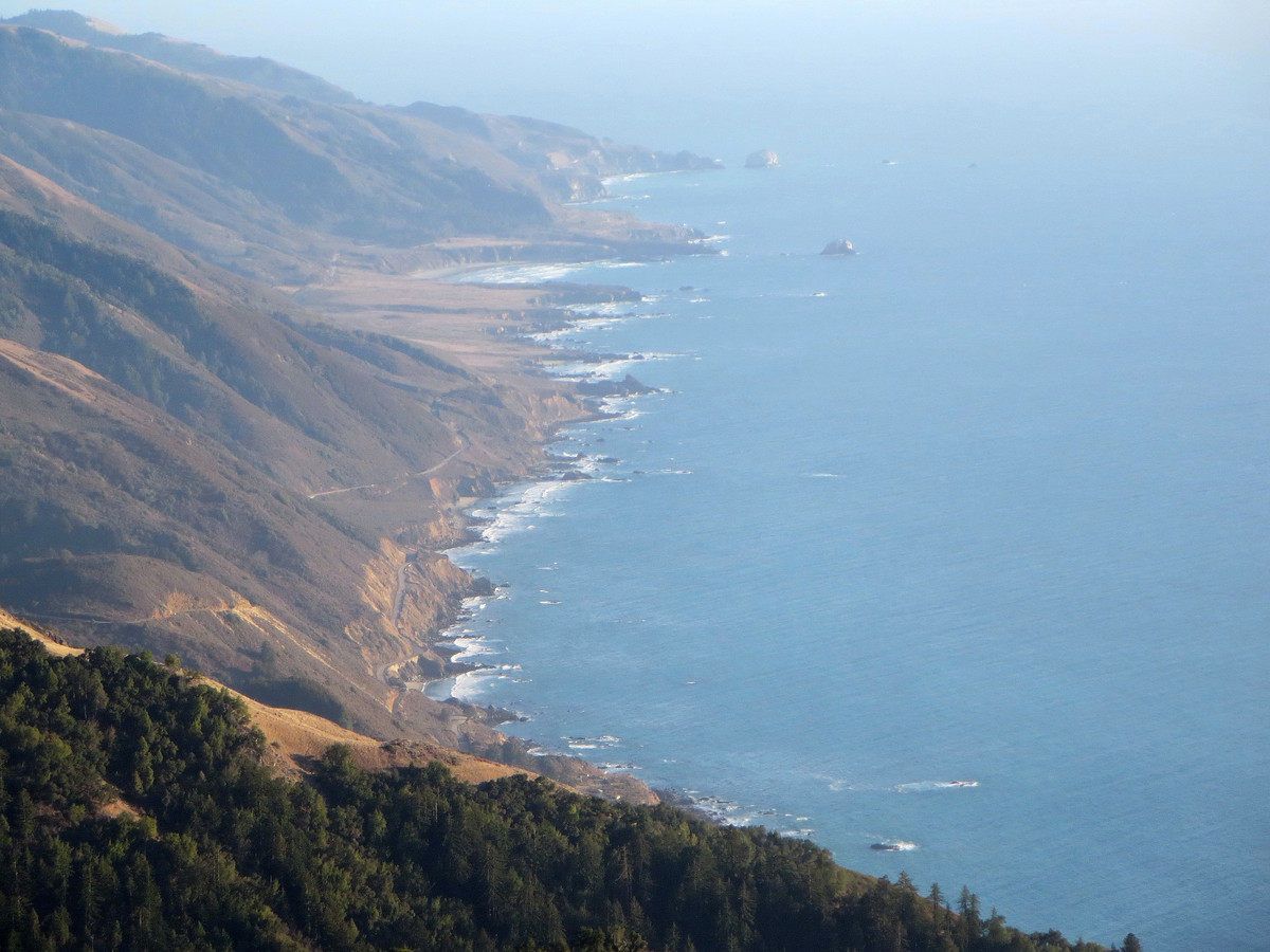
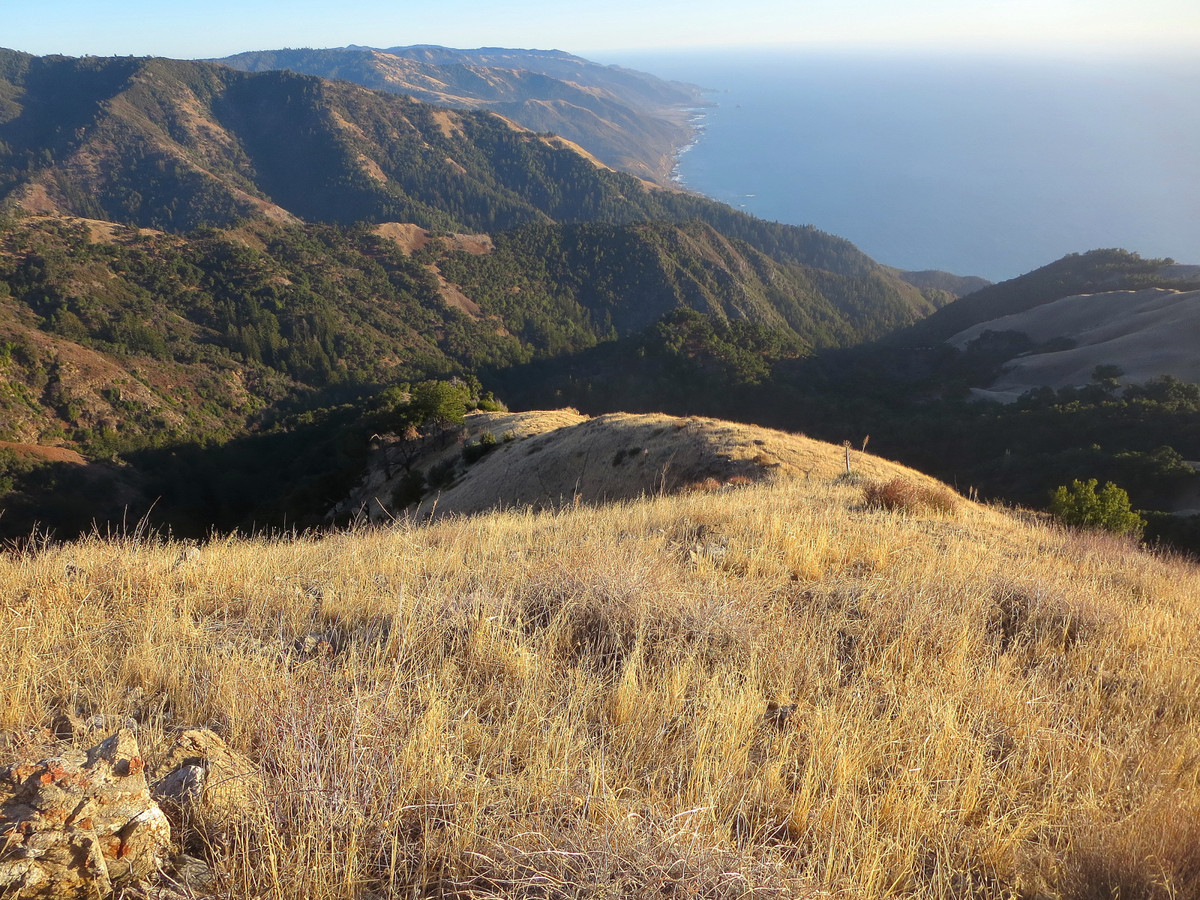
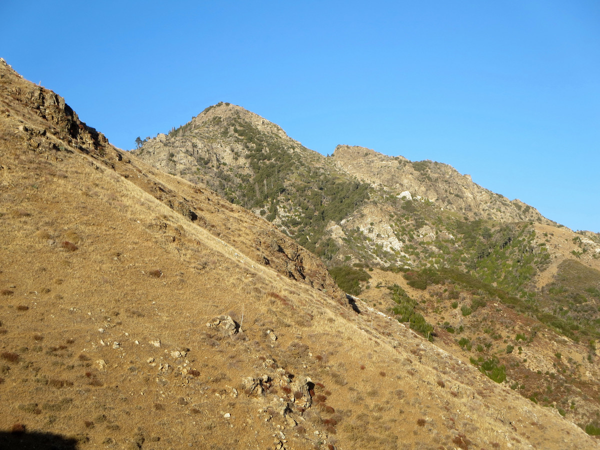
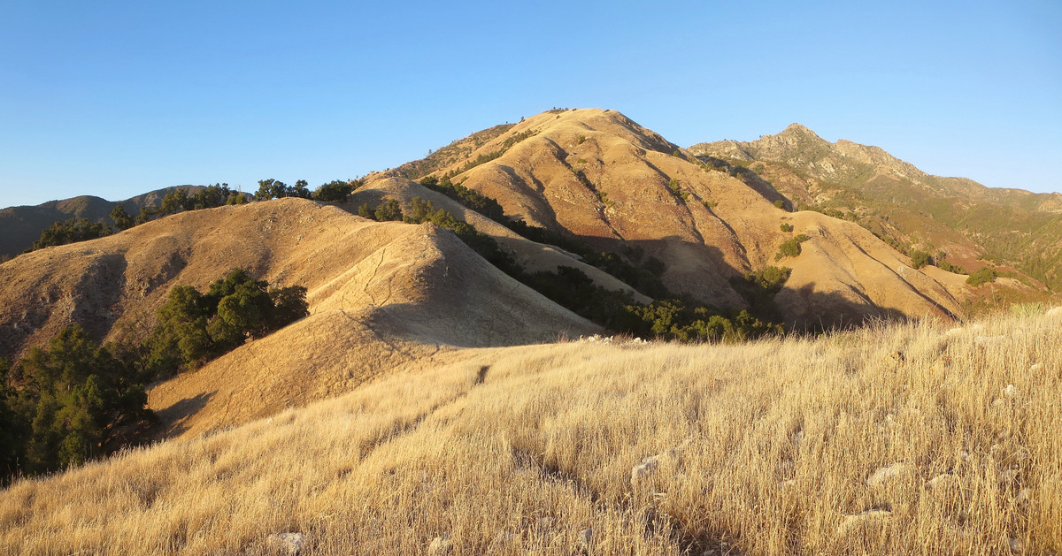
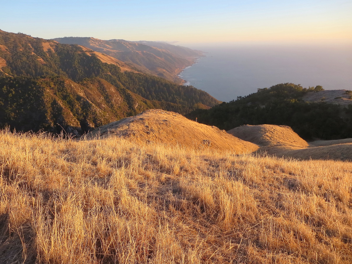
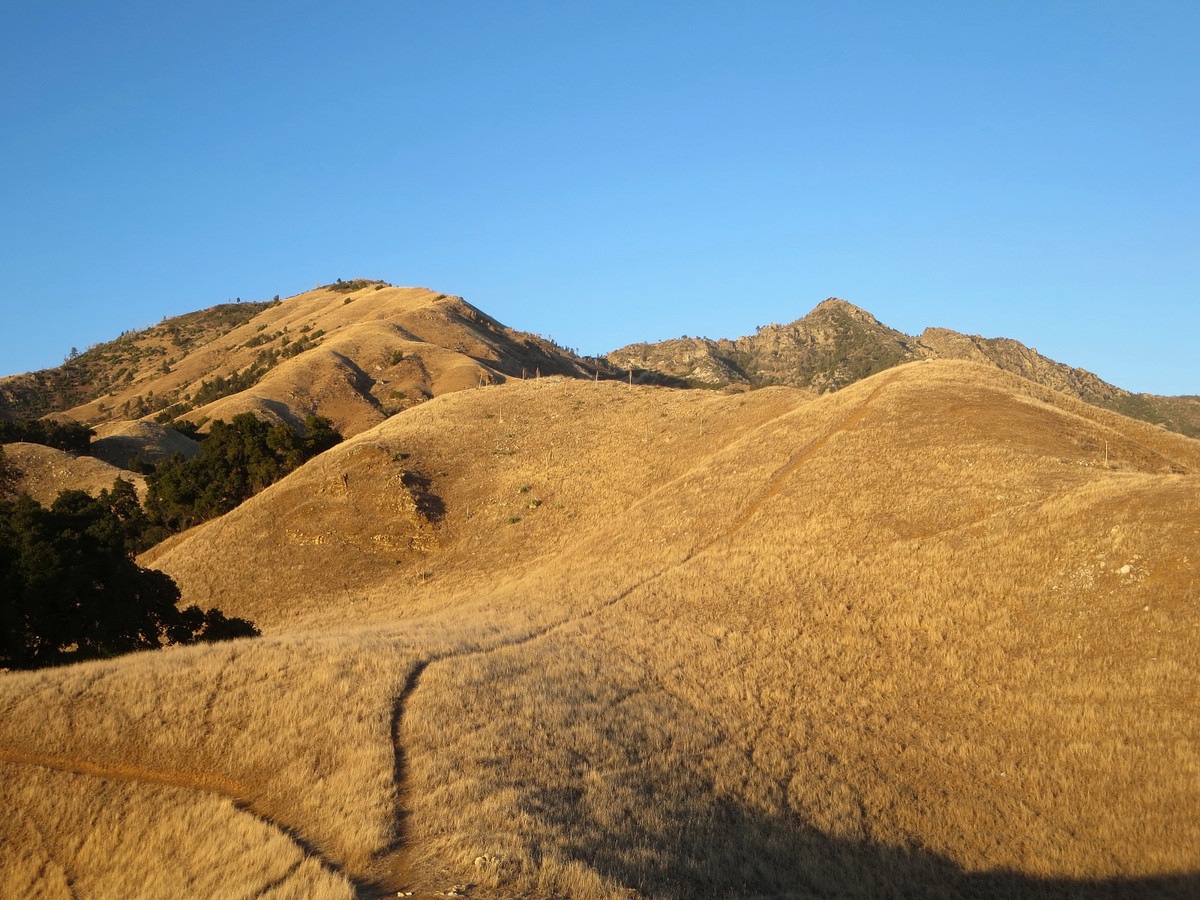
The Stone Ridge Sea to Sky route is extremely aesthetic remaining on the ridge crest virtually the entire way and features outstanding and uninterrupted scenery with a panorama that broadens with each ascending step. Fortunately, the non-stop views distract from the difficult nature of the steep use path. A section between 2,600 ft and 4,000 ft is particularly steep and relentless, a section I like to call “The Escalator” since there are tiny flat spots between the steep flights. This route features amazing diversity of ecosystems including redwoods, expansive grassland, oak woodland, chaparral, Coulter Pines and a rare forest of Santa Lucia Fir and Sugar Pine on the north side of Twin Peak and Cone Peak in the South Fork Devils Canyon. For my third time up Stone Ridge, I decided to visit in the afternoon to capture evening light after doing the Shouey-Plaskett loop in the morning. 
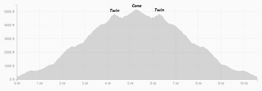
A picture is worth a thousand words and the only thing better is more pictures so this post contains around a hundred photos from the evening trip up Stone Ridge. Despite taking over 500 shots (from which I made this selection), I still managed to reach Cone Peak less than 2h10m after starting and I was back at the car before dusk for a roundtrip of 4h18m. I would be interested to see what I could do on this route sometime if I took speed seriously (i.e. left the camera in the car). Despite being half the distance of the all-trail Kirk Creek-Vicente Flat route, times appear fairly similar. I suspect a dialed-in Stone Ridge attempt would ultimately be faster. Regardless of speed, Stone Ridge Direct is definitely a route I look forward to doing many times in the future with hundreds more photos. Hopefully I’ll also be on the route when the mythical winter snow event turns Stone Ridge to a striking white. Strava GPS route here. 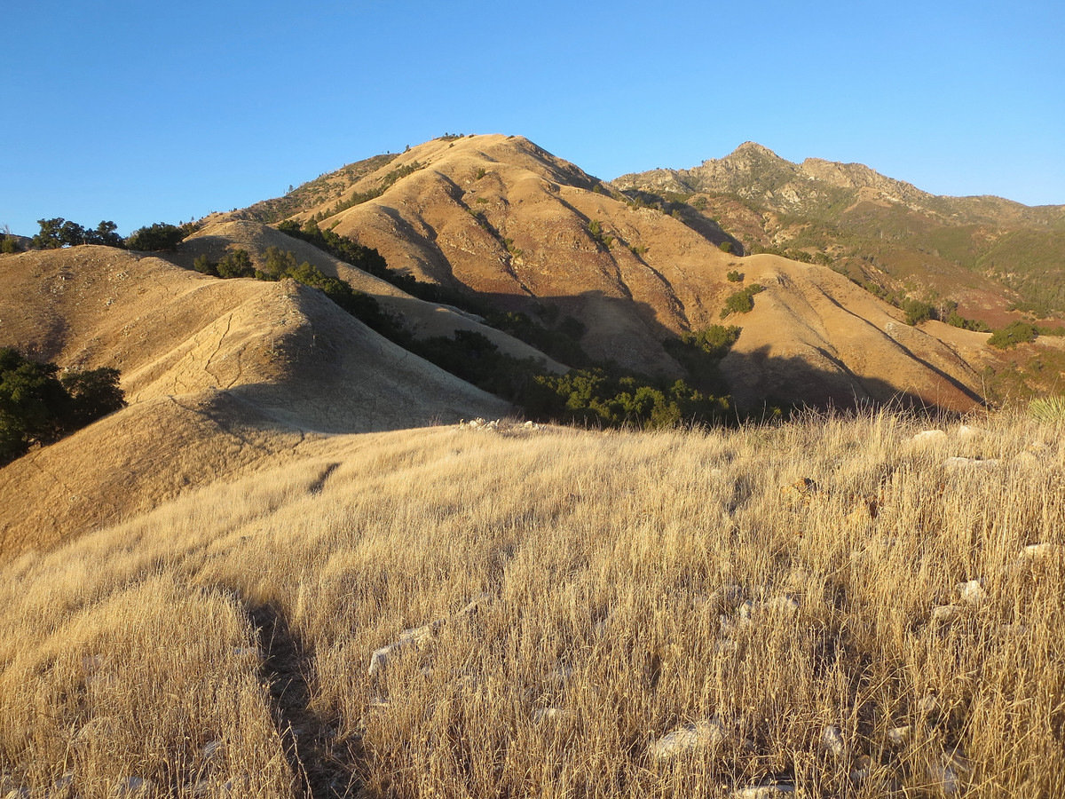


I tried getting to Stone Ridge via Limekiln like you did, but I never did find the way to Stone Ridge. Once you enter the Limekiln Canyon from that old road, how do get to Stone Ridge? Neither the rangers at Big Sur Station nor the ones at Limekiln State Park itself could tell me.