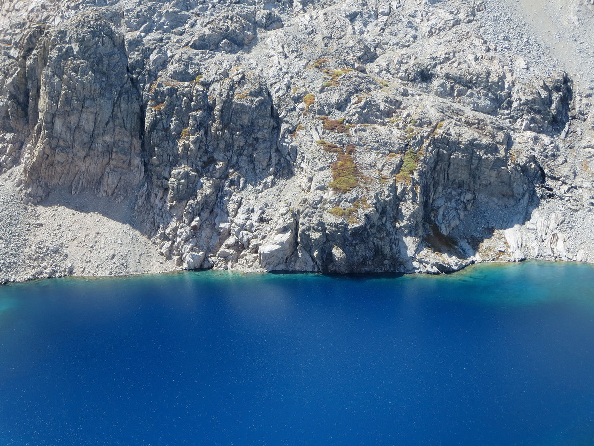
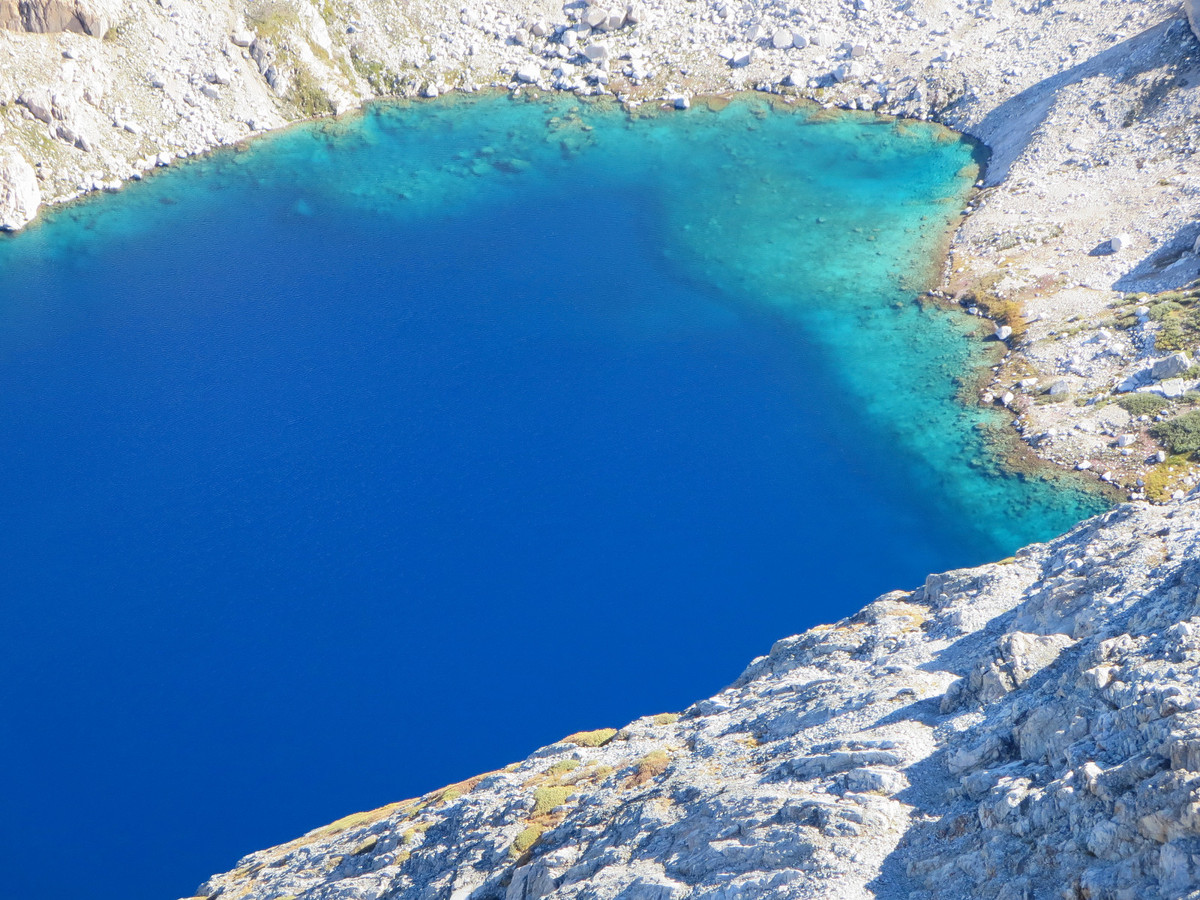
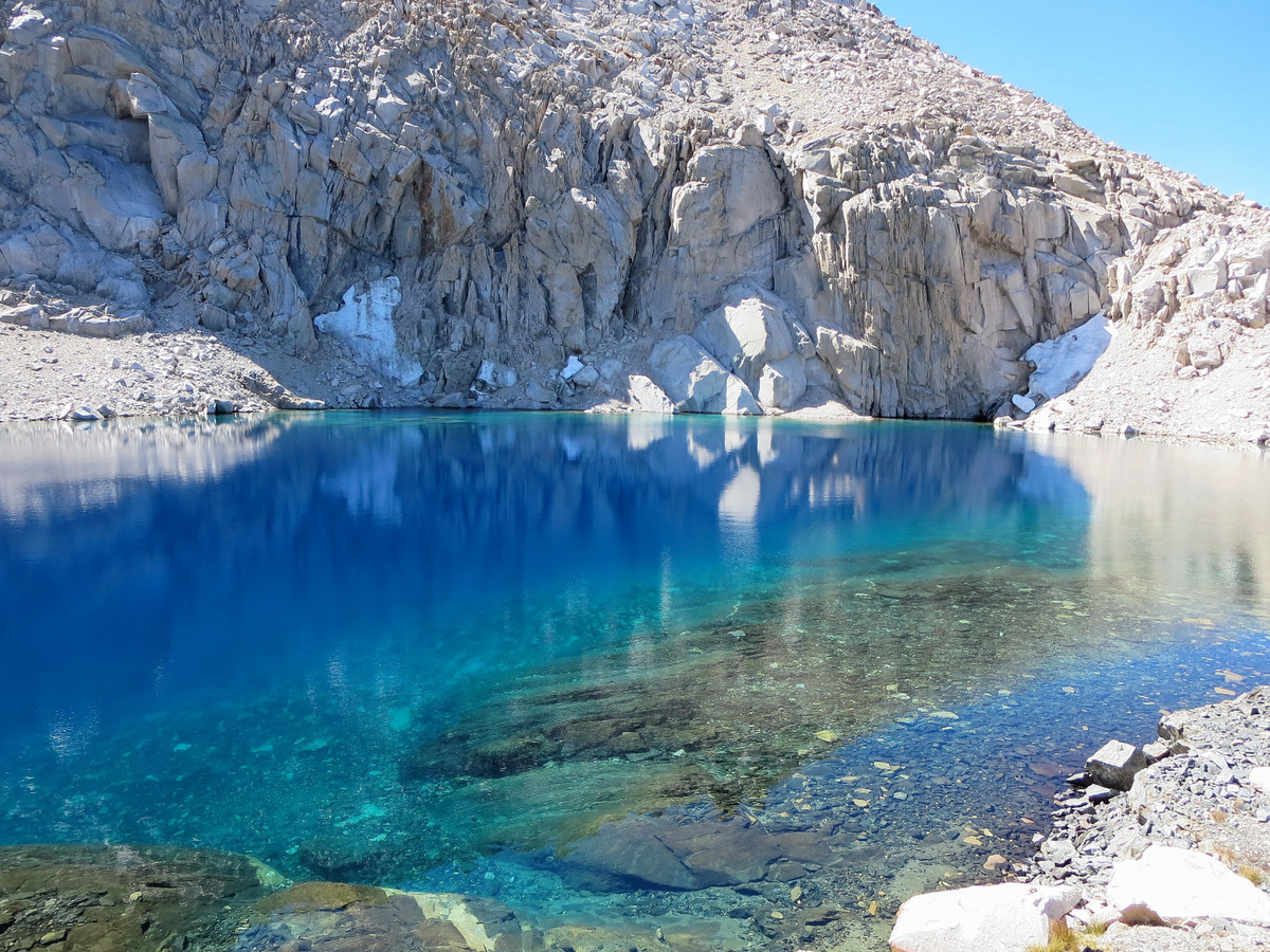
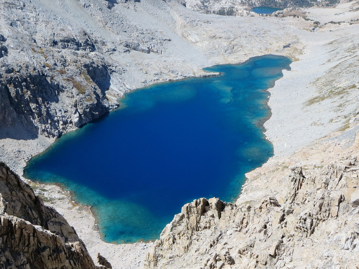
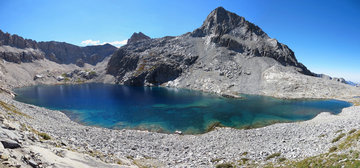
The “Lion Loop” is a spectacular large loop that I designed out of Wolverton utilizing the High Sierra Trail and the Tablelands to access one of the most remote corners of the High Sierra along the Great Western Divide. Lion Lake is the centerpiece feature of the route and is absolutely stunning with Triple Divide Peak and Lion Rock creating an impressive background against its azure waters. The entire region is highly scenic with a rugged and wild feeling that is among the finest in all of the High Sierra. Strava route here.

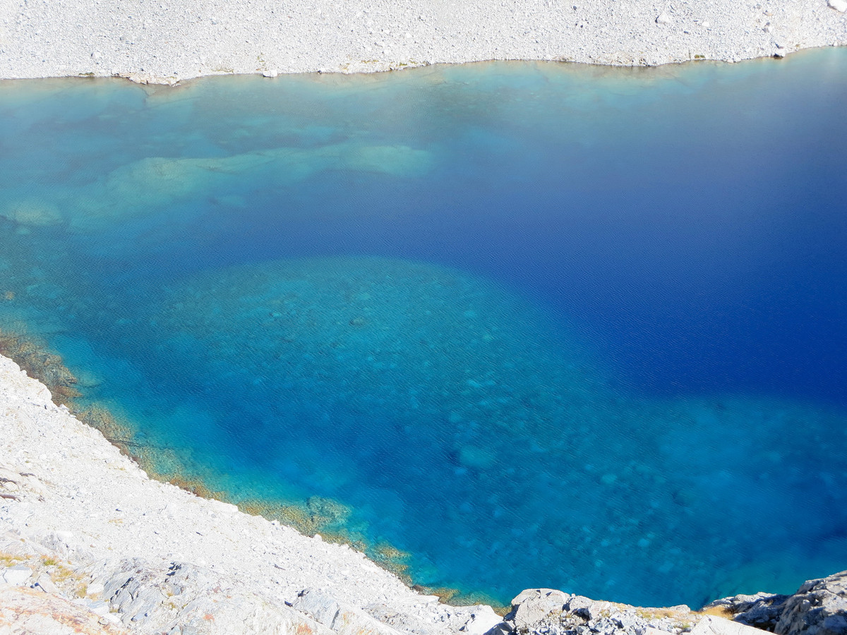
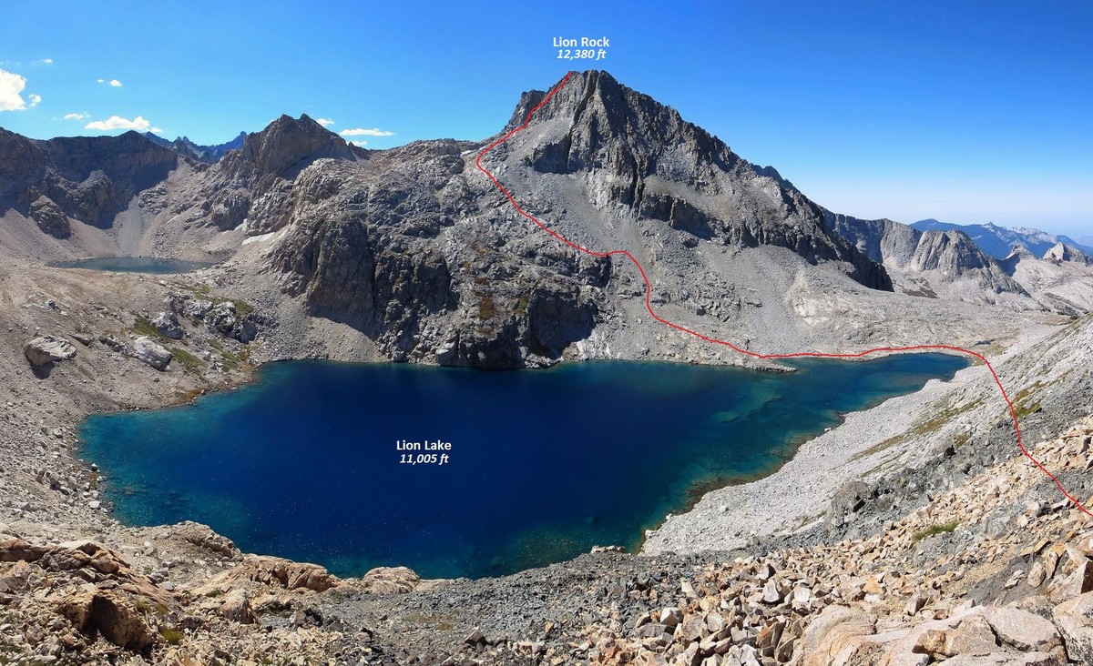
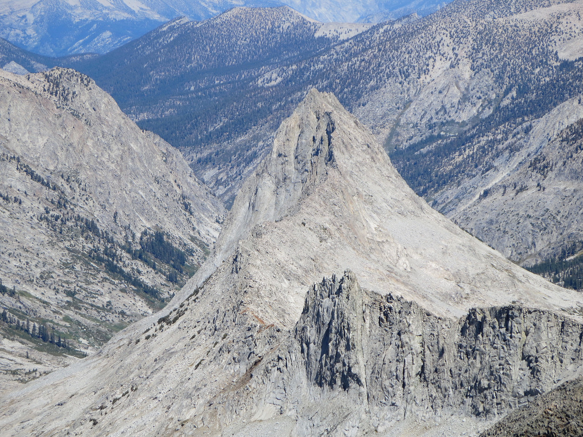
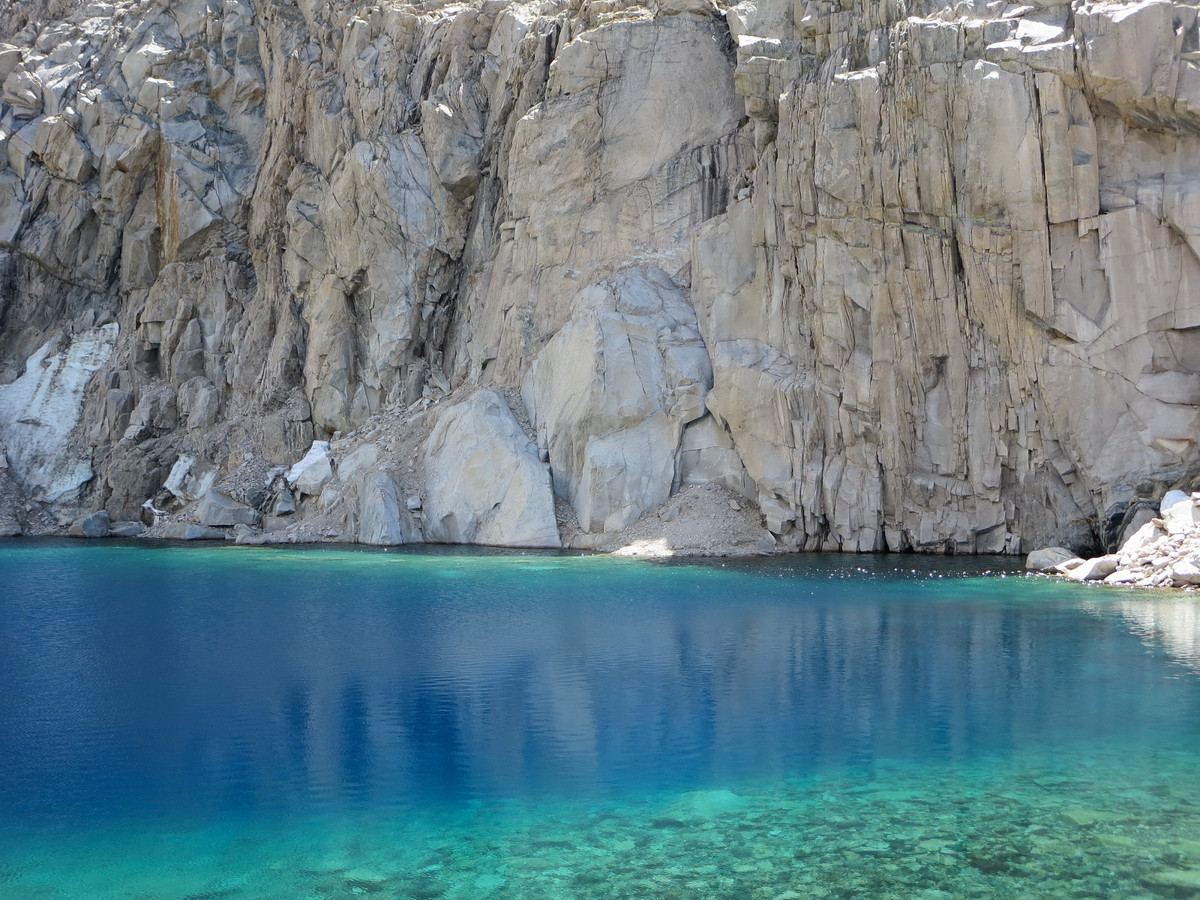
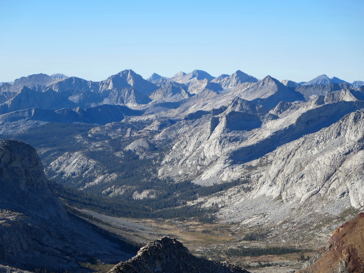
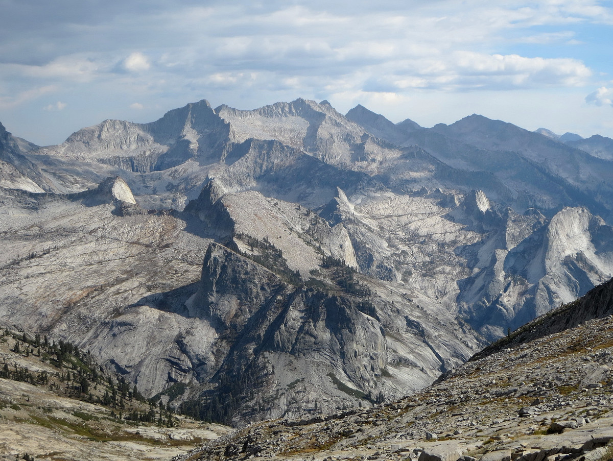
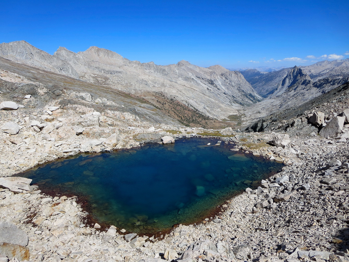
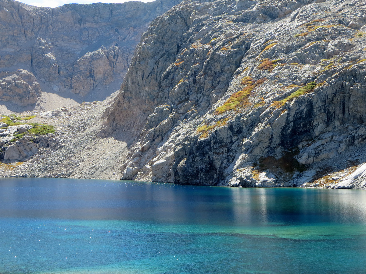
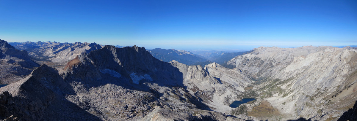
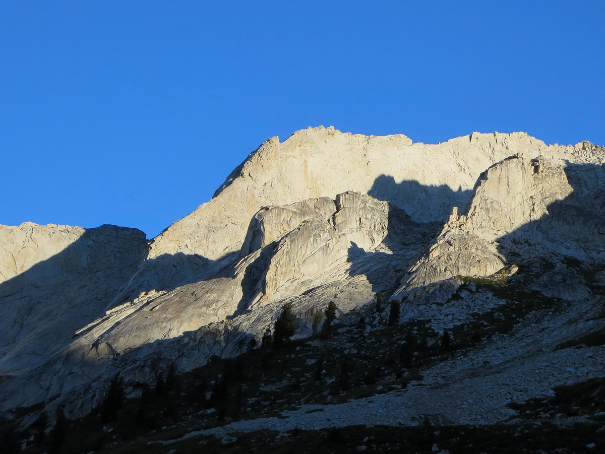
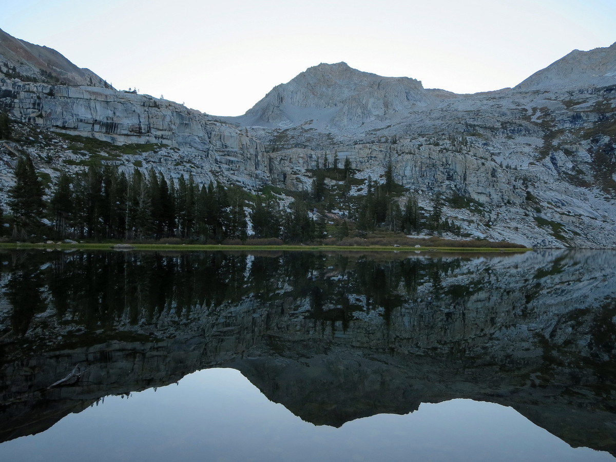
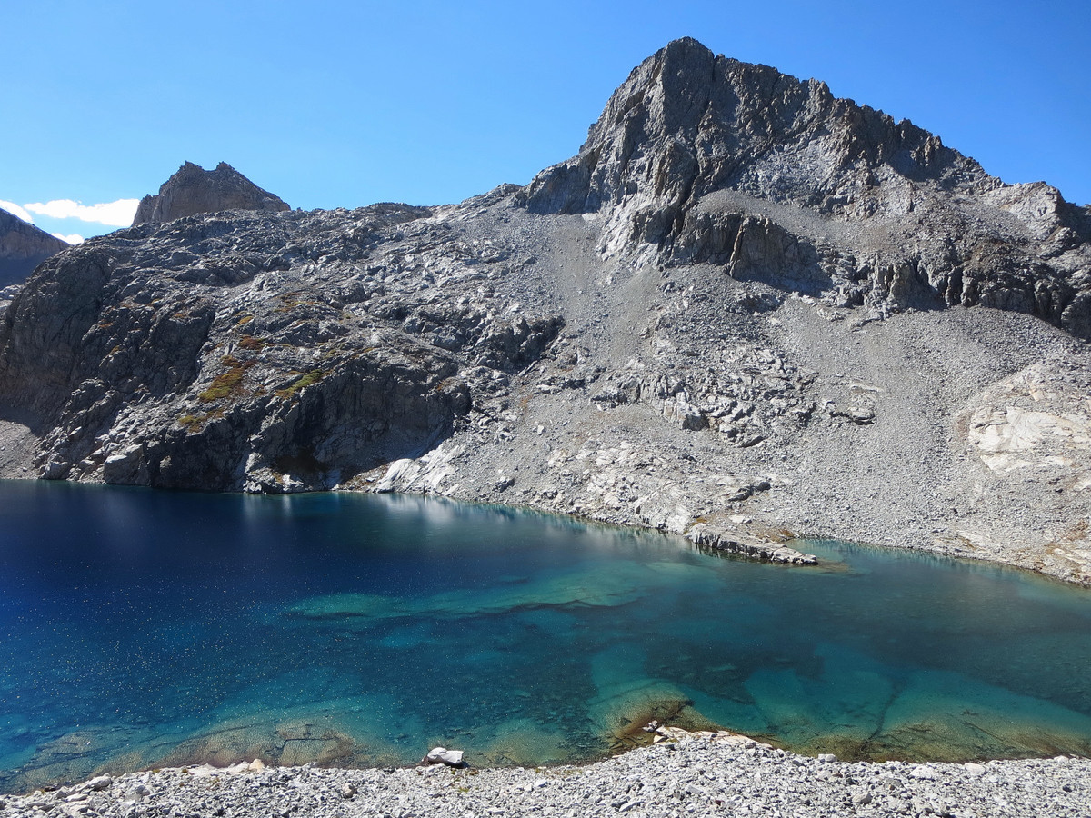
I started at 3:25 a.m. and had about 2.5 hours of nighttime running through Bearpaw meadows. Continuing to Tamarack Lake I gazed up at the impressive granite domes and faces lining the canyon. Beyond Tamarack Lake, I made my way efficiently up granite slabs and benches until the last 500 vertical to the summit of Lion Rock. There is some loose rock in this final scramble section and the class 3 route was not immediately obvious, but not hidden either and I soon found myself at the summit enjoying a magnificent view in all directions, but the favorite angle was down to Lion Lake glistening in the early morning sunlight framed by the triangular-shaped Triple Divide Peak. From the summit of Lion Rock I decided to attempt descending the northeast chute. At first the downclimbing was easy but then I reached a crux portion – the final few feet to get into the chute proper was pretty smooth granite with few features. I’m not a rock climber so I was not comfortable with most of the options until I found a solution across the face and into the chute that I could manage. It was probably low 5th class. There might have been a third class access point somewhere, but I didn’t find it and I’m thinking access is much easier when the chute is filled with snow. After gently lowering myself through the remainder of the extremely loose and steep chute, travel was surprisingly straightforward and efficient to Lion Lake where I enjoyed the stupendous views of the lake and surroundings every step of the way.
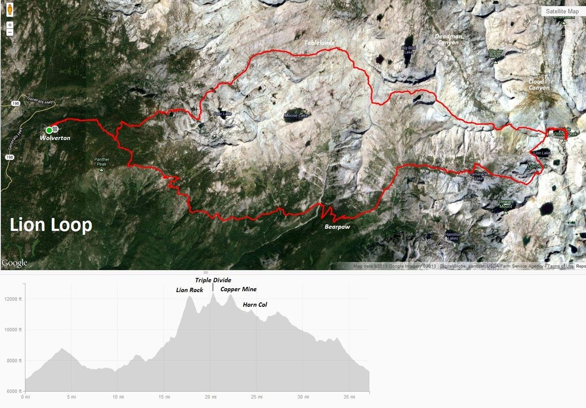
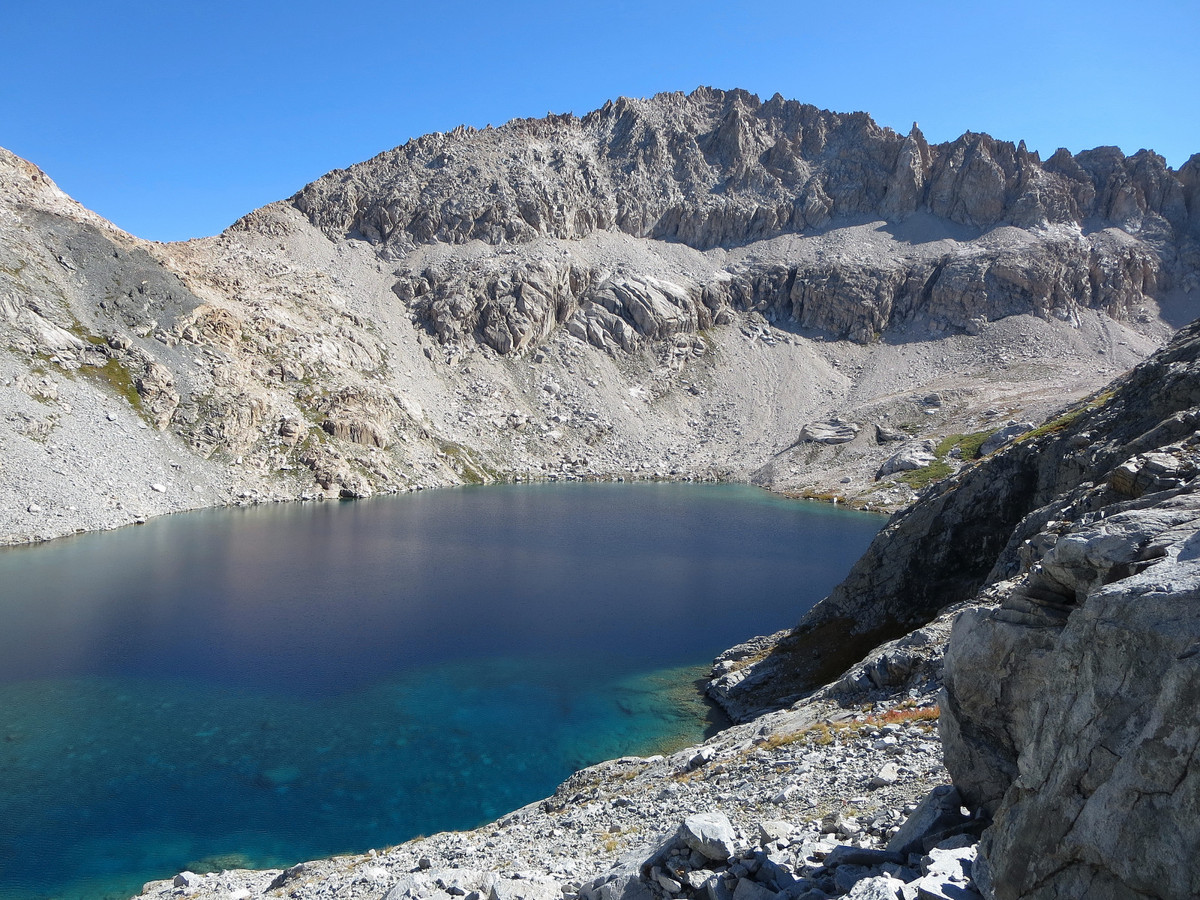
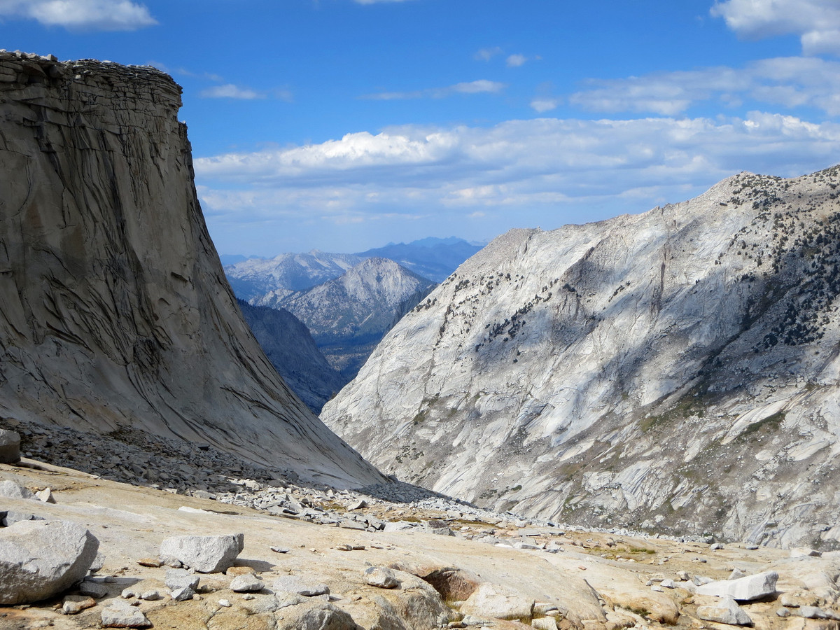
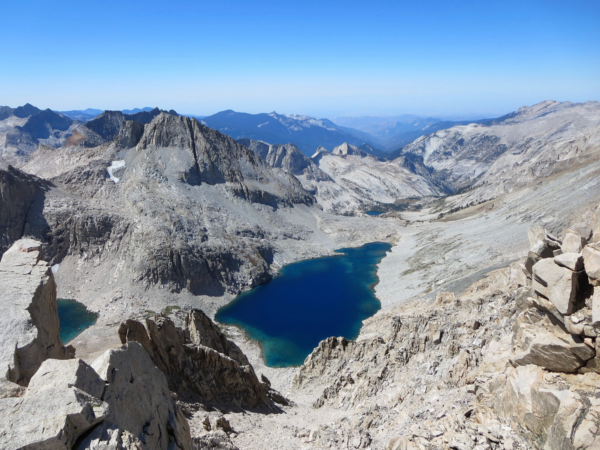
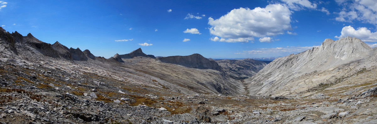
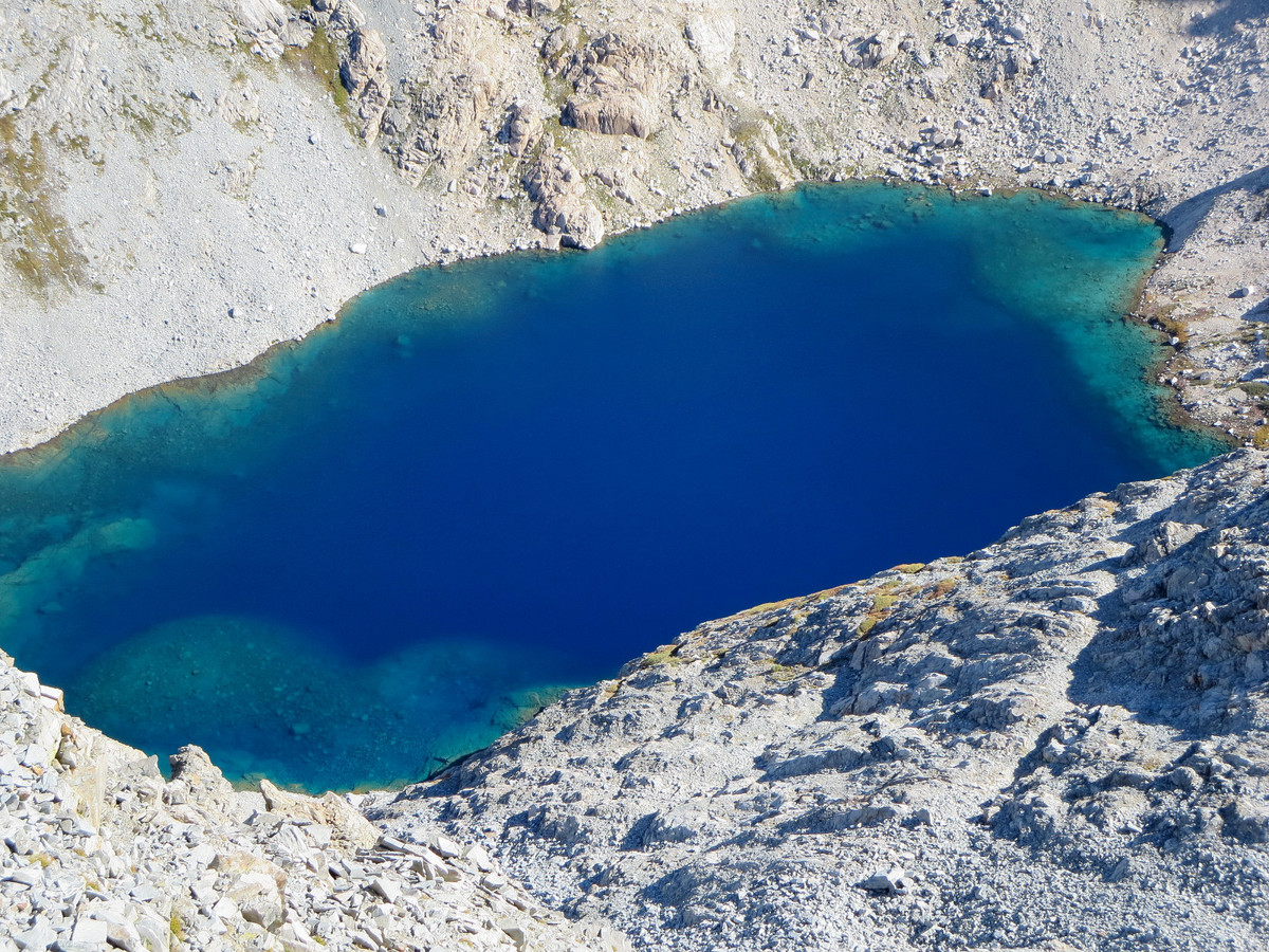
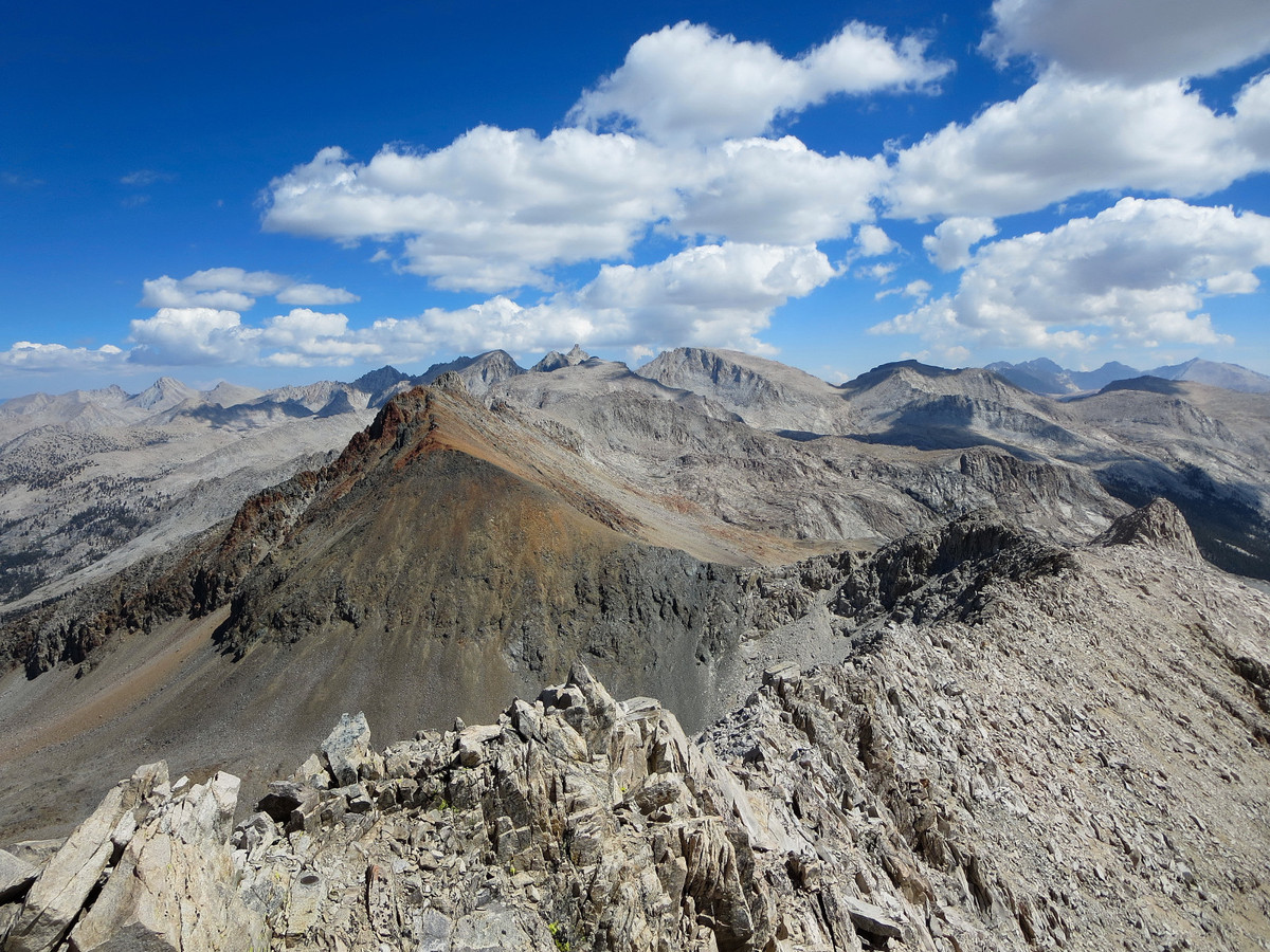
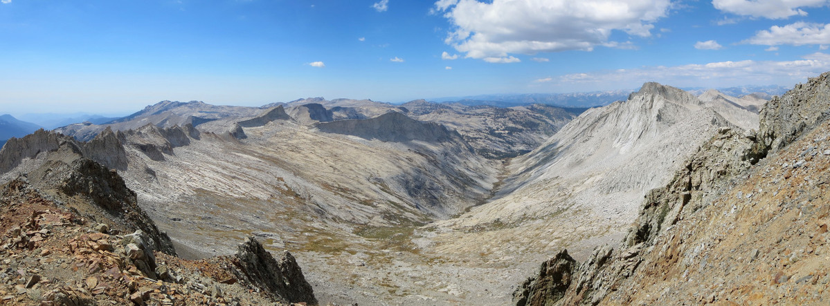
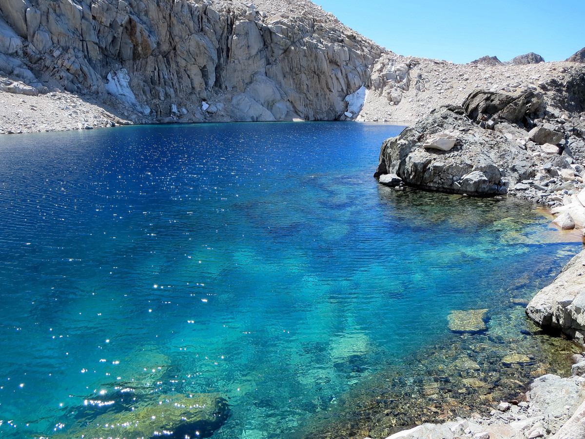
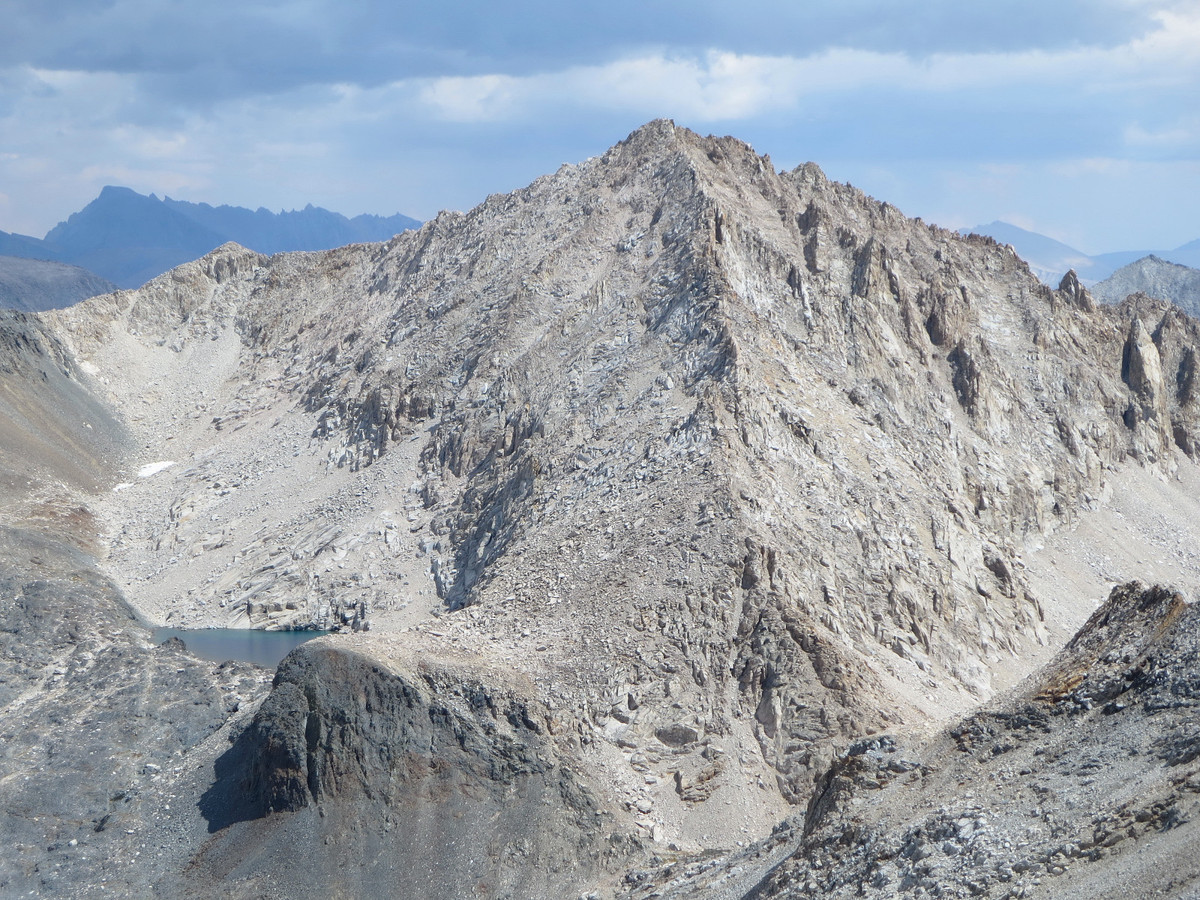
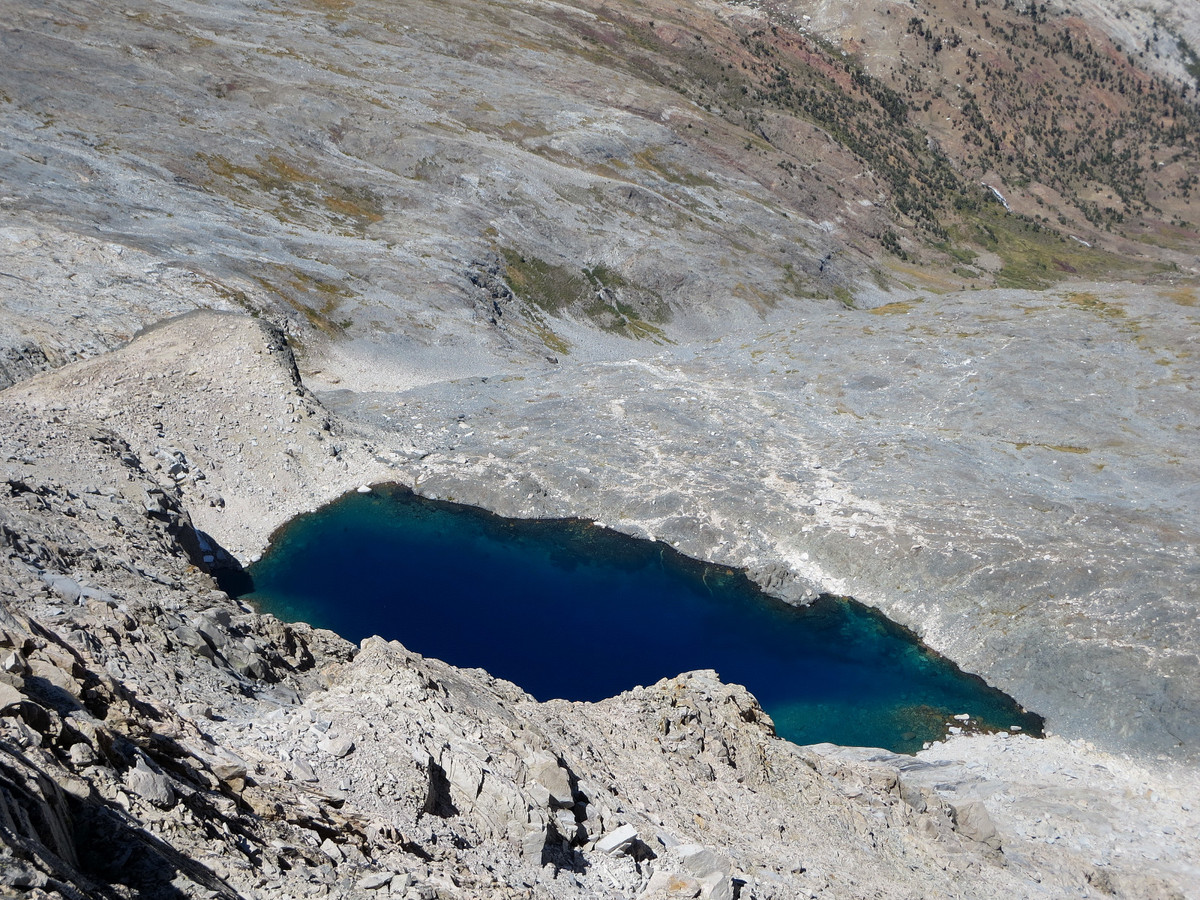
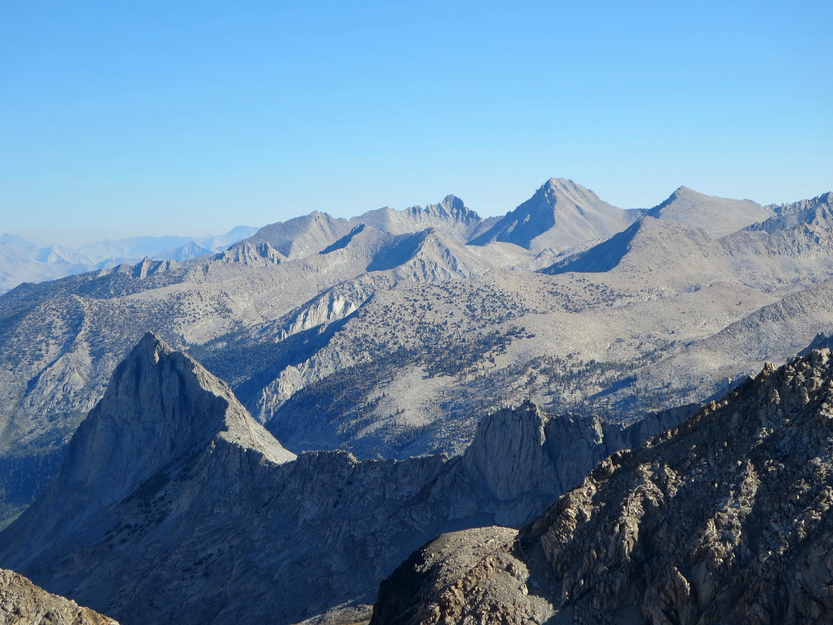
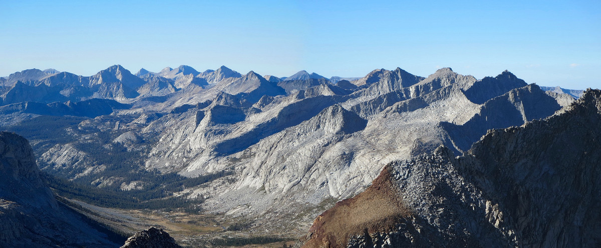
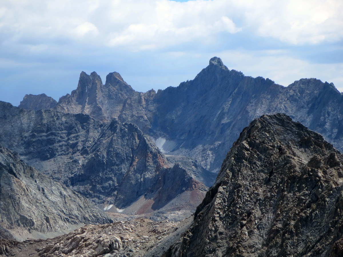
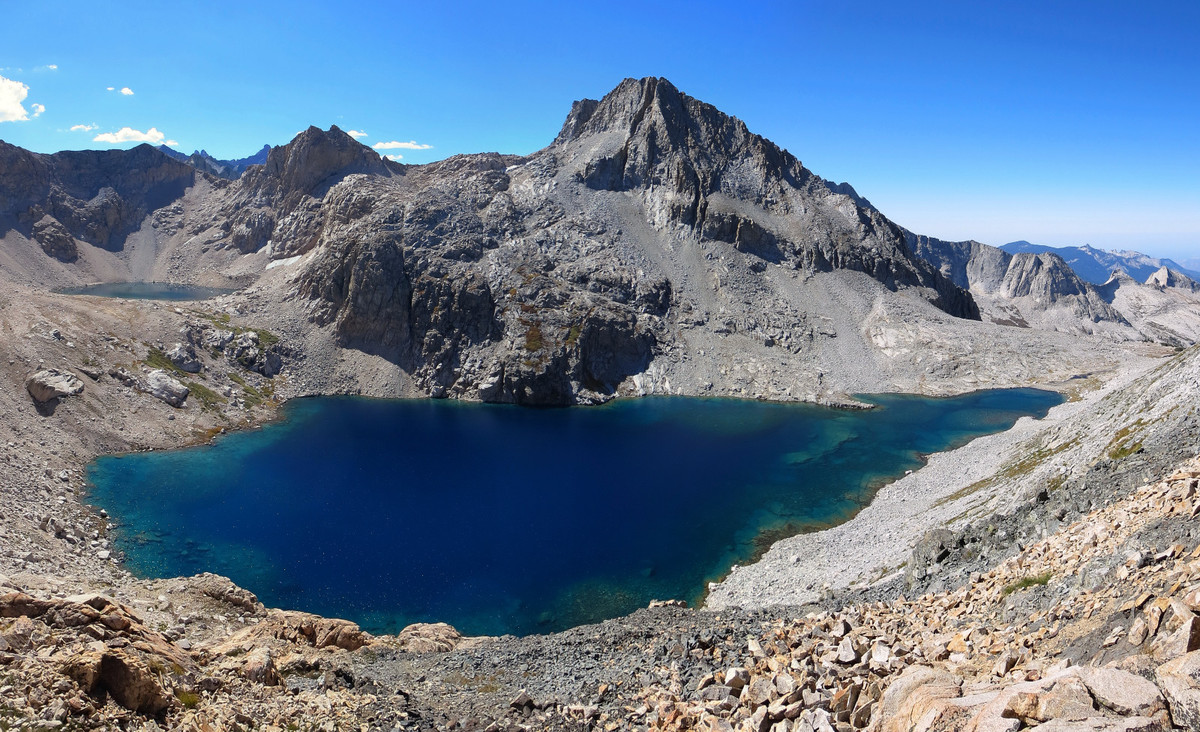
Rounding my way around Lion Lake, I then went up to Lion Lake Pass. From the pass, I went around a buttress to beautiful Glacier Lake. The lake is tucked in under an impressive rock face and reminds me of Precipice Lake along the High Sierra Trail. The view from the lake down Cloud Canyon and the Whaleback are equally impressive. From Glacier Lake, I took a loose chute up Triple Divide’s north face with some fun class 3 scrambling in the upper reaches. Triple Divide Peak is aptly named as it divides the three primary river drainages of the Southern Sierra: the Kings, Kern and Kaweah. From Triple Divide I returned back to Glacier Lake and just below Lion Lake Pass before traversing toward Copper Mine Pass. Instead of going to the pass I ascended the peak at the head of basin dividing Cloud Canyon and Deadman Canyon – “Copper Mine Peak.” This peak featured more amazing views down both of these canyons. From the summit of Copper Mine Peak an old use trail heads west to a saddle for easy access into Deadman Basin. In this area I passed by some rusty, old and rudimentary mining artifacts. The trek across Deadman Basin to Horn Col was spectacular with gorgeous views down Deadman canyon. From Horn Col, I traversed across the basin to Pterodactyl Pass and then rounded Big Bird Peak’s shoulder to the Tablelands. Descending the Tablelands through the Marble Fork of the Kaweah River was fast I was soon at the Pear Lake backcountry ranger outpost and on the maintained trail. From here it was a fairly quick jog over the last 6 miles back to Wolverton for a 15h42m minute day. Strava route here.


I wonder, do you ever get anxious about being out there alone so far from civilization? Beautiful photos of the water.
Thank you for you entry. Some friends and I tried a similar route in 2009, but we did not quite make it to Lion Lake. We came form Wolverton to Moose, and over that way, and were going to go over the pass from Lion lake to Nine Lakes Basin, but instead went out to Tamarack. I would like to try your trip sometime. (my trip report can be seen at: http://nicholasmeier.wordpress.com/2009/08/31/wolverton-to-almost-triple-divide-loop/
Leor, would you happen to have any pictures from the area with the mine artifacts? Specifically, I am interested in that pass right above it, which I believe is the real Elizabeth Pass (See my latest blog post at 100peaks.com) If you happen to have any shots down to Tamarack Lake, that would be awesome. http://100peaks.com/2015/09/15/solving-a-1904-mystery-is-elizabeth-pass-misplaced-on-maps/ Thanks!
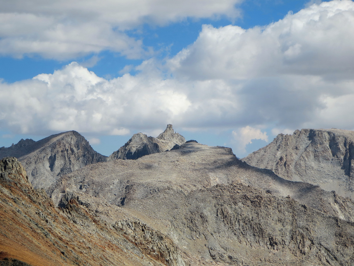
I could actually see a little bit of it from your pano from Lion Rock, which is pretty cool to see. Hard right, I could see the grove of trees and the green ledge.