Photos here.
The Pioneer Loop is a complete loop (no repetition) coming in around 22 miles and offers a great mix of scenery of the Mono Recess region. Highlights of the route include Ruby Lake, Mono Pass, Trail Lakes, Pioneer Basin, Mount Stanford and Hilton Creek Lakes. There are numerous route variations, additional peaks and potential side trips including Mount Starr, Mount Huntington, Mount Hopkins Mount Crocker, Mount Morgan, Fourth Recess Lake and Third Recess Lake. There is plenty here to explore over several trips! GPS track here. 

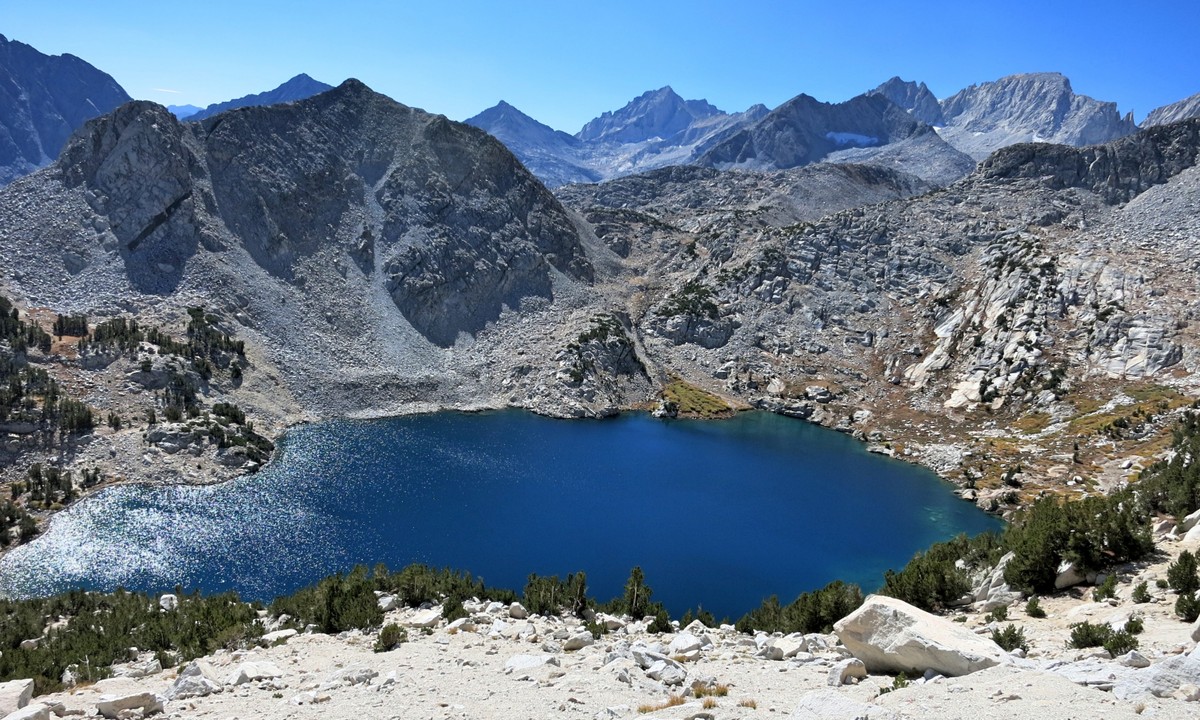
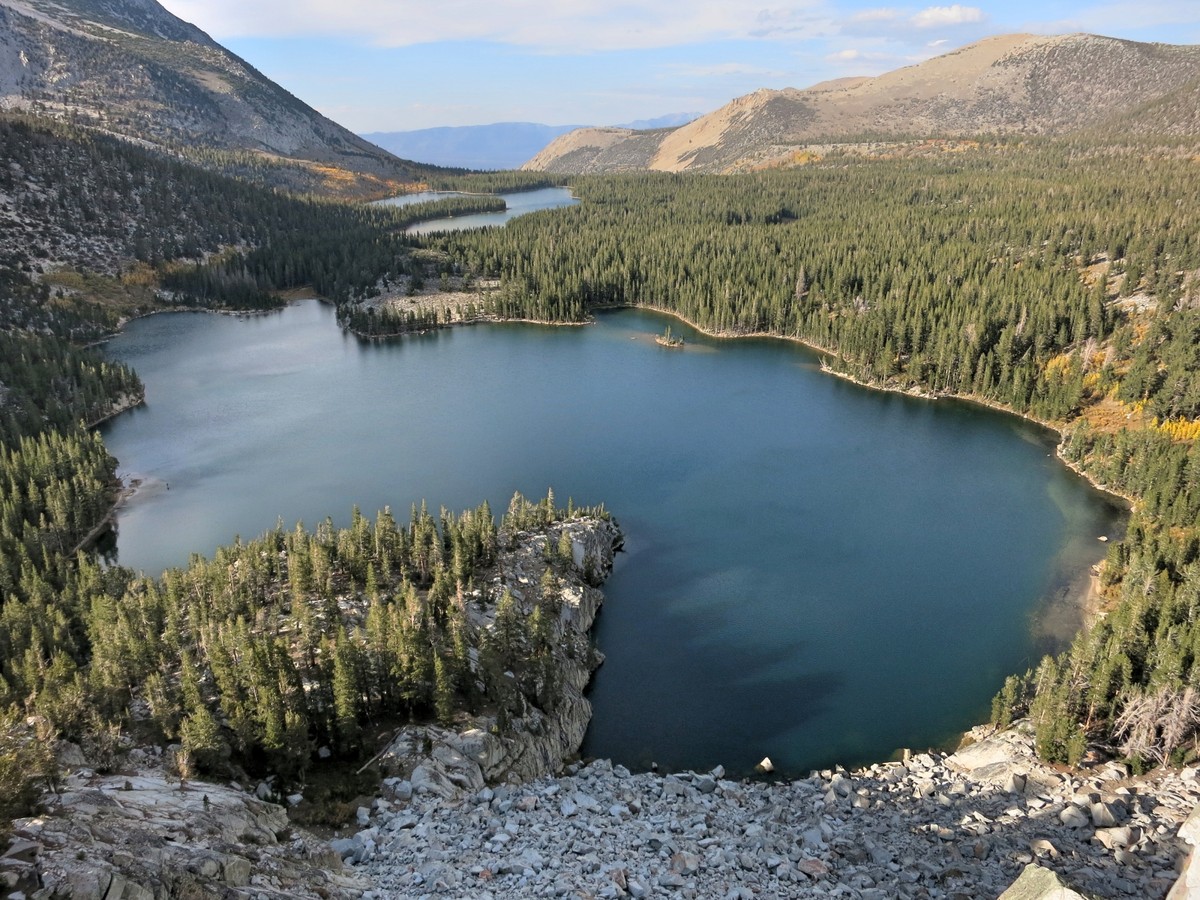
 The route starts at the ever-popular Mosquito Flat Trailhead at the end of Rock Creek Road. Most visitors are headed to the spectacular Little Lakes Valley which arguably offers the most bang for the buck in the High Sierra in terms of superb scenery for relatively little effort. The trail to Mono Pass splits from the Little Lakes Valley Trail a half mile from the trailhead and the foot traffic on the Mono Pass trail is substantially reduced, although still well traveled. As one gains elevation the views of Little Lakes valley improve with several vistas where one can take in the string of alpine lakes with Bear Creek Spire at the head of the valley. The trail traverses into a bowl where lovely Ruby Lake resides. A short spur-path leads to the shores of the lake while the main trail begins a series of switchbacks. At the top of these switchbacks as the trail begins its traverse to Mono Pass is an amazing view of Ruby Lake with the rugged peaks of the Bear Creek Spire group in the background.
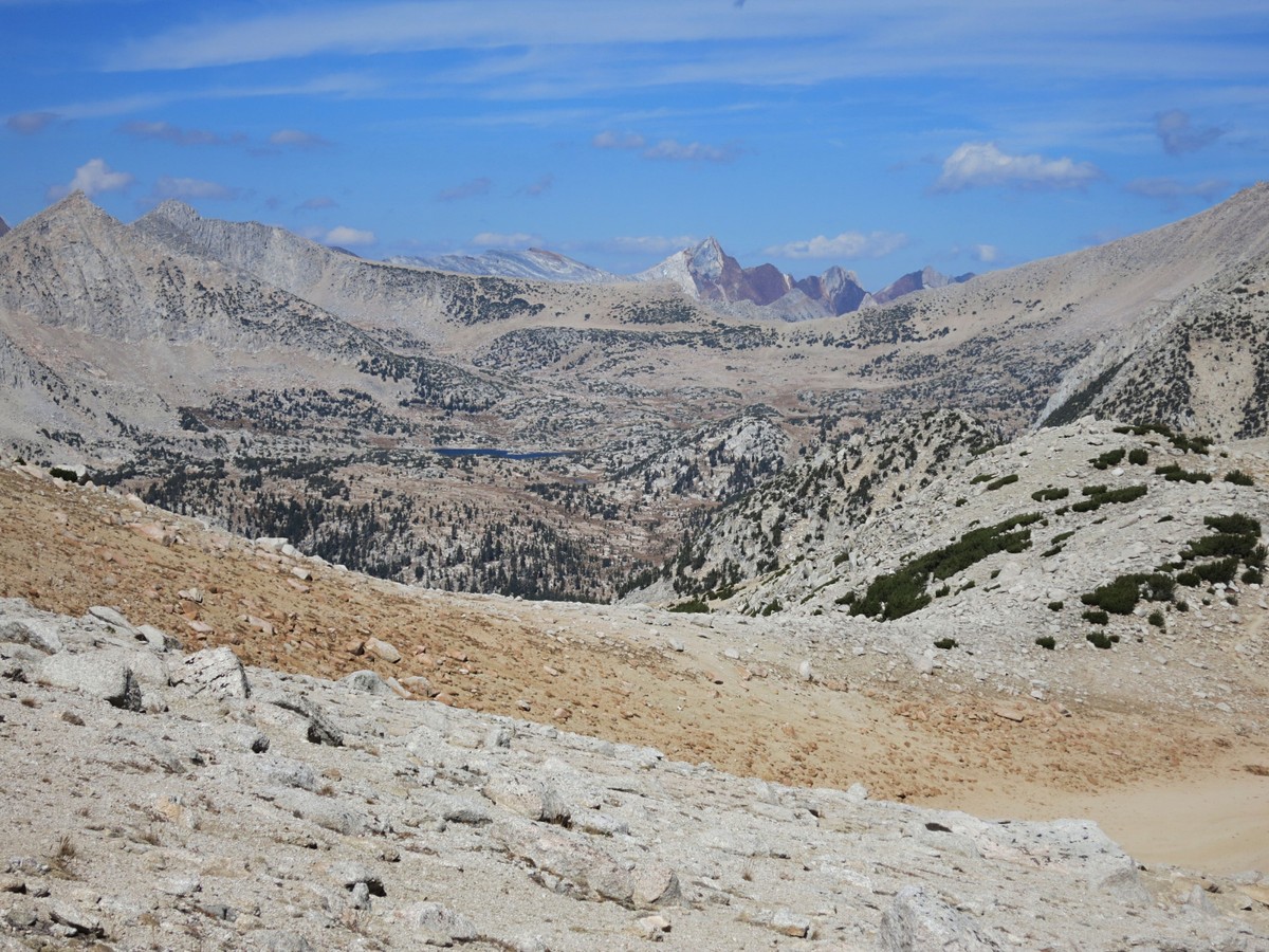
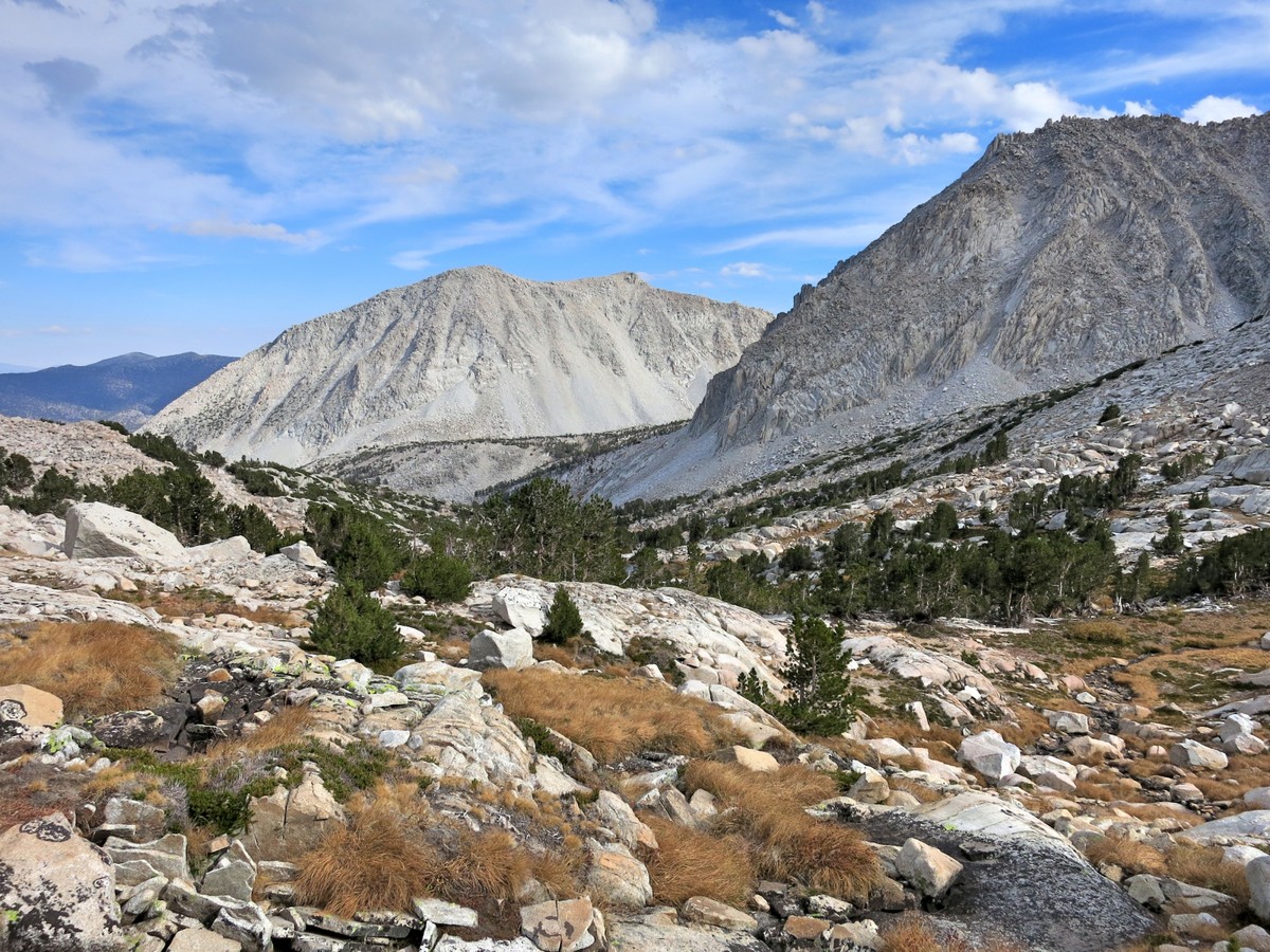
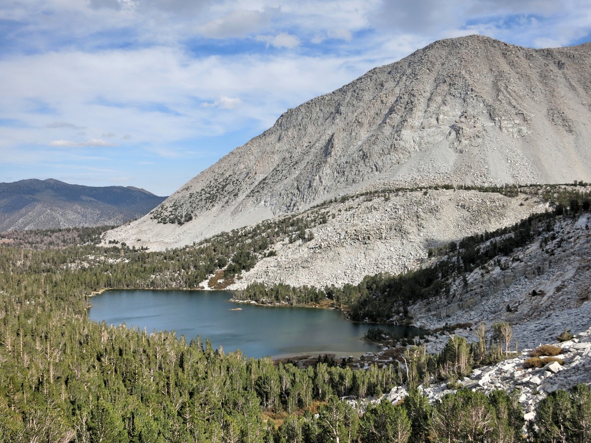
 Beyond the Ruby Lake vista, the trail enters a small hanging valley and then makes a final push to Mono Pass. Mono Pass and the terrain to the north is rock and tundra. The blue waters of Summit Lake are a sharp contrast to the desolate and barren landscape. Descending from Summit Lake to Trail Lakes the vegetation begins to increase with clumps of pine trees and excellent views across the Mono Creek canyon to Pioneer Basin and adjacent peaks. Red Slate Mountain and Red and White Mountain rise above the first set of mountains with their striking red color. Trail Lakes are nestled in a pretty bowl making for a nice location for the snow course cabin. From Trail Lakes the trail drops down into the upper reaches of Mono Creek Canyon and enters a mature pine and fir forest. Shortly after passing the junction with the spur path to Fourth Recess Lake, the trail reaches another junction with the trail to Pioneer Basin. The path to Pioneer Basin starts out relatively flat but soon begins a moderate to steep ascent to the first lakes in the basin.
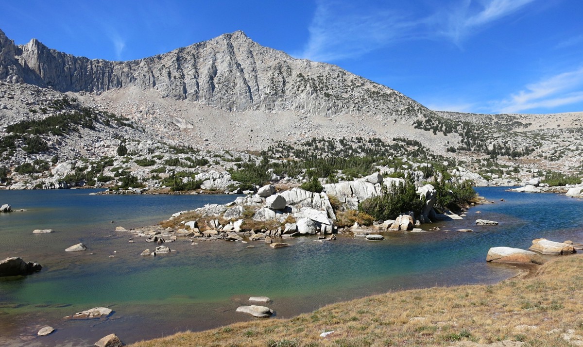
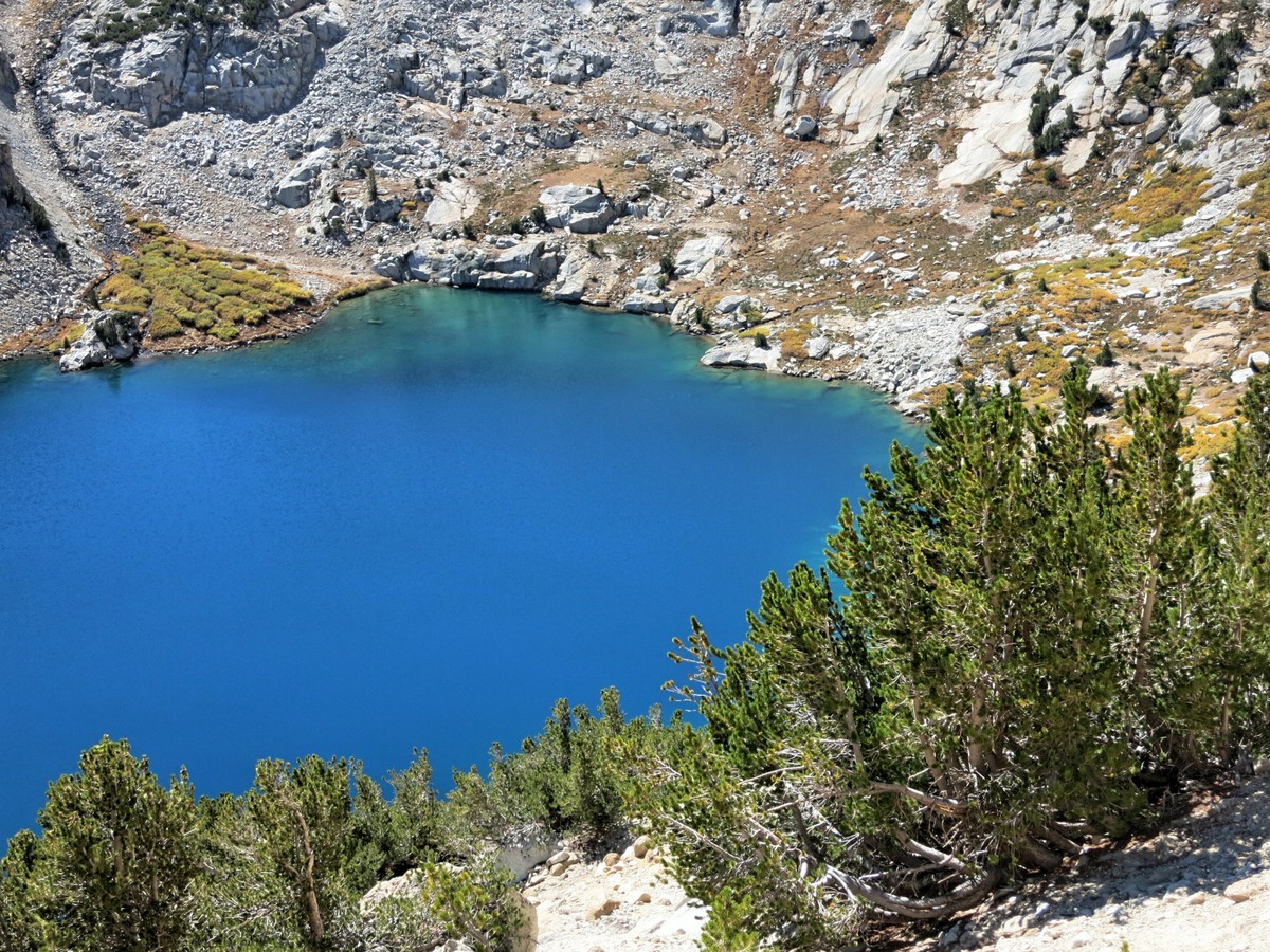
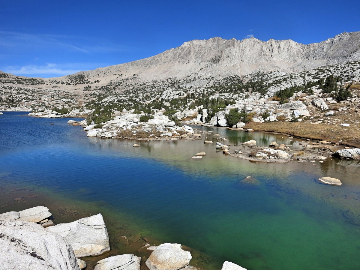
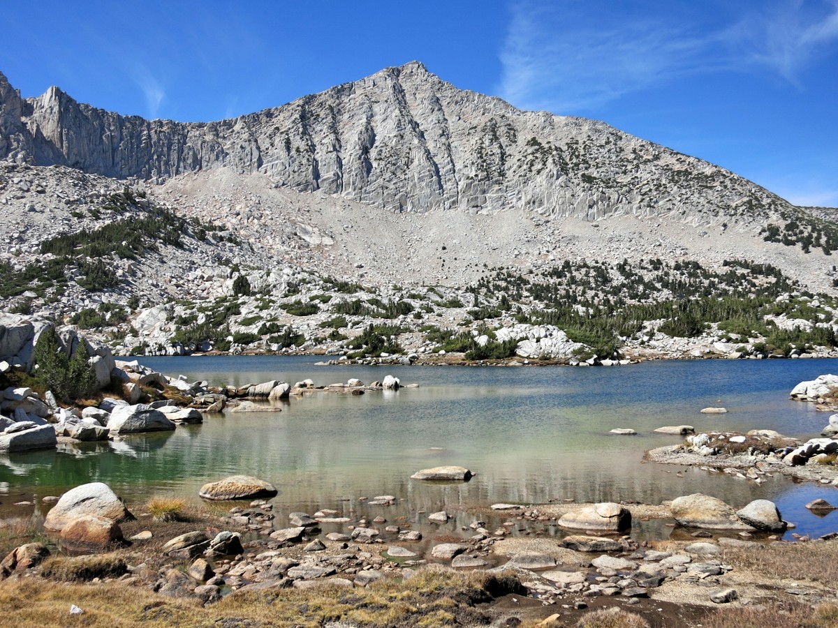
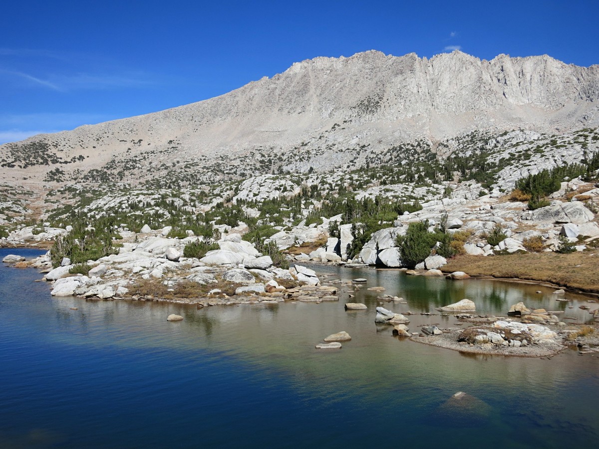
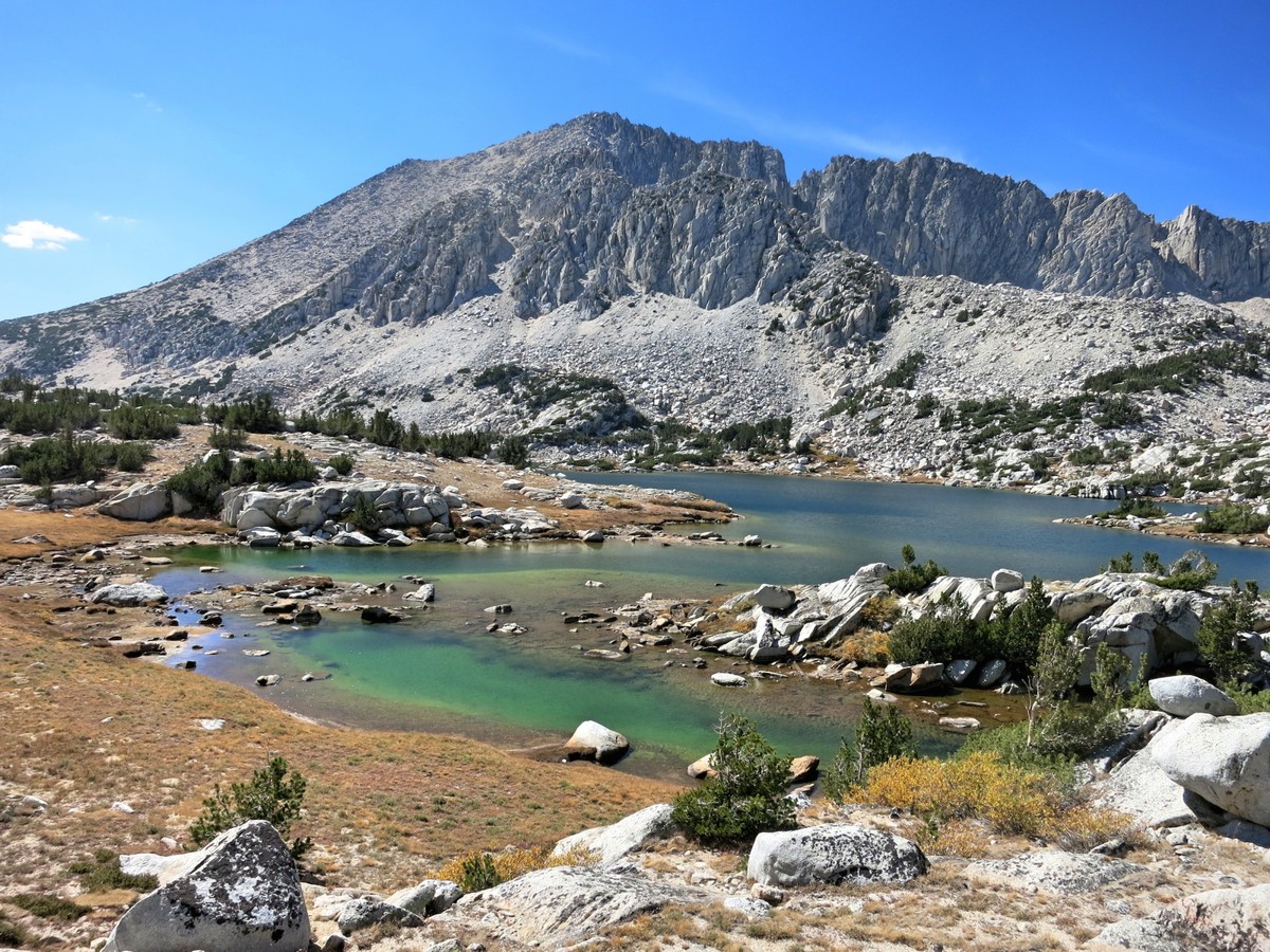
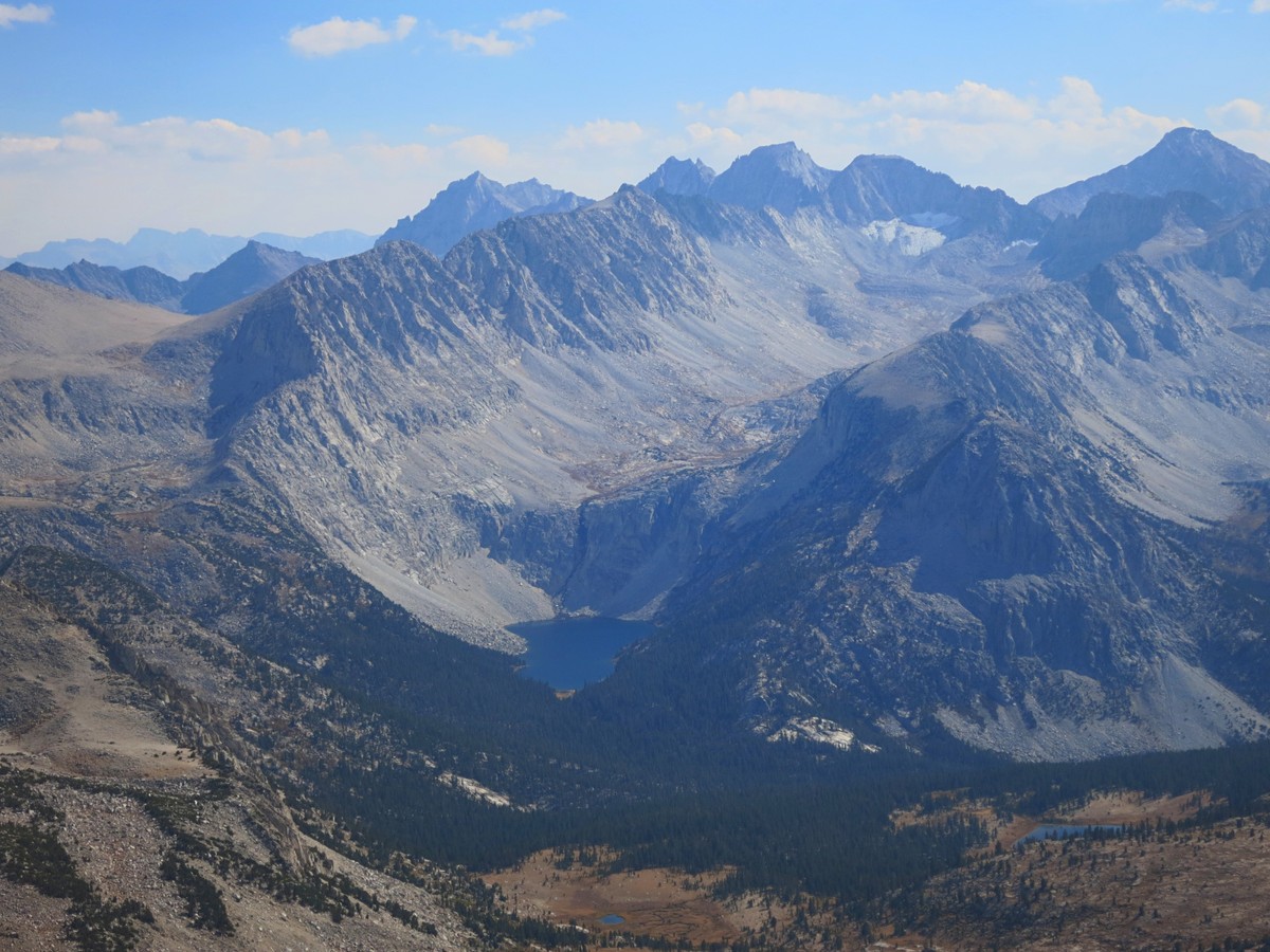
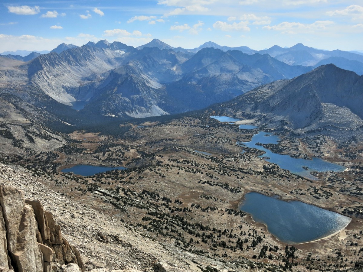
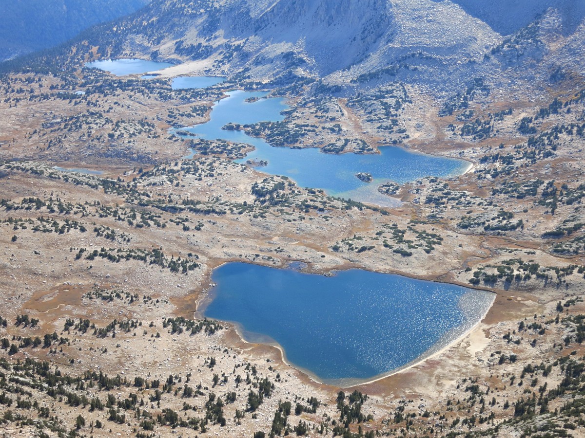
 Lovely Pioneer Basin contains at least a half dozen major lakes and many more smaller lakes and tarns. The majority of the lakes are situated near tree line between 10,800 feet and 11,000 feet. The result is a lovely mix of grassy meadows and clumps of pine trees. The rugged summits of Mount Hopkins, Mount Crocker, Mount Huntington and Mount Stanford surround the basin and provide a sense of true wilderness and seclusion. Lake 10,862 is the largest lake in the basin and contains several coves and a passageway connecting two lobes. The intricacy of its shoreline makes for excellent photography. Late in the season the lakes in Pioneer Basin become standing bodies of water supporting an impressive algae bloom that produces a distinct greenish color in shallow waters. It appears prudent to either boil or treat water in Pioneer Basin in late season.
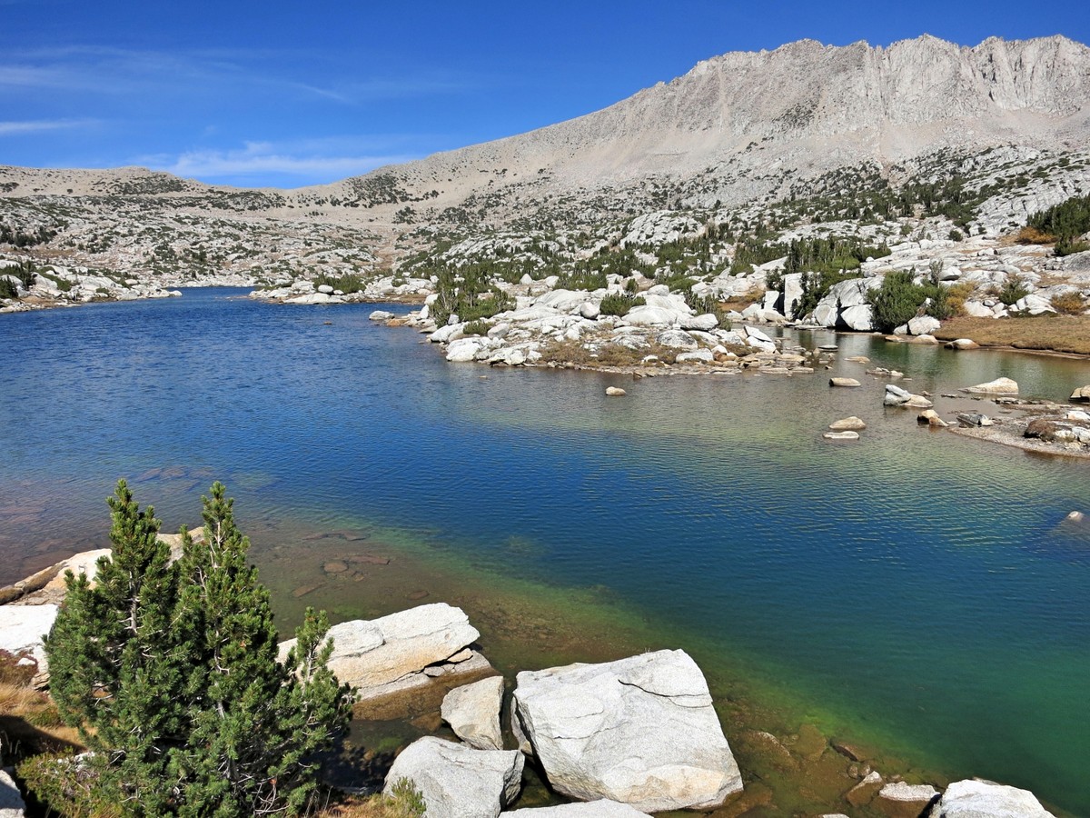
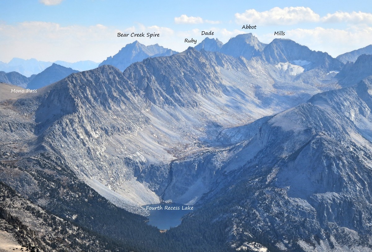
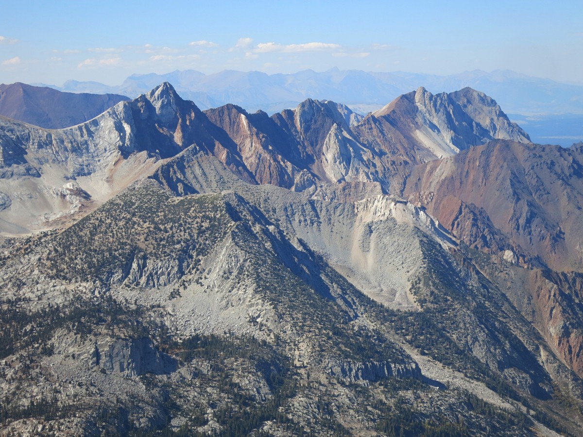
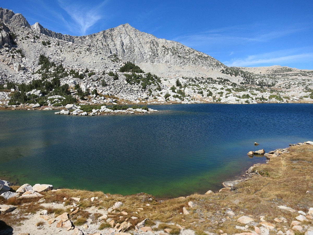
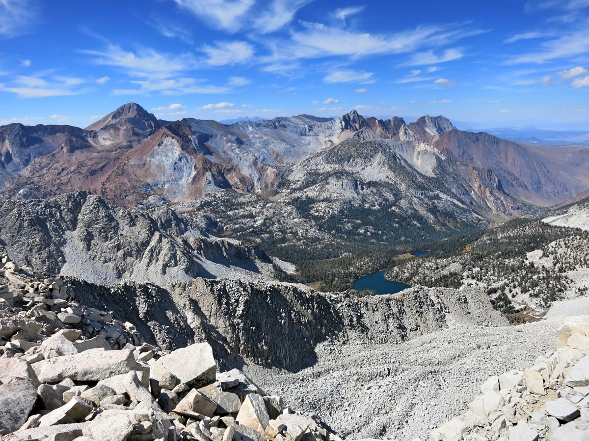
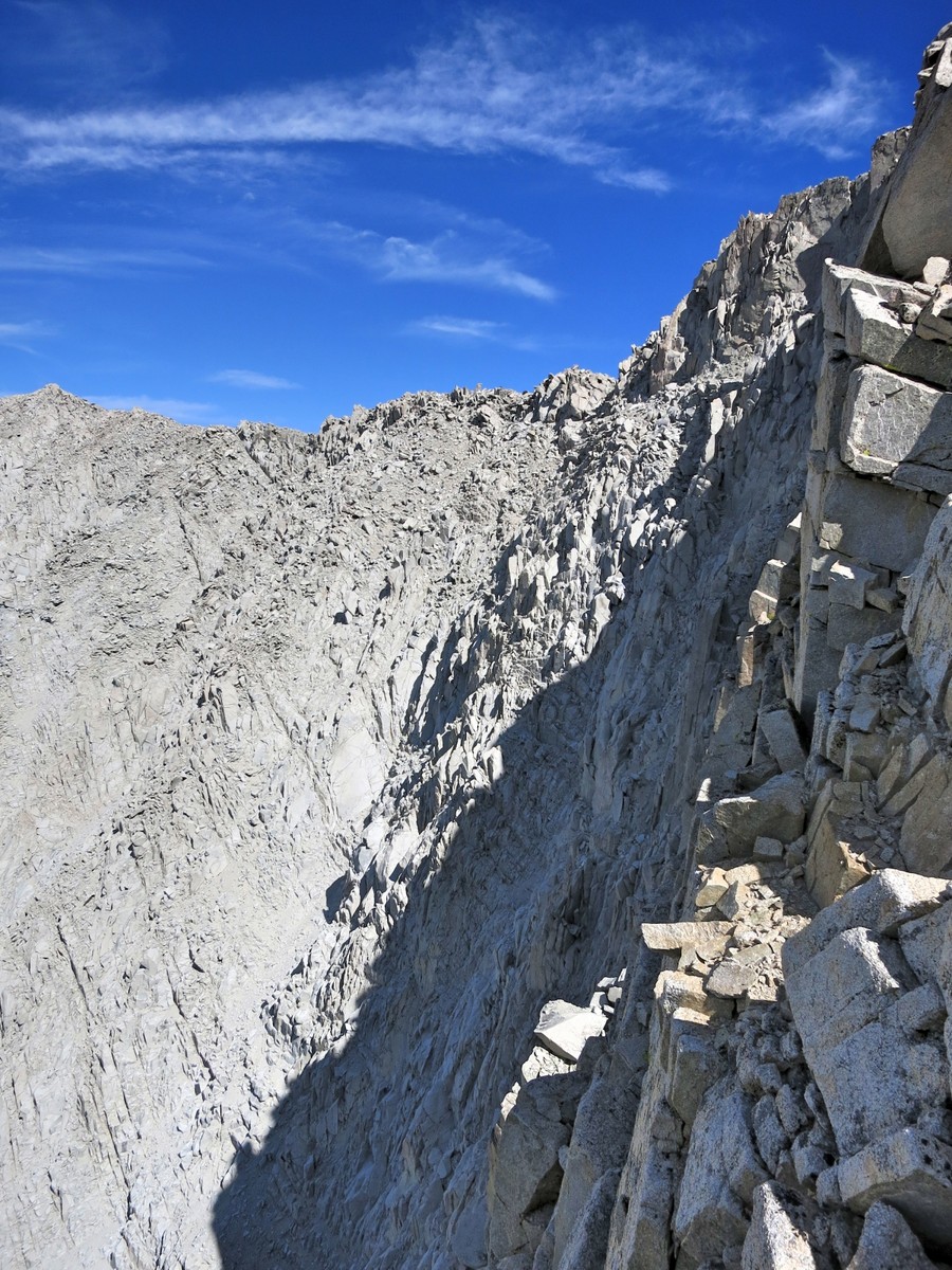
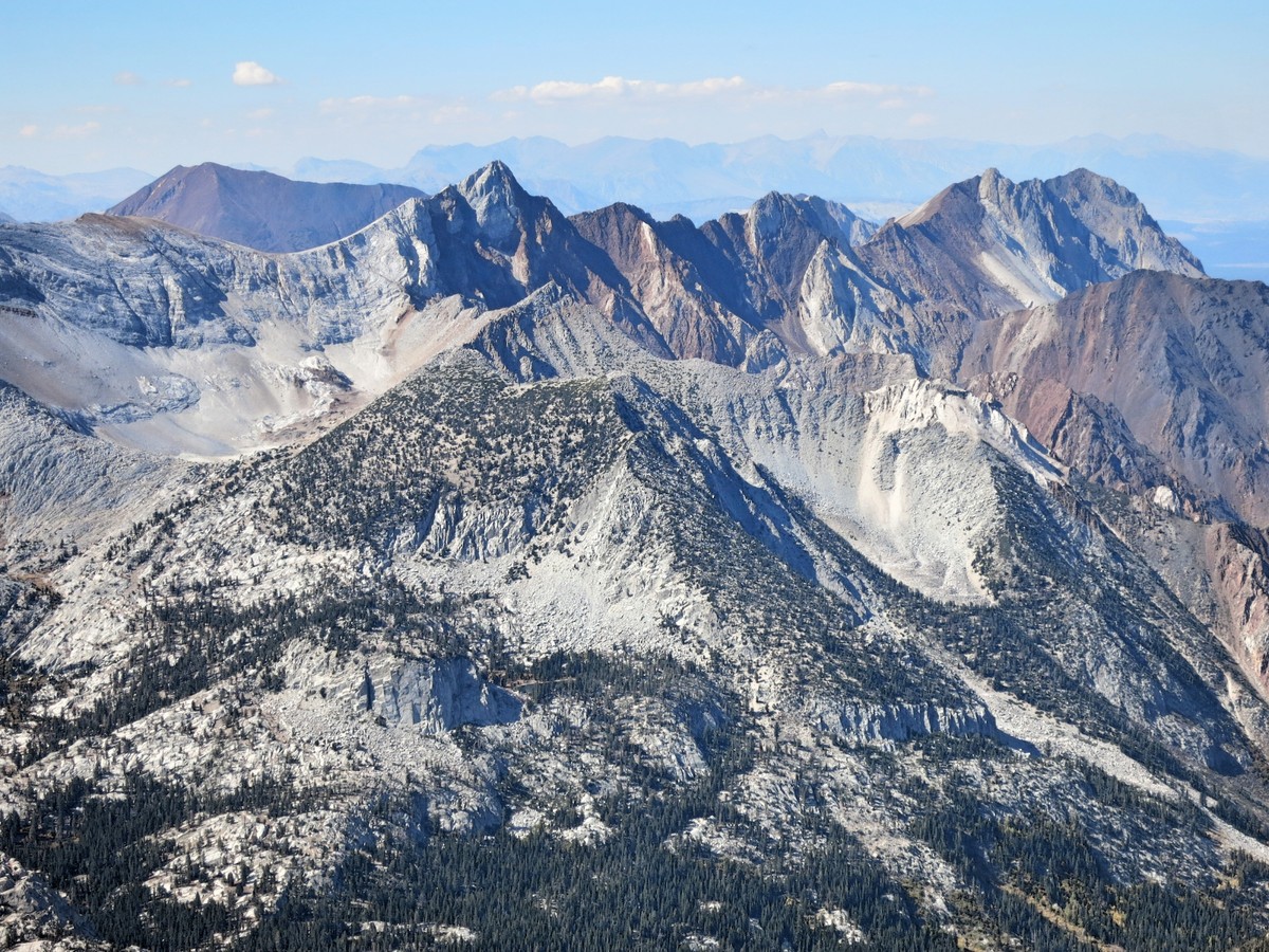
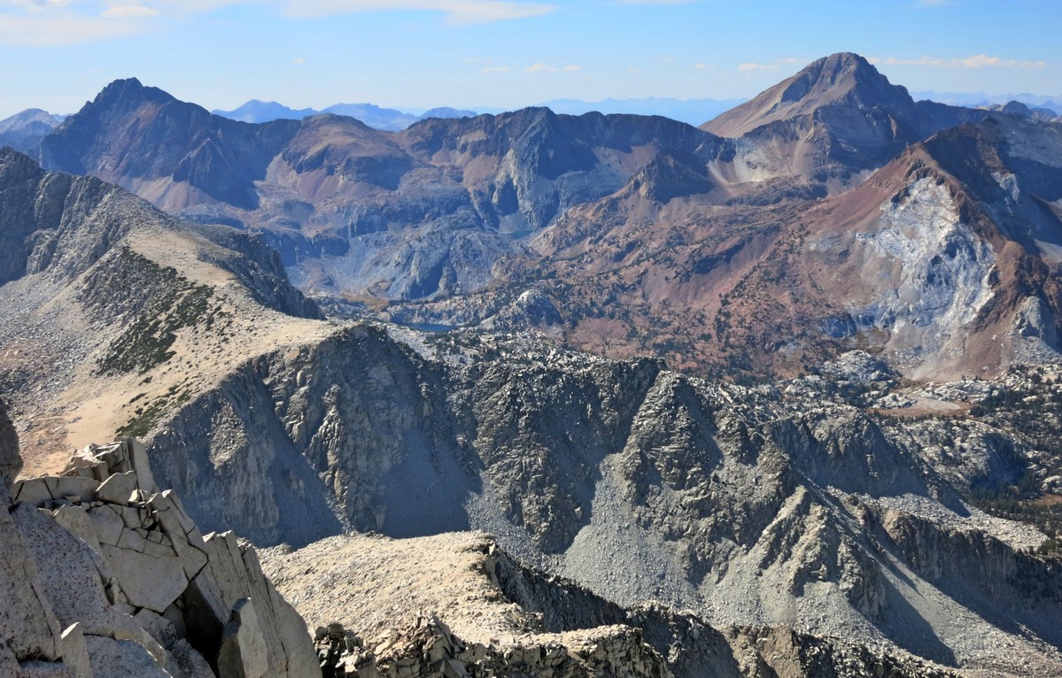
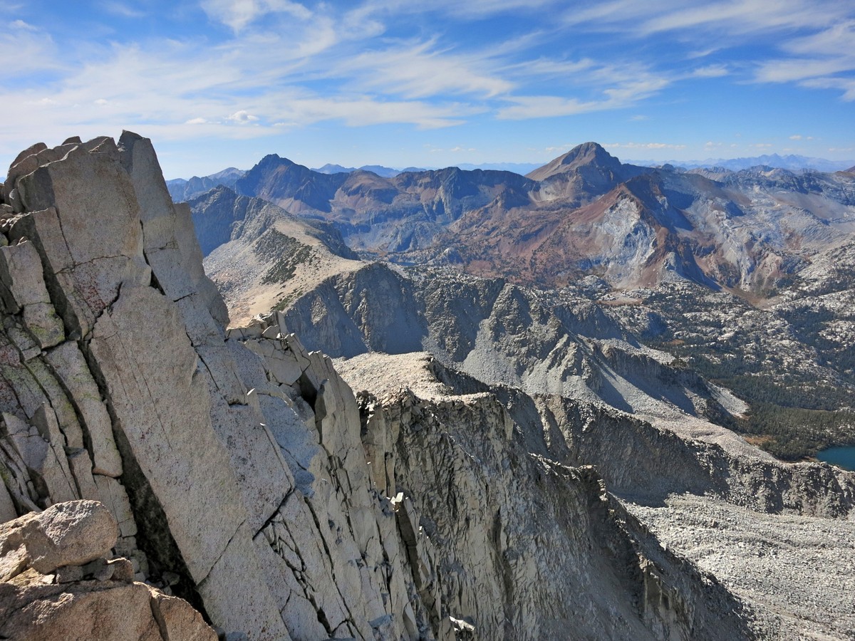
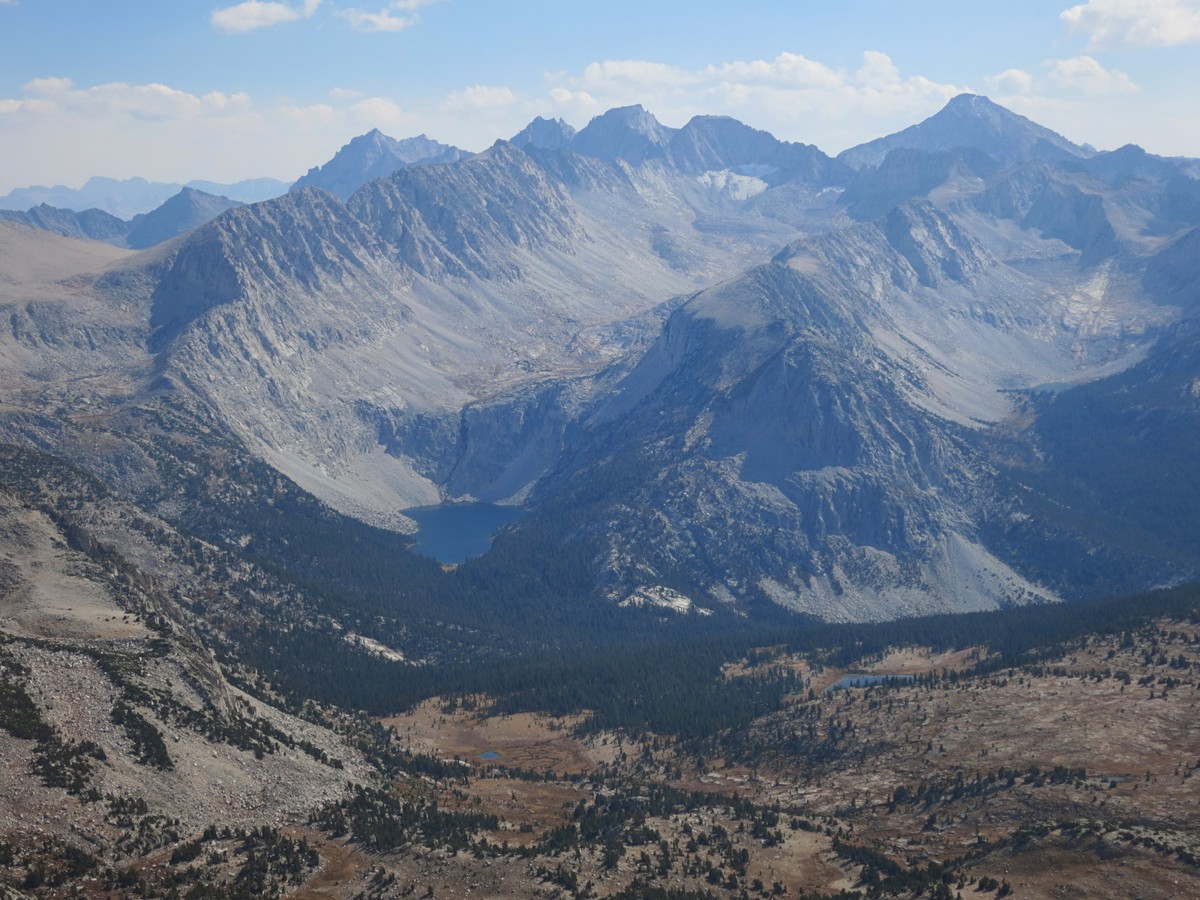
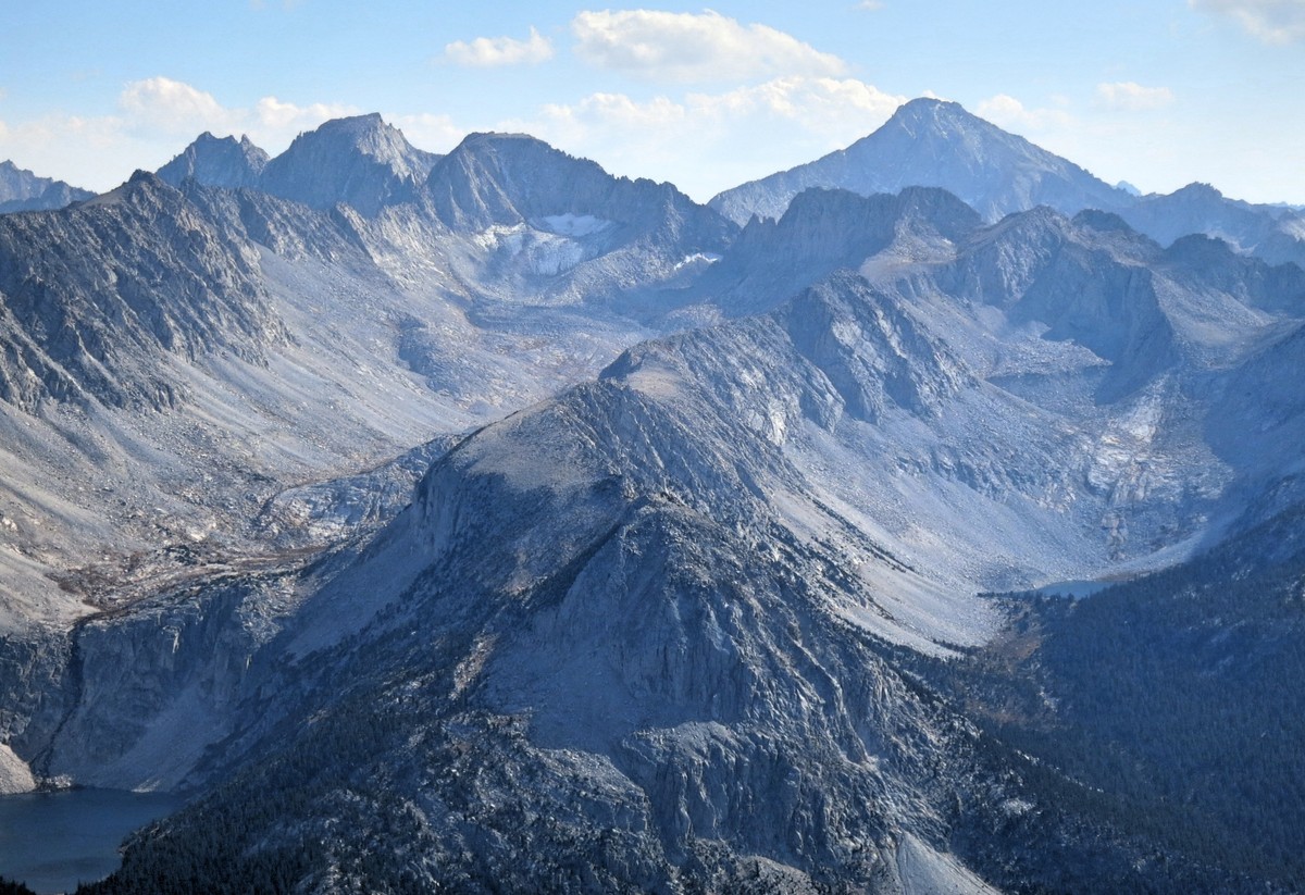
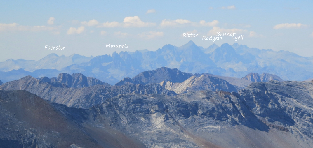 Stanford has the distinction of having two prominent Sierra peaks bearing the name. The southern summit is near the Kings-Kern Divide in King Canyon National Park and is just shy of 14,000 feet. The northern summit is the one described on this route and while shorter and less prominent than its southern brother, is a fine summit in its own right. From near Lake 11,026 one can make a fairly direct ascent up the slopes of Mount Stanford. It’s a bit of slog with much loose gravel in the lower slopes but becomes a bit more solid class 2 scramble in the upper part. Mount Stanford is the named summit in this vicinity, but a higher points lie along the ridge immediately to the NE ultimately culminating in Mount Morgan. I’m guessing Mount Stanford earned its name due to the fact that it sits on the Sierra Crest and also because of the rugged character of its precipitous north face as viewed from McGee Canyon. Mount Stanford has an excellent vantage of the McGree Creek Canyon region including Mount Baldwin, Red Slate Mountain and Red & White Mountain. Beyond these nearby peaks, the view includes the Ritter Range to the north and the Kuna-Dana region in Yosemite. To the south is a birds eye view of Pioneer Basin, Mono Creek Canyon and Fourth Recess Lake. The southern horizon is filled with a sea of peaks including Bear Creek Spire, Mount Dade, Mount Abbot, Mount Mills and Mount Gabb.
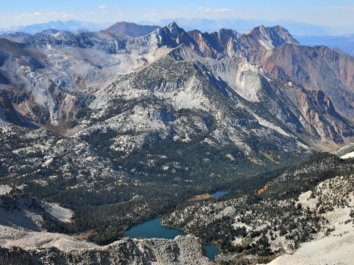
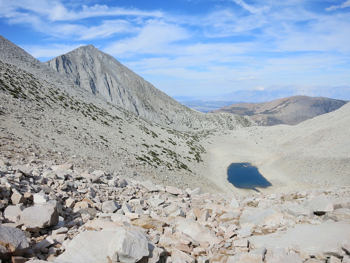
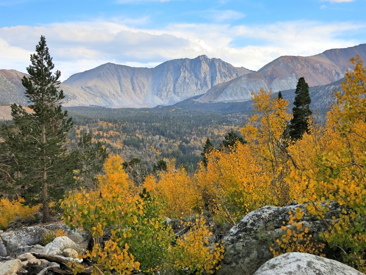
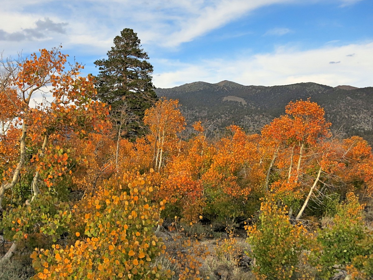
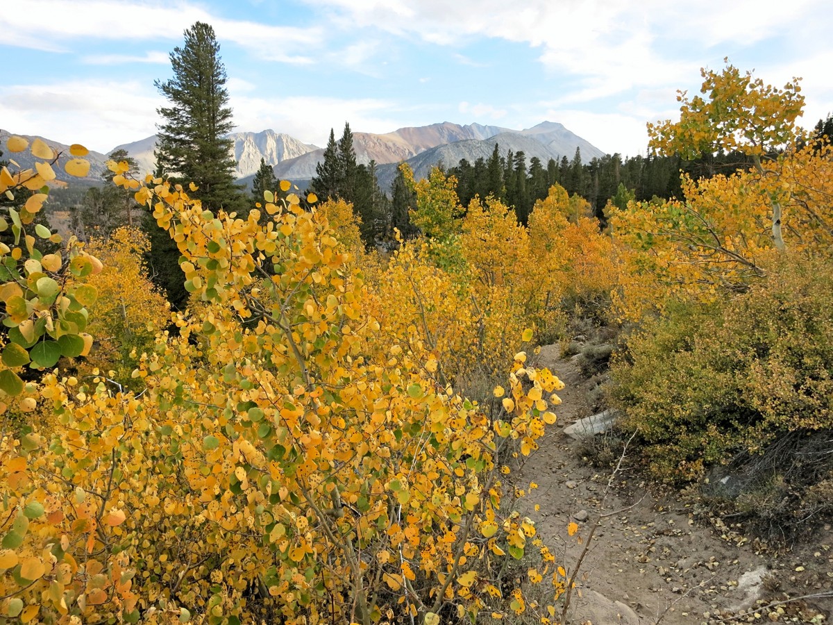
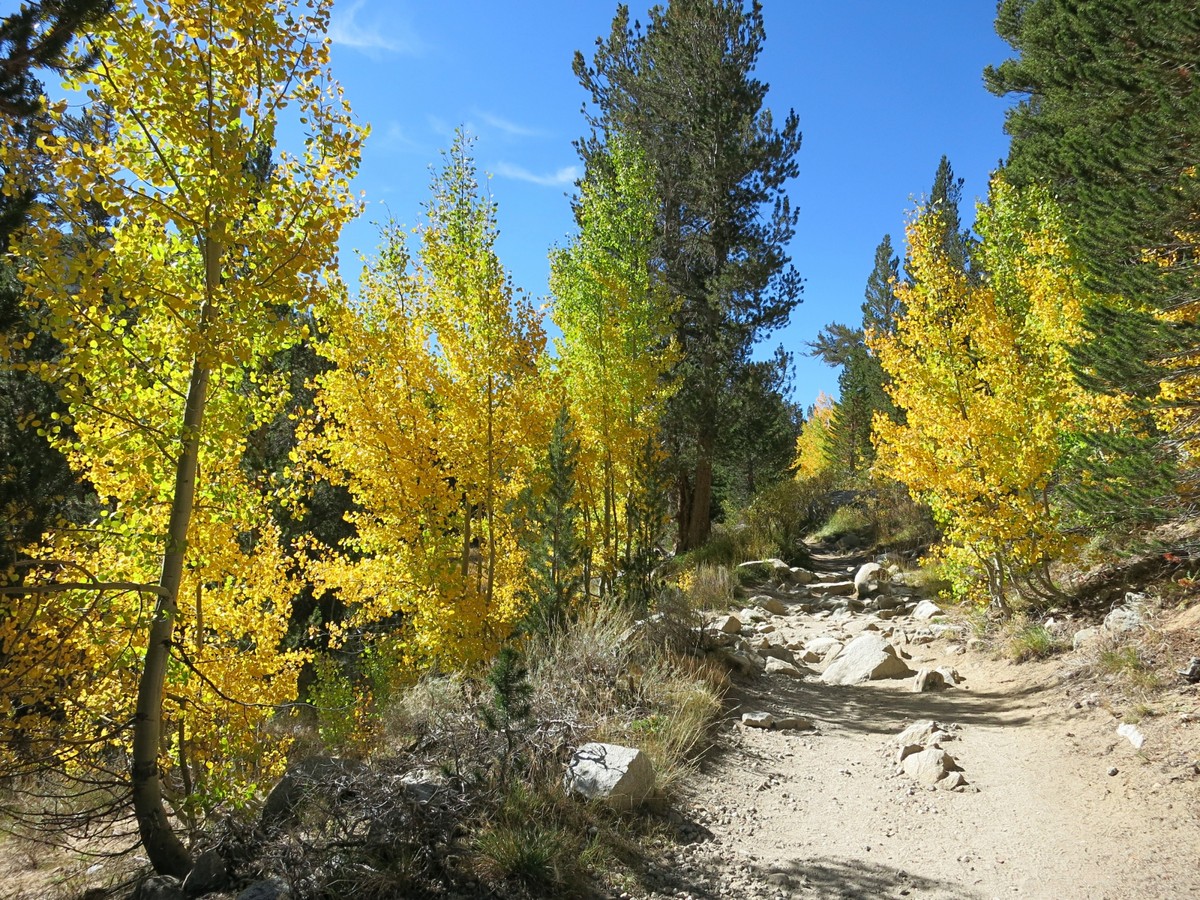 From Mount Stanford descend class 2 talus toward Stanford Lake but at around 11,700 feet begin traversing south to a small pass. This pass provides entry into the Hilton Creek drainage and the beginning of a pleasant and relatively efficient cross country descent to the Hilton Creek Lakes. The Hilton Creek Lakes are very typical lakes of the eastern High Sierra but attractive nonetheless. At Lake 10,353 a trail can be picked up. At the junction above Lake 9,852, make a right and head towards Rock Creek Lake. The trail crosses a broad plateau and then parallels Rock Creek for a few miles before making a final descent to Rock Creek Road. This section has some expansive aspen groves that show fantastic color in the early fall. From the road it’s about a mile back to Mosquito Flat to complete the loop.
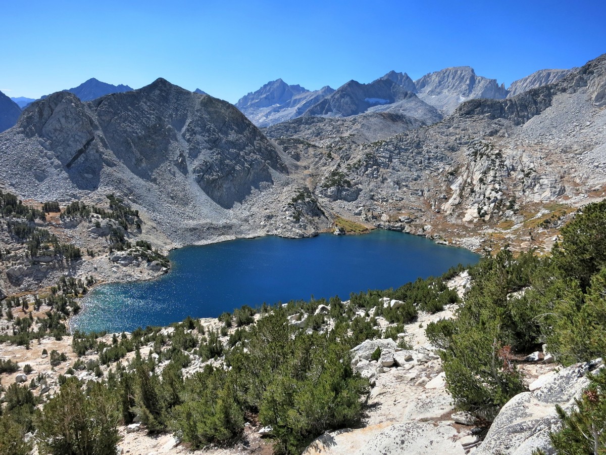


WOW.
Nice WOW factor!
You have observed very interesting points ! ps decent internet site . “By their own follies they perished, the fools.” by Homer.