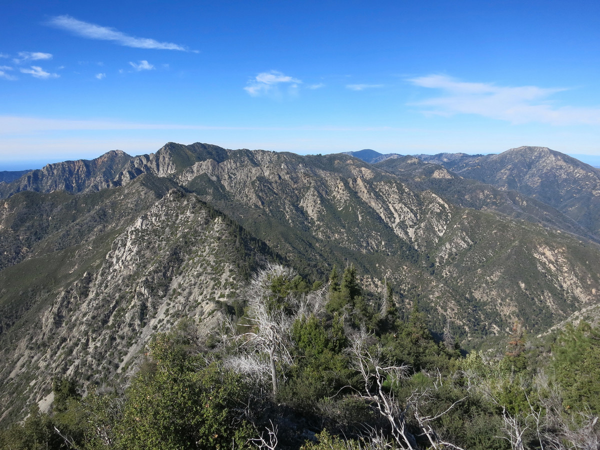
After carefully analyzing topographic maps and satellite imagery I saw potential for an aesthetic route from the depths of the Carmel River Canyon directly to Ventana (single) Cone, arguably the most remote major summit in the Ventana Wilderness. Only an average of one party a year visits Ventana Cone and all appear to access via the 2 mile bushwhack from Pine Ridge. I was looking for a more adventurous and less brushy approach that would take us from the lush environs of the Carmel River headwaters up steep talus slopes to the 4,738 ft summit with sweeping views of much of the Ventana Wilderness. Designing new adventure routes carries a lot of uncertainty and in terrain this rugged there was a real chance of encountering an impasse and getting turned around. It’s not always easy to find partners for these types of routes, but Brian Lucido was game. We ended up nailing the route, but not without encountering some challenges. I’m especially proud of designing and executing this extremely aesthetic new route to a major summit of the Ventana in an awesome area of the wilderness with outstanding scenery virtually the entire way. GPS route here. 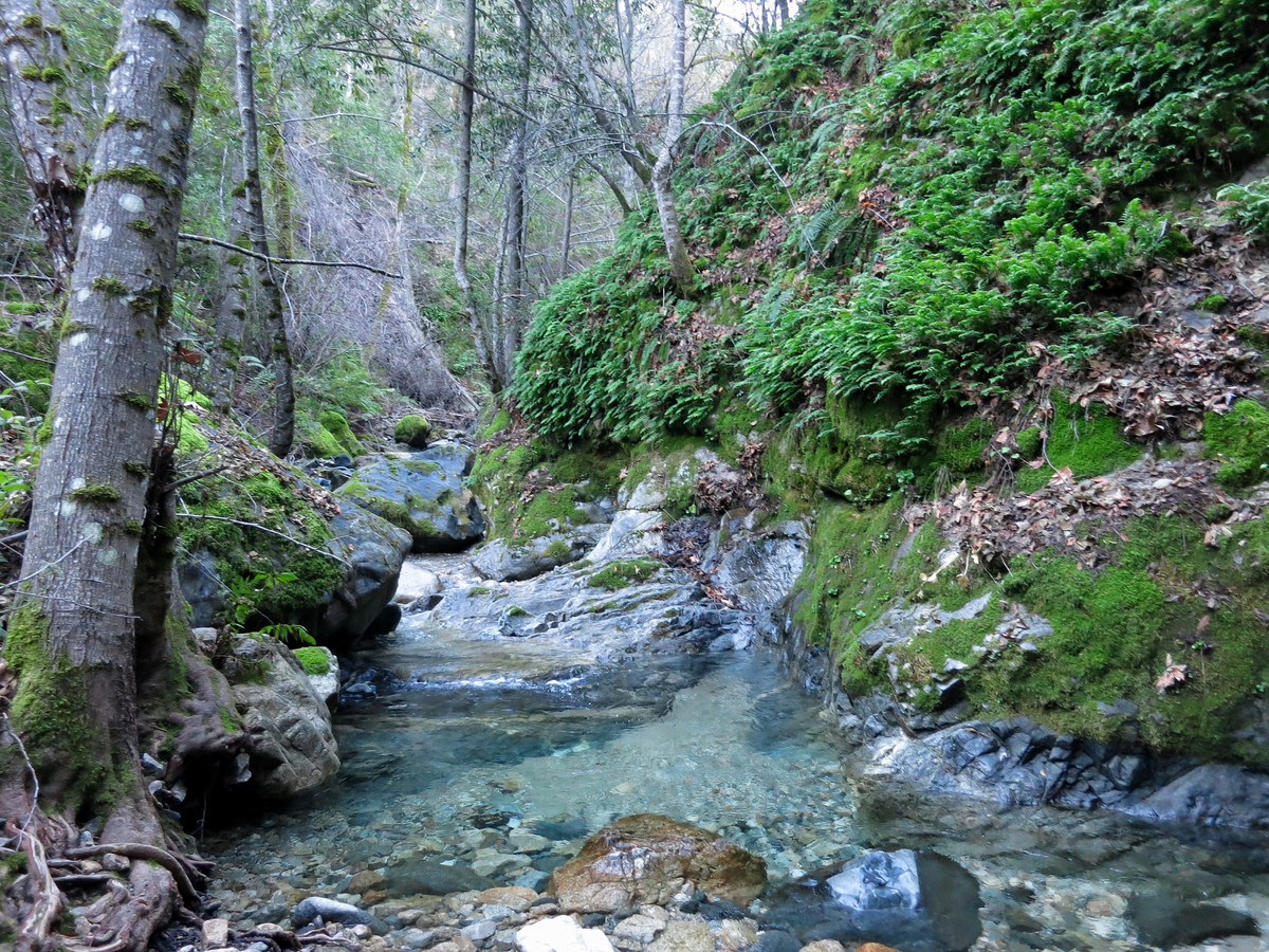
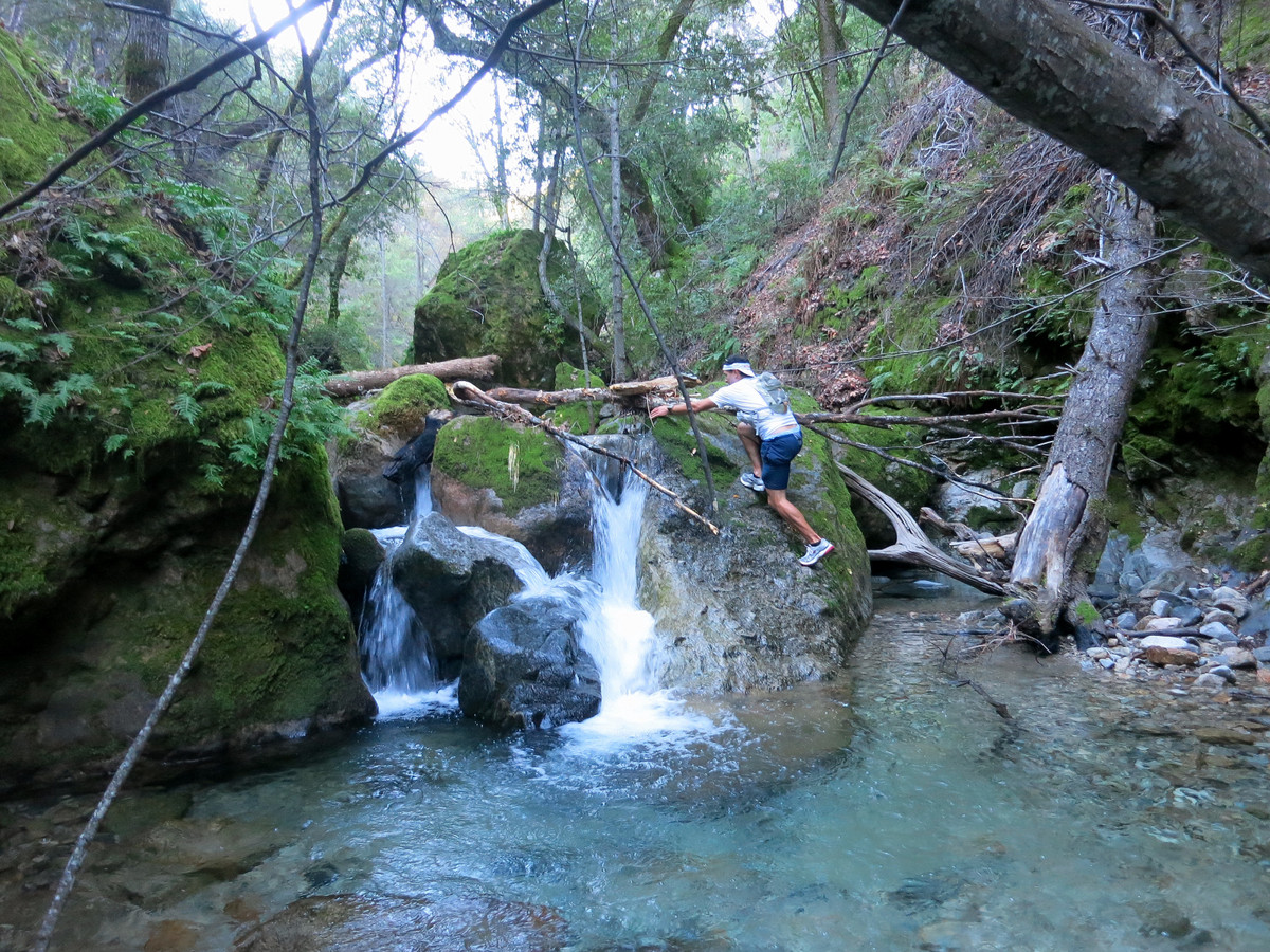
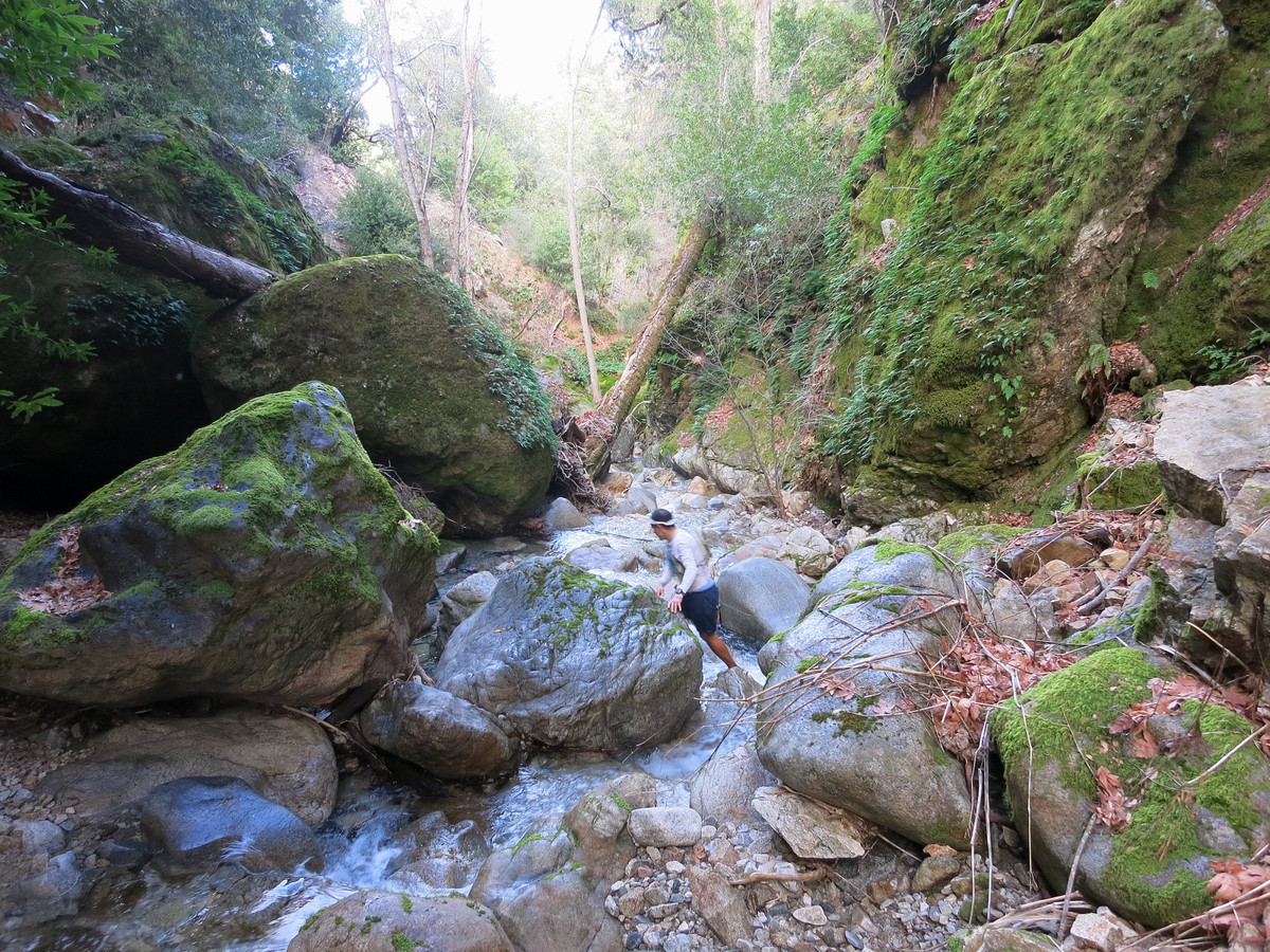
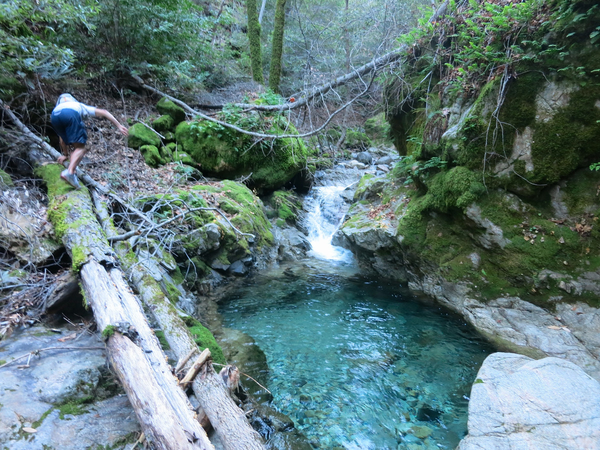
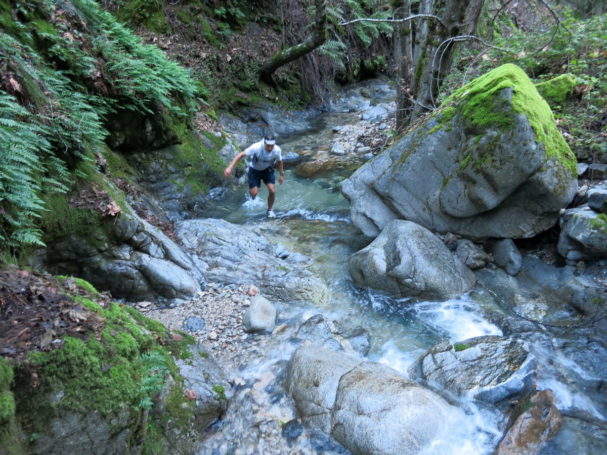
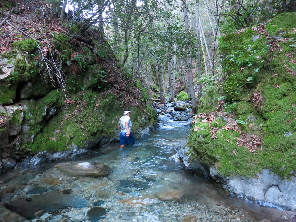
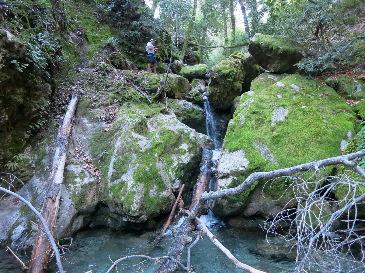
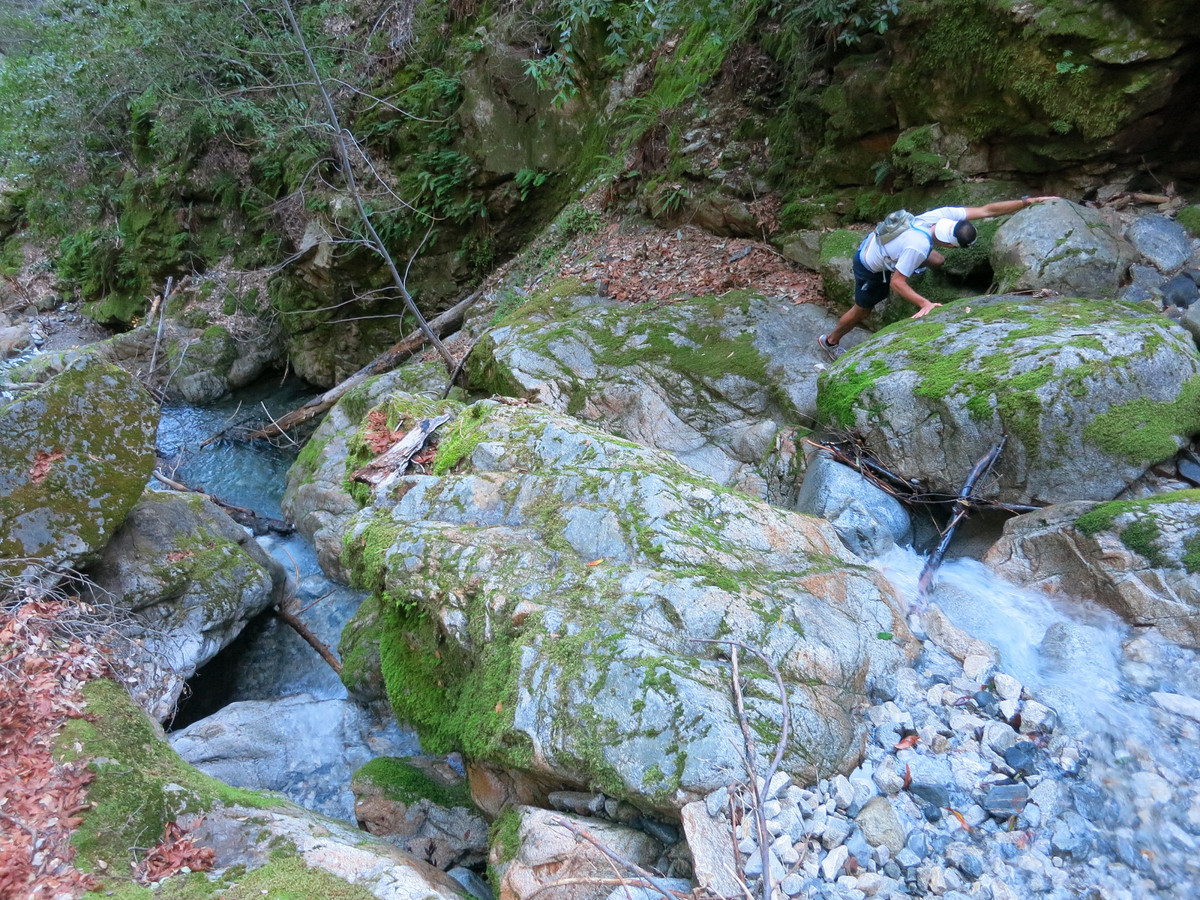
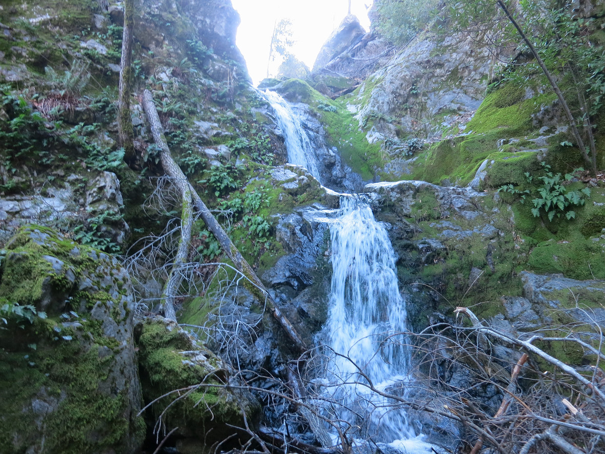
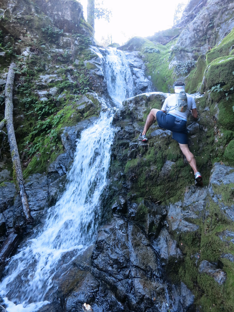
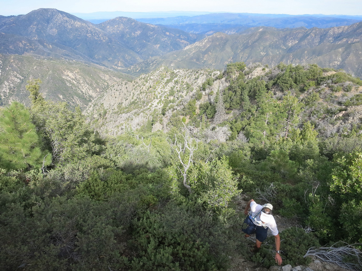
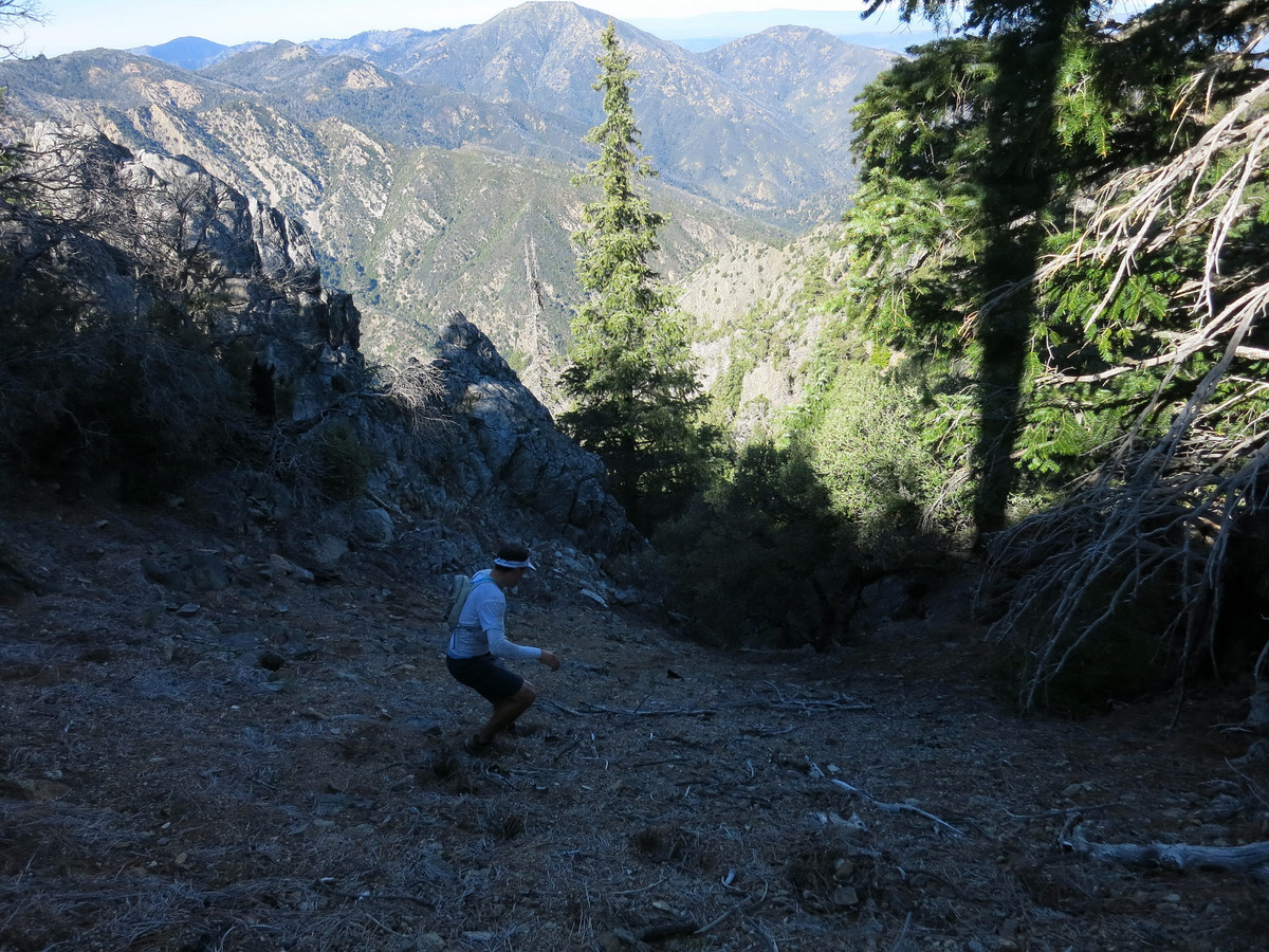
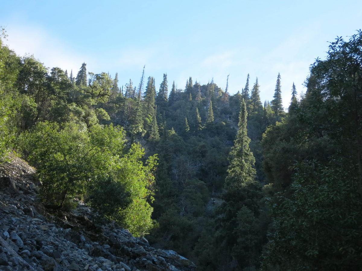
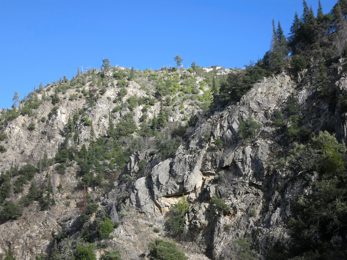
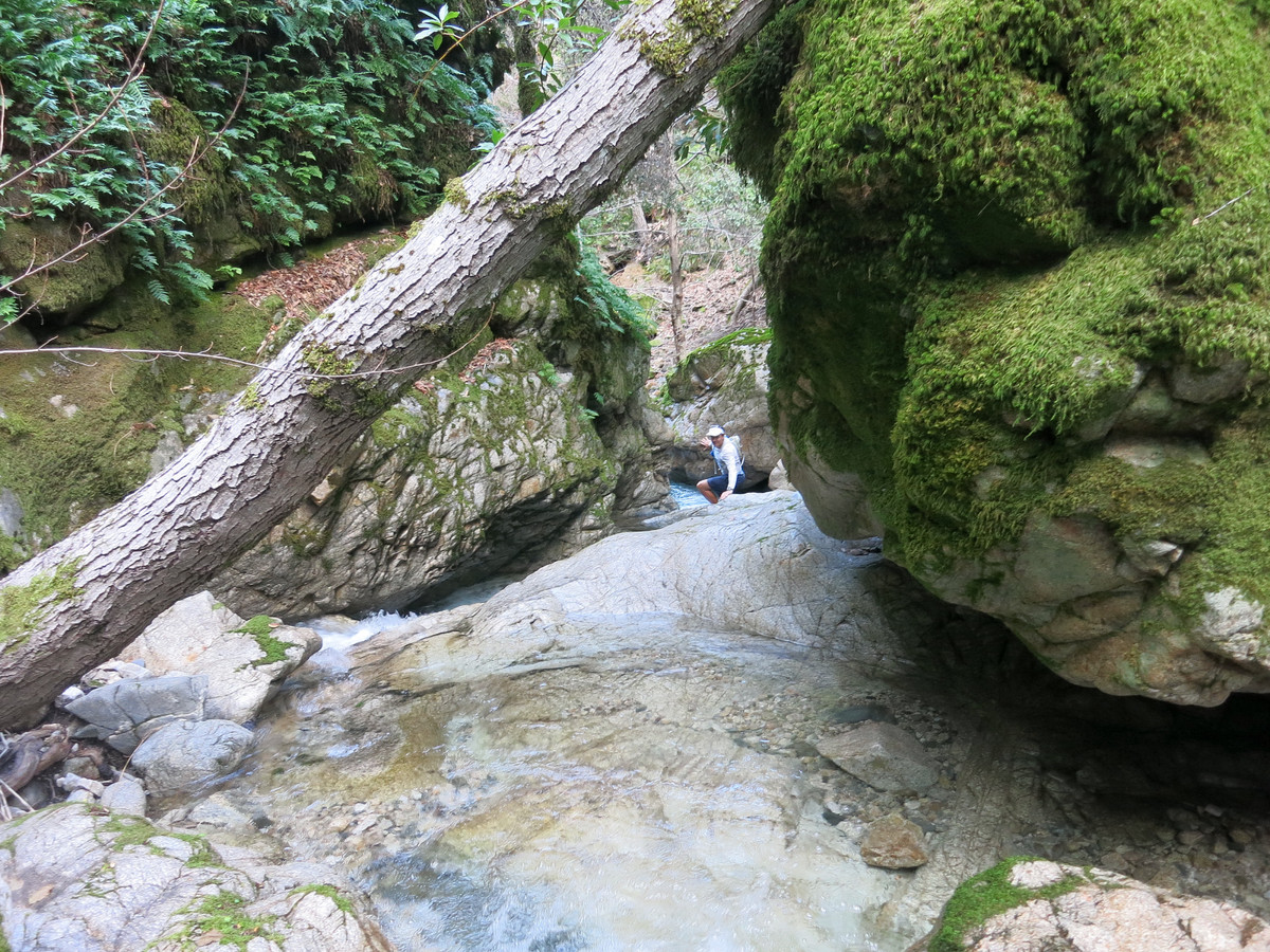
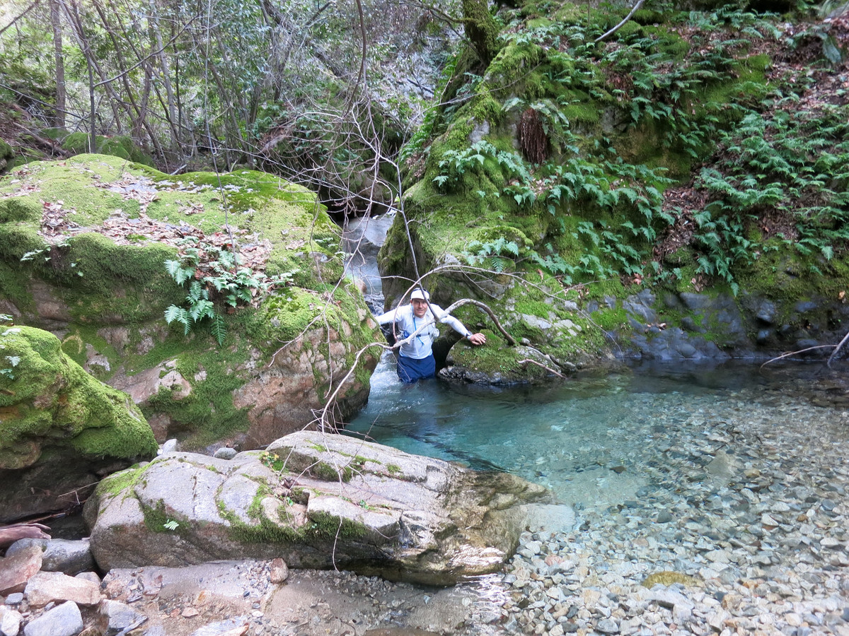
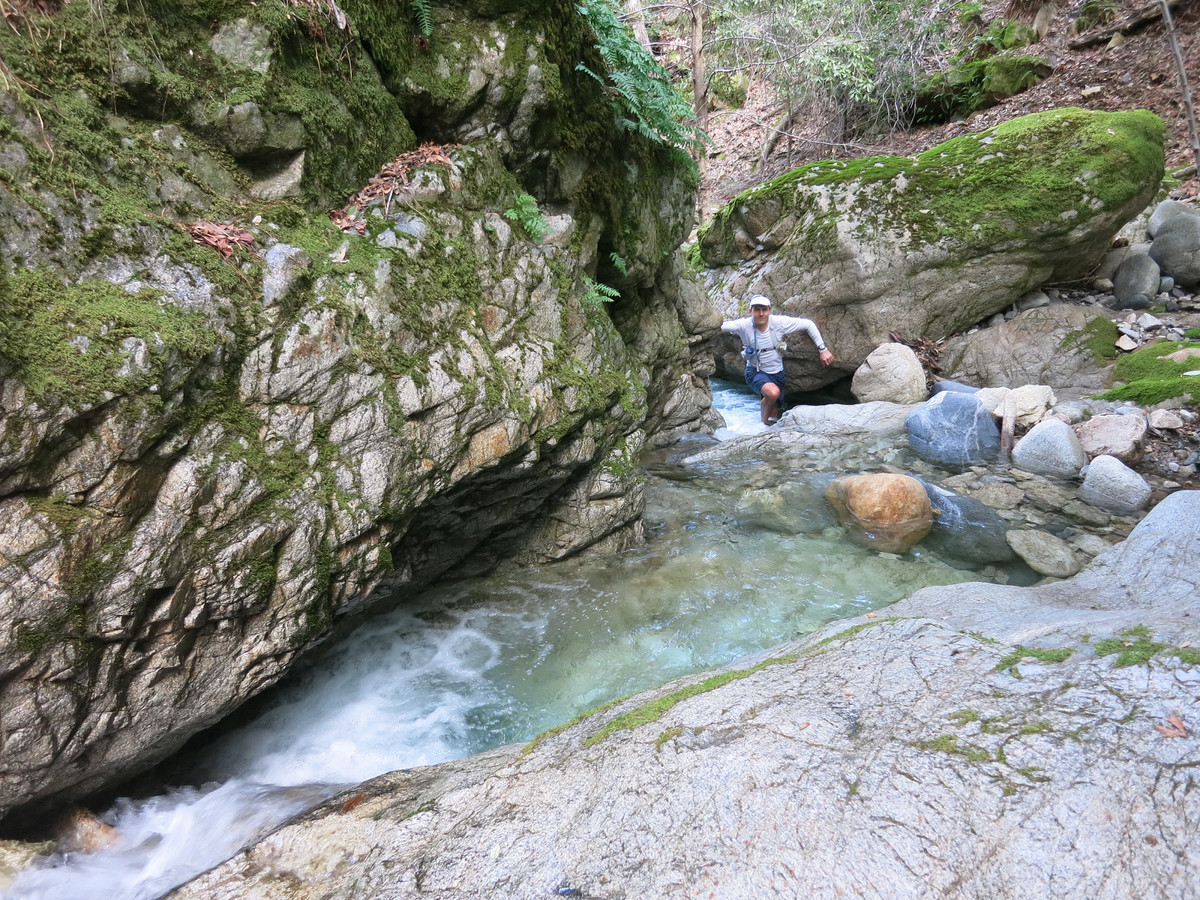
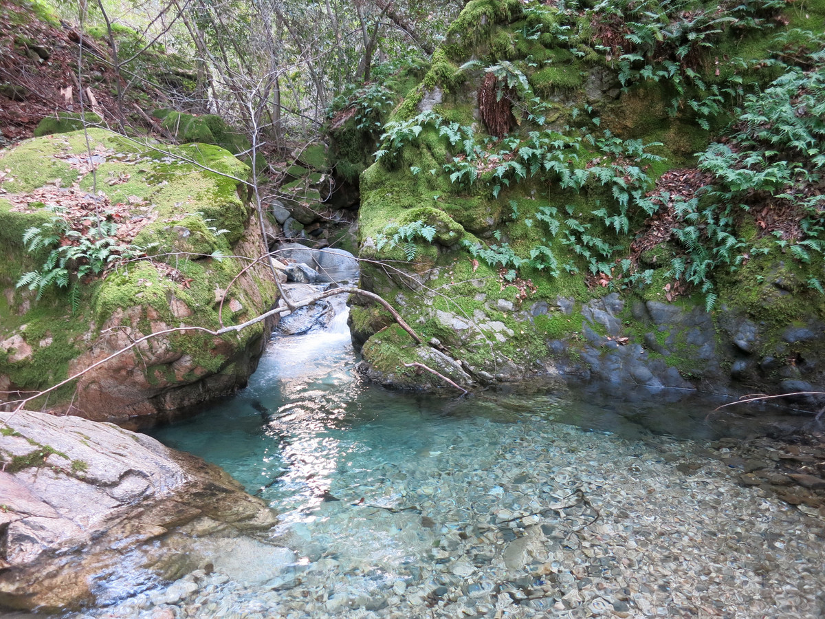
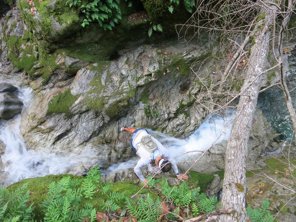
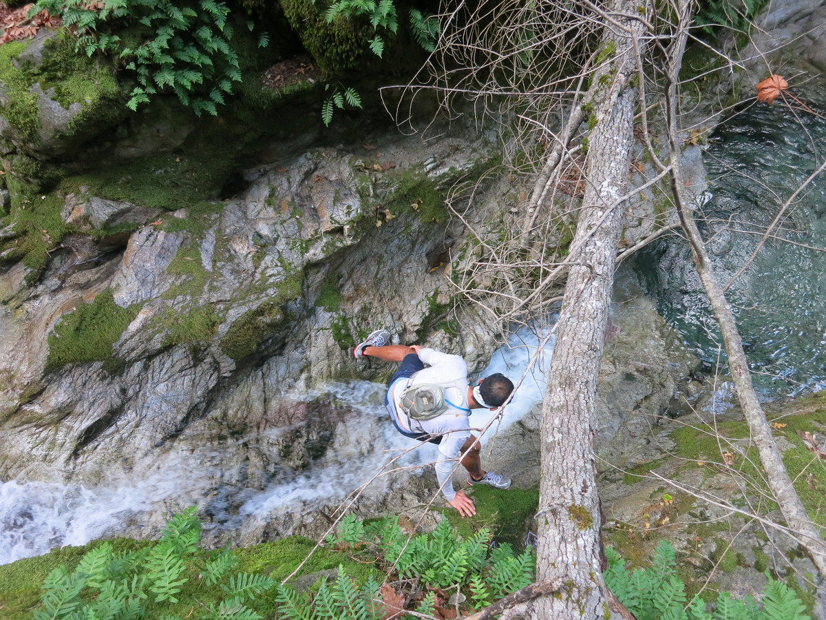
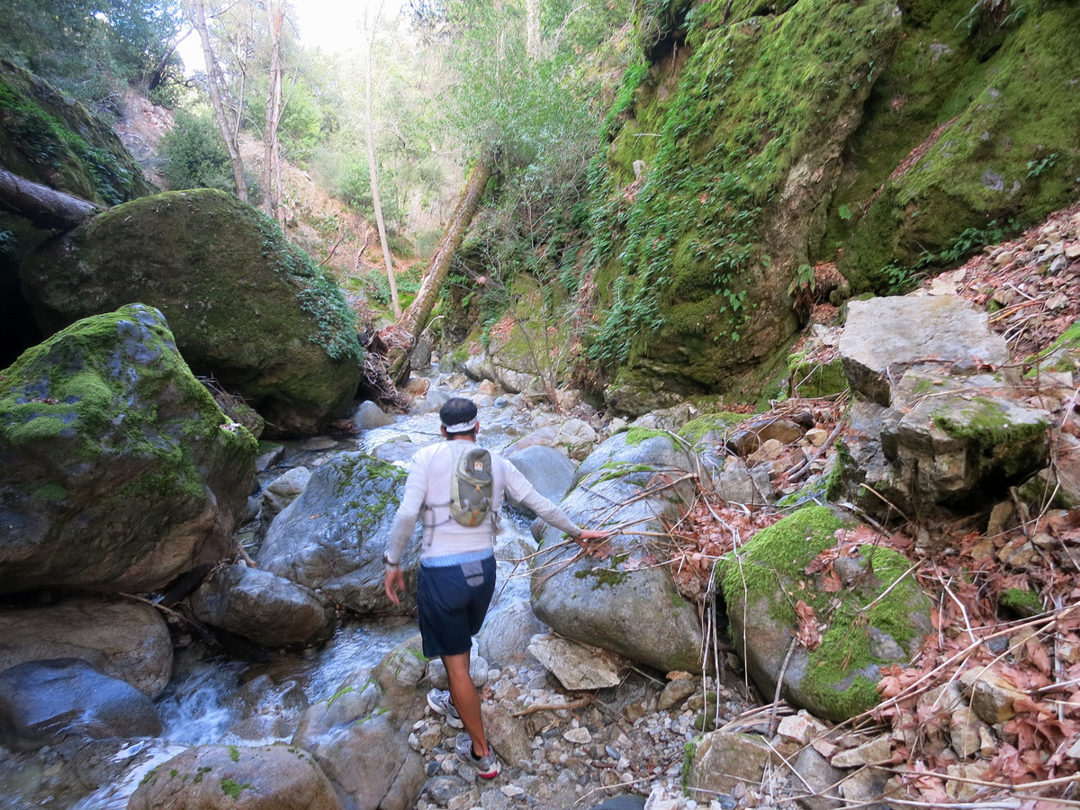
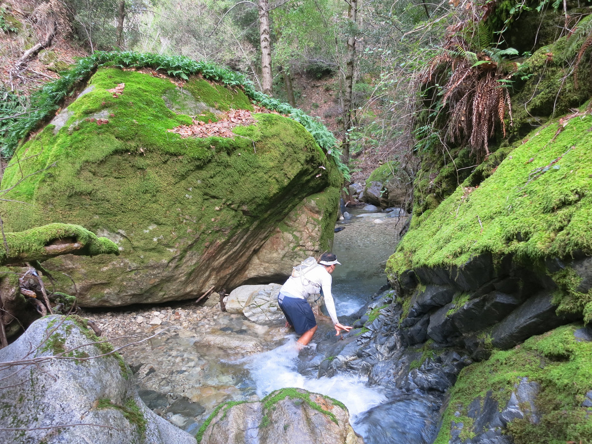
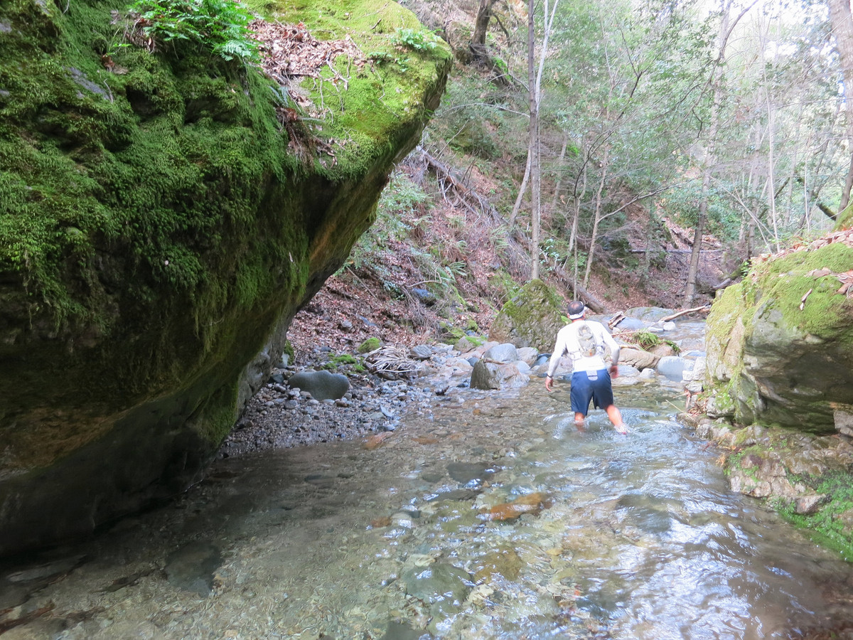
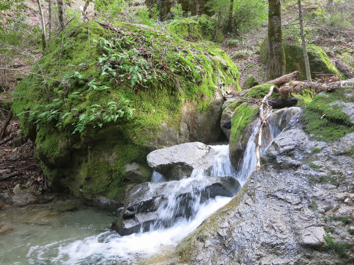
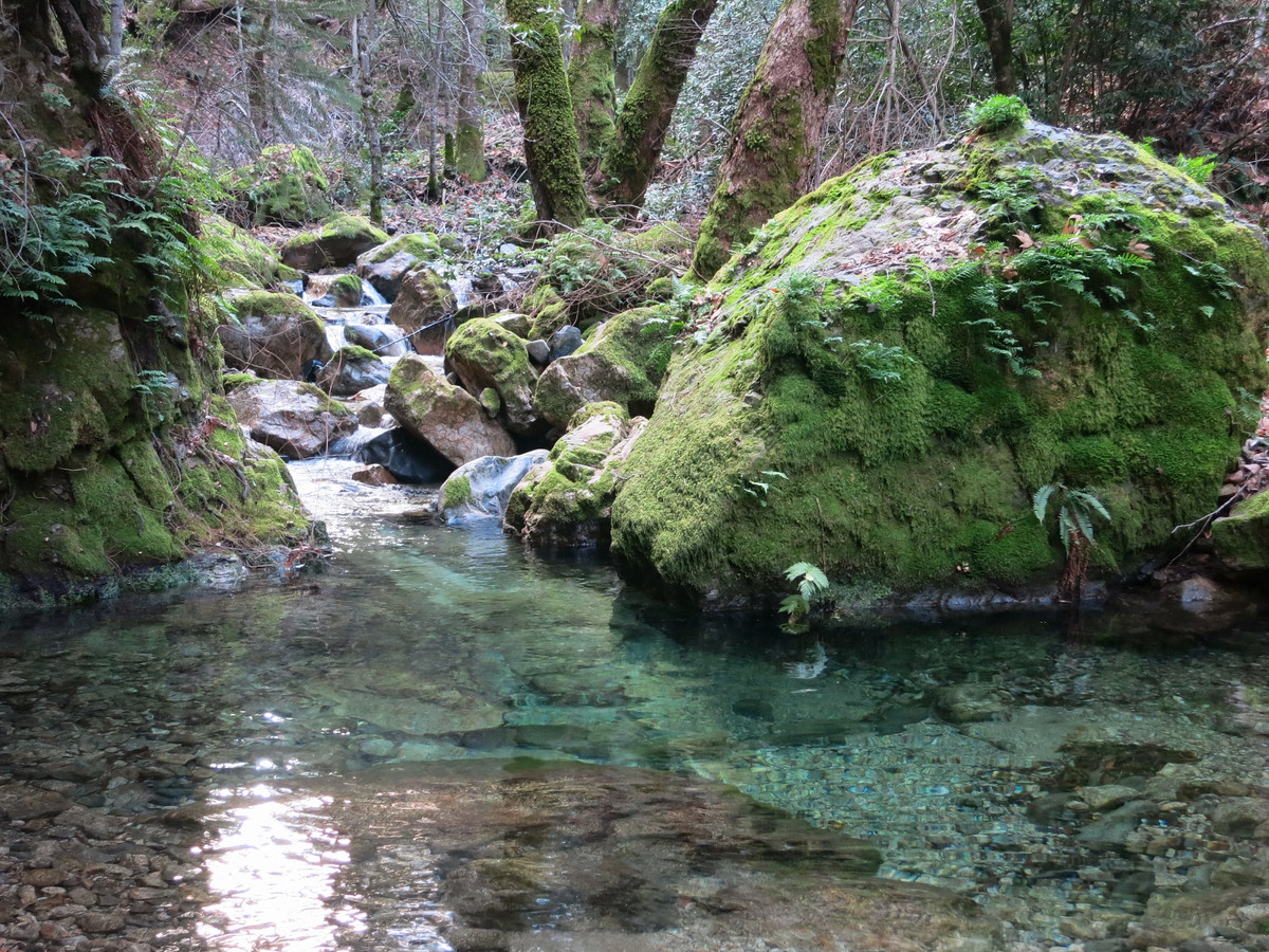
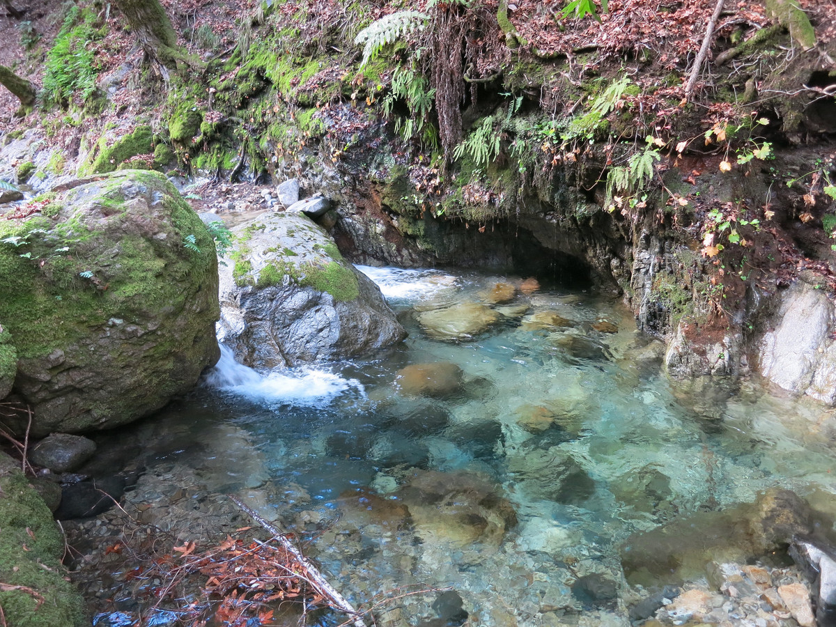
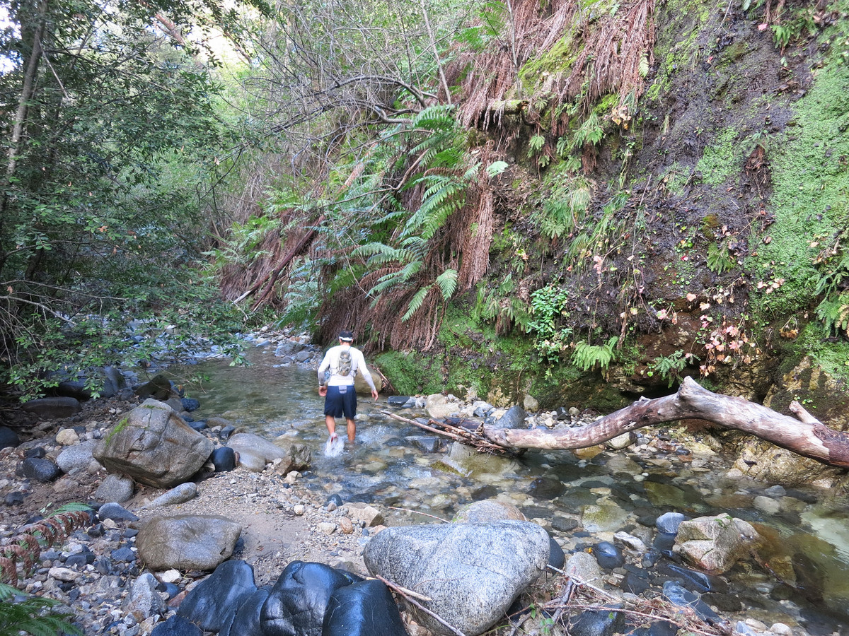
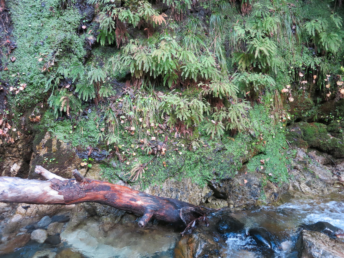
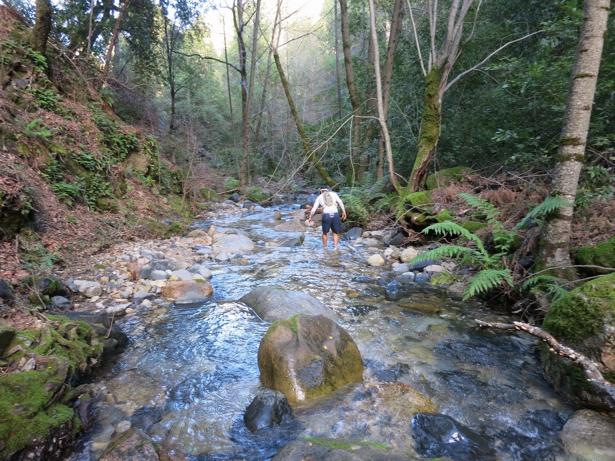
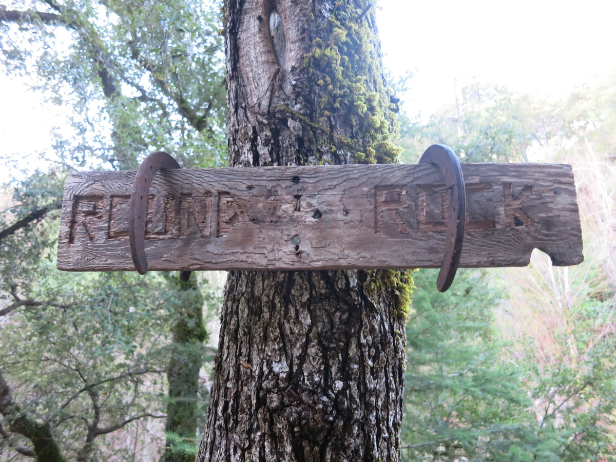
 The first part of the morning entailed running the Carmel River Trail from Los Padres Dam. The first few miles along the old road were by headlamp but by Bluff Camp daylight had arrived. We continued along the Carmel River Trail deep into the canyon and above Hiding Canyon CAmp we to the Round Rock Camp Trail to Round Round Camp. At Round Rock Camp we continued upstream along the Carmel River before finding the unnamed major tributary that drains the north side Ventena Cone. This amazing stream flows through a stunningly beautiful canyon of turqoise pools, slick rock, cascades, house-sized boulders, ferns, and moss. The amazing lushness of this deep canyon with several different varieties of ferns, and moss covering virtually everything created a scene fit for Jurassic Park. Almost was everything was photogenic. At the head of the canyon the stream splits and we took the left fork. The pace of ascent along the stream rapidly increased and we soon reached our first challenge of the day, a waterfall surrounded by cliffy terrain. Brian and I took different routes up this waterfall but each was probably low 5th class. Shortly after this waterfall we encountered another waterfall. While this waterfall did not have a feasible route alongside it, there was a loop around it, but not without copious brush and wading through thickets of poison oak. The good news was that this bypass around the second falls was the only substantial brush we encountered on the route. That being said, the poison oak was tall and thick and left it’s mark on my allergic skin (thankful that prompt washing with Tecnu after these adventures makes it about 95% better that it can be).
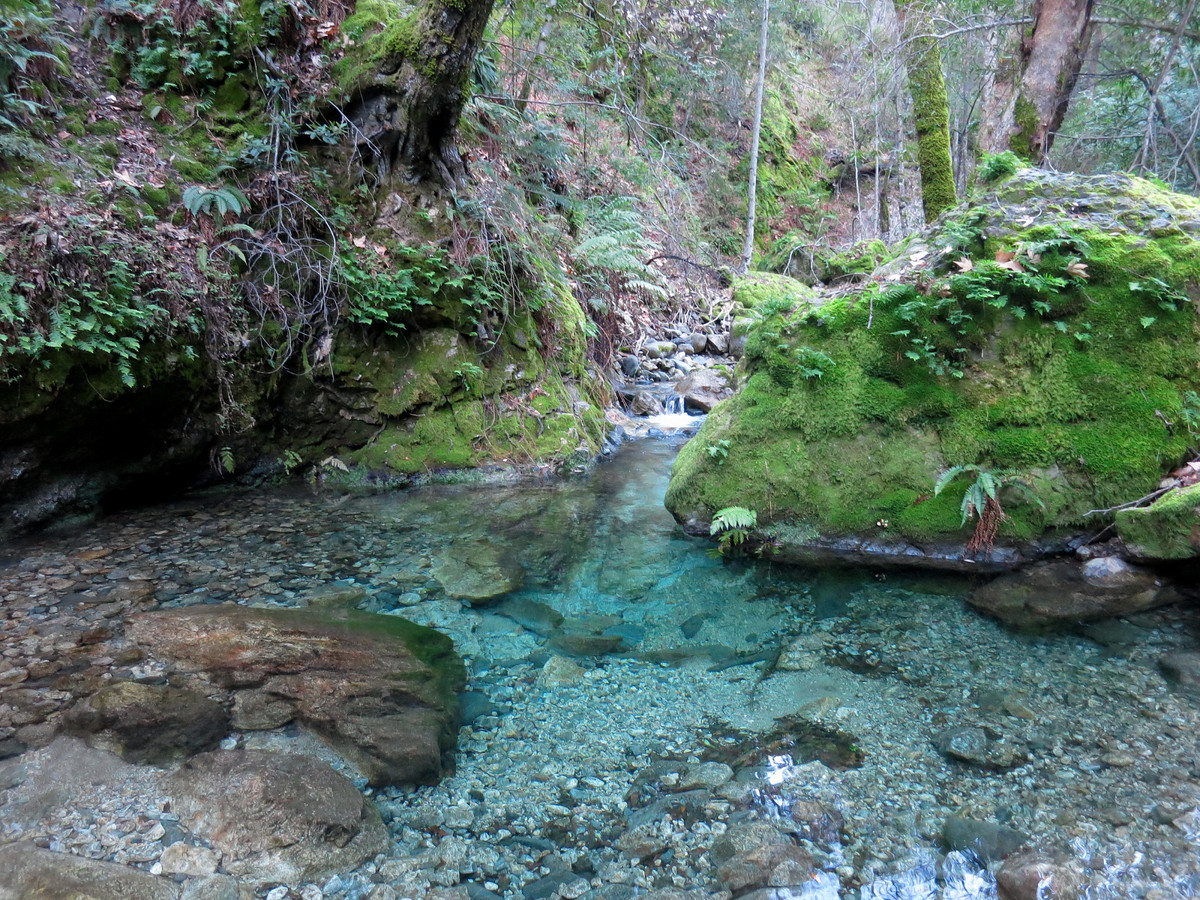
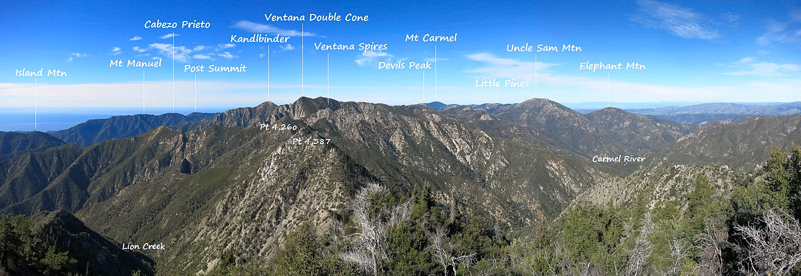 Large version of annotated panorama here.
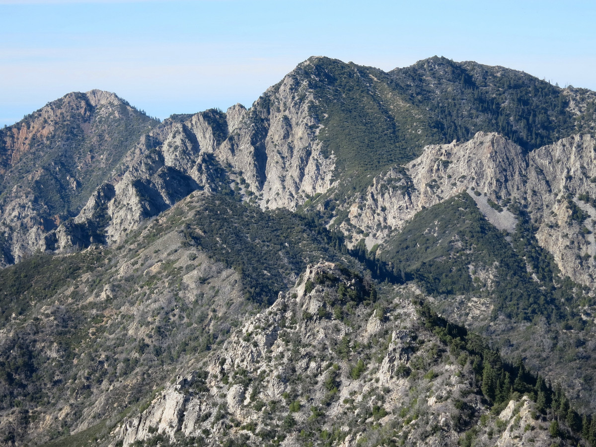
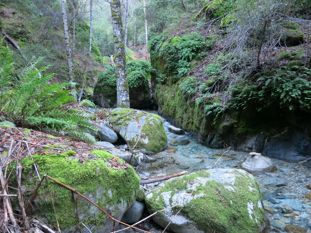
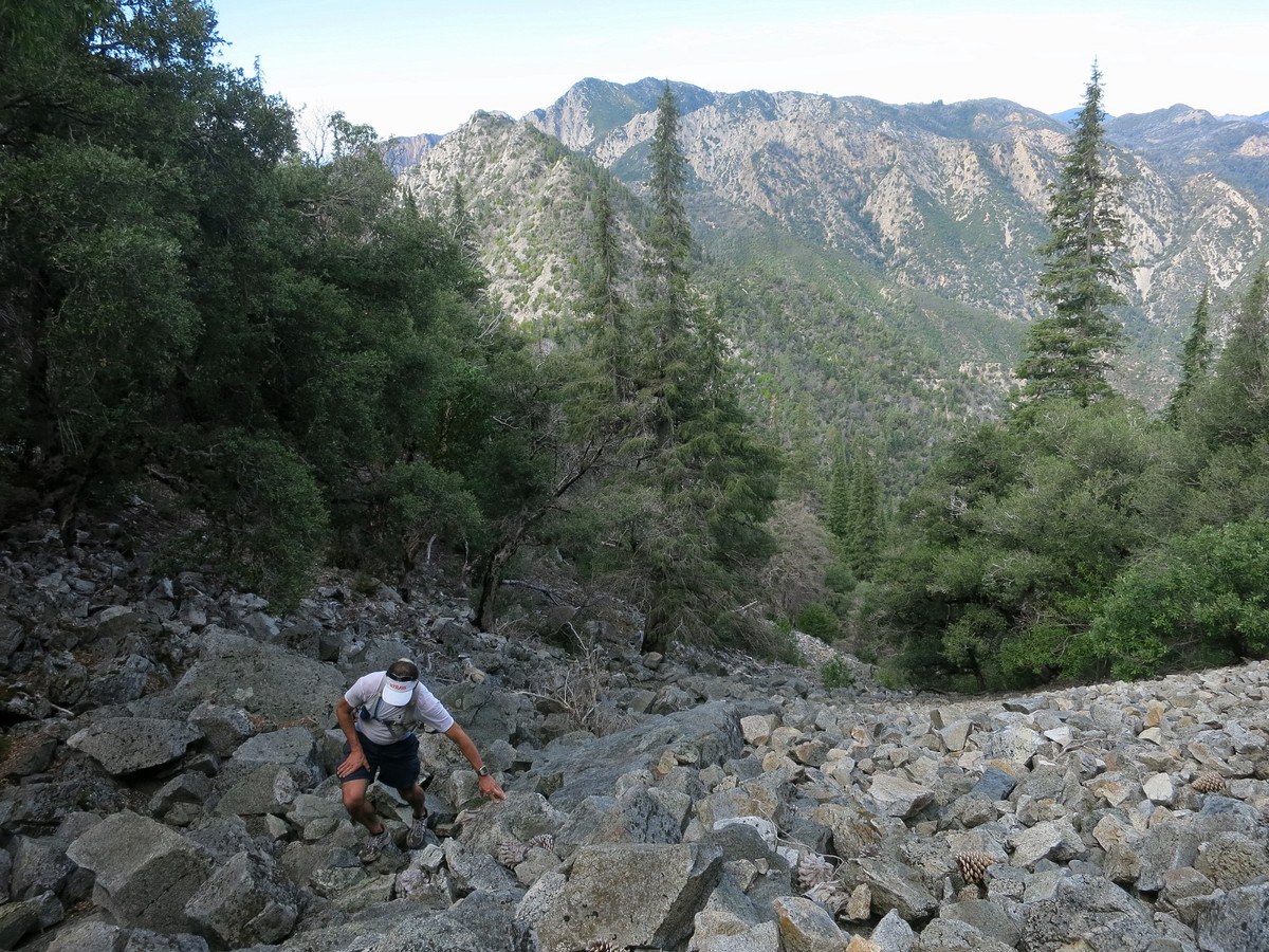
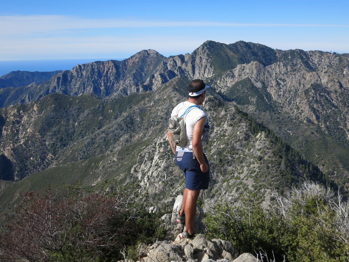
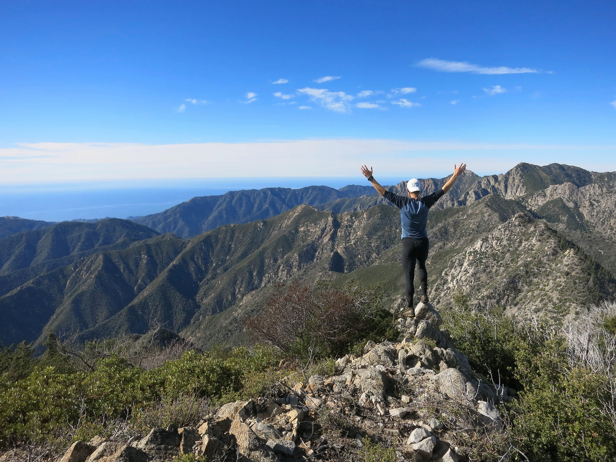
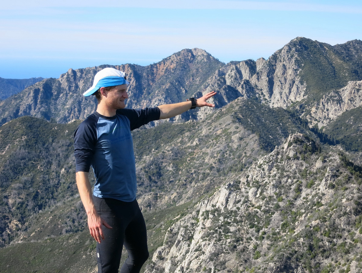
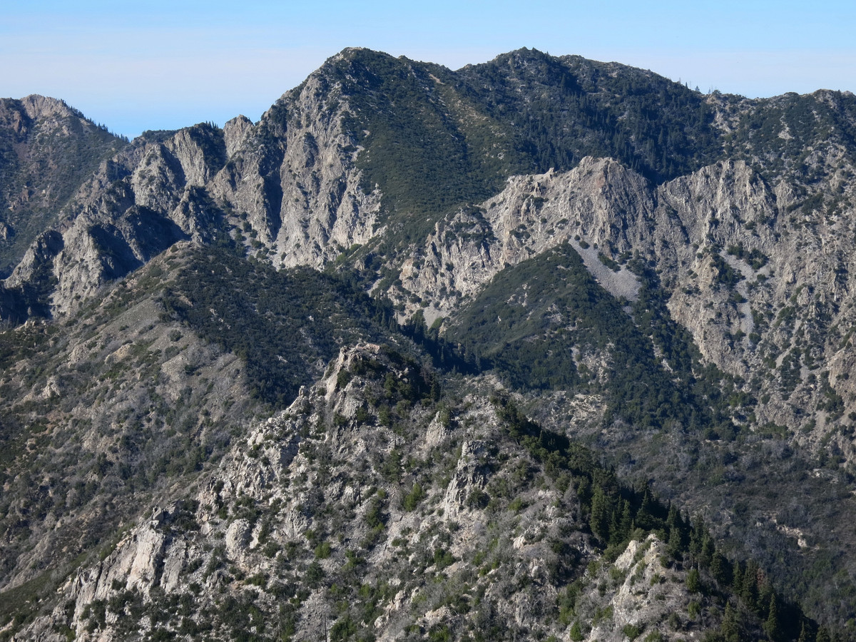
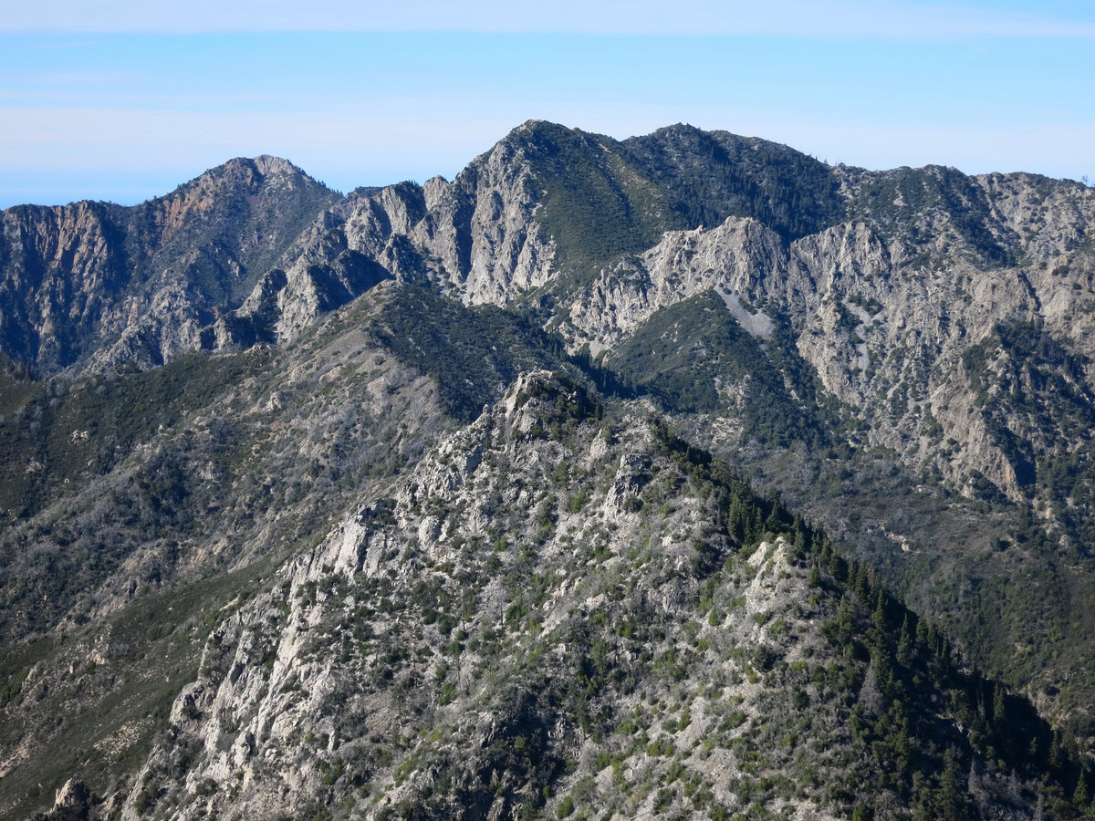
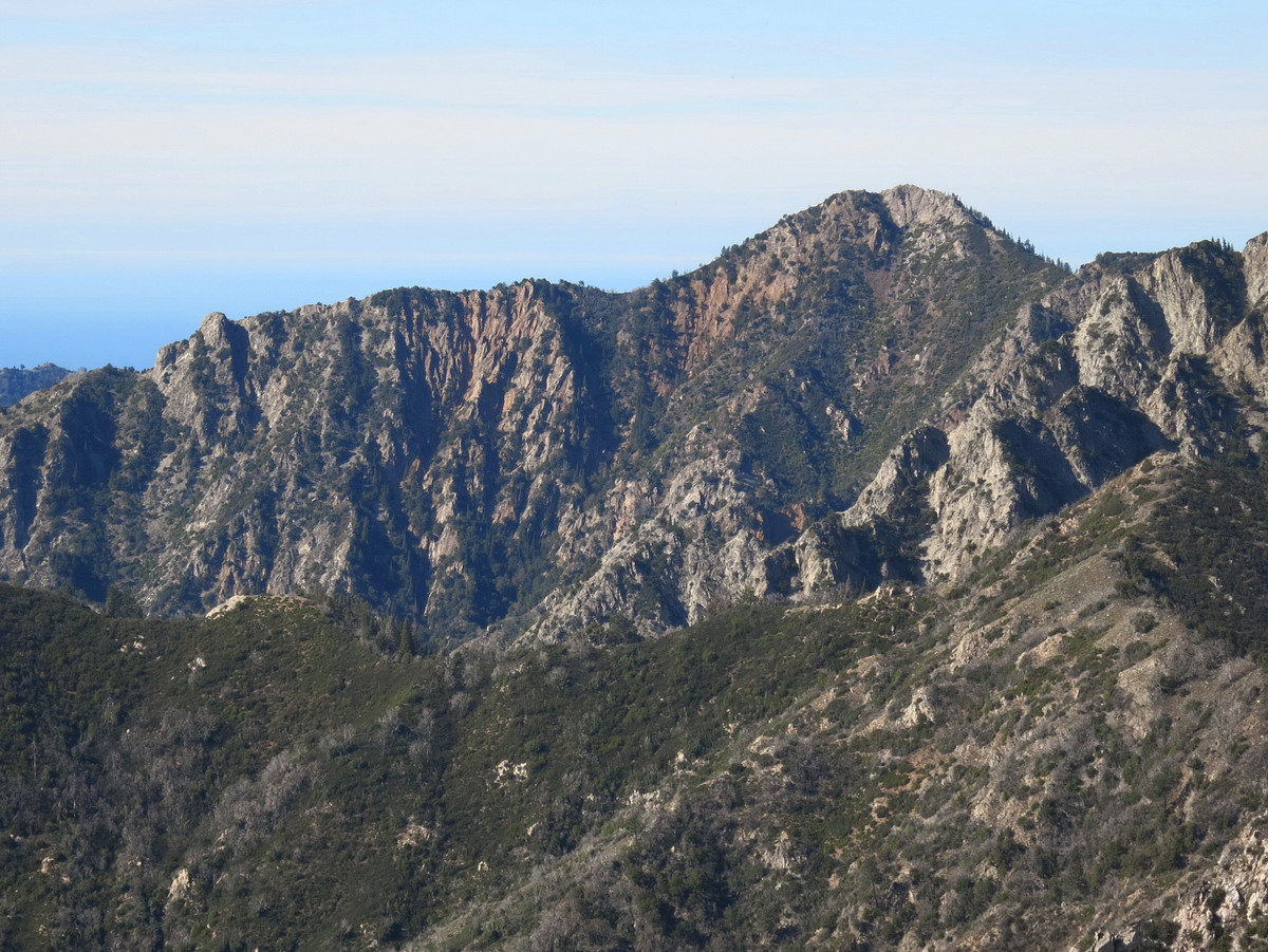
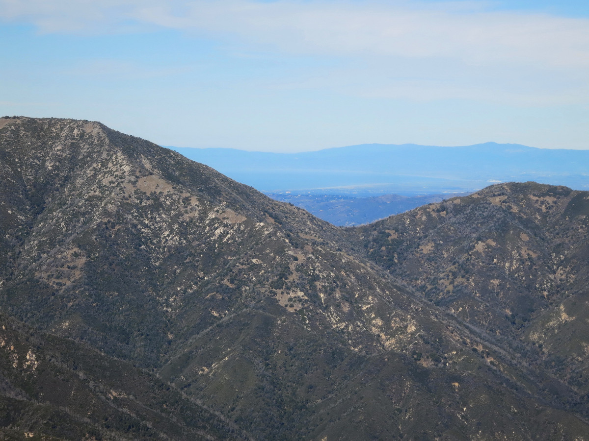
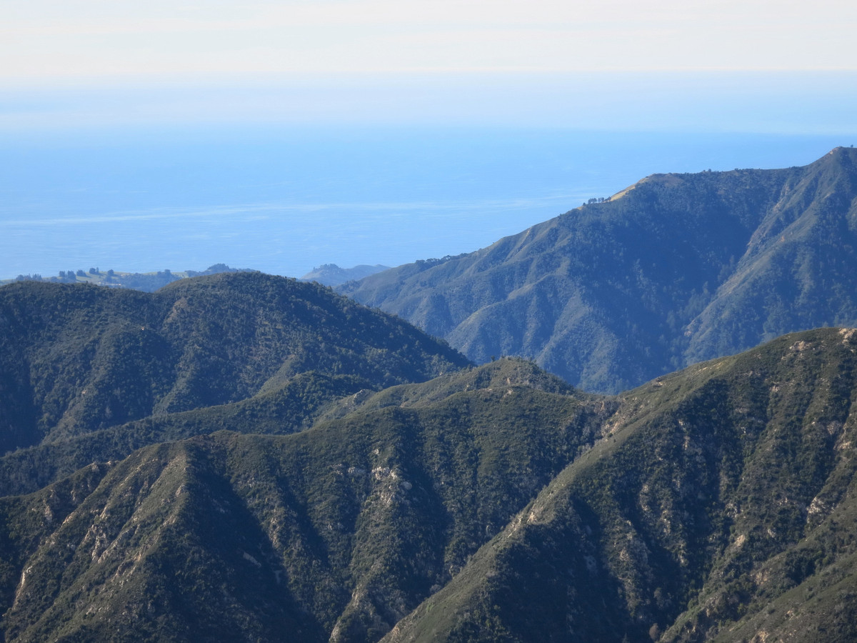
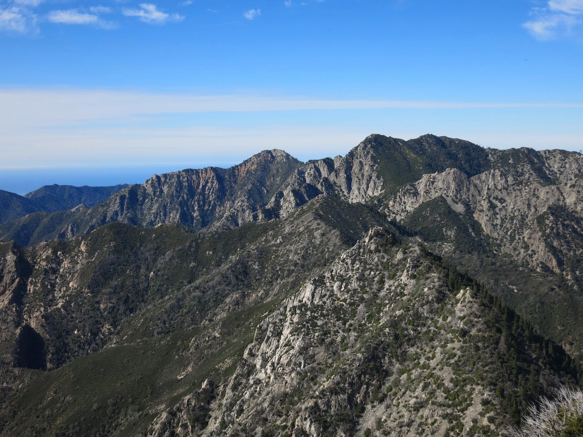
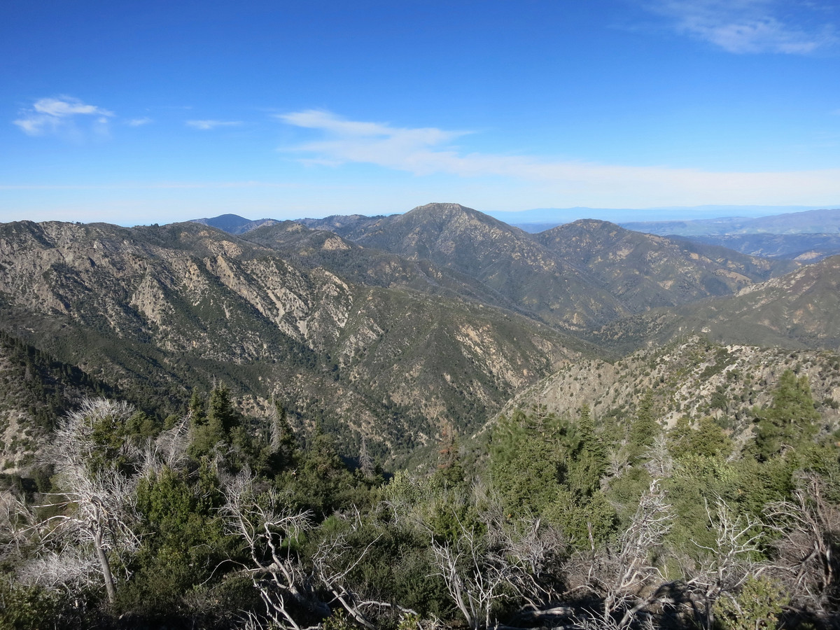
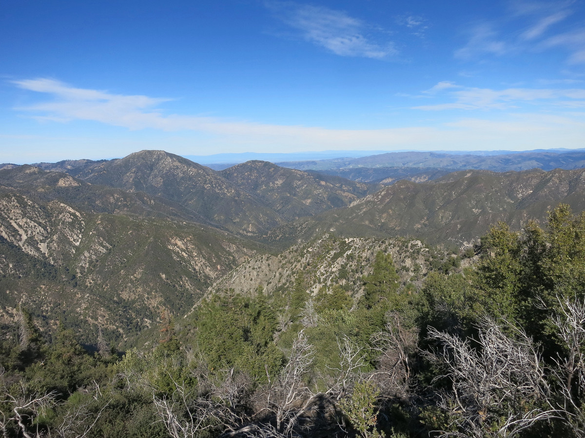
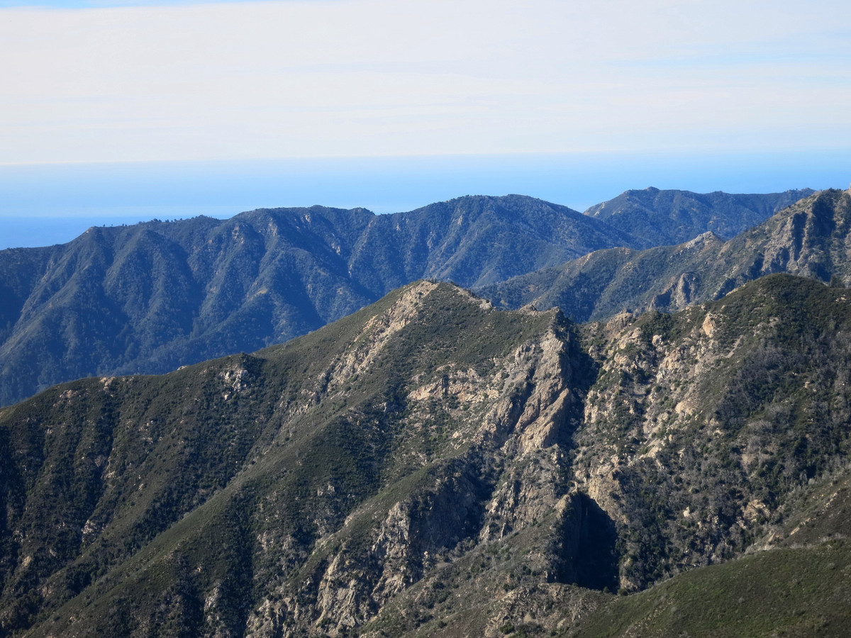
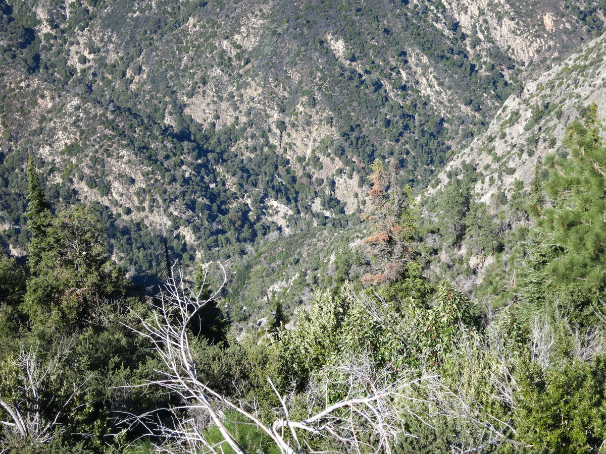
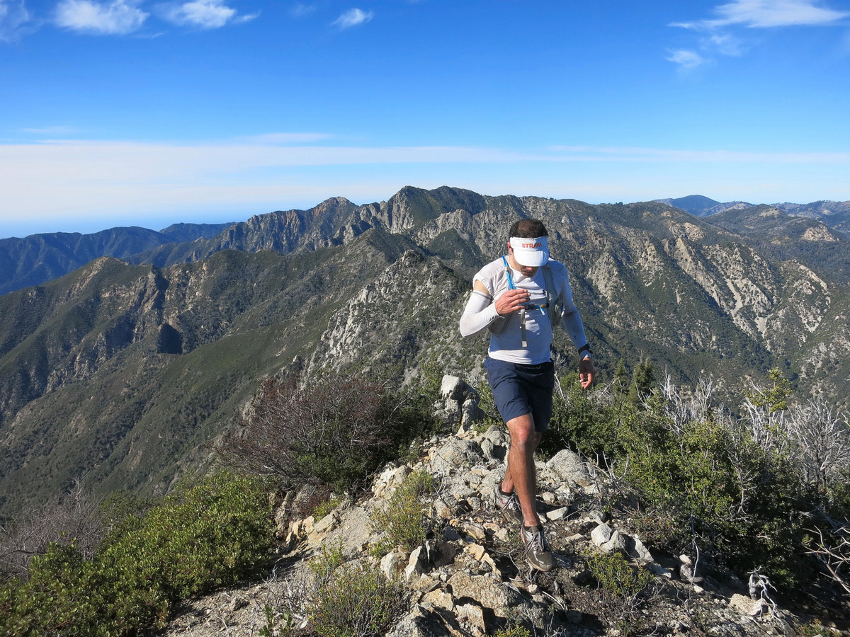
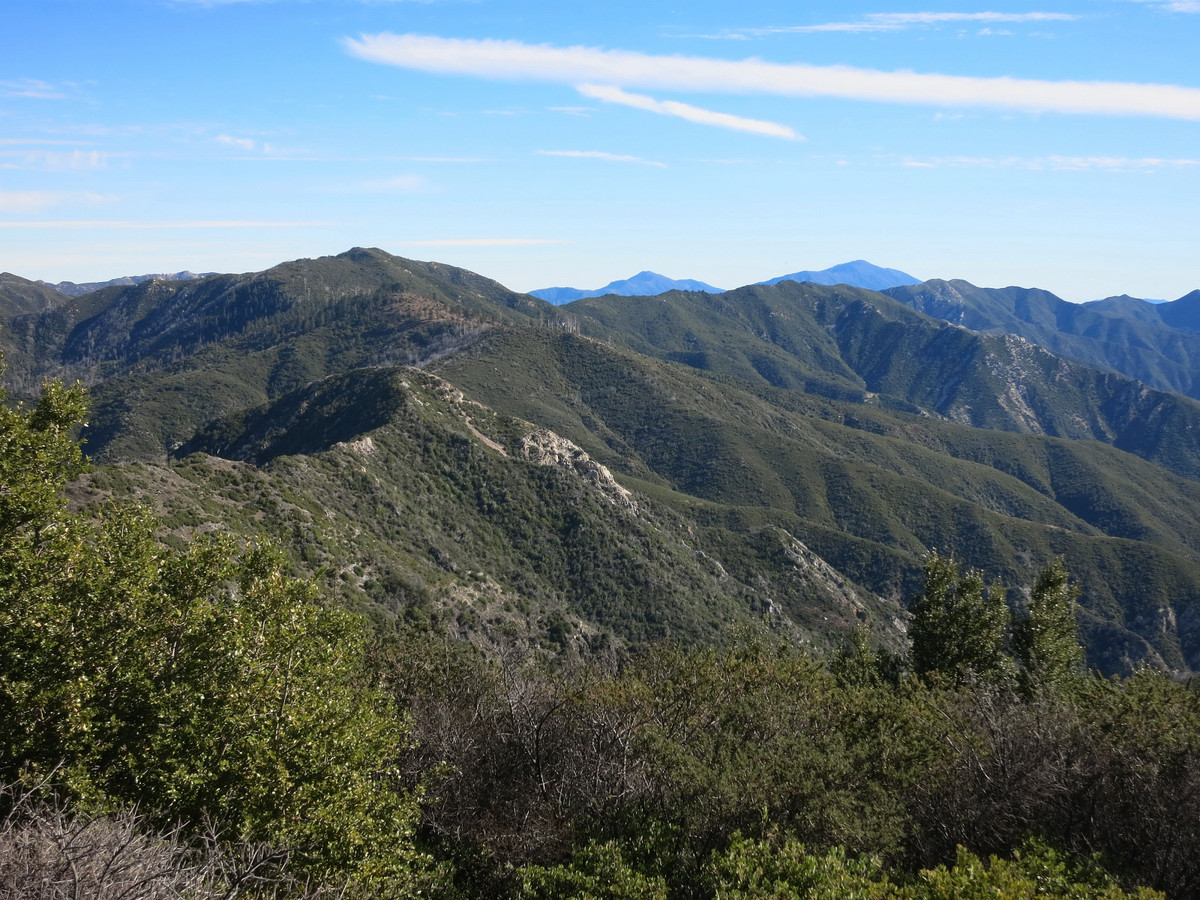
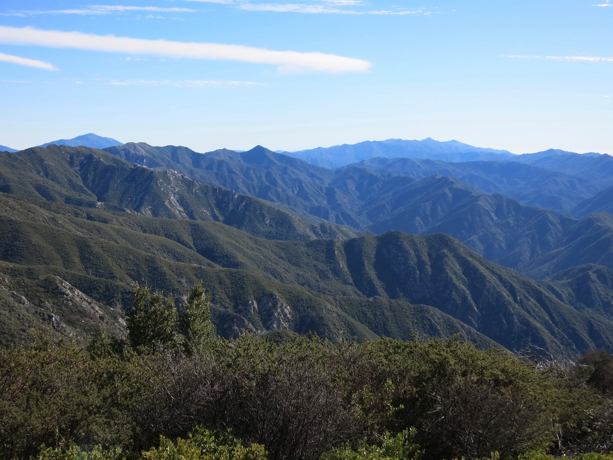
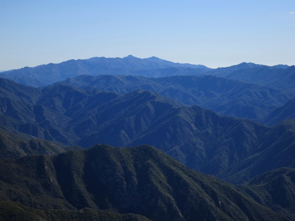
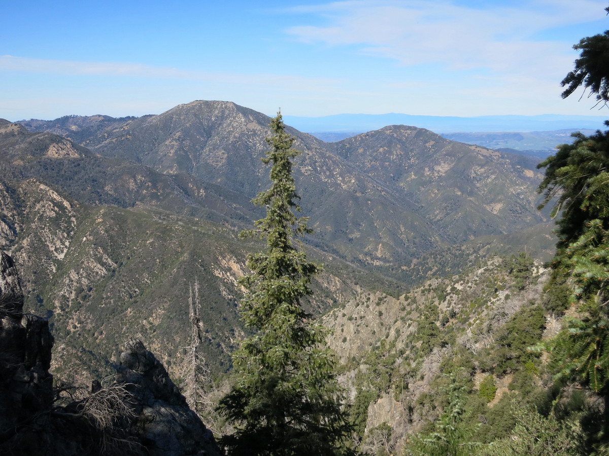
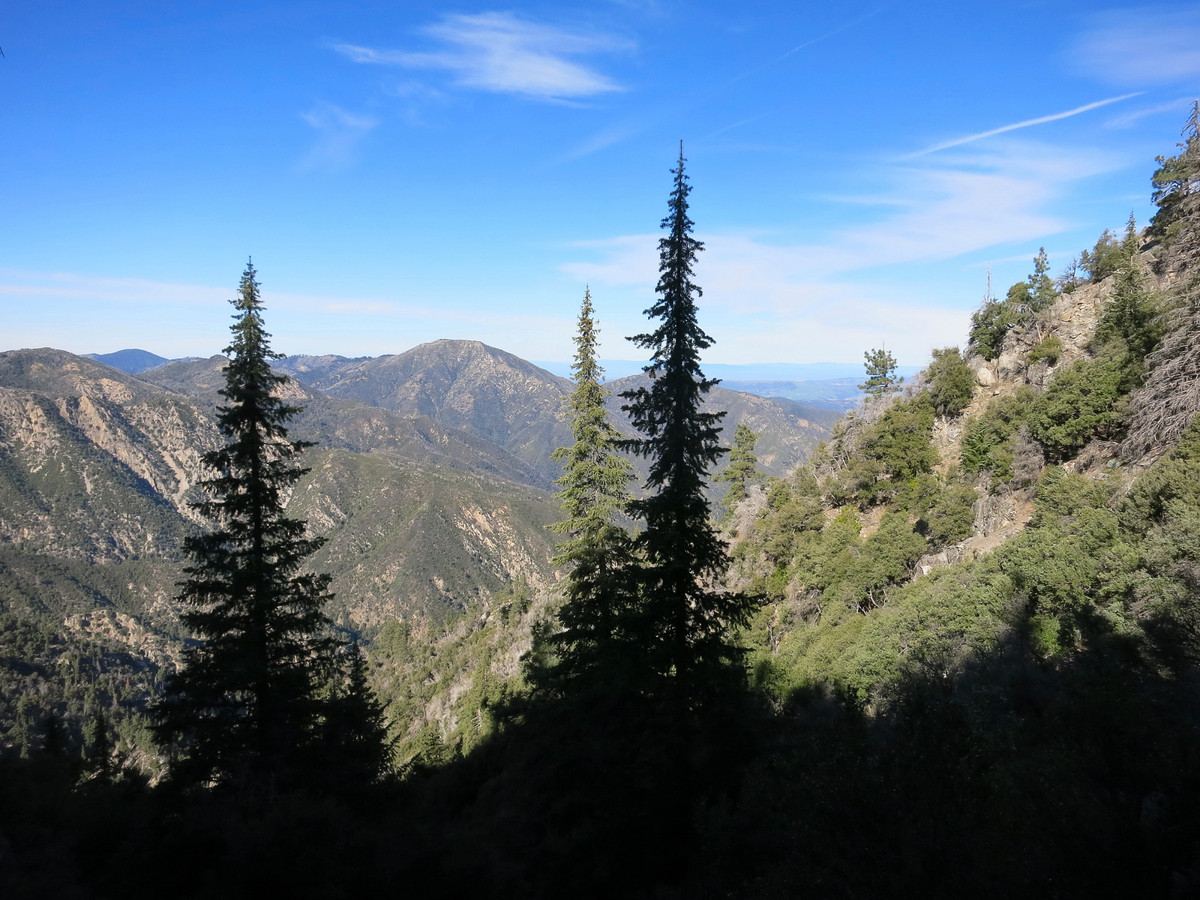
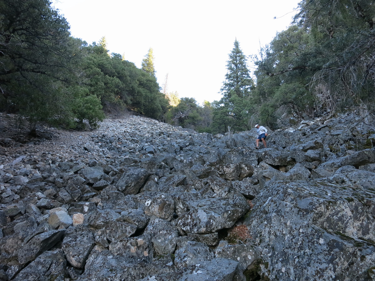
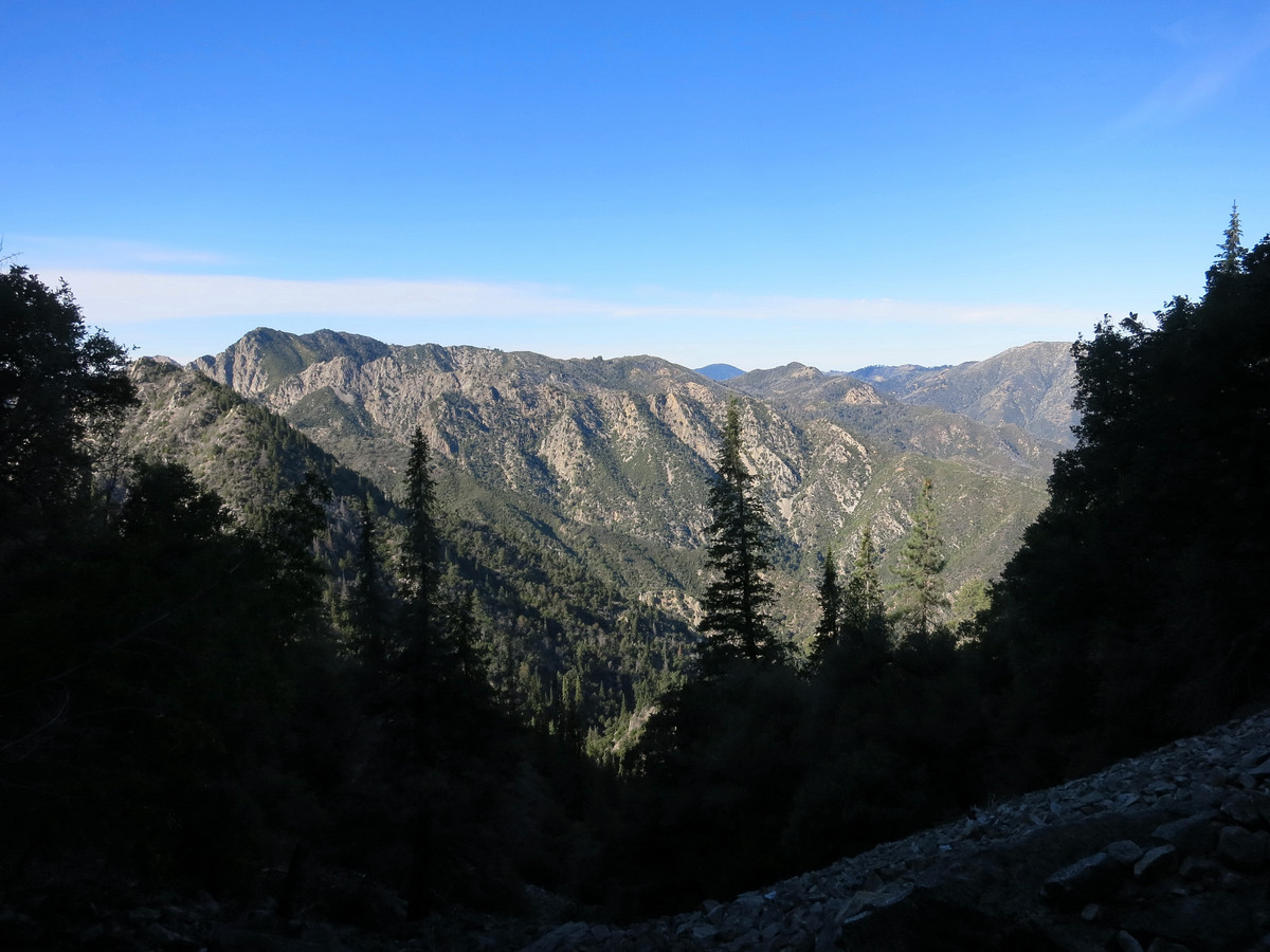
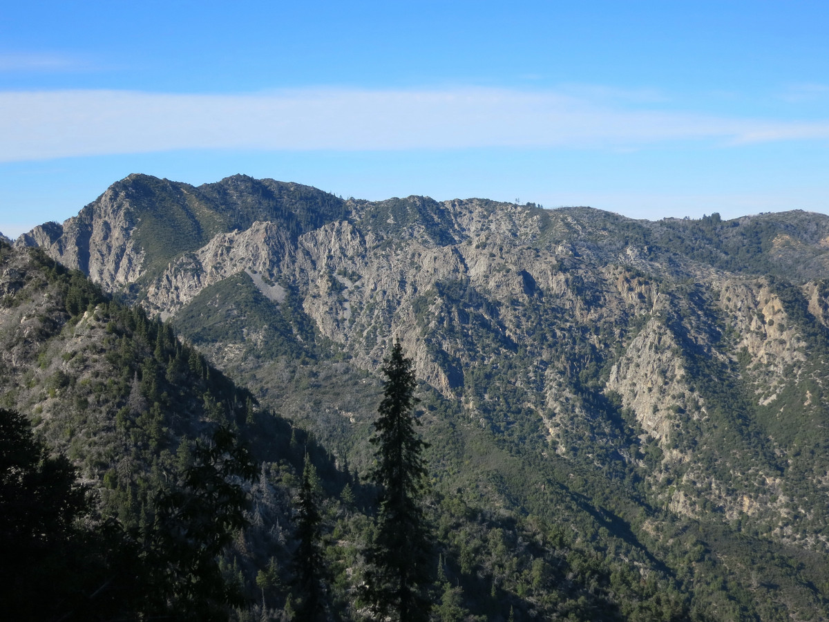
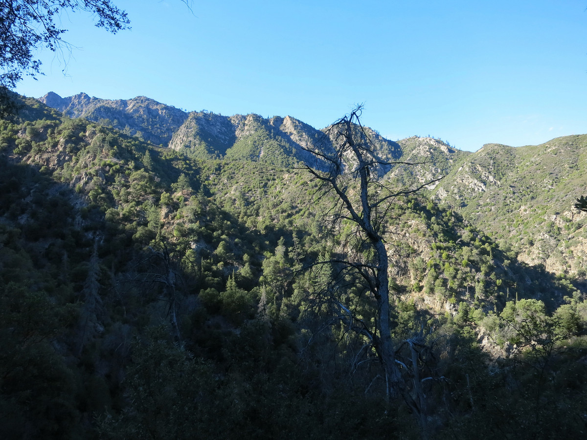
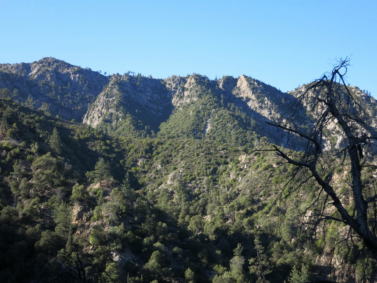
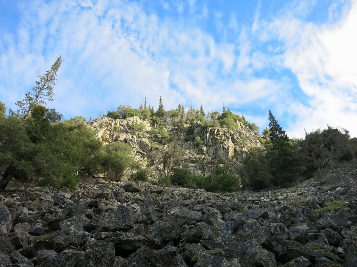
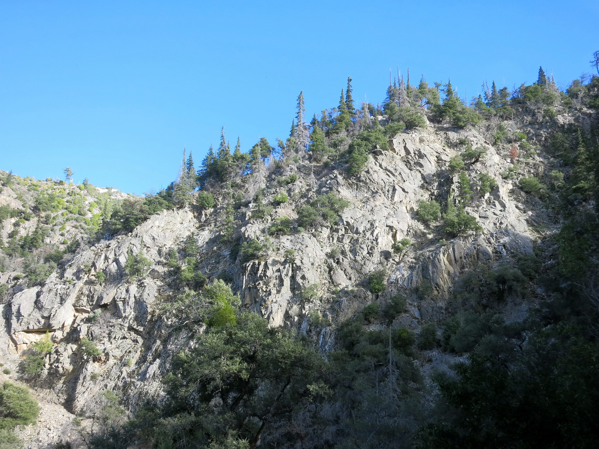
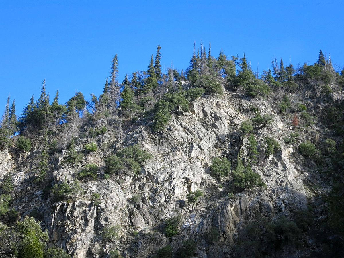
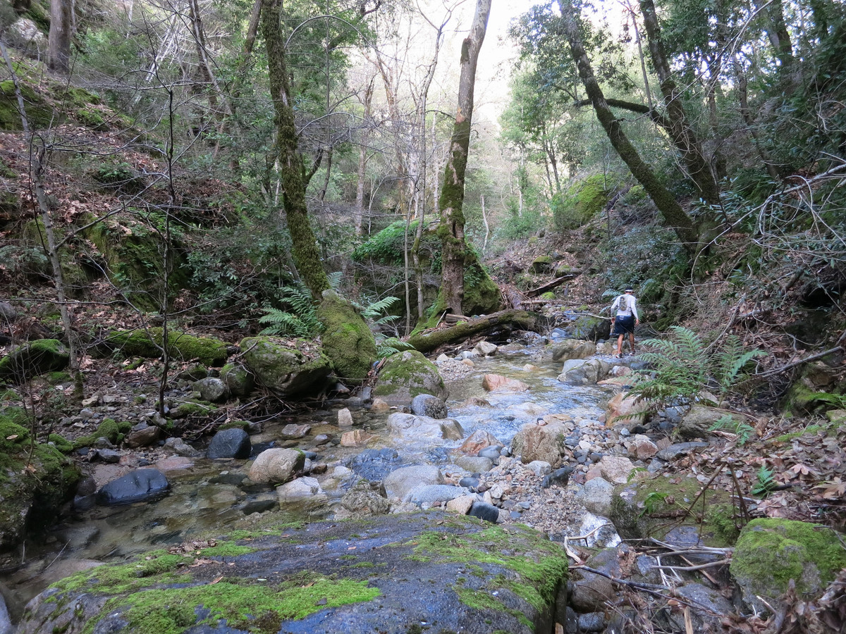
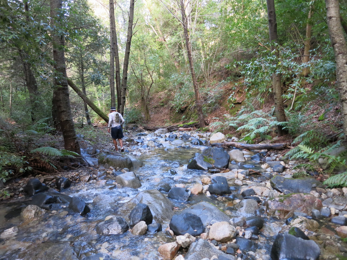
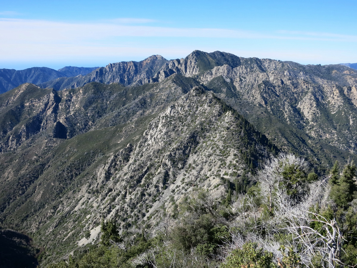
  Above the waterfall headwall and we were back in the stream bed starting what would be nearly 2,000 feet of talus slopes in Santa Lucia Fir forest. The stream would disappear underneath the talus rocks which were unstable as-is, but since water was running underneath they had some slippery condensation adding to the arduous nature of the slope. At times the stream would reappear on the surface when it flowed over the bedrock. Most of this section was remarkably devoid of brush although there was the occasional brush patch to plow through. The routes passed through several rugged cirques surrounded by impressive cliffs and ridges. The Santa Lucia firs in this fire-proof terrain looked very old and the rocky certainly protects these majestic trees from fire. Approaching the summit the final pitch increased in steepness one more time for a direct finish to Ventana Cone. Cresting at the top we were treated to an amazing 360 panorama including virtually all of the Ventana Wilderness. My favorite view was along the rugged divide to Ventana Spires, Ventana Double Cone and Kandlbinder. I also enjoyed the views of the Pacific Ocean and down the unnamed canyon we had just ascended. After a nice break on the summit to soak in the views we headed back down. The return trip proved to be nearly as long since the unstable and sometimes slippery talus slopes are not much faster to descend and the creek walking is not much faster on the descent either. Back down at the waterfall, we carefully reversed our moves down the wet rock, which was naturally much more difficult as a downclimb. After the downclimb we were back in the lush stream and found lovely afternoon light shining down the canyon bringing out the blues in the pools and the vibrant green of the moss and ferns. I enjoyed this section immensely. Back at Round Rock Camp we took a short break and then set off for the 2.5 hour run back to Los Padres Dam. We had about an hour of running with headlamp over the last 5 miles but it was quite pleasant with mild temps. It was an awesome day in the Ventana Wilderness, one of my favorite routes for sure and especially satisfying to know that we had put up a new and aesthetic route in the Ventana. GPS route here.
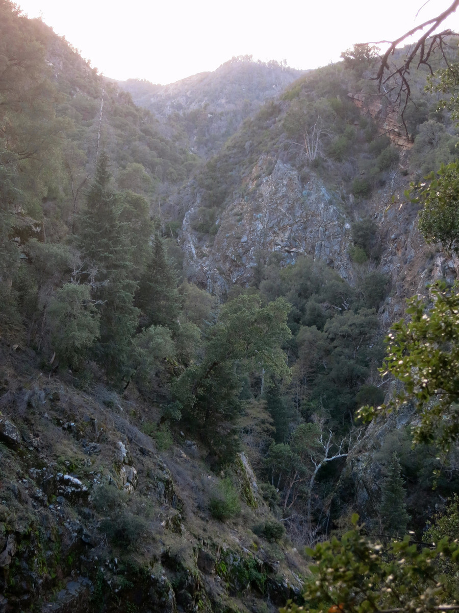
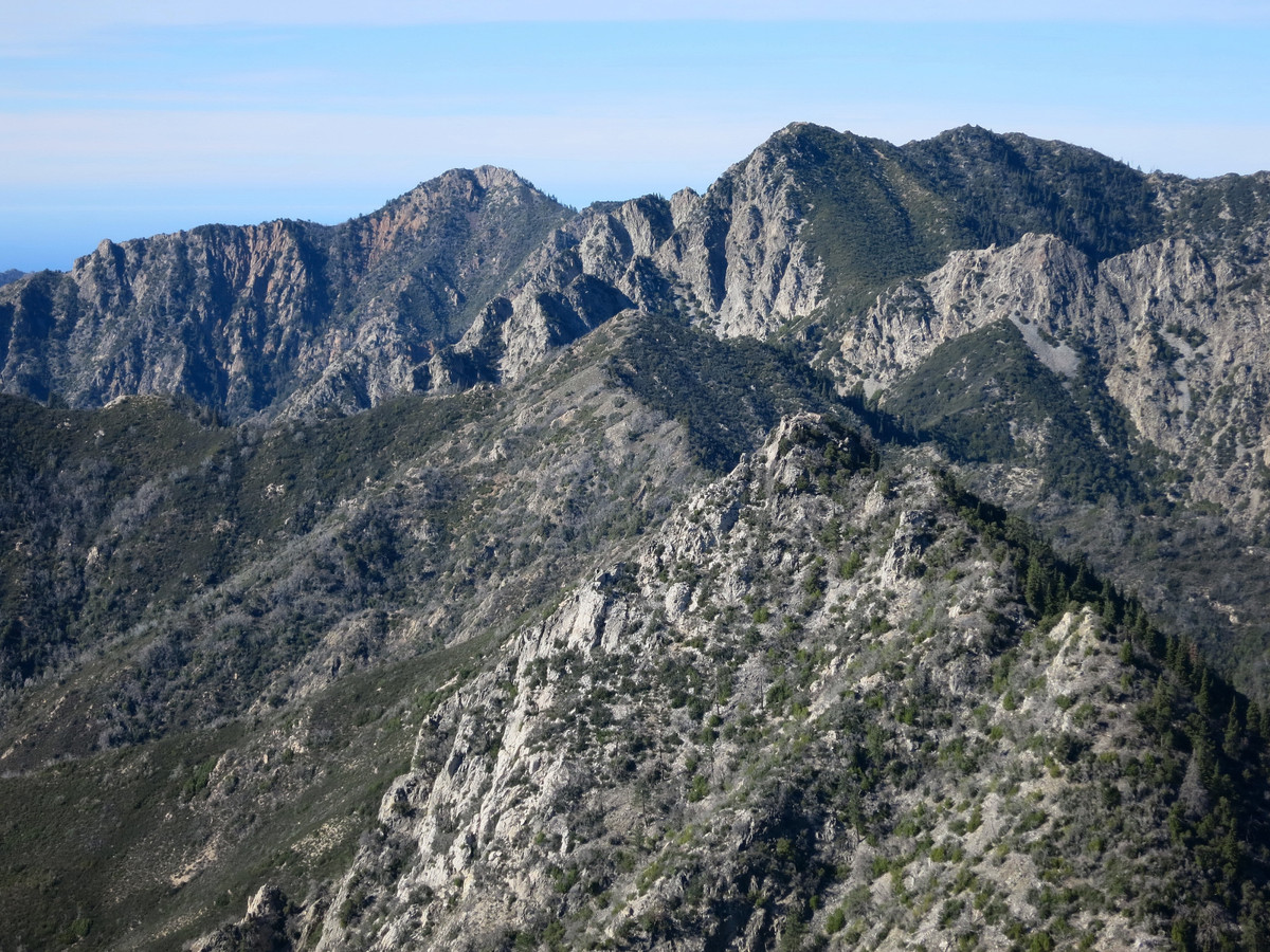
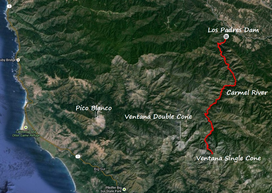


- Comment
- Reblog
-
Subscribe
Subscribed
Already have a WordPress.com account? Log in now.

Quite impressed with your trip into Los Padres Round Rock. Been there many times backpacking. How many miles from Round Rock Camp up the Carmel River did you go? Did you make it to Pine Valley Falls? Or did you take the first tributary on the right about a 1/4 mile from Round Rock camp? Was your whole trip all in one day? What time did you start? I have more questions. Planning another trip in at the end of may.
Jennifer, since this trip I’ve been to the area several times and explored the Carmel River and and all of the tributaries. I’ve been to Pine Falls and the many other falls in the area. All of my trips are over one day. This is a similar (but different) route up Ventana Cone from the Carmel River I did this year: https://pantilat.wordpress.com/2016/02/23/ventana-cone-lion-rock/ Enjoy!