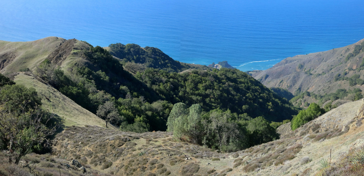
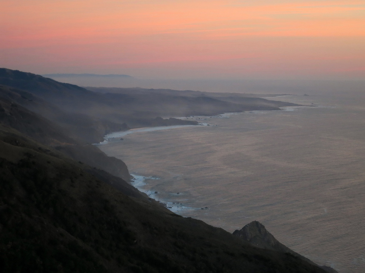
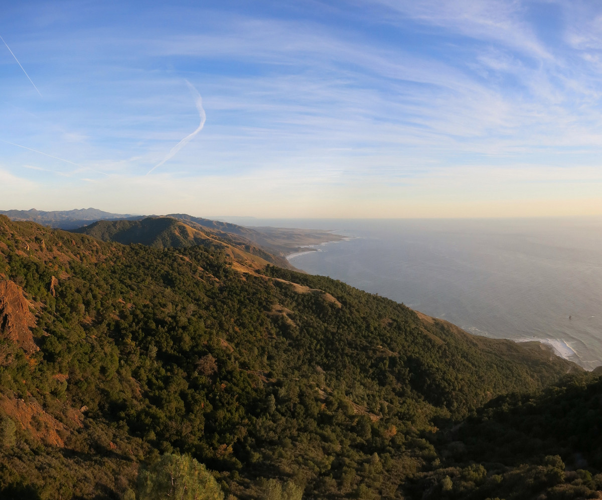
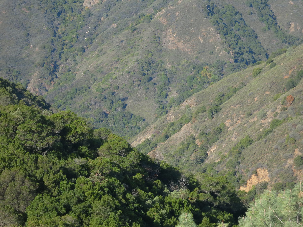
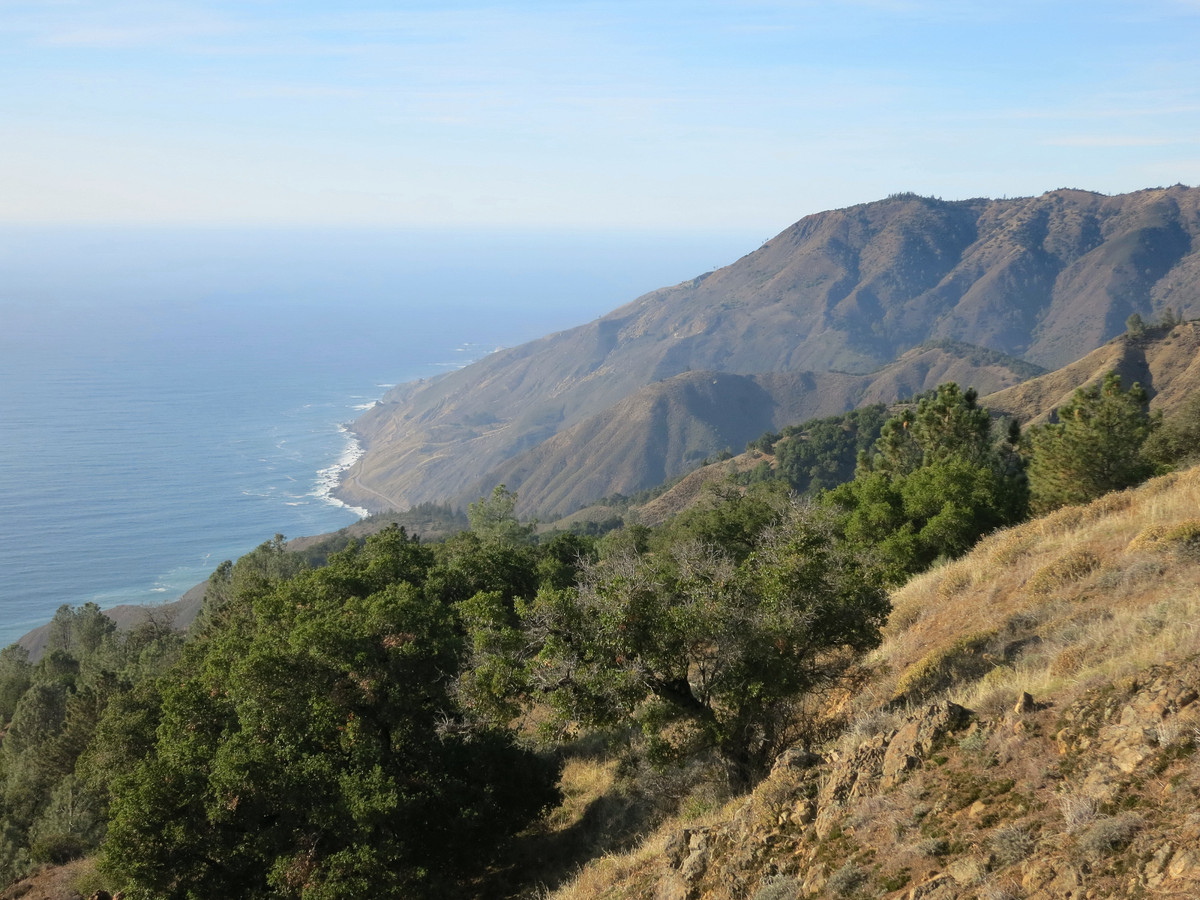
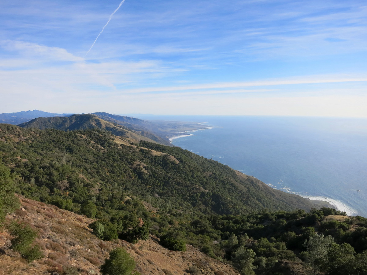
The South Coast of Big Sur has some of the best scenery of the entire Big Sur coast. The majority of the region is protected by the Silver Peak Wilderness, a 31,555 acre wilderness established in 1992. While only a fraction of the size of the better known Ventana Wilderness to the north, there are several awesome trails and great opportunities for exploration in the Silver Peak Wilderness. The region has great biodiversity of vegetation including redwoods, chaparral, oak woodland, pine forest, and even some groves of the rare Santa Lucia Fir. Villa Canyon and Salmon Creek Canyons are the heart of the wilderness and are both spectacular. Fires have not affected this region in a number of years so the flora is generally more developed with far fewer signs of fire compared to the badly burned areas of the Ventana Wilderness from the 2008 Basin Complex fires. As the South Coast is far from both the SF Bay Area to the north and the Los Angeles basin to the south, this stretch of the Big Sur Coast is probably the least visited and an excellent location if you’re looking for solitude. On this occasion from back in November I put together a loop including Dutra Flats, County Line Ridge and Mount Mars, some of my favorite spots on the South Coast. I enjoyed this loop so much that I recently did it again in the reverse direction with Erica and it was nice to see the hills turning green after December Rains (photos here). GPS for Dutra Loop here.

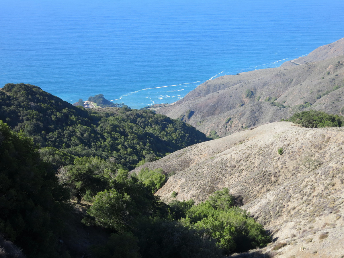
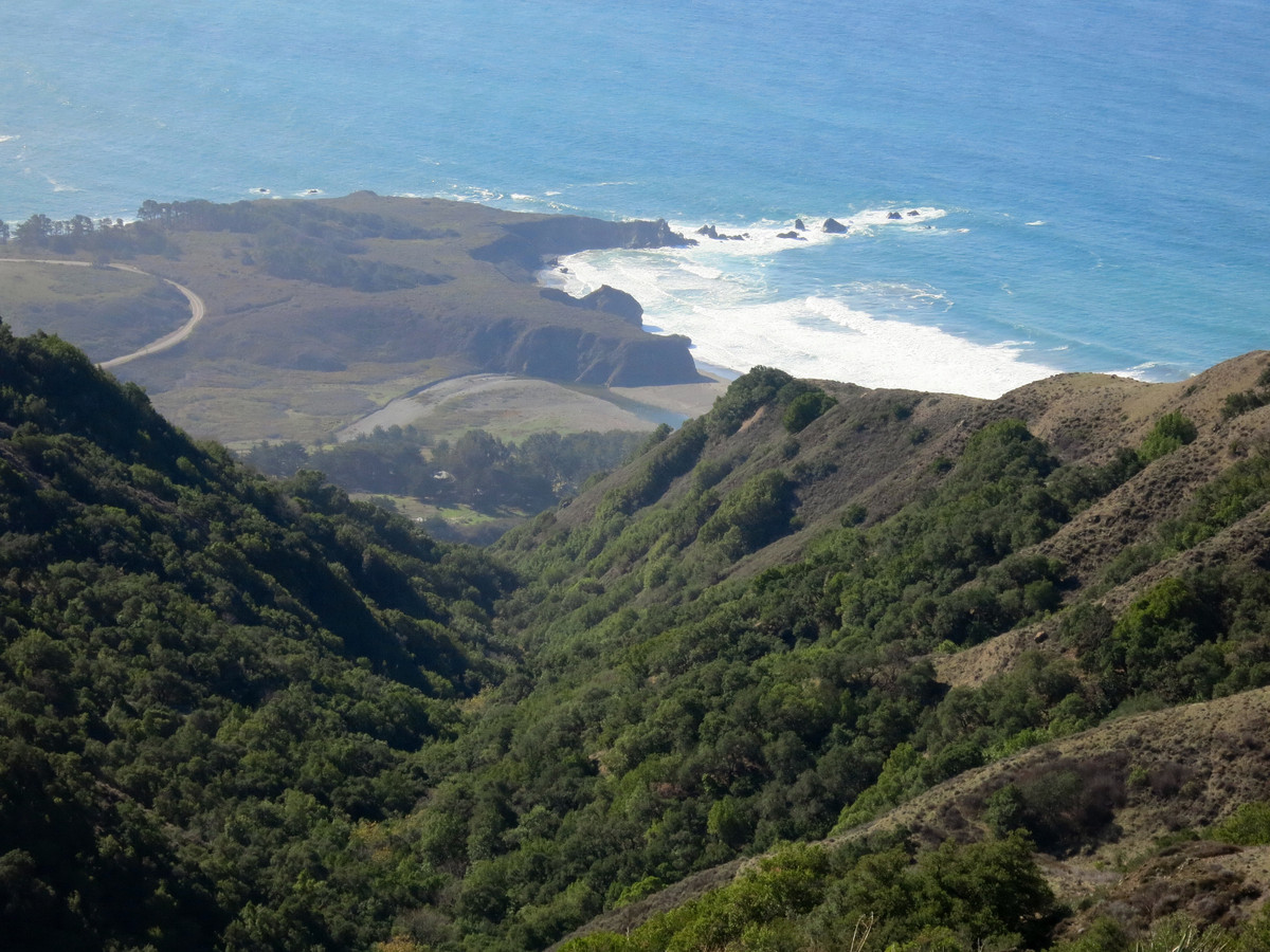
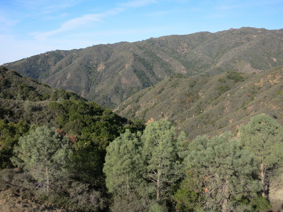
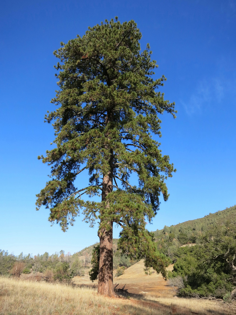
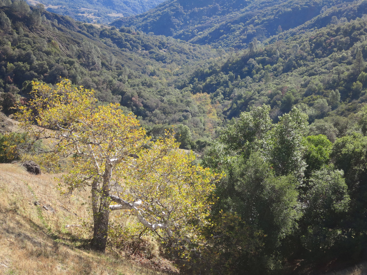
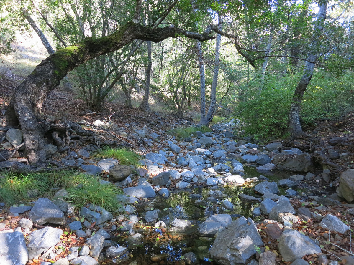
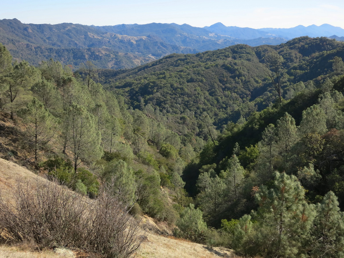
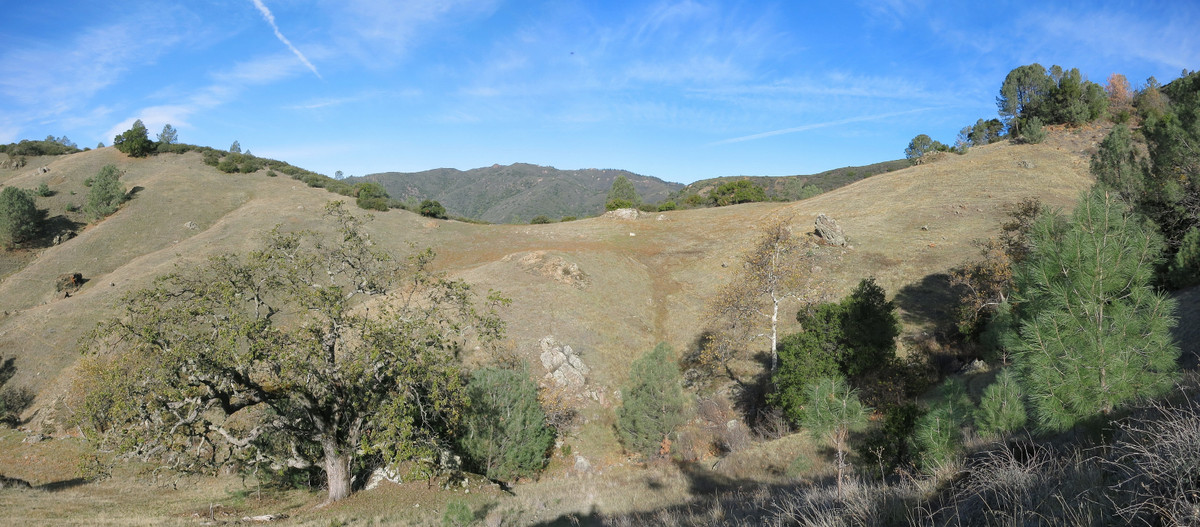
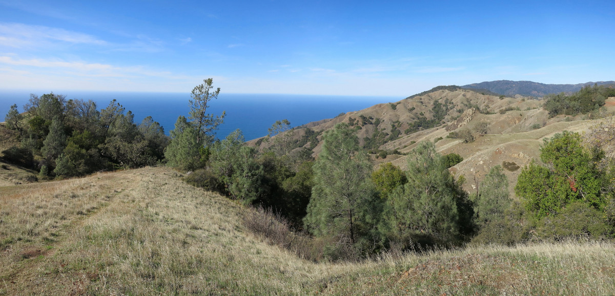
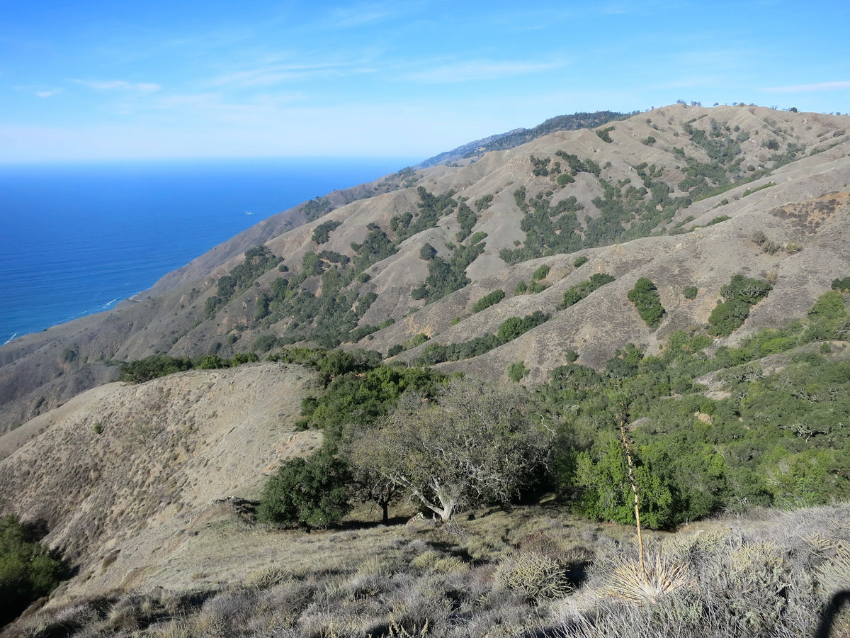
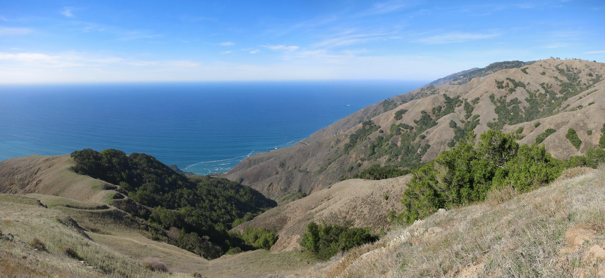
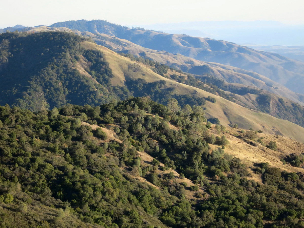
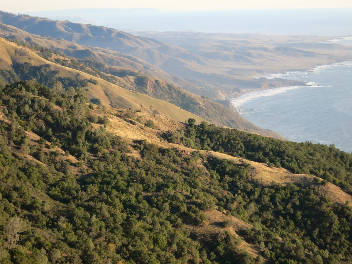
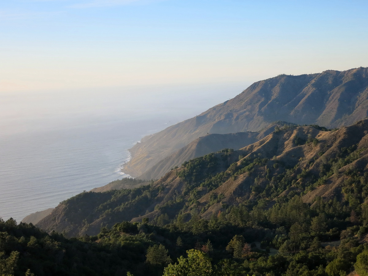
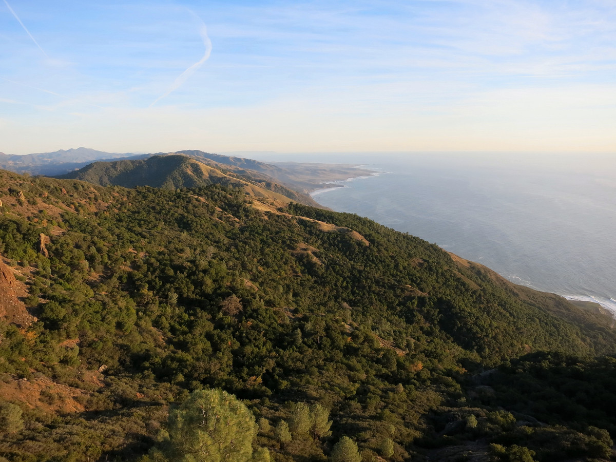
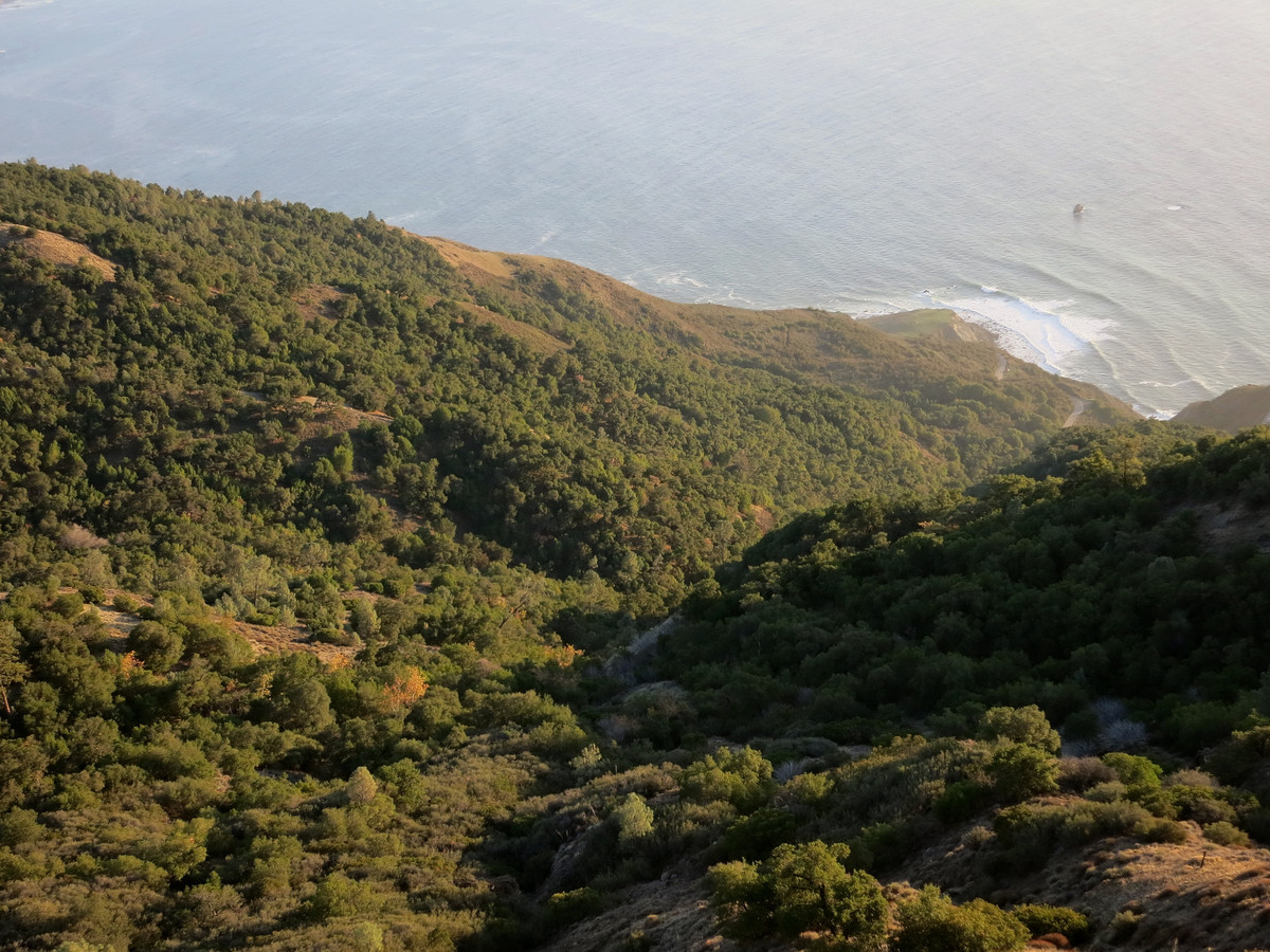
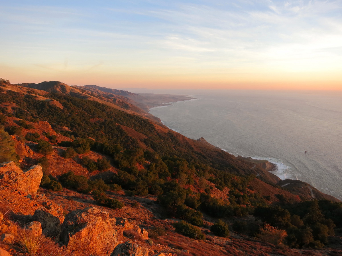 The Dutra Loop route utilizes a established trails and some use paths giving an excellent taste of both the interior and coastal aspects of the Silver Peak Wilderness. Access to Dutra Flats is via the standard route of the Salmon Creek Trail and Spruce Creek Trail, both awesome single tracks in a lush canyon environment with Douglas Fir forest. The Spruce Creek Trail is especially lush and there is a glimpse of a remote Santa Lucia Fir grove high in the drainage, one of the southernmost stands of the rarest fir on earth. Dutra Flats is such a pleasant peaceful spot with its green pastures lined by gray pines, ponderosa pines and heritage oaks. From the edge of the flats a use path contours down and into the Dutra Creek drainage. The path peters out in the grassy area but is picked up again at the edge of the forest at the bottom of the hill. After crossing Dutra Creek, the well-defined use path heads uphill and emerges at the Baldwin Ranch Road. One can cross Baldwin Ranch Road and continue on more use path to the Baldwin Ranch Shortcut, passing through more beautiful meadows and then entering a pine and oak forest for a climb up to County Line Ridge. A spring about halfway up the climb to County Line Ridge appears to have perennial water. County Line Ridge is a beautiful mixture of grassland and oaks with impressive relief to the Pacific Ocean. On this day I explored two spurs off the main ridge, the better being Point 1950 which has enough horizontal prominence to yield an excellent view up and down the coast including Piedras Blancas and most of the Big Sur south coast. At the north end of County Line Ridge a use path traverses the various summits of Mount Mars through pine forest and then chapparal. Beyond the highest summit, the path emerges on the impressively steep grassy slope of Mount Mars. This steep grassy slope is a Big Sur classic with incredible relief down the deep blue ocean seemingly at your feet. At the base of this grassy ridge a use path can be taken back down to the Salmon Creek Trail.
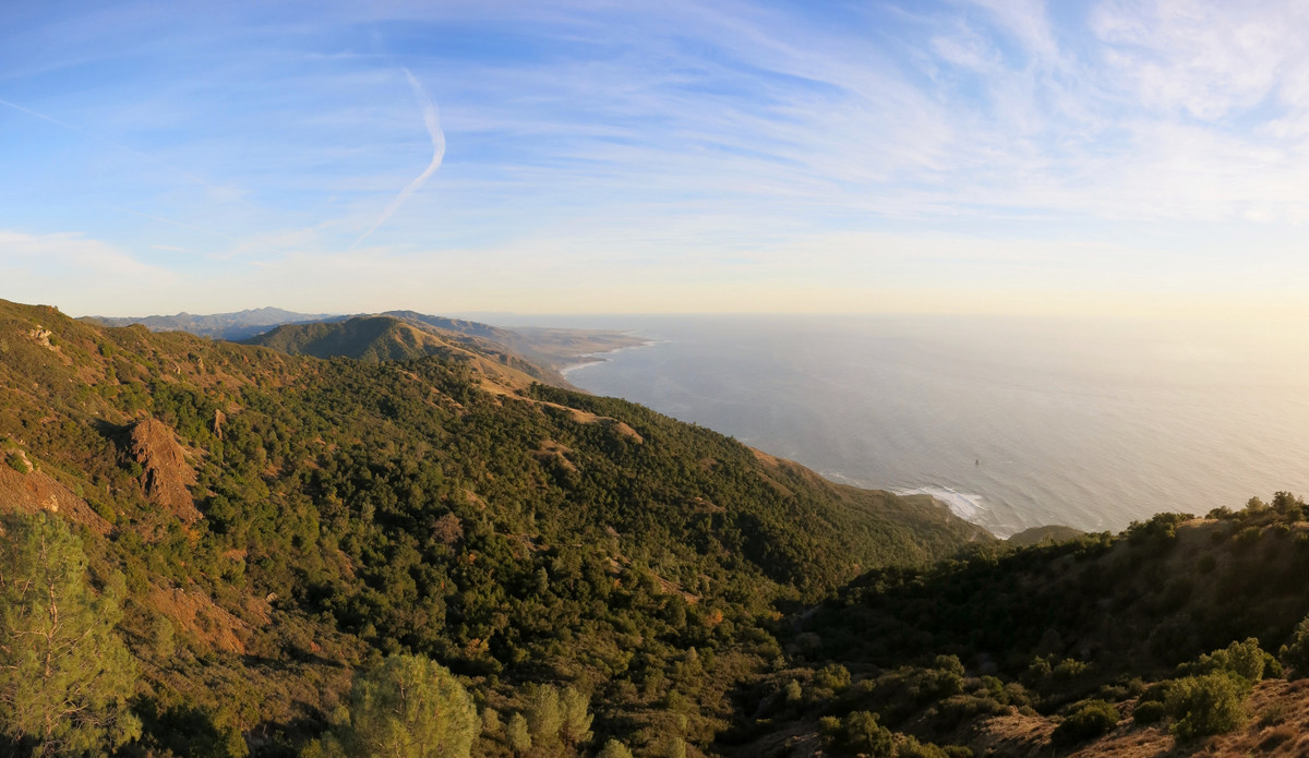
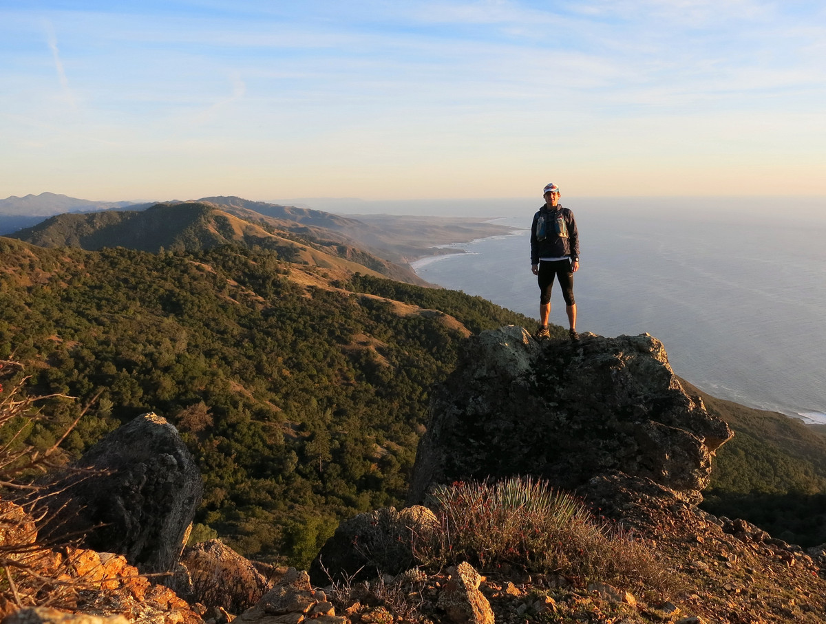
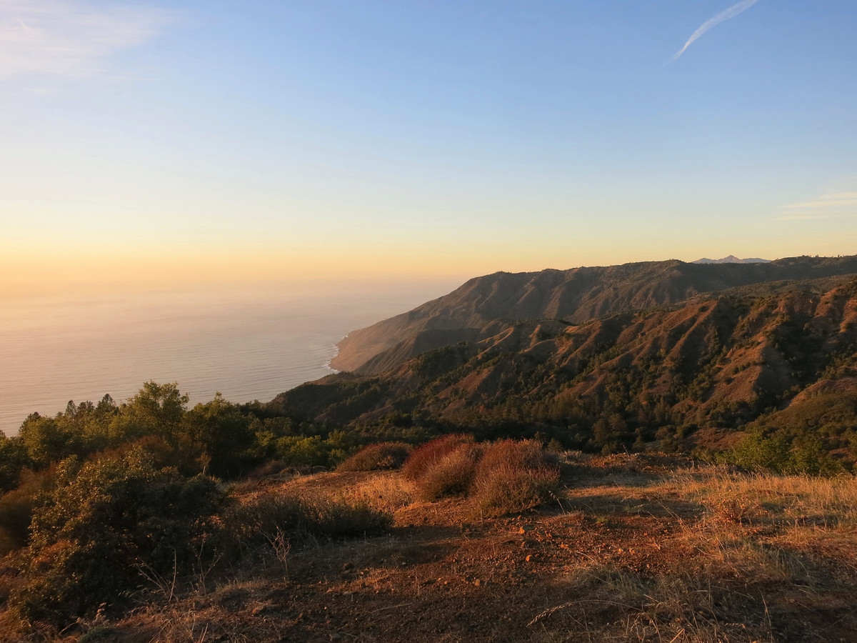
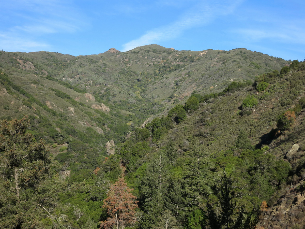
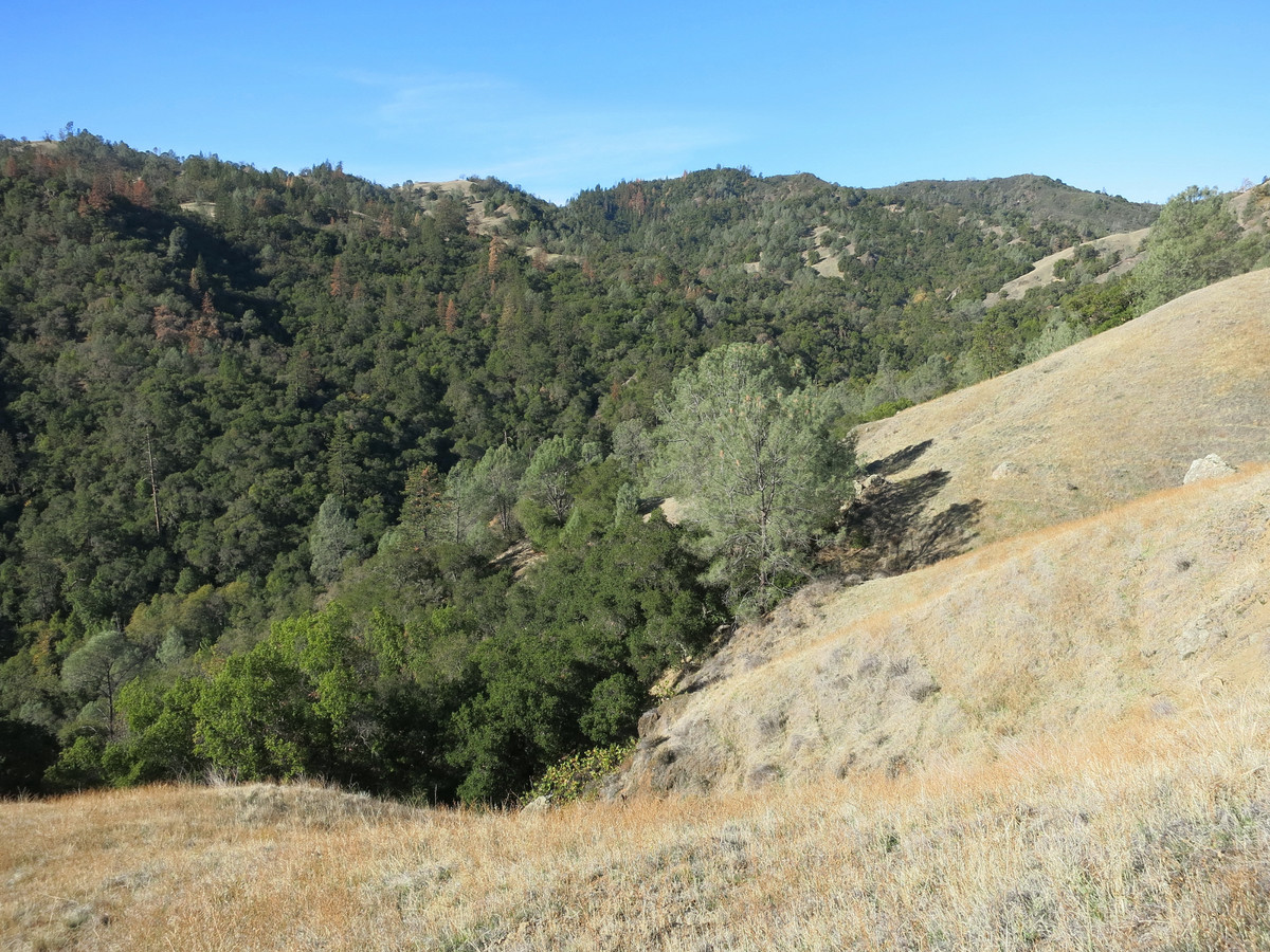
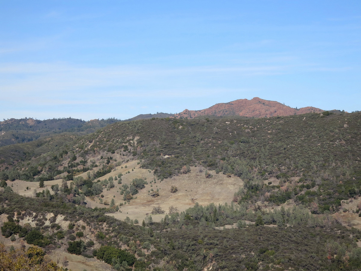
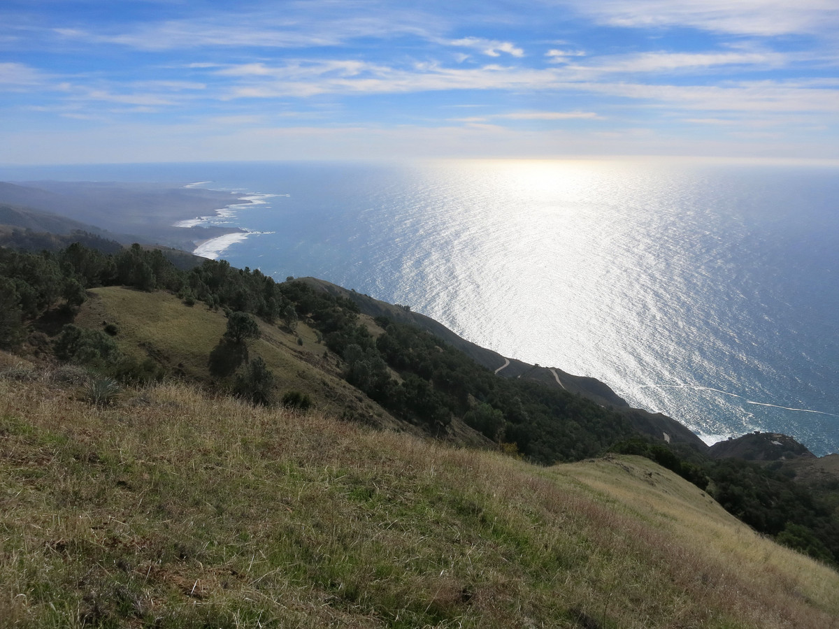
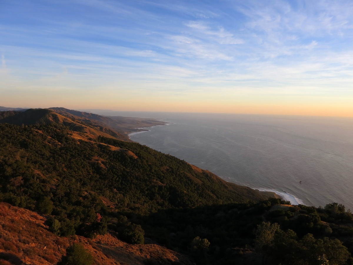
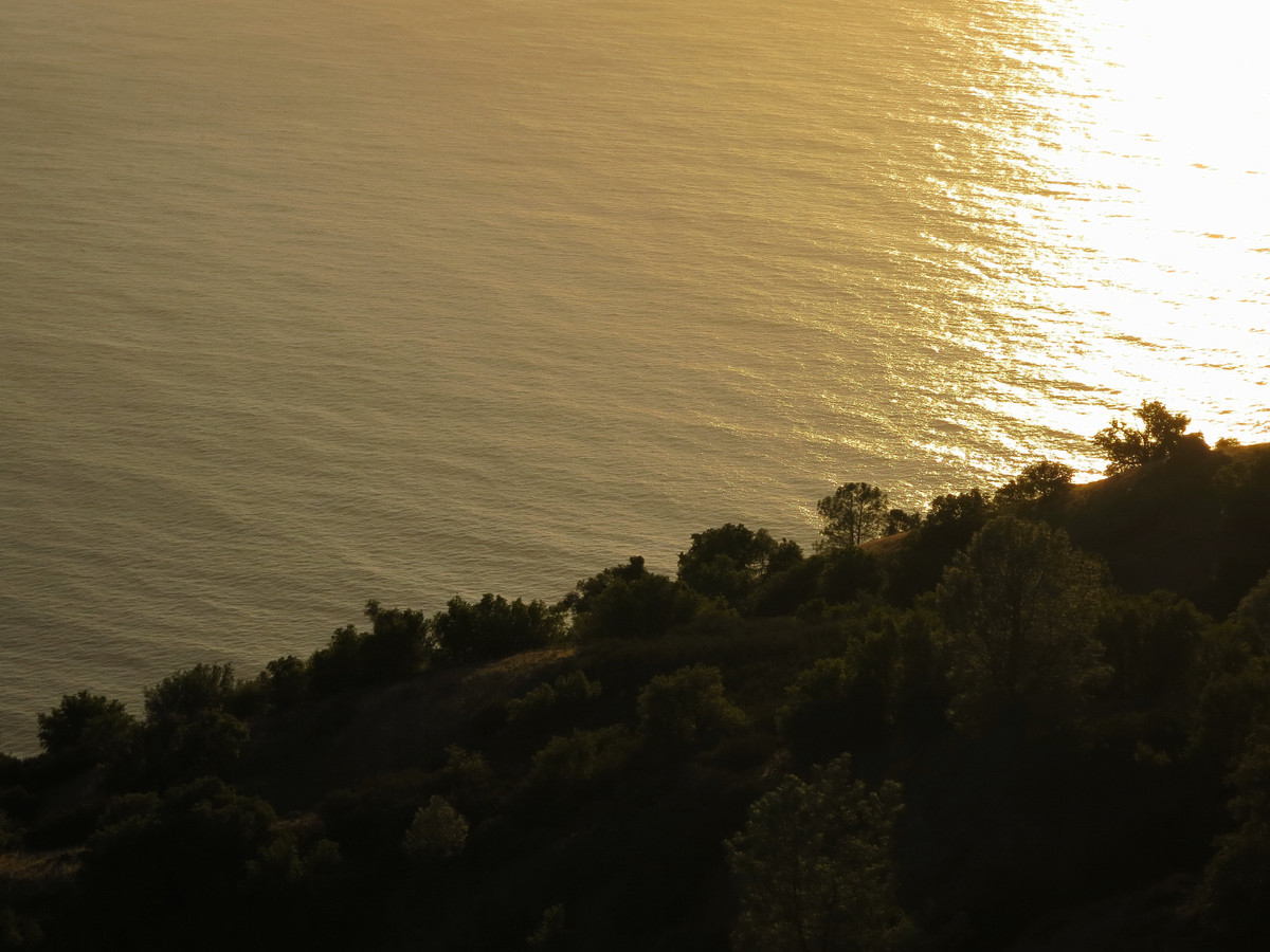
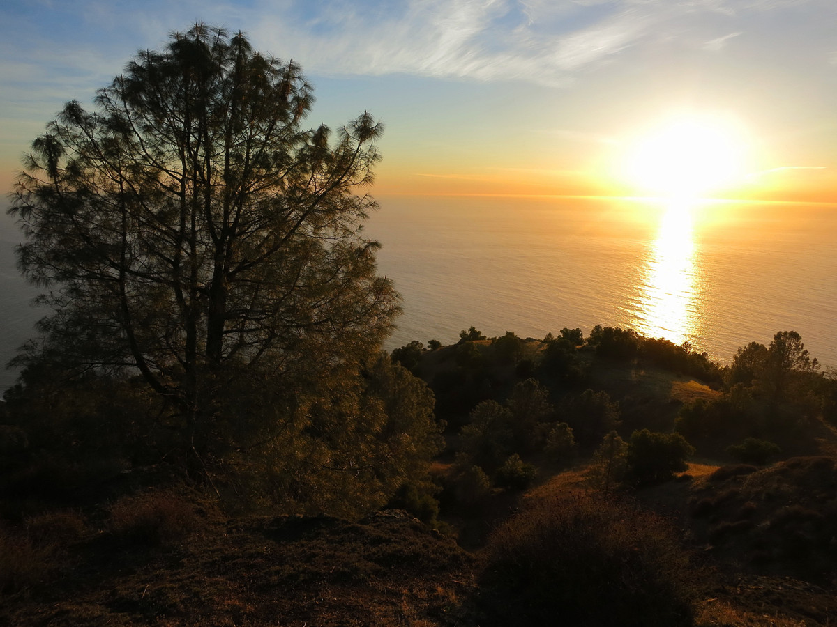
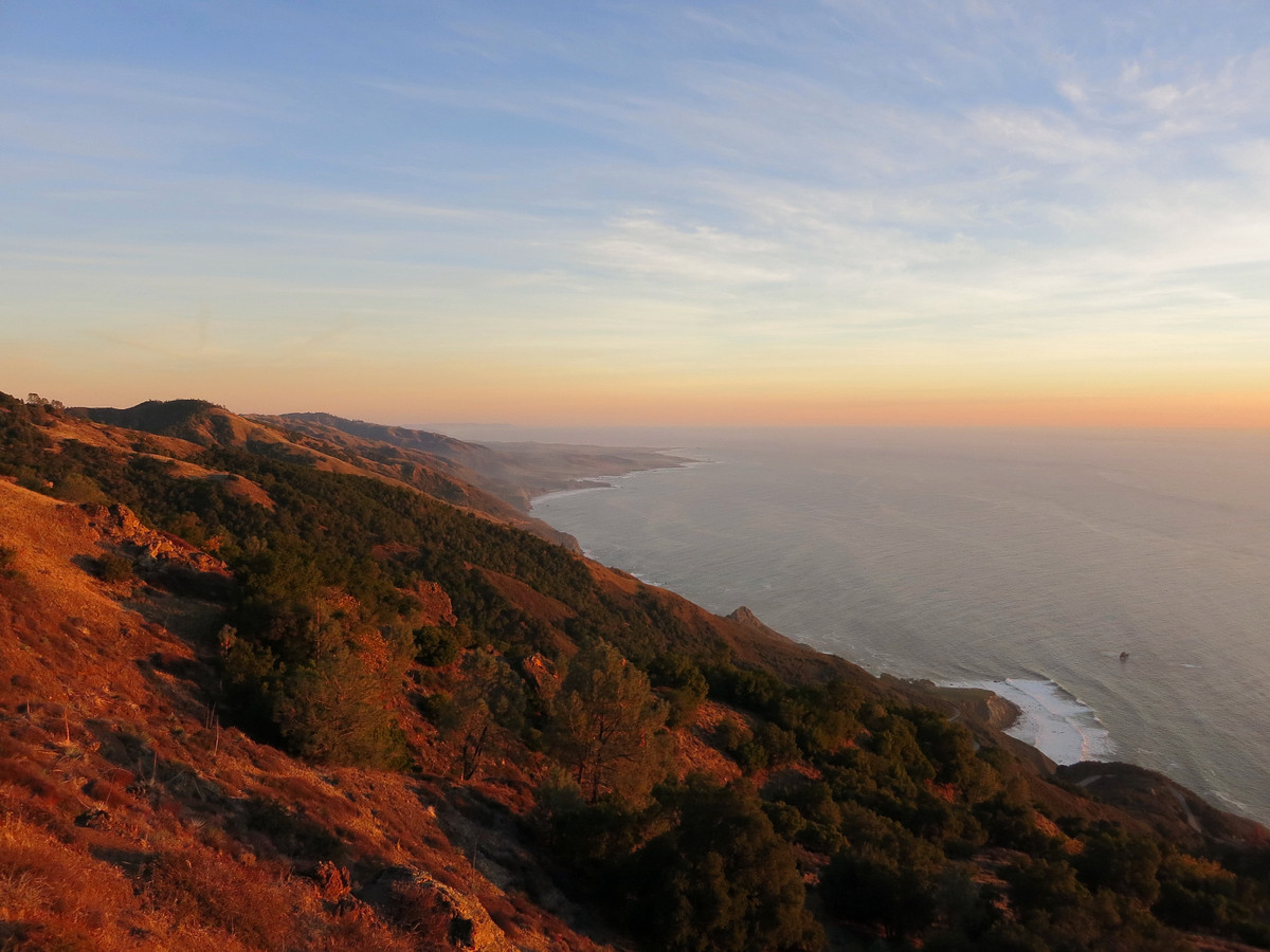
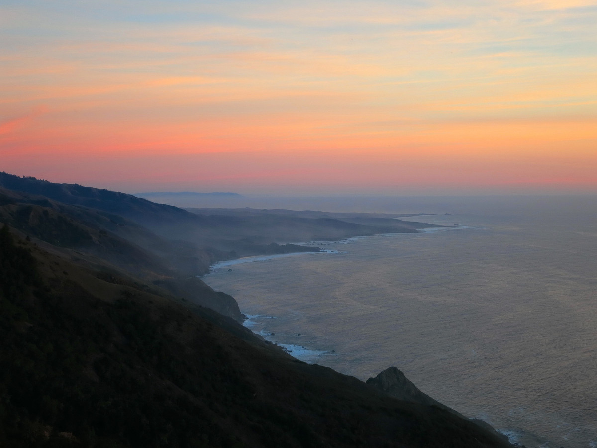
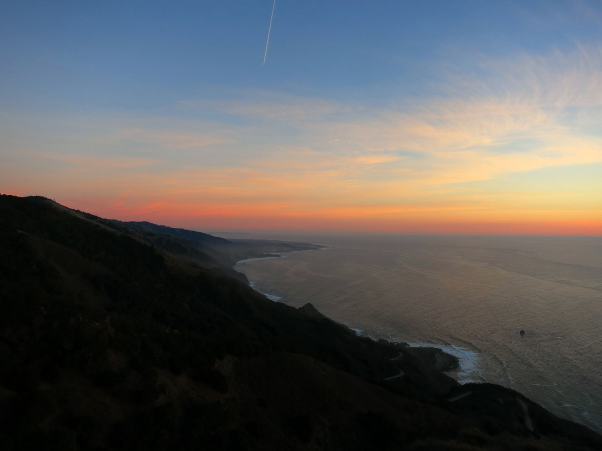
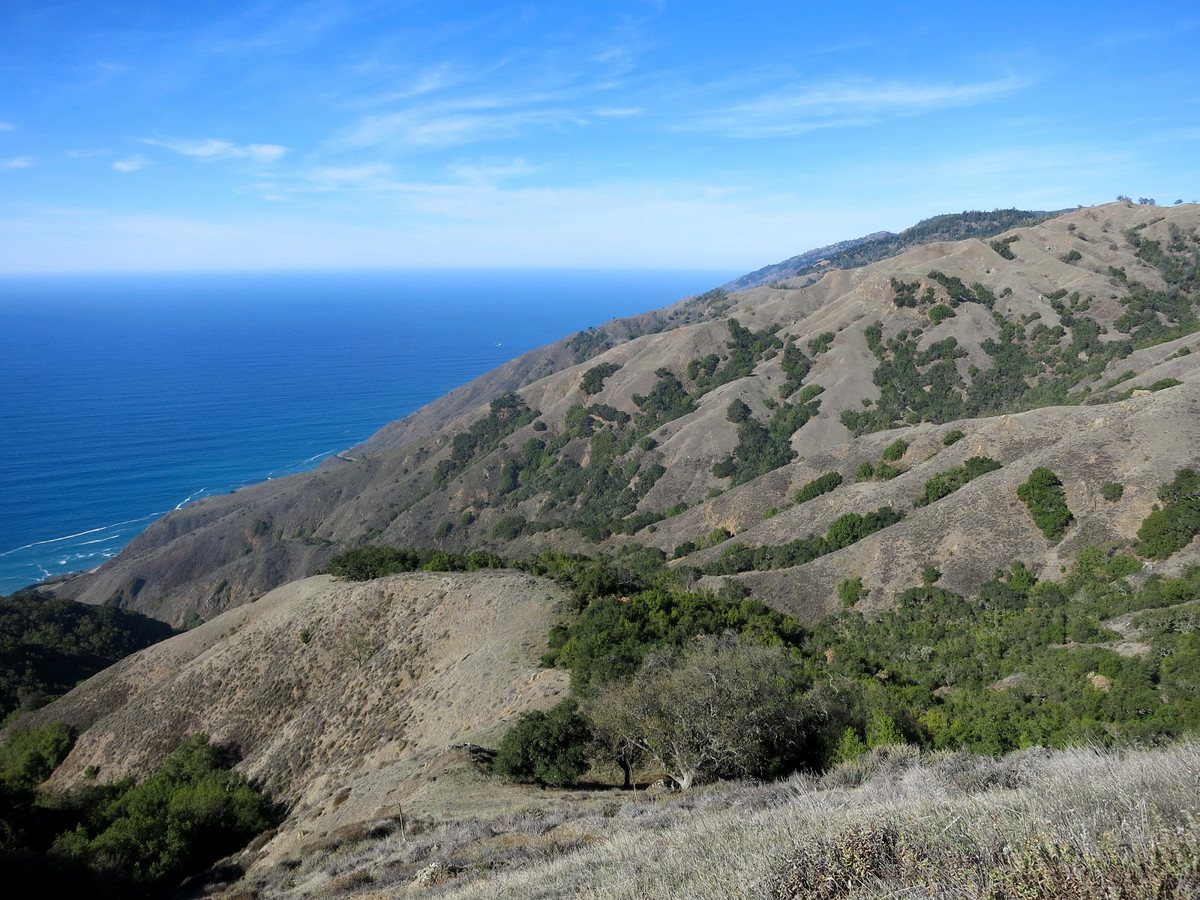 After the Dutra Loop I headed up to Point 2866 via the Soda Creek Trailhead. Point 2866 is on the WSW ridge coming off Silver Peak. The ridge contains several high points but the last one and most dramatic is Point 2866. It appears this point has no official name but “Soda Peak” makes geographical sense since it sits at the head of the Soda Creek drainage. Since Soda Peak is the last point of prominence along the ridge it has a commanding view of the south Big Sur coast. The rocky limestone summit is also mostly free of brush enabling an excellent 360 degree panorama including San Martin Top, Silver Peak, Cone Peak and Mount Mars. I guessed that evening light would be great from this spot and I was not disappointed. The easiest way to reach Soda Peak is via the Soda Creek Trailhead and then the Buckeye Trail. At about 2,100 ft along the Buckeye Trail take a use trail on the southern of two spur ridges coming off Soda Peak. The use path is fairly easy to follow and in about 750 vertical feet you’re on top and gazing across the Soda Creek drainage to Mount Mars and beyond, a truly spectacular vantage. It’s only about 3 miles each way to Soda Peak, but the few miles pack around 2,500 ft of elevation gain.


Do you have a map or GPX for this hike?