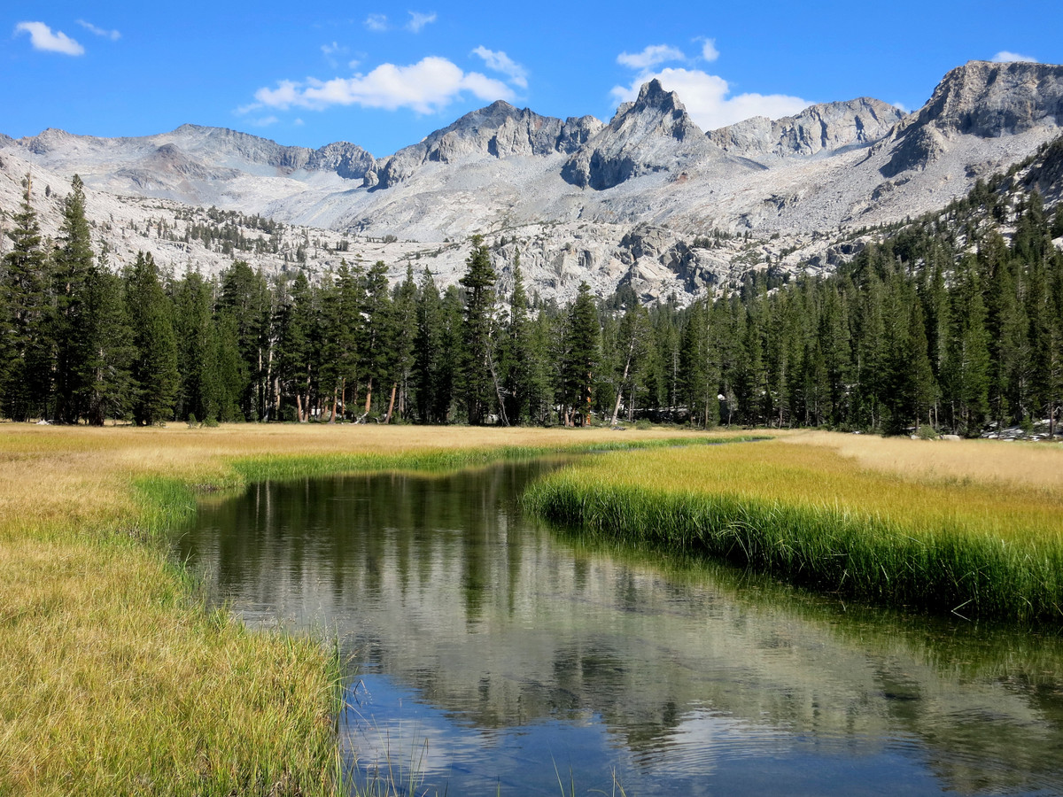
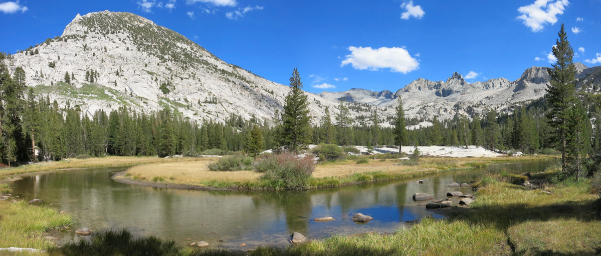
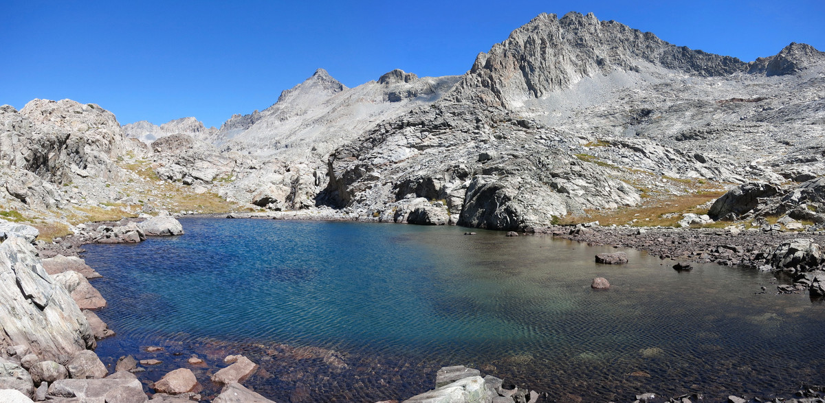
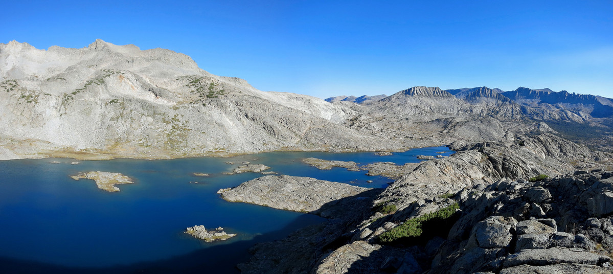
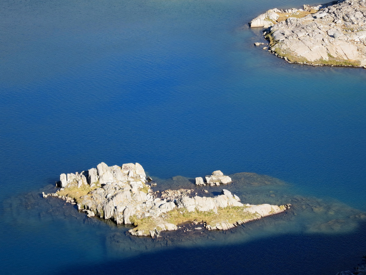
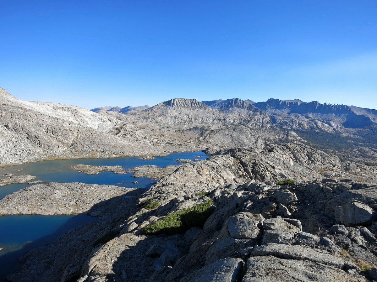
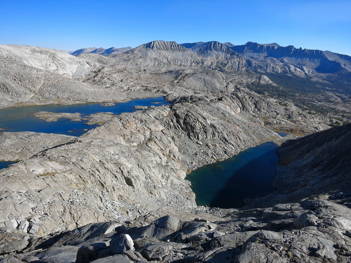
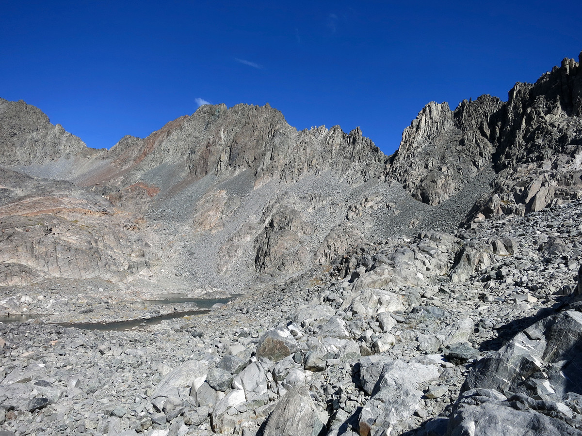
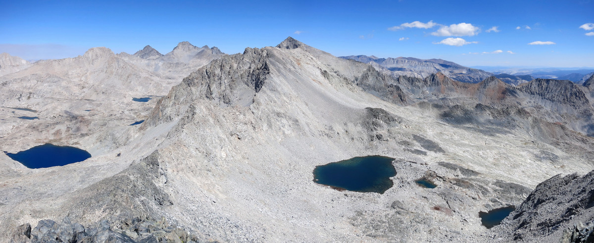
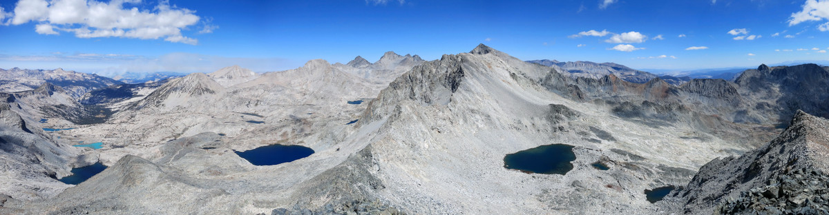
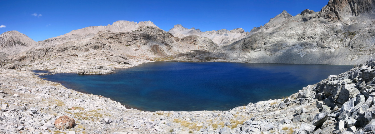
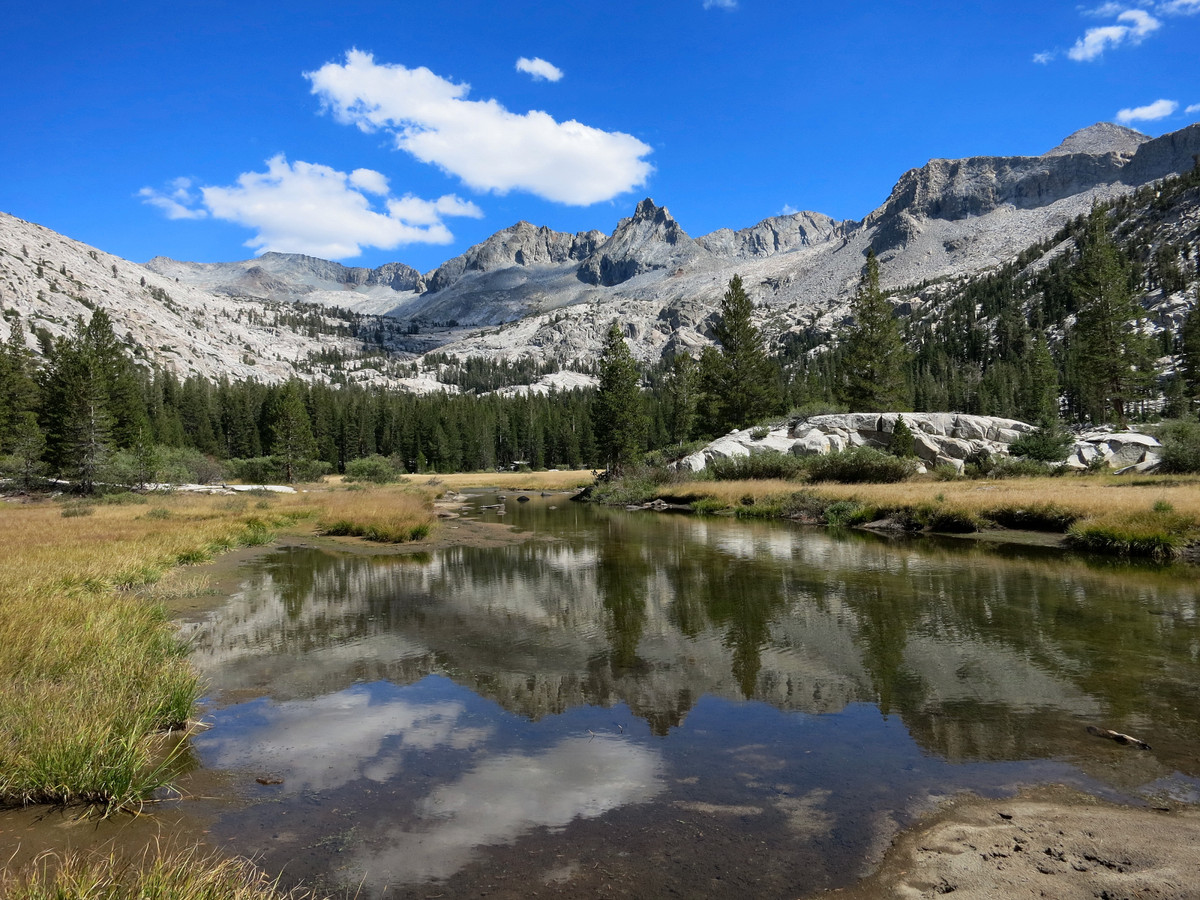
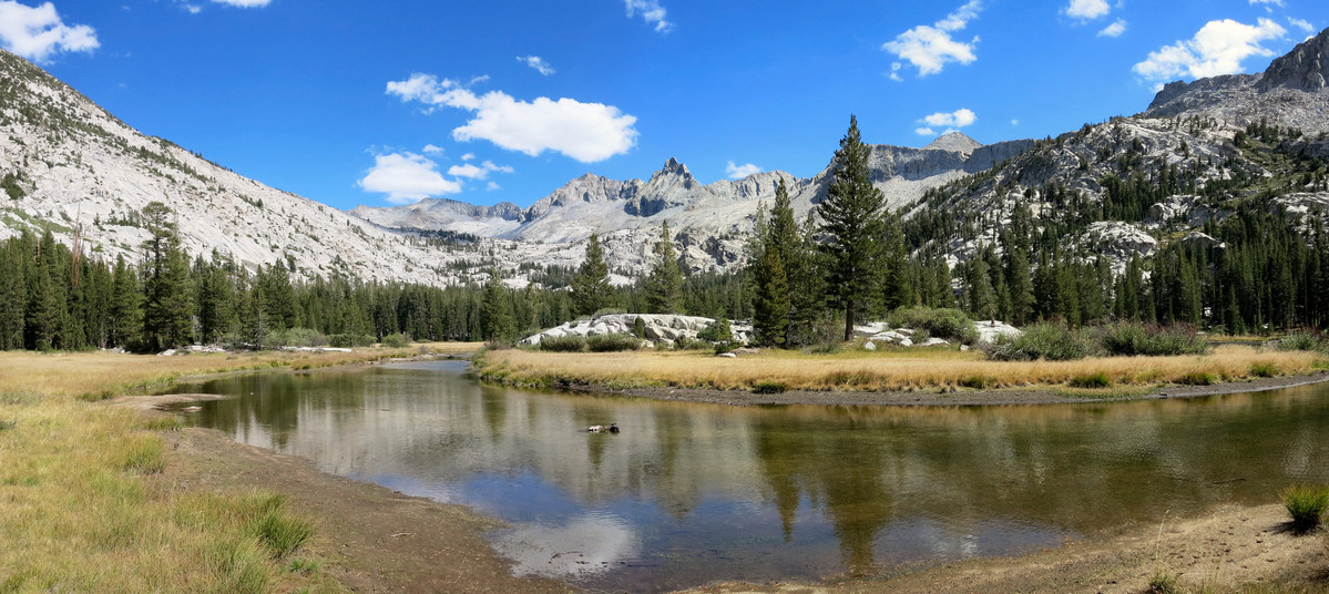
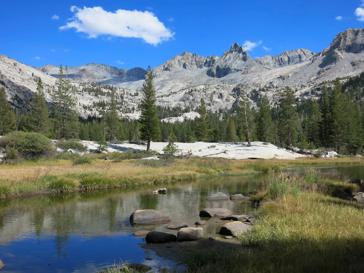
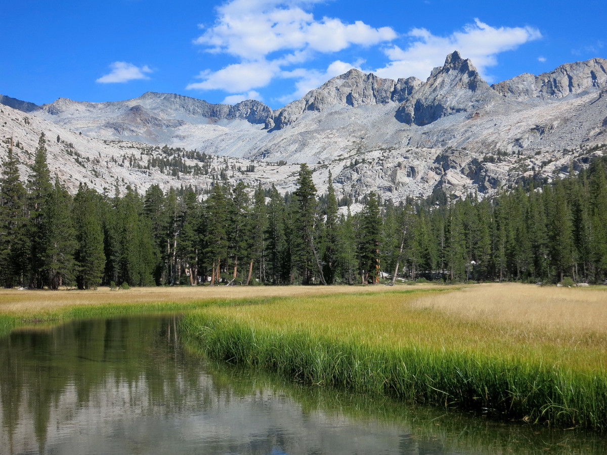
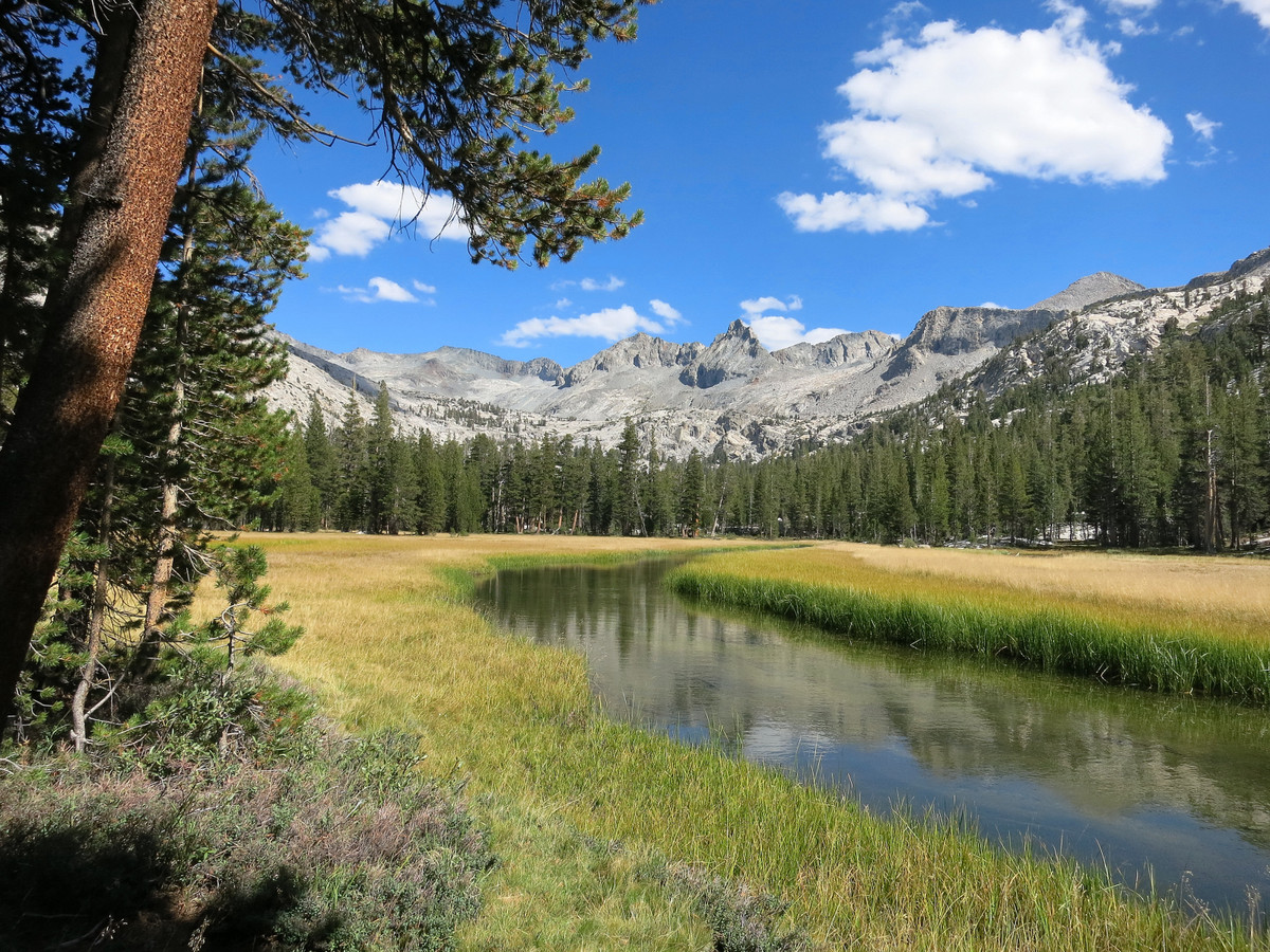
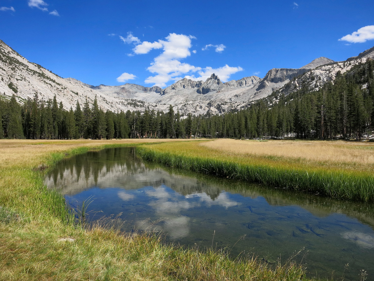
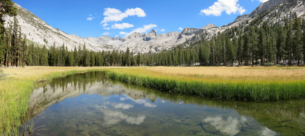
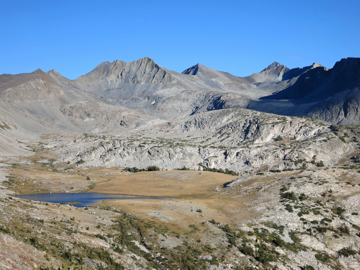
The Lyell Fork of the Merced River is one of the most remote and rugged regions in Yosemite National Park. Any approach requires many miles on trail followed by off-trail travel. The lower part of the drainage features a splendid series of meadows as the river snakes through a grassland with an amazing view upstream to the chiseled rideline including Mount Ansel Adams and Electra Peak. Higher up in the basin, the forest thins and the terrain transitions to a granite playground with a series of spectacular alpine lakes. It seems as if each lake has a different color, from midnight blue to milky turquoise. It’s not entirely clear to me what is responsible for producing the different colors when the lakes are all connected and in such close proximity, but the resulting palette is magical. At the highest reaches of the basin the terrain is entirely devoid of vegetation and the uppermost lakes sit in a strikingly barren landscape of talus and granite. Above these uppermost lakes is the roof of Yosemite, Mount Lyell, at 13,120 feet above sea level and the highest point in the national park. I have looked down into the Lyell Fork of the Merced River from numerous points including Mount Lyell, Foerster Peak and Rodgers Peak and I have always wanted to explore the basin. In order to accomplish this goal, I designed an aesthetic loop out of Tuolumne Meadows that would include the Lyell Fork of the Merced River and also the summit of Electra Peak, one of the more remote summits in Yosemite with a grand view of the region. Since Electra Peak is the central feature of the route I called it the “Electra Loop” and entails nearly 44 miles and close to 10,000 feet of elevation gain. The loop is similar to the Roof of Yosemite Loop I did earlier this year but is a bit longer to incorporate the Lyell Fork Merced River and Electra Peak. GPS route info here.

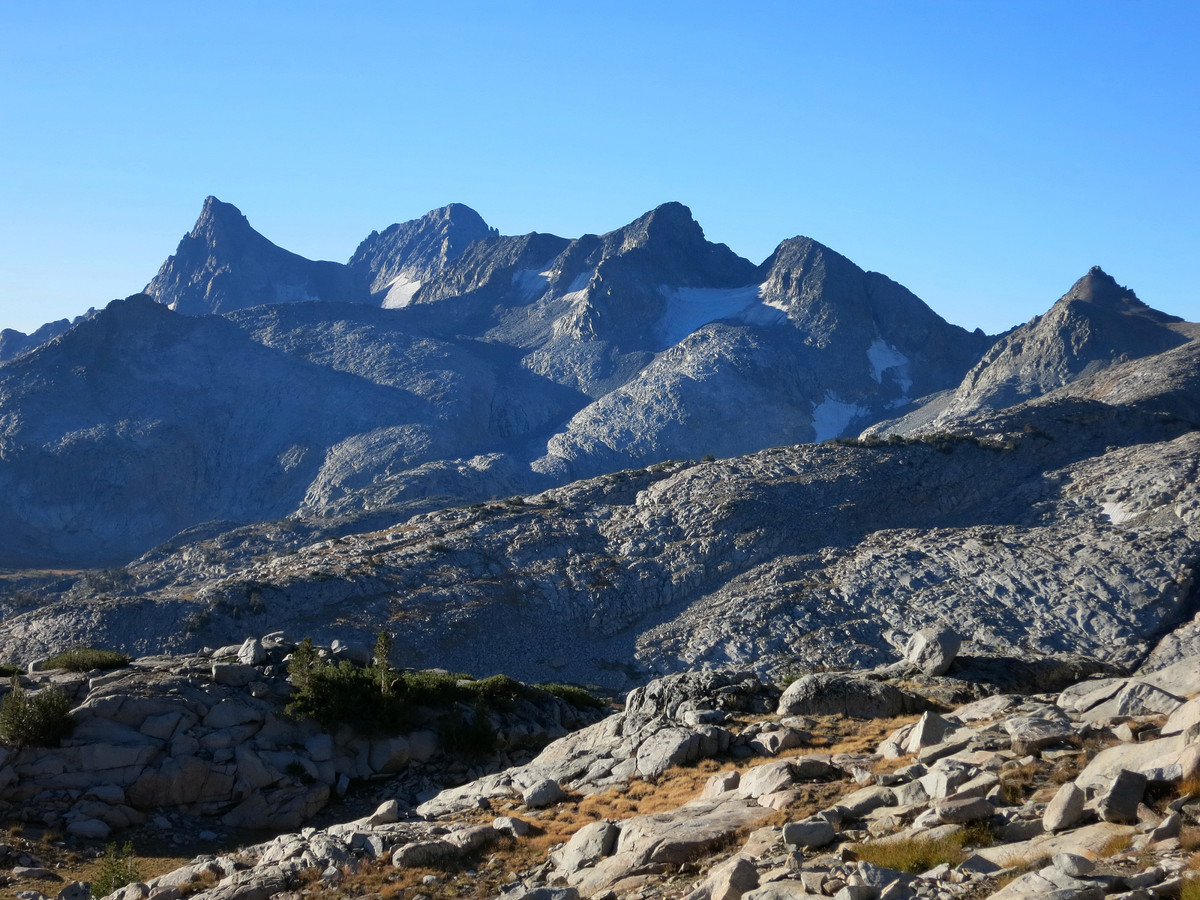
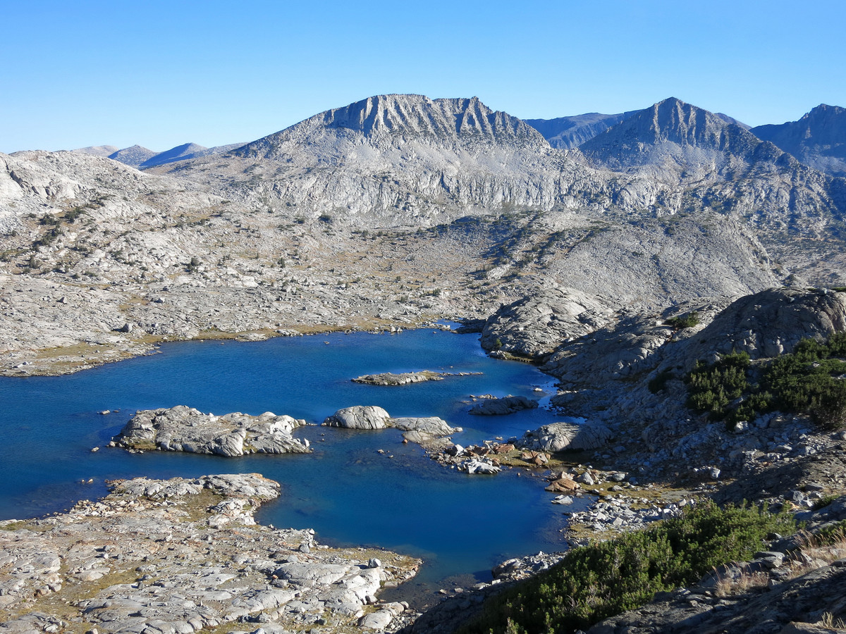
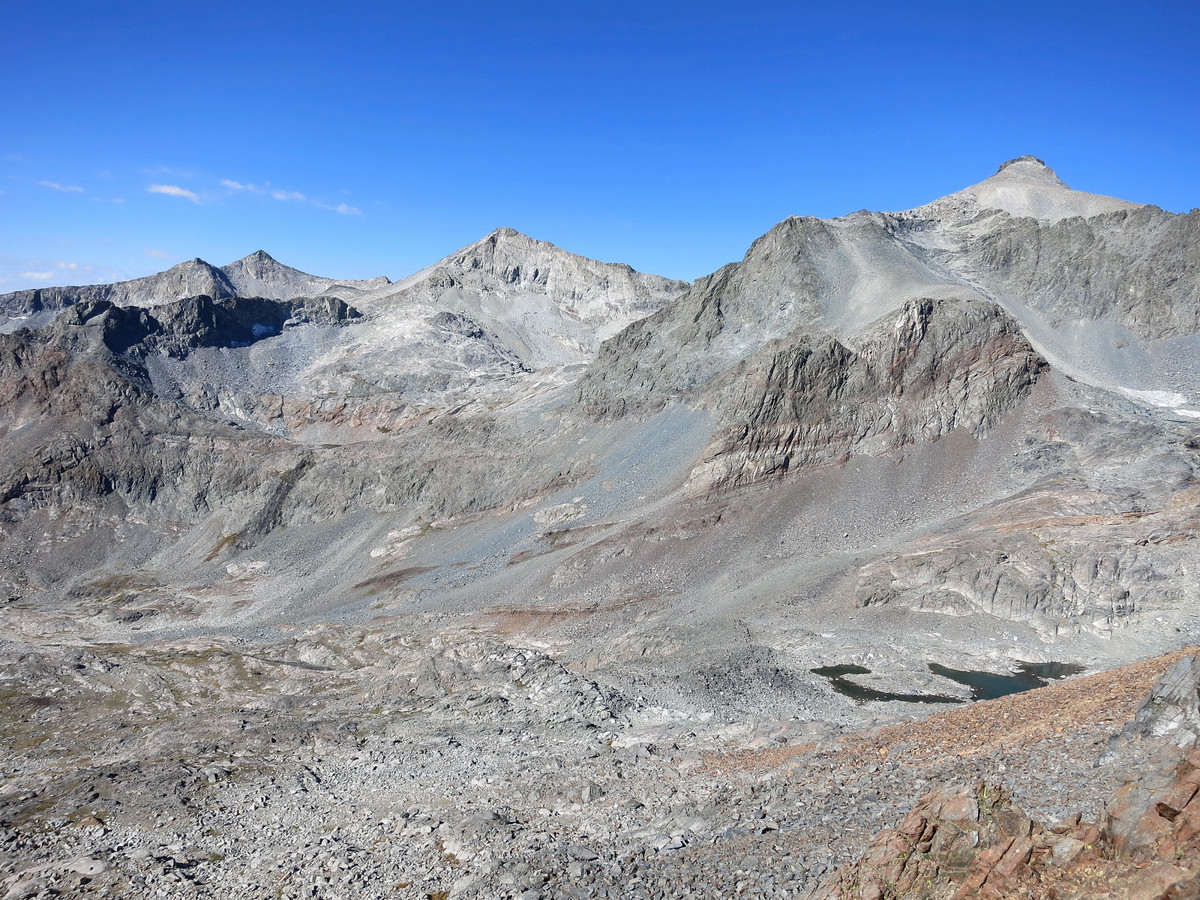
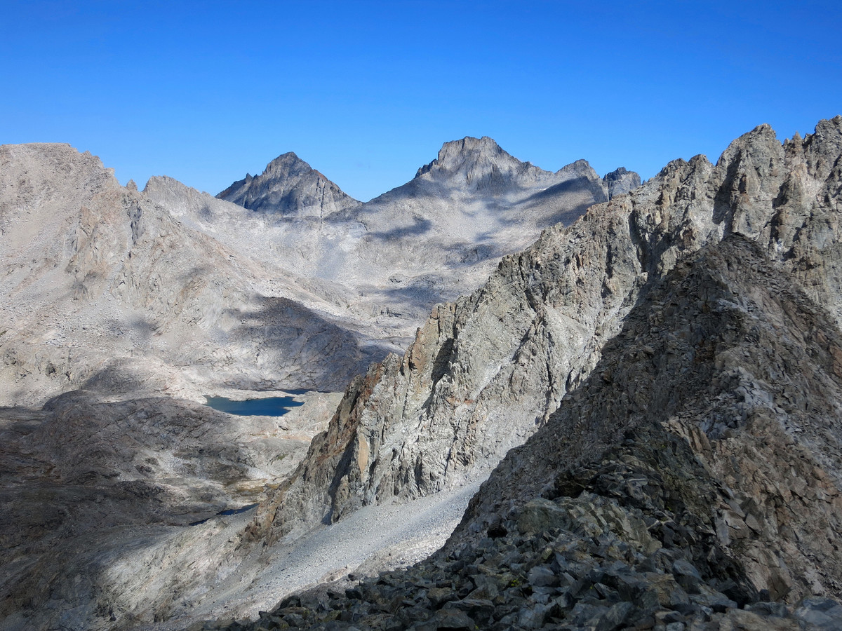
 The route starts with a trek up Lyell Canyon on the John Muir Trail, one of the most runnable stretches of trail in the High Sierra. At the head of the canyon is a climb up to Donohue Pass with an excellent view of Mount Lyell and Mount Maclure. Soon after Dononhue Pass leave the trail and head south through easy alpine terrain to the meadows beneath Marie Lakes where the Marie Lakes trail is intersected. A short climb on this trail brings one to Lower Marie Lake. From here continue cross country up a ridge on the south side of the lake and then traverse granite and talus slopes to North Clinch Pass. Lower Marie Lake is a large body of water and includes stupendous views of Mount Lyell and also across Rush Creek basin to Donohue Peak and Mount Andrea Lawrence. The narrow ridgeline is particularly scenic with a “secret Marie Lake” visible deep in a granite bowl. The direct route over North Clinch Pass includes some class 3 scrambling on its south side but it looks like a somewhat circuitous detour south along the ridge could eliminate the class 3 altogether. Passage through North Clinch Pass brings one into the remote upper reaches of the North Fork San Joaquin River. This drainage, like the Lyell Fork of the Merced River, is rarely visited but a real gem of the High Sierra. My passage through this basin was at its uppermost reach via a high traverse to Electra Peak on talus and granite slabs. I could see the numerous inviting lakes below, but my path would remain above them. I look forward to visiting these lakes in the future. in fact, the High Sierra Route passes through perhaps the most dramatic part of the North Fork San Joaquin River drainage as it descends from Lake Catherine and traverses to Twin Island Lakes with wild views of the North Fork San Joaquin River Canyon and Mount Ritter and Banner Peak towering above.
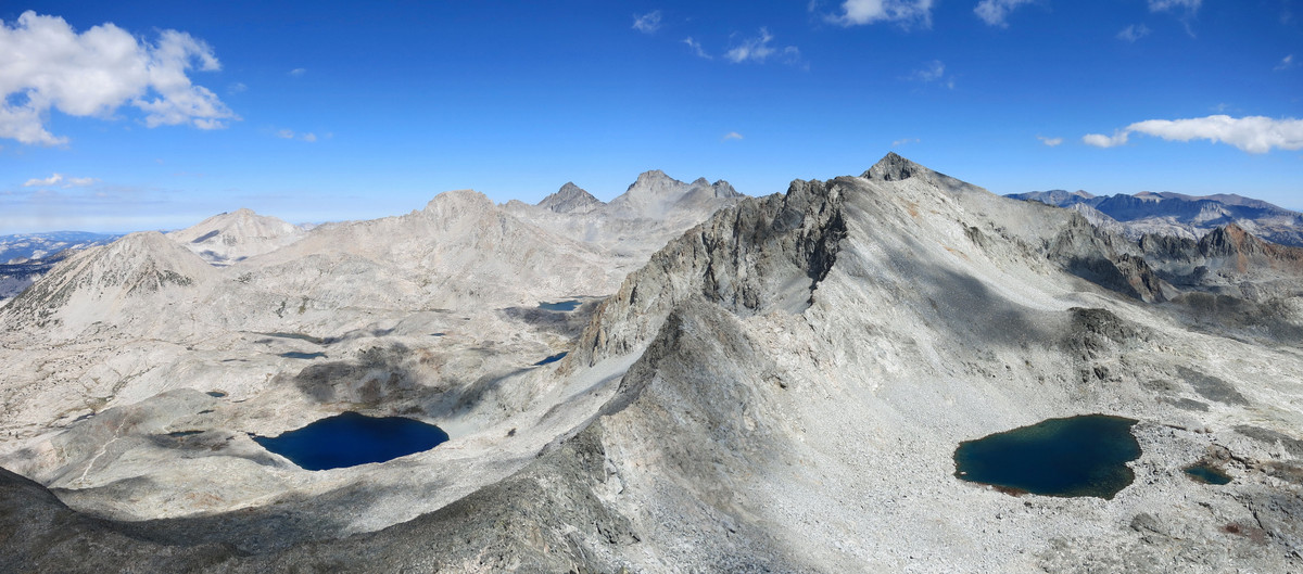
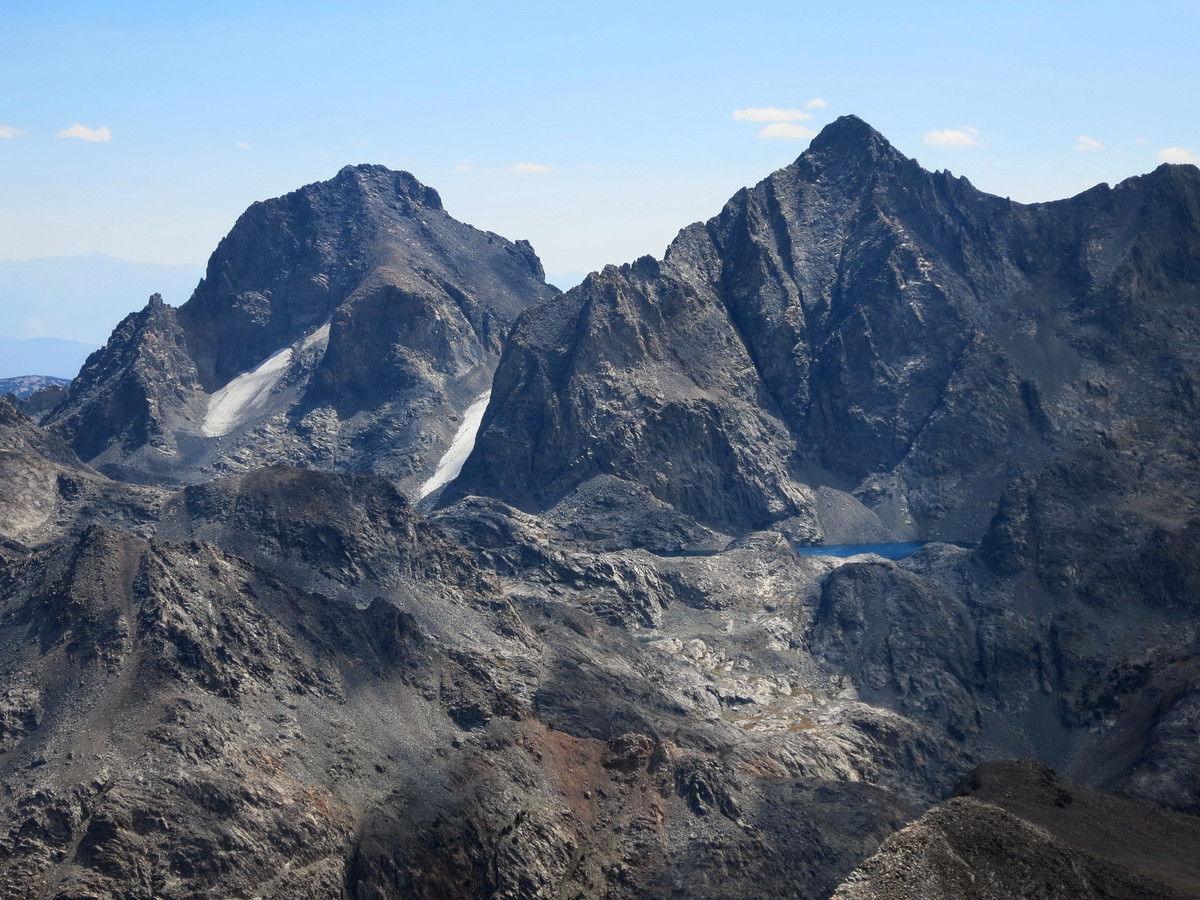
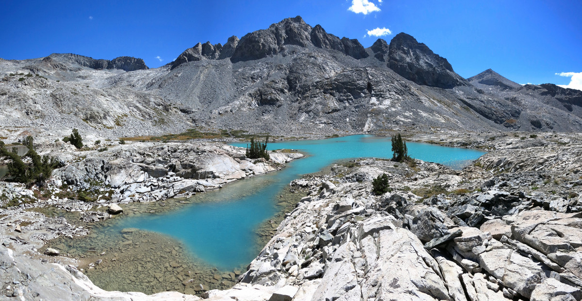
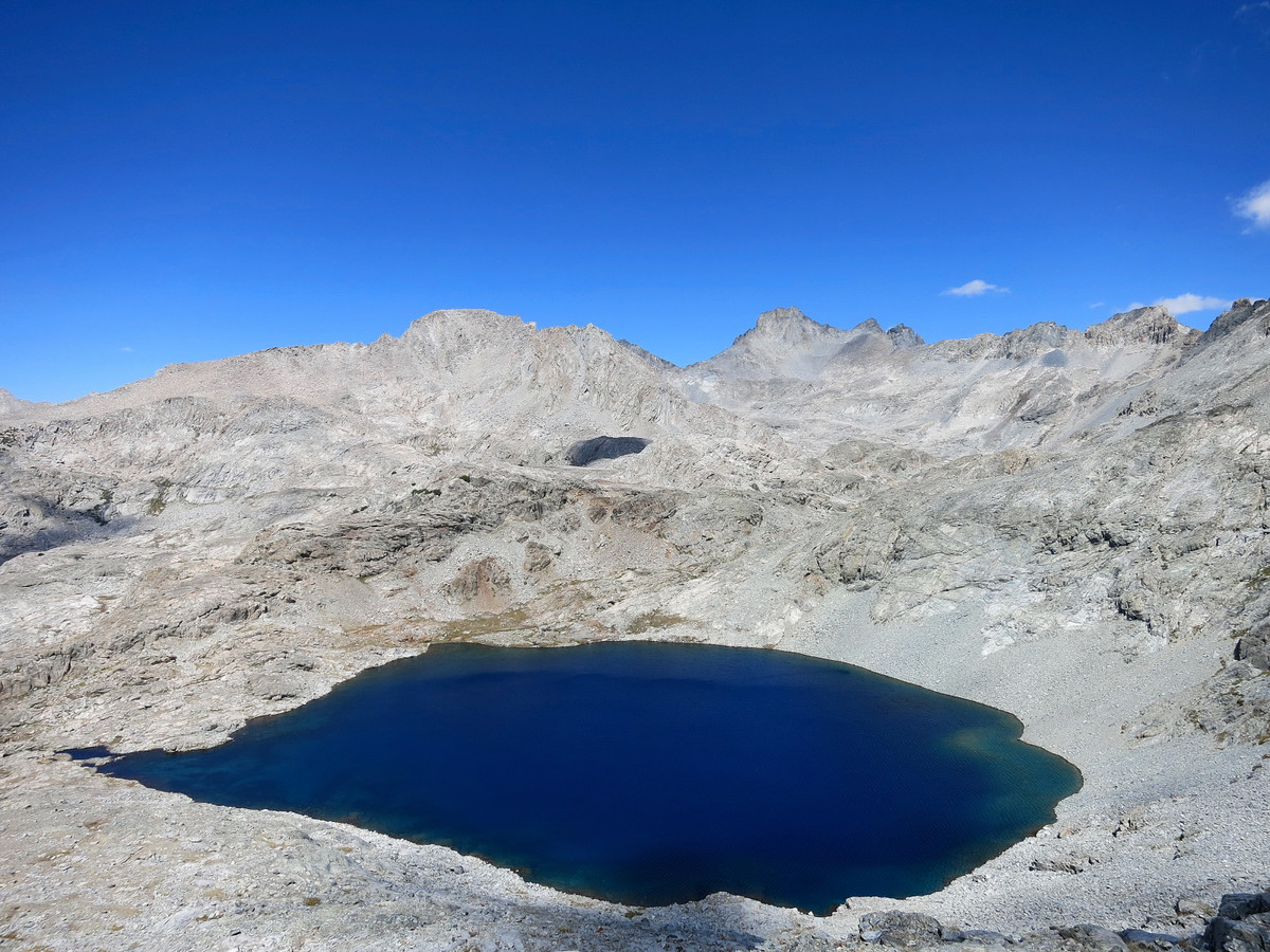
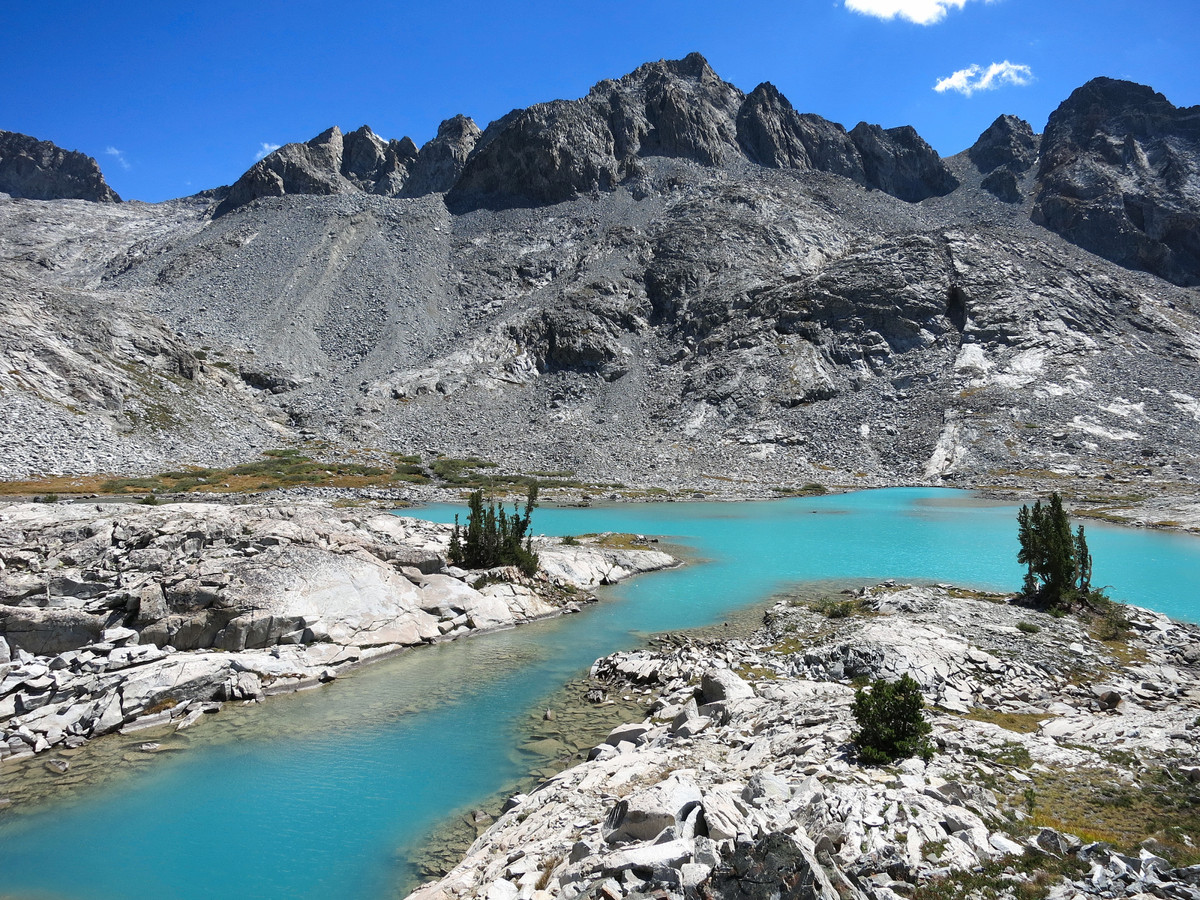
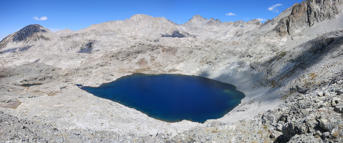
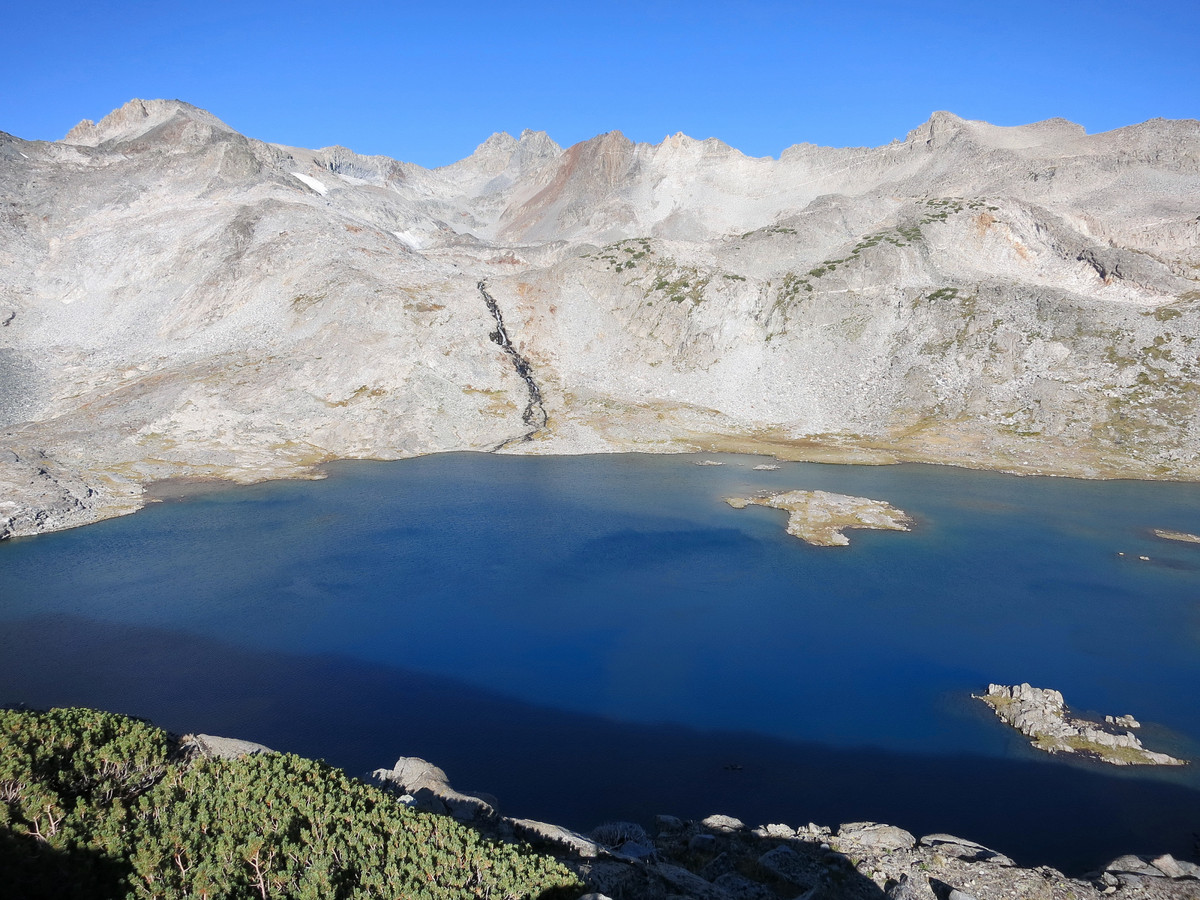
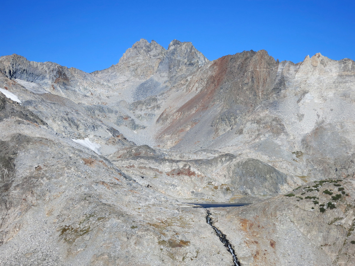
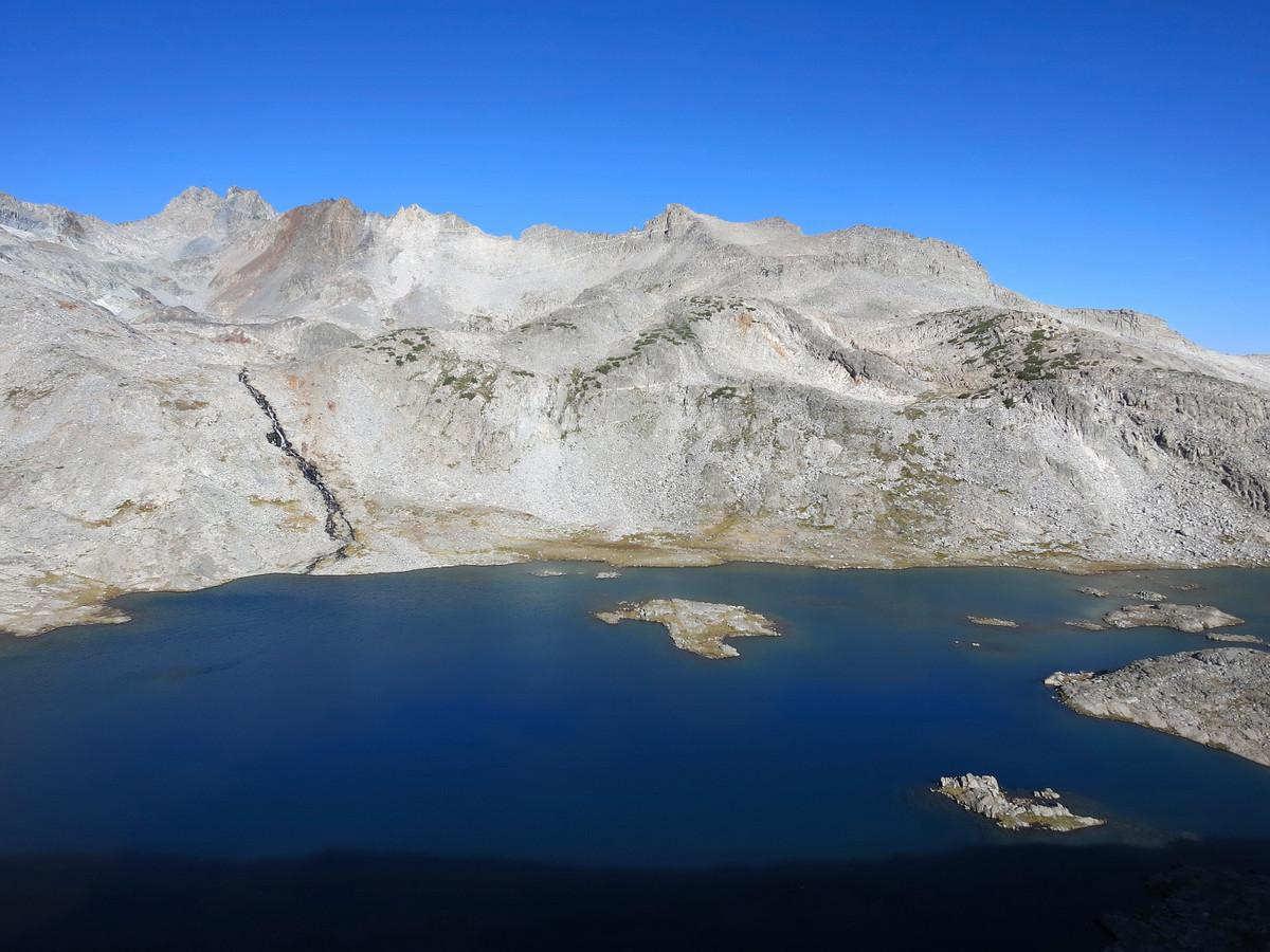
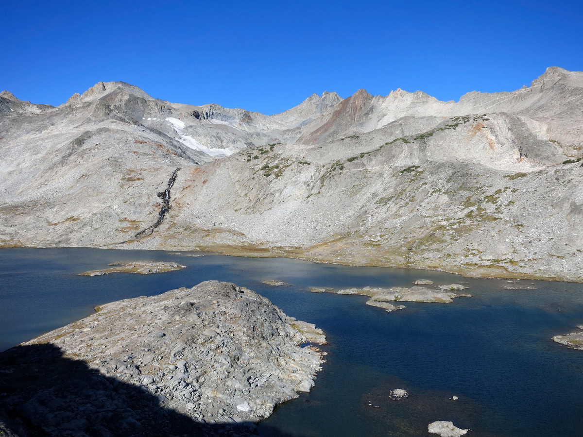
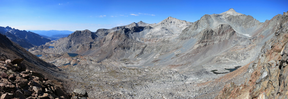
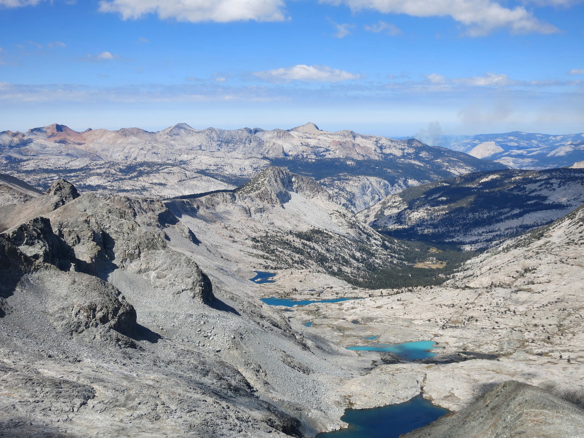
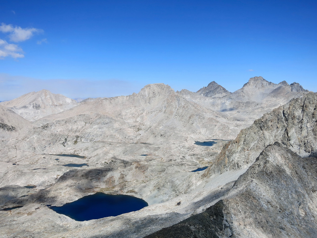
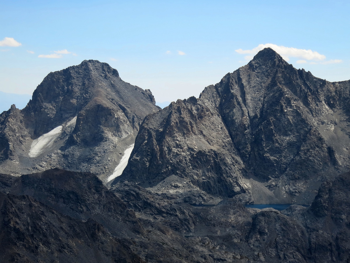
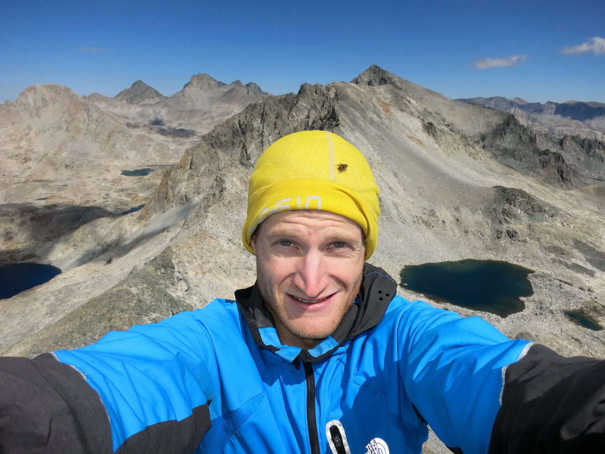
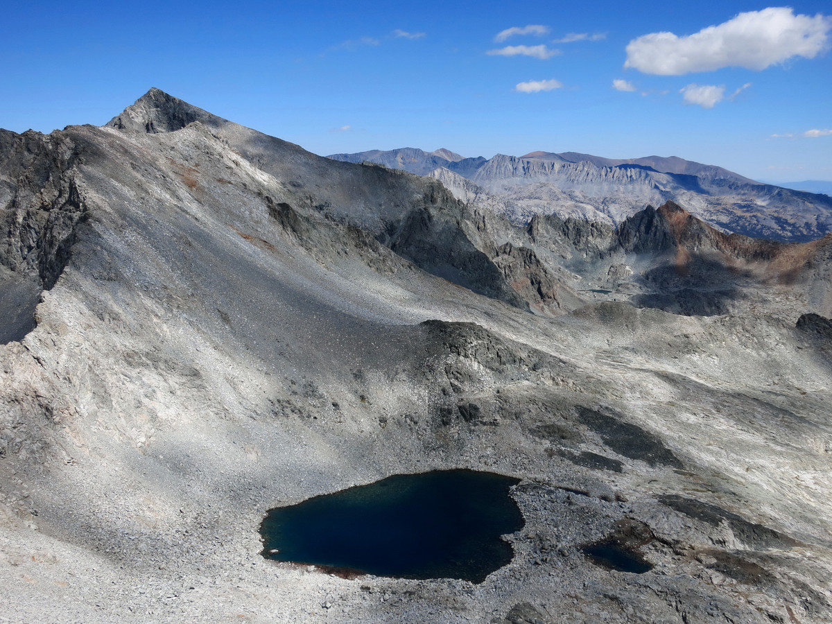
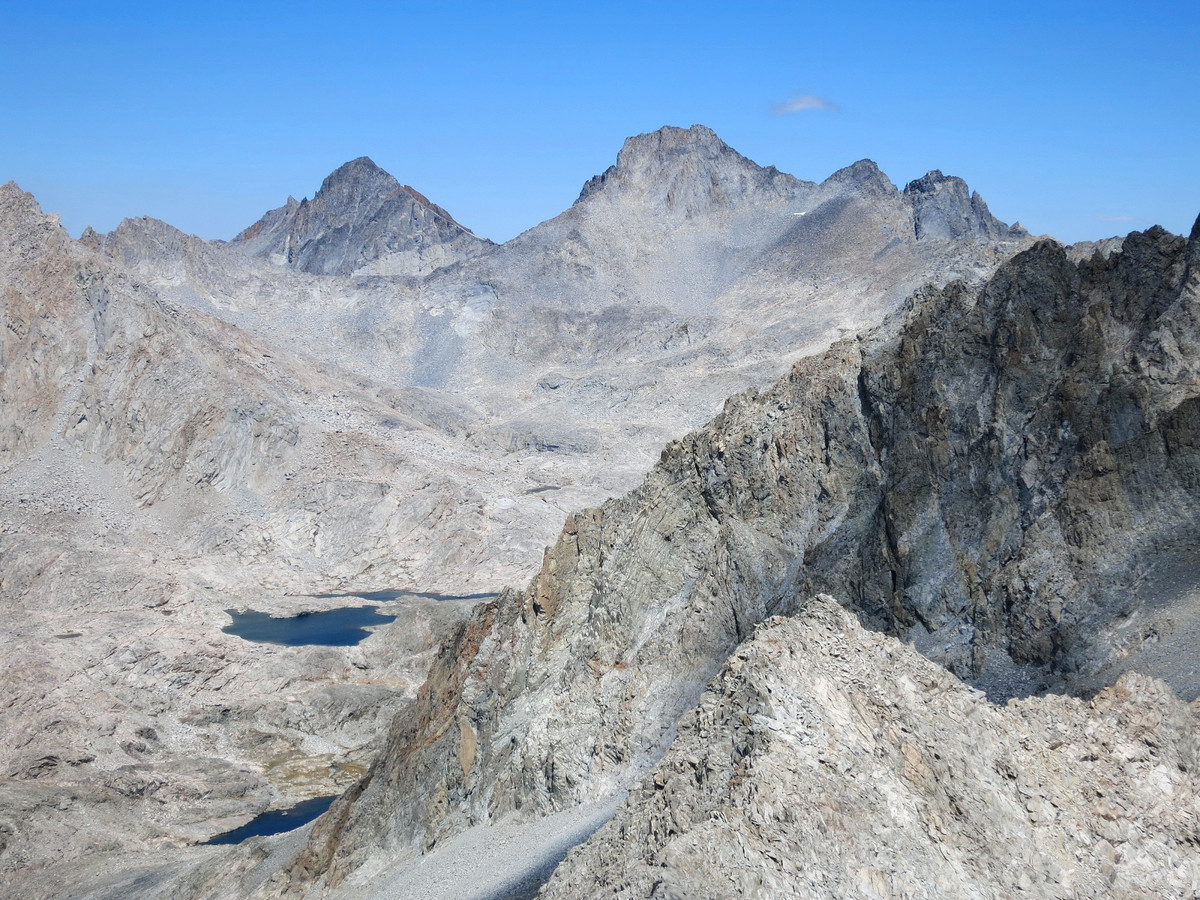
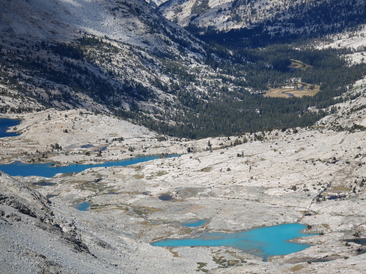
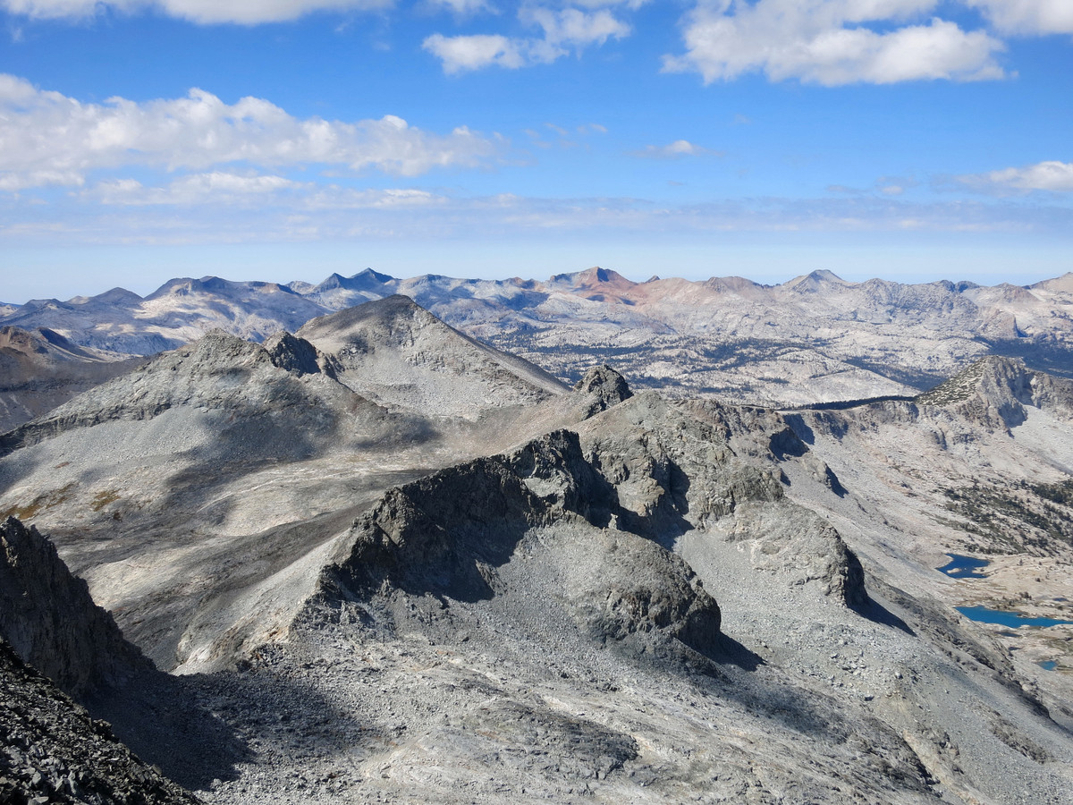
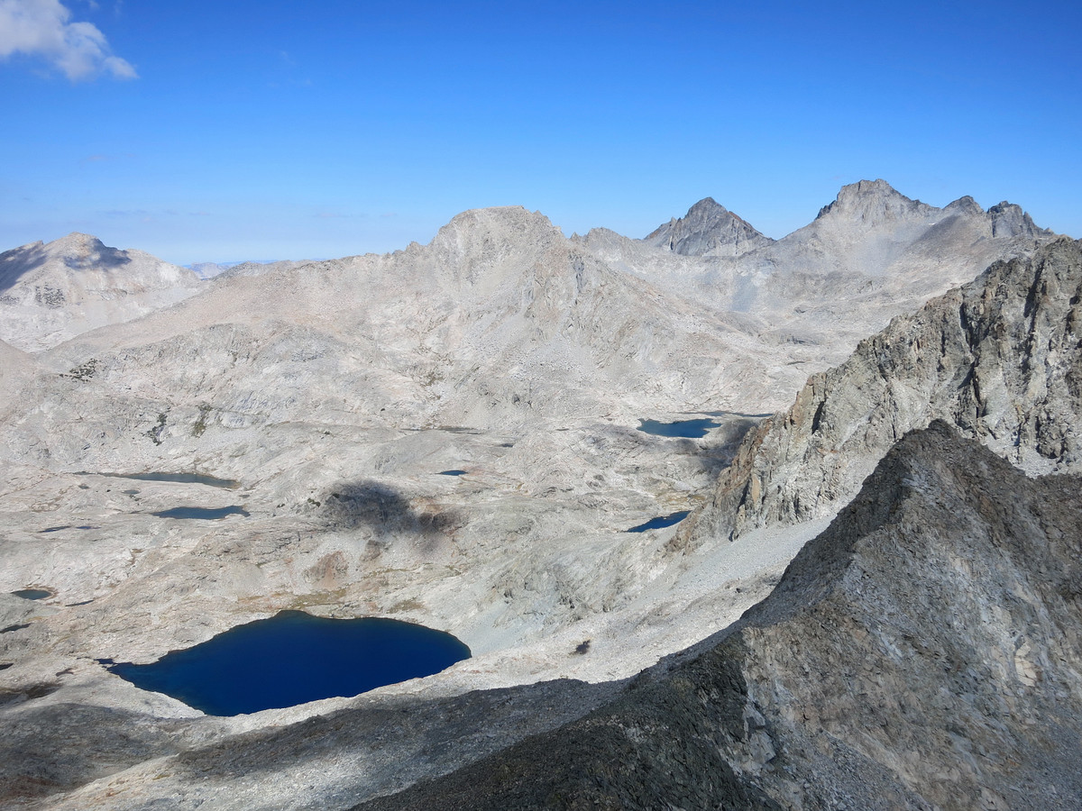
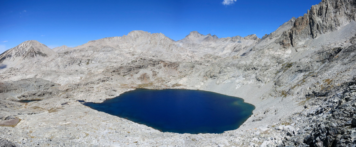
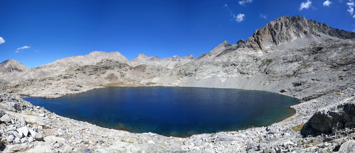
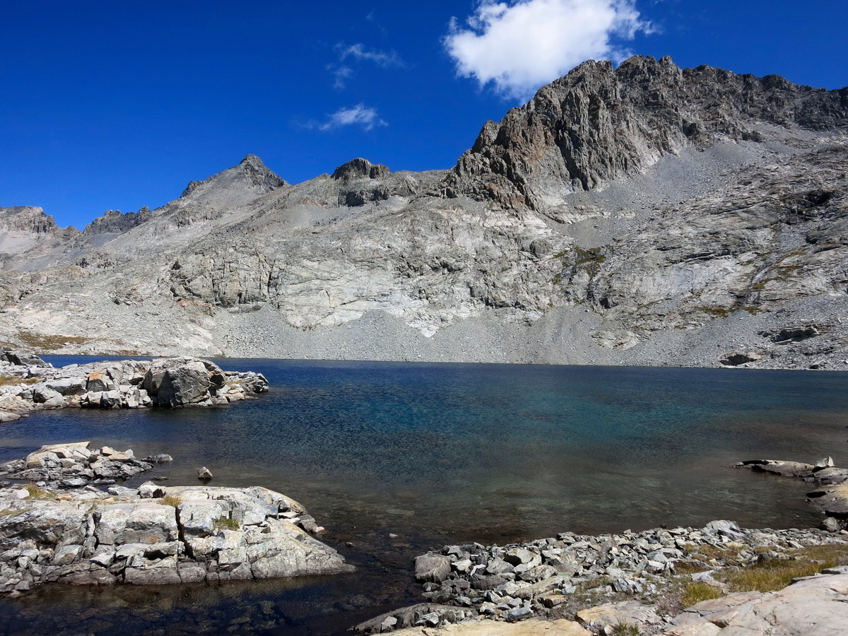
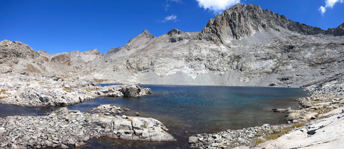
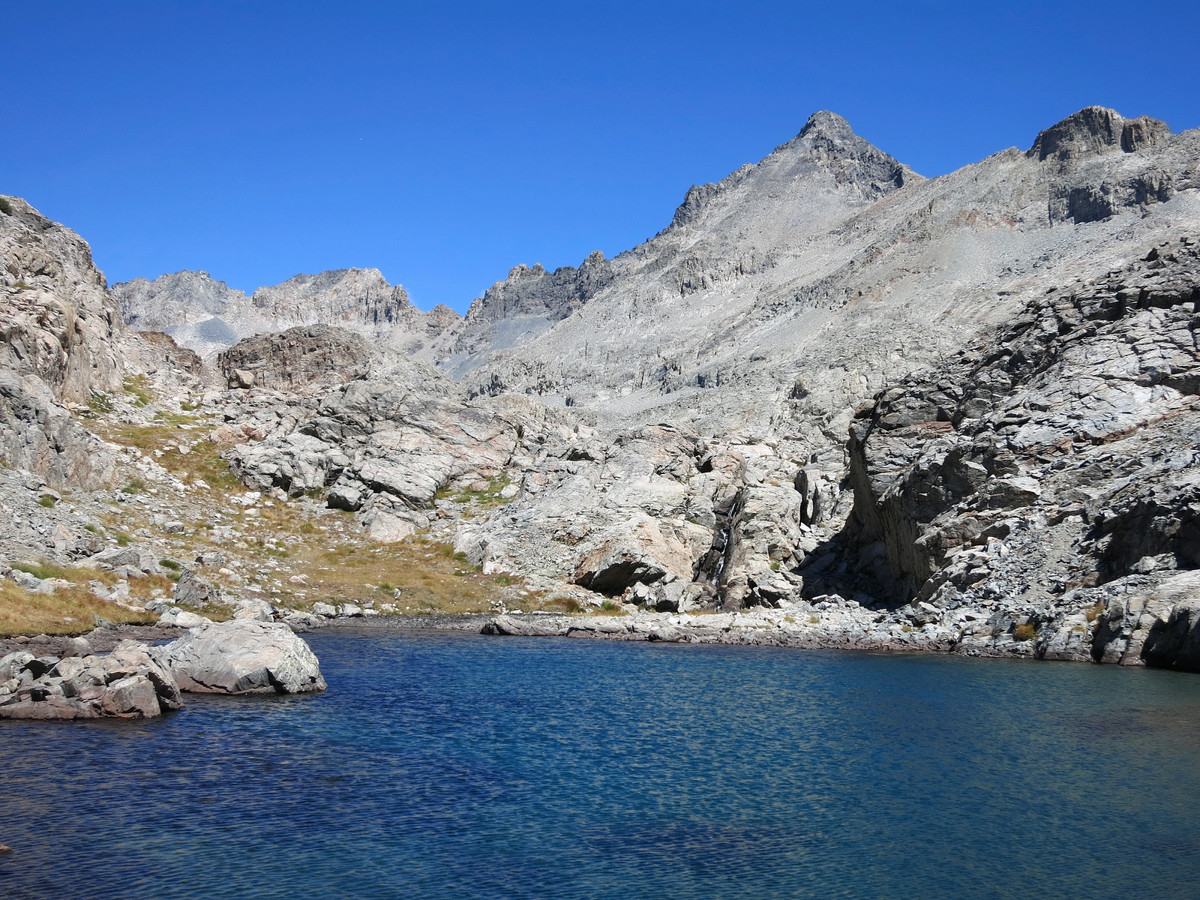
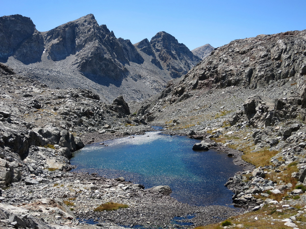
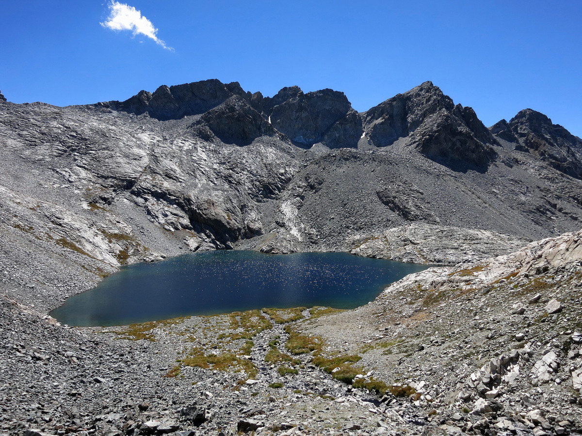
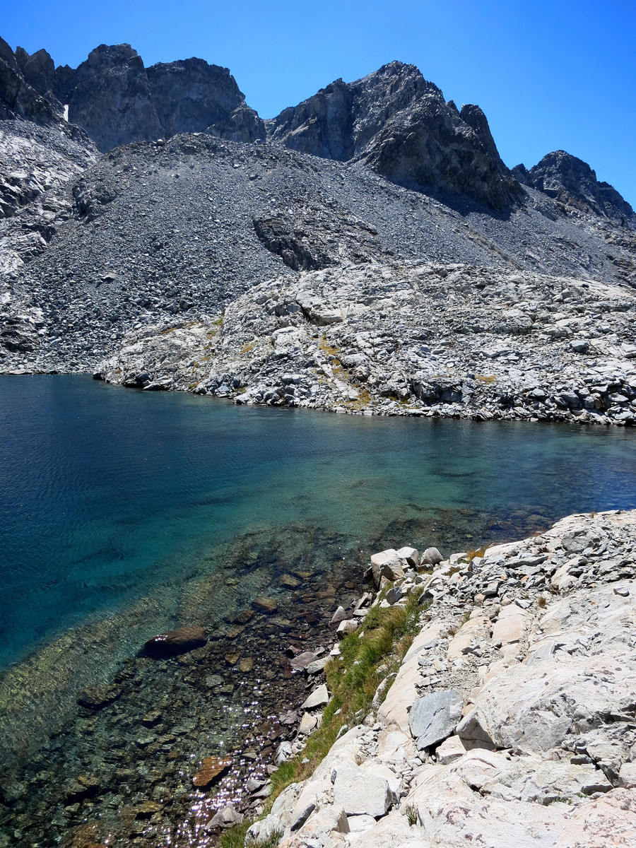
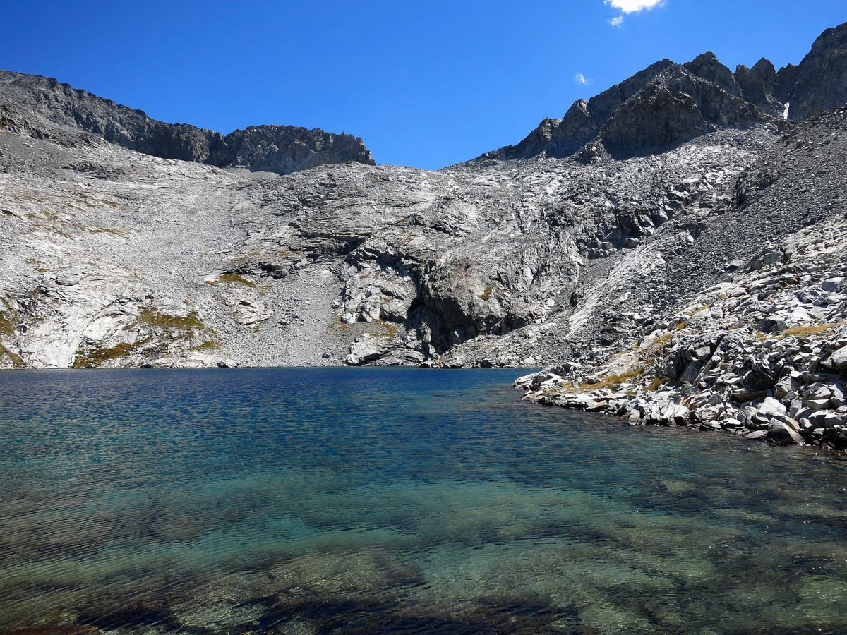
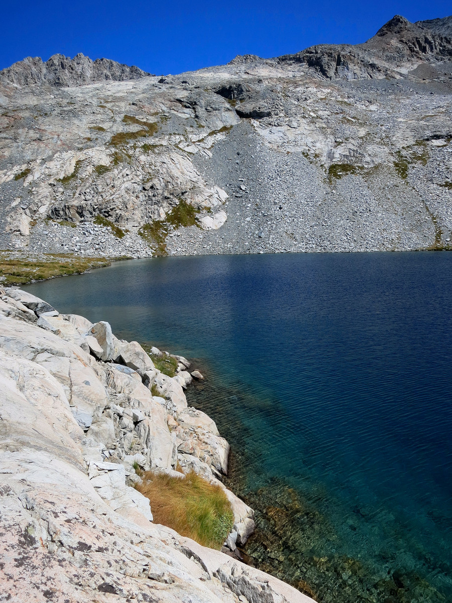
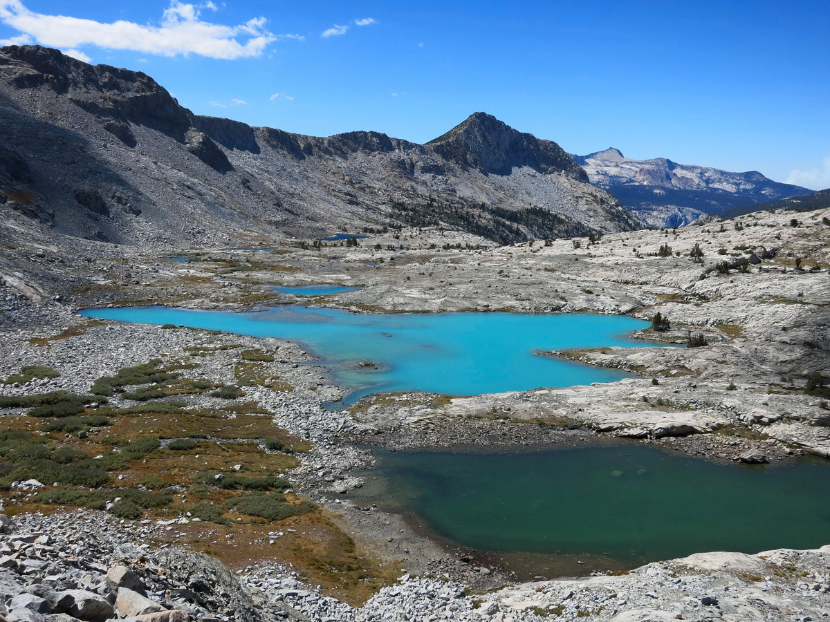
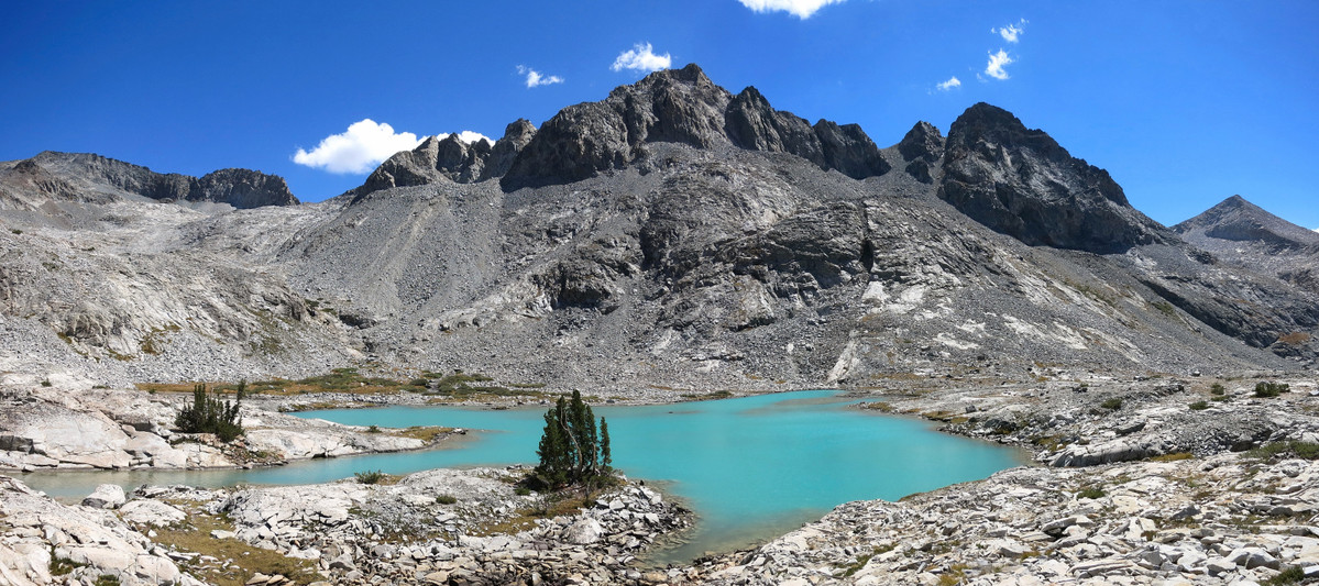
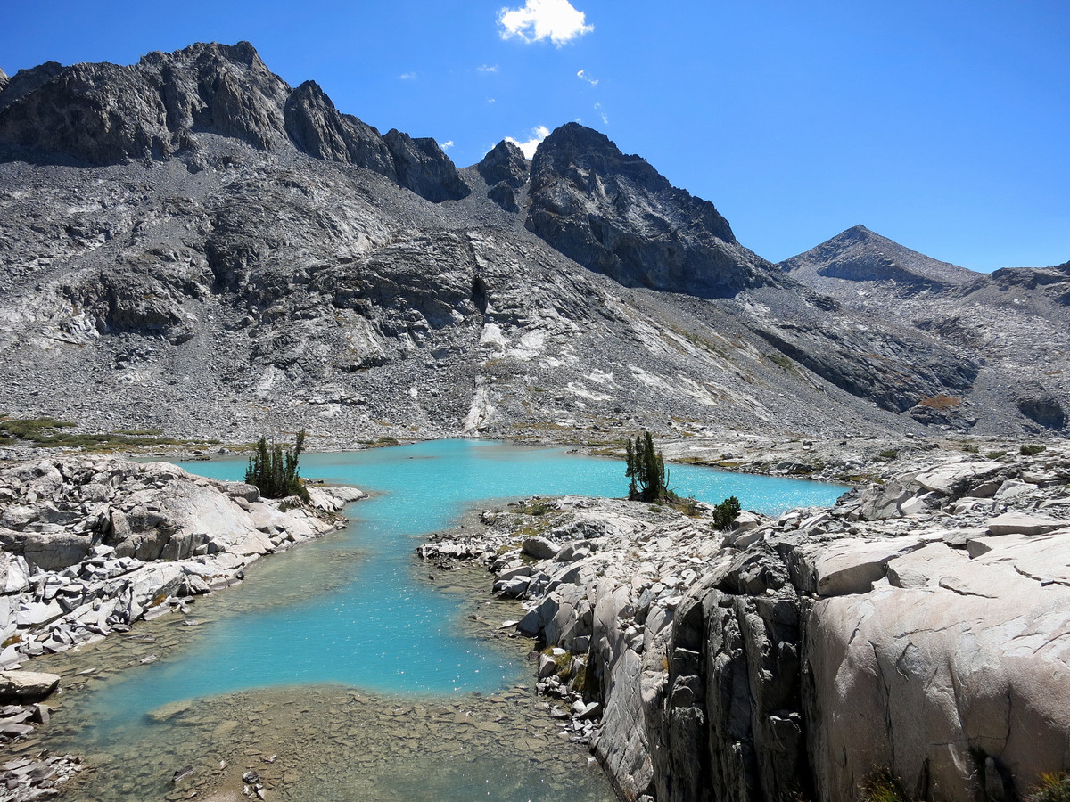
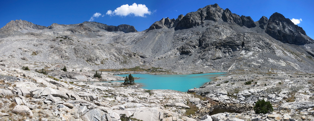
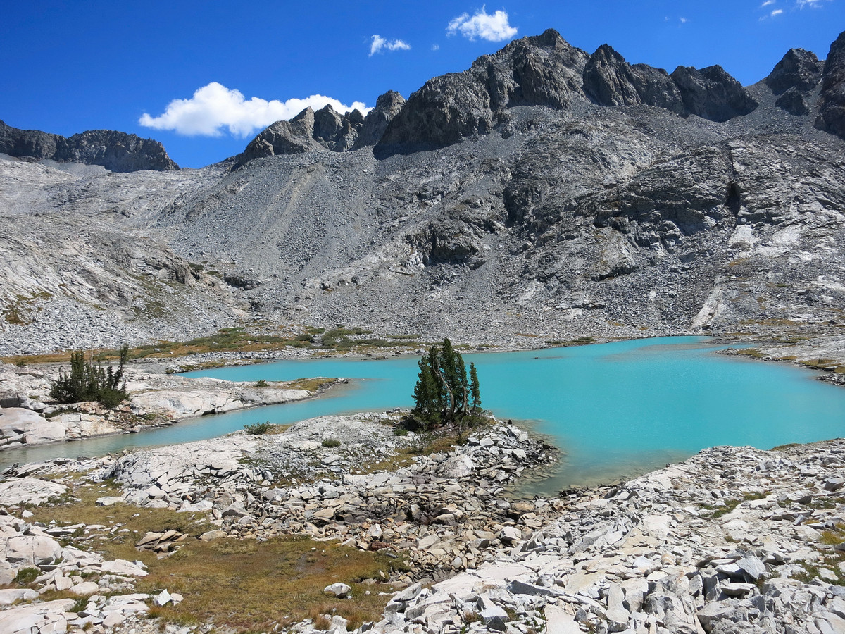
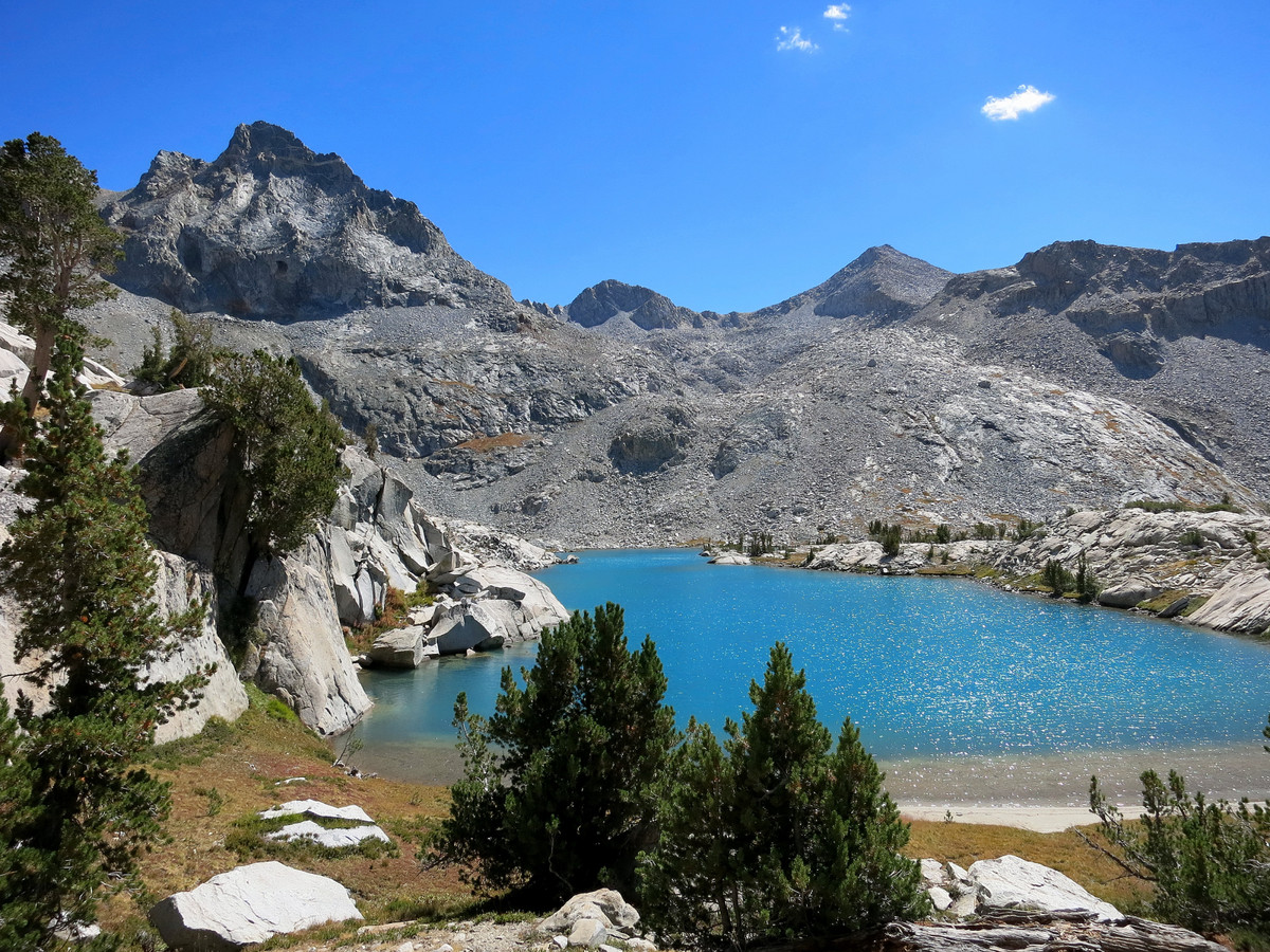
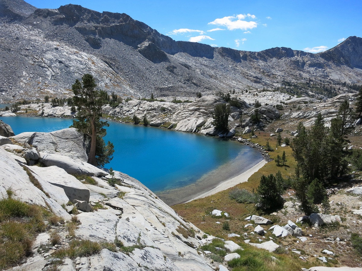
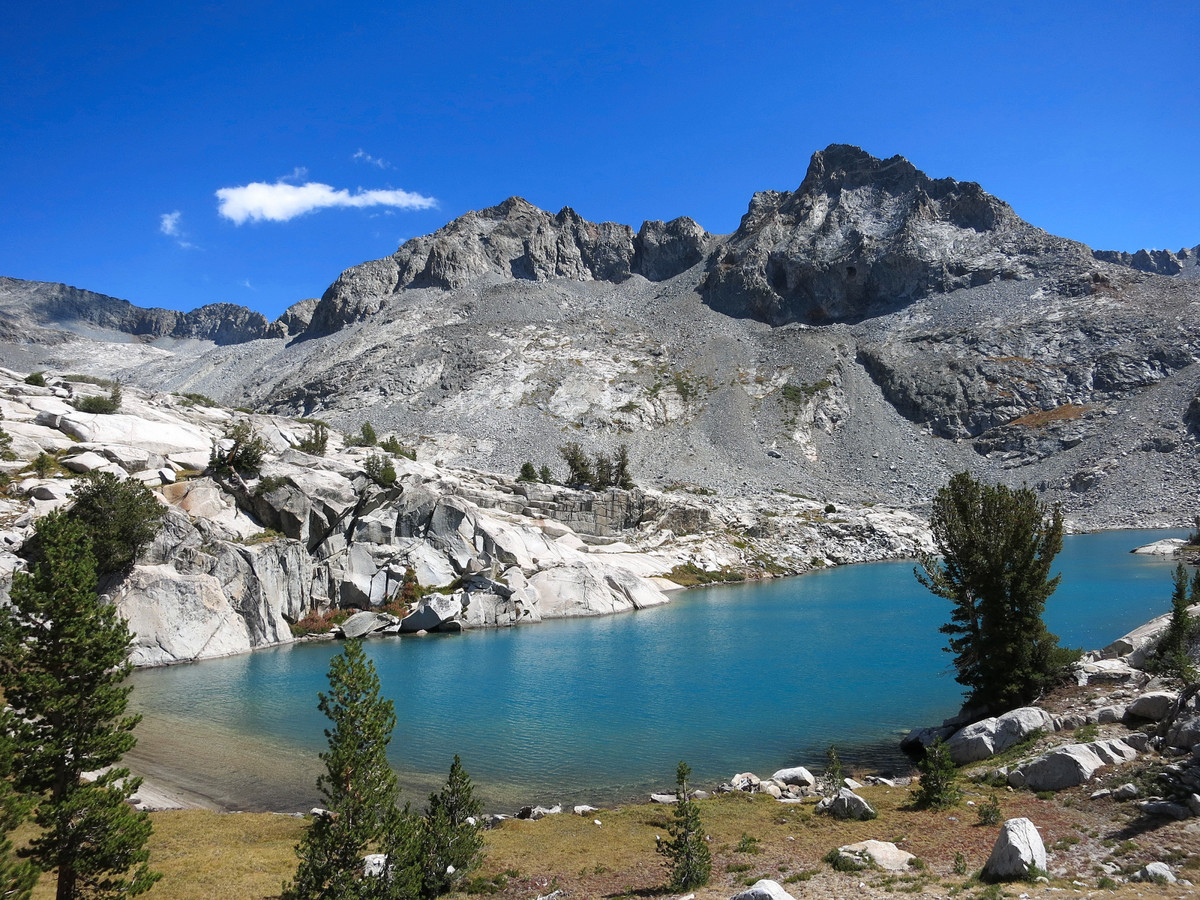
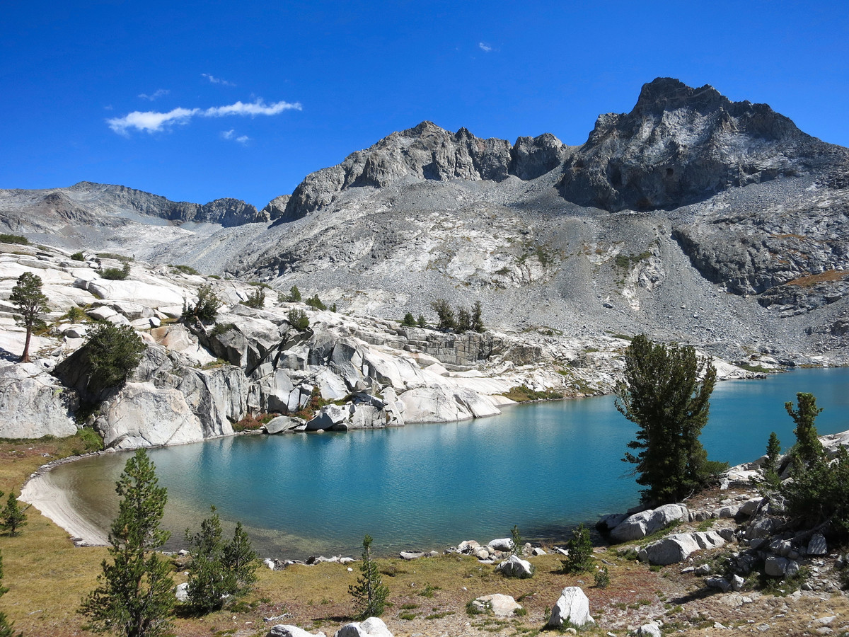
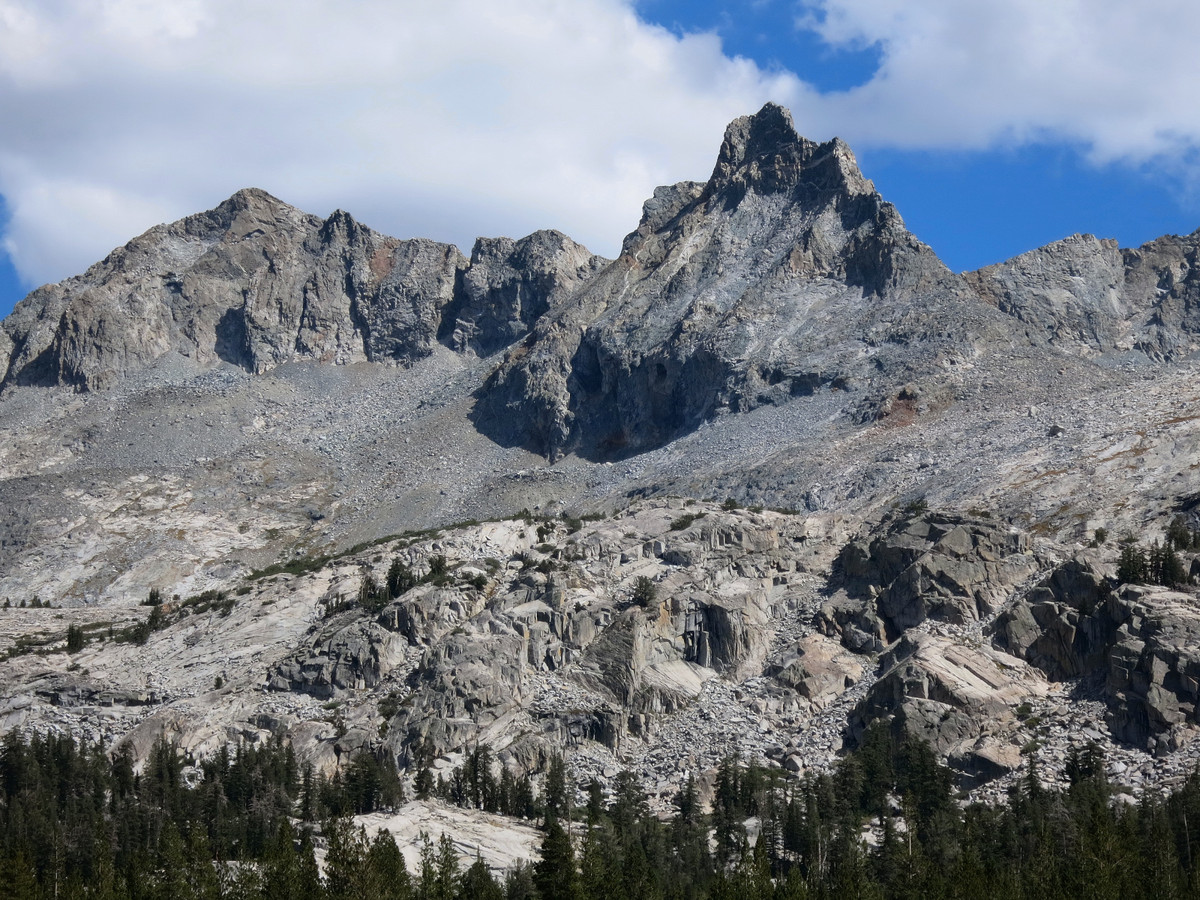
 After the traverse of the headwaters of the North Fork San Joaquin River to Lake 11,815, the climb of Electra Peak’s north ridge is a straightforward scramble on talus and then some rock on the final portion on the ridge. The view from the summit is incredible and takes in a 360 degree panorama encompassing everything from Half Dome to the Clark Range to Mount Lyell to Ritter and Banner. The best view in my opinion looks down the Lyell Fork of the Merced River with it’s numerous colorful lakes and beautiful meadows. From the summit, descend Electra’s northwest slope (talus and slabs) to Lake 10,999, a deep blue lake situated in a barren granitic landscape. Descending down the drainage from Lake 10,999 leads to Lake 10,702 tucked in beneath a rugged ridge extending to Mount Ansel Adams. A descent down a minor headwall beneath Lake 10,702 leads to a lake with striking bright turquoise color. This lake is not even assigned an elevation on the topo maps, but is one of the unique highlights of this region. The next lake on the trip down the Lyell Fork is perhaps the most spectacular and is labelled as Lake 10,217 on the topo map. This lake retains some of the turqouise color as the previous lake but has a bit more of a blueish tint. The lake also includes more vegetation along its shores, an alpine beach, and an elongated shape that makes it look like a swimming lane with Mount Ansel Adams and Foerster Peak towering above. This is certainly a spot I could spend some time relaxing! Below Lake 10,217 is the primary headwall of the drainage and includes a fair amount of micro-navigating to avoid small cliff bands (although numerous routes are available). Below the headwall, travel becomes easier through open forest eventually reaching the splendid meadows. From the meadows it’s about a mile downstream through forest and granite slabs to the Isberg Pass Trail which is taken north to the Lewis Creek Trail. The ascent up the Lewis Creek Trail leads to Vogelsang Pass and then down the Rafferty Creek trail back to Tuolumne Meadows. GPS route info here.
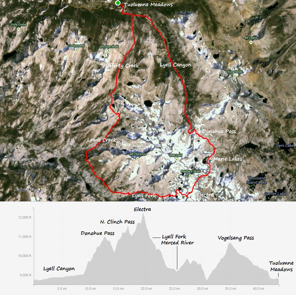


Enjoyed your report and photos. After Donohue Pass head South NOT North to Marie Lakes! I have been through those areas and plan to return to the Lyell Fork of the Merced to climb Mt. Ansel Adams next year.
Thanks, error corrected. Happy to see that somebody actually reads the text 🙂
Hey, let’s do a trip sometime! Lyell Fork of the Merced in 2015! Thanks. Best, Steven_thaw@yahoo.com 925-376-3380 Moraga,CA
Mt. Lyell 13,114′
I know 13,114′ is the standard elevation used by most folks, but NAVD88 lists 13,120′ so you can’t completely discredit it, and in fact a good argument can be made that NAVD88 is the more accurate vertical survey. I’m also willing to give Lyell the benefit of 6 more feet 🙂
Hey dude, great read, especially surprised by “secret marie lake”, good catch. I’ve been planning a variation of your Roof of Yosemite route for next month, is it easily approachable from the base marie lake? Also I found out the variations in lake color up in the high sierras is a product of glacial till concentrations: fine powder produced in the glacial erosion process over granitic surfaces. The milky turquoise lakes have higher concentrations usually because they’re closer to terminal moraines. Neat stuff!
Hi Loren, it does not seem easily approachable from Marie Lakes and will entail talus fields and reportedly some class 4. Secret Marie is relatively small and it’s not really visible until you get up the ridge. I’ve definitely been around many turquoise lakes due to glacial flour, but what is somewhat perplexing and unique about this basin is the lakes in the upper basin are deep blue, devoid of any glacial flour and then in the lower basin you have clear, high concentration of glacial flour and everything in between within close proximity. In a typical set-up the highest lakes would have the highest glacial flour concentration since, as you mentioned, they are closer to the most recent moraines, but not here. This inverted progression and high variability within a close range makes it special. My suspicion is that between Lake 10,702 and Lake 10,217 the water passes through an old glacial moraine explaining why the lakes below have the glacial flour while the lakes above are completely clear. Meanwhile, the adjacent lakes in the lower part that are totally clear receive their water source from different parts of the basin. Put it all together and you have everything from clear blue to milky turquoise in a span of less than a mile.
Its an incredible process! The stark contrasts in color within such close proximity seems anomalous, but that would make sense that water is filtered through an old moraine to make the lower lakes brighter. Its photos like http://cascadeclimbers.com/plab/data/513/electra49.JPG that are a bit weird, where it appears drainage should be uniform, but the lakes prove that it probably isn’t. Keep it up man!
Hey, let’s do a trip sometime. Best, Steve Thaw, 925-376-3380 Moraga, CA facebook, steven_thaw[at]yahoo[dot]com
That’s really neat about the lakes. Incredible trip.
Beautiful trip! I usually head from Agnew – Ediza – Ritter/Banner Saddle – N. Fork San Jac – Lower to Upper Bench – Forester Pass – Lyell Fork. But I’ve been eyeing coming back the way you went down the drainage in Lyell fork. Also wondering if you (or anyone) has ever down climbed or rappelled from the trail in Lyell Fork down the cascade to where it meets the Merced River. Would love to do that soon!
Hi. How did you find the North ridge ascent of Electra? I want to do it with my wife and she’s not particularly brave when it comes to exposure (High Route variation). The North ridge is the ridge leading to the sub peak, not the saddle ridge, correct? Thanks.
Major props for envisioning this route. We combined this loop with portion of the Maclure high route (via Amelia Earhardt Pk) for a four day backpacking trip.
We are reasonably experienced with off-trail travel in the Sierra and I think your description of the traverse of the upper reaches of North Fork of San Joaquin basin does not do it justice. We did not have a detailed GPS route and the traverse looked super improbable and we were second guessing ourselves a lot whether it would go.
Also, the climb up the beginning of Electra’s north ridge was solid class3/4 – we gained the ridge at the northern most end (N37.710284 W119.260115) and the climb went over a subpeak. We never dropped down to Lake 11,815. Maybe you climbed up from the lake to where the final part of north ridge leads to the summit?
Thanks for the inspiration! I could never run your routes the way you do but they make cool backpacking trips!
Thanks! You must have taken an “alternative” exciting route since I found the traverse from North Clinch Pass to Lake 11,815 relatively easy off-trail travel (a lot of easy granite slabs). I did go to Lake 11,815 and from there climbed talus to the final saddle before the North Ridge, which is south of the subpeak where you encountered some more difficult climbing.