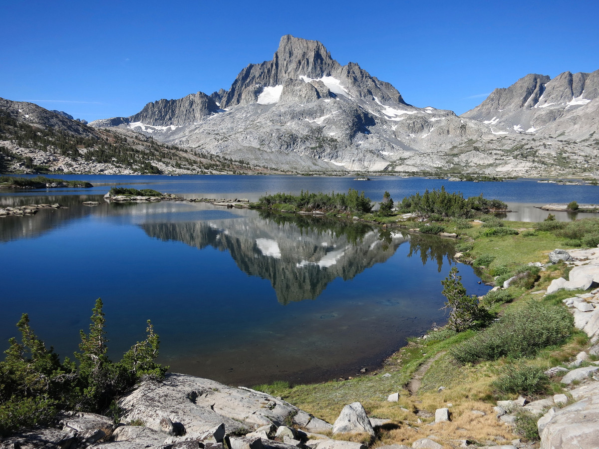
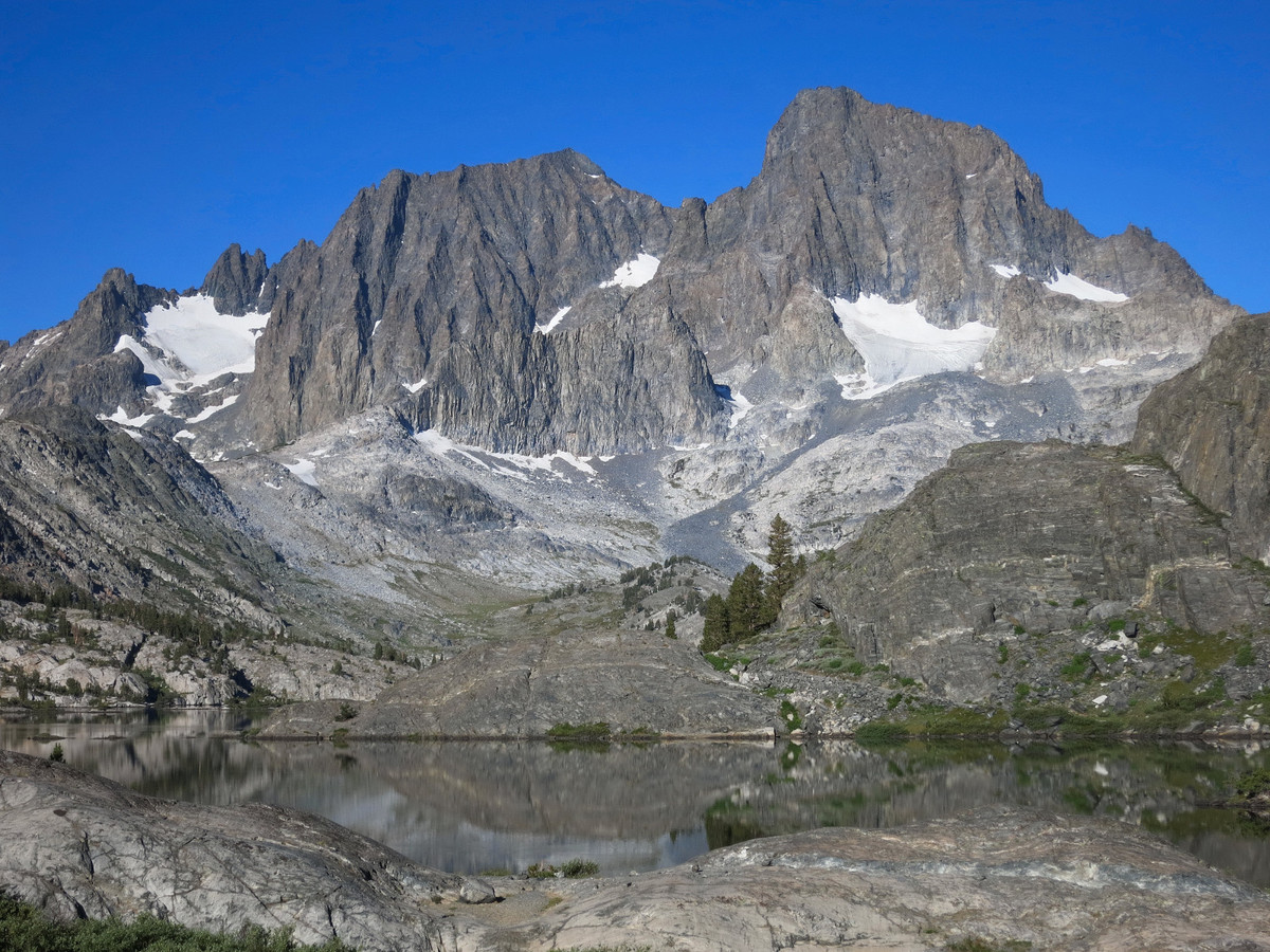
Higher is not always better. I’ve been to several peaks recently that are only modest in elevation but contain outstanding views. It many ways, being surrounded by impressive peaks of equal or greater height provides a more dramatic perspective. Mount Davis is one of these peaks. While relatively remote and obscure, the views are breathtaking and include taller and well known neighbors to the north (Mount Lyell and Rodgers Peak) and south (Mount Ritter and Banner Peak). To the west is the rugged and wild headwaters of the North Fork San Joaquin River, including the enchanting Twin Island Lakes, and to the east is spectacular Thousand Island Lake and the Davis Lakes. On my way to Mount Davis I visited the always-beautiful Garnet Lake and Thousand Island Lake, making sure to time my passage with idyllic morning light. While the shortest route to Mount Davis is via Silver Lake trailhead, I prefer the route from the Agnew Meadows trailhead which is more scenic in my opinion. This route also enabled me to easily include a morning visit to Garnet Lake, one of the prettiest lakes in all of the Sierra. GPS route here.
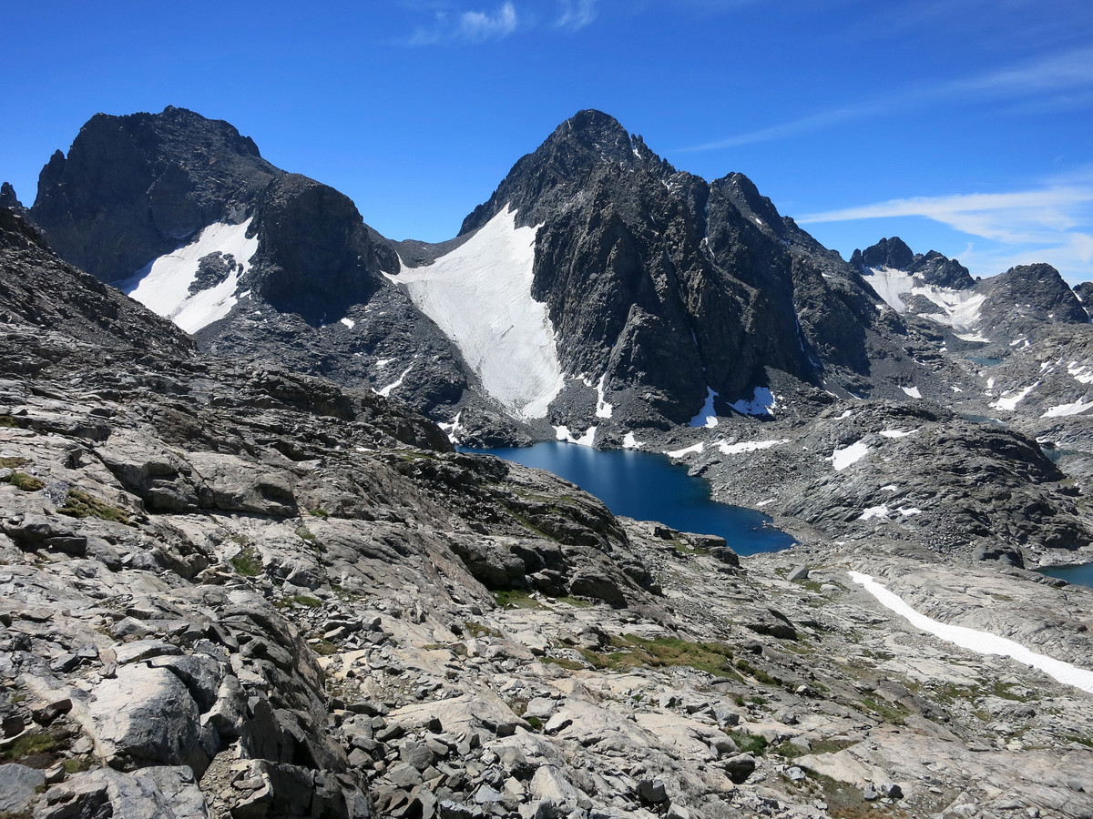
 I continued up from Thousand Island Lake to North Glacier Pass, a route that seems more efficient each time I get the chance to visit the pass. The pass is a worthy destination in itself with a commanding view of the deep blue Lake Catherine situated below the rugged north faces of Mount Ritter and Banner Peak. The view includes the glacial remnant that flows between these two impressive peaks. From North Glacier Pass, it seems as if Davis would be close, but quite a bit of leg work remains. One can either descend to the rocky shores of Lake Catherine or traverse higher up to avoid losing elevation. Both require some travel through cumbersome talus, but the beautiful clear waters of Lake Catherine are a great distraction.
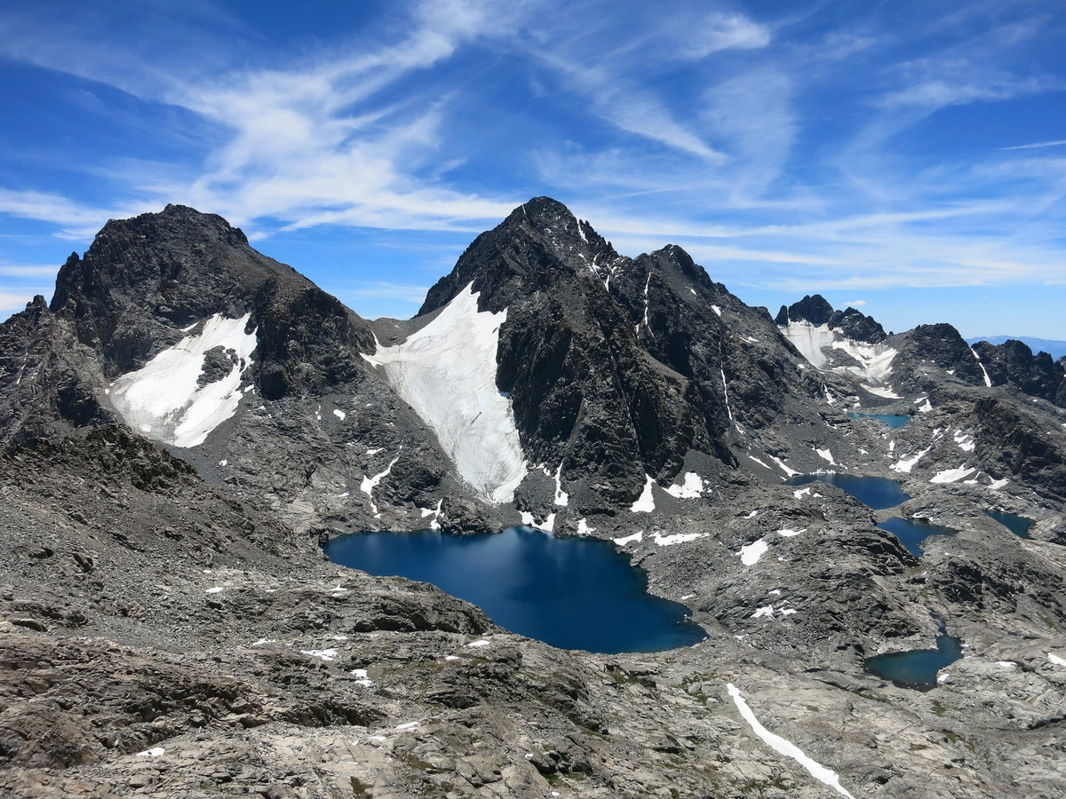

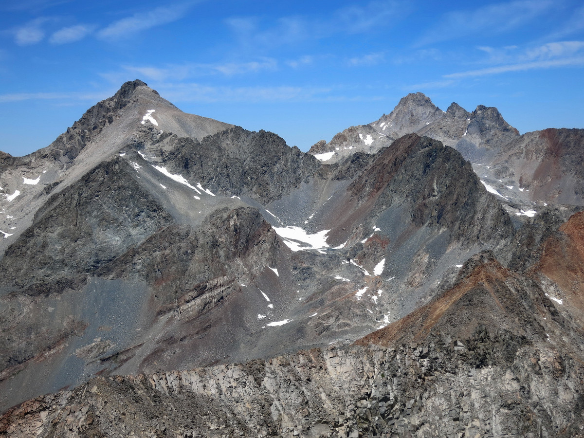
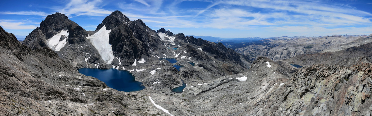
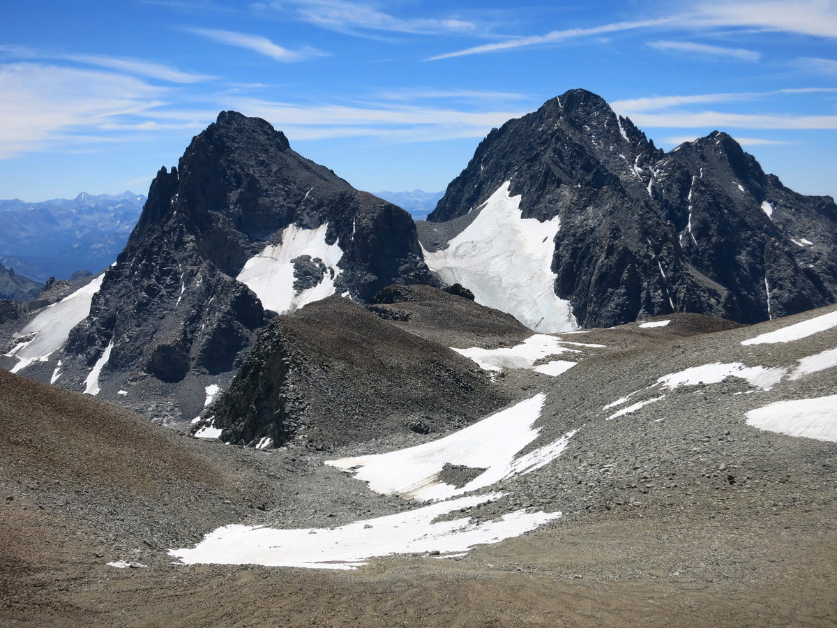
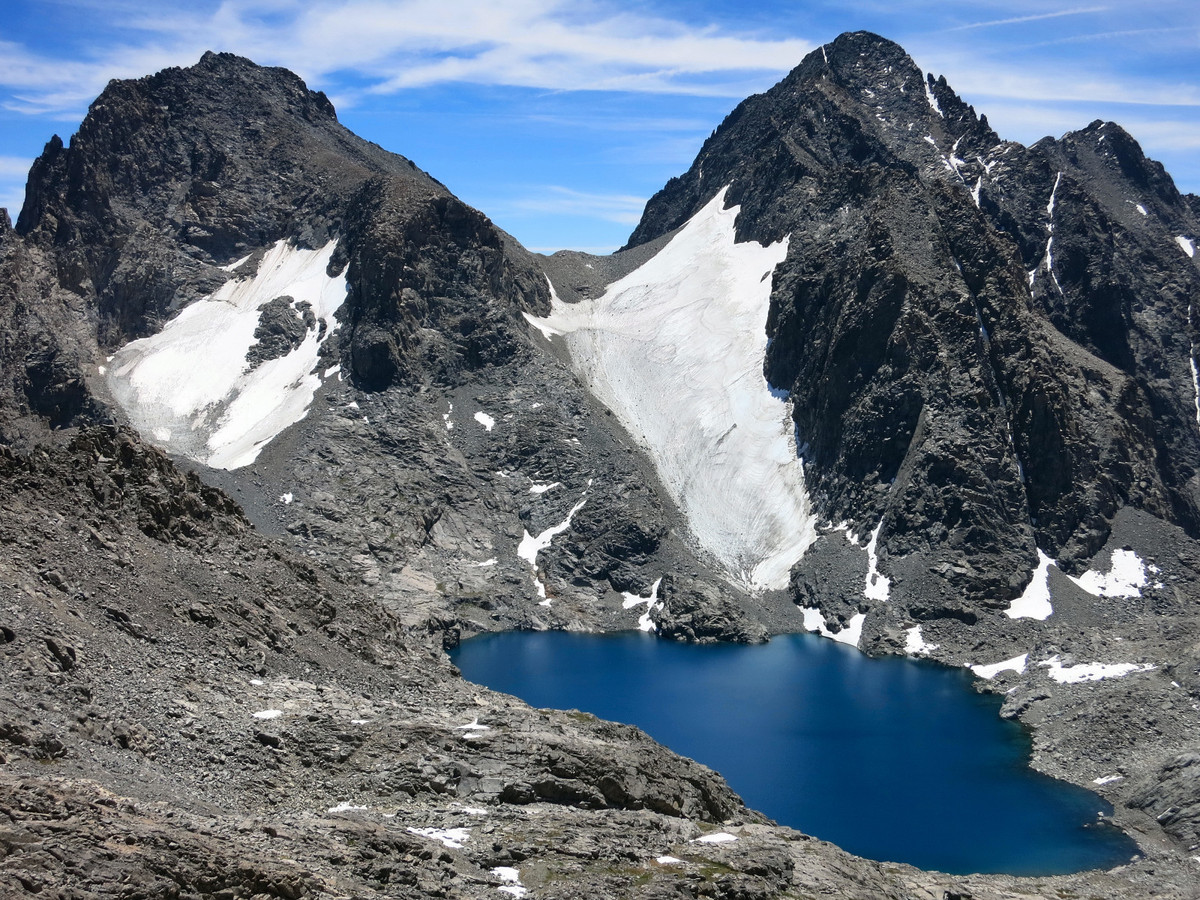
 Higher up above Lake Catherine the terrain transitions to friendly granite slabs that lead to the “Davis Plateau,” a broad area of high elevation between North Glacier Pass to the south and the summit of Mount Davis at the north end of the plateau. While the summit of Davis has some prominence, there are numerous ridgelines and points along the plateau that are not that much lower in height. In this regard, Davis is more of a massif. In order to reach the high point, which includes the best views looking north along the crest toward Mount Lyell, an expansive glacial bowl must be crossed with copious talus and some interesting ice remnants (sadly it’s doubtful this ice makes it through this exceptionally dry and warm year). After crossing the bowl, the summit of Davis is an easy talus hop. On the way back I made a slight diversion to a small point at the south end of the Davis plateau that features an amazing view overlooking the deep blue waters of Lake Catherine and the multi-colored Ritter Lakes, nestled underneath the rugged buttresses of Mount Ritter with colors ranging from deep blue to turquoise. I have probably spent more time in the Ansel Adams Wilderness region exploring the area around the Minarets and Ritter/Banner than anywhere else in the High Sierra but the scenery never ceases to amaze and inspire. GPS route here.


- Comment
- Reblog
-
Subscribe
Subscribed
Already have a WordPress.com account? Log in now.

Awesome pics Leor. Wish I could join you on one of those explorations.
This is a nice example of Leor’s posts, which came to me earlier this month by email.