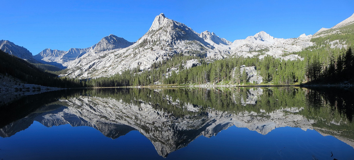
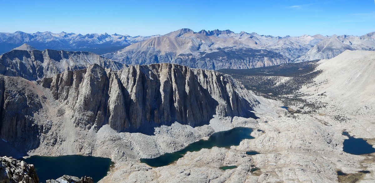
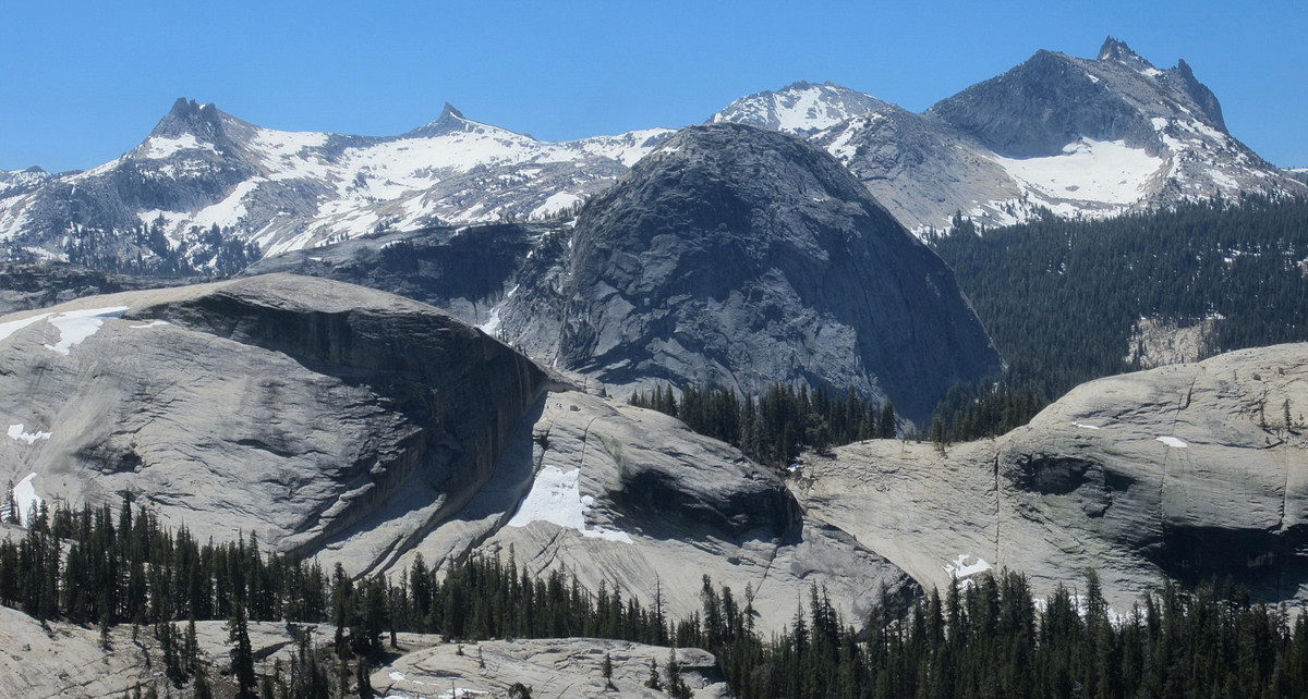
It should come as no surprise that I have many ideas for adventure runs (see 2013 post here and 2012 post here). Listed below are several potential routes in the High Sierra, Trinity Alps and Coastal Region (mostly Big Sur/Ventana, but some Lost Coast). Many of these ideas are rather obscure, but the Ventana Wilderness and Sierra Nevada are filled with hidden gems and I expect all of these will be aesthetic routes with outstanding scenery. Hopefully I’ll get to several of these ideas this year and several more routes that I haven’t thought about yet! I also hope to visit the North Cascades in Washington State at some point, but since my opportunities to travel up north are limited I won’t dedicate a special ideas post to the Cascades this year. All photos by me from adventures in 2013 and 2014.


Sierra:
- Mount Kaweah and Second Kaweah: Fantastic views from the summits compensate for otherwise chossy climbing. The approach is also highly scenic through Little Five Lakes.
- Whitney Zone Loop: Full meal deal with the Cleaver, Tunnabora, Carillon, Russell, Whitney, Muir, and maybe some of those other pinnacles between Whitney and Muir.
- Tyndall & Williamson: Double the fun for these two fourteeners via Shepherd’s Pass and Williamson Bowl.
- Mount Rixford, Dragon Peak & University Peak: These all look like fun peaks to ascend. Mount Rixford, with its position west of the crest, is a particularly good viewpoint. Dragon Peak looks impressively rugged from the Rae lakes Basin. I’d also like ascend Mount Bago via its walk-up side.
- Comb Spur & Goat Mountain: Great early season route with huge views.
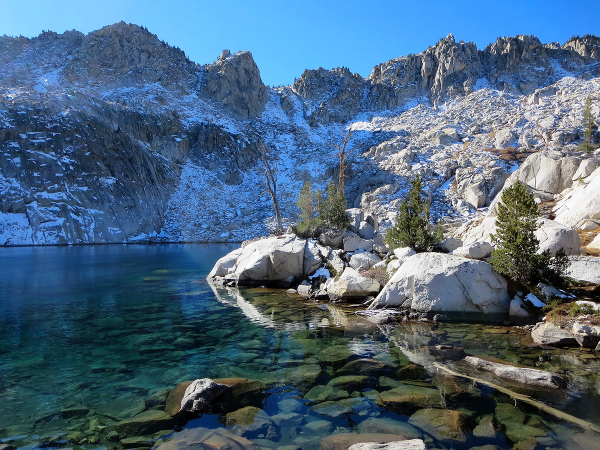
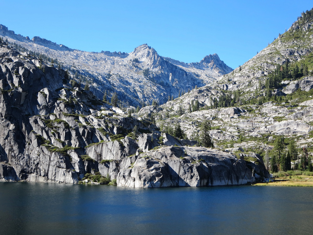
- Cirque Crest Loop: An area I have yet to explore with some cool peaks I’d like to climb including Mount Ruskin and Observation Peak. This region also contains some of the range’s most remote basins including Dumbell Basin, Lake Basin and Amphitheater Lake.
- Arrow Peak and Bench Lake: An adventure via Taboose Pass that has been on the list for many years, but I haven’t made it out yet to see the classic Sierra view of Arrow Peak from Bench Lake. Perhaps this trip could be combined with the Cirque Crest Loop described above.
- Ionian Basin – Scylla & Hansen: Accessed via Sabrina Basin and Echo Col, this region is near Muir Pass and the JMT, but far away from the beaten path and features spectacular peaks and many high lakes amid one of the most rugged and strikingly desolate settings in the High Sierra.
- The Black Divide Loop – Charybdis, Black Giant, McDuffie: A three peak loop tour of of the Ionian Basin, accessed via Bishop Pass and South Lake.
- Bench Valley: Another western approach to the LeConte Divide, featuring a string of remote high alpine lakes off-trail.
- Mt. Henry, Red Mountain and Hell for Sure Lake: A beautiful area with lots of easy cross country terrain.
- Evolution Loop: Last time I did the horseshoe loop from north to south, but I’m wondering if south to north is actually faster. The argument for south to north is that most of the steep climbing is completed earlier rather than later, which may work better for me as I’ll be able to attack the long and at times steep climb out Pate Valley to Muir Pass early in the route. Despite it being a long uphill slog from the JMT junction to Piute Pass, it’s fairly gradual and I think most of it is runnable for me if I’m feeling good at that point in the run, whereas the climb from Pate Valley to Bishop Pass is too steep for any running late in the run. I also like the idea of running down through Evolution Basin and Valley. Finally, the South Lake trailhead is also marginally higher by about 500 feet. I guess I’ll have to find out if south to north is faster.
- Bench Canyon Loop: At the remote headwaters of the North Fork San Joaquin River this loop entails a section of the Sierra High Route from Thousand Island Lake to Tuolumne Meadows.
- Northern Yosemite 50 miler: This is a fantastic loop including Peeler Lake, the Benson Lake riviera, Smedberg Lake, Matterhorn Canyon and Burro Pass.
- Boundary Lake and Cherry Canyon: In northwest Yosemite and the Emigrant Wilderness.
- John Muir Trail: The classic trail through the range of light. I’ve seen most of the trail over the years so it’s my hope to put it all together.
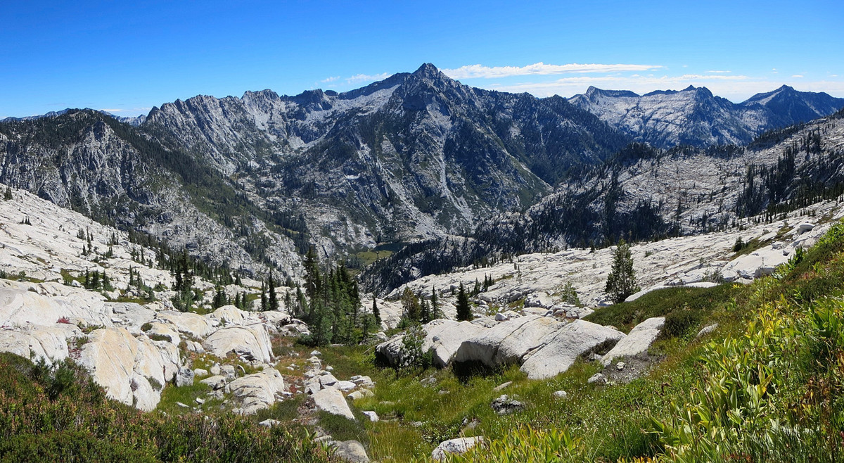
- Sierra High Route: Another big project. Over 195 miles, largely off trail through some of the best scenery the High Sierra has to offer.


Trinity Alps:
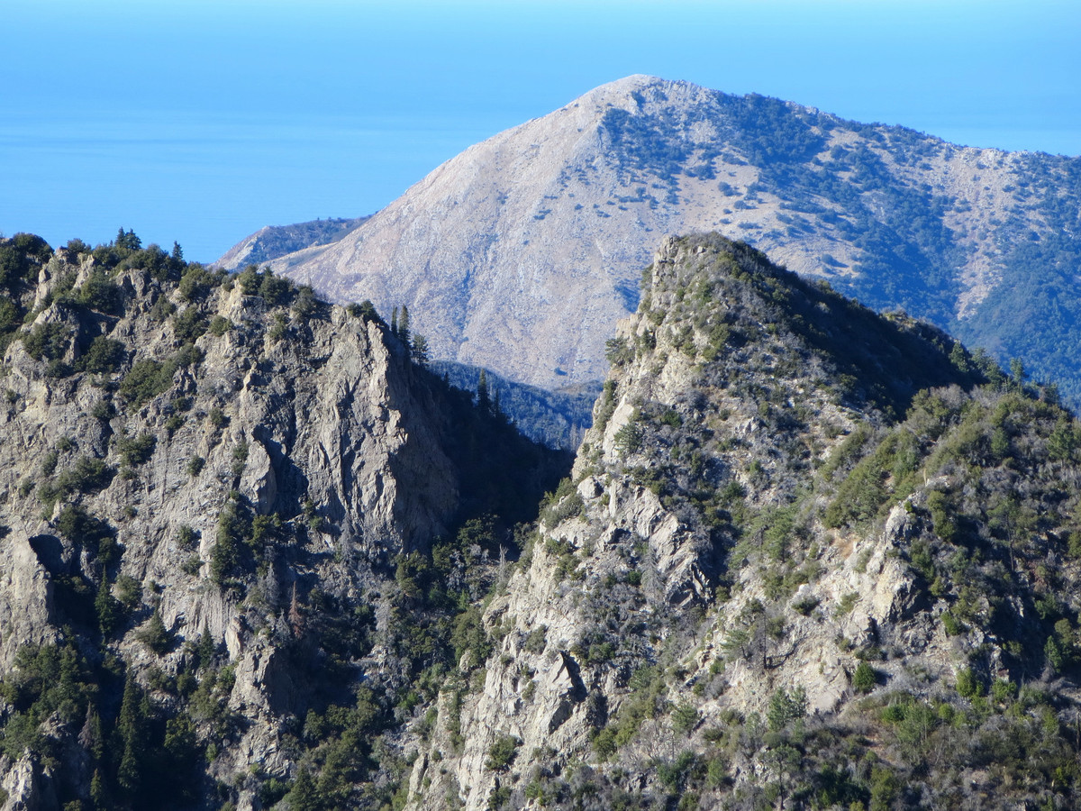
- Sawtooth Mountain & Smith Lake: Easily the most rugged peak in the Trinity Alps and ironically it’s also arguably the most rugged mountain north of Sawtooth Ridge in the High Sierra (Yosemite/Hoover Wilderness). This route will include the remote Smith Lake nestled in a granite basin underneath Sawtooth Mountain, which is accessed via Alpine Lake, another fitting spot for an afternoon swim.
- Caesar Peak via Stuart Fork: A trip up the Stuart Fork Trinity River to Emerald, Sapphire and Mirror Lakes finishing with a climb of Caesar Peak.
- Caribou Mountain and Sawtooth Ridge: Beautiful views overlooking the Caribou Lakes basin, Stuart Fork Canyon and the Trinity Alps.

Coastal:
- Lost Coast: I have done the entire Lost Coast from the Mattole River to Usal Beach twice over two days each. The idea is to do the entire 53 mile stretch of the coast in one single day push.
- King Crest 50: A 50 mile route in the King Range portion of the Lost Coast, including the entire King Crest, the Cooskie Creek route to Gorda 2, and a spectacular section of the Lost Coast beach walk [completed March 23rd, blog post coming soon].
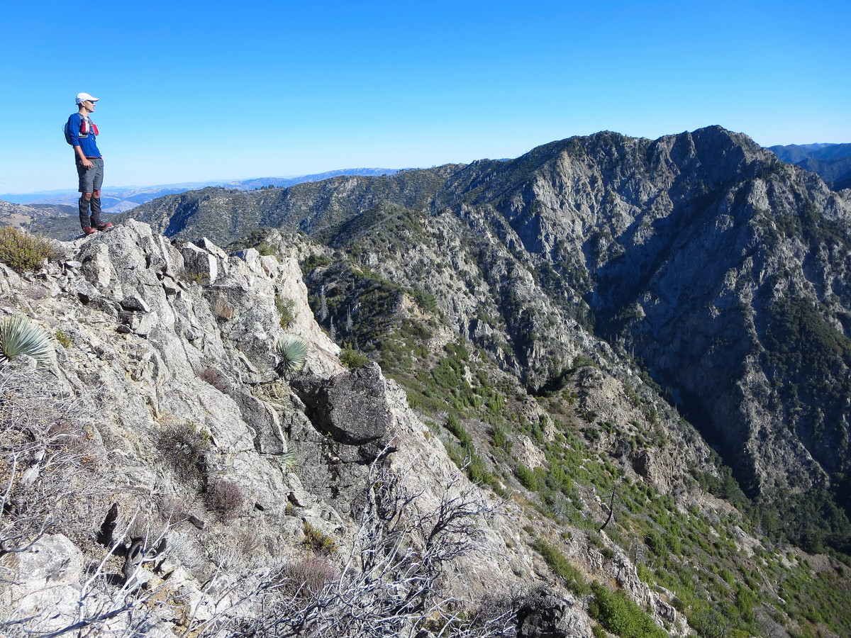
- Pico-Cabezo Route: A point-to-point tour of the peaks from Bottcher’s Gap to Pfieffer Big Sur State Park, incluidng Pico Blanco, South Fork Little Sur River, East Molera Ridge, Post Summit, Cabezo Prieto and Mount Manuel.
- Ventana Loop: Finding some inspiration in my La Ventana Loop report, Sachin and Toshi put up an awesome variation by descending into the rugged cirque between Kandlbinder and Ventana Double Cone and then ascending the rugged west ridge of Ventana Double Cone via what appears to be an instant classic scramble route.This is an awesome region with a lot left for me to explore.
- Mocho Falls along the South Fork Big Sur River: A trail run to Sykes Hot Springs and then a creekwalk along the Big Sur River and then the South Fork Big Sur River to an enigmatic waterfall that is apparently 80 feet tall on the main stem of the south fork, but has seen few visitors and no photographs that I can find.
- South Big Sur Coast Adventures: I have done several trips in the Silver Peak Wilderness recently, including the South Coast Adventure point-to-point and the Silver Peak Wilderness Loop, but it’s got some of the best scenery along the entire Big Sur coast so I look forward to returning for more exploration.
- Arroyo Seco River Gorge: For a hot day in the summer I would like to see the entire Arroyo Seco Canyon from top to bottom in a ~25 mile loop, 13 miles on old road and the balance walking in and swimming the Arroyo Seco.


I envy your life… you, my sir . Successfully living the life i wish i had
So excited to see the JMT and HSR on this list and as always will enjoy seeing that sporadic trip back to the cascades. After seeing you do the ptarmigan traverse three times, I think this is the summer for me to hit it.
Heck of a list and great photos!
Beautiful photos.
Looks like a great list! If you’re interested, the first week of August (3-5) I along with a Brazilian adventure racer will be doing the entire route in about 7-10 days…depending on what the safe/smart pace is…in case your interested and the timing worked out!
SHR route that is…left that out oops
It’s that time of year… !
I like the loops using the Sierra High Route and JMT. Bench Canyon and Cirque Crest would be nice that way for sure.
Here’s one that’s been done a few times lately: Cottonwood Lakes to Shepherd’s Pass Trail, climbing all the 14ers on the way!
I also wonder about the Great Western Divide. Lots of remote, high peaks up there. What about a traverse of its crest? Could be technical. Something that could be quite wild would be to make loop via the Sierra crest (Whitney to University — roughly at least) and return via the Great Western Divide. Might take two days…
Here’s another thing I was thinking about recently: what’s the fastest way up Williamson? Is it the Long Twisting Rib, which is more direct but more difficult, with bushwhacking and steep scree? Or is if faster via Shepherd’s Pass?
Thanks for the stimulating post and hearty food for thought! Great ideas here!
One more idea Leor — Devil’s Crag #1. Remote, high, and difficult. 10k gain, 35+ miles, and difficult 4th class climbing to gain the summit. A classic for running alpinism?
Another SHR – JMT loop that could be nice is a loop from Piute Pass through the Bear Lakes to Lake Italy and then back via JMT and Piute Pass trail. An ascent of Feather Peak by its SW ridge would be a nice exclamation point on the journey. It’s a little longer than the other loops though; perhaps close to 70 miles (30 miles XC, 40 miles trail). It looks like the JMT may be fairly flat on the return, however.