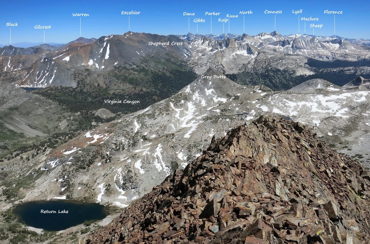
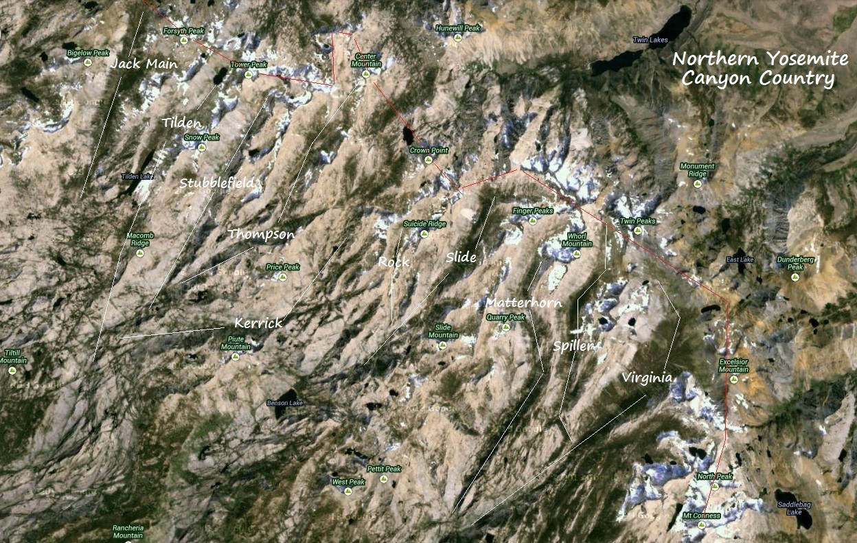
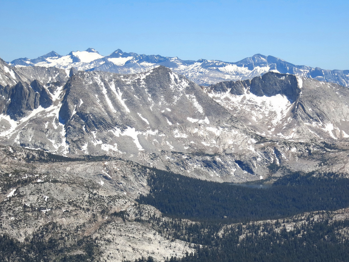
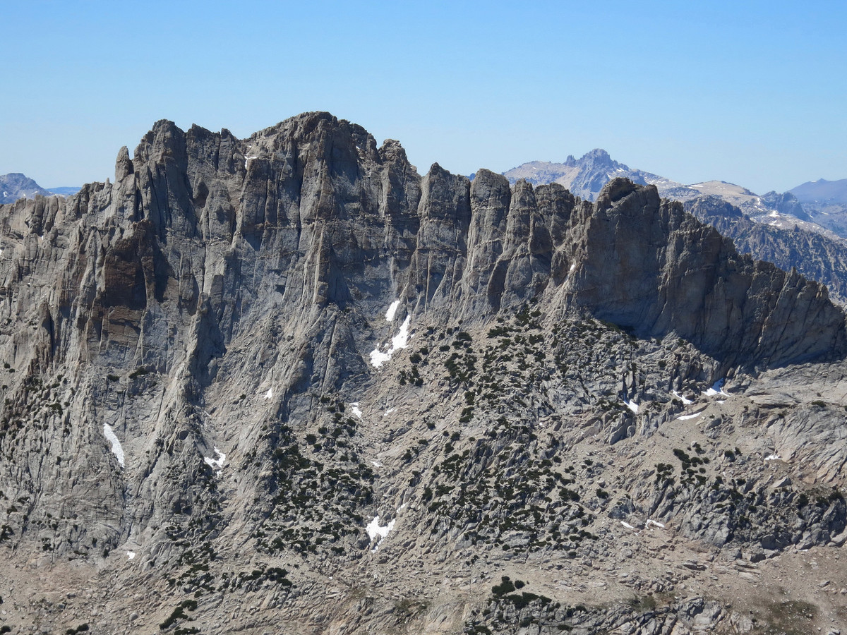
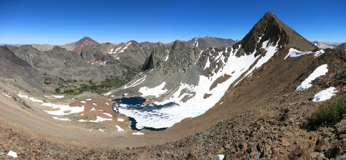
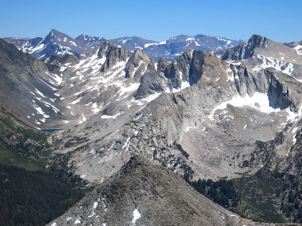
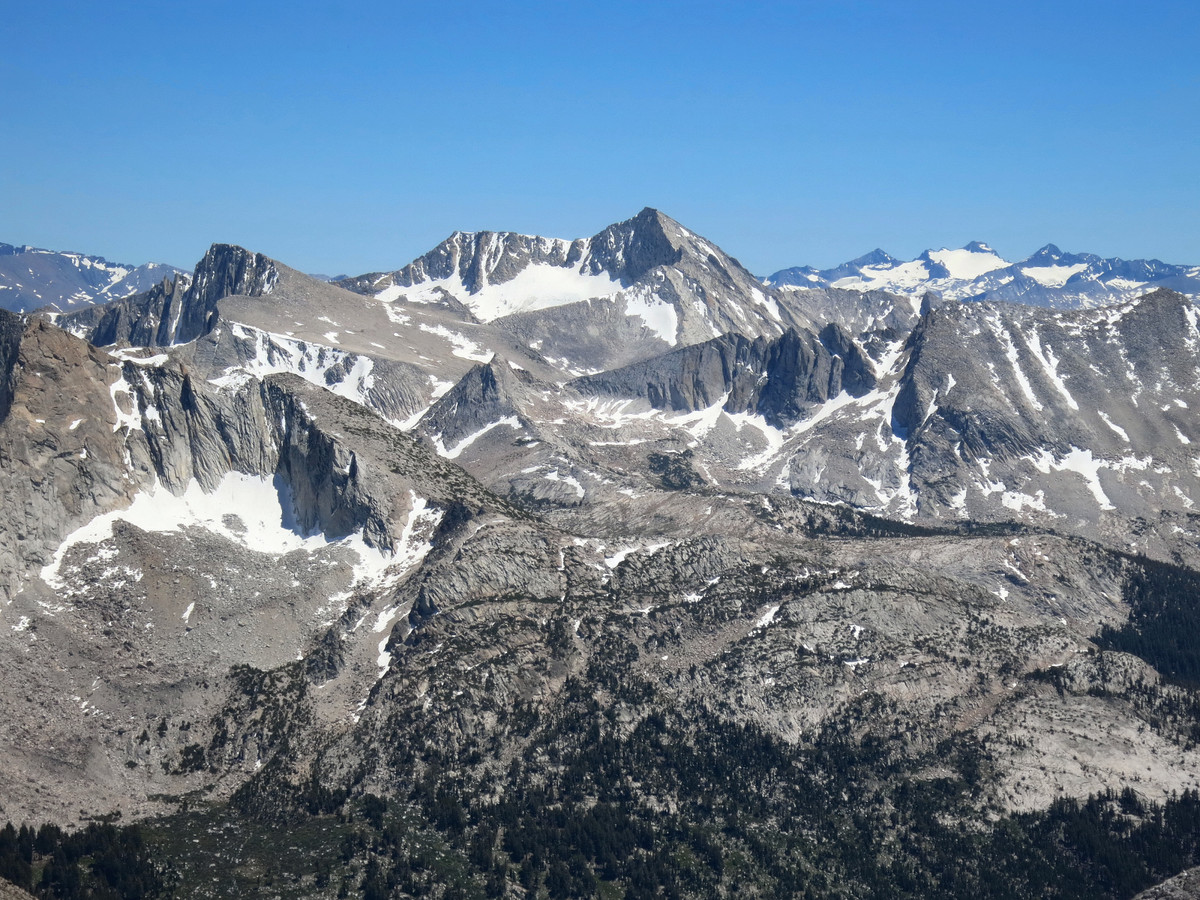
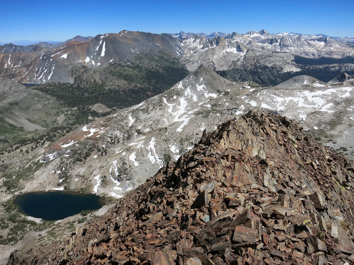
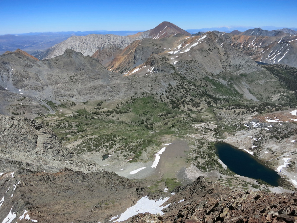
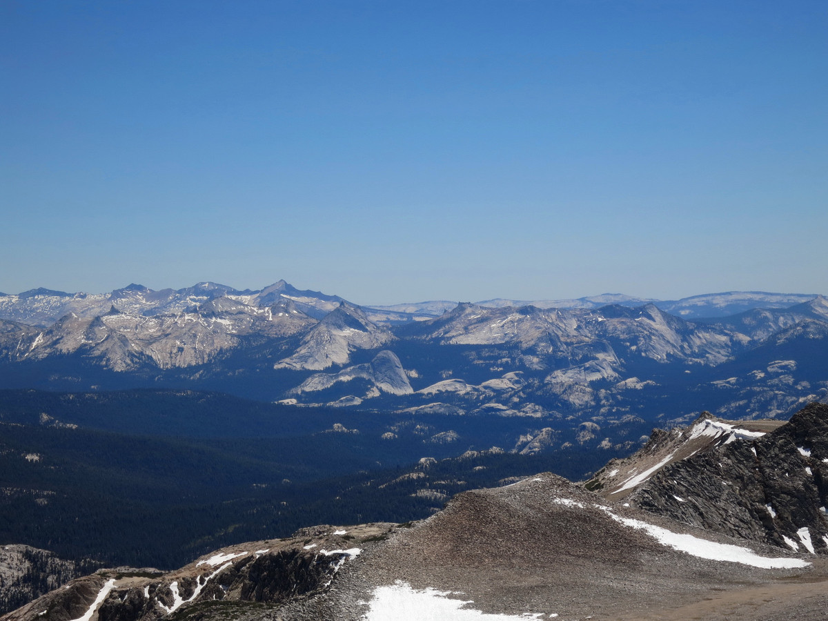
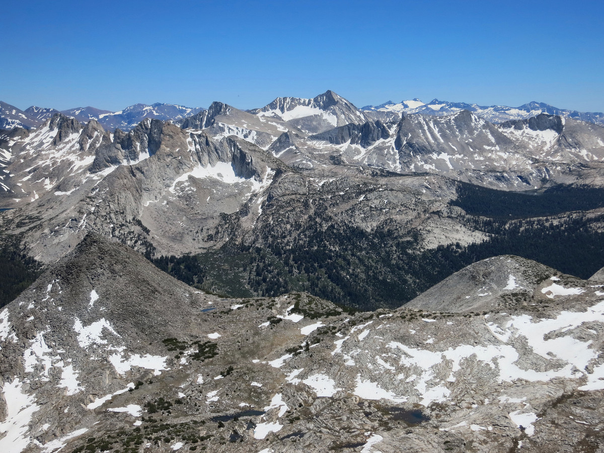
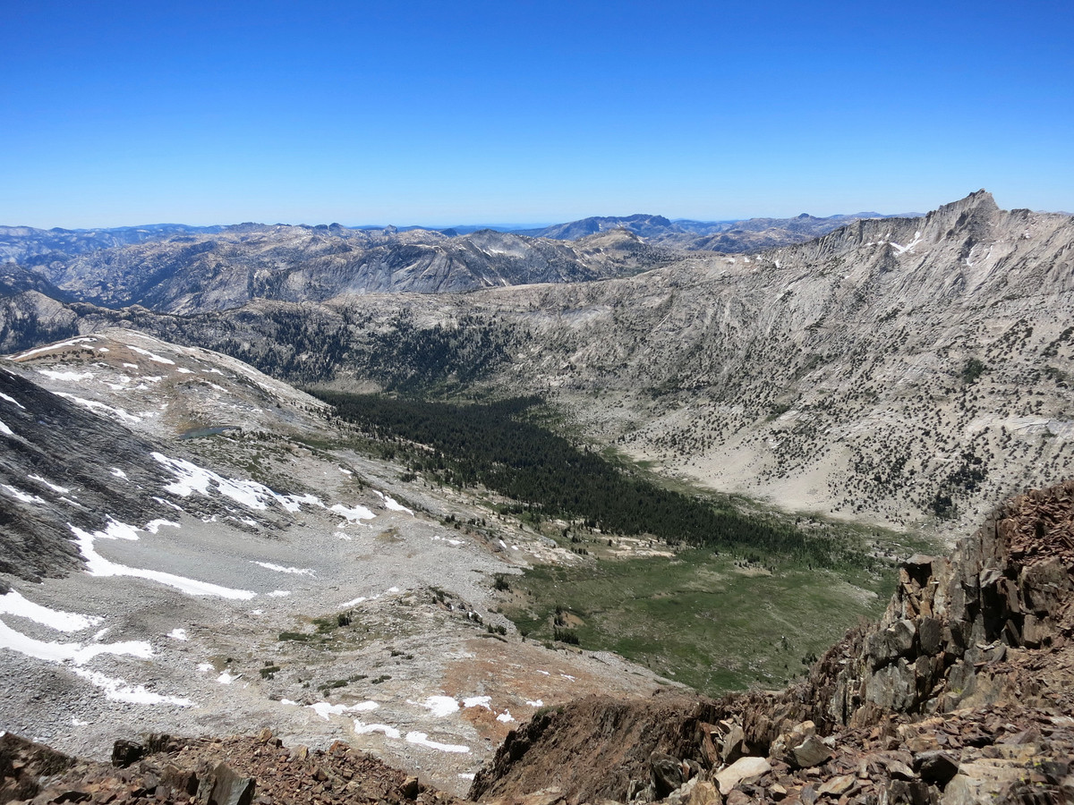
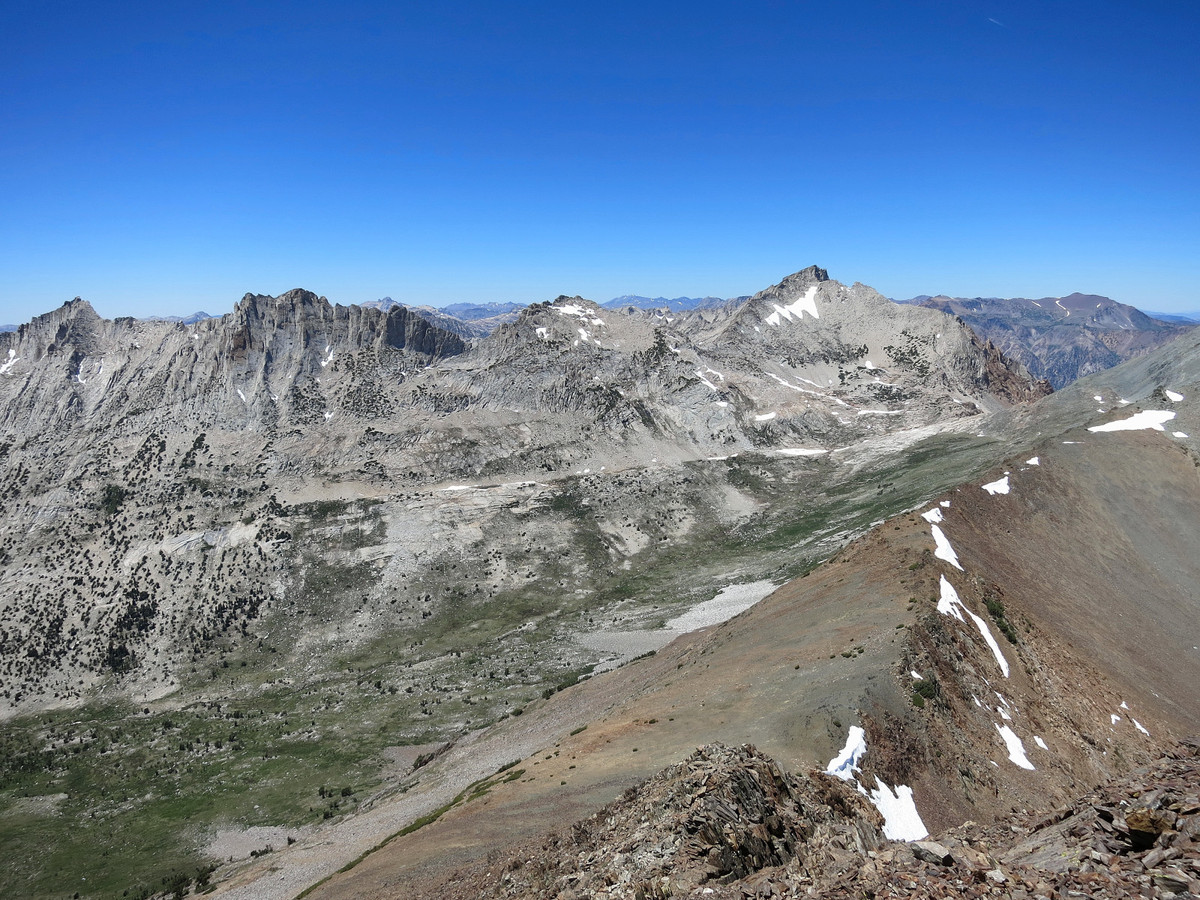
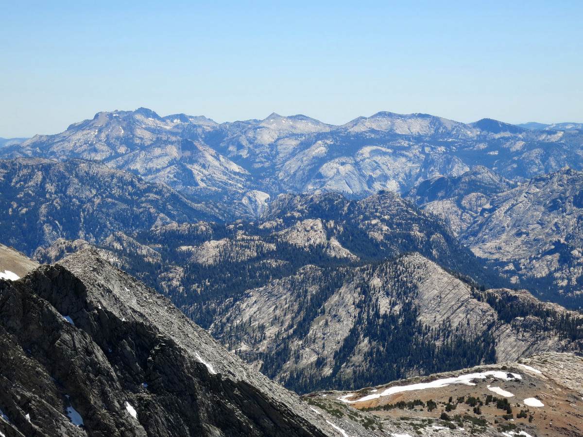
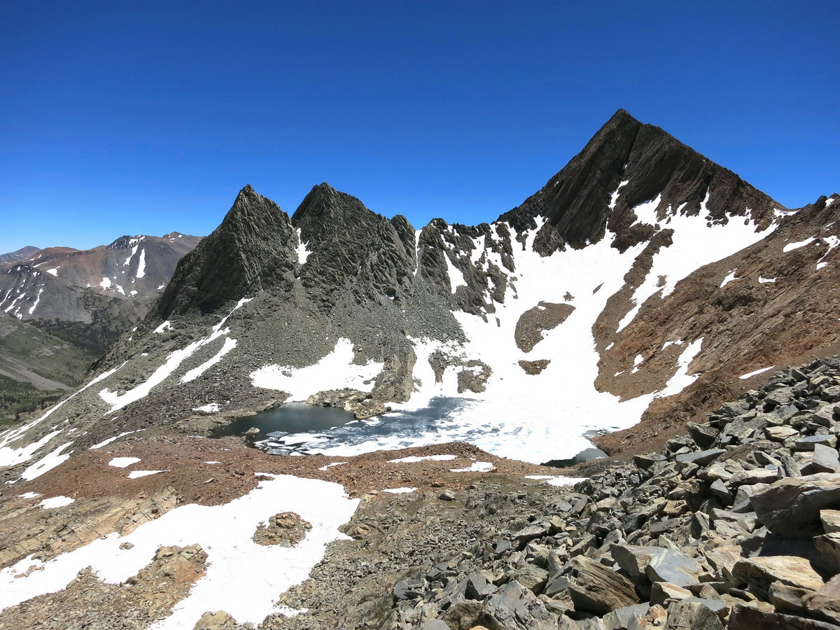
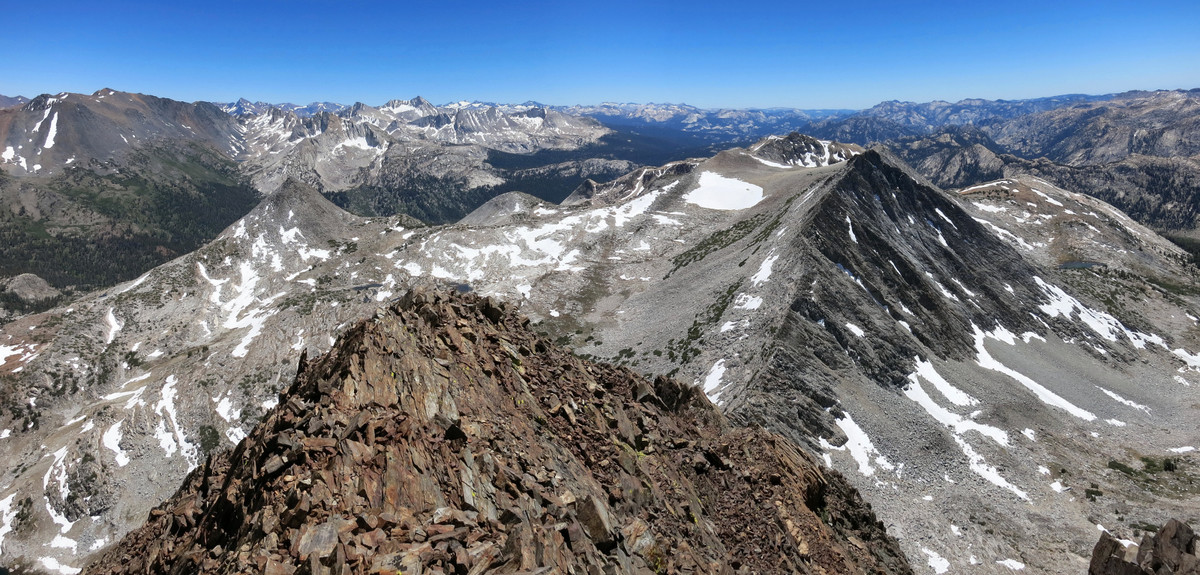
Northeast Yosemite is one of my favorite places in the Sierra Nevada. The peaks are not as high as the Southern Sierra, but it’s a distinctly alpine region characterized by a series of long glacier-carved canyons separated by sharp granitic peaks and ridgelines. The numerous canyons (from east to west) include Virginia Canyon, Spiller Canyon, Matterhorn Canyon, Slide Canyon, Rock Canyon, Kerrick Canyon, Thompson Canyon, Stubblefield Canyon, Tilden Canyon and Jack Main Canyon (see annotated satellite image of the canyons). All of the canyons flow into the Tuolumne River watershed and provide virtually limitless opportunities for exploration, and several of the canyons are completely trail-less canyons. The entire region offers some of the best wilderness terrain to wander off the beaten path in solitude. On this day I was looking for a relatively quick afternoon warm-up (post drive from the Bay Area) before my trip to Arrow Peak’s northeast ridge so I decided to do Virginia Peak, a striking peak that rises between the deeply-carved Spiller Canyon and Virginia Canyon. From the summit of Virginia Peak there is a magnificent view in all directions, including the impressively steep Whorl Mountain across picturesque Spiller Canyon, Matterhorn Peak at the head of the canyon, Mount Conness and Shepherd Crest to the south, and the Roof of Yosemite including Mount Lyell, Mount Maclure and Mount Florence.
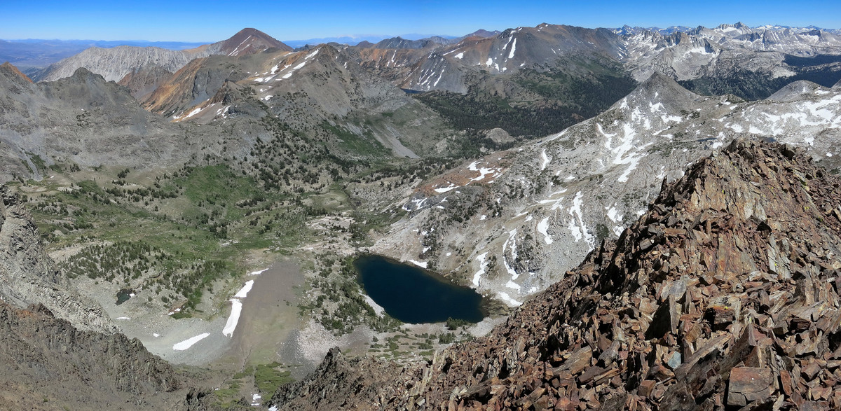
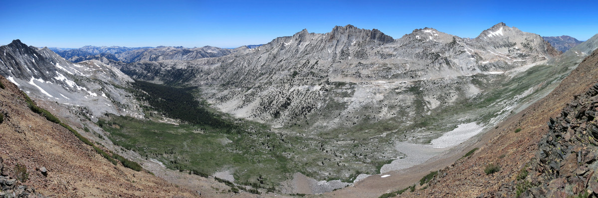
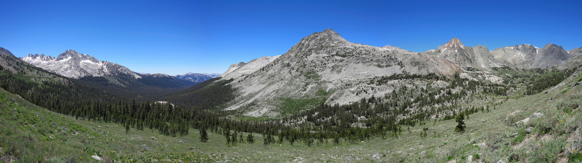
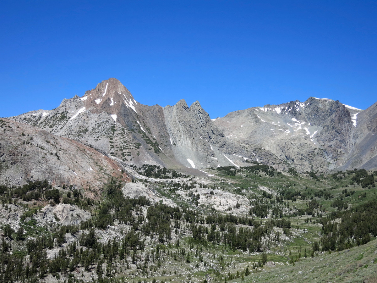
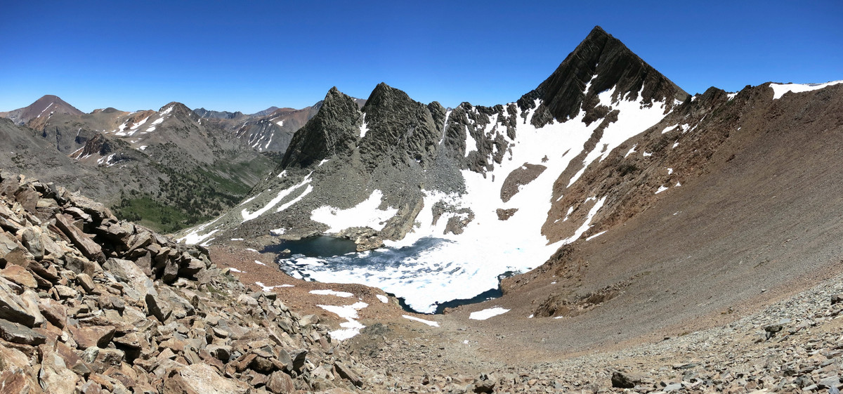
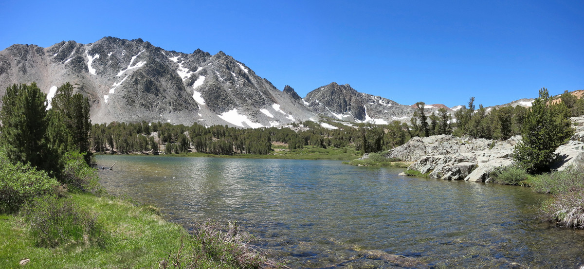
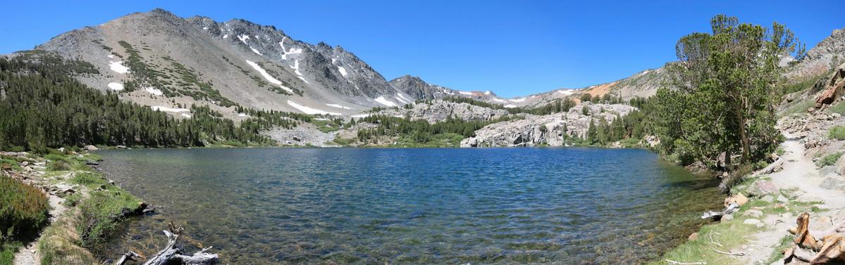
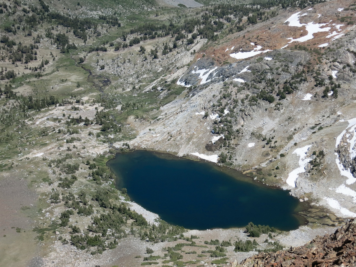
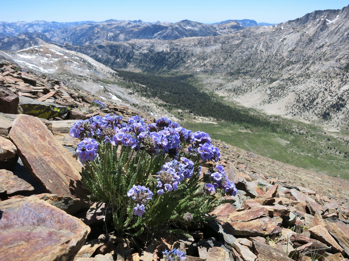
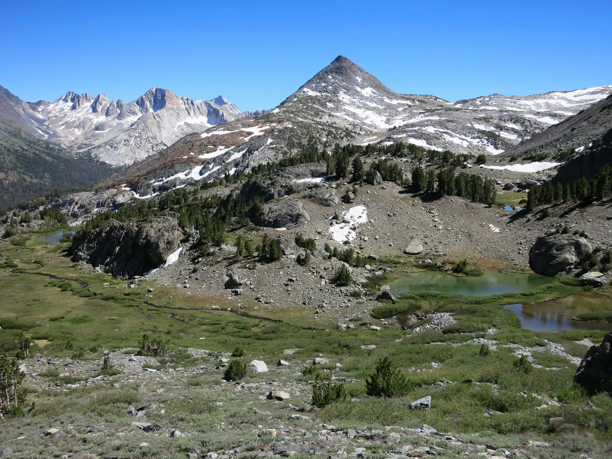
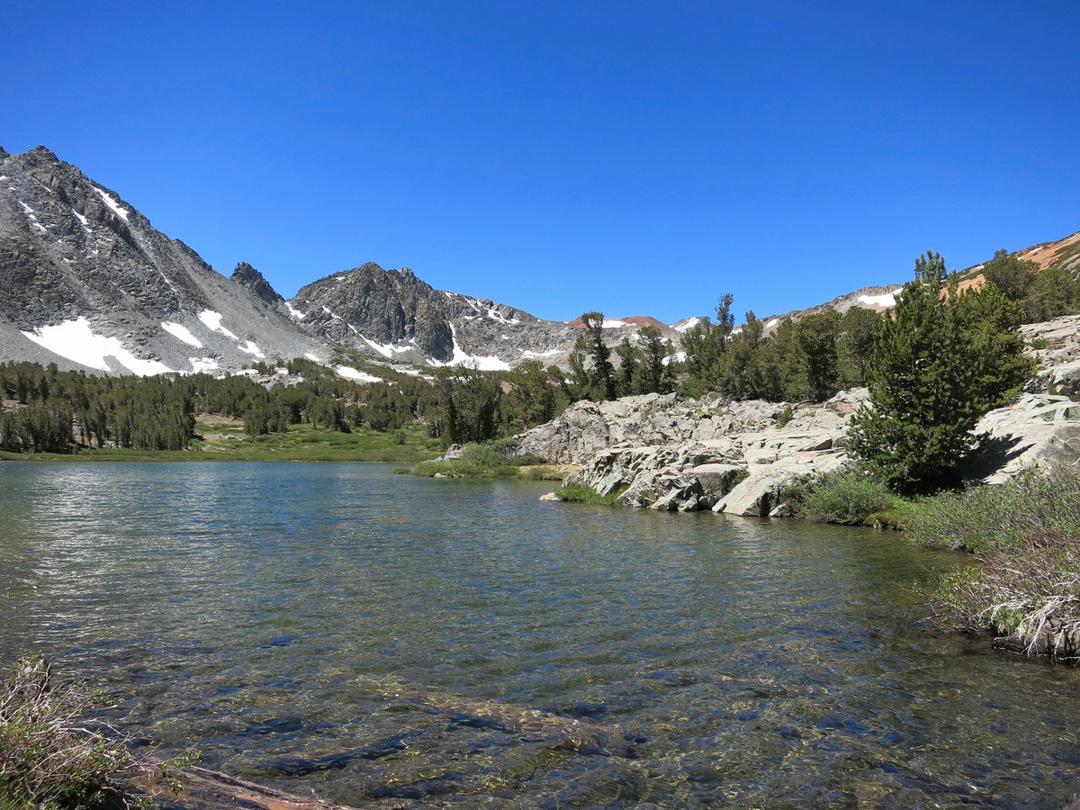
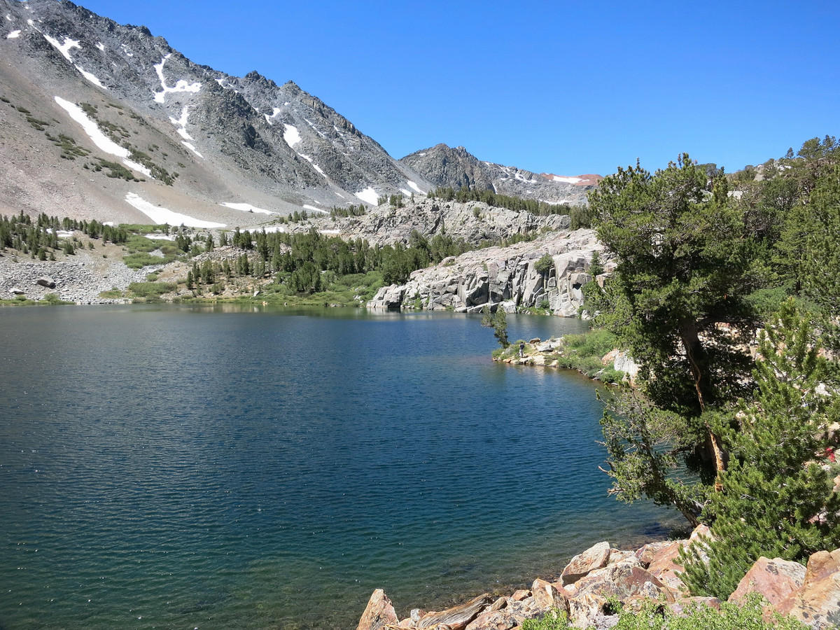
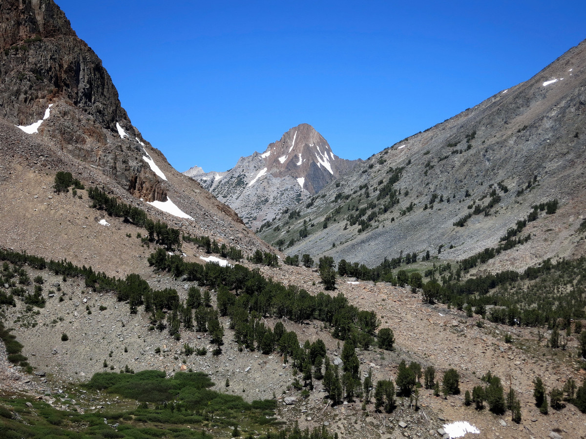
 The shortest and likely quickest access to Virginia Peak is via the Green Lake Trailhead, but I decided to access via Virginia Lakes, a pretty chain of alpine lakes I had never seen with trailhead access that is almost all on paved road (the Green Lake TH is a long dirt road). Moreover, the Virginia Lakes TH starts a bit higher. The downside is the approach builds in an extra climb over a saddle that is over 11,000 ft resulting in a decent climb on the way back. On balance, the extra distance to the peak seemed worthwhile. I used maintained paths to below Summit Lake and then set off cross-country traversing across the lowest slopes of Camiaca Peak to Upper Virginia Canyon. A trail once existed in upper Virginia Canyon but I could only find bits and pieces of it in the meadows. Either way, travel is easy in the canyon and the main objective is to avoid brush patches that tend to grow near the watercourse. At the highest reaches of Virginia Canyon a headwall is reached with a waterfall. Apparently an easy route exists to bypass the waterfall and continue along the main drainage, but I found a nice gully to the right that provided an easy “staircase” up to the granite benches and talus fields below Virginia Peak and Twin Peaks Pass. The final ascent to the pass entailed some loose rock, but I was soon traversing over to the start of the scramble. The final scramble up Virginia Peak’s northeast ridge is short and mostly class 2 with a couple class 3 moves. The view from the top is awesome and I soaked in the scenery for nearly an hour before returning to the Virginia Lakes TH with plenty of time to drive south for the next day’s adventure. GPS route here.
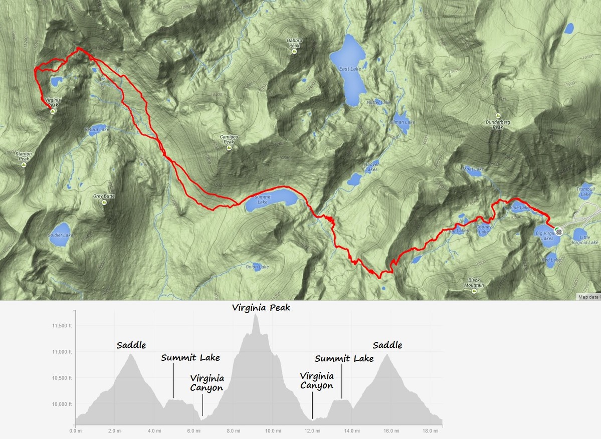


2 Comments Add yours