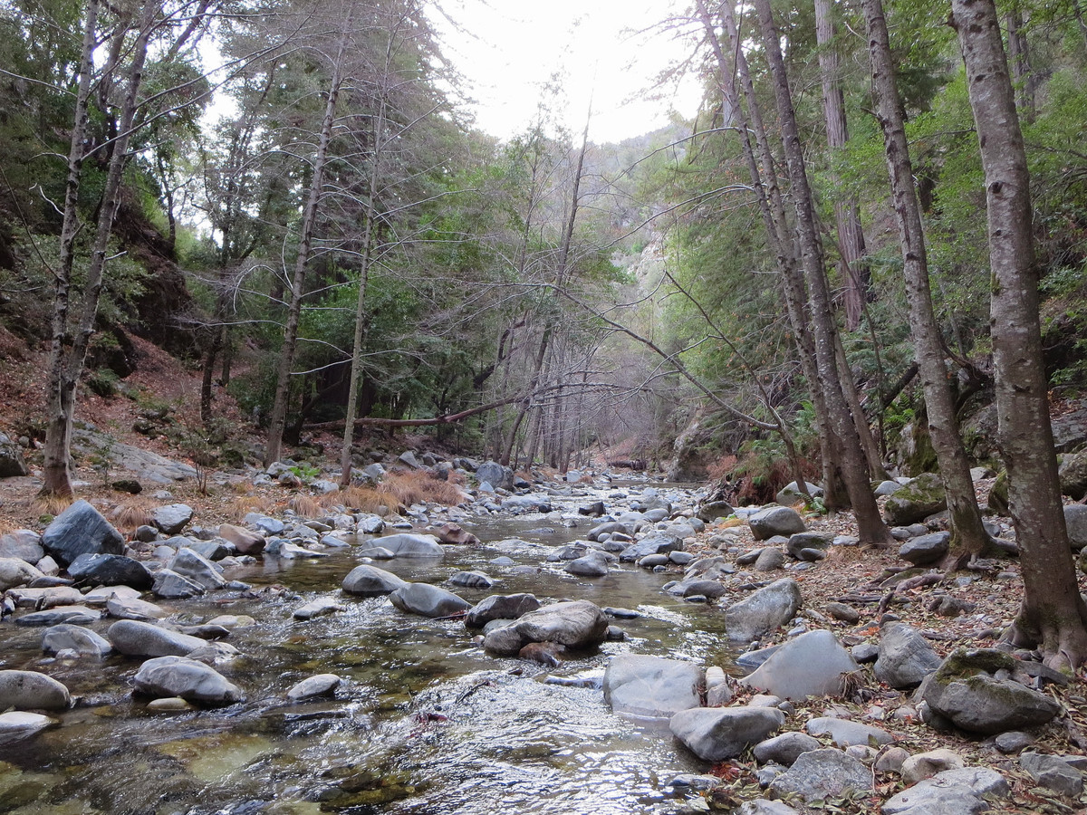
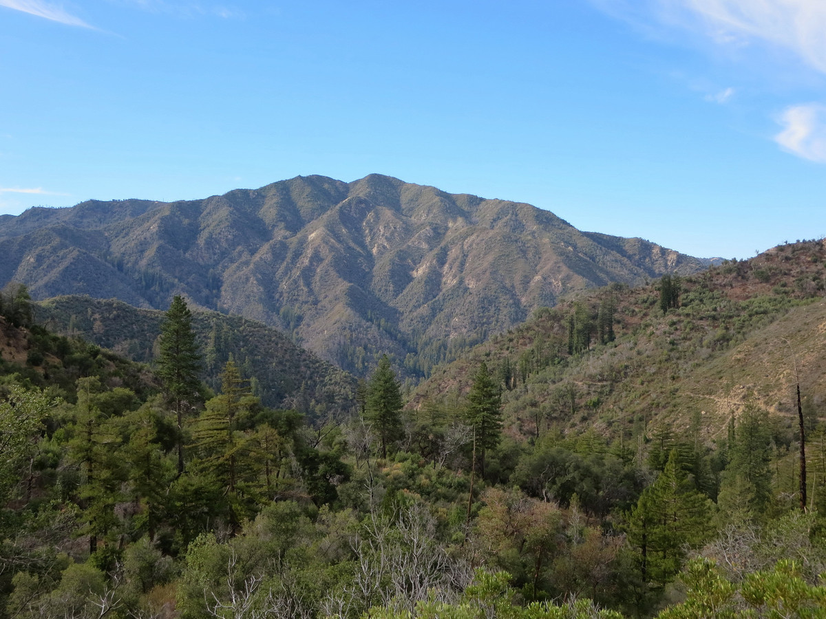
The Big Sur Trail is a rugged, overgrown trail, but the reward for the arduous effort is passage through the remote north and south forks of the wild and scenic Big Sur River. We also visited Rainbow Falls along the South Fork Big Sur River, rock hopping through the spectacular stream bed to reach this remote, hidden waterfall. Perhaps only in the bottom of the South Fork Big Sur River canyon can one find a forest composed of redwoods, Santa Lucia Firs and Coulter Pines, all living side by side. The wilderness feeling in these canyons is unparalleled. It was a treat to see the wild and scenic canyons of the Big Sur River, arguably the heart of the Ventana Wilderness. It’s no wonder the trail posses the name “Big Sur,” the descriptive name for this rugged section of California coastline. The Basin Complex Fire in 2008 served to temporarily clear out the brush, but 5 years later the vegetation and impediments have returned with a vengeance. The remote nature of the route, and its reputation for brush, blowdowns and route finding issues explains why so few people venture into these canyons. The grand finale was a run down Boronda Ridge in evening light with an amazing sunset over the golden hills and Big Sur coastline. I had the pleasure of joining Brian Robinson for this adventure. Brian knows this trail well and spoke highly of the beauty of this region which got my imagination going and was the impetus for this trip. After seeing the Big Sur Trail for myself, I agree that it’s a gem and worth the effort. I will definitely be returning for further exploration. Strava route here.


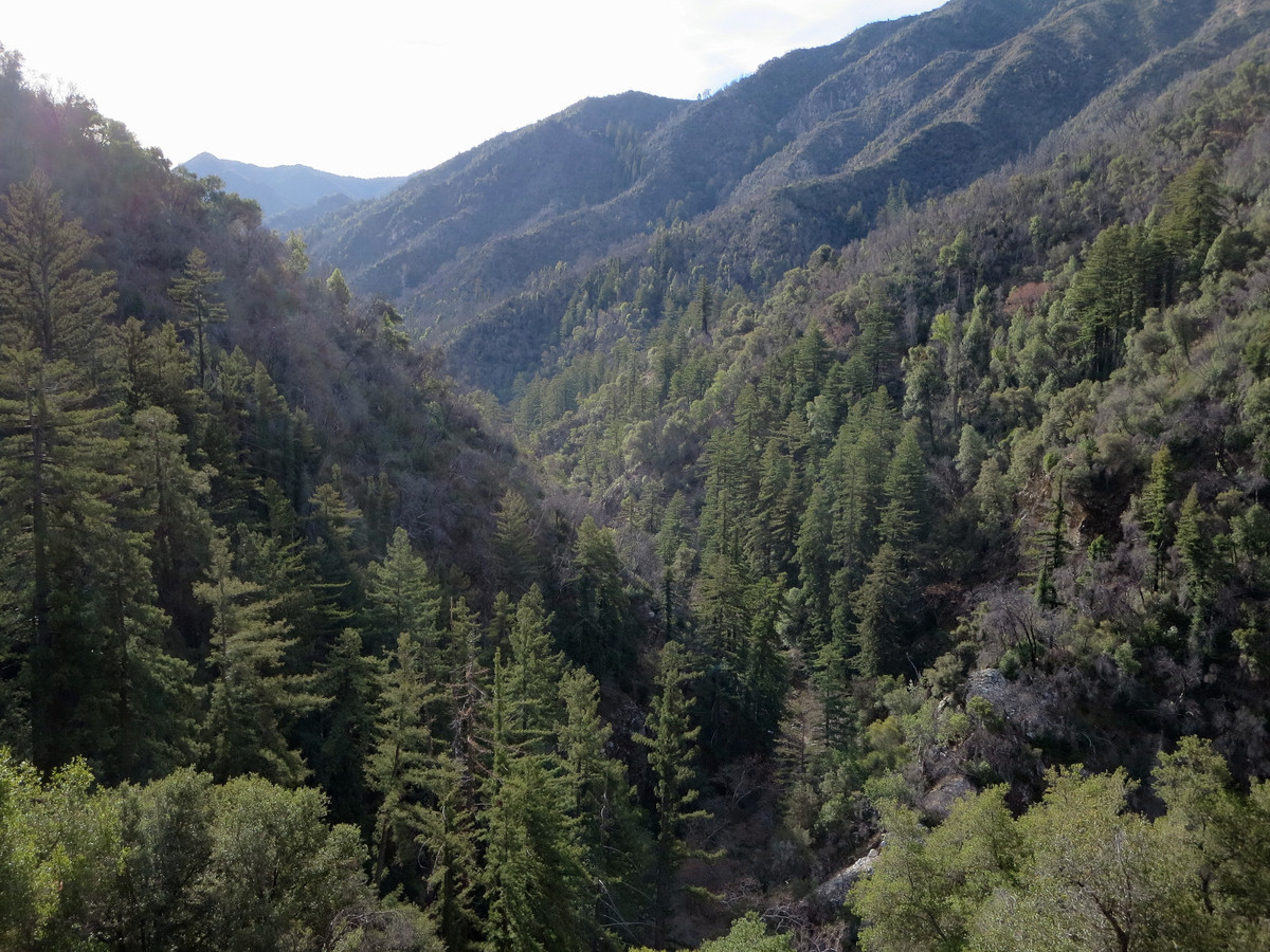
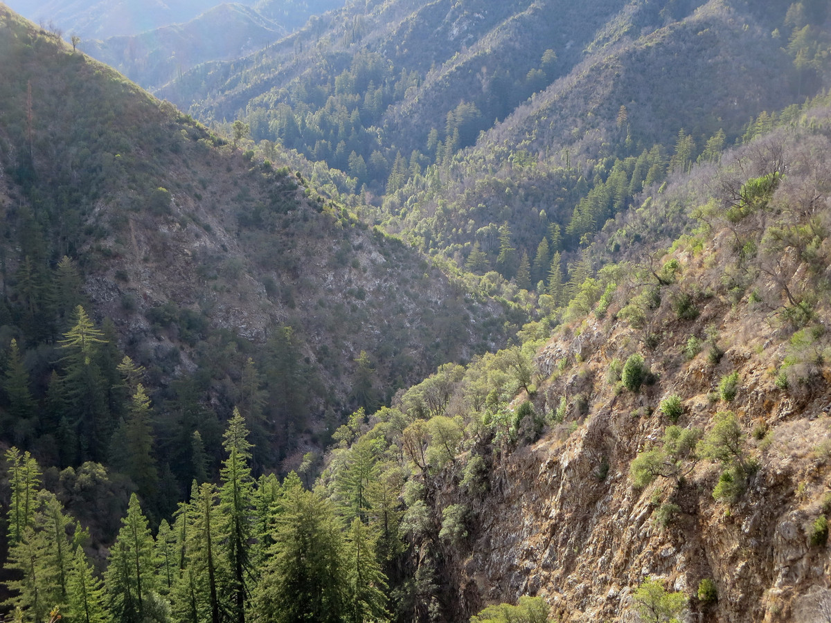
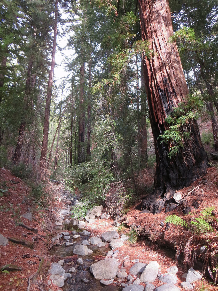
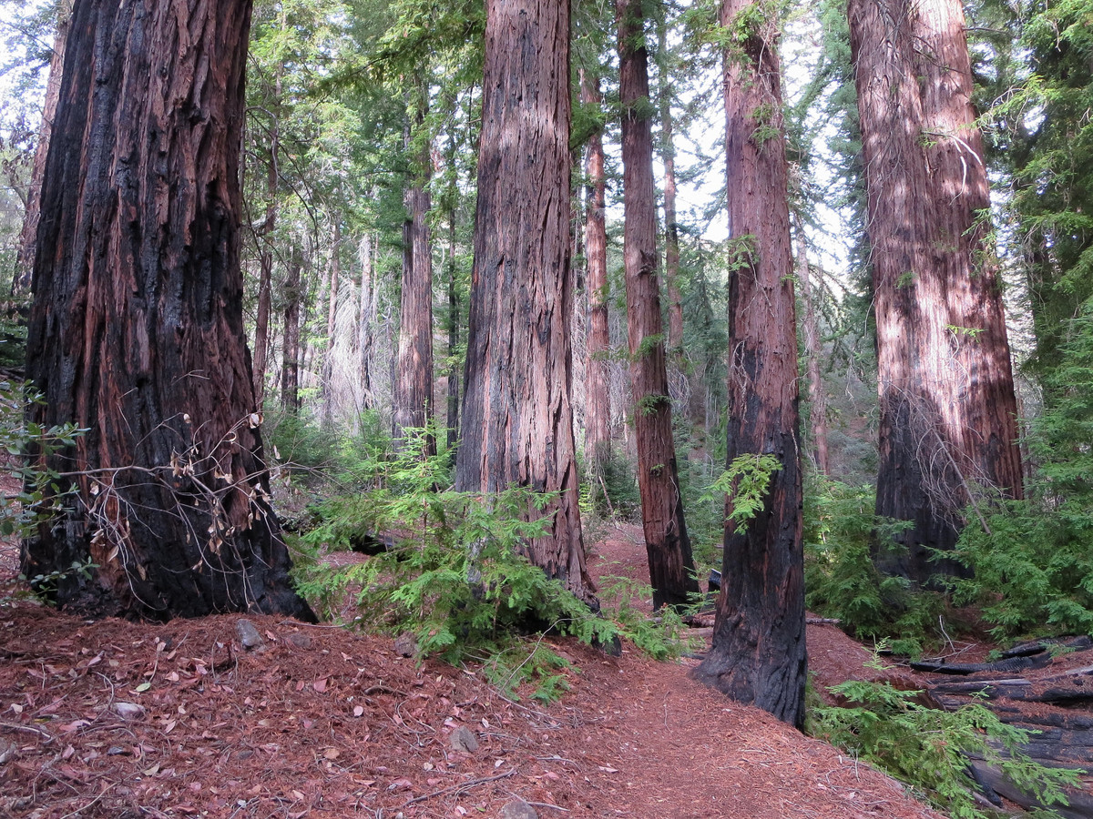
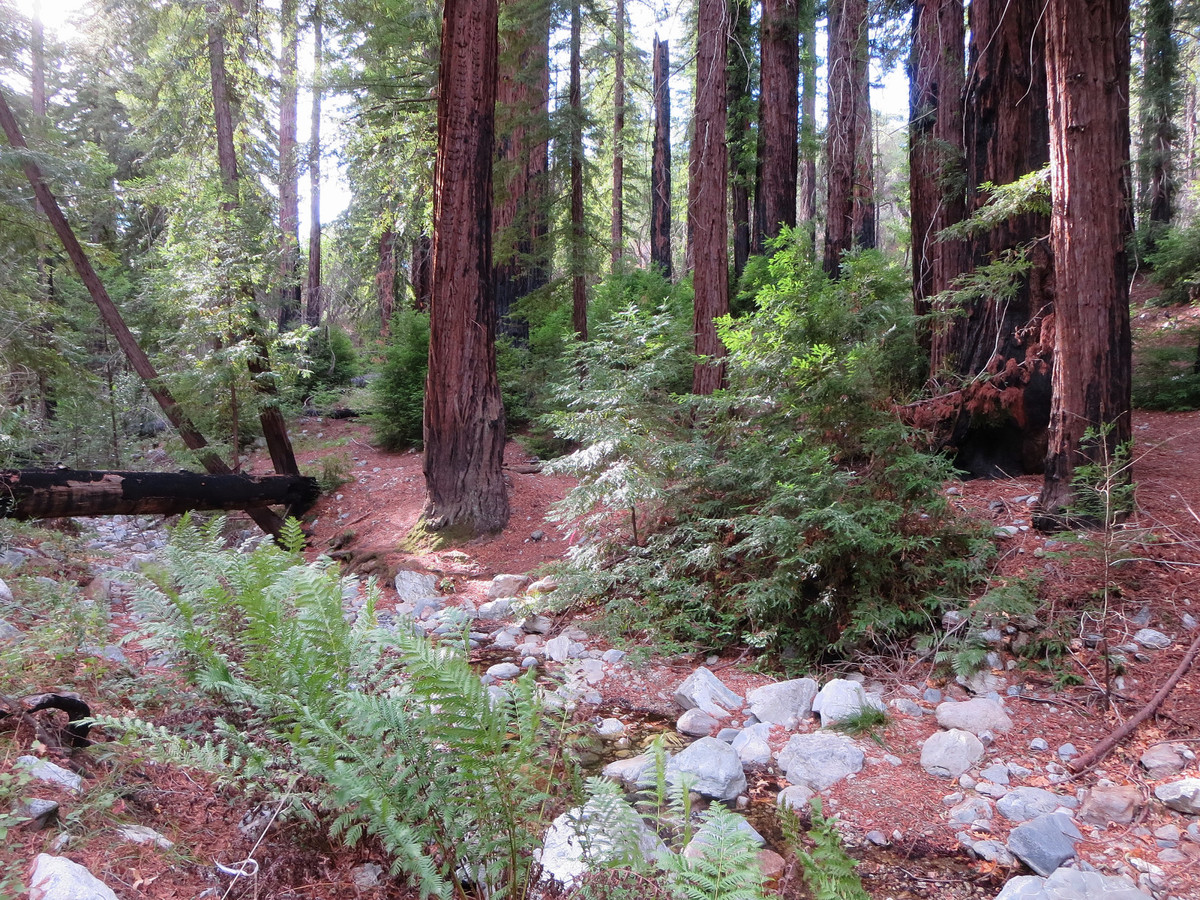
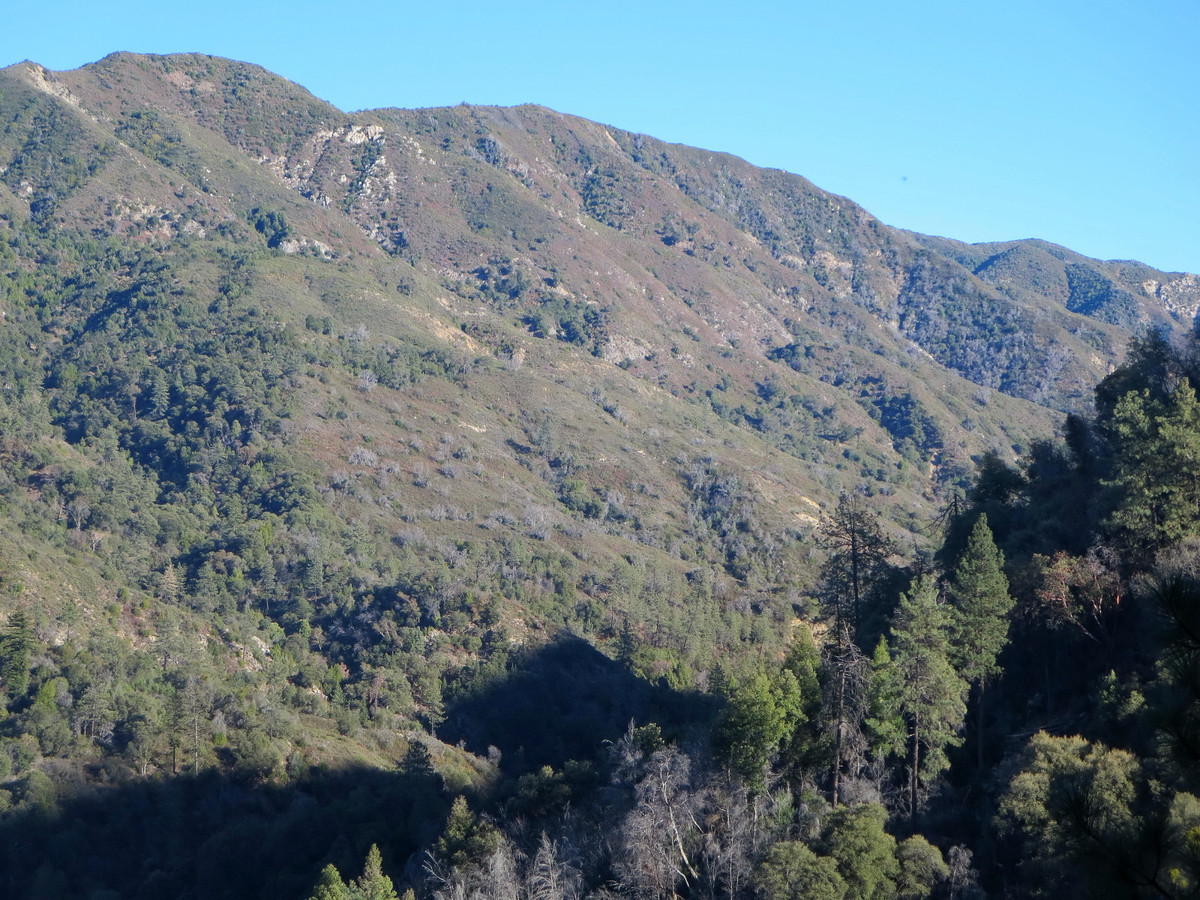
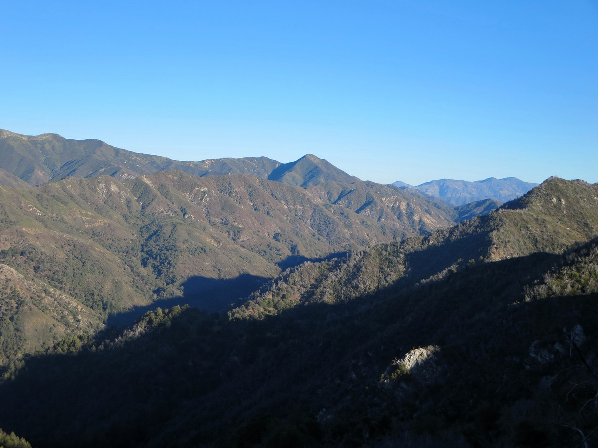
We began by running up the Pine Ridge Trail to Sykes Hot Springs. Unlike most of the Ventana trail network, the 10 mile stretch of the Pine Ridge Trail is a well-maintained wilderness freeway with no severe ups and downs making it an enjoyable trail run. Beyond Sykes Hot Springs, the terrain was new for me and the quality of the trail decreased. After some switchbacks above Sykes, the trail traverses a steep slope (erosion in spots) with excellent views down to the confluence of the south and north forks of the Big Sur River and up the rugged canyon of the north fork. Rounding a corner in to the Redwood Creek drainage is an excellent view of an ancient redwood grove that was miraculously spared in the Basin Complex Fire. The trail descends into this beautiful grove where an excellent camp spot is located among towering redwoods and a verdant stream. Emerging from this redwood grove, one begins to see more evidence of the devastation of the 2008 fires. Along most of the Big Sur River, the redwoods have filled in and the scars of fire are becoming less striking. However, in the section from redwood camp to Cienega Creek the fire burned hot and the survival rate much less. The trail descends down the brushy and fire-scarred Cienega Creek drainage to the North Fork of the Big Sur River.

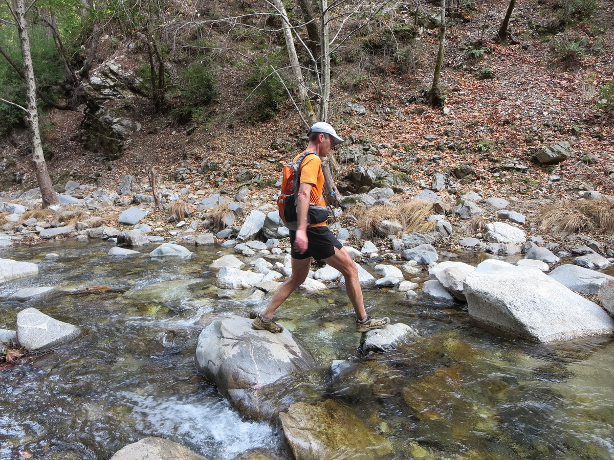
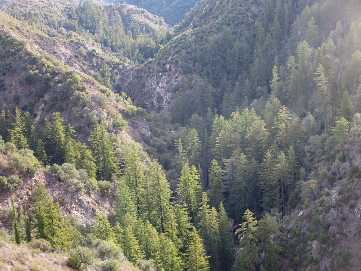
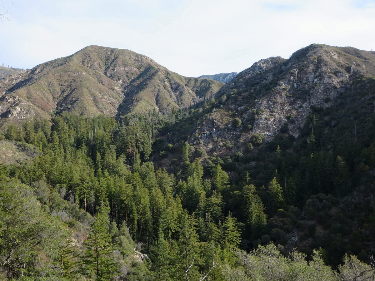
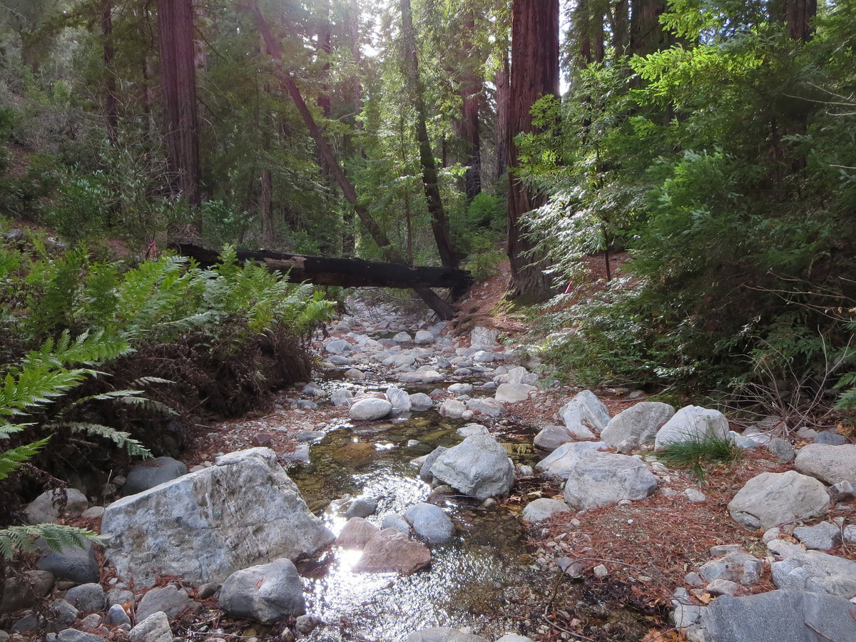
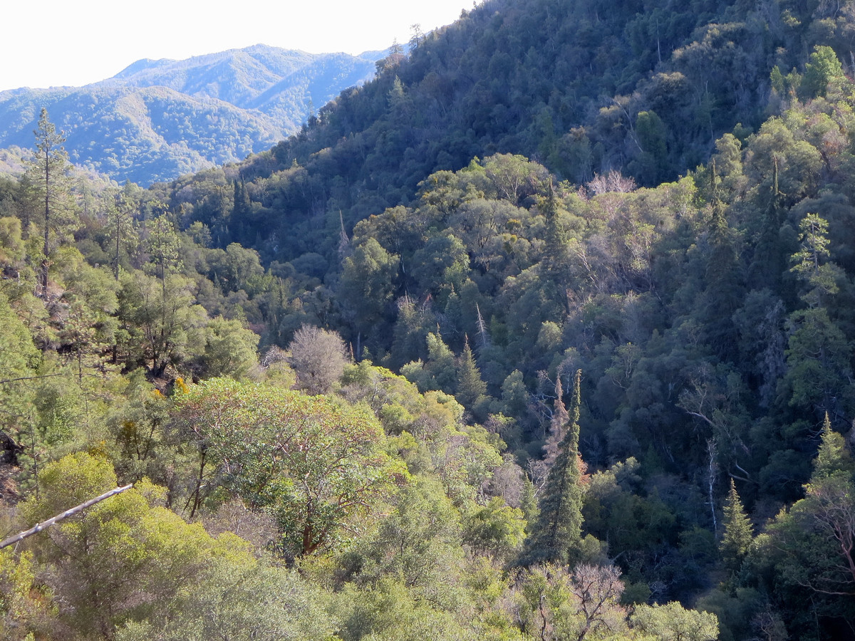
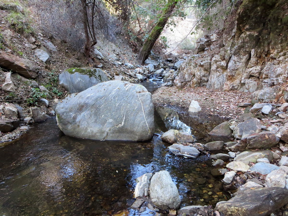
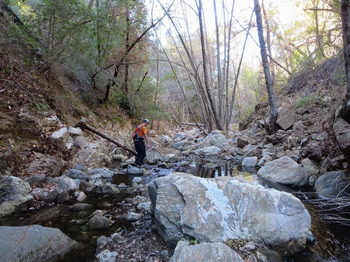
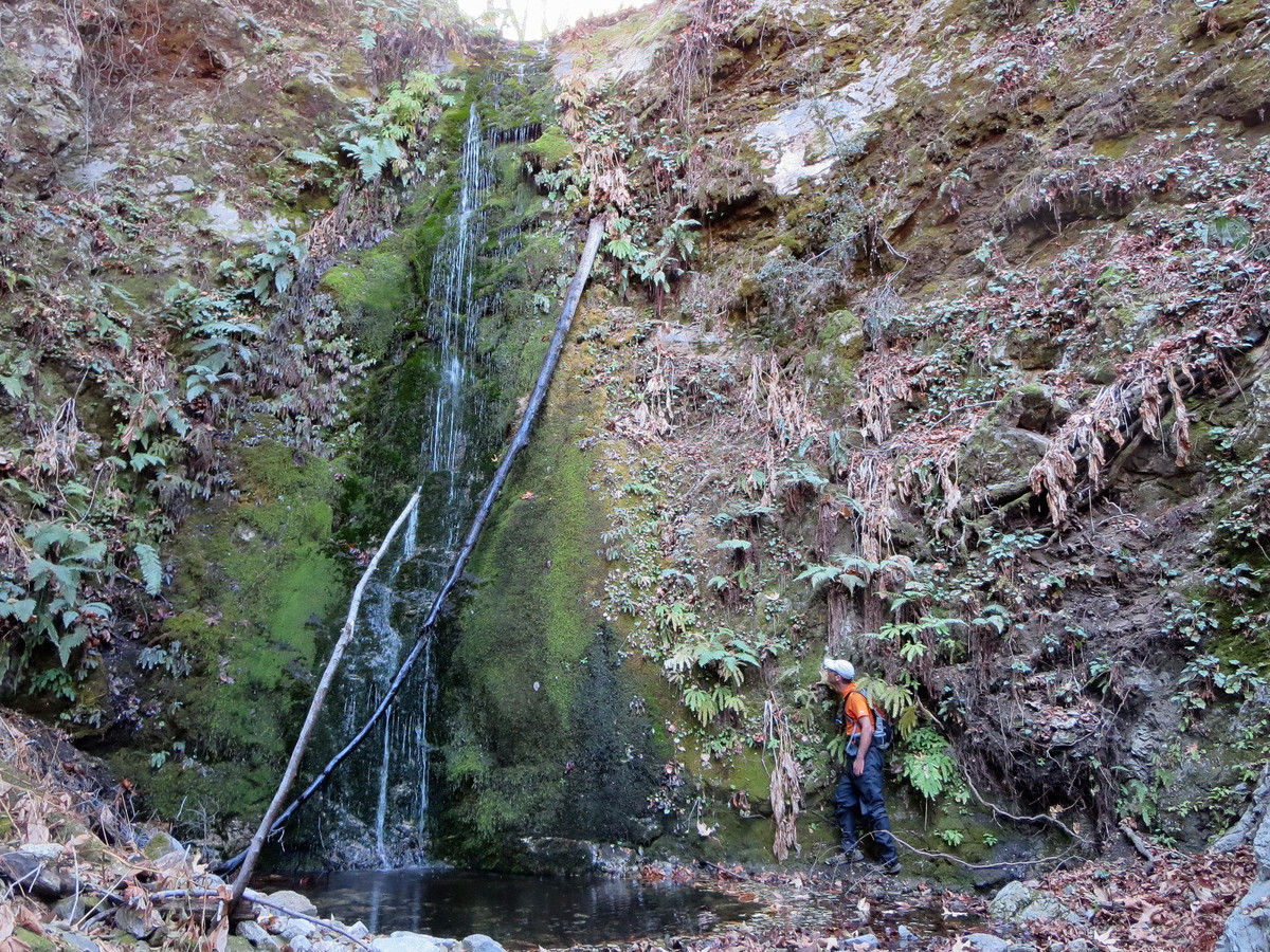
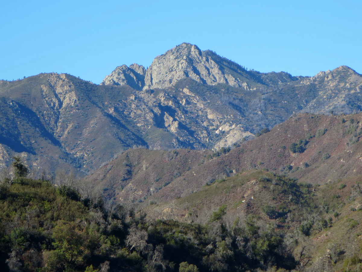
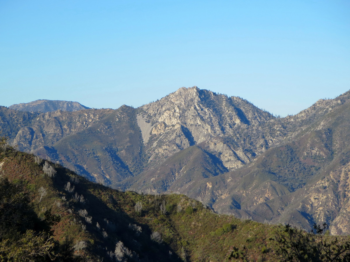
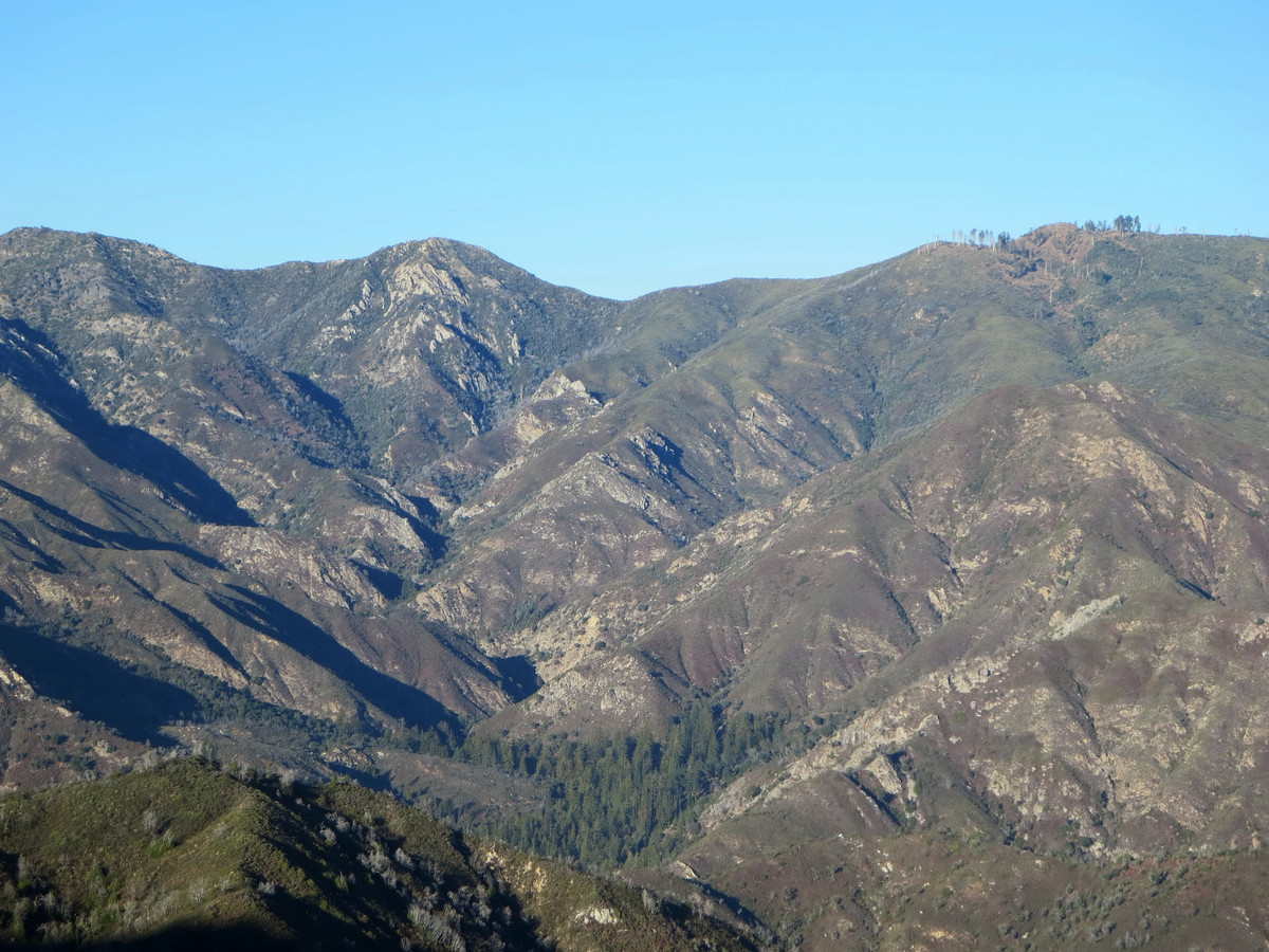
Beyond the North Fork, the trail begins many brushy switchbacks up to a small pass along a ridge that separates the north and south forks of the Big Sur River. The top of this pass represents a dividing line in fire behavior. On the south fork side, the vegetation was much less impacted with pines and oak woodland seemingly unharmed. I very much enjoyed the descent into the South Fork of the Big Sur River with some brush-free stretches of trail and excellent views into the wild and remote south fork canyon. At the bottom of the canyon is a spectacular forest of redwoods, pine trees, and Santa Lucia Firs. It’s an ethereal scene seeing Santa Lucia Firs standing proud at the bottom of the canyon when I’m more accustomed to seeing them high on rocky ridges. At Rainbow Camp along the South Fork Big Sur River we took the remnants of the South Fork Trail to a sport where we could descend back to the river. From here, we rock hopped downstream to a small tributary that I guessed (correctly) was flowing from Rainbow Falls. We scrambled a short distance up this tributary and were treated to an awesome 55 foot drop of Rainbow Falls with a gorgeous amphitheater setting of rock and hanging gardens. The environment was relatively dry and water volume low due to the drought, but it was an awesome sight to see. After the waterfall, we rocked hopped all the way back to Rainbow Camp. Along this stretch of the river I felt the genuine wilderness feeling in this rarely trodden canyon. It was as if we were traveling into the wild of the Ventana Wilderness. Back at Rainbow Camp, we had a snack and then continued on the Big Sur Trail to Mocho Camp about 0.5 miles distant. 

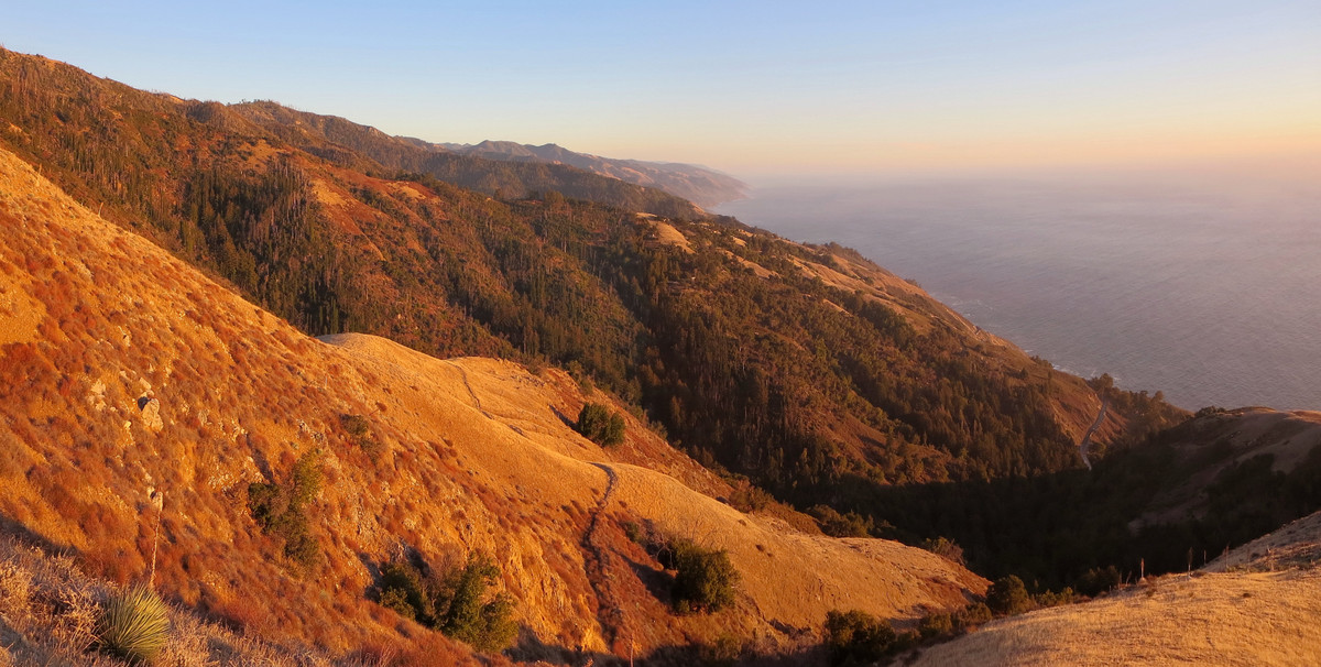
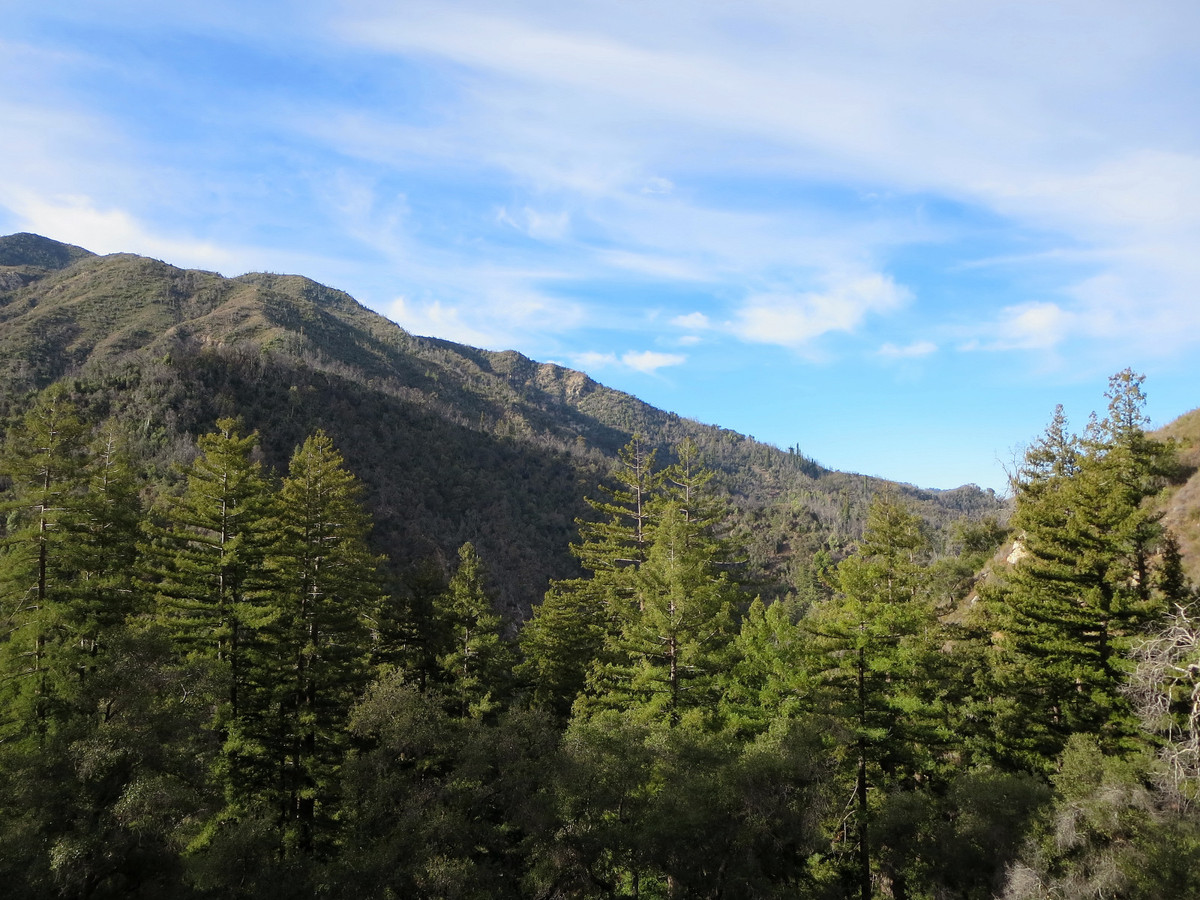
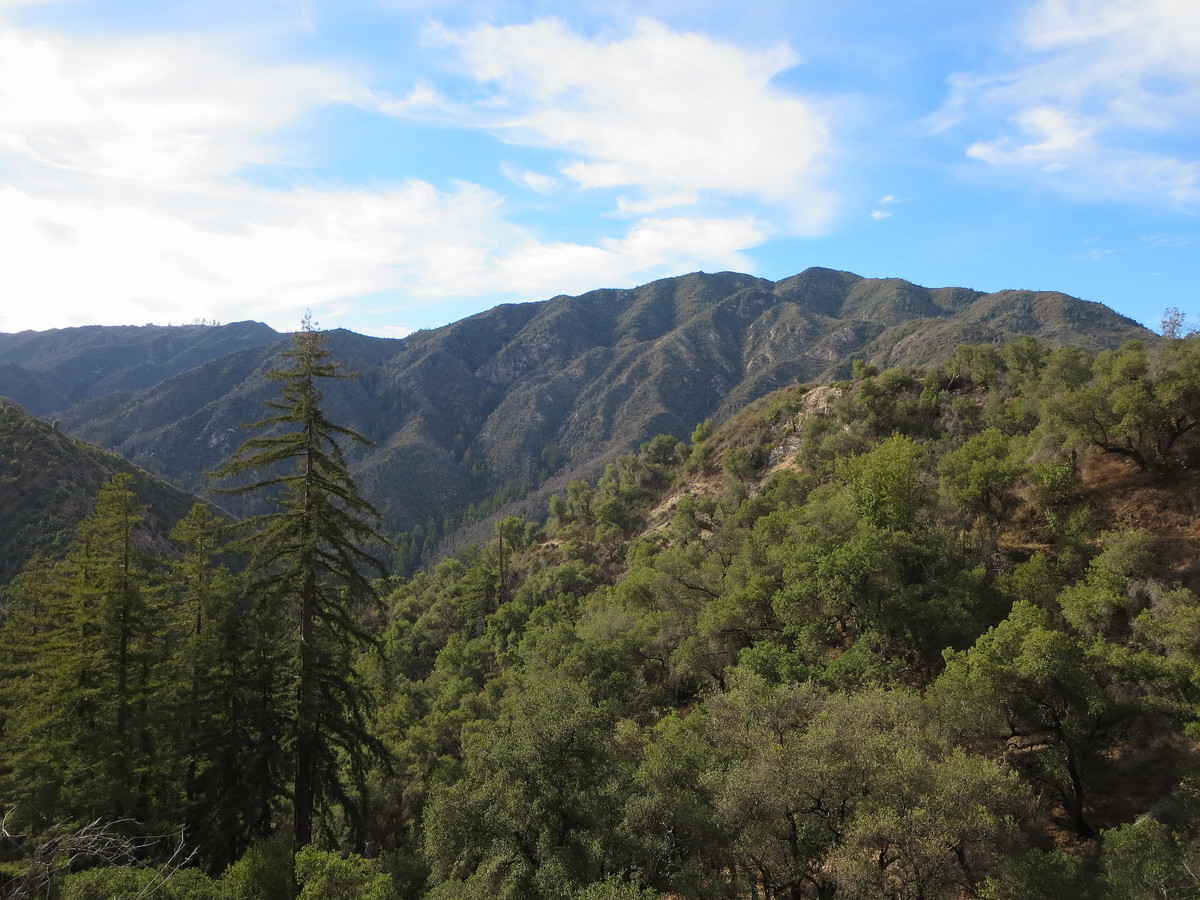
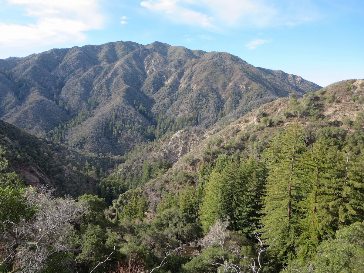
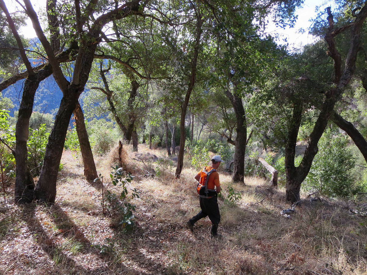
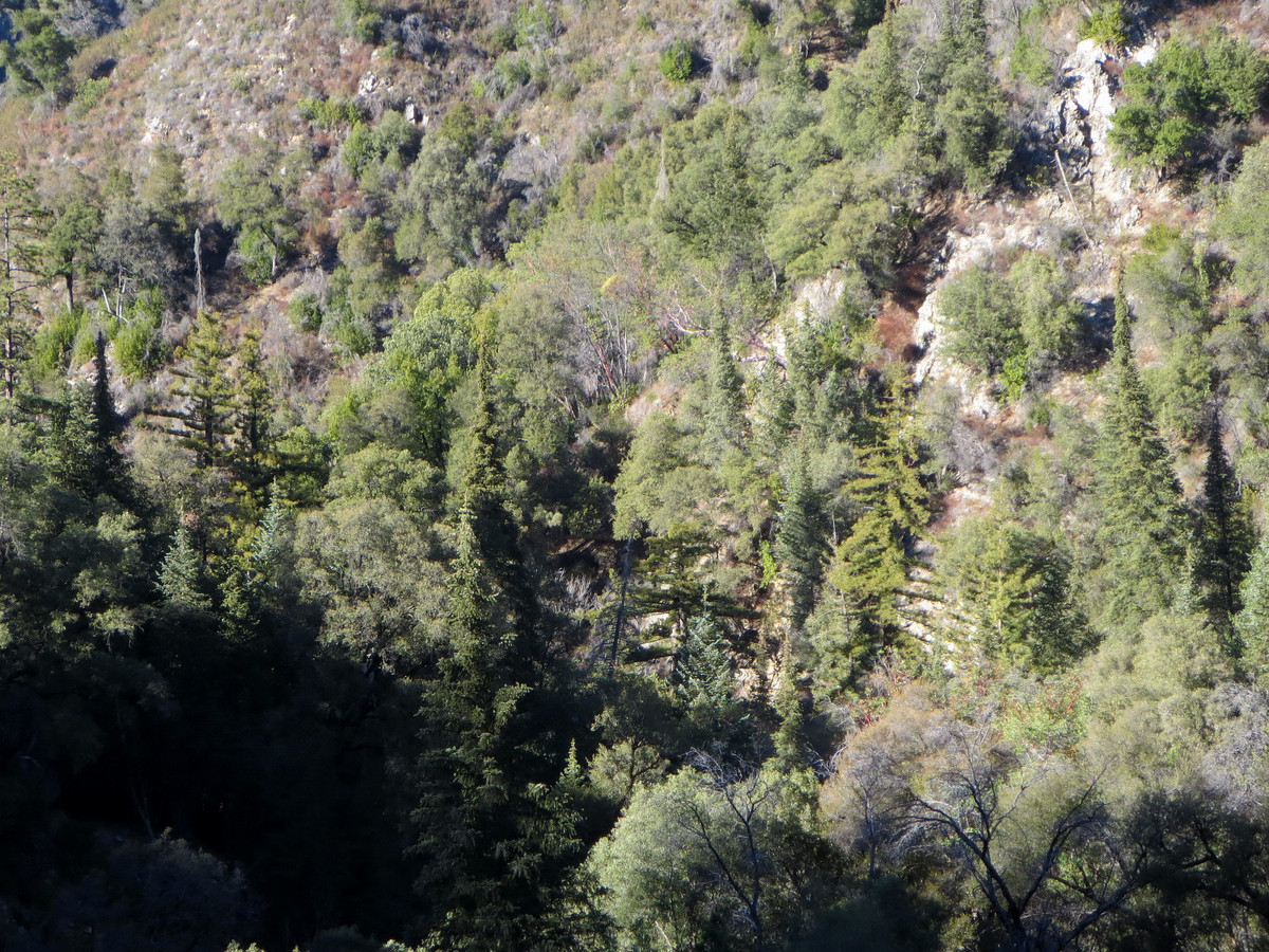
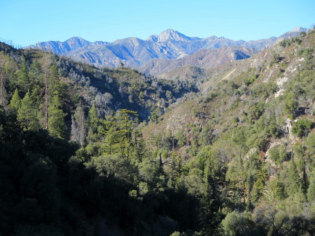
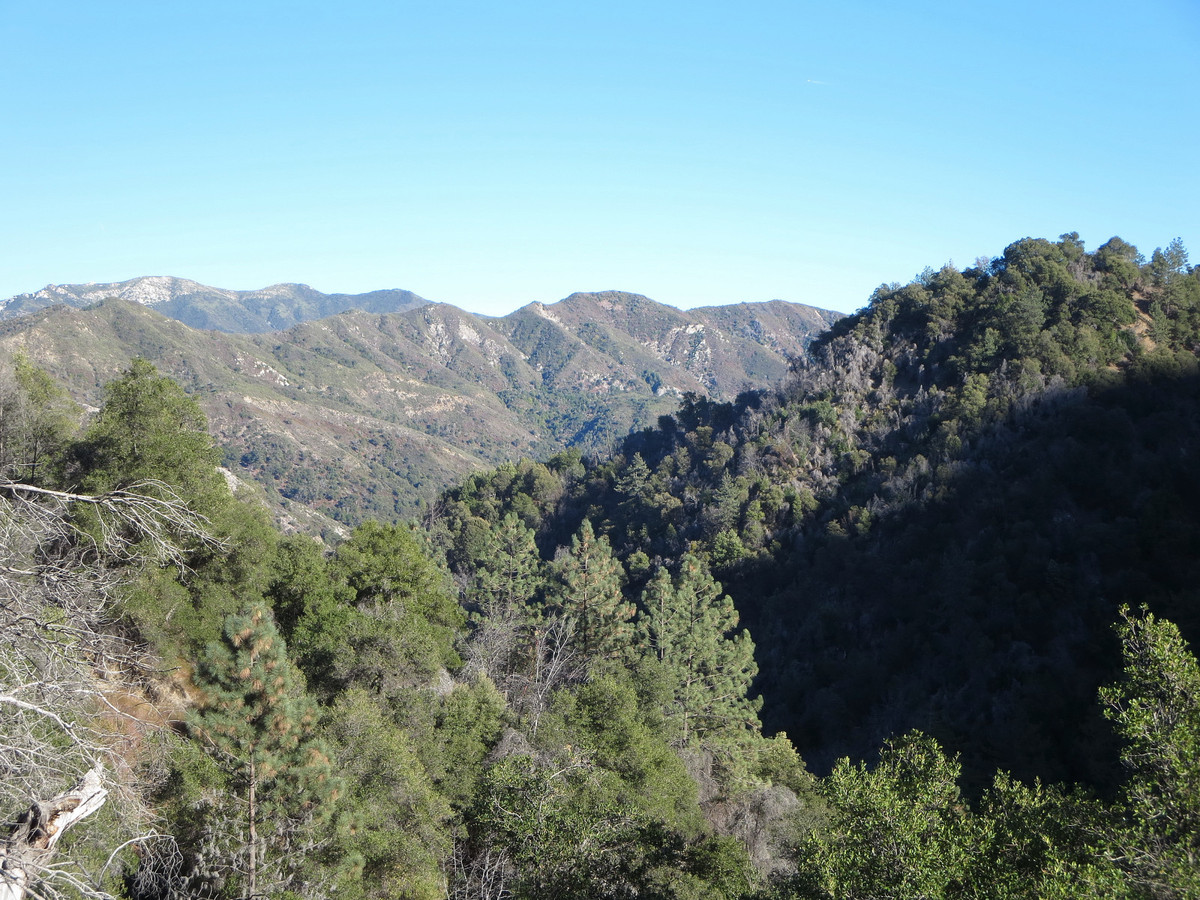
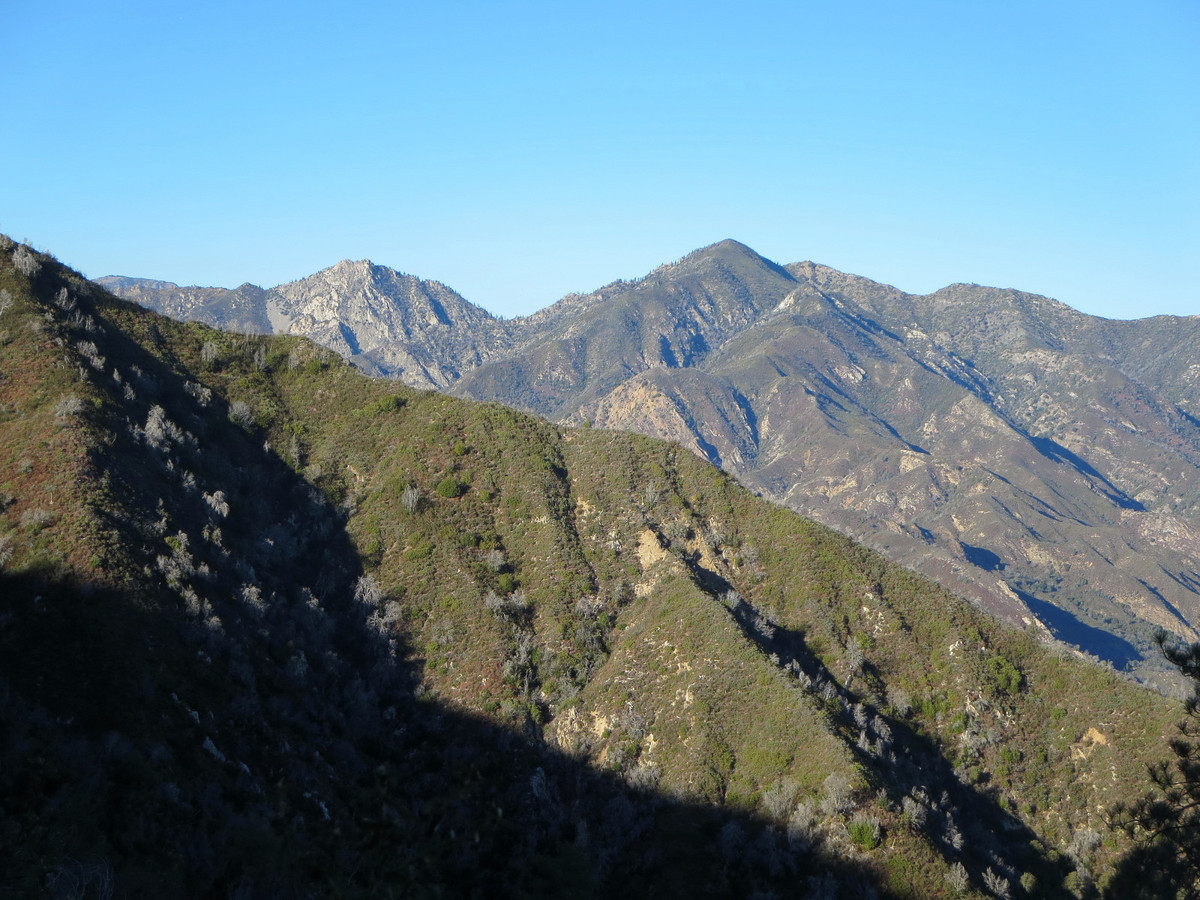
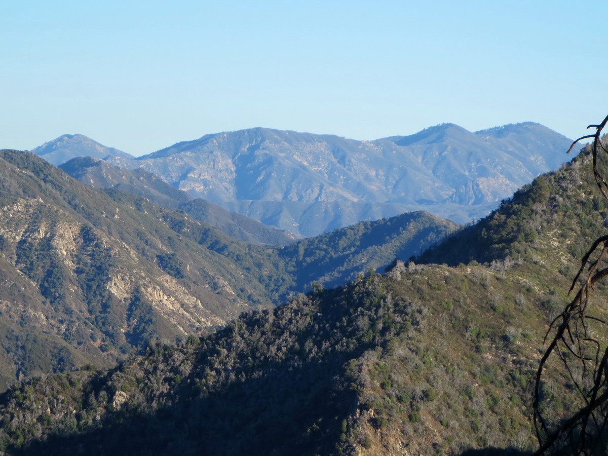
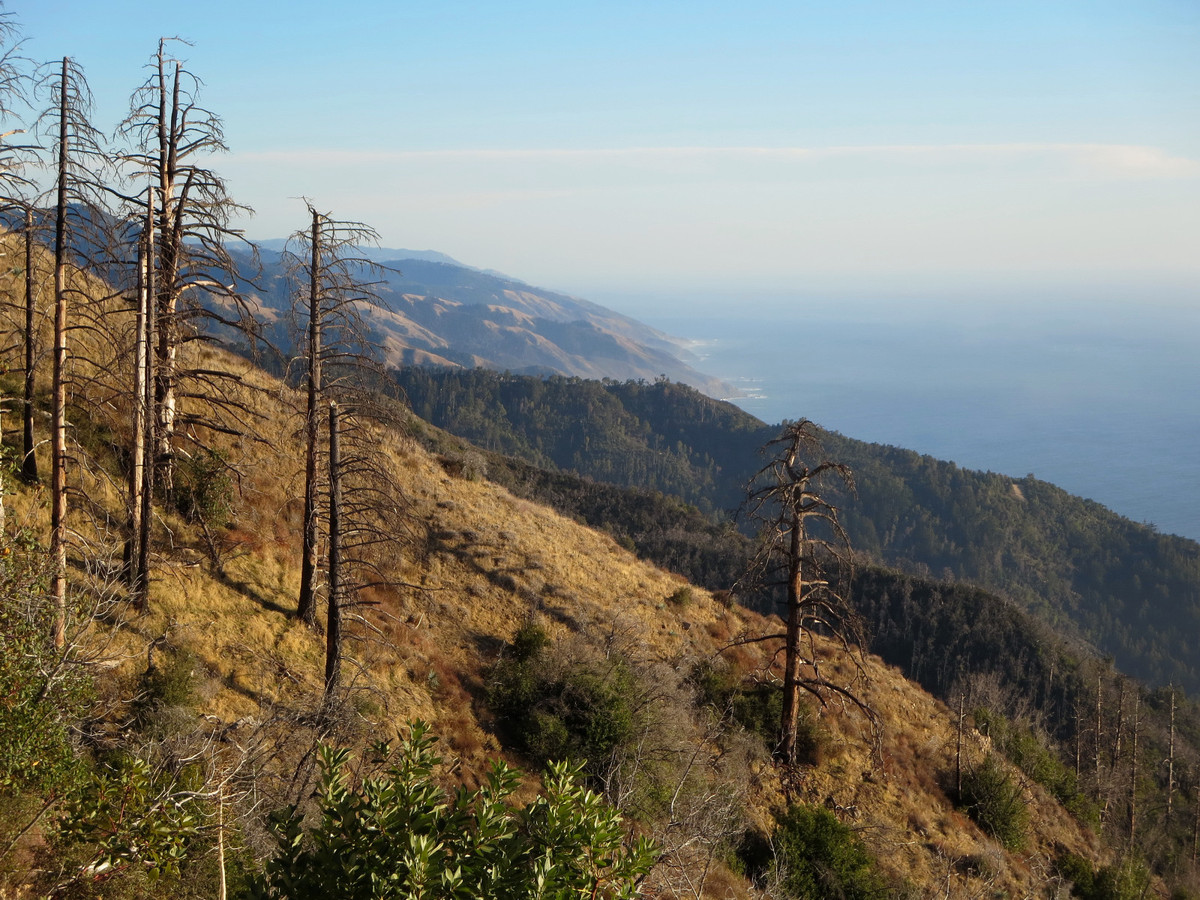
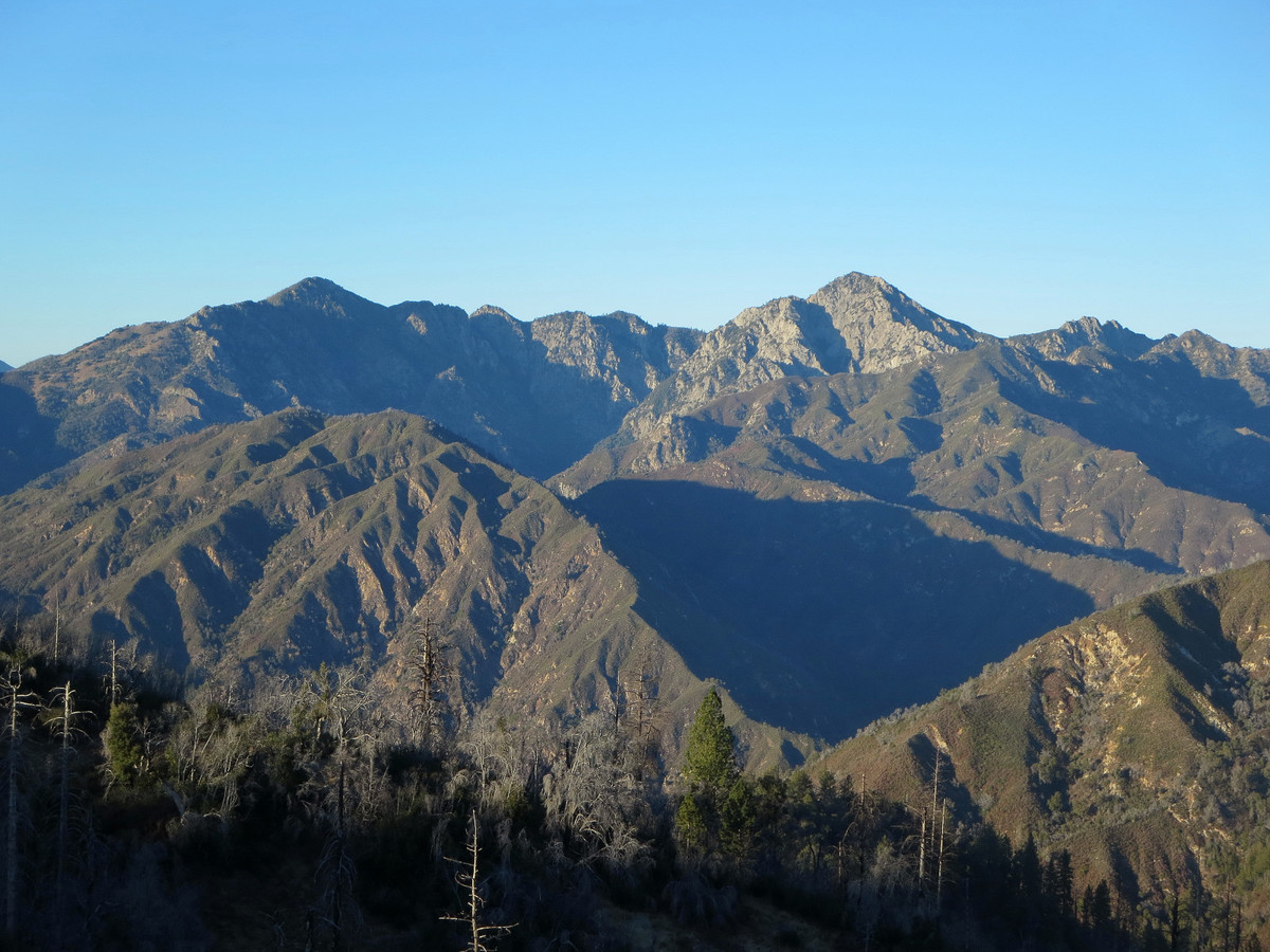
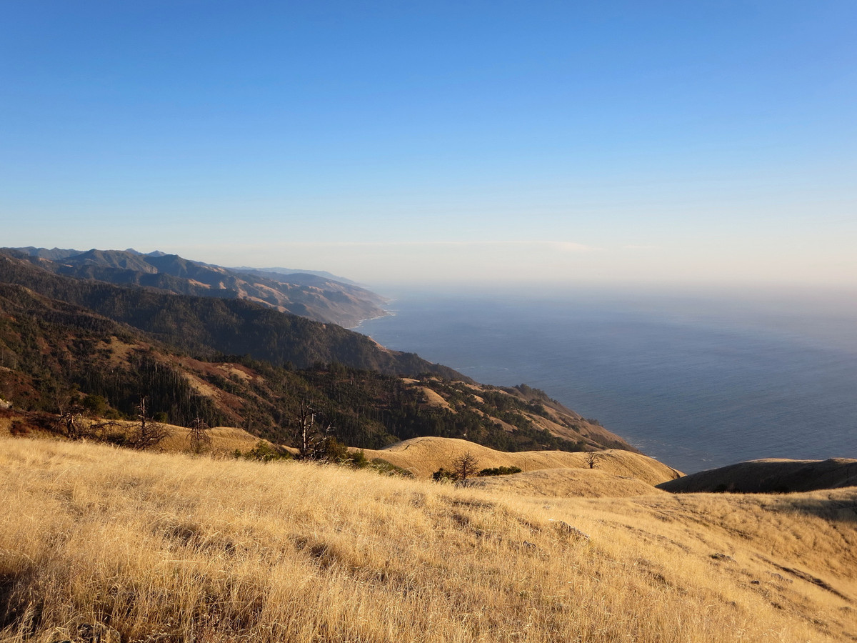
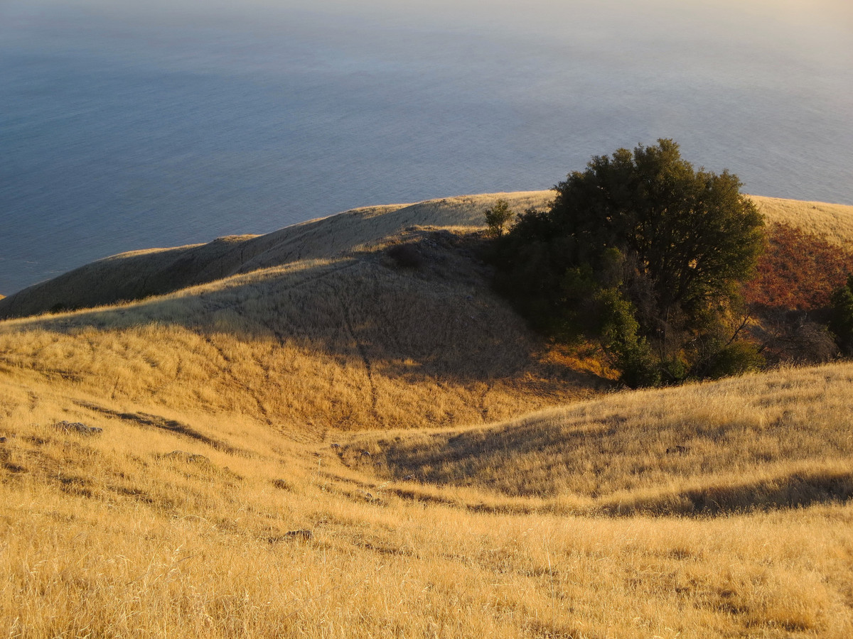
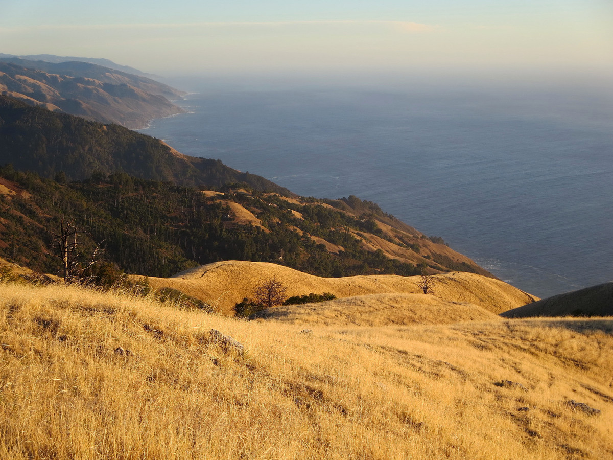
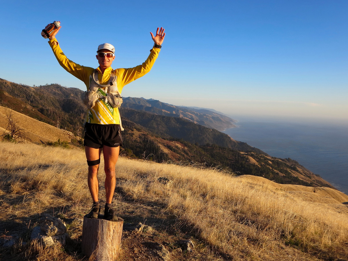
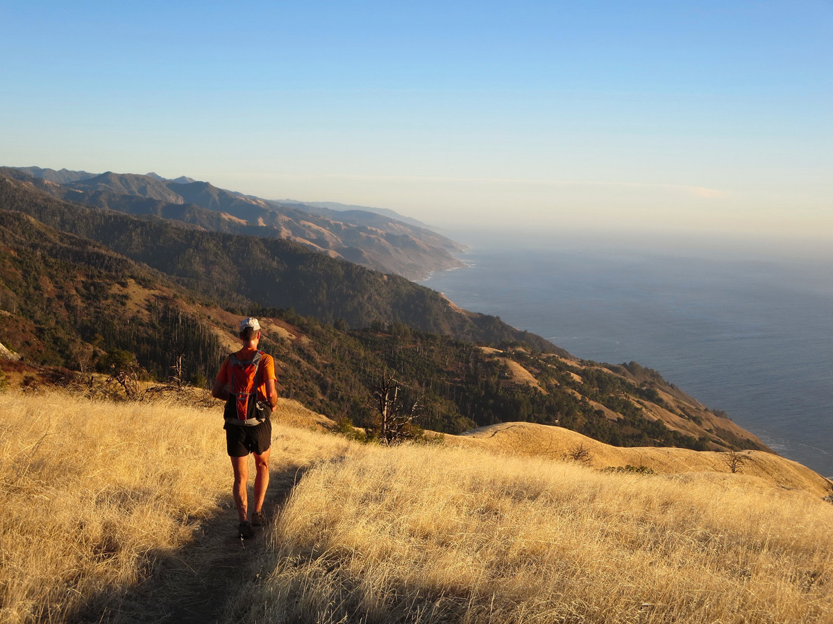
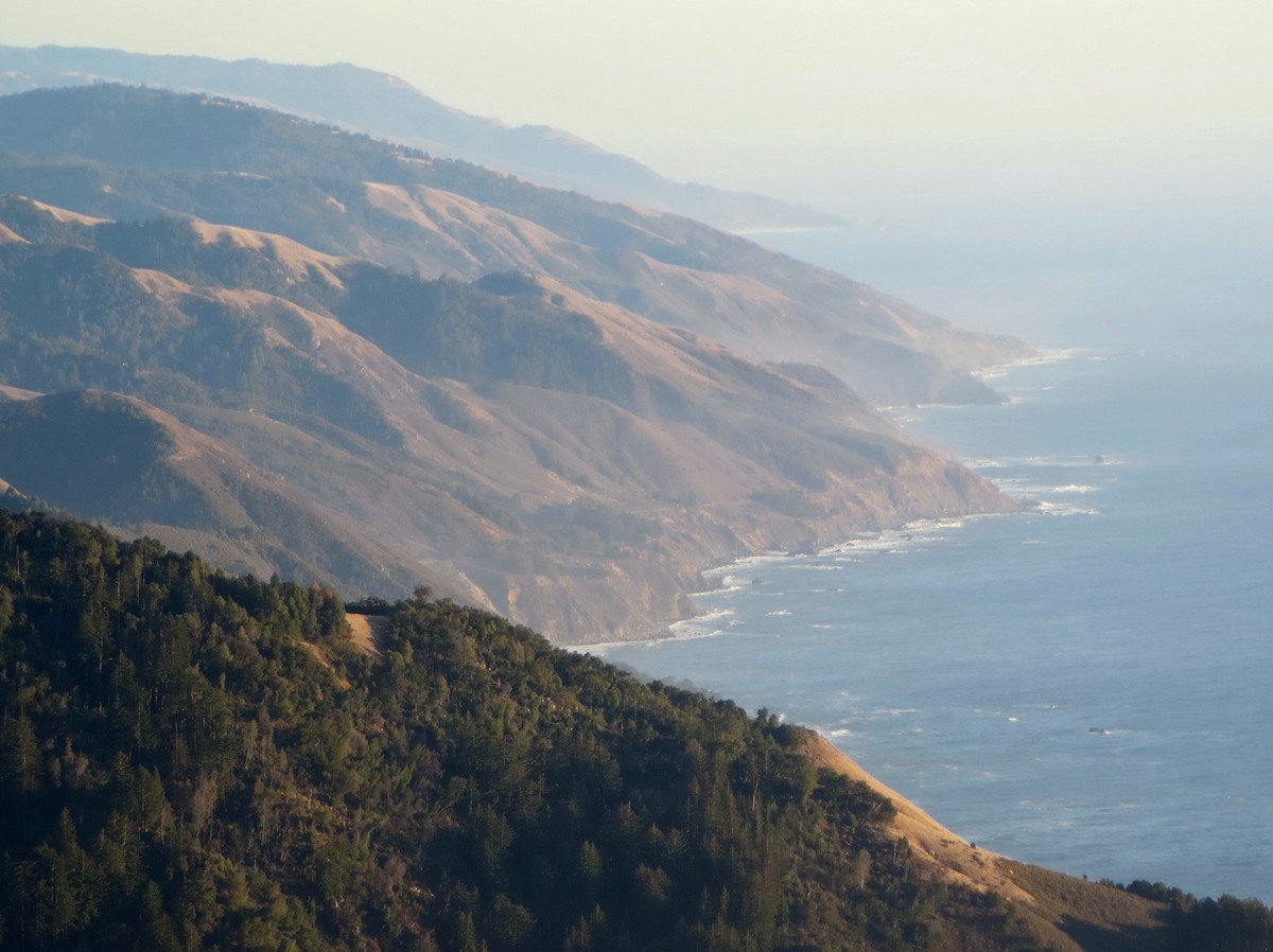
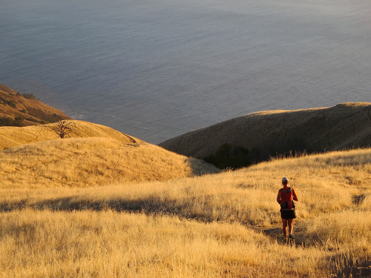
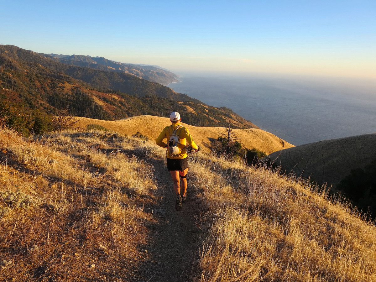
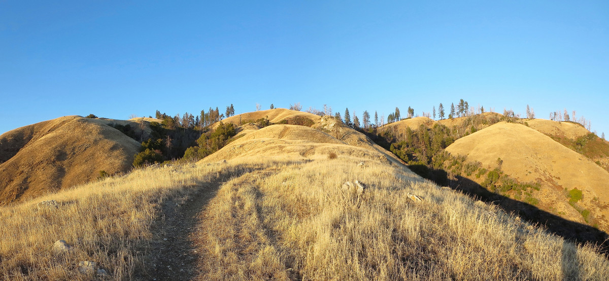
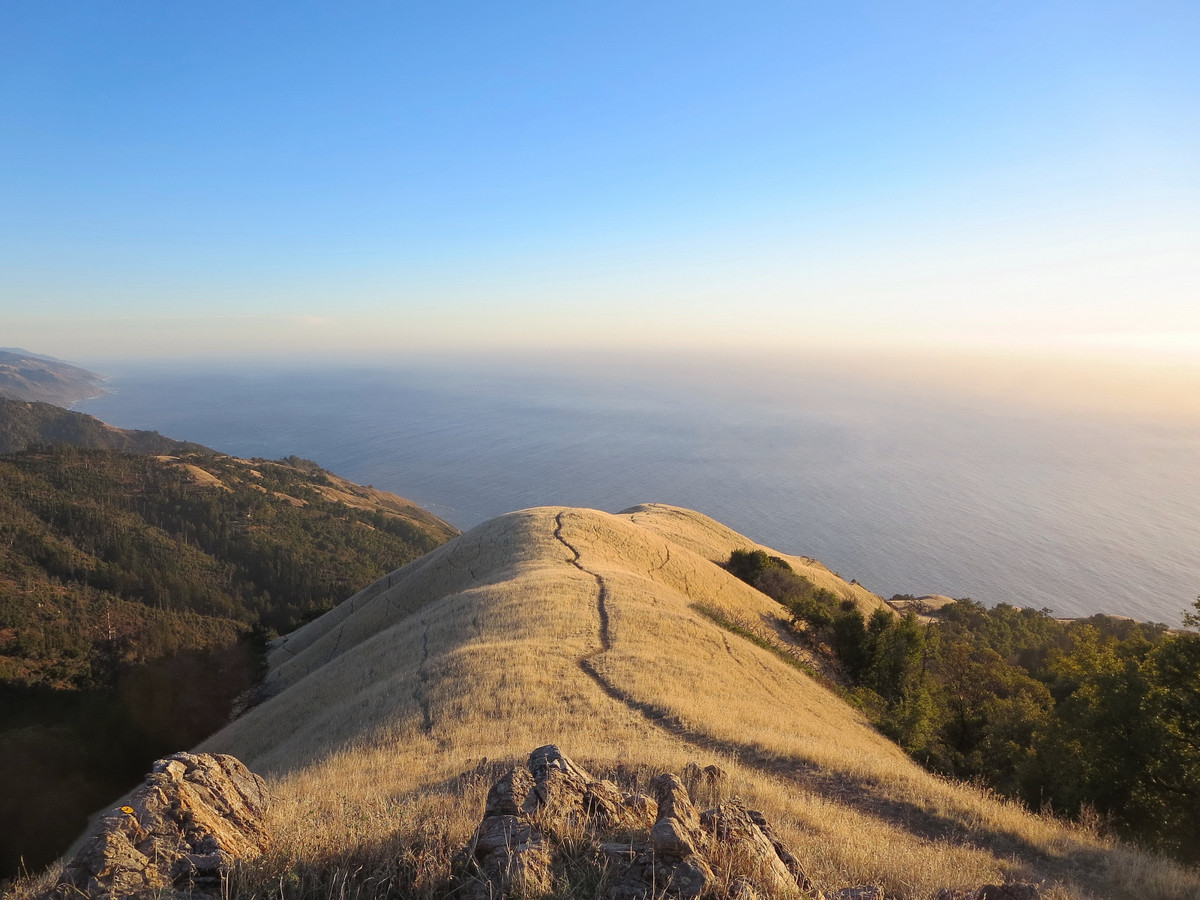
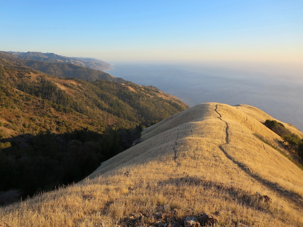
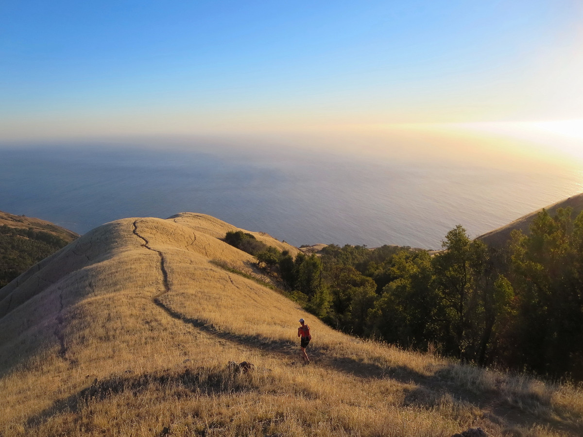
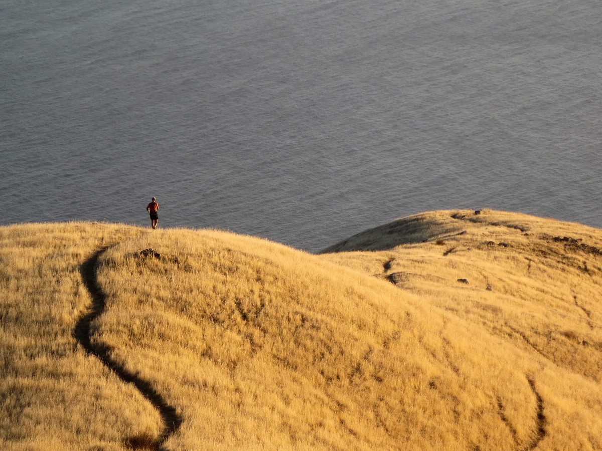
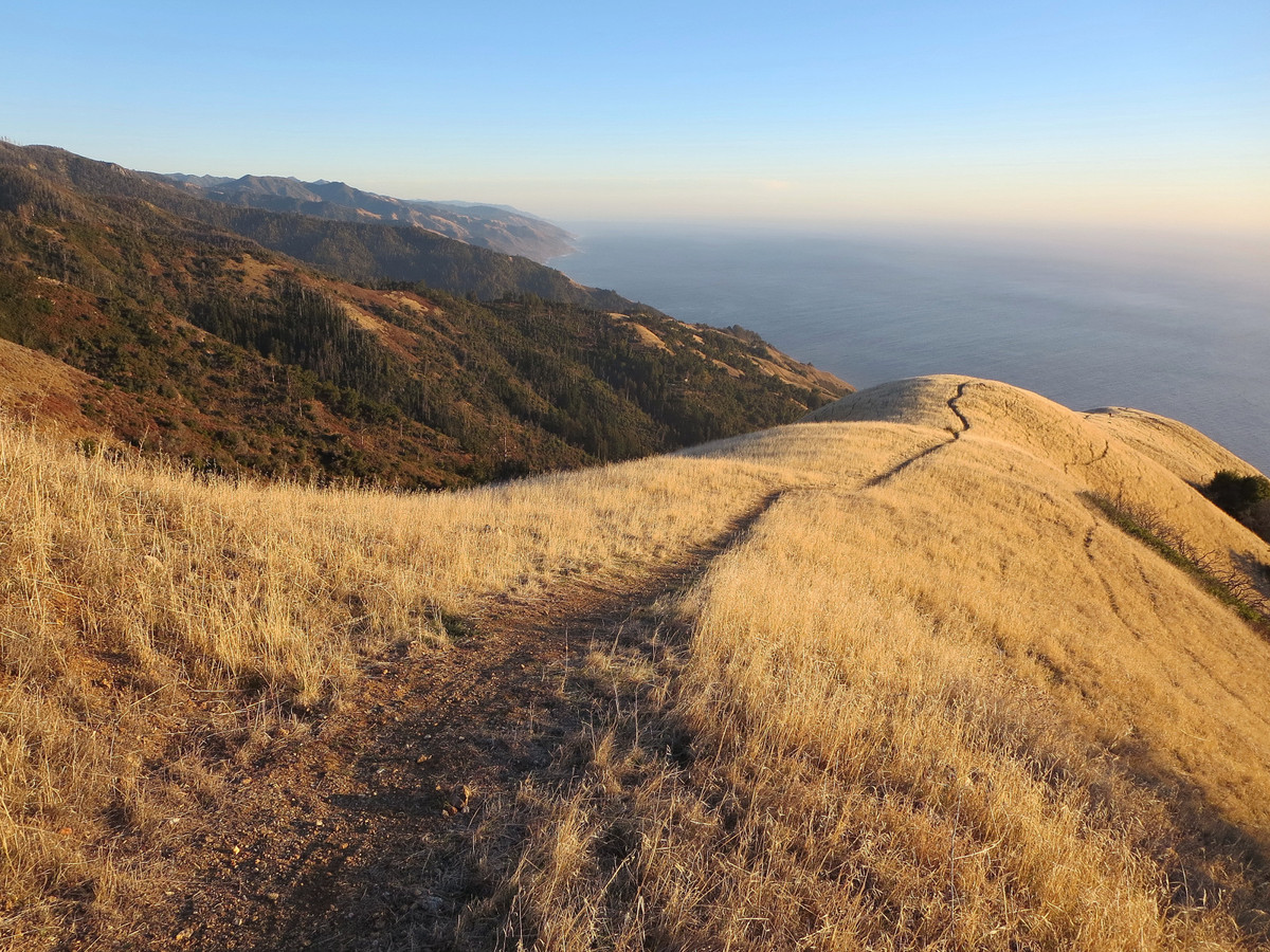
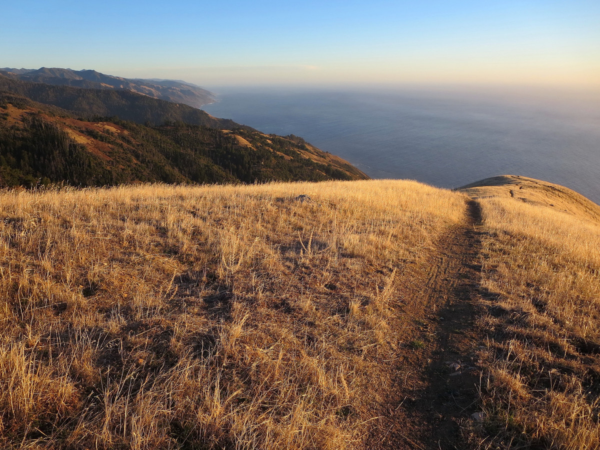
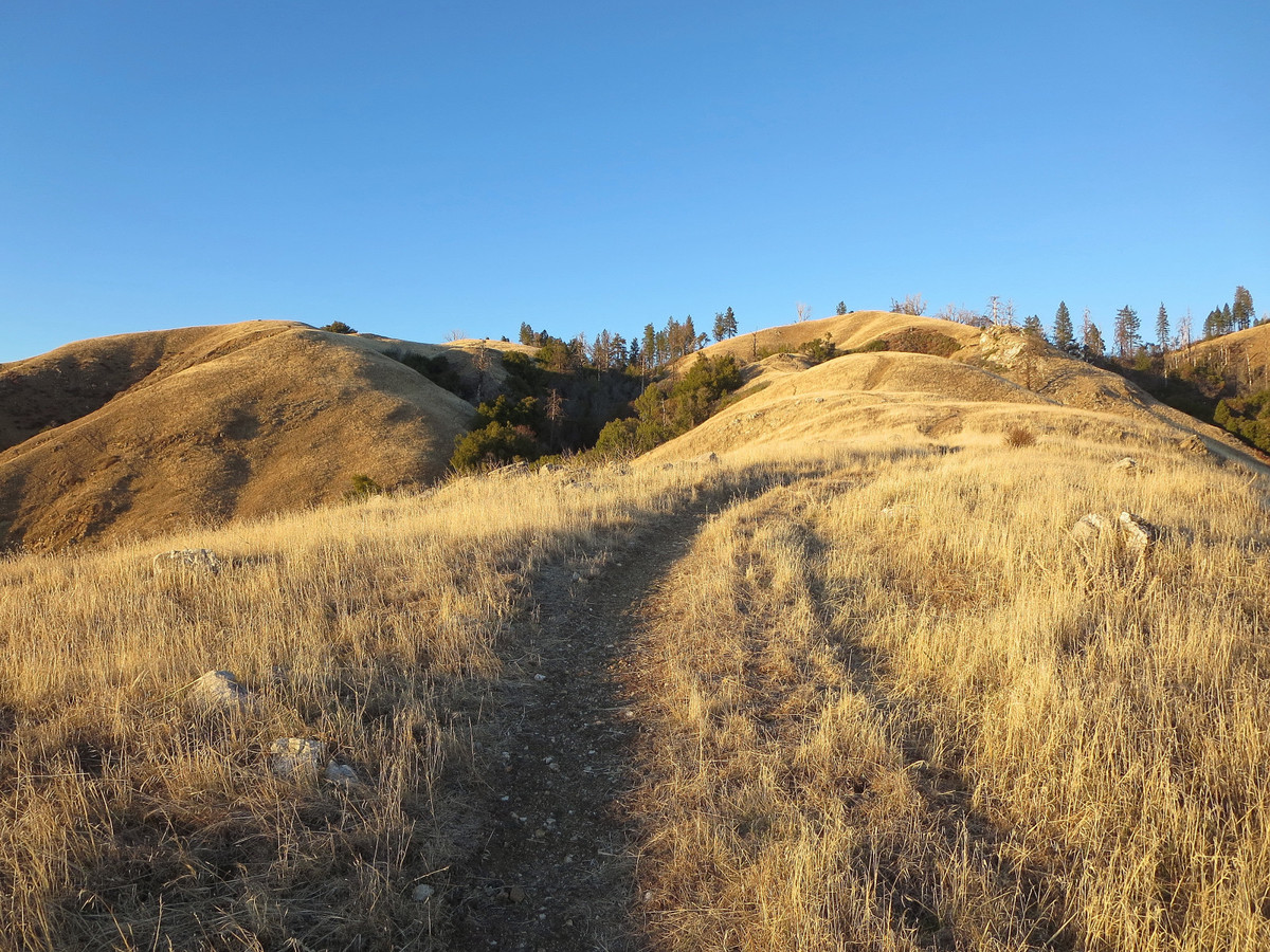
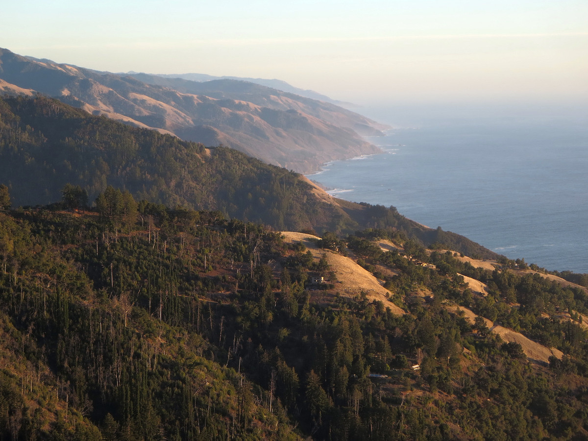
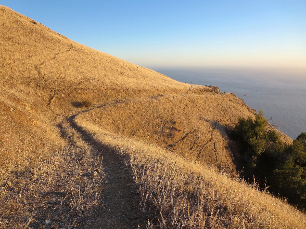
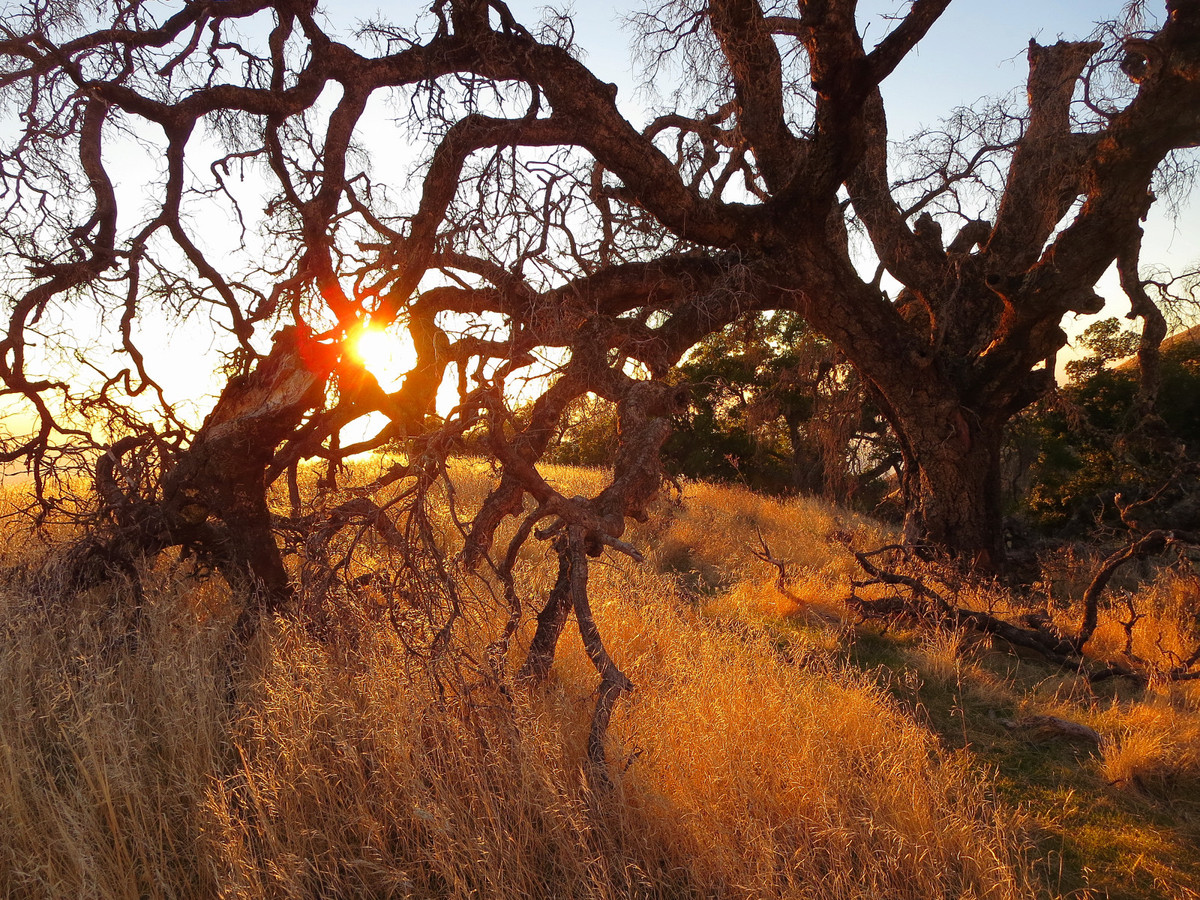
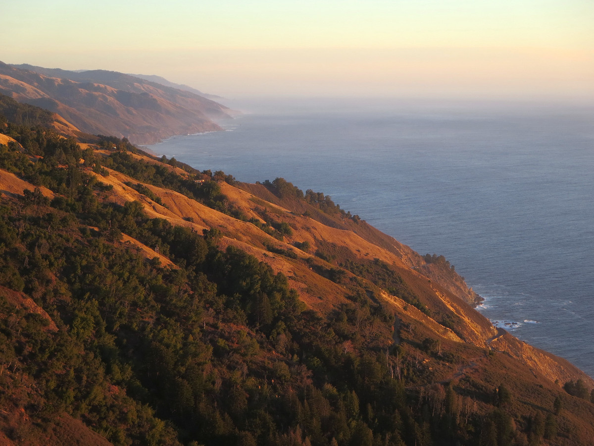
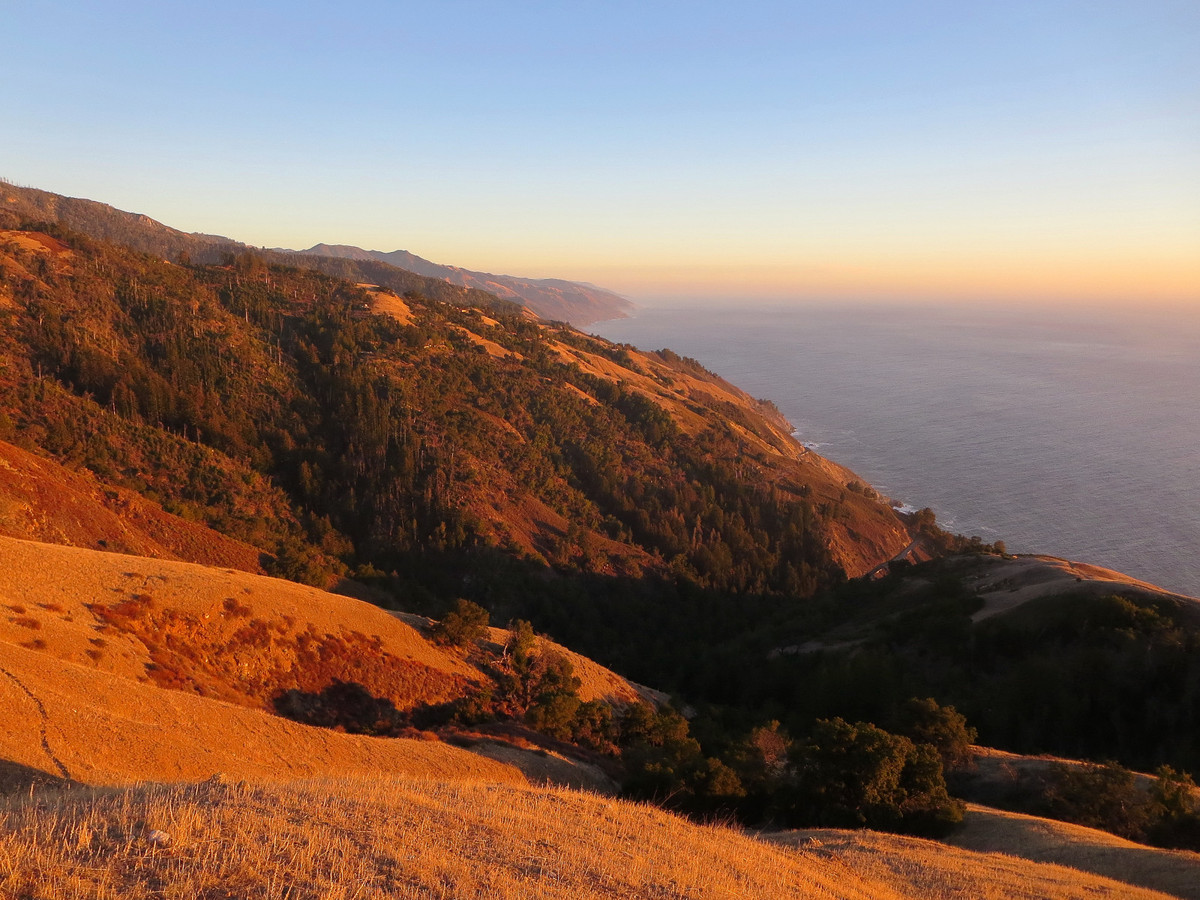
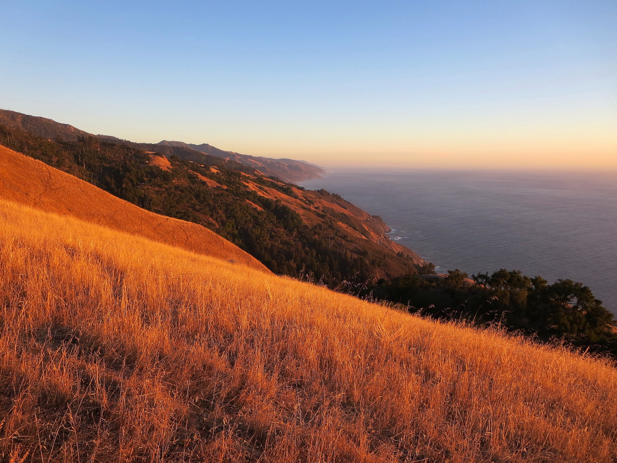
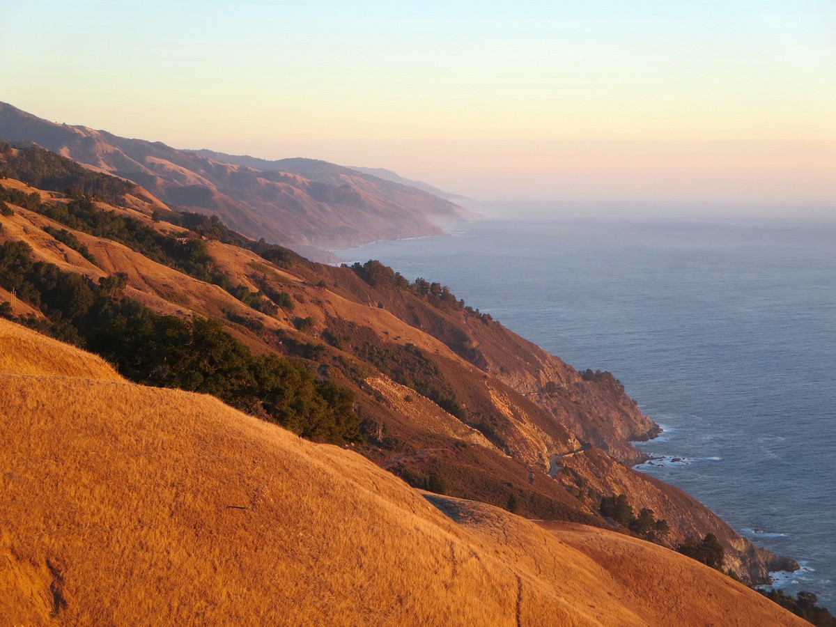
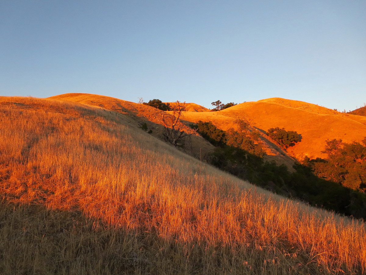
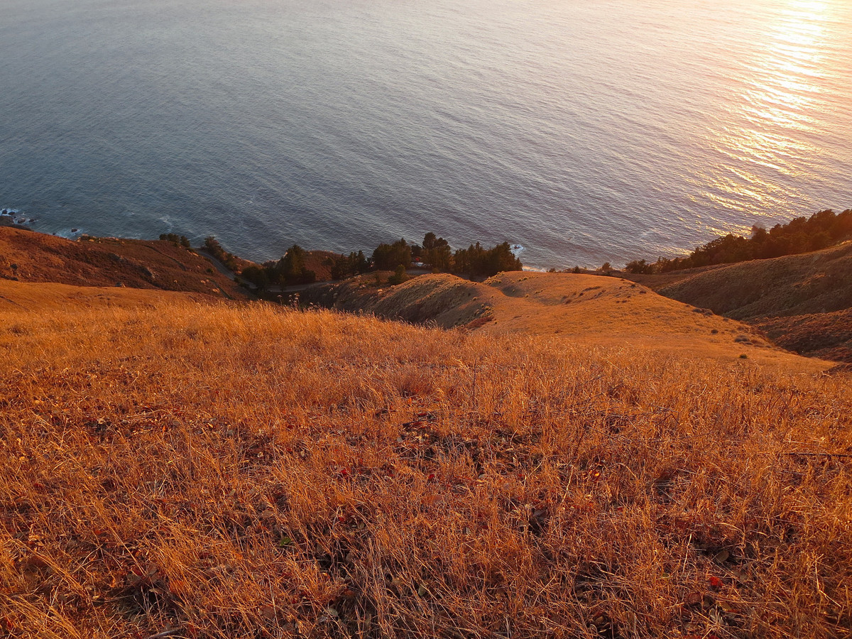
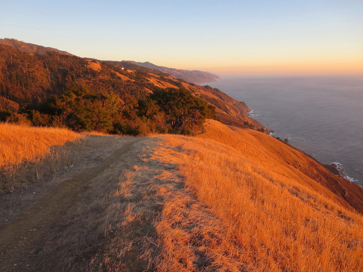
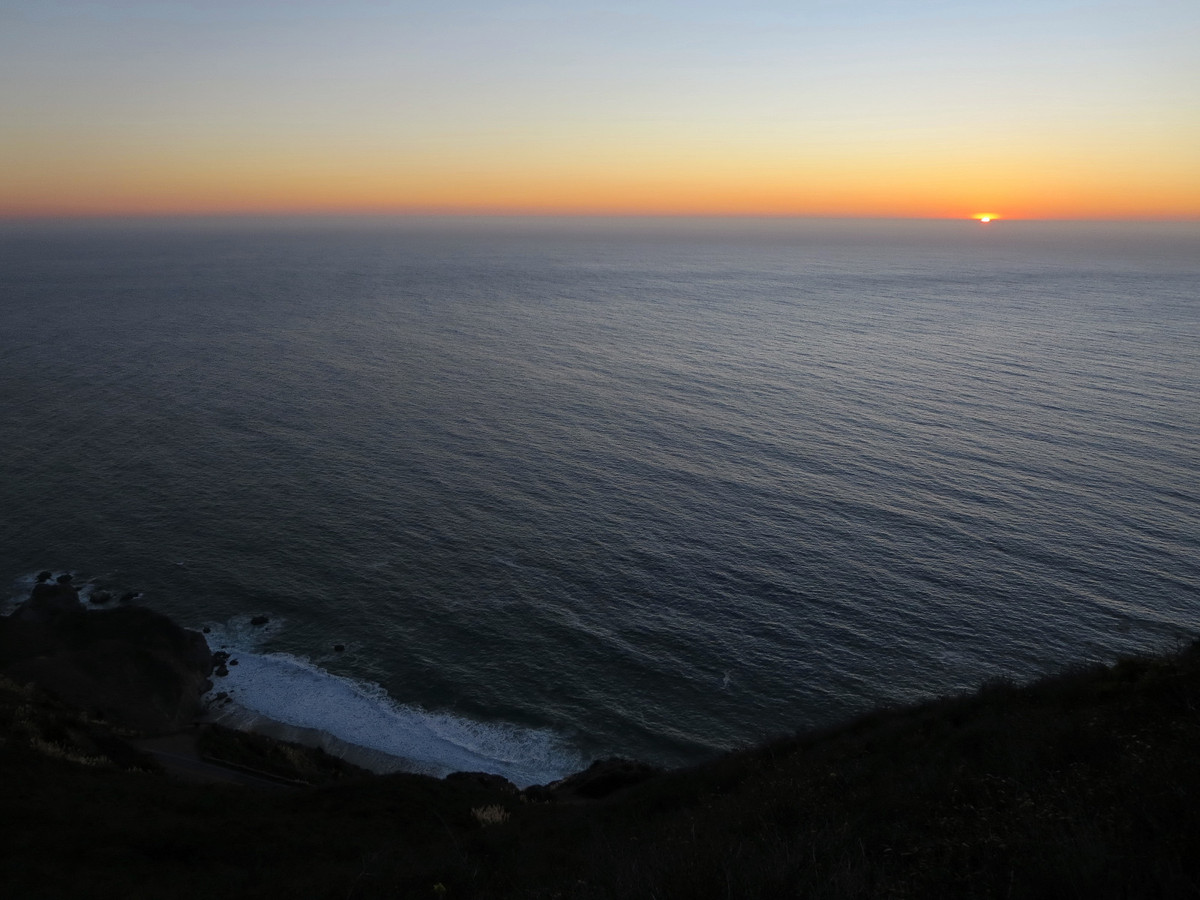
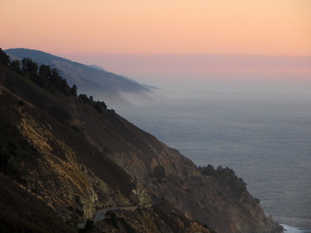
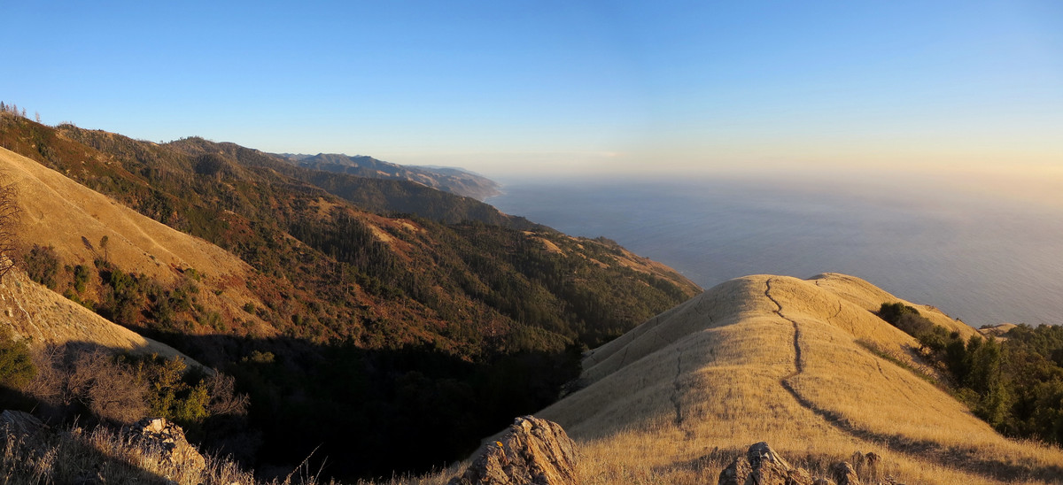
Along the way there is a fantastic view looking down the South Fork with Santa Lucia Firs, Redwoods and pines filling the canyon and Ventana Double Cone towering above (first photo below). In my opinion this vista epitomizes the Ventana. Beyond Mocho Camp is a section known as the Devil’s Staircase, so named after the long and arduous climb up numerous switchbacks from Mocho Creek to Logwood Creek. I had read reports of this section having heinous brush, routefinding problems and lots of blow downs, but I found that while the trail was brushy and difficult, travel was not unreasonable and we actually made good progress the entire way to Cold Springs, the end of the Big Sur Trail. In fairness, we came prepared for the conditions. I wore gaiters and board shorts while Brian wore pants so our legs were completely covered from the scratchy brush. We also had gloves to push aside anything in our way. I highly recommend an outfit that protects the legs to make the Big Sur Trail an enjoyable experience. After grabbing some water at Cold Springs we took the Coast Ridge Road down to Timber Top just in time for evening light down Boronda Ridge. The run down Boronda Ridge that evening culminating in sunset is about as good as it gets; nothing short of amazing! Boronda is the most elegant grassy ridge in all of Big Sur and timing was perfect. The clarity down the coast was phenomenal and I soaked it all in as much as I could while filling my cameras with as many photos as could take. It was one of those magical stretches in Big Sur that keep me coming back for more. All I could say upon arriving at the trailhead along Hwy 1 was “Wow!” Strava route here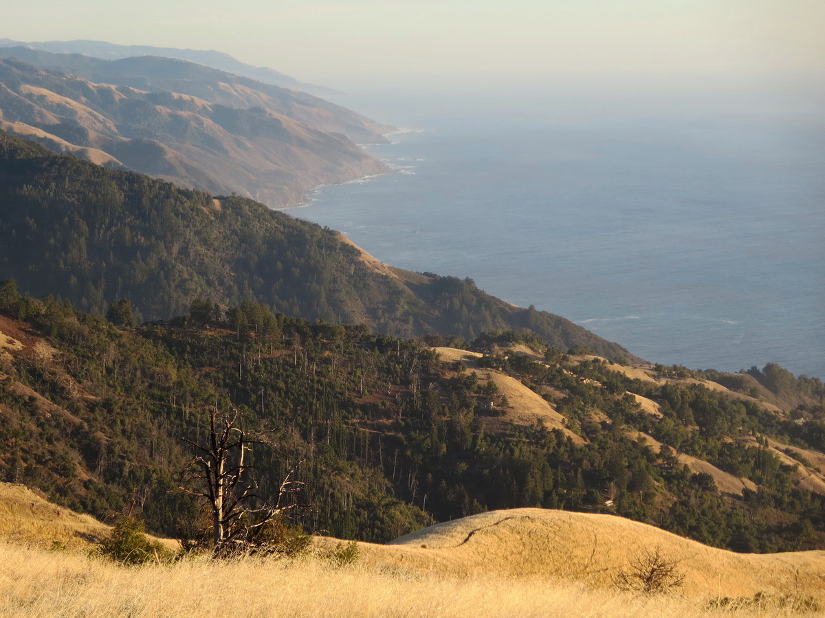


Great pictures – that looks amazing!!
That looks like an amazing area! What a range of views.
You have opened my eyes! When I saw ‘Big Sur’ and ‘running’, I assumed that your post would be about the marathon. I had no idea that there was such a fabulous trail system just inland. You have made me add this onto my list. Thx
Love your blog. You (and a recent trip snowshoeing in Yosemite) has inspired me to dedicate this year to exploring new trails and mountains. Thank you and have a great new adventurous year.
I did this route over New Year’s, but over three days 🙂
Unfortunately, I was not aware that there were bushes ALL over the trail, and nearly got killed trying to get through!