The Monarch Divide is a region of the High Sierra that is easily overlooked. Topping out below 12,000 feet, the peaks along the divide are not as impressive as nearby zones to the north, east and south. The most used trail into the Monarch Divide is the Copper Creek Trail to Granite Lake and Granite Pass, starting at Road’s End in Kings Canyon. This trail is well-maintained and includes some fantastic views of Kings Canyon right from the start and much of the way up. The other access trail is the Lewis Creek Trail which is near Cedar Grove. This trail is used infrequently resulting in some sections of narrow tread and brushy sections. Either way, it’s a long way from the canyon floor to the Monarch Divide with over 10 miles and 6,500+ feet of elevation gain either way you go. Looking at the maps, my first desire was to climb Goat Mountain and see the panoramic views from its summit. Upon further inspection, it seemed like a point-to-point semi-loop was possible utilizing both the Copper Creek and Lewis Creek trails and including the summits of Kennedy Mountain, Munger Peak and Goat Mountain and a traverse through Volcanic Lakes. The section from Kennedy Pass to Granite Pass would be off-trail but the terrain seemed favorable to easy wandering. This last minute itinerary design turned out to be fantastic. I found an adventure running playground that exceeded my expectations with stellar scenery and opportunities for off-trail exploration. Strava route here. 
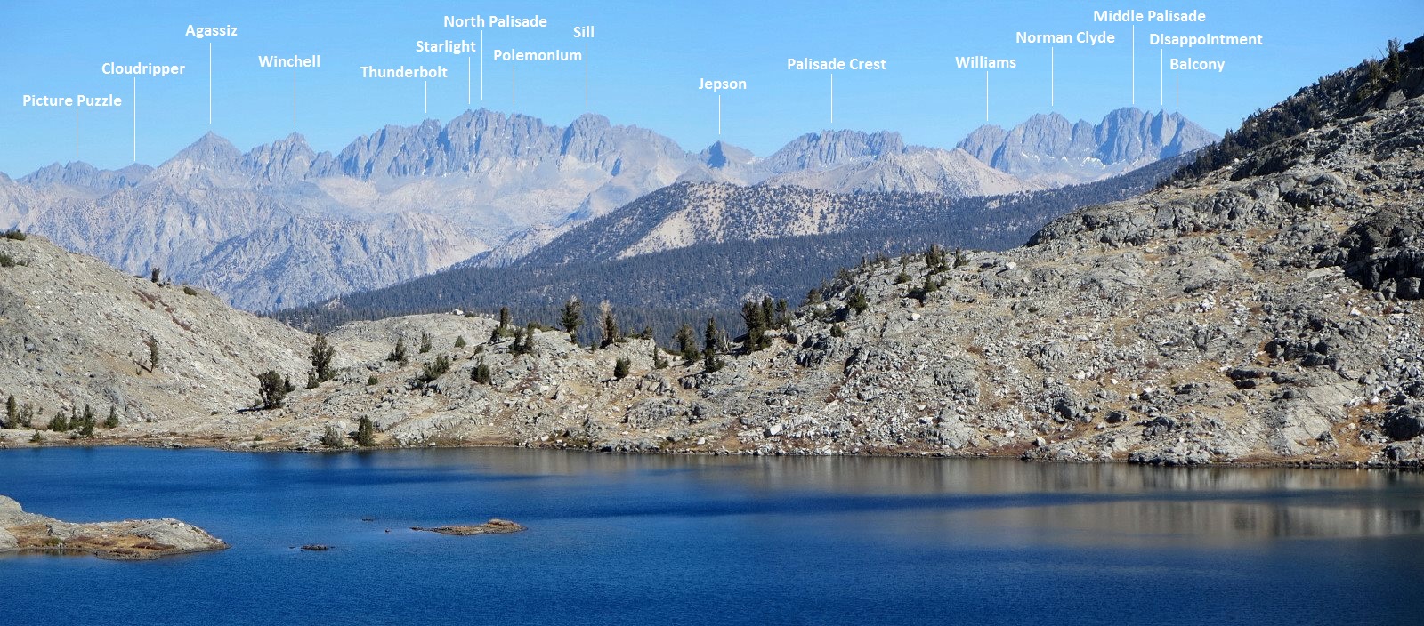
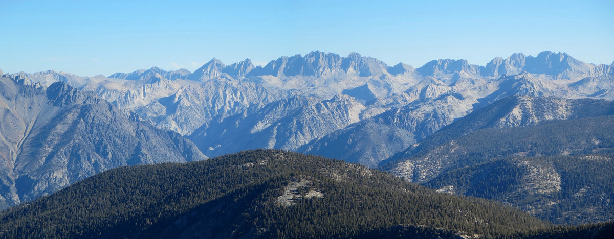
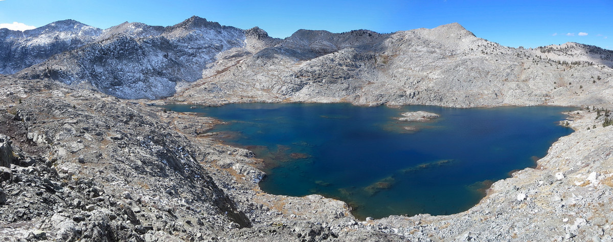
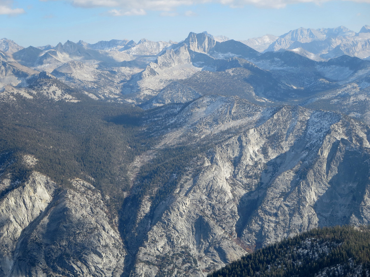
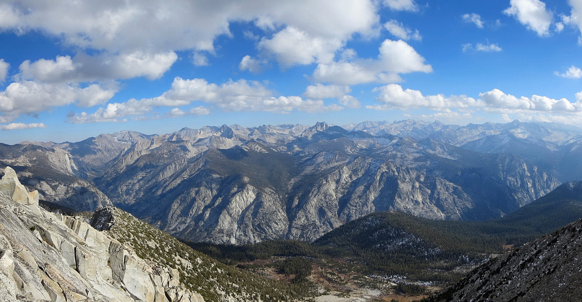
 The next image is an annotated panorama from the summit of Kennedy Mountain which shows virtually the entire drainage basin of the Middle Fork Kings River from Finger Peak to Mount Bolton Brown to the Monarch Divide, arguably the most rugged and wild watershed in the High Sierra. Click on image or here for the full high resolution version.
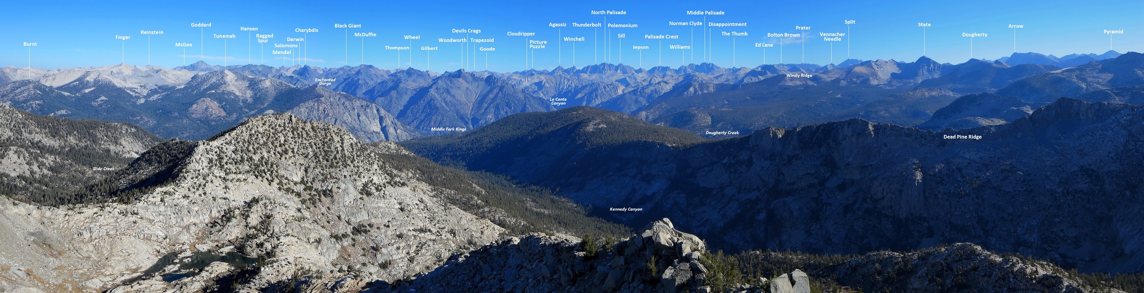
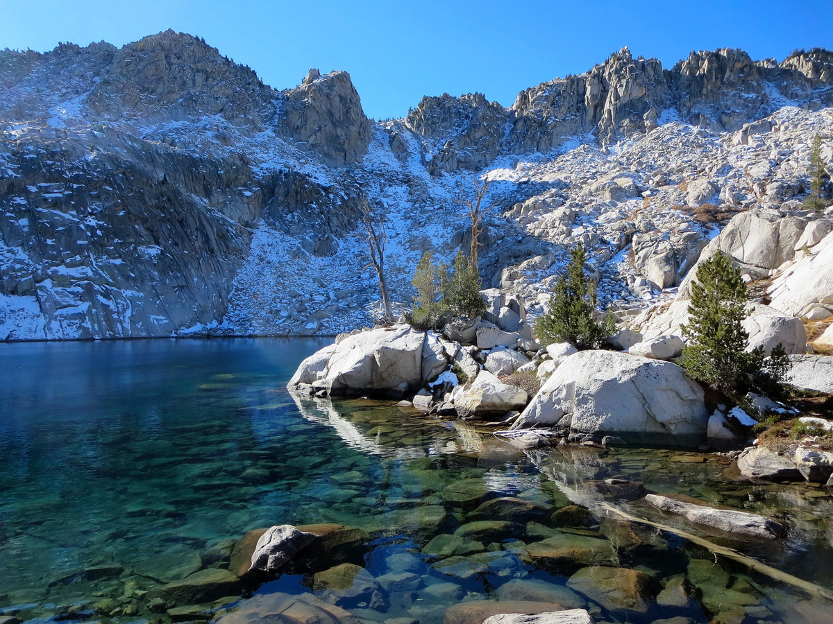
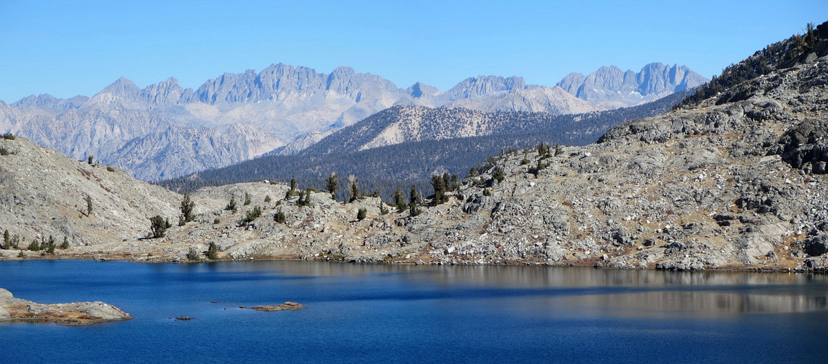
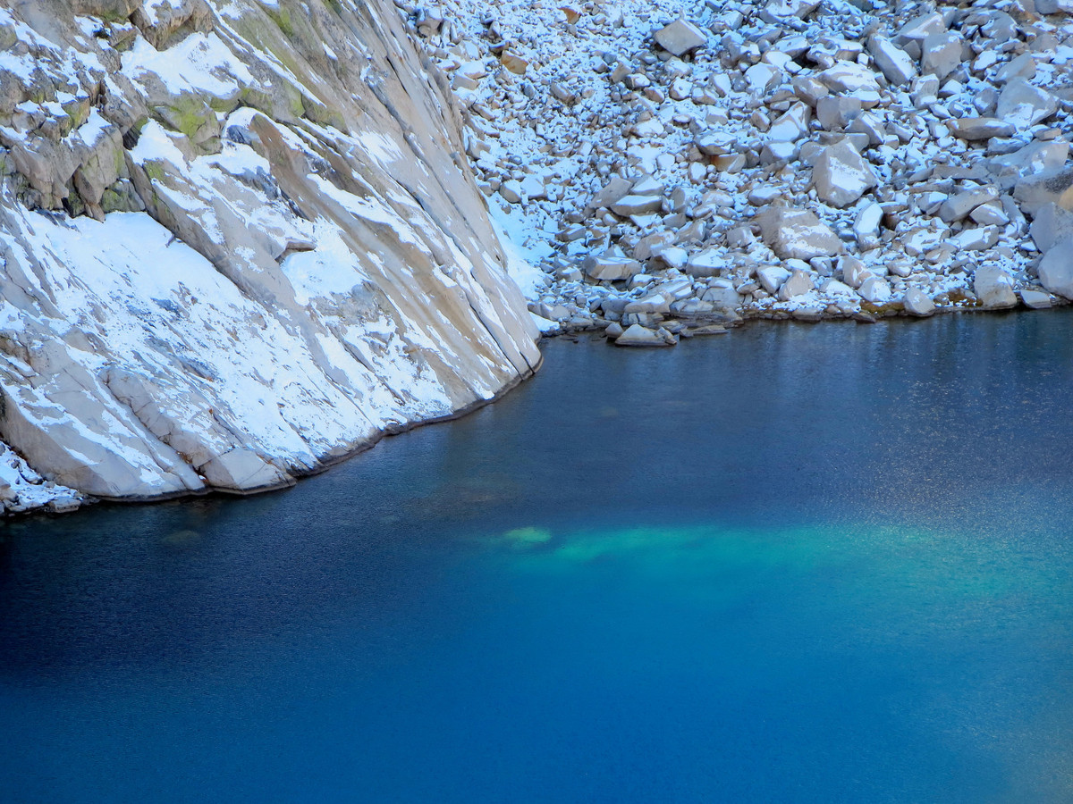
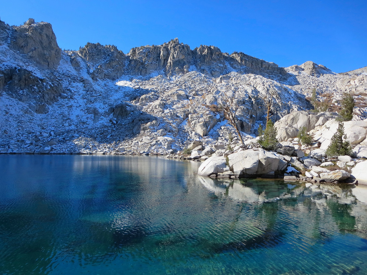
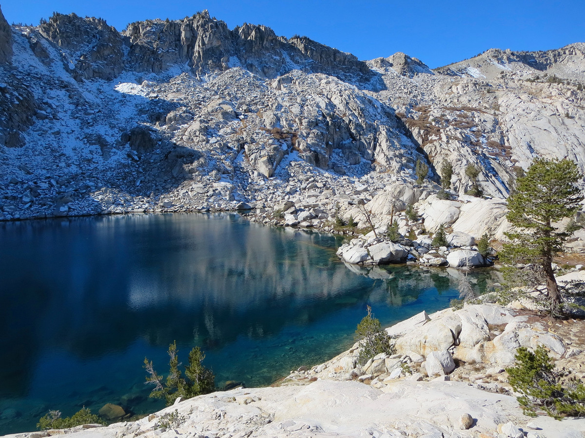
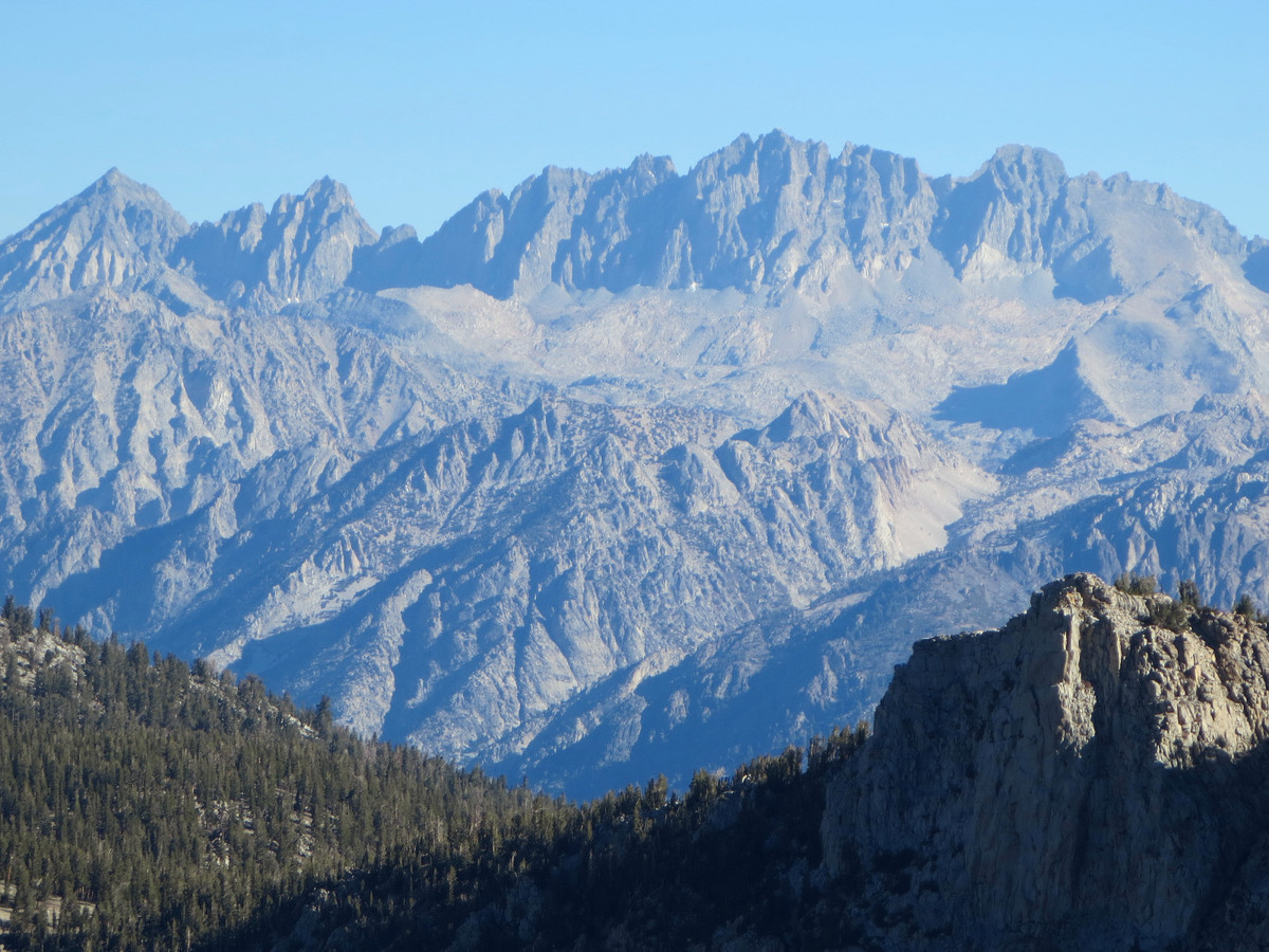
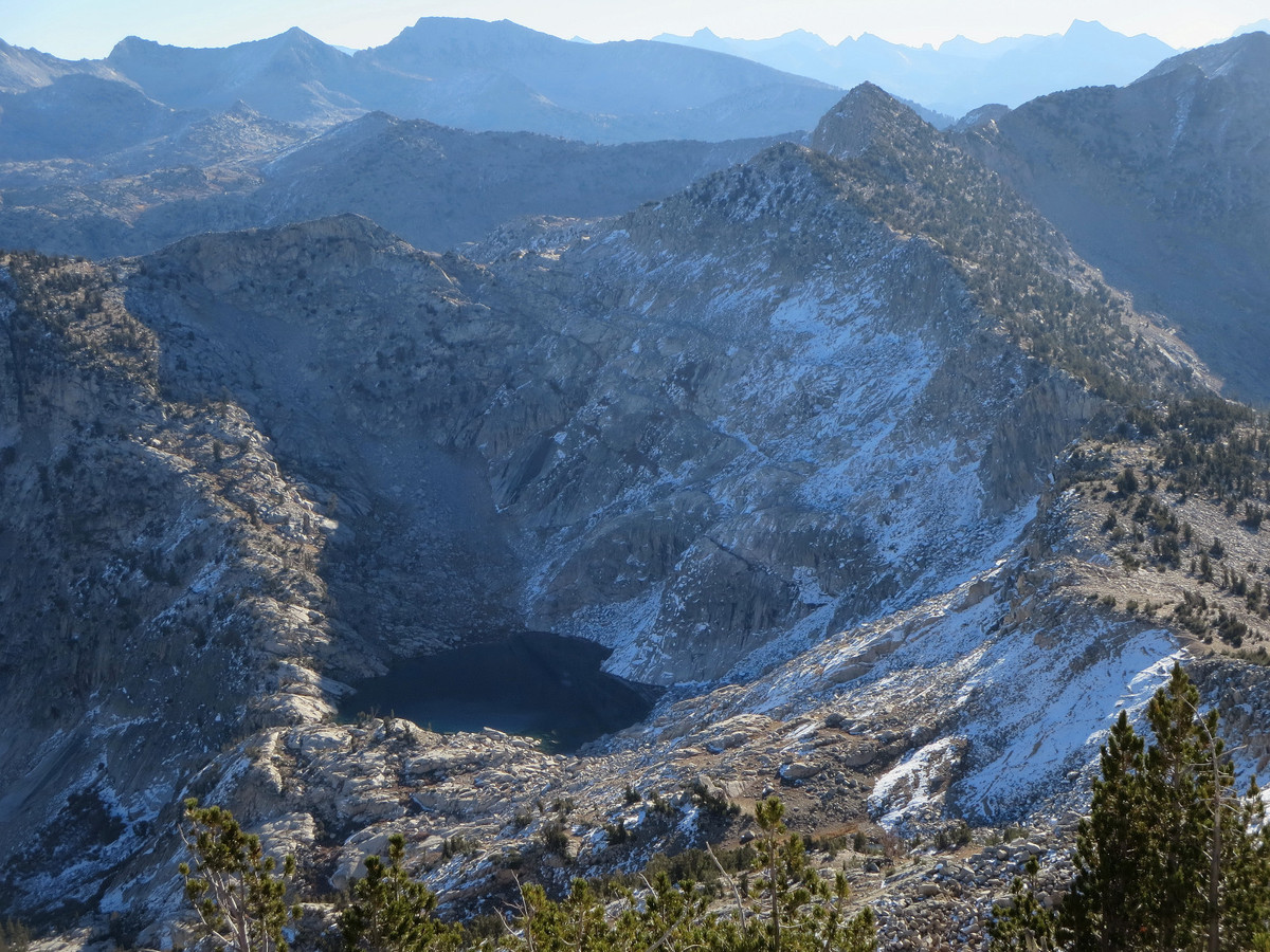
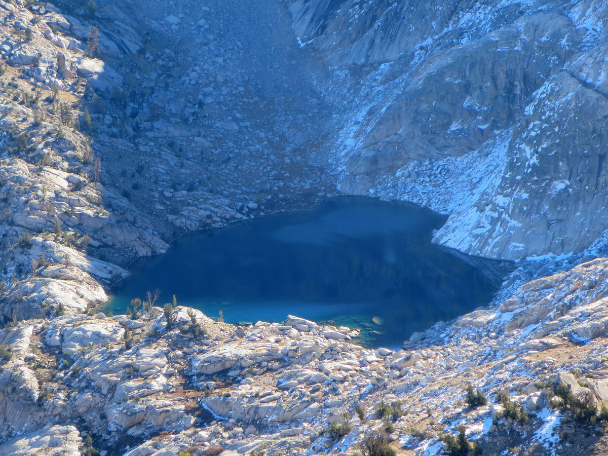
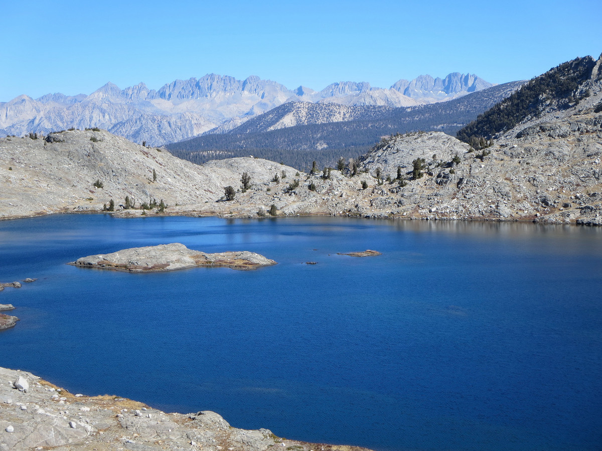
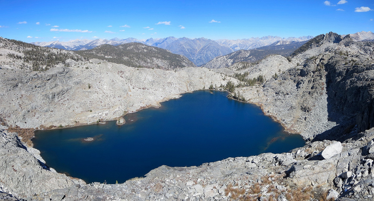
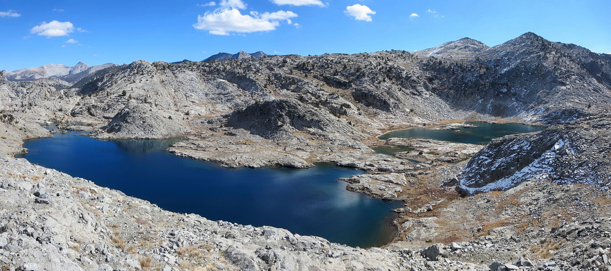
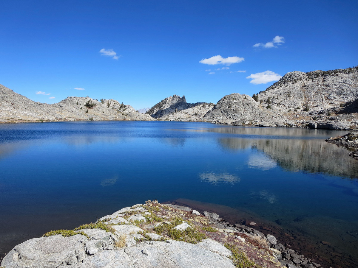
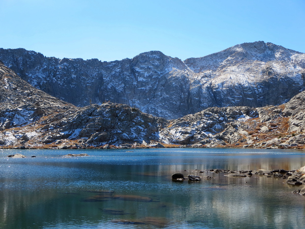
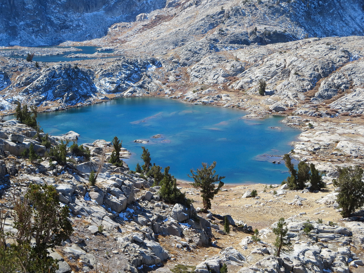
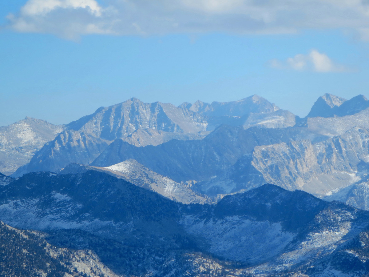
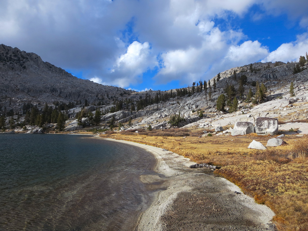
I started out up the Lewis Creek Trail with some pre-dawn running making way into a pleasant pine forest for a few miles. Eventually, the forest became more alpine in character before opening up into a long avalanche scoured hillside with a forest of miniature aspens (except a handful of large aspens). I was about a week too late to see the fall color through this section but I imagine it to be awesome if timed correctly. After a long traverse through the avy slope I made my way up the final switchbacks to Kennedy Pass and then continued up the ridge through easy off-trail terrain to the summit of Kennedy Mountain where I was greeted with a lovely view to the Middle Fork Kings Canyon, the Palisades, Goddard Divide, Black Divide and White Divide. From Kennedy Mountain, I returned to Kennedy Pass and dropped down the Pass’s north side through a section of snow. I mistakenly turned off the trail a bit too soon, but scrambled down some steep grass and granite slabs to rejoin the trail near a small tarn. At the tarn I left the trail for good and headed up to East Kennedy Lake, a Sierra gem with pristine blue waters and a beautiful backdrop of cliffs along the Monarch Divide. The surreal setting was highlighted by the recent snow on the granite cliffs.

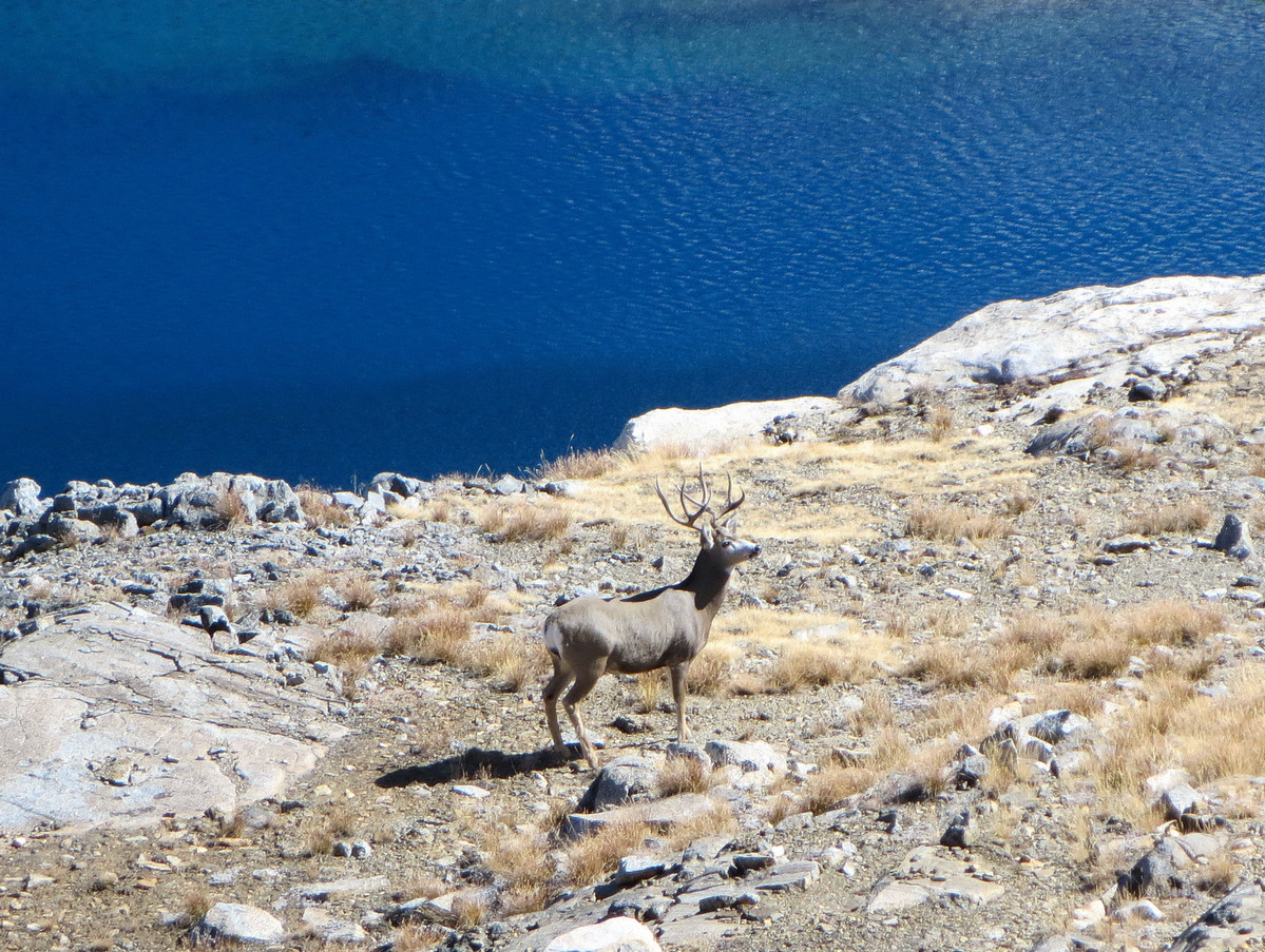
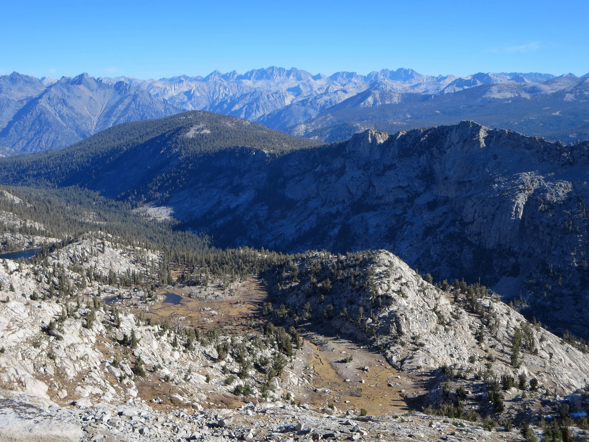
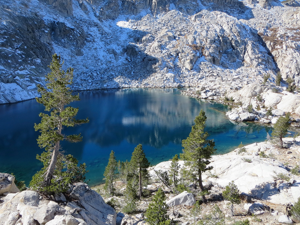
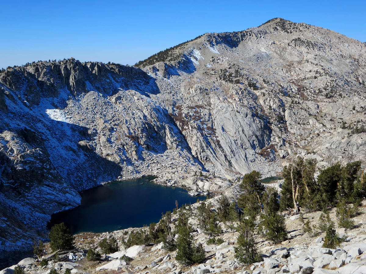
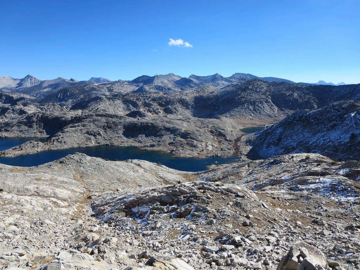
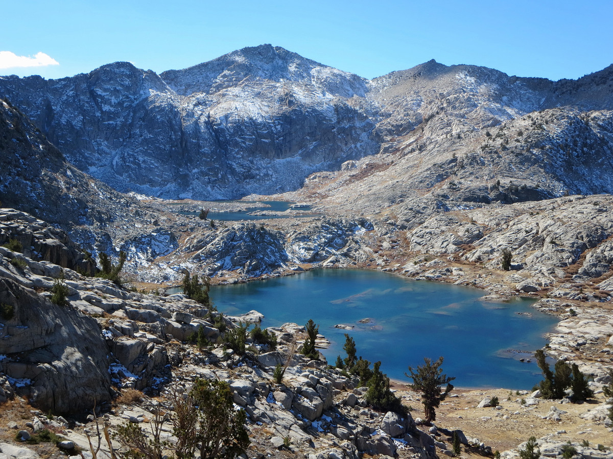
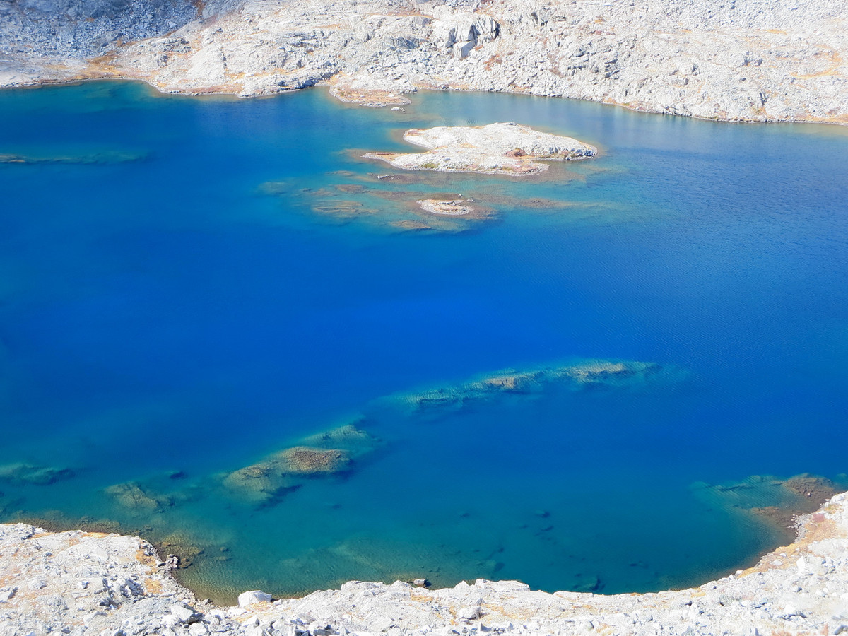
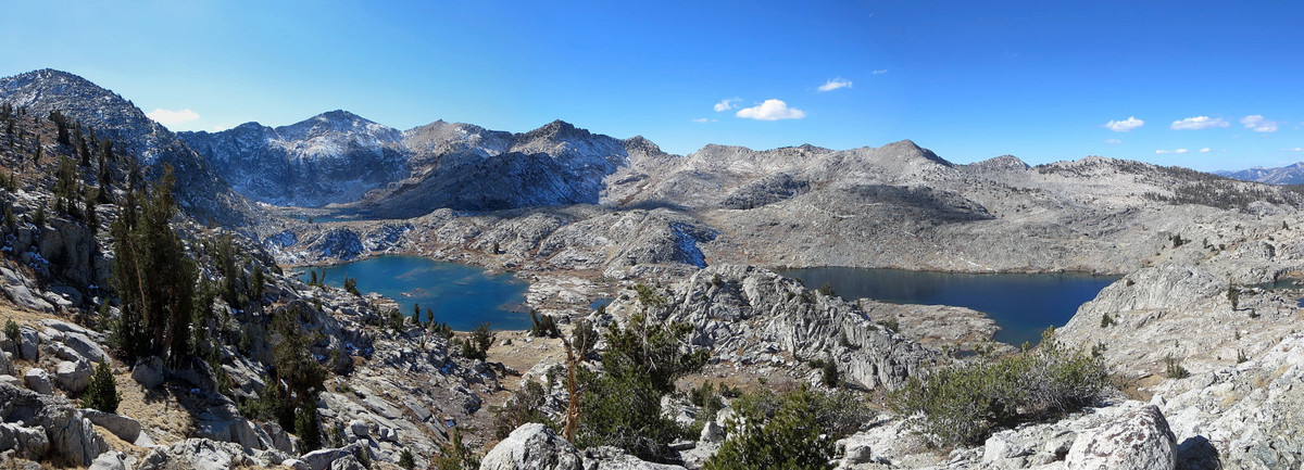
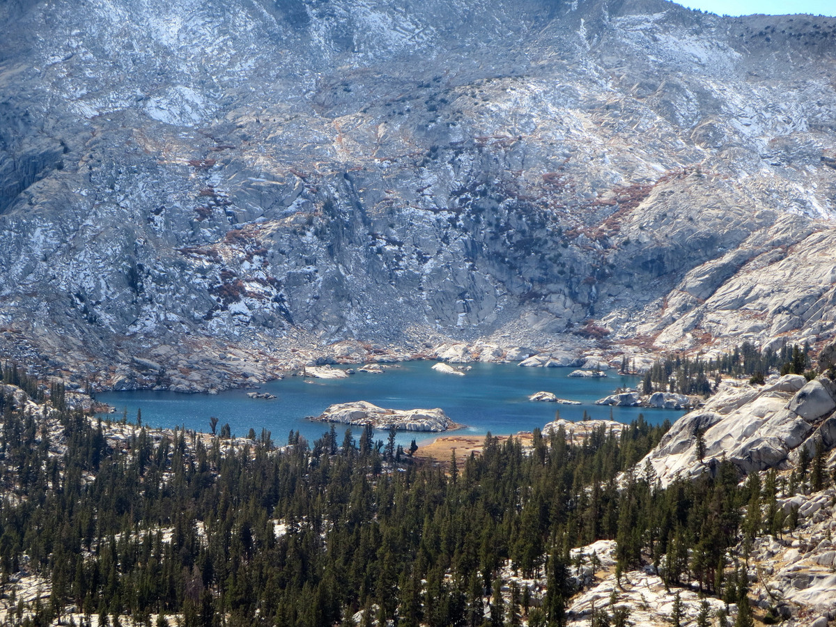
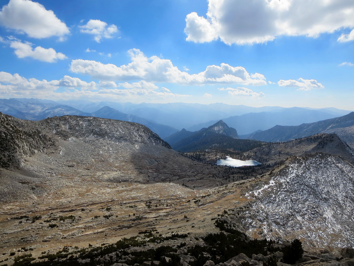
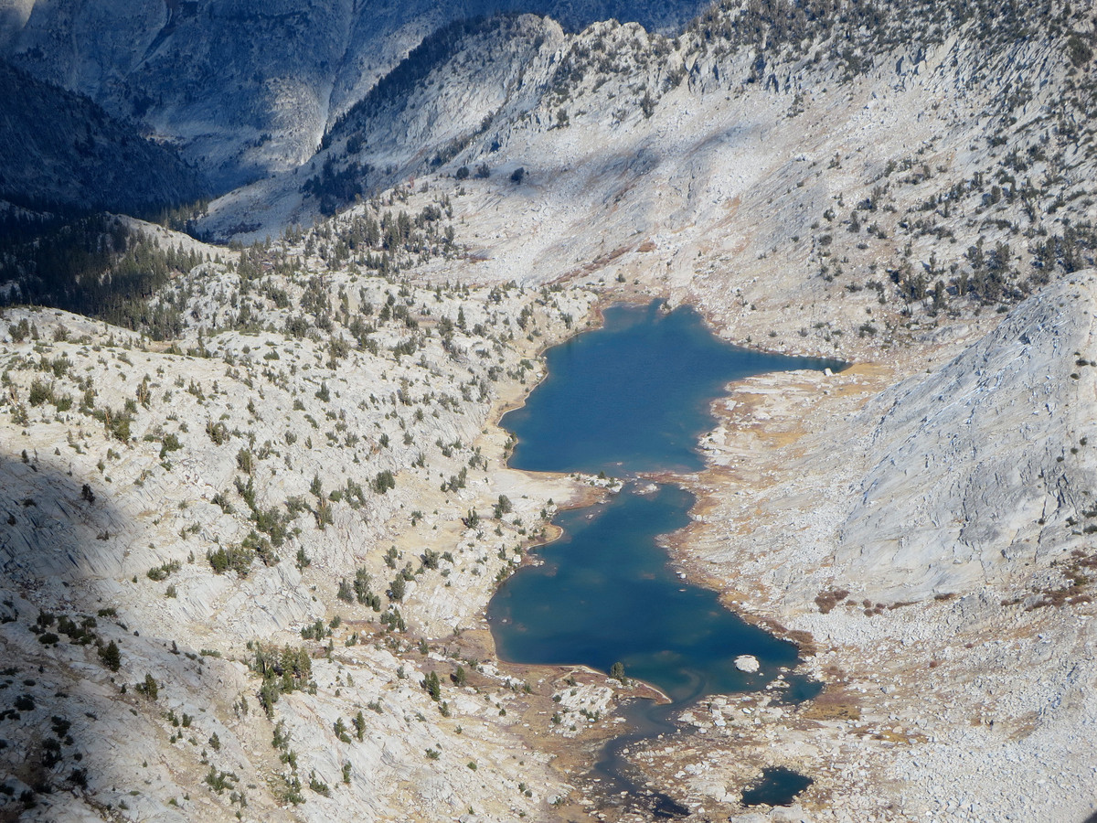
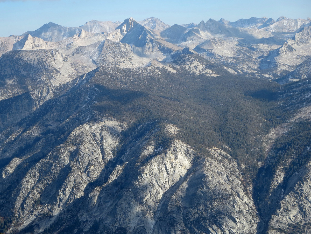
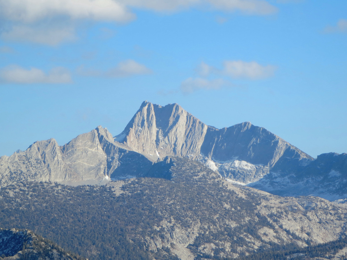
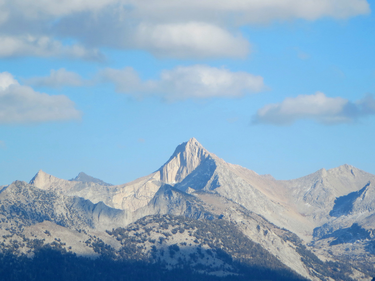
 From East Kennedy Lake, I ascended steep grassy slopes up to a small saddle high on Dead Pine Ridge that provided access to Volcanic Lakes, a glorious granitic basin with a series of large alpine lakes. The origin of the name “Volcanic” perplexed me as this area seem far from volcanic in character. Descending to the largest Volcanic Lake (10,199 ft) via meadows and granite slabs, a tremendous view of the Palisades above the lake came into focus. The setting was so impressive I could hardly take a few steps without stopping to photograph and admire the picturesque scene. At the shores of Lk 10,199 I ascended more slabs to a knob with a centralized vantage where I could see five of the lakes surrounding me (there are at least eight large lakes in the basin). From the knob I crossed between Lk 10,284 and Lk 10,288 and then ascended yet another grassy gully to a broad area of meadows and slabs which took me to Granite Pass. In my entire time from East Kennedy Lake to Granite Pass I saw no evidence of human impact.
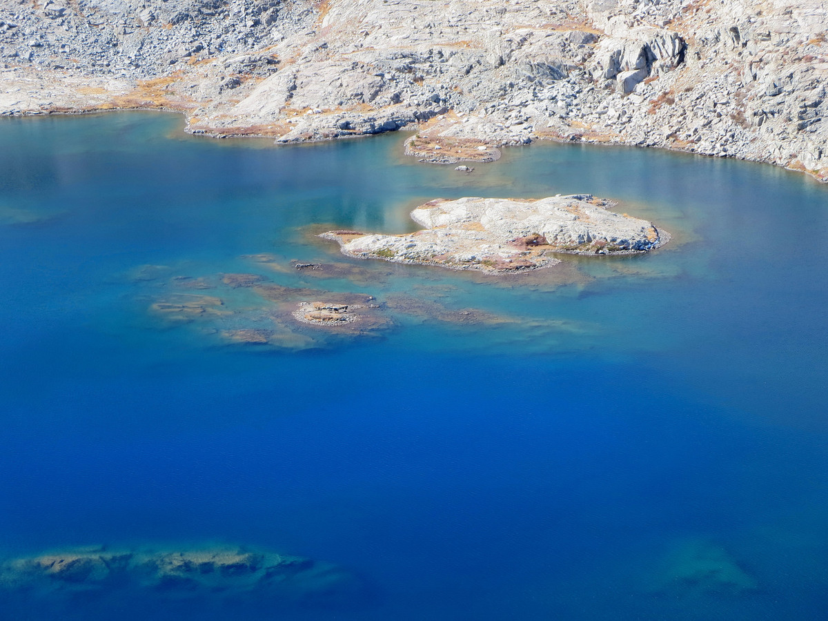
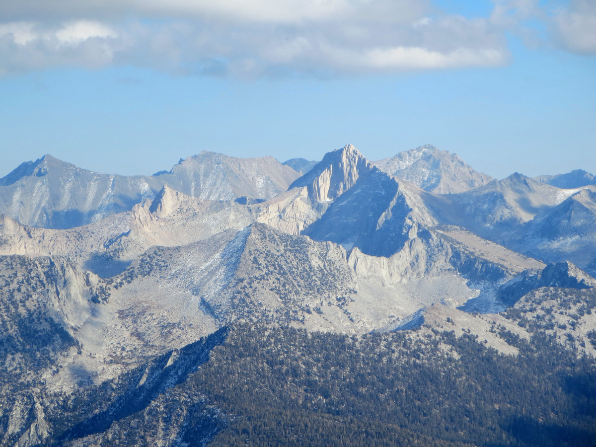
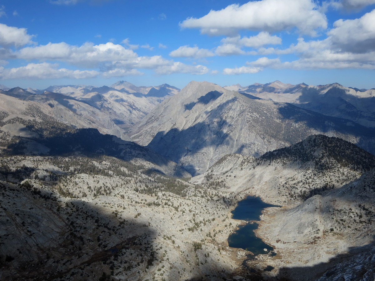
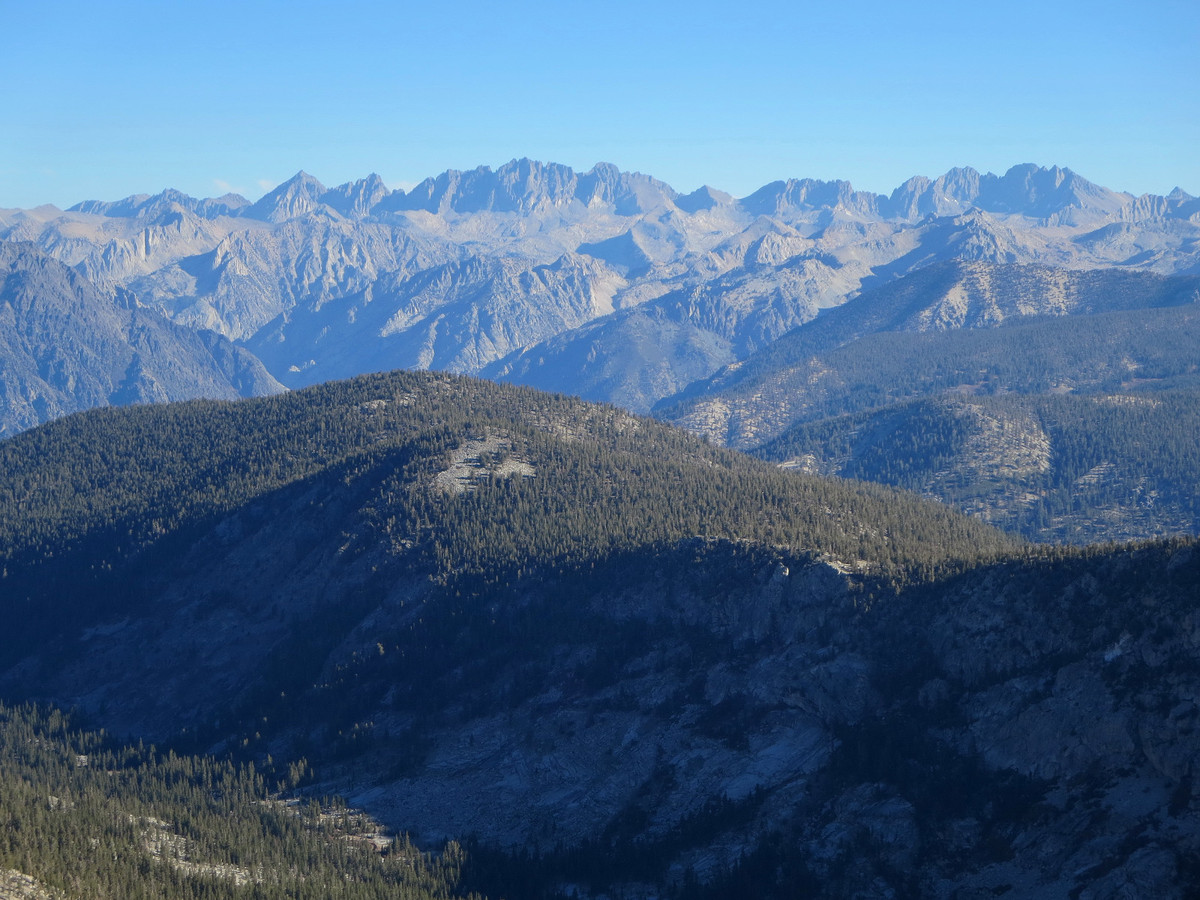
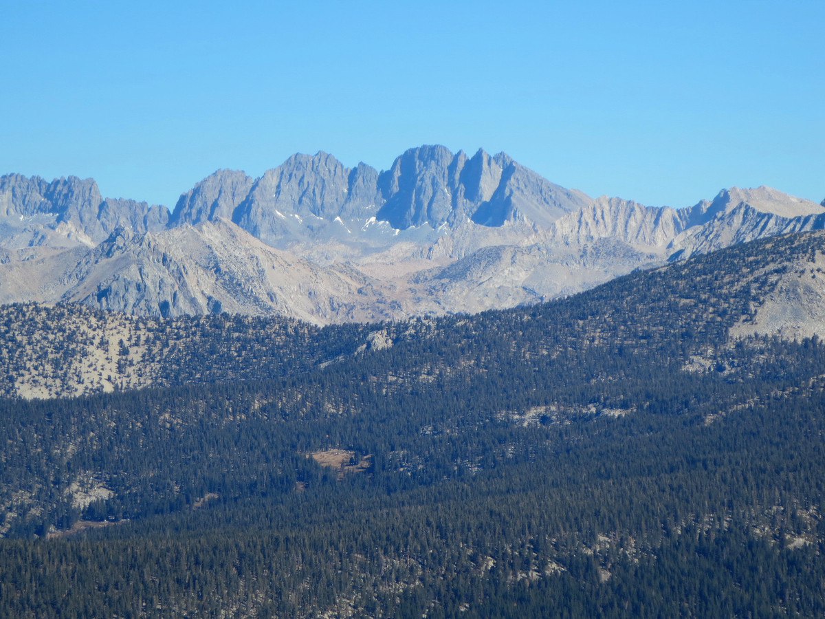
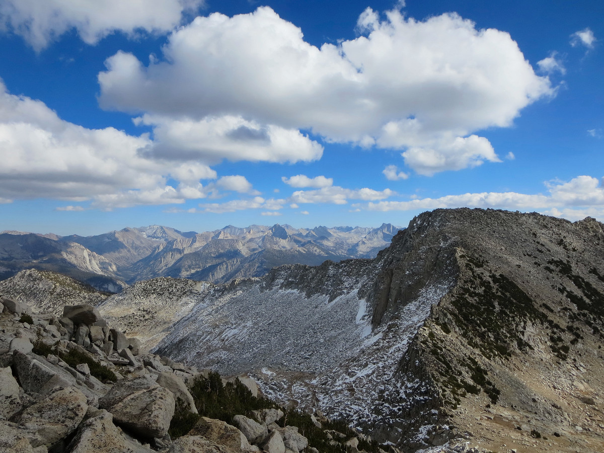
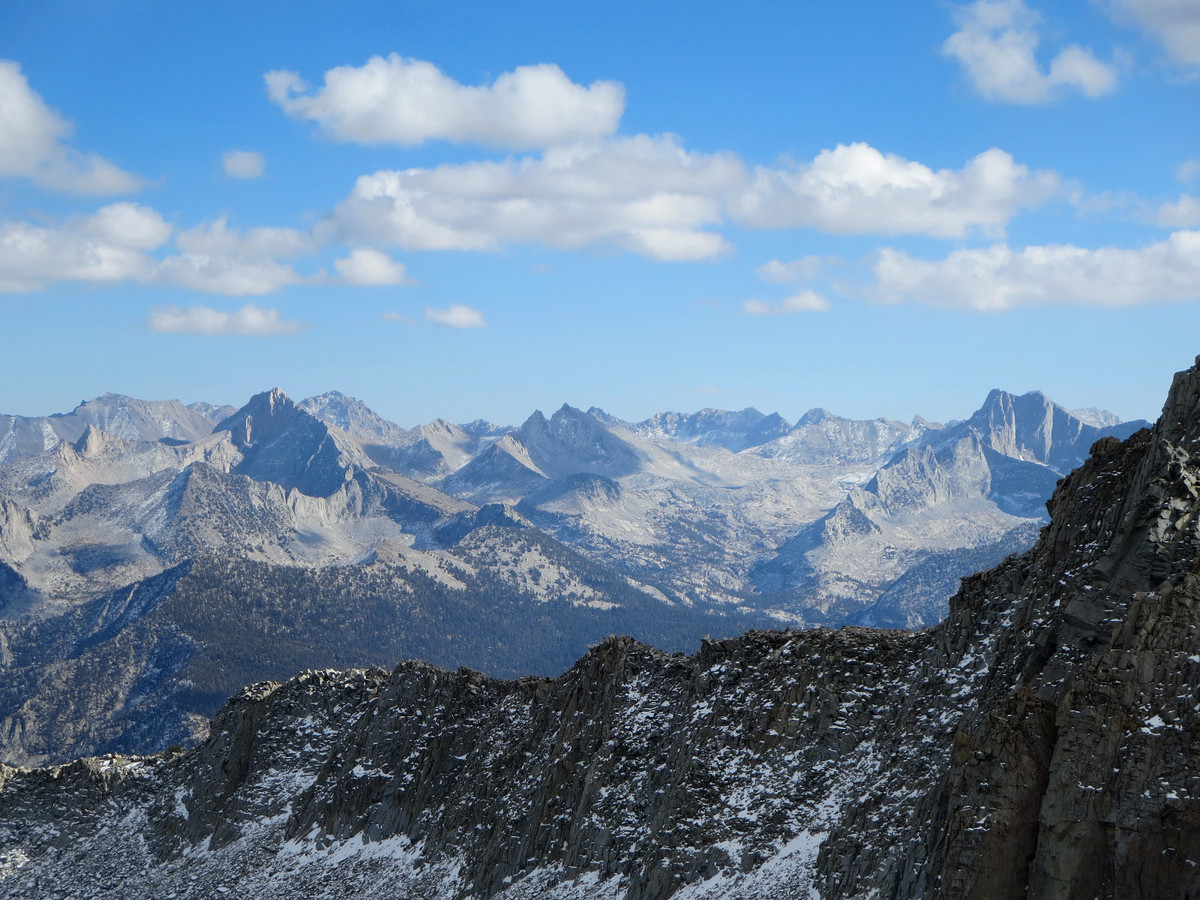
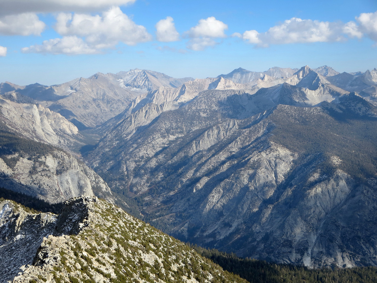
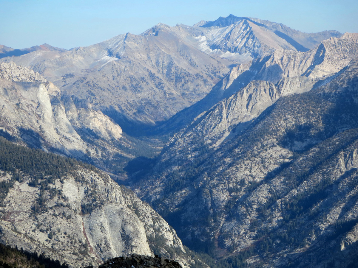
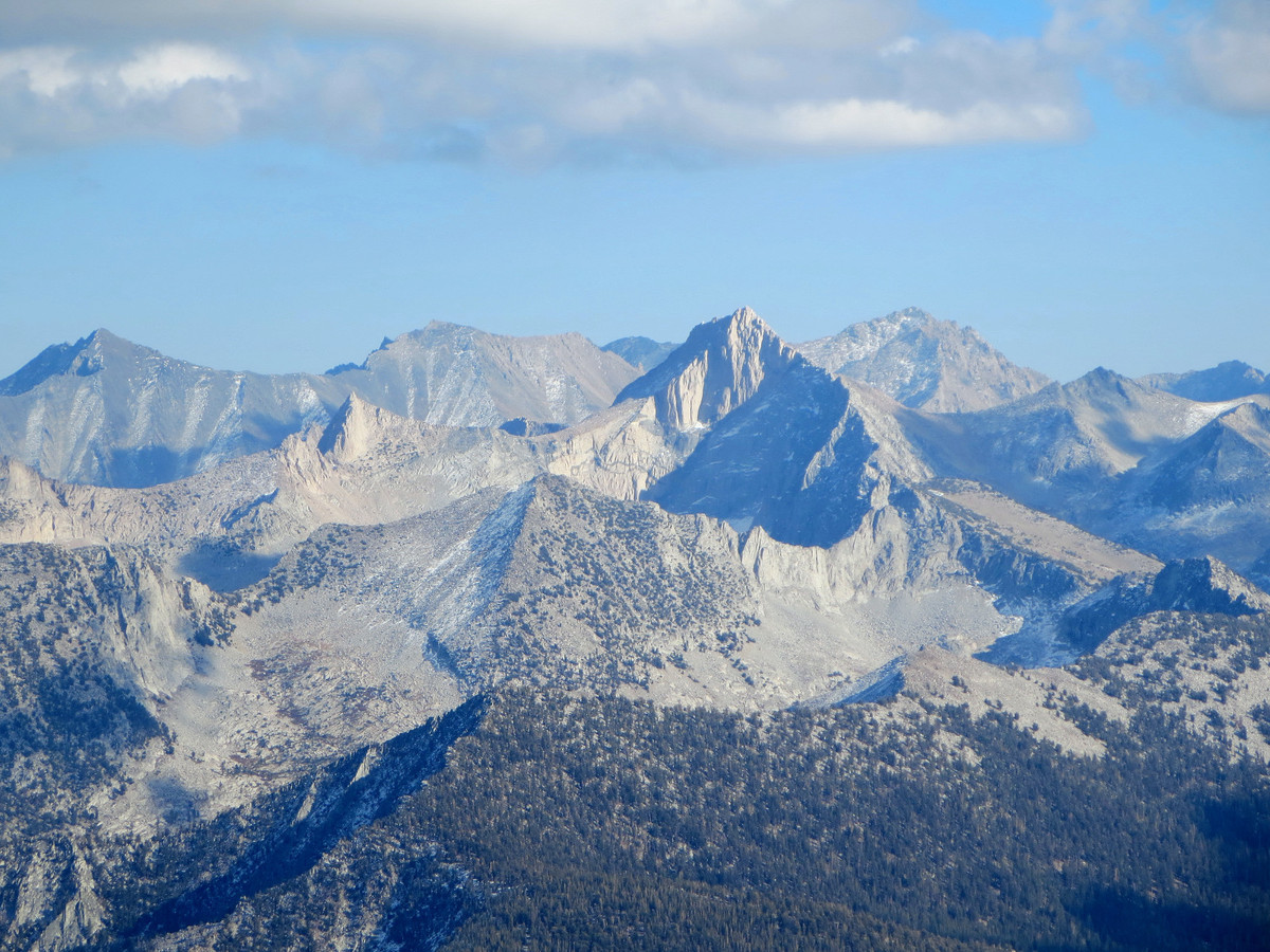
 From Granite Pass, I crossed the Copper Creek trail and traversed slabs and more meadows into the basin below Munger Peak. Munger Peak and Goat Mountain lie along the Goat Crest, a short north-south oriented spur between the Monarch Divide to the west and the Cirque Crest to the east. I chose to climb over Munger Peak from the north and found slippery snow on the talus in the final few hundred feet which made things slower than I otherwise would have expected. With conditions as they were, it would have probably been more efficient to cross over to Munger’s dry south side and tag the summit as an out-and-back. At any rate, I eventually made the summit of Munger and snapped some photos before heading down to the gap between Munger and Goat for the much-anticipated last climb of the day up Goat Mountain. The ascent up Goat Mountain was loose in the lower part but became more solid in the upper portion with a finish through large talus blocks near the top. The view from Goat Mountain’s summit was all that I had expected and more. It’s truly a remarkable point with a sweeping panorama from the Evolution area to the Kaweahs. The centerpiece of the view overlooks the South Fork Kings Canyon and the Murro Blanco with the peaks of the King Spur most prominent, including Mount Clarence King, Mount Cotter and Mount Gardiner. I also enjoyed the view looking to the Kings-Kern Divide including Mount Stanford, Caltech Peak and Mount Ericsson. Beyond the Kings-Kern Divide Mount Williamson and Mount Whitney were clearly visible. At this point in the afternoon clouds were beginning to gather to the south and chilly winds were increasing, but I spent quite a bit of time on the summit admiring the stupendous panorama. The afternoon light along with some the cumulus clouds enhanced the photography.
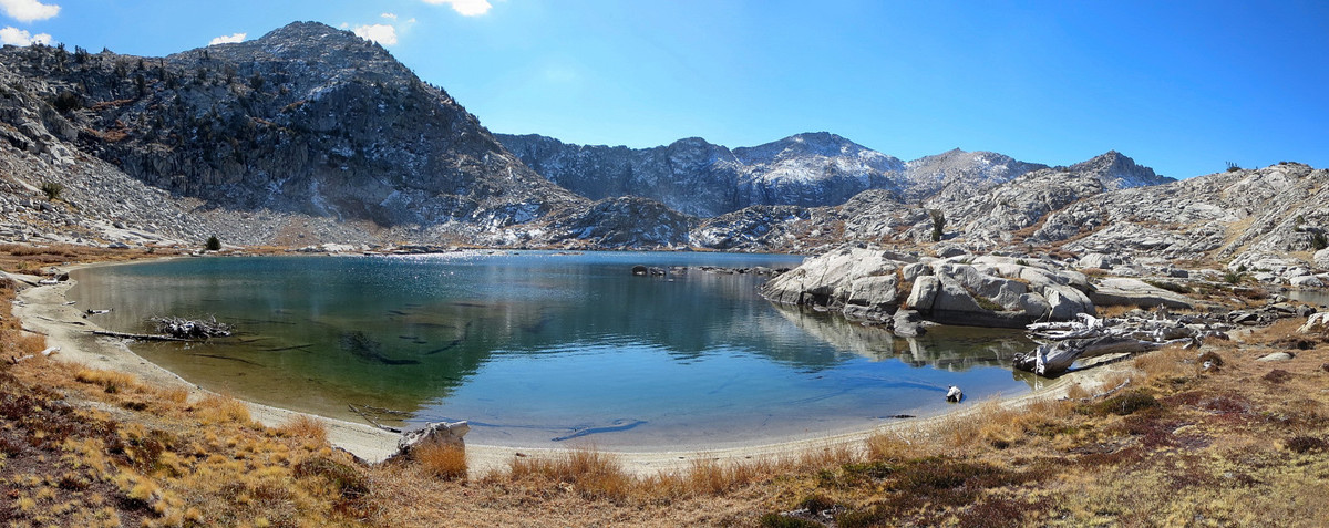
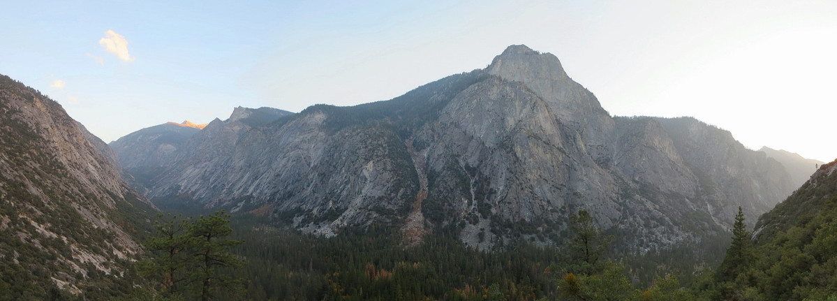
 After over 30 minutes on the summit, I descended Goat Mountain and headed down down to Grouse Lake with straightforward and efficient cross country travel en route. Below Grouse Lake I located a use path which deposited me at the Copper Creek Trail. Along this use path there were some phenomenal views of Mount Clarence King and Mount Gardiner. After a break, I started running down the well-maintained Copper Creek trail which is excellent for a descent since its fairly non-technical. I caught up to Erica part of the way down, the only person I would see all day (Erica enjoyed the day at Granite Lake). Towards the bottom of the trail there was some great evening light through Kings Canyon and the Grand Sentinel rock feature (aka the El Capitan of Kings Canyon). Both Erica and I made it back before dark and we both agreed it was a fine late-season day to be in the Sierra. I’ll definitely be back for further exploration in this area and I’m especially keen on ascending Goat Mountain in the spring when the snow-capped peaks will offer a different perspective of the panorama; one of the best in the Sierra. The Copper Creek Trail to Goat Mountain segment is also the beginning of the Sierra High Route, which I aspire to do someday as well.
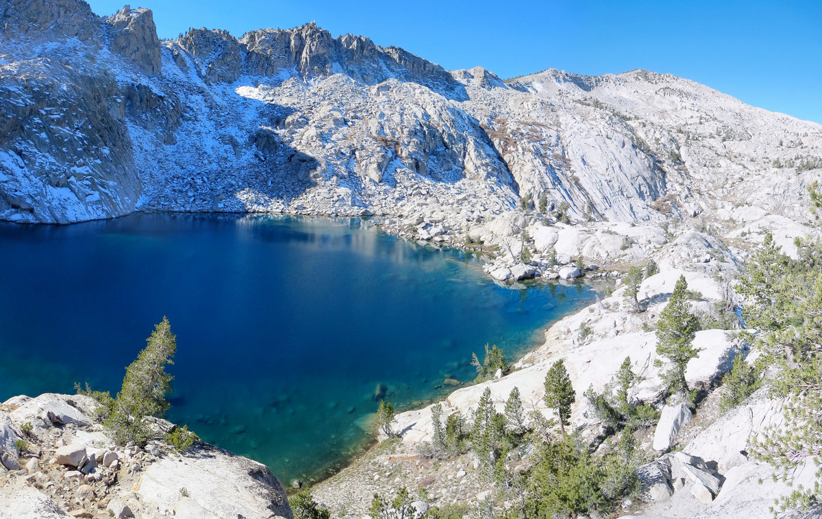


Great Pictures. I attempted Goat Mtn, but took the wrong way up. In the end I admitted failure, but got some nice photos all the same.
I did this “open jaw” trek back in 1982, less the ascent of Mounts Munger and Goat, but it still ranks up as one of the best backcountry treks I ever attempted. The Volcanic Lakes was magical-it is the benchmark for all my upcoming high country treks over similar terrain (ie, large expanses of granite). Thanks for the post!