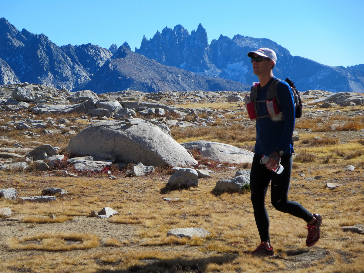
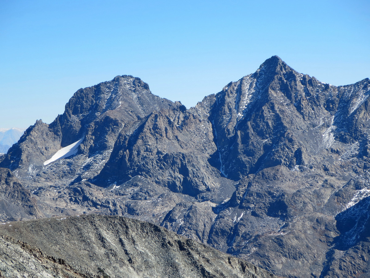
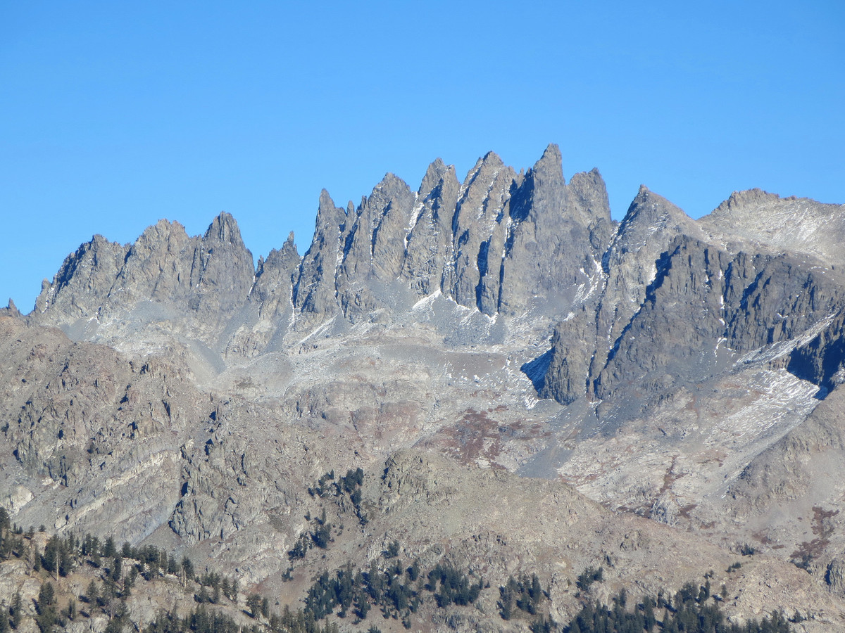
Fall is one of my favorite times of the year in the Sierra. This time of year comes after the summer monsoon thunderstorm season but before winter storms roll in off the Pacific burying the high country in snow. The result is weather that is characterized by numerous clear and crisp days interspersed with the occasional light snowfall. Mosquitoes and crowds are non-existent, and the trails are in great condition. Foerster Peak hadn’t really been on my radar, or the entire region for that matter, but while looking at the maps midweek it looked like a nice objective and I’m always interested in visiting new spots off the beaten path. Joey joined me for this trip and we both agreed this adventure far exceeded expectations entailing a beautiful off-trail approach through Long Creek to Rockbound Lake and the exquisite Blue Lake, and a stellar 360 degree summit panorama including the entire Clark Range and much of the Cathedral Range and Ritter Range. My favorite view was the rarely seen west side of the jagged Minarets. Strava route here.
A sweeping 360 degree annotated panorama from the summit of Foerster Peak can be found here or be clicking on the image below for a much larger image. 
Clark Range Panorama (click image for larger version): 
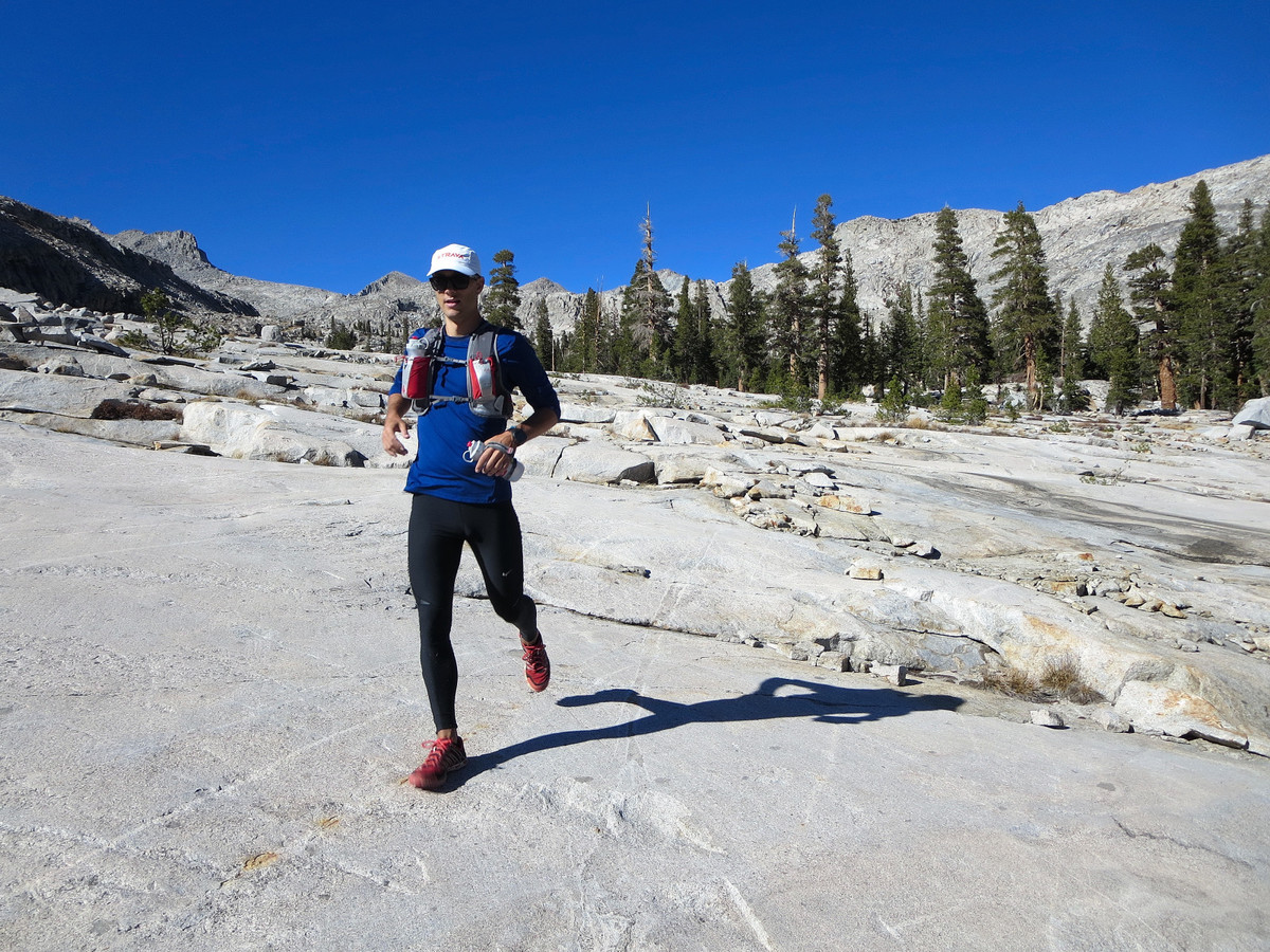
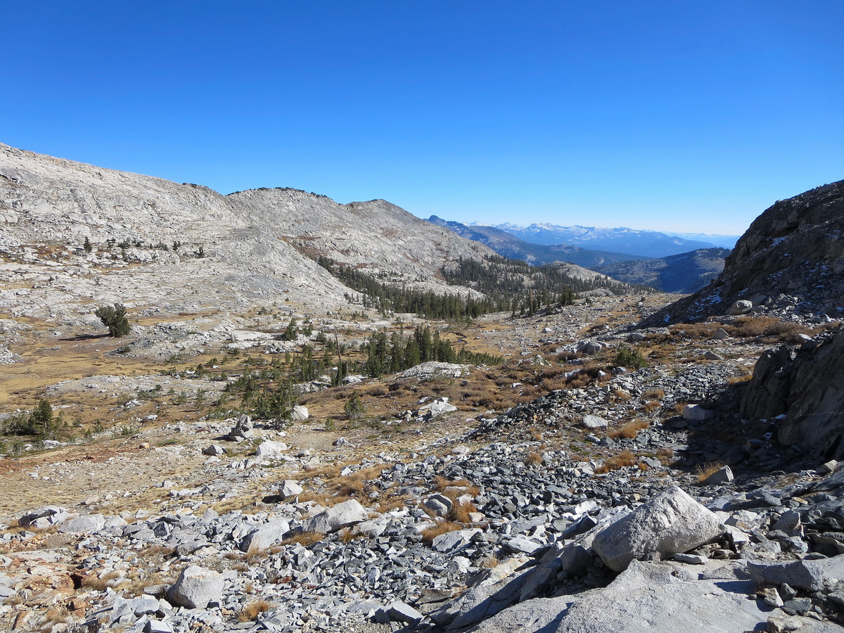
We started the trip from Isberg Pass Trailhead after a long, bumpy ride on the Beasore Rd. While this route is shorter, the pavement on Beasore road is so badly eroded it’s actually worse than if the road had been all gravel. We parked about 0.6 miles from the trailhead to avoid a rocky section of road (the reality of driving low clearance cars). On the way back we took the Minaret Road which is substantially longer in distance, but a much better drive due to its smooth pavement. We followed the Isberg Pass Trail through the Niche and shortly thereafter broke off on the Chetwood Cabin Trail. The montane forest and meadows were so pleasant for running we passed the dilapidated Chetwood Cabin without even noticing it, which meant we also passed the location where we were supposed to turn off. On the way back we took the old use trail that we were supposed to take in the morning and came to the conclusion that trying to follow this path is essentially useless and our unintended off-trail route in the morning was more efficient. A couple years ago a major windstorm blew through the forest and toppled countless trees over the old trail. Combined with lack of use, the old path has grown very faint and difficult to follow.

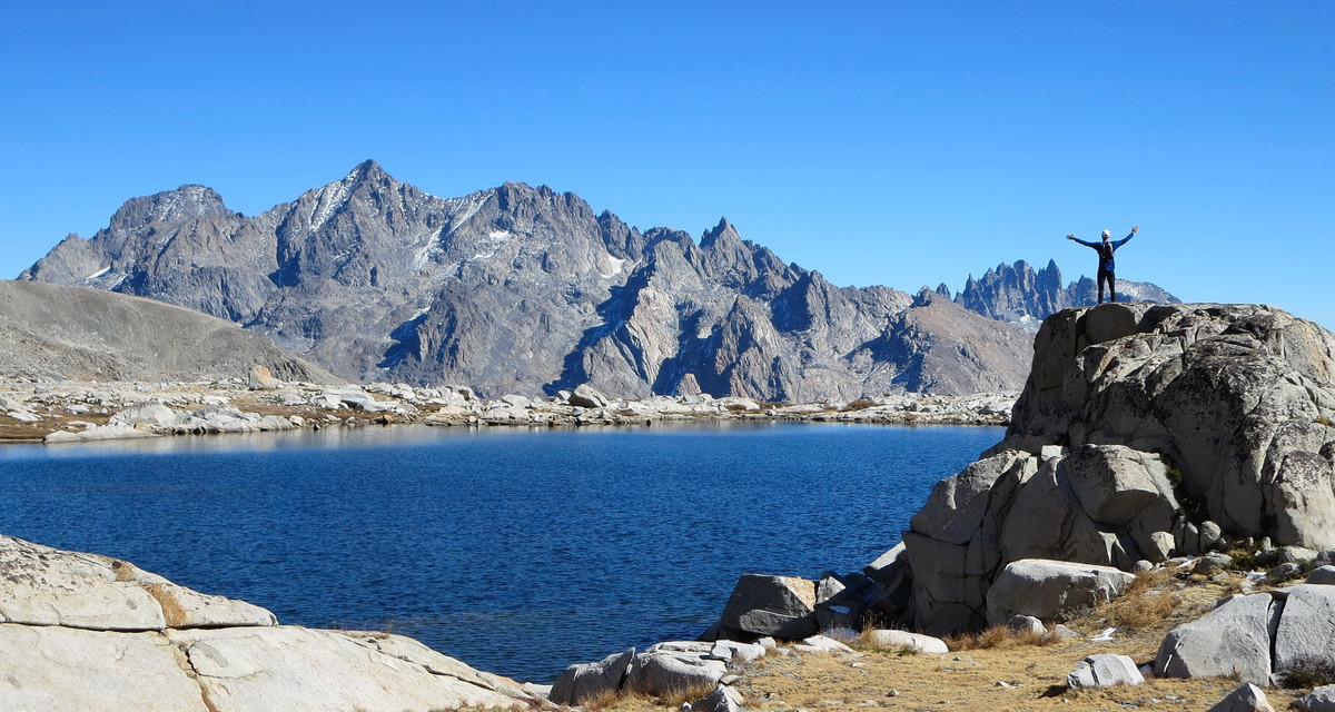
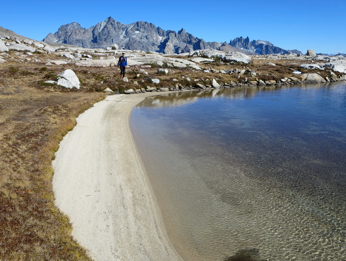
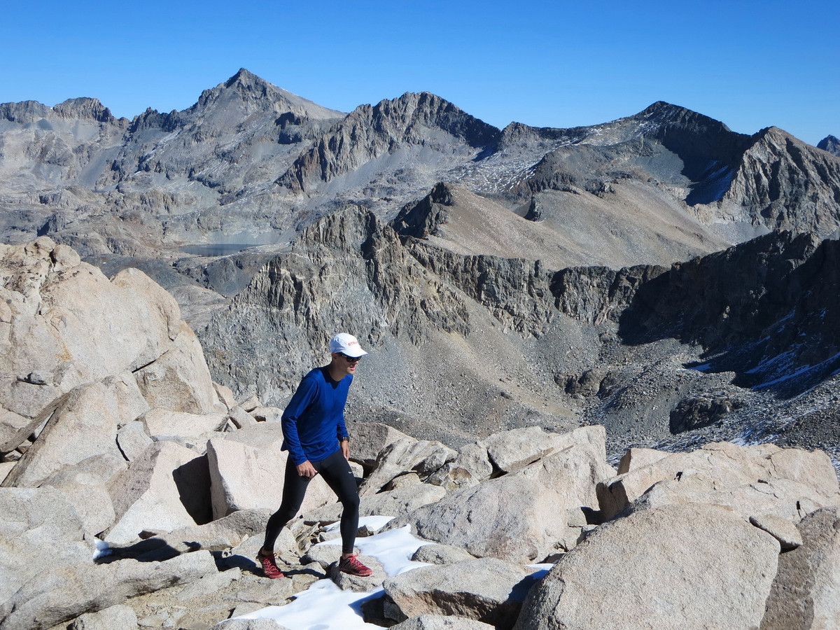
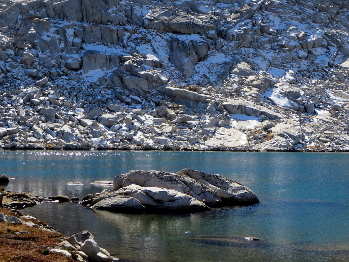
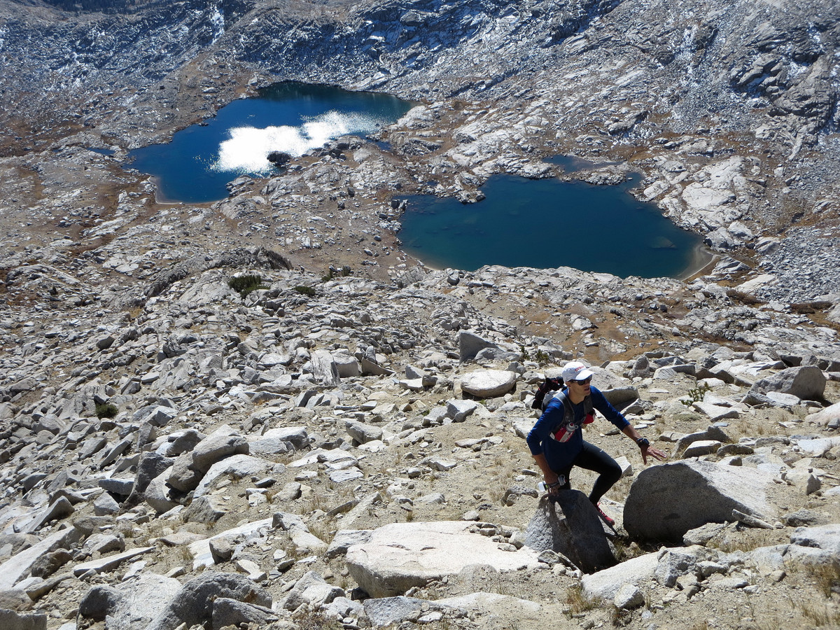
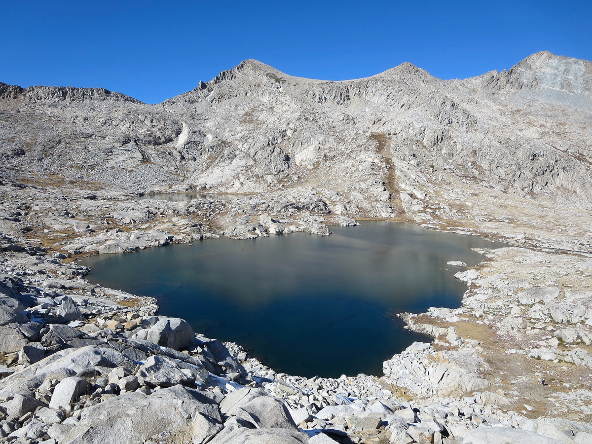
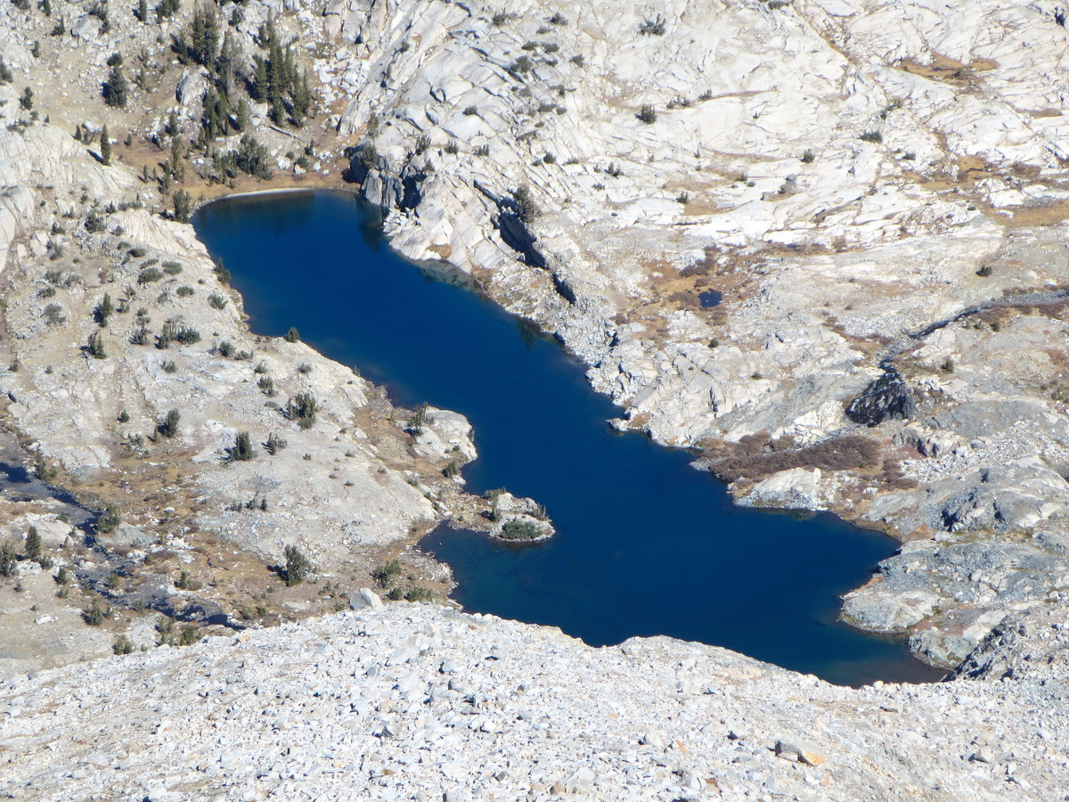
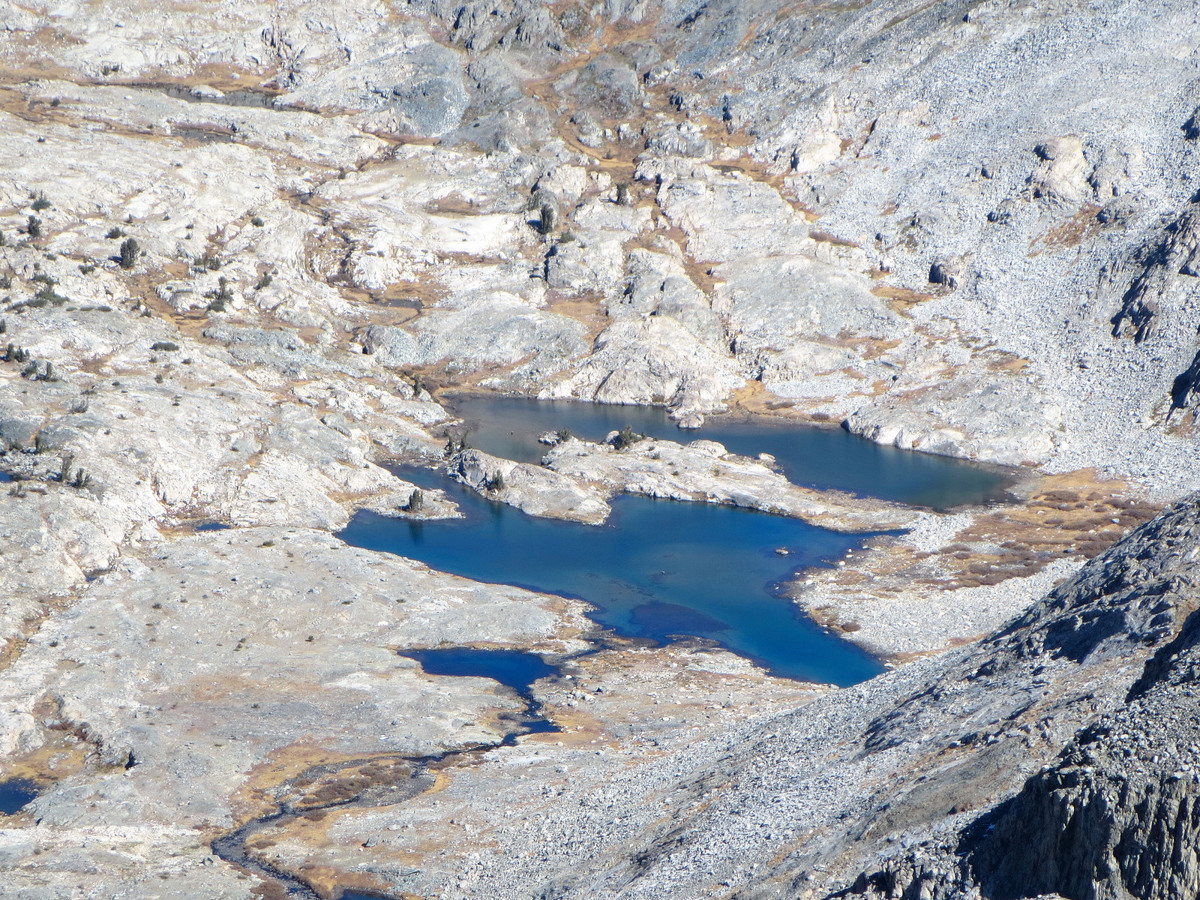
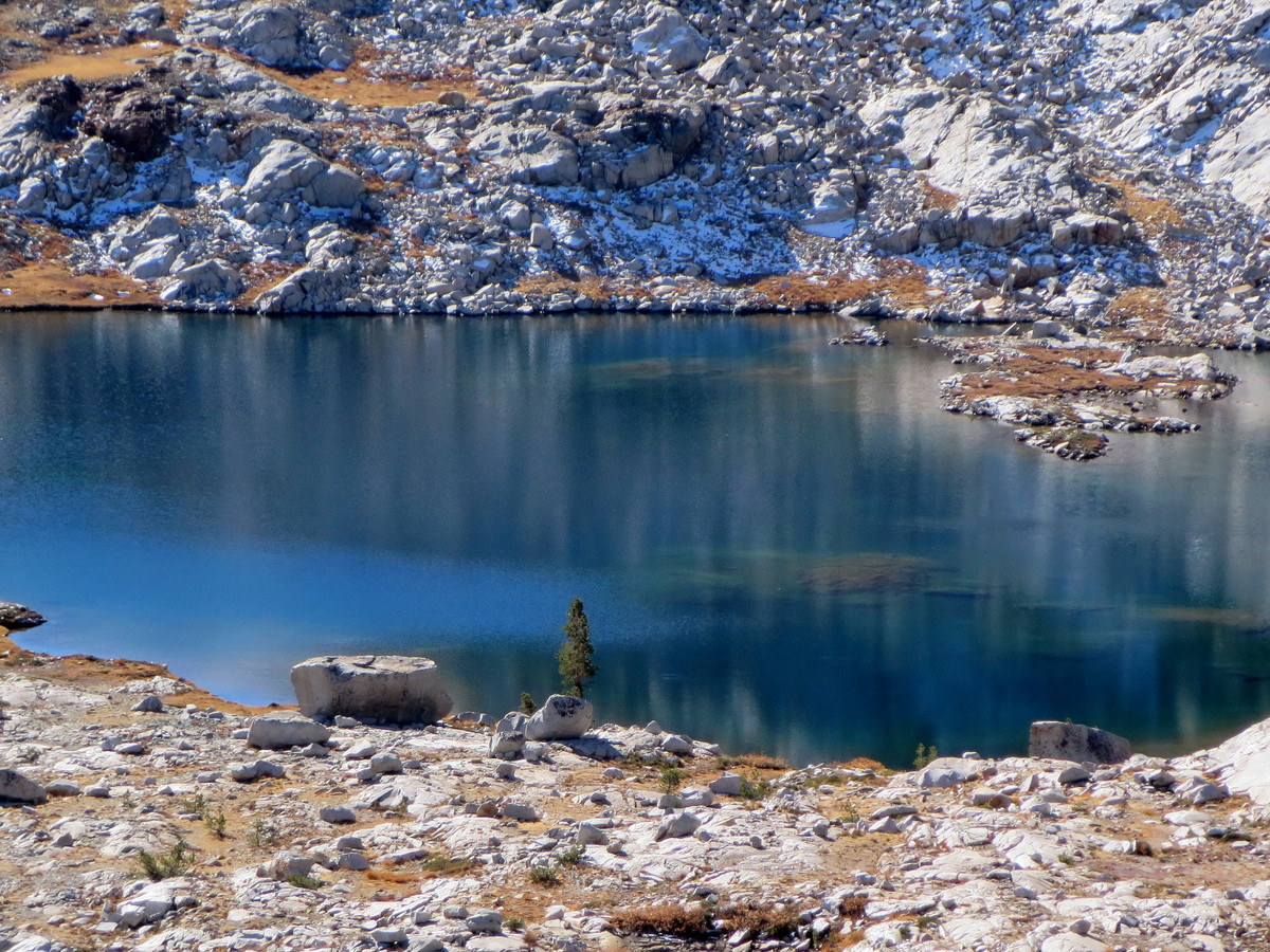
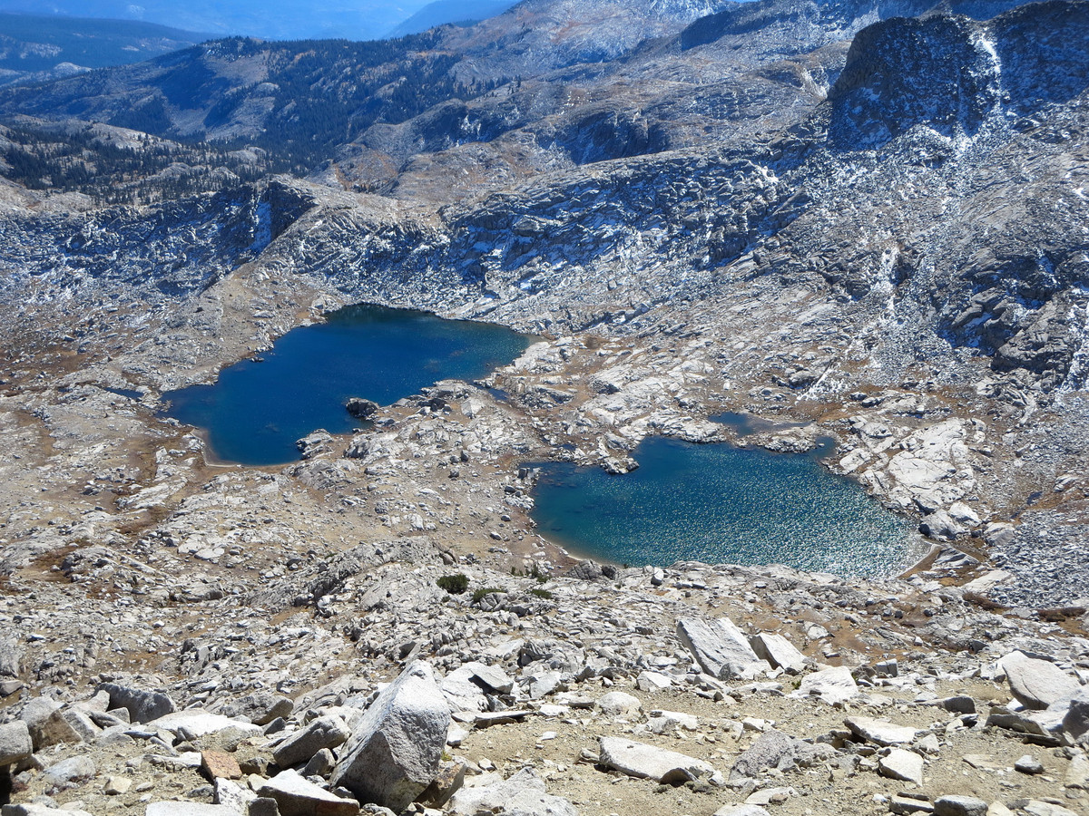
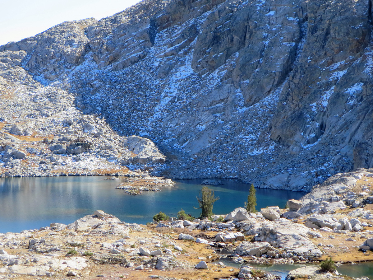
Back to the morning, we discovered our “error” of overshooting Chetwood Cabin when we came to a second junction for Cora Lakes. Instead of backtracking we headed uphill cross country to a saddle on the east side of Sadler Peak. The cross country travel proved to be very efficient and straightforward and it turns out this is my recommended route versus the route we took in the afternoon. Thus, for the most direct route into Long Creek I would stay straight past the Niche heading to Cora Lakes and then head cross country from the second junction with the Chetwood Cabin trail. Beyond the saddle on Sadler Peak’s east side, the use trail can be picked up again with numerous cairns and followed down to Long Creek where the trail ends for good. Travel up the granite canyon of Long Creek is a pleasure with a babbling stream, grassy meadows and clumps of trees amid a setting that is predominantly ice-polished granite. At the headwaters of Long Creek we turned east ascending slabs and grass over a ridge to spectacular Blue Lake with a perfect backdrop of Mount Ritter, Banner Peak and the Minarets. At Blue Lake, Foerster Peak is finally within striking distance. The final scramble starts with an ascent up a grassy ramp, followed by granite slabs, and finally some talus hoping to the summit.


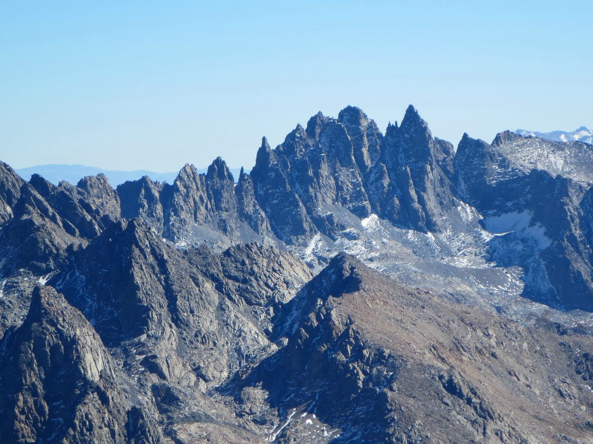
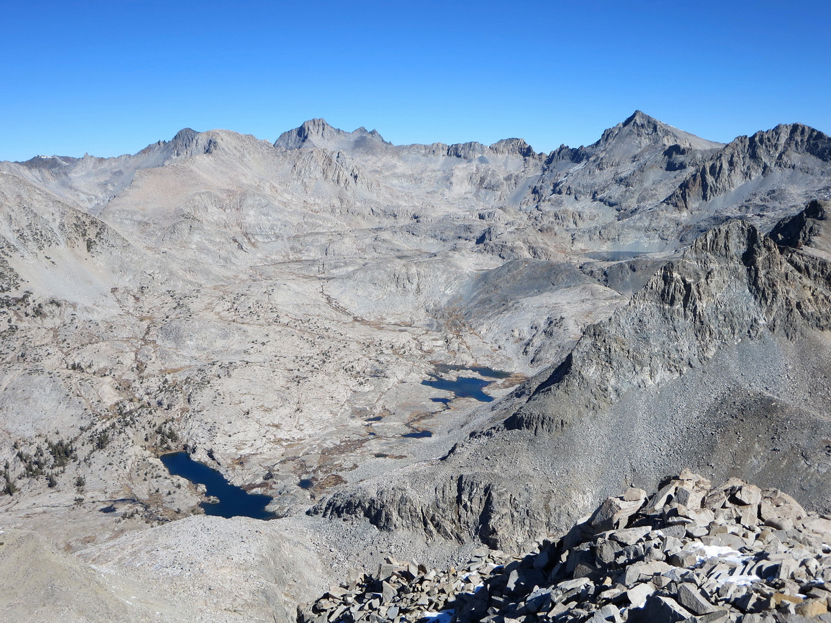
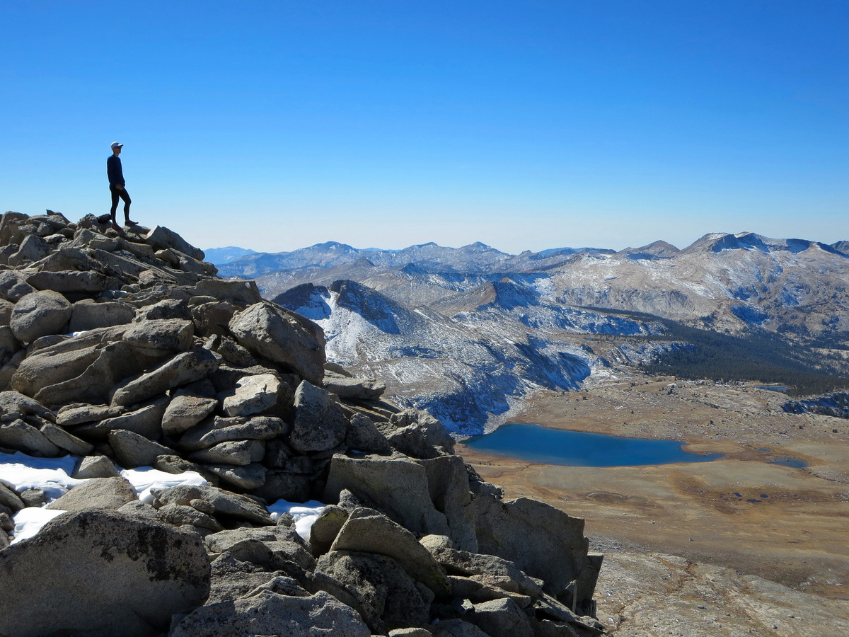
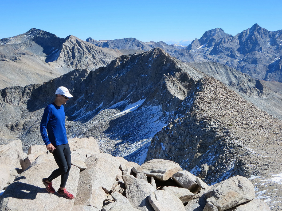
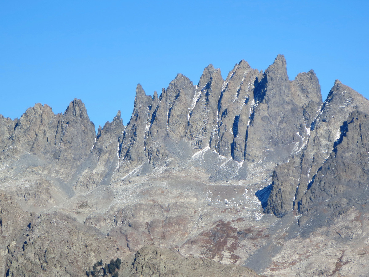
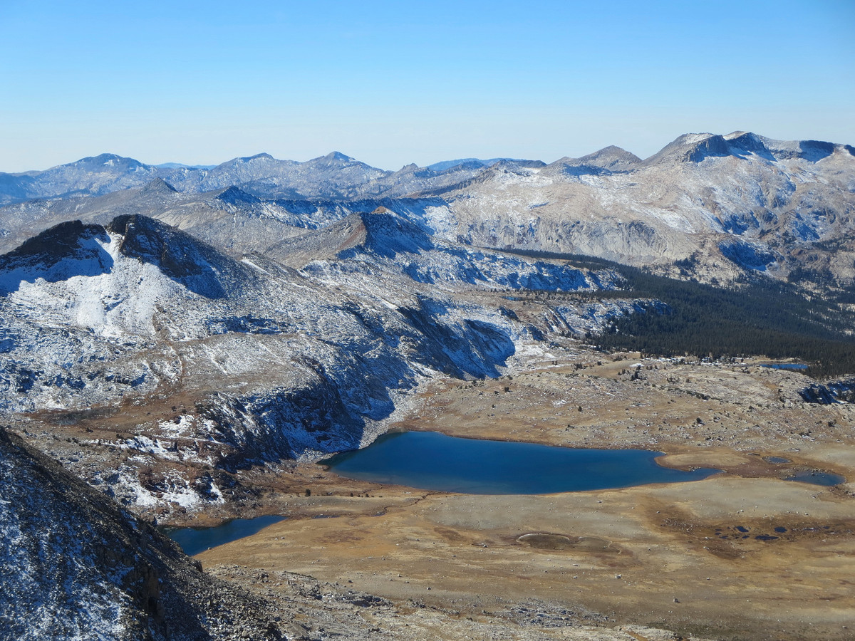
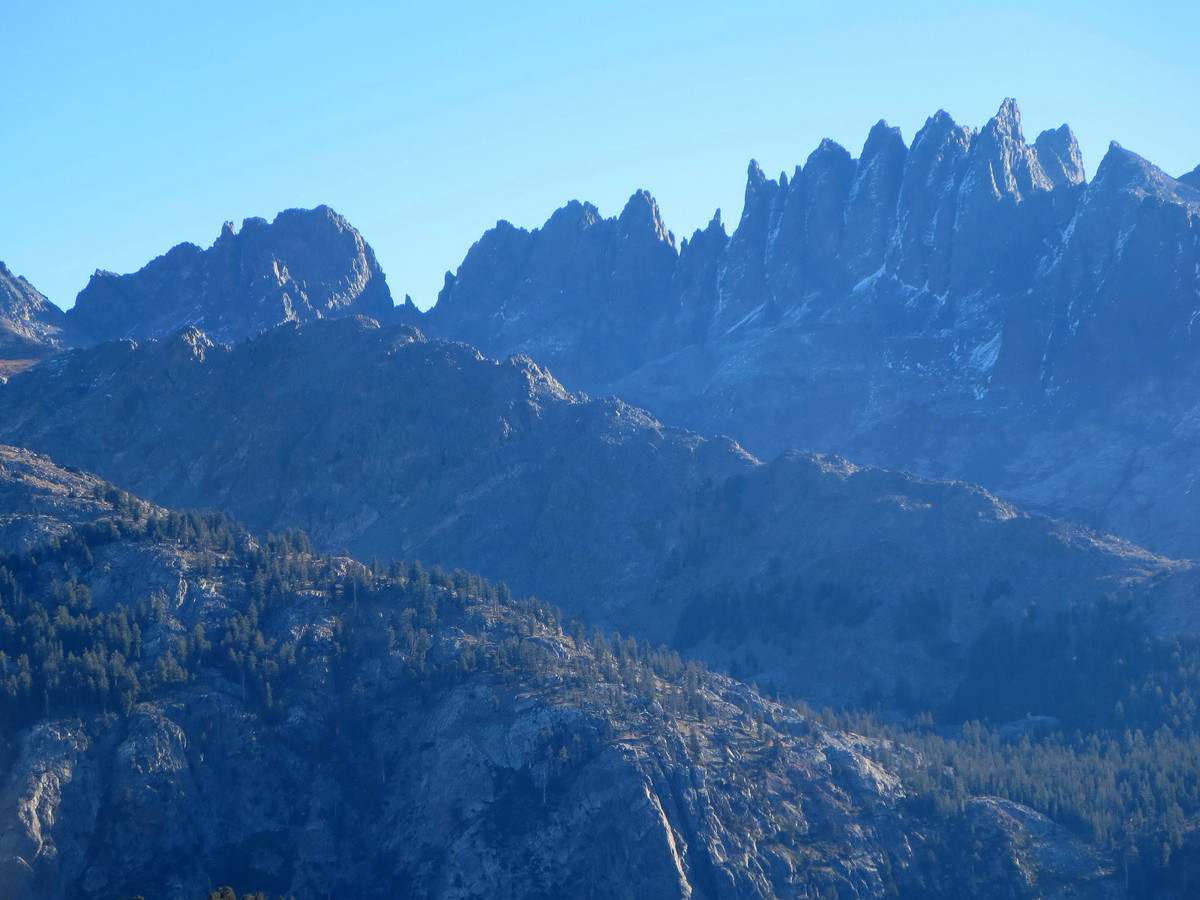
The challenge of Foerster Peak is clearly its remote location and not the straightforward scramble. The reward for reaching the summit is a truly remarkable vista, which was enhanced for us by a perfect fall day. We could see virtually all of the headwaters of the Merced River and the top of Half Dome. Mount Lyell and Mount Maclure (the roof of Yosemite) stood tall across the Lyell Fork of the Merced River with a series of high alpine lakes visible in the granite basin. Close at hand was the rugged west face of Ansel Adams Peak and the ridge crest to Electra Peak and Rodgers Peak. To the south, the rugged Ritter Range dominated the skyline with impressive views of the west side of the Mount Ritter and Banner Peak massif and the intricate spires of the Minarets. Over our stay at the summit, we watched the light on the Ritter Range become increasingly better. After spending over 45 minutes on top, we retraced our steps to Blue Lake and stopped for a photography extravaganza along its blue shores… just great!

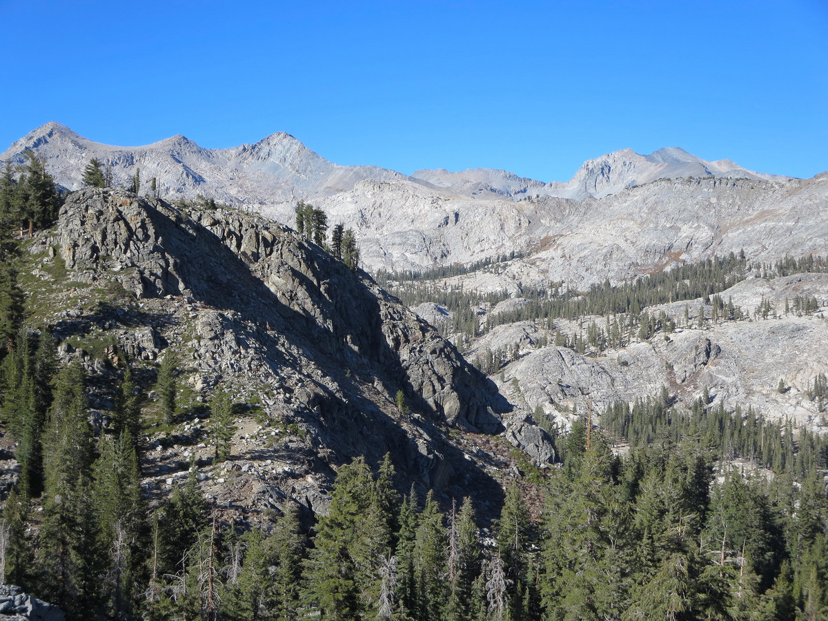
The final views of the day (before entering forest) were near Sadler Peak with excellent afternoon light on the Minarets and the North Fork San Joaquin River canyon. I look forward to climbing to the summit of Sadler and taking the 2 mile ridge to Long Peak in the future. This ridge is sure to have excellent views for its entire length. Enjoying this last view, we thought we were set for a fairly easy last 8 miles back to the trailhead, but we were wrong. The old use path we were supposed to take in the morning from Chetwood Cabin proved extremely challenging to follow with copious downfall to navigate. In fairness, the Tom Harrison Map does not show this trail at all and we were relying too heavily on outdated USGS topo maps. This region has seen more foot traffic in the past. In the end, we decided the unintended cross country route taken in the morning was now a more efficient, superior access route to Long Creek and Foerster Peak. After what seemed like a long time, we finally popped out into a meadow and saw the ruins of the Chetwood Cabin indicating we were back on familiar ground and maintained trail. From this point we made good time back the trailhead. Foerster peak and this remote region far exceeded expectations and I will definitely be back for further exploration!


Awesome; especially from a dark office with PNW rain pounding on the windows. Thanks for always posting and sharing your adventures!
Beautiful. You really get perspective of how big the area is when you see a lone tree near the lake with the huge granite mountains nearby.
Stellar scenery. Very inspirational!
Named for my Great Uncle Lewis. Going next year!