I have heard great things about the scenery at Point Reyes National Seashore but very little about the quality of trail running so I decided to check it out for myself on New Year’s Day. I found excellent trail running and stunning views over varied terrain and ecosystems. The run was 22 miles with 4,000+ feet of elevation gain (map of route).
Much of the southern portion of the park is designated as the Philip Burton Wilderness under the Federal Wilderness Act, which, among other things, precludes organized trail runs. I carefully studied the trail map designing a long run that seemed to hit most of the highlights in the southern portion of the park, which is where the vast majority of the 150 miles trail network is located. Reading others’ hiking reports, it seemed improbable to run from Mount Wittenberg all the way to Alamere Falls, but this is the beauty of trail running!
I knew it was foggy at Point Reyes in the morning by looking at the visible satellite so there was no need to rush to get there early. Once I saw the stratus eroding on the animated satellite, I set out and arrived at the Bear Valley visitor center at 12:30 pm. I started the run a little after 1 pm and the biggest hill climb in terms of elevation gain commenced almost immediately up the slopes of Mount Wittenberg. The summit of Mount Wittenberg itself is overgrown precluding views however, a path heading south from the saddle leads to an open area with magnificent views of Drakes Bay.
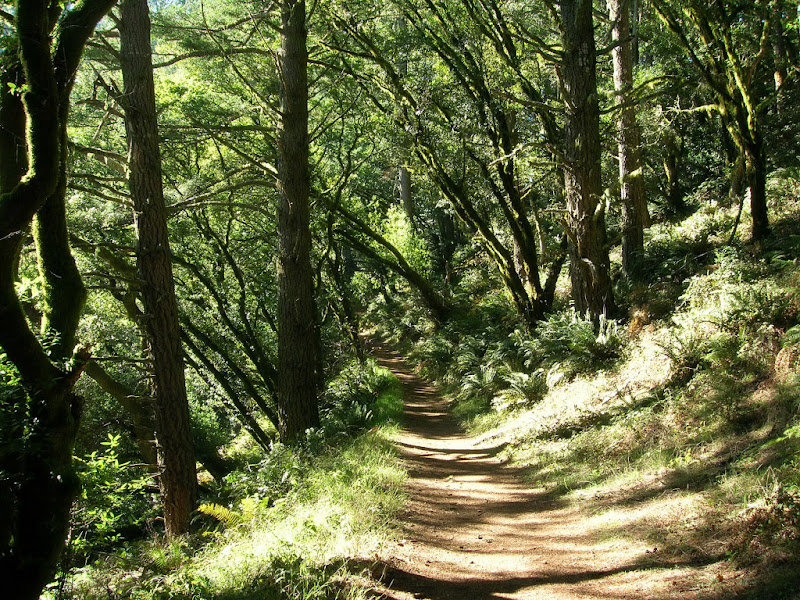
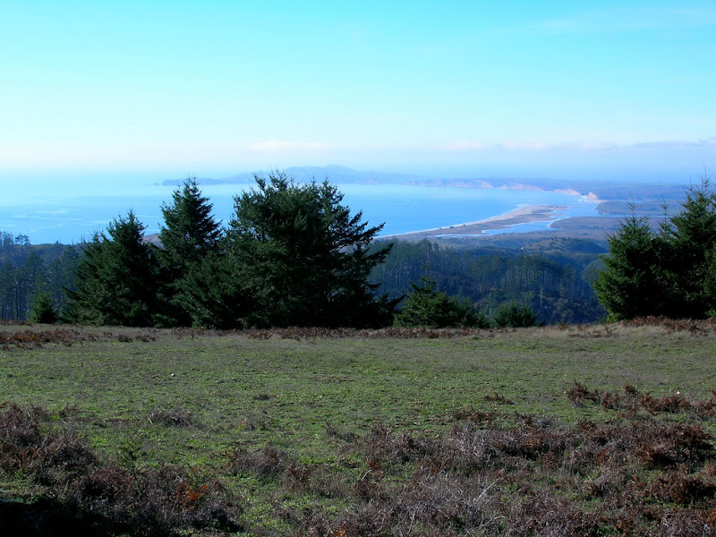
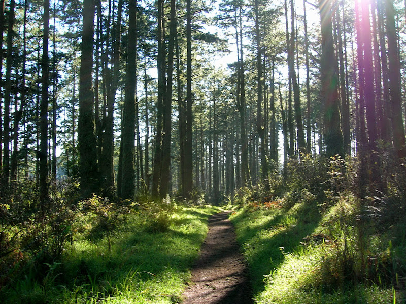
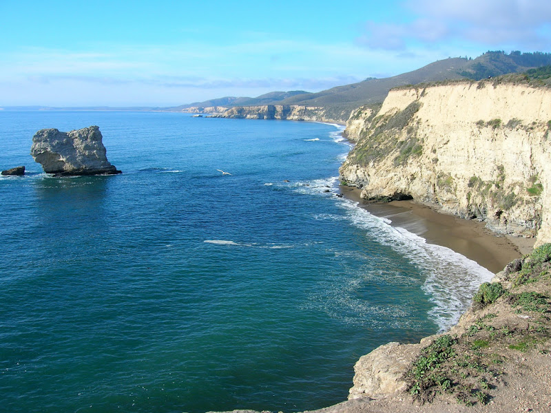
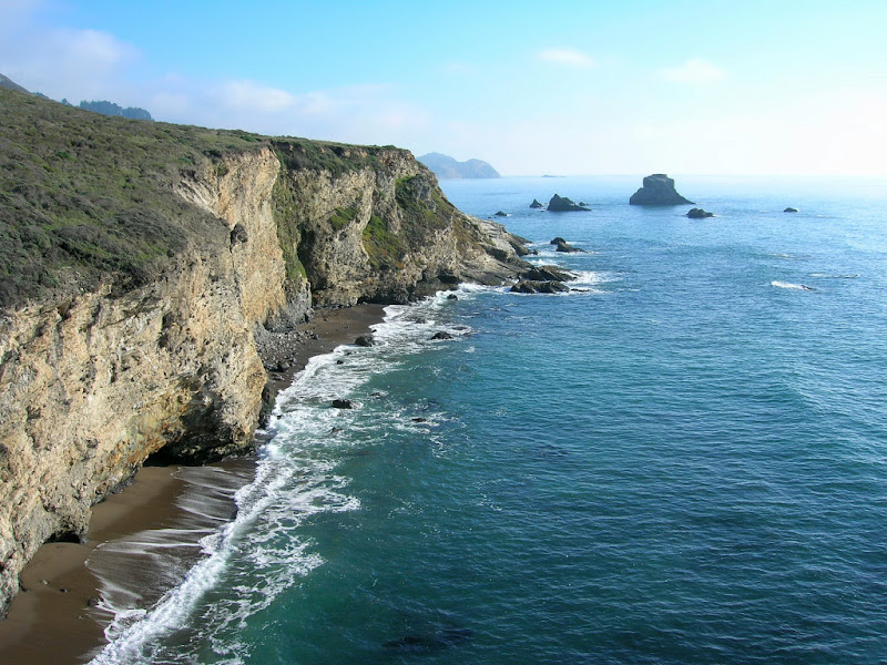
I continued from Mount Wittenberg down the forested Sky Trail and then the Woodward Valley Trail, which actually runs along a ridge as opposed to a valley. The views are great, especially towards the bottom of the Woodward Valley Trail. Once I reached the Coast Trail, I found 3.5 miles of relatively flat and fast running. I made two side trips to Sculptured Beach and Kelham Beach. Kelham beach is probably is one of the most remote beaches in Point Reyes. There is not sign for the beach, but the use path off the coast trail starts from a giant solitary eucalyptus tree.
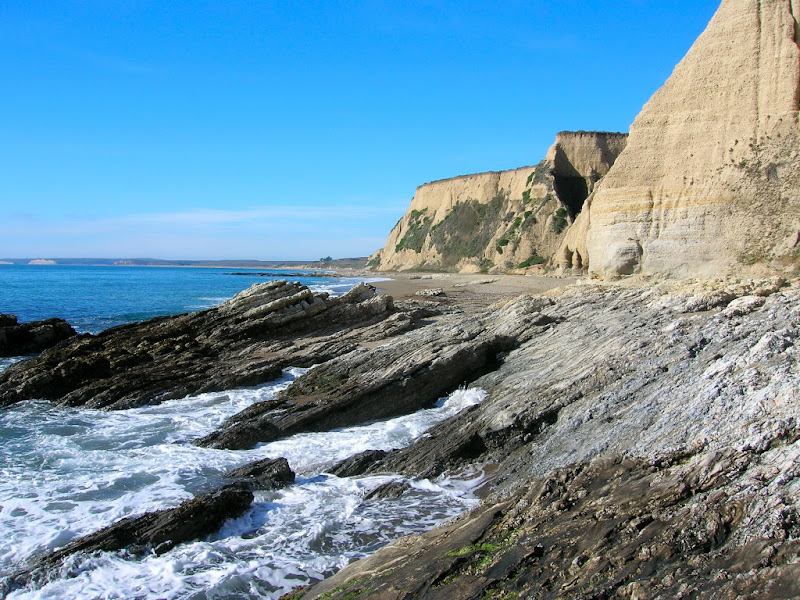
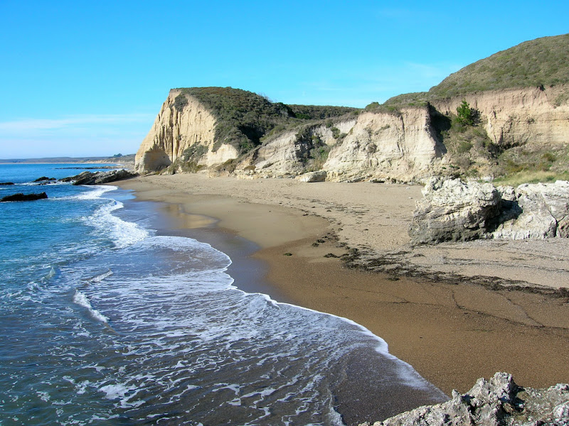
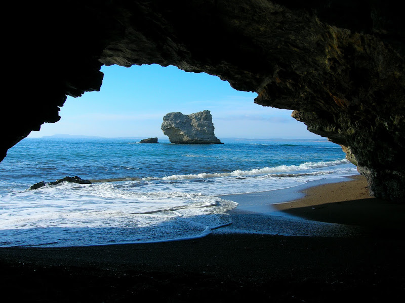
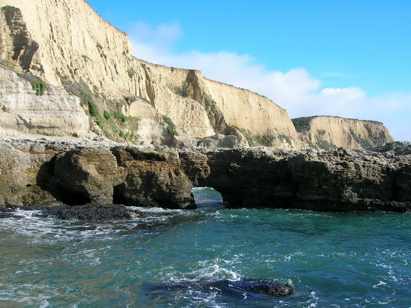
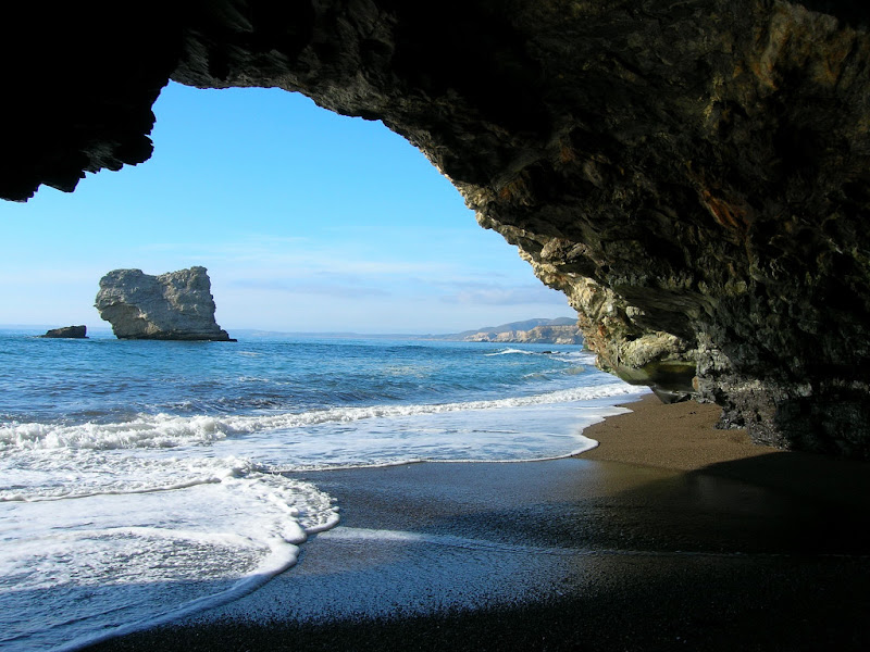
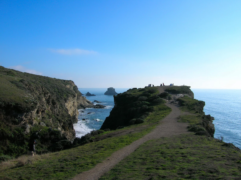
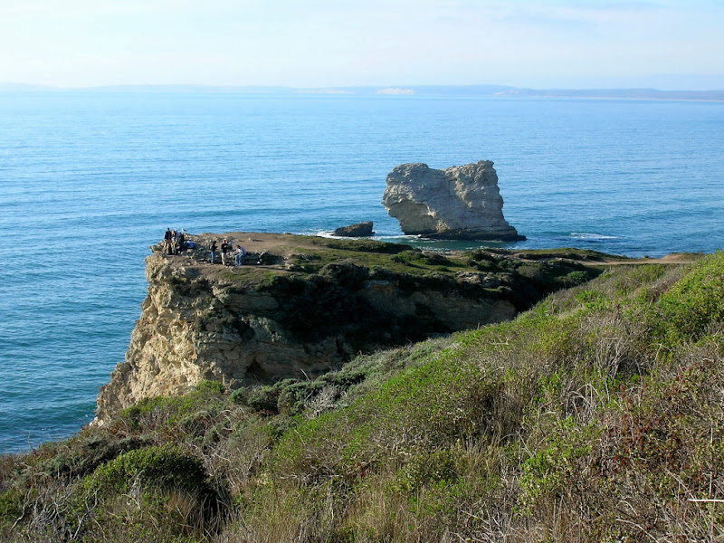
In low tide you can walk from Kelham Beach all the way to Arch Rock, but the tide was still too high so I climbed up the path back to the coast trail and continued to Arch rock. As the terminus of the popular Bear Valley Trail, Arch Rock is probably the most visited site in the southern portion of the park. However, the trail itself ends on top of the arch. The views are great, but to actually see the arch, you must scramble down another use path to the small cove. The tide was now just low enough that I didn’t have to get wet to snap some photos of the awesome arch.
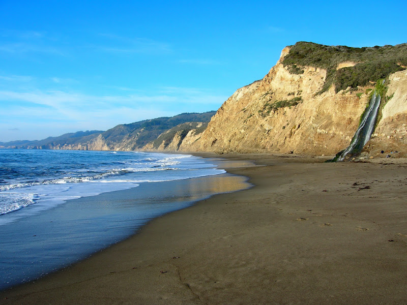
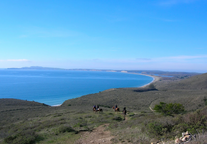
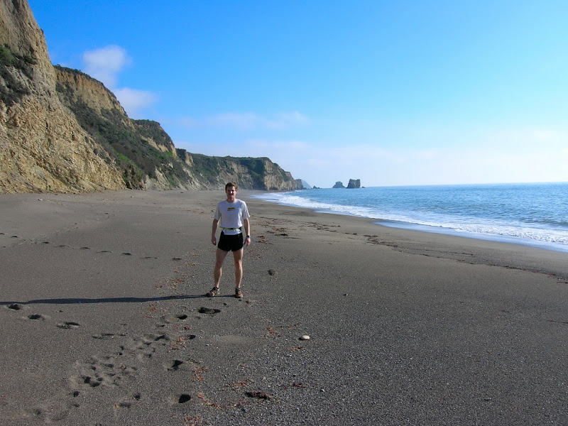
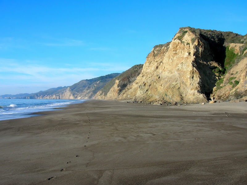
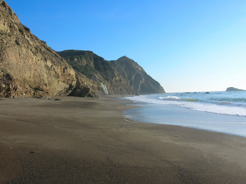
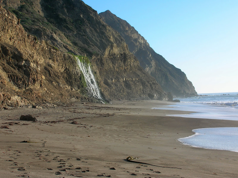
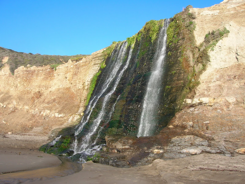
The next section of the coast trail from Arch Rock to Wildcat camp is more difficult featuring a substantial hillclimb of nearly 900 vertical feet but nice single track and views. The elevation is lost on the descent down to Wildcat Camp, which is situated in a small valley near the ocean and a nice spot to refill the water bottle. I was hoping to be able to run to Alamere Falls via Wildcat Beach and was happy to find that the tide would not be an issue. The section along the beach was awesome with views in every direction and the tumbling falls coming into better view as I approached it. Alamere Falls is truly picturesque!
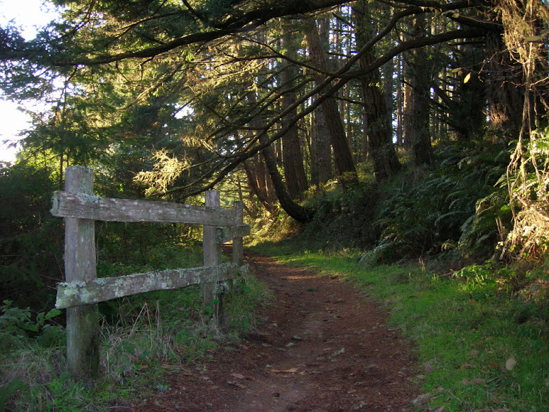
Instead of running back on the beach to Wildcat Camp I decided to use the Coastal Trail and ascended the Alamere Falls use path up the cliffs. I heard this path is choked with poison oak so I made sure to slather on the Tecnu when I returned to my car. I enjoyed the afternoon sunlight as I returned back to Wildcat Camp and began the nearly 900 foot climb up towards Glen Camp. The Glen Camp area is heavily forested and lush and I enjoyed more single track on the Glen Trail down to Bear Valley. The last 3.2 miles along the Bear Valley Trail were relatively flat and this is where I saw most of the people along the course of the run.
This was definitely one of my favorite runs. The contrast between rugged coast and lush mountain forest on the same run is a treat. Clear skies, light winds, and comfortable temperatures made it virtually perfect for sightseeing.

Wow, beautiful pictures. Looks like you had an amazing run! 🙂
such a great run. We stayed a week at the hostel for our training camp when I ran for UC Davis. Brings back some memories.