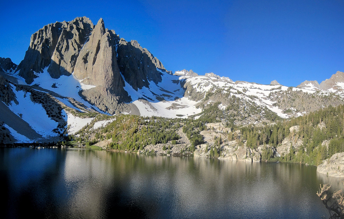
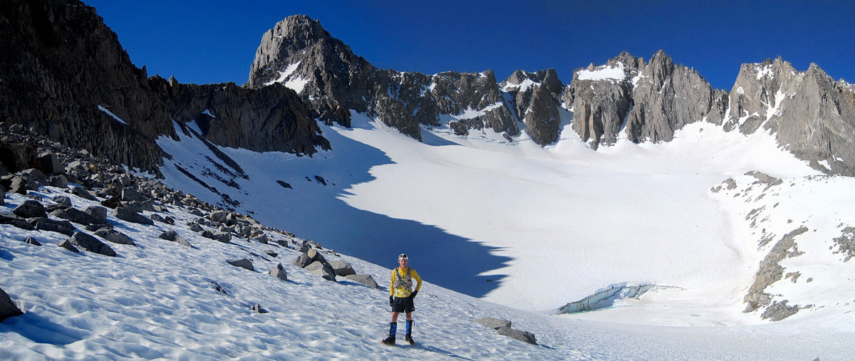
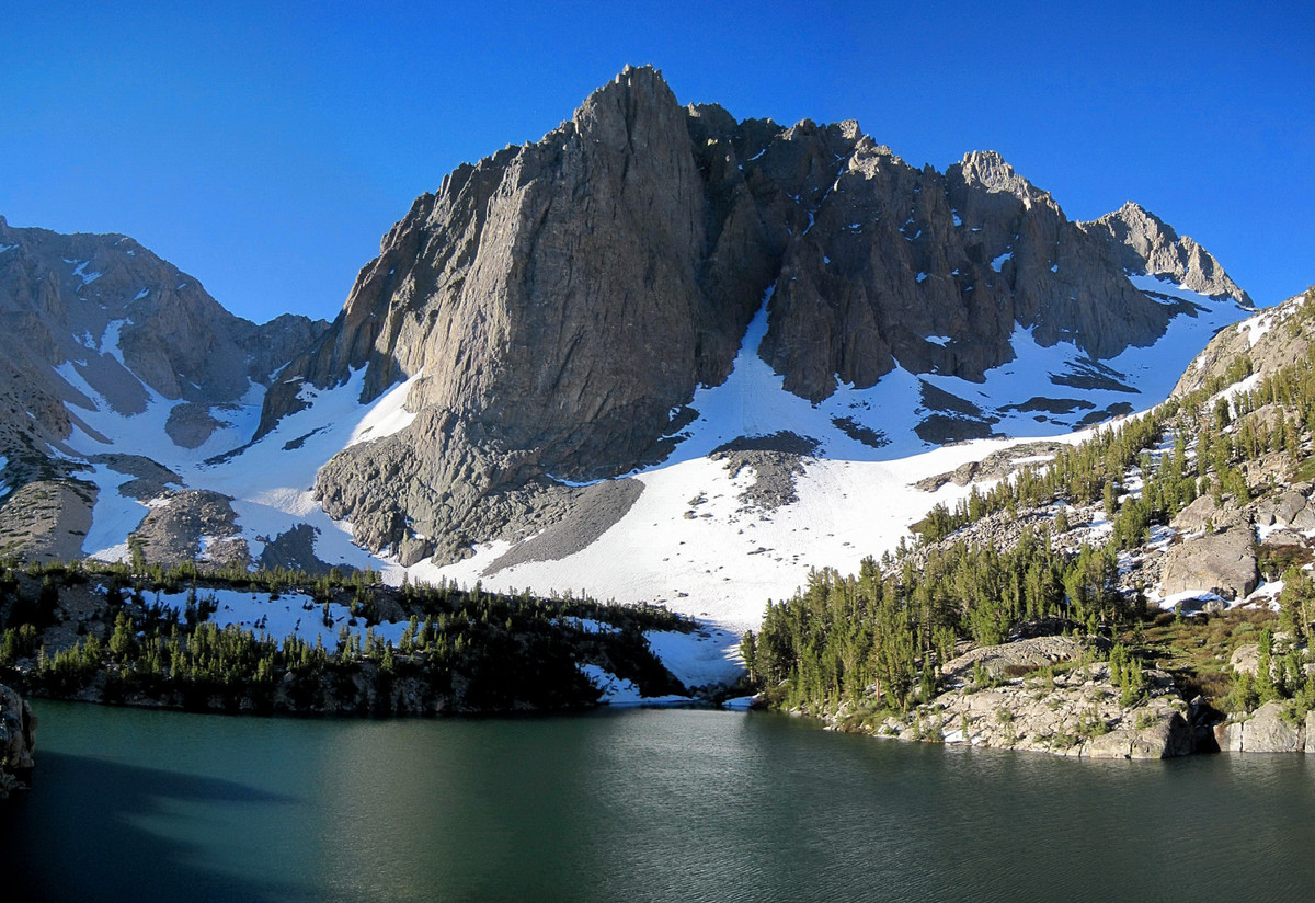
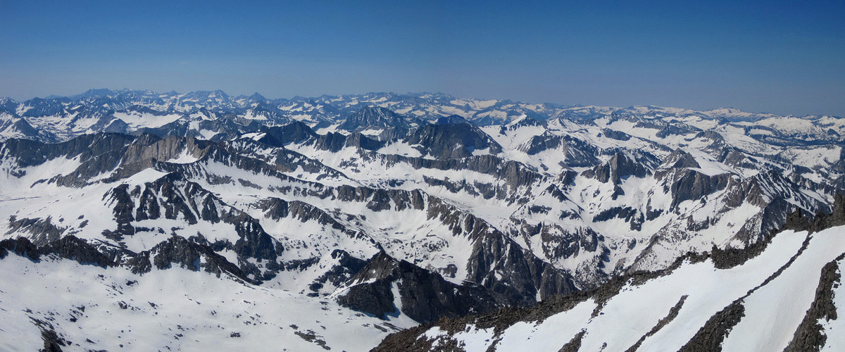
I climbed 14,159 ft Mount Sill on July 3rd and enjoyed spectacular scenery from the summit and through the North Fork Big Pine Creek. I had previously climbed Mount Sill via the same North Couloir route on July 9, 2009 and that it was time to return! The trail approach along the North Fork Big Pine is gorgeous passing through First, Second and Third Lakes with Temple Crag towering above. This year there was quite a bit more snow lower down and the talus moraine near the Palisade Glacier was substantially more covered. Conditions heading up to Glacier Notch were ideal for cramponing in the morning, but the snow in the L-shaped couloir was incredibly soft with thigh deep post-holing in spots for 700 vertical feet. In fact, the snow was so soft that I was unable to glissade on the way down despite the steep angle. On the 4th class section, all snow patches can now be avoided and it’s fairly straightforward. The final bit of scrambling along the ridge up to the summit was fun and I enjoyed the spectacular vista from the “best summit view in the Sierras.” Starting at 5:15 am, the total roundtrip took 8:45 finishing just before 2 pm. (5:15 up, 3 hours down, 30 minutes on top), making this trip 2 hours faster than the 2009 effort. More photos here.

Wow, Stunning photos!
Wow, that’s some impressive hiking! And what a fast pace. Great photos to boot. Going to be in the Big Pine Lakes area in a couple weeks for some leisurely hiking. Will look for Mt Sill and the Palisade Glacier from the lakes to get an idea of what you did..