Last Sunday I ran the 72 mile High Sierra Trail from Whitney Portal to Crescent Meadow in 15h46m starting at 3:19 am and finishing at 7:05 pm, a new FKT (previous mark was 18h39m). It was a great experience in an immensely scenic region of the High Sierra. A special thanks goes to Joel Lanz who helped with the car shuttle and made the whole adventure possible. Complete photo album here.

The High Sierra Trail is a masterpiece of Sequoia National Park traveling from the iconic giant sequoias to the highest point in the lower 48, and passing through some of the most stunning scenery in the Sierra Nevada Mountains en route. The trail stretches 61 miles from Crescent Meadows to the summit of Mount Whitney. As a practical matter, the trail is 72 miles since it takes another 11 miles to reach the Whitney Portal trailhead from the summit. The High Sierra Trail shares the same trail as the John Muir Trail from Wallace Creek to the summit of Mount Whitney leading some to speculate that the High Sierra Trail ends at the Wallace Creek junction, but the summit plaque on Whitney and the High Sierra Trail sign at Crescent Meadows prove that the High Sierra Trail indeed ends at Whitney’s summit. While the trail is traditionally done from west to east, for adventure running, the preferred direction is east to west due to a net loss of around 1,600 feet, and more importantly, the biggest climb of the day up Mount Whitney (6,200ft+ elevation gain) is completed first thing on fresh legs.
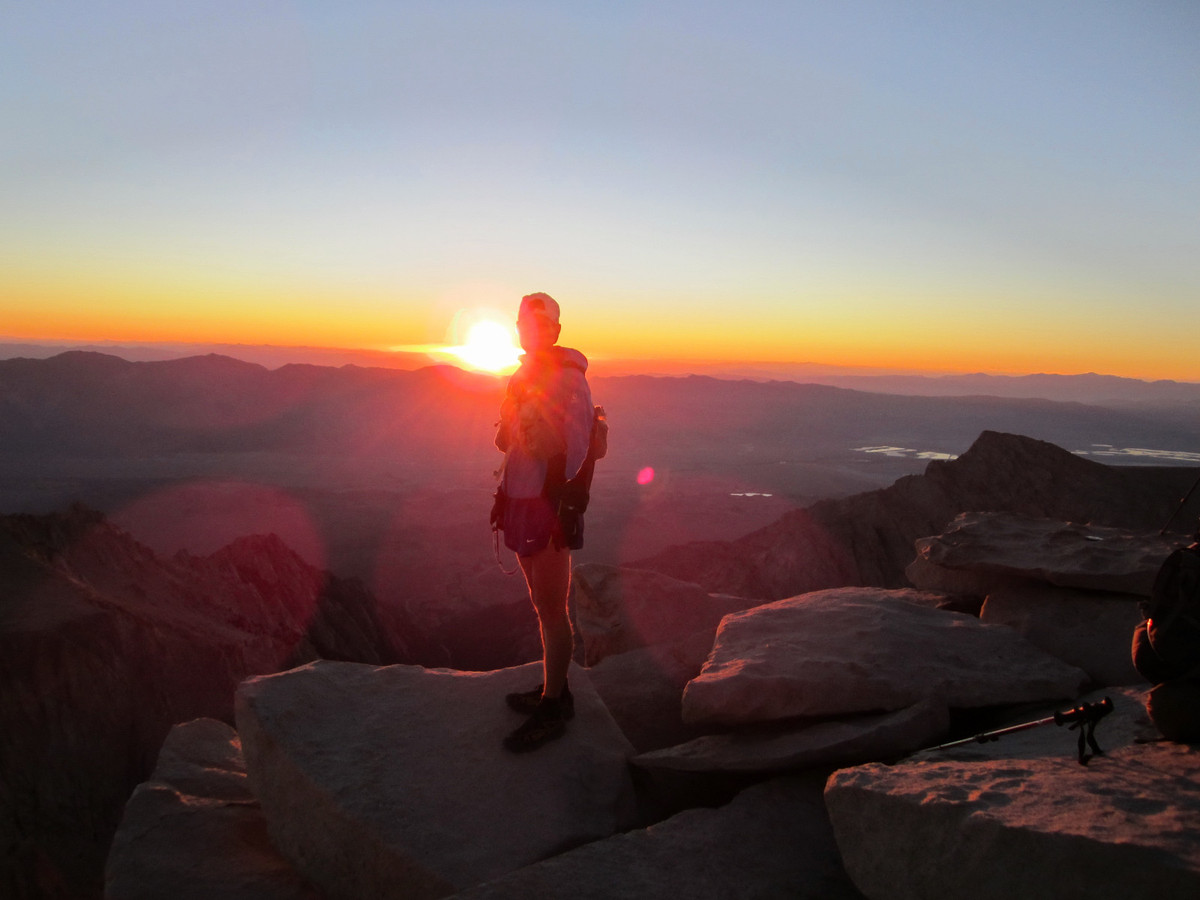
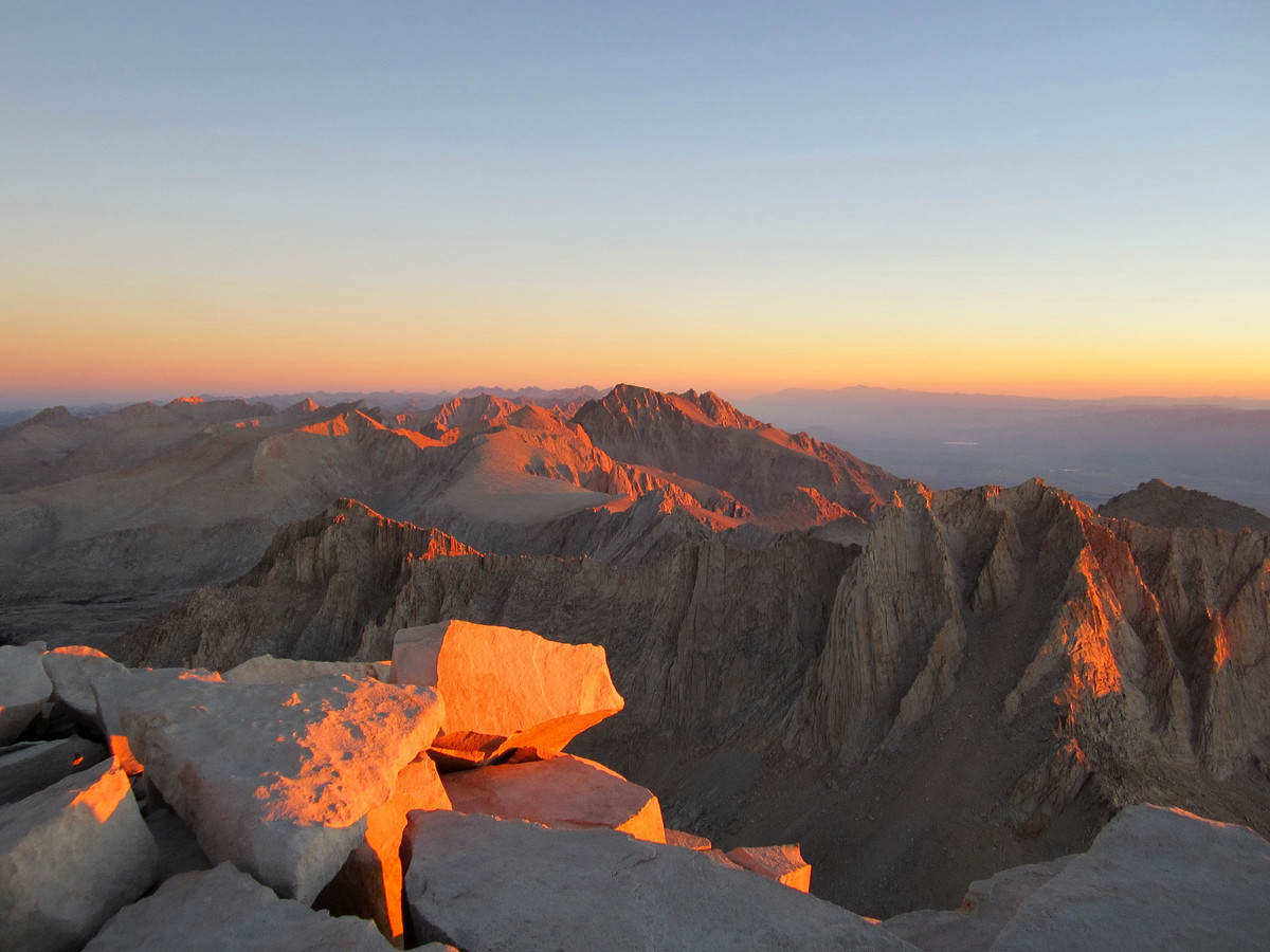
I was lucky to snag two day use permits for the Whitney zone on Friday afternoon so on Saturday Joel and I drove down to Lone Pine and picked them up. In the afternoon we did a short hike to the Cottonwood Lakes (~11,000 ft) below Mount Langley for helpful (albeit brief) acclimatization. It was gorgeous up there and I look forward to returning to explore more of the lakes and summit Mt. Langley. Sunday I woke up at 2:35 a.m. and departed Whitney Portal at 3:19 a.m. I got into a decent rhythm working the switchbacks all the way to Trail Crest. I reached the summit at 6:20 a.m. just as the sun was rising and it was amazing to watch the peaks and cliffs illuminate in orange – Sierra light at its best.

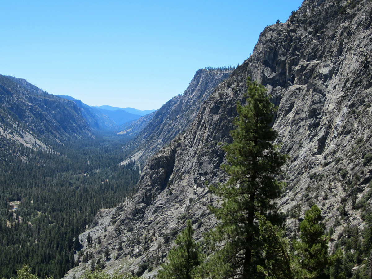
After a few photos and congratulating a couple who had just become engaged, I descended the slopes back to the junction. Oddly, I felt the altitude much more on the descent to Crabtree meadow, but the spectacular scenery was a good distraction. Fortunately, on the stretch between Crabtree and Wallace Creek I was able dial into my nutrition and hydration plan so I started feeling better. I got into a nice rhythm descending into Kern Canyon and then running the 9.5 miles of awesome rolling single track down the canyon. I saw several bears in the canyon, including a mother bear and two cubs that literally jumped right in front of me. This caused momentary panic, especially when momma bear gave me a little grunt and stare, but I made some noise and she calmly directed her cubs up the hill away from the trail.

The steepest part of the route, and the crux in my opinion, is the long climb out of lower Kern Canyon to the Chagoopa Plateau below the Kaweah Range. All told, this climb entails nearly 4,500 ft of cumulative elevation gain and the first part is quite steep on a hot south facing slope. The black diamond ultra light z-poles were extremely helpful on this section and I soon found myself on the plateau with a pleasant breeze. Most of Chagoopa is uninteresting terrain with open forest and no views. It is only until one essentially reaches the top of the plateau does the Great Western Divide and Kaweahs come into view. The scenery becomes more impressive and inspiring on the descent into the Big Arroyo Valley.


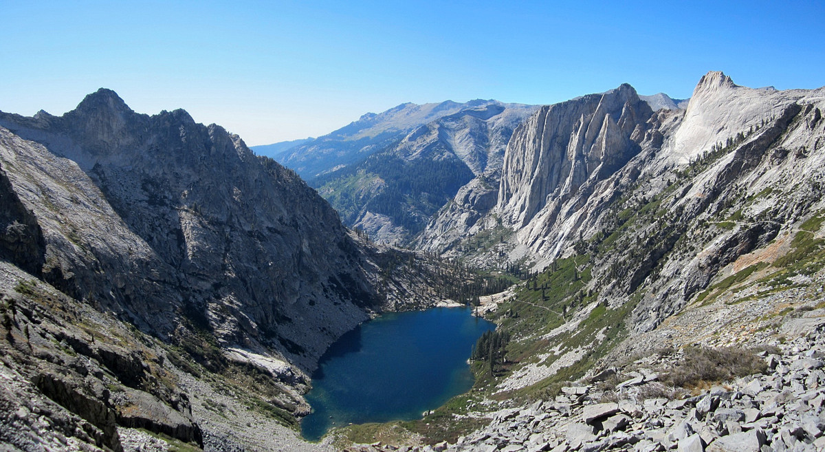
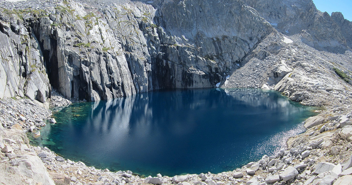
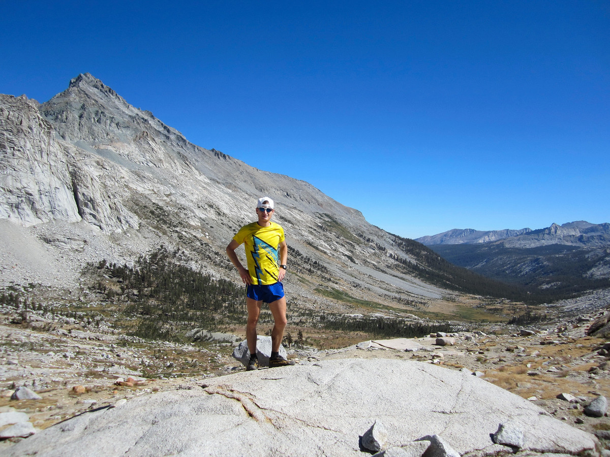
Upper Big Arroyo is amazing with a wide open tundra setting in the valley juxtaposed with sharp granite cliffs and peaks in the background. I met Jim Castleberry on this stretch and he was kind enough to take the photo of me immediately below. After Jim’s trip, he sent me a message: “This past Sunday I was hiking on the High Sierra Trail and took your picture on the east side of Kaweah Gap. Because of the remote location, when I heard the sound of feet running on the gravel surface behind me, it was a true WTF? moment. I was too shocked at the time to give you proper encouragement. Hope the rest of your run went well. You seemed to be in good condition when I saw you.”
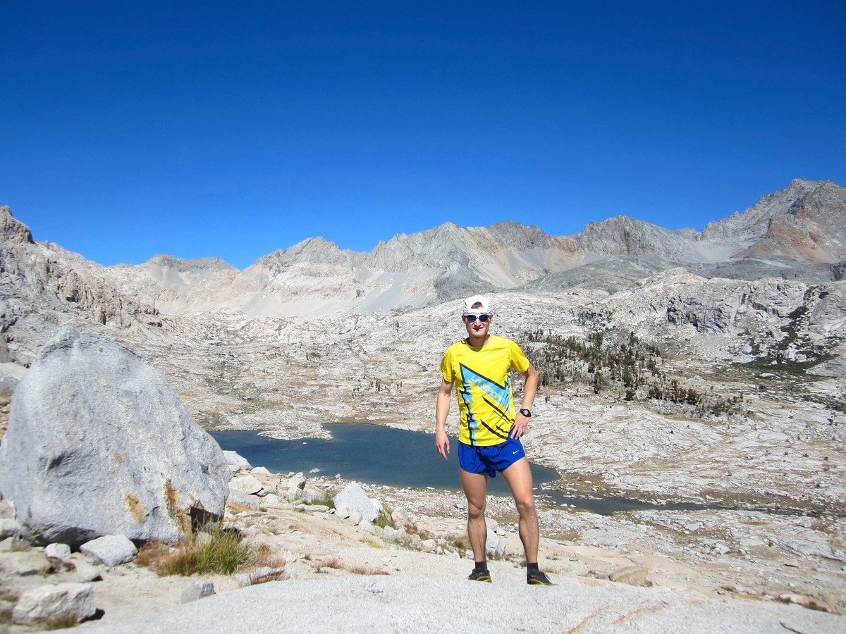
The panoramic views continue up to 10,700 ft Kaweah Gap, the top of the last major climb of the route. I soaked in the views from Kaweah Gap and then continued down familiar territory to stunning Precipice Lake and Hamilton Lakes. This section is also one of the most scenic in the entire High Sierra and I couldn’t resist making several stops to take photos. While taking over 100 photos certainly cost me some time, photography is a big part of my enjoyment both during and after the adventure run. I felt there was no need to run “head down” the whole way at this stage of the trail’s FKT evolution.

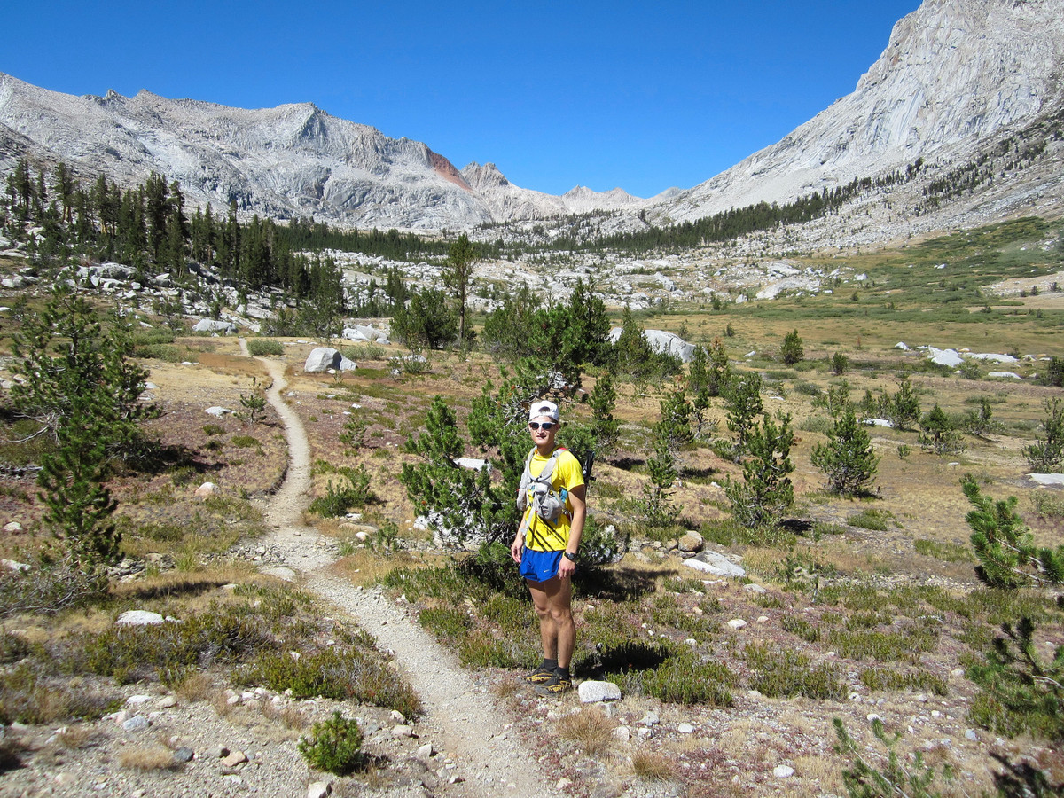
I heard that legendary rock climber Peter Croft was staying at Hamilton Lakes to scope out a new route on the Angel Wings, the biggest rock wall in Sequoia National Park. As I passed by his party’s campsite, they asked me where I was coming from and gave words of encouragement. I wish I got his autograph! While the last 16 miles of the route is not without some climbing, there is also a lot of runnable terrain. I felt decent and was able to run a good chunk of the way from Kaweah Gap covering the last 20 miles in about 3:45 minutes. This was my first run over 50 miles ever and all things considered I felt good at the finish. It was great to see Joel at Crescent Meadows and give the High Sierra Trail sign a hug! Complete photo album here.
Splits:
- Whitney Portal 0:00:00 (3:19 a.m.)
- Outpost Camp 0:53:06
- Trail Crest 2:21:54
- Whitney Summit 3:01:15
- Depart Summit 3:06:23
- Crabtree Meadow 4:45:58
- Wallace Creek 5:36:57
- Junction Meadow 6:18:50
- Kern Hot Springs 7:33:08
- Lower Kern Canyon 7:56:42
- Junction in Arroyo 10:53:22
- Kaweah Gap 11:45:53
- Bearpaw Meadow 13:41:30
- Crescent Meadows 15:46:22 (7:05 pm)

Nutrition:
- Pre-run: 680 calories (2x bars, 1 banana)
- En route: 3,200 calories (7x150cal First Endurance EFS drink mix, bars, shot bloks, gels)
- Post-run: First Endurance Ultragen cappuccino
Gear:
- La Sportiva C-Lite 2.0
- Ultimate Direction Wasp pack and Fastdraw plus hand holder
- Black Diamond Ultra Distance pole
- Petzl Tikka XP 2 headlamp
- Rudy Project Rydon II Sunglasses
- North Face Better Than Naked jacket
- Injinji socks
- Canon Powershot elph 100 hs
Complete photo album here.

Awesome adventure with a Momma Bear and all. Glad to see you liked the BD z-poles. I’ll be using those at WF100 this weekend. How did the mileage difference feel compared to some of your 50 mile races/adventures?
Thanks Will! I have used the BD ultra distance poles extensively the past year and they are very helpful on steep climbs. I could definitely feel the extra mileage beyond what I’ve run before, but I have experience with adventure runs lasting 24+ hours so it wasn’t totally unfamiliar.
Wow- amazing run. I just love the Sierras… your recent posts from the PacNW were – but this one surpasses them for me. This is a route I’d love to do someday.
Thanks Jake! The Sierras and Cascades are both amazing in different ways. The High Sierra Trail is a classic and highly recomended!
That saddle at the top of 99 switchbacks is one of the best spots…true trail porn.
Leor, your headlamp blinded me like a deer before Outpost Camp! I was running mostly under moon light without poles. Now I realize the use of pole as in alpine skiing. Nonetheless, you did a great FKT! Many hikers that day were truly amazed and you were the gossip subject.
This is an absolutely jaw dropping effort. I followed your intersections on my SEKI map and almost fell out of my chair. Although beautiful, this is insanely hard running terrain. And after an already long day getting off Kaweah and then grinding back up the trail to the parking has got to be tough. Have you considered using a GoPro? This write-up is beyond awesome – inspiration for days when I’m slacking a bit!!! – Do you do any spinning or riding for recovery? – Gus
Thanks Gus! Haven’t put serious thought into running in a GoPro. For recovery I’ll do some easy hiking, jogging or elliptical – no cycling.
Always blown away by your photos. Keep up the good work. – Snodgrass
Thanks!
Great job Leor! You stopped to say hi to me and my friends on the way down from Precipice. It was like a celebrity sighting out there, hope we didn’t slow you down too much. Beautiful trail, I plan to run it next year (sub-24, nothing close to your time). Hope to see you try and break your record at the Quad in November!! Well done!
Dave, great to see you below Precipice and thanks for the comment! It was a beautiful day in the Sierras and highly recommend the HST for next year.
Great write up & pics!
Any interest in running a 100mi race anytime soon? Not that I doubted you before, but after seeing you do this, I know you could tear up the 100’s – they do have a different, fun vibe to them.
Thanks Chris! No real interest running an organized 100 in the near term but I do have some adventure run ideas that are in that distance range.
Well done! Great pics as always.
This is epic. Great job!
Reblogged this on Little Princess: to travel is to live and commented:
1 vài năm nữa ta sẽ hòan thành trail này, hãy đợi đấy :))